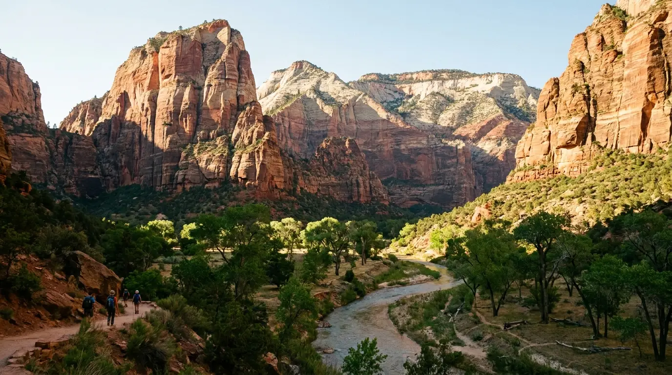
A towering red-and-cream sandstone canyon with sheer walls rising from a green cottonwood valley and a river, warm morning light, Zion National Park Utah, ultrarealistic photograph representative of the region
Trekkr Trail Journal · No. 037 · Zion & Bryce Canyon, Utah

Zion & BryceZion Canyon, the Angels Landing Lottery, the Narrows & the Hoodoos — The Complete Field Guide

Two of the busiest parks in America, ninety minutes apart, planned honestly. Here's what nobody tells you at the visitor center: Zion Canyon is shuttle-only and the shuttle is free, there is no park-wide timed entry to chase, and the one thing you actually reserve is Angels Landing — by lottery. What will catch you out is the heat in Zion Canyon (100°F+), the flash floods in the Narrows that arrive under a blue sky, and the fact that Bryce sits at 8,000–9,100 feet and freezes overnight even in summer. This issue is about water, permits, the shuttle, and packing for two seasons at once.

Utah · United States Zion Canyon & Kolob Bryce amphitheater SR-9 · US-89 · SR-12
FreeThe Zion shuttle — and the only way into the canyon in season
LotteryAngels Landing permit — recreation.gov, not walk-up
150 CFSVirgin River flow that closes the Narrows
~9,100 ftBryce's high point — pack for cold and heat both
Conditions verified 21 July 2026 · Heat & flash floods are the headline hazards here · This block goes stale — the links don't

Zion doesn't get you with the cliffs — it gets you with heat, water and weather you can't see

The rest of this journal is evergreen; this box is not. Three things on this list — the shuttle, the Angels Landing lottery, and the absence of any park-wide timed entry — trip up more first-time planners than any trail does, so read them even if you think you know these parks. Everything below is dated to the day we checked it. Trust the live sources, not our date stamp, and read the full Safety section (§06) before you go anywhere.

  • Zion has NO park-wide timed entry — but the canyon is shuttle-only, and the shuttle is freeThere is no reservation to enter Zion and none to drive the canyon. Instead, in shuttle season the Zion Canyon Scenic Drive is closed to private vehicles and the free shuttle is the only way in — no ticket, no reservation to ride. The 2026 season resumed March 7, 2026 and runs into the winter holidays. Park at the visitor center or in Springdale and ride. Three roads stay open to private vehicles: the Zion–Mt. Carmel Highway (Canyon Overlook), Kolob Terrace Road, and the Kolob Canyons Scenic Drive. [VERIFY AT PUBLISH — shuttle dates change yearly; re-check nps.gov/zion within a week of departure]
  • Angels Landing past Scout Lookout needs a PERMIT — by lottery, not walk-upThe chained final section requires a permit awarded on recreation.gov through two lotteries: a Seasonal Lottery months ahead and a Day-Before Lottery (apply 12:01 a.m.–3 p.m. Mountain Time the day before; results 4 p.m. MT). Cost is $6 to apply (group of up to 6) plus $3 per person if awarded. Scout Lookout itself, via the West Rim Trail, needs no permit. (§05)
  • HEAT is the #1 hazard in Zion Canyon — summer regularly tops 100°F (38°C)The canyon walls trap and radiate heat. NPS guidance: hike before 10 a.m. or after 4 p.m., rest in shade, and carry at least a gallon of water per person per day — roughly a litre per person per hour in extreme heat. Most Zion rescues are heat-driven, not fall-driven. (§06)
  • FLASH FLOODS in the Narrows arrive under blue skyNPS: floods "can occur even when it's sunny" and have stranded, injured and killed hikers here. The Narrows closes when Virgin River flow exceeds 150 CFS, and walking upstream gets hard above ~70 CFS. Check the National Weather Service flash-flood potential rating the morning of — its four tiers run Not Expected / Possible / Probable / Expected — and do not enter any narrow canyon on a Probable or Expected day. The water is cold year-round: rent neoprene or a drysuit in Springdale outside high summer. (§06)
  • Observation Point via the East Rim (Weeping Rock) is CLOSEDThe East Rim route to Observation Point has been closed since a 2023 rockfall. Weeping Rock Trail and Shuttle Stop 7 itself reopened September 5, 2025, but the trail up to Observation Point from there did not. Observation Point is still reachable via the longer East Mesa Trail off Kolob Terrace Road. Don't plan the classic Weeping Rock ascent. Check Zion current conditions first, every time. (§03)
  • Bryce is a different climate — 8,000–9,100 ft, and it freezes overnight in summerThe Bryce rim sits thousands of feet above Zion Canyon. Expect cold nights year-round, snow and ice into spring, and a Bryce shuttle that runs (optionally) April 3 – October 18, 2026. The Navajo Loop's Wall Street switchback closes for winter and spring due to ice and rockfall. Pack for heat in Zion and cold at Bryce, in the same trip. (§04, §06) [VERIFY AT PUBLISH — shuttle dates and Wall Street status change yearly]
  • South Campground reopened; check current camping statusZion's South Campground was under reconstruction and, per NPS, was scheduled to reopen May 29, 2026 with reservations required. Watchman is year-round by reservation. Bryce's North and Sunset are $30/night, and Bryce takes card or check only — no cash. (§07) [VERIFY AT PUBLISH — confirm campground openings and fees on recreation.gov]
Live sources · nps.gov/zion — current conditions · Zion shuttle system · Angels Landing permits · The Narrows (flow & flood) · Bryce current conditions
In an emergency, 911. The nearest hospitals are in St. George (about 40 miles southwest of Springdale) and near Bryce in Panguitch; we name no specific facility, hours or phone here because we could not verify them for this issue — get the current nearest-ER answer from a visitor center on arrival. Make the Zion Canyon Visitor Center and the Bryce Canyon Visitor Center your first stops — they hold the current road, trail-closure and flash-flood knowledge no website reliably publishes hour to hour. This box was true at press and will not stay true.
01 / THE HOOK

Two parks, one trip, two completely different mountains

Zion and Bryce Canyon get lumped together on every southern-Utah itinerary, and treating them as the same kind of place is the most common planning error people make. Zion is a deep, hot, walled canyon you look up from, entered on a free shuttle, where the marquee objectives are gated by permit, flow and weather. Bryce is a cold, high plateau you look down into, where the hoodoos are drive-up but the altitude quietly taxes every step. They are ninety minutes apart and they want different clothes, different hours and different plans.

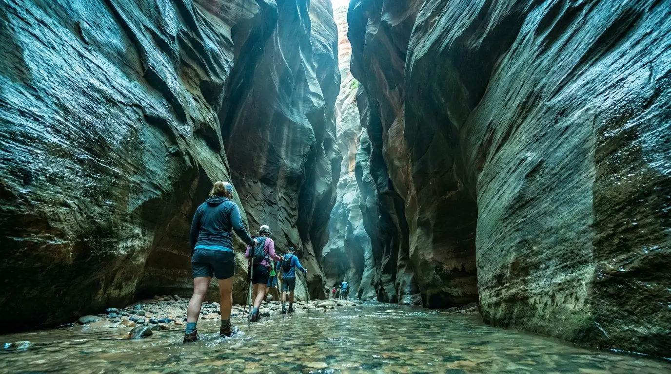
Hikers wading a shallow river between sheer thousand-foot sandstone walls that nearly meet overhead, cool filtered light, The Narrows Zion National Park Utah, ultrarealistic photograph representative of the region
The Narrows — the trail is the river. No permit needed from the bottom, and one of the great walks on the continent. It's also a slot canyon that floods under a blue sky and closes above 150 CFS. Same canyon, two completely different days — the difference is the forecast and the flow.

The access reality

Zion Canyon is shuttle-only in season and the shuttle is free — but there is no park-wide timed entry to book. The single reservation that matters is the Angels Landing permit lottery. (§02, §05)

The water & weather reality

Zion Canyon tops 100°F with little water on trail; the Narrows floods under sun and closes above 150 CFS. Bryce, ninety minutes away, can freeze the same night. (§06)

The two-season packing job

You need sun, salty snacks and a gallon of water for Zion and a warm layer and traction for Bryce's rim — in the same duffel. Plan the elevation, not just the miles. (§04, §11)

The way to think about the region — one corridor, two climates, three gateway clusters Everything strings along one route. Zion's south side sits on SR-9 at Springdale, with Hurricane and La Verkin as the cheaper-bed, fuel-and-supply towns twenty minutes west. Drive east through the Zion–Mt. Carmel Tunnel (RVs over 11'4" tall or 7'10" wide need a paid escort) and you reach US-89 and the Mt. Carmel / Orderville junction, with Kanab forty minutes south as the big base for slot-canyon and Grand Staircase country. Head north on US-89 and turn onto SR-12 for Red Canyon, Bryce Canyon City and the Bryce amphitheater. And off to the northwest, reached separately from I-15 Exit 40, is Kolob Canyons — geographically part of Zion, but its own quiet entrance. One clock ties Zion together: in summer, be off the Zion trails between 10 a.m. and 4 p.m. One fact ties Bryce together: you're at 8,000 feet, so everything is colder and harder than the map says.
🔴 The two mistakes that define a bad Zion–Bryce trip First, arriving without an Angels Landing permit and expecting to walk up — you can't; the chains require a lottery permit, and Scout Lookout (no permit) is the consolation, not the summit (§05). Second, entering the Narrows or any slot on a monsoon afternoon — floods here come from storms you cannot see, and the standing advice is to check the National Weather Service flash-flood potential rating before you set foot in moving water (§06). Get those two right and the rest of this trip is logistics.
02 / THE PARKS & THE GEOGRAPHY

Zion Canyon, Kolob, Bryce — the shuttle, the fees, the geography

Four things to understand before you book anything: how you actually get into Zion Canyon (the shuttle), what stays open to your own vehicle (three roads), how the two parks differ by thousands of feet of elevation, and what it all costs. Fees below are official NPS 2026 figures; the shuttle and elevation facts are the ones that reshape a plan.

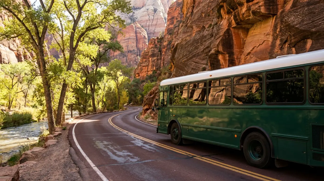
A green park shuttle bus on a canyon road beneath immense striped sandstone cliffs with cottonwoods and a river alongside, warm daylight, Zion Canyon Utah, ultrarealistic photograph representative of the region
The free shuttle is the front door to Zion Canyon. When it runs, the Scenic Drive is closed to private cars, so this is how you reach Emerald Pools, The Grotto, Weeping Rock and the Narrows. Park at the visitor center or ride the town line from Springdale — and leave the RV parked all day.
DestinationHow you get thereThe characterWhat it costs you
Zion CanyonFree shuttle only in season (car banned on the Scenic Drive); park at the VC or ride from Springdale Deep walled canyon; the icons — Narrows, Angels Landing, Emerald Pools $35/vehicle, 7 days · shuttle free · no timed entry
Zion–Mt. Carmel HighwayPrivate vehicle — open; through the tunnel toward US-89 Switchbacks, the tunnel, and the drive-up Canyon Overlook trailhead Included in entry · tunnel escort fee for large RVs
Kolob Canyons (Zion NW)Private vehicle — open; I-15 Exit 40, separate entrance Finger canyons, Taylor Creek, Timber Creek Overlook — and quiet Same Zion entry pass · no shuttle · low crowds
Kolob Terrace RoadPrivate vehicle — open; north from Virgin to Lava Point High meadows, the Subway approach, Lava Point Campground at 7,890 ft Included in entry · high, cool, remote
Bryce Canyon~90 min from Zion; SR-9 → US-89 → SR-12 → SR-63. Optional free shuttle High plateau of hoodoos you look down into; the amphitheater + 18-mi drive $35/vehicle · 8,000–9,100 ft · card/check only
The SR-12 corridorBetween US-89 and Bryce; free-to-reach stops Red Canyon arches & bike path, Kodachrome Basin, Mossy Cave near Tropic Red Canyon free · Kodachrome day-use ~$10

The Bryce scenic drive runs 18 miles from the entrance to Rainbow/Yovimpa Points, climbing past 9,100 ft; the Bryce Amphitheater and its four rim overlooks sit in the first ~3 miles. Driving distances and times to the region from Las Vegas, Salt Lake City or St. George were not verified for this issue and are deliberately not printed — see §13.

🔴 The shuttle, stated precisely — because the sloppy version leaves you circling for parking When the shuttle runs, you cannot drive the Zion Canyon Scenic Drive. Your only options are to park at the Zion Canyon Visitor Center (it fills early — often by mid-morning in peak season) or to park in Springdale and ride the free town shuttle to the pedestrian entrance, then transfer to the canyon line. The canyon line has nine stops — Zion Lodge (Emerald Pools), The Grotto (Angels Landing), Weeping Rock, the Temple of Sinawava (the Narrows) among them — and runs roughly every 5–10 minutes.

⚠️ The overlanding consequence, stated plainly: your rig is dead weight in the canyon. Base yourself where you can leave it parked — a Springdale campground or RV park on the town-shuttle line is worth more here than being ten minutes closer to a gate you can't drive through. The three roads that do stay open to private vehicles (Mt. Carmel Highway, Kolob Terrace, Kolob Canyons) are where a vehicle actually helps.

Fees & passes — 2026

Identical at both parks: private vehicle $35 (7 days, vehicle + all occupants) · motorcycle $30 (7 days) · per person on foot or bike $20 (16+) · under 16 free.

Park annual pass — $70 at each park (Zion or Bryce). America the Beautiful: $80 resident annual. Non-residents (age 16+) pay an added $100 per person in 2026, waived by an Annual or America the Beautiful pass; the non-resident annual is $250.

The math: if you're a U.S. resident doing both parks plus anything else, the $80 America the Beautiful pass pays for itself fast. If you're Canadian or otherwise non-resident, weigh two $35 entries plus the new $100/person surcharge against the $250 non-resident annual — for a couple doing both parks, the annual likely wins.

One operational gotcha: Bryce Canyon does not accept cash — card or check only at the gate. Zion takes card. Entrance fees are separate from and additional to the Angels Landing and wilderness permit fees in §05.

$35/vehicle · 7 days$80 America the BeautifulNon-resident +$100/person

Crowd & heat strategy — the parks tell you how

  • In Zion, ride the first shuttles — the Narrows and Angels Landing crowds build fast; a dawn bus buys you the trail and the cool air both
  • Off the Zion trails 10 a.m.–4 p.m. in summer — NPS guidance, and it's a heat rule, not a crowd rule
  • Base in Springdale to leave the rig parked — the town shuttle makes a vehicle unnecessary inside the canyon
  • When Zion Canyon is a zoo, go to Kolob Canyons — same park pass, a separate I-15 entrance, a fraction of the people
  • At Bryce, sunrise from Sunrise Point and sunset from Bryce Point — and note the whole amphitheater is walkable on the Rim Trail
  • Bryce is high and cold — a summer dawn on the rim can be near freezing; bring a real layer even in July
  • Use the free-to-reach corridor stops — Red Canyon and Mossy Cave have no fee station and thin crowds
  • Drive the Mt. Carmel Highway for Canyon Overlook — the one big-view Zion hike you can reach in your own vehicle
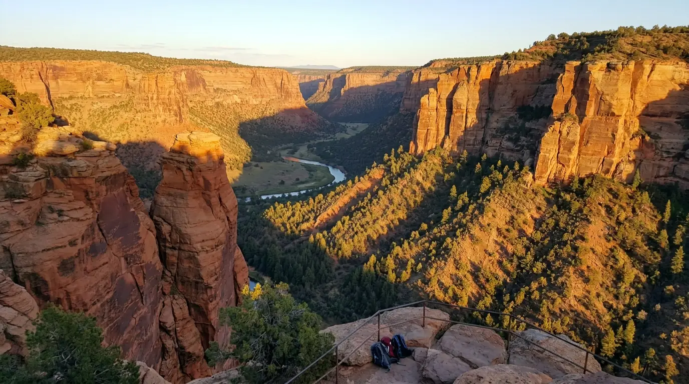
Deep red finger canyons and sheer cliff walls glowing at day's end above a forested valley, seen from a quiet scenic overlook, Kolob Canyons Zion National Park Utah, ultrarealistic photograph representative of the region
Kolob Canyons — Zion's quiet northwest. A separate entrance off I-15 Exit 40, open to private vehicles, with a fraction of the crowds. Same park pass, higher and cooler than Zion Canyon, and the pressure valve on a packed day. Taylor Creek and the Timber Creek Overlook live out here.
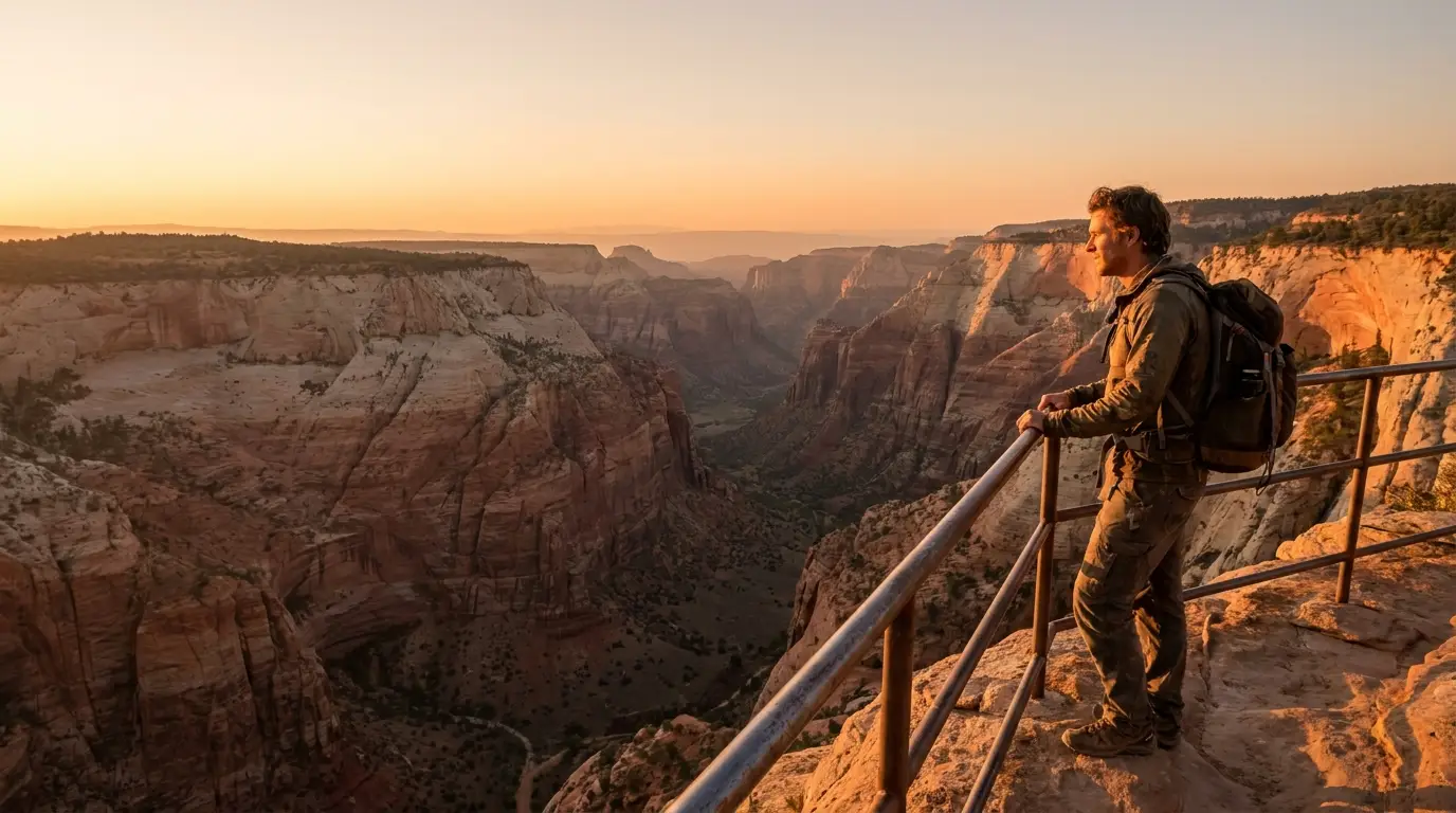
A person standing on a rock ledge looking down a vast curving canyon of red and white cliffs from a high viewpoint, warm afternoon light, Zion National Park Utah, ultrarealistic photograph representative of the region

Kolob Canyons — Zion's quiet northwest, and you can drive it

Reached off I-15 Exit 40 — a completely separate entrance from Zion's south and east gates, and one most visitors never see. The Kolob Canyons Scenic Road climbs about five miles from the visitor center to the easy Timber Creek Overlook (1.0 mi RT, official), past the trailhead for Taylor Creek (5.0 mi RT, 450 ft, official) to the Double Arch Alcove.

Why it matters for this trip: it's the same Zion pass, it takes private vehicles, and on a hot, packed day in Zion Canyon it's the pressure valve — higher, cooler and far quieter. Note it's higher than Zion Canyon, so its road can close after storms and its trails hold snow and mud longer.

Private vehicle — openSame Zion entry passHigher; snow/mud lingers
03 / THE ZION HIKES

The walks in the canyon — with honest distances and honest hazards

Nearly every distance below is an official NPS figure, stated flat; the one exception (Pa'rus) is flagged where it appears because the park serves its mileage dynamically. What doesn't change: most of these trailheads are shuttle-only, most trails carry no water, and the two that people underestimate — the Narrows and Angels Landing — are gated by weather and permit respectively. One correction to bake in: the classic Observation Point hike from Weeping Rock is closed (§00).

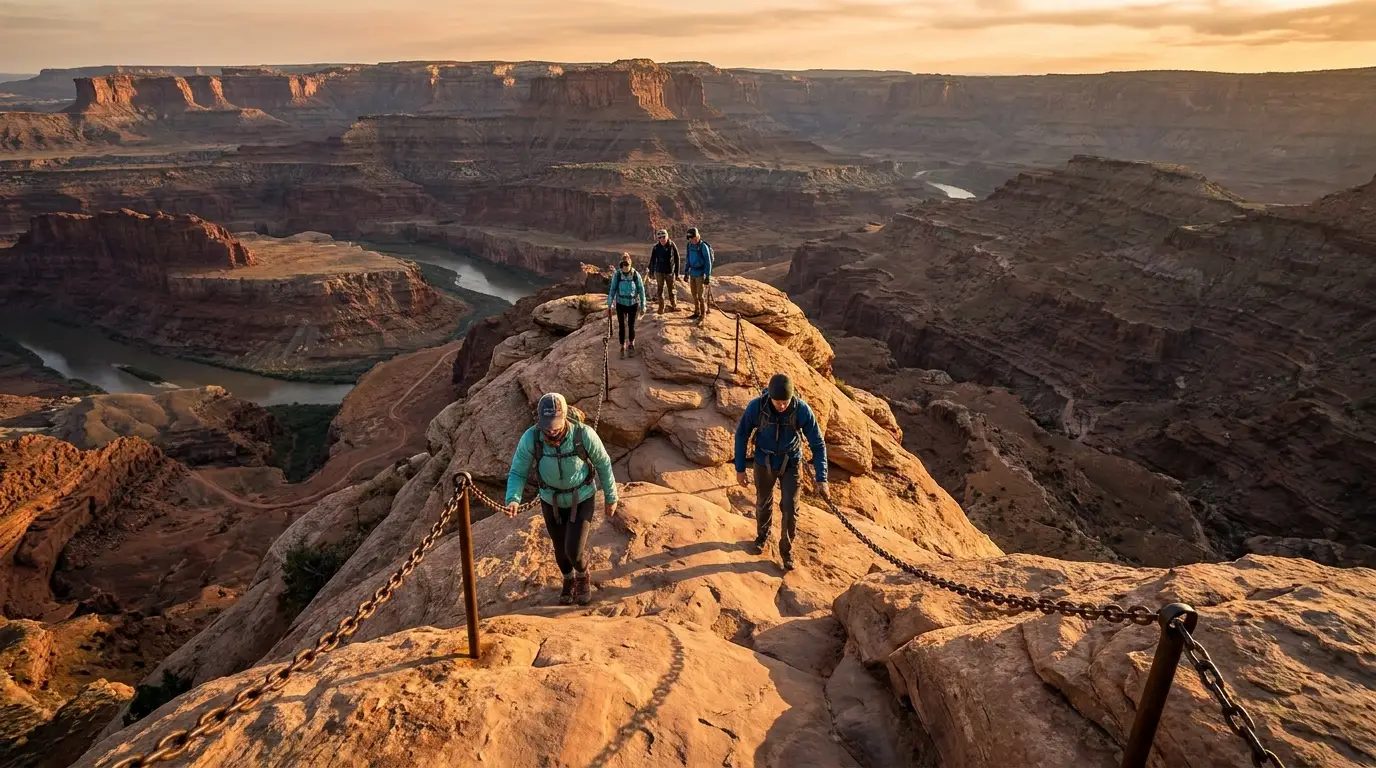
A narrow rock fin trail with support chains climbing a steep exposed sandstone ridge high above a canyon floor, hikers ascending, warm light, Angels Landing Zion National Park Utah, ultrarealistic photograph representative of the region
Angels Landing — the chains, and the permit. 5.4 miles round trip, 1,488 feet of gain, and a final knife-edge where most of the trail's deadly accidents since 1930 have happened. You need a lottery permit to go past Scout Lookout. Draw one, pick a dry morning, and don't go if heights unnerve you.

5.4 mi RT · 1,488 ft · permit required past Scout LookoutAngels Landing

From The Grotto shuttle stop up the West Rim Trail: 5.4 miles round trip, 1,488 ft of gain, strenuous, about 4 hours (official NPS). Scout Lookout at ~2.25 miles needs no permit; the chained fin beyond it does — a permit awarded by lottery on recreation.gov ($6 to apply, $3/person if drawn). See §05 for how the lottery works.

NPS: most of this trail's deadly accidents since 1930 happened on the chained section. Sheer drop-offs on both sides, rockfall, and slickrock that turns lethal when wet. Do not go in storms, wet or icy conditions, darkness, or with a fear of heights — Scout Lookout is a genuine, permit-free consolation with much of the view.

5.4 mi RT · 1,488 ft · officialPermit lottery · chains · exposureScout Lookout = no permit
The Grotto · shuttle stop 6
chains past Scout Lookout

Up to ~10 mi RT · no permit from the bottom · the trail is the riverThe Narrows (Bottom-Up)

From the Temple of Sinawava, walk the paved Riverside Walk (2.2 mi RT, official) then continue upstream in the Virgin River as far as Big Spring — anywhere from a one-hour paddle to a ~10-mile all-day round trip, no permit. The 16-mile top-down route from Chamberlain's Ranch does require a wilderness permit (§05).

Flash floods here arrive under blue sky and have killed hikers. The Narrows closes when Virgin River flow exceeds 150 CFS, and walking upstream is hard above ~70 CFS. Check the NWS flash-flood potential rating the morning of; do not enter on a Probable or Expected day. The water is cold year-round — outside high summer, rent a drysuit, canyon boots and a stick in Springdale. Slippery boulders; a good stick is not optional.

No permit bottom-up · official accessCloses >150 CFS · flash flood · cold waterRent gear in Springdale
Temple of Sinawava · stop 9
turn around at Big Spring

1.0 mi RT · 163 ft · you can DRIVE to this oneCanyon Overlook

1.0 mile round trip, 163 ft of change, about an hour, moderate (official NPS). The trailhead sits just east of the Zion–Mt. Carmel Tunnel on the Mt. Carmel Highway — which stays open to private vehicles, so this is the big-view Zion hike you can reach without the shuttle. Ends at a railed overlook down the main canyon.

Rock steps, ledges and unfenced drop-offs along the way — keep children close, and it's slick with ice in winter. The trailhead lot is tiny and fills fast; parking near the tunnel is tight, and RVs over 11'4" tall or 7'10" wide need a paid tunnel escort to pass through. Superb at sunset.

1.0 mi · 163 ft · officialDrive-up — no shuttleUnfenced ledges · tiny lot
Mt. Carmel Hwy · east of tunnel
the no-shuttle big view

Emerald Pools (Lower · Middle · Upper)

From the Zion Lodge stop. Lower is 1.2 mi, 69 ft, paved, passing behind a seep waterfall; Middle adds up to ~2.2 mi RT on unpaved trail with drop-offs; the Upper spur is a short ~0.3 mi one-way climb to a pool beneath a cliff (official NPS).

Do not enter or swim in the pools. Rock near the falls is slick, and the upper trail ices in winter. The best half-day when the Narrows or Angels Landing are too much for the group.

Riverside Walk · Pa'rus · Watchman

Riverside Walk: 2.2 mi RT, 57 ft, easy and paved (official) — the family gateway to the Narrows. Watchman Trail: 3.3 mi RT, moderate (official), from the visitor center, no shuttle needed, best early or evening.

Pa'rus Trail: paved, near-level, the only Zion Canyon trail open to bikes and leashed dogs — roughly 3.5 mi RT [distance UNVERIFIED — NPS serves it dynamically]. The default for families, riders and anyone with a dog.

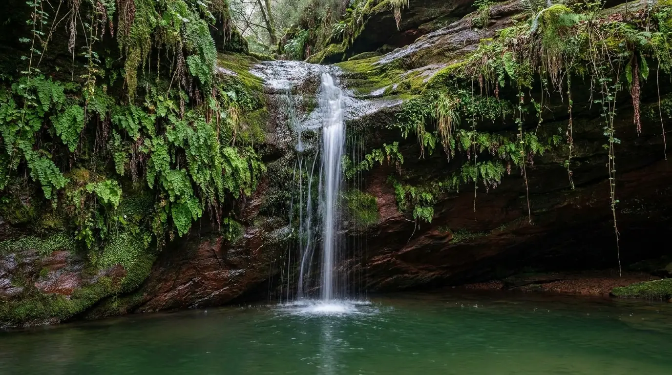
A thin seep waterfall dropping over a red sandstone overhang into a green pool surrounded by hanging gardens and ferns, cool shaded light, Emerald Pools Zion National Park Utah, ultrarealistic photograph representative of the region
The Emerald Pools — seep water on a hot day. Lower is paved and passes behind a curtain of falling water; the upper trail climbs to a pool under a cliff. The best shady half-day when the Narrows or Angels Landing are too much for the group — just don't swim in the pools.
🔴 Observation Point via the East Rim is CLOSED — don't plan the Weeping Rock climb The classic Observation Point hike from Weeping Rock up the East Rim Trail has been closed since a 2023 rockfall. Weeping Rock Trail and Shuttle Stop 7 themselves reopened September 5, 2025, but the ascent to Observation Point from there did not reopen with them. Observation Point can still be reached the long way, via the East Mesa Trail off Kolob Terrace Road — a different trailhead, a different day, and outside the canyon shuttle system. Confirm current status on the Zion conditions page before building any plan around Observation Point.

Also note Hidden Canyon, which shared the Weeping Rock access, has been closed since the same event. Don't trust older guidebooks or blog posts that route you up from Weeping Rock — they predate the rockfall.

Kolob Canyons on foot — the quiet alternative, all official NPS figures Taylor Creek 5.0 mi RT, 450 ft, moderate, to the Double Arch Alcove past two 1930s cabins — expect repeated creek crossings (a flash-flood channel in monsoon season). Timber Creek Overlook 1.0 mi RT, 100 ft, easy, at the end of the Kolob Canyons Road. And for the very fit, the La Verkin Creek Trail to Kolob Arch is ~14 mi RT with an overnight wilderness permit — Kolob Arch spans 287 feet, among the largest in the world. All reached from I-15 Exit 40, on the far northwest edge of the park, with a fraction of the Zion Canyon crowds.
04 / BRYCE & THE SR-12 CORRIDOR

The hoodoos, the rim, and the free stops on the way

Bryce is the high, cold half of this trip — a plateau of pink-and-white hoodoos you look down into, where the drive-up overlooks are the easy win and the loops below the rim are harder than the mileage because of the altitude. Every distance here is an official NPS figure. Around it, the SR-12 corridor holds two genuinely good, largely free stops most people blow past: Red Canyon and Kodachrome Basin.

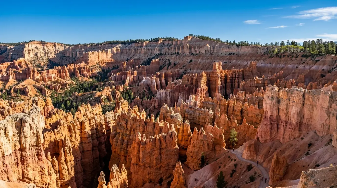
A vast amphitheater of thousands of orange and cream rock spires and hoodoos below a forested rim under a bright sky, warm light, Bryce Canyon National Park Utah, ultrarealistic photograph representative of the region
The Bryce Amphitheater from the rim. Not a canyon carved by a river but a bowl of hoodoos eaten out of the plateau edge by frost and rain. The overlooks — Sunrise, Sunset, Inspiration, Bryce — are drive-up. The magic is dropping below the rim on the Queen's Garden / Navajo loop, then climbing back out at 8,000 feet.

Bryce — the roster (all official NPS figures)

TrailDistanceElev. changeDifficultyThe honest note
Sunset → Sunrise (Rim)1.0 mi40 ftEasyPaved, flat, the amphitheater's edge — do this at sunrise
Queen's / Navajo Combo2.9 mi625 ftModerateThe best hike in the park. Wall Street side closes in winter/spring
Navajo Loop1.3 mi515 ftModerateSteep Wall Street switchbacks; an out-and-back when Wall St is closed
Queen's Garden1.8 mi450 ftModerateThe gentlest way below the rim
Peekaboo Loop5.5 mi1,560 ftStrenuousShared with mule trains; the climbs bite at altitude
Fairyland Loop8.0 mi1,900 ftStrenuousLong, quiet, exposed — a serious day at 8,000 ft
Bristlecone Loop1.0 mi200 ftEasyAt Rainbow Point, 9,100+ ft, ancient pines — the altitude is real
Mossy Cave0.8 mi150 ftEasyOff SR-12 near Tropic — no fee station on this access

Source: NPS Bryce Canyon day-hikes table. Two figures the park itself lists inconsistently — Fairyland's own trail page says 1,716 ft of change against the 1,900 ft on the day-hikes table, and Peekaboo's often-quoted "670 ft descent from Bryce Point" is the descent only, not the 1,560 ft total. We print the day-hikes-table figures and flag the discrepancy rather than smoothing it over.

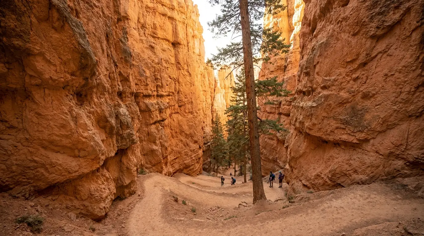
A steep switchback trail descending between towering narrow rock walls with a tall pine growing from the canyon floor, warm filtered light, Wall Street Navajo Loop Bryce Canyon Utah, ultrarealistic photograph representative of the region

Queen's Garden / Navajo — the one to do, and the Wall Street catch

2.9 miles, 625 ft, moderate, 2–3 hours (official) — the classic descent from Sunset Point down Queen's Garden and back up the Navajo Loop, and the single best way below the rim without a strenuous commitment. Do it clockwise (down Queen's, up Navajo) to keep the steepest climbing short.

The catch: the Navajo Loop's steep Wall Street switchback slot closes for winter and spring due to ice and rockfall, which turns the loop into an out-and-back on the Two Bridges side. Check the status before you count on the full loop.

And the altitude: at ~8,000 ft the climb back to the rim is the hard part. Take it slow, carry water, and don't be surprised if a "2.9-mile easy" reads harder than it looks on paper.

2.9 mi · 625 ft · officialWall Street closes winter/springClimb out at 8,000 ft
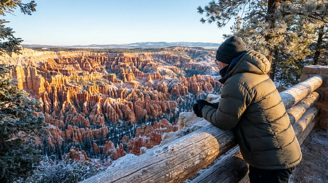
First light striking a vast field of orange rock spires from a forested rim overlook with long shadows and a person watching, cold clear morning, Bryce Canyon National Park Utah, ultrarealistic photograph representative of the region
Sunrise on the rim. The overlooks — Sunrise, Sunset, Inspiration and Bryce Points — are drive-up and linked on foot by the Rim Trail. First light sets the hoodoos on fire. Bring the warm layer: a July dawn up here can be near freezing.
The overlooks, and the shuttle The four Bryce Amphitheater rim overlooks — Sunrise, Sunset, Inspiration and Bryce Points — are all drive-up and all linked on foot by the Rim Trail (Bryce Point to Fairyland Point is ~5.5 mi one-way; the paved Sunrise-to-Sunset segment is a flat 1.0 mi). Sunrise from Sunrise Point and sunset from Bryce Point are the standing recommendations. The far end of the 18-mile scenic drive reaches Rainbow and Yovimpa Points above 9,000 ft. A free, optional shuttle runs the amphitheater core roughly April 3 – October 18, 2026 (buses about every 15 minutes) — useful when the small overlook lots fill, but unlike Zion, Bryce's scenic drive stays open to private vehicles. [Shuttle dates change yearly — confirm before travel.]

The SR-12 corridor — the free-to-reach stops most people skip

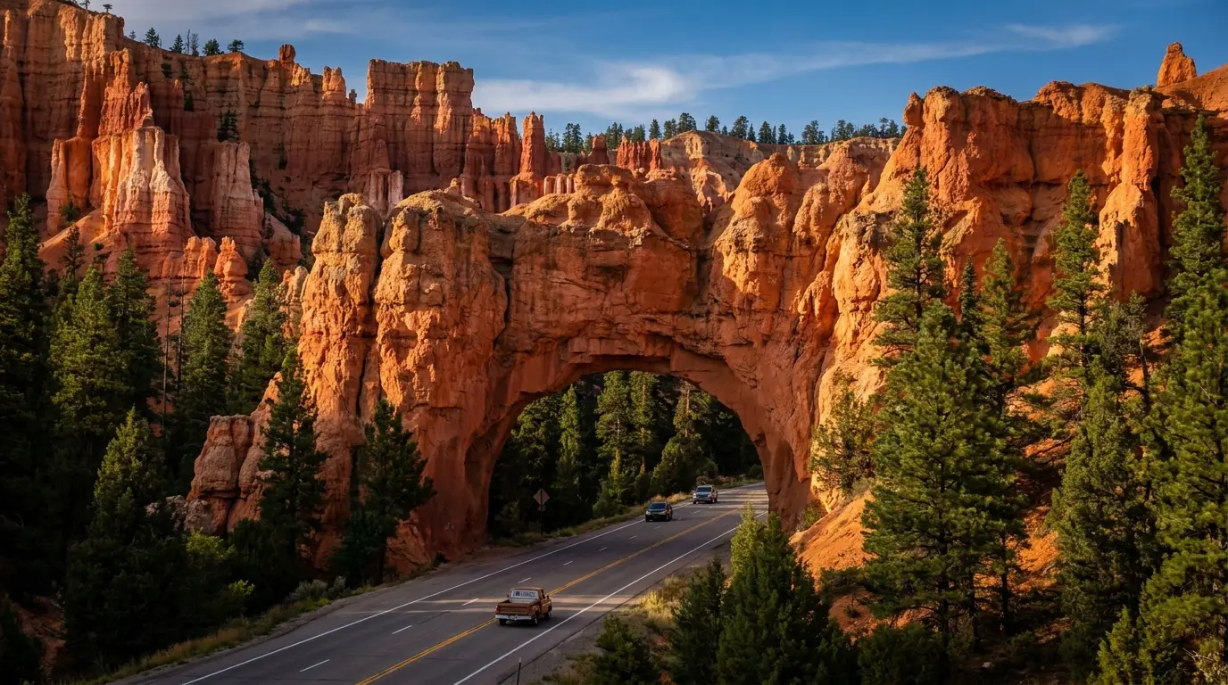
A two-lane highway passing beneath a natural red rock arch tunnel with vivid vermilion hoodoos and pines crowding the roadside, warm daylight, Red Canyon Dixie National Forest Utah, ultrarealistic photograph representative of the region
Red Canyon, on the way to Bryce. Two red-rock arches span SR-12 itself, and a paved bike path runs alongside. No entrance fee, no crowds, and a colour that rivals Bryce — the best free stop most visitors drive straight past.

Red Canyon — the arches over the highway

On SR-12 about 4 miles east of US-89, roughly 8 miles from Ruby's Inn, in Dixie National Forest — no day-use entrance fee. Two red-rock arches span the byway itself; a short Arches Trail (~0.7 mi) and other paths climb into the formations, and the ~8.6-mile paved Red Canyon Bicycle Trail parallels the highway. A Forest Service visitor center sits at the mouth.

Why it's worth the stop: it's free, it's on the way, and the colour rivals Bryce with a fraction of the people. Trail distances beyond the bike path weren't individually verified — get the map at the Red Canyon visitor center. There's also a first-come Forest Service campground here (§07).

Kodachrome Basin — stone chimneys, and a campable detour

Near Cannonville off SR-12, a Utah state park named by a 1948 National Geographic expedition, known for its ~60 sedimentary rock chimneys and easy-to-moderate trails like the Angel's Palace and Panorama loops. Day use ~$10/vehicle [confirm current rate on stateparks.utah.gov].

The overlander angle: it has a developed campground with standard and full-hookup sites (§07) and splits the drive nicely between Bryce and Escalante. A quiet, scenic overnight that most Bryce visitors never reach.

Mossy Cave — the short, free, kid-friendly one near Tropic 0.8 mi RT, 150 ft, easy (official NPS), reached from SR-12 near Tropic, outside the main park gate — so there's no fee station on this access. A streamside walk to a mossy overhang that ices into a frozen curtain in winter, plus a small waterfall on a spur. The stream is an irrigation ditch dug in the 1890s, not a natural creek — the water is diverted, so respect posted rules. The best low-effort stop in the Bryce area for young kids or a time-limited afternoon.
05 / THE PERMITS & THE SHUTTLE

What you reserve, how the lottery works, and how you get around

This is the section that replaces "the 4x4 trails" of a canyon-country guide — because in Zion the thing that gates your trip isn't a rock crawl, it's a permit system and a shuttle. Get these right and you don't get turned away. Angels Landing, the Narrows top-down, the Subway and the West Rim all run through recreation.gov; the canyon shuttle is free but non-negotiable.

Angels Landing — the permit lottery, step by step

A permit is required only to go past Scout Lookout onto the chained fin. Scout Lookout via the West Rim Trail from The Grotto needs none. Permits come through two recreation.gov lotteries:

1. Seasonal Lottery — apply well in advance for a chosen season, ranking up to seven date-and-time preferences. This is how you plan a trip around the hike months out. The 2026 spring seasonal lottery opened February 13, 2026.

2. Day-Before Lottery — apply between 12:01 a.m. and 3 p.m. Mountain Time the day before you want to hike; results post at 4 p.m. MT the same day. This is the flexible option if you didn't win (or didn't enter) the seasonal draw.

Cost: a $6 application fee (non-refundable, covers a group of up to 6) plus $3 per person if you're awarded. The hike: 5.4 mi RT, 1,488 ft, strenuous (§03). Pick a dry, calm morning — the chains are the danger, not the switchbacks.

$6 apply + $3/personSeasonal & day-before lotteriesChains section only — Scout Lookout is free

The Narrows — permit only if you go top-down

Bottom-up needs no permit — from the Temple of Sinawava as far as Big Spring. Only the 16-mile top-down through-hike from Chamberlain's Ranch requires a wilderness permit, and you arrange your own shuttle to the top.

The gate that actually stops you isn't a permit — it's the river. NPS closes the Narrows when Virgin River flow exceeds 150 CFS, which commonly shuts it during spring snowmelt. And flash floods can strike under sun. Check flow and the flash-flood rating the morning of, every time.

The Subway & West Rim — the other wilderness permits

The Subway (Left Fork of North Creek) requires a permit even as a day hike — top-down is a technical canyoneering route with rappels and swims; bottom-up is a strenuous scramble. The West Rim thru-hike and all overnight backcountry trips need wilderness permits too.

All of these run through recreation.gov (advance and last-minute components) plus the park wilderness desk. Exact per-permit and per-person fees load dynamically and are not printed here — pull the current amounts from the Zion gateway on recreation.gov before you budget.

The shuttle — free, and the only way into the canyon in season

Two free lines. The Zion Canyon Line runs the Scenic Drive (nine stops, visitor center to Temple of Sinawava) roughly every 5–10 minutes; the Springdale Line connects the town's lodging strip to the park's pedestrian entrance. The 2026 season resumed March 7, 2026 and runs into the winter holiday period.

When it runs, private vehicles are banned on the Scenic Drive. Park at the visitor center (fills early) or in Springdale and ride. The three roads that stay open to your own vehicle — Zion–Mt. Carmel Highway, Kolob Terrace Road, Kolob Canyons Scenic Drive — are the only places a rig helps you inside the parks.

Free · every 5–10 minNo private cars on the Scenic Drive in season2026 season from Mar 7
The permit-and-shuttle rule, in one line each
  1. Want the Angels Landing chains? Enter the recreation.gov lottery — seasonal months out, or day-before by 3 p.m. MT. No permit, no chains.
  2. Want the Narrows bottom-up? No permit — but check flow (≤150 CFS) and the flash-flood rating the morning of.
  3. Want the Subway or an overnight? Wilderness permit via recreation.gov — the Subway needs one even as a day hike.
  4. Getting into Zion Canyon? Park and ride the free shuttle. You cannot drive the Scenic Drive in season, so base where the rig can stay put.
06 / SAFETY — READ THIS FIRST

Heat, flash floods, altitude and cold water — in that order

These parks look manageable — a free shuttle, paved trails, a hospital within reach — and that's the trap. Zion's headline killers are heat and flooding; Bryce's is altitude; the Narrows adds cold water year-round. Read this before any trail, and match your plan to the specific hazard of the specific place.

Heat & water — the Zion Canyon numbers

Zion Canyon regularly exceeds 100°F in summer, with reports above 110°F, and the walls trap and radiate heat long after the sun moves. NPS guidance: hike before 10 a.m. or after 4 p.m., rest in shade, and turn back at the first sign of trouble.

Water: carry at least a gallon per person per day, roughly a litre per person per hour of hiking in extreme heat, and eat salty snacks — water alone doesn't replace what you sweat out. There's no water on most trails once you leave the trailheads.

Most Zion rescues are heat-driven, not fall-driven. The exposed slickrock and the photogenic cliffs get the attention; the thing that actually puts people down is the sun on a shadeless trail at 2 p.m.

100°F+ in summer1 gal/person/dayOff trail 10 a.m.–4 p.m.

Flash floods — the sentence that is the whole problem

NPS on Zion's narrow canyons: floods "can occur even when it's sunny." The storm that catches you is the one you cannot see, miles upstream. Water can rise many feet in minutes. Floods here have stranded, injured and killed hikers.

The discipline: check the National Weather Service flash-flood potential rating the morning of — its four tiers are Not Expected / Possible / Probable / Expected. On a Probable or Expected day, stay out of the Narrows, the Subway and every slot, and pick a rim or drive-up objective instead.

The Narrows also closes when flow exceeds 150 CFS — a separate, published threshold from the flood rating. Both can shut your plan; check both.

Floods under blue skyCloses >150 CFSCheck the NWS rating

Altitude & cold — the Bryce and Narrows hazards

Bryce sits at 8,000–9,100 ft. The air is thinner, every climb out of the amphitheater is harder than the mileage, and it can freeze overnight even in summer. Snow and ice linger into spring, and steep switchbacks like Wall Street ice up — which is why they close seasonally. Microspikes are a real Bryce item from late fall through spring.

The Narrows is cold water year-round. Even in summer, hours in the river drop your core; outside high summer, hypothermia is the risk, not heat — rent a drysuit, not just boots. And the 40-degree daily swings typical of the Colorado Plateau mean a hot Zion afternoon can be a cold canyon morning.

Bryce freezes overnight in summerNarrows: cold water, hypothermiaMicrospikes + drysuit

The hazards people don't budget for

  • Exposure on the icons. Angels Landing's chained fin is where most of that trail's deaths have happened; Canyon Overlook and the Emerald Pools upper trail have unfenced drop-offs. Wet or icy rock is the multiplier
  • Cell coverage is unreliable in the canyons. Plan for none in the Narrows, Kolob and the Bryce backcountry. [We found no primary NPS statement breaking Zion coverage down by area — treat "no signal in the canyon" as the safe assumption, not a quoted fact.]
  • The tunnel is a hazard for big rigs. RVs over 11'4" tall or 7'10" wide need a paid escort through the Zion–Mt. Carmel Tunnel; oversized vehicles can't just drive it
  • Toxic cyanobacteria have appeared in the Virgin River. Don't drink untreated river water, keep it out of your mouth in the Narrows, and heed posted advisories
  • Wildlife and the desert crust. Don't feed anything (Zion's rock squirrels bite more people than any other animal), and stay on trail and slickrock — the biological soil crust doesn't recover
  • Sun at altitude burns faster. Bryce's thin, clean air is brutal on skin and eyes even when it's cold — sunscreen and shades on the rim, not just in the canyon
If it goes wrong

911. The nearest hospitals are in St. George (about 40 miles southwest of Springdale) for the Zion side and near Panguitch for the Bryce side. We deliberately name no specific facility, phone number or hours here — we could not verify current details for this issue, and a wrong ER address in an emergency is worse than an admitted gap. Get the current nearest-ER answer from the Zion or Bryce visitor center on arrival, and remember the canyons have no signal to call it in from (§13).

07 / THE CAMPING STRATEGY

Where to sleep — in the parks, on the corridor, and in the gateway towns

Two facts shape every camping decision here. First, the in-park campgrounds are small, popular and mostly reservation-driven — they book out, and the status keeps changing (South Campground was closed and only just reopened; Bryce's loops open and close by season). Second, the smart overlander move on the Zion side is to base in Springdale so you can leave the rig and ride the shuttle. Fees and dates below are flagged where the source is dated or dynamic — confirm on recreation.gov before you rely on them.

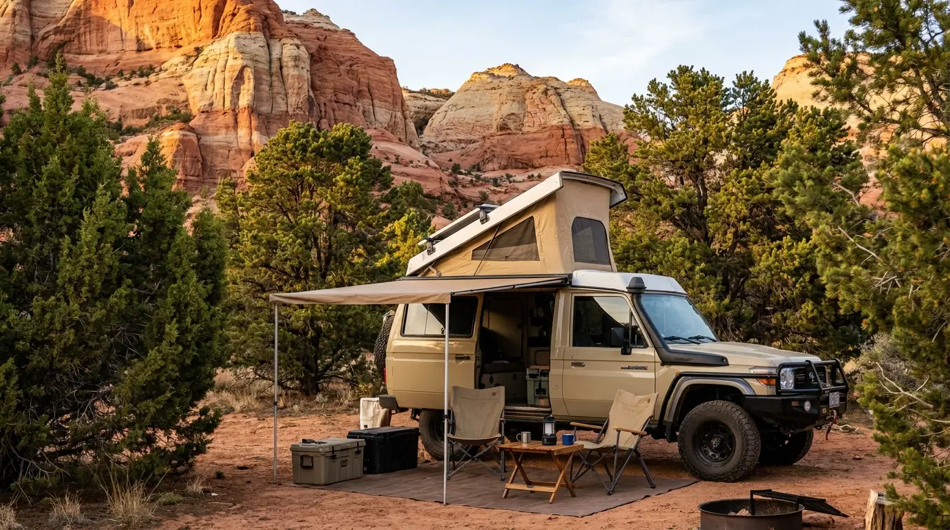
A camper van and rooftop-tent rig parked at a campsite among junipers and pinyon pines beneath red sandstone cliffs at golden hour, near Zion Utah, ultrarealistic photograph representative of the region
The Zion–Bryce bed. Two in-park campgrounds at Zion, two at Bryce, a Forest Service campground in Red Canyon, a state-park loop at Kodachrome Basin, and private RV parks in the gateway towns. Reserve early, and on the Zion side base where you can leave the vehicle parked and ride the free shuttle.

Inside the national parks

CampgroundPark · notesWater / hookupsReserve?SeasonFee
Watchman
Zion — South entrance
NPS · walkable to VC, shuttle, Pa'rus Water; 30-amp electric & non-electric; dump station; no full hookups Required — recreation.gov, up to 6 mo ahead Year-round ~$35 non-elec / ~$45 elec [confirm on rec.gov]
South
Zion — South entrance
NPS · on the Virgin River near the VC Water; dump station; no hookups Required — recreation.gov Reopened ~May 29, 2026 after reconstruction ~$20 individual [older figure — confirm]
Lava Point
Zion — Kolob Terrace Rd
NPS · 6 primitive sites, 7,890 ft, ~45 min from Virgin NO water; vault toilets; no hookups recreation.gov, up to 14 days ahead Typically May–Sept, weather permitting Fee not published — confirm
North
Bryce Canyon
NPS · ~99 sites, central — walk to VC, store, Rim Trail Water; no hookups Required in season (Loop A year-round) Year-round (Loop B seasonal) $30
Sunset
Bryce Canyon
NPS · ~1.5 mi south of VC, by Sunset Point Water; no hookups Reservable ~14 days ahead in season Closed in winter (~late Mar–mid-Oct) $30

Notes: Watchman and South nightly fees load dynamically on the NPS pages — the ~$35/~$45 (Watchman) and ~$20 (South) figures come from a July 2024 NPS increase and an older South page respectively, so confirm the current 2026 rate on recreation.gov before relying on it. Lava Point's fee is not published on the NPS page (historically free/low). Bryce takes card or check only — no cash, including at the campgrounds. Bryce sits at ~8,000 ft, so pack for freezing nights even in summer. Sunset Campground's exact site breakdown came from a third-party aggregator and is not asserted here — confirm on the NPS Sunset page.

🔴 Base on the Zion side where you can leave the rig — the shuttle makes it the smart play Because the Zion Canyon Scenic Drive is closed to private vehicles in season, a campsite you can walk or town-shuttle from is worth more than one that's marginally closer to a gate you can't drive through. Watchman and South put you inside the park on the shuttle and town-shuttle network; the private RV parks in Springdale (below) put you on the free town line. Either way, plan to park the vehicle for the day and ride. On the Bryce side there's no such restriction — the scenic drive is open — so proximity is simpler there.

On the corridor & in the gateway towns

Red Canyon Campground

Dixie NF, SR-12, ~8 mi from Ruby's Inn

37 sites, first-come, first-served. Drinking water, flush & vault toilets, coin showers ($2.50), dump station ($10). Single $30 / double $60. The paved Red Canyon bike path is at the door. A cheaper, quieter alternative to the Bryce campgrounds. Season roughly late spring–fall — confirm.

Kodachrome Basin State Park

Near Cannonville, off SR-12

The Basin Campground has standard and full-hookup sites plus bunkhouses, with showers and a dump station. Reserve via ReserveAmerica (Utah State Parks), up to ~4 months ahead. Fee figures (~$35 standard / ~$45 full-hookup) come from an aggregator — confirm on stateparks.utah.gov. A scenic overnight that splits the Bryce–Escalante drive.

Private RV parks — the gateway beds

Springdale · La Verkin · Bryce Canyon City

Zion Canyon Campground & RV Resort (Springdale — closest private option, on the town shuttle line), Gateway Luxury RV Resort (La Verkin, ~20 min from Zion), and Ruby's Inn RV Park (Bryce Canyon City, on the park shuttle). Full hookups and dump stations. Site counts, seasons and current rates weren't verified — book direct. (§09)

A note on dispersed camping There is BLM and Forest Service land in this region where dispersed camping is allowed — but the rules, closures and fire restrictions vary by district and change seasonally, and we could not verify current dispersed-camping boundaries for this issue. Do not assume you can pull off and camp near the parks — much of the land immediately around Zion and Bryce is private, tribal or restricted. If you want to disperse-camp, get the current legal areas and fire status from the BLM (St. George or Kanab field office) or the Dixie National Forest office before you rely on it, and never build a plan around an unconfirmed pin. [Red Cliffs BLM campground near Hurricane appears in our campground data with a low-clearance-access caveat and unverified details — confirm before towing anything under that I-15 underpass.]
08 / THE NIGHT SHIFT

Dark sky — a real reason to build a night into the plan

Bryce Canyon is a certified International Dark Sky Park, and its combination of high elevation, clean dry air and remoteness makes it one of the darkest places in the country. Zion, deeper and closer to town lights, is good but not Bryce. This is the one activity that gets better in the cold months, when Bryce's long nights and steady air peak.

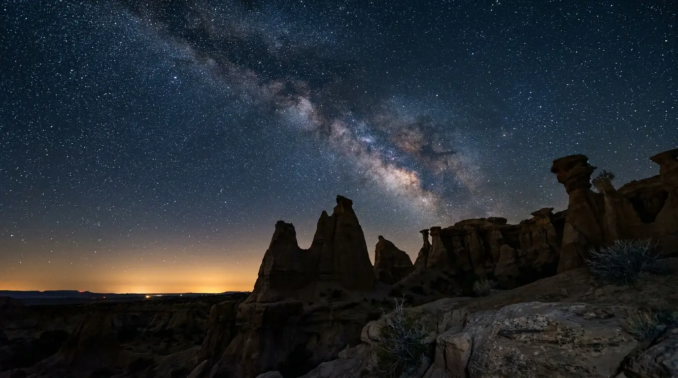
The Milky Way arching over silhouetted rock spires and hoodoos with a faint glow on the horizon and a dense starfield, Bryce Canyon Utah at night, ultrarealistic photograph representative of the region
Bryce, after dark. Certified an International Dark Sky Park in 2019, with ranger-led telescope programs in season and some of the darkest skies in the lower 48 — a product of 8,000-plus feet of elevation, dry desert air and distance from any city glow.

Where to shoot — Bryce

The amphitheater overlooks — Sunset, Sunrise, Inspiration and Bryce Points — give you the hoodoos as a silhouetted foreground under the Milky Way. Rainbow Point at the road's end is darker still, if it's open.

Bryce runs ranger-led night-sky and telescope programs in season (generally summer weekends at the visitor center; check the current schedule). NPS publishes an air-quality/visibility page but we quote no specific distance statistic — pull it live if you want a hard number.

Where to shoot — Zion & the corridor

Zion's deep, walled canyon and Springdale's glow make it a harder night than Bryce, but the Kolob Terrace and Kolob Canyons areas get you away from the light. Kodachrome Basin on SR-12 is a quiet, dark, campable option between the parks.

If dark sky is a priority, weight the Bryce end of the trip toward the new moon and sleep at altitude — the payoff is dramatically better than fighting Zion's canyon walls and town lights.

Technique & timing

Allow 20–30 minutes for your eyes to adjust, use a red light, not white (and don't ruin others' night at a crowded overlook), and plan around the moon, not the month — the darkest skies come at new moon or when the moon is below the horizon.

The Milky Way core season runs roughly April–September; at Bryce that collides with the only warm months, so late spring and early fall on a new moon are the sweet spot — dark, and just warm enough to stand still at altitude. [Best-months call is our inference from core visibility plus Bryce's elevation, not an NPS statement.]

Dress for it — the part people forget A Bryce night is a near-freezing night, even after a warm July day, because you're at 8,000 feet. The single most common dark-sky mistake here isn't camera settings — it's arriving in shorts and lasting fifteen minutes. Bring the warm layer, gloves and a hat you packed "for Bryce during the day," and use them at night. Pair a Bryce dark-sky session with a rim-overlook sunset so you're already in place as the stars come out.
09 / PRACTICAL & SERVICES

The gateway towns — and who to hire

Springdale is Zion's front porch, Hurricane and La Verkin its supply towns, Kanab the big base for the slot-canyon country to the east, and Bryce Canyon City the hub at Bryce. The businesses named below were each confirmed to have a live website. We publish what they do and where; we don't publish prices, and for a couple of well-known operators whose sites blocked automated checks, we name them without a link and say so.

🔴 Make the visitor centers your first stop for anything time-sensitive The Zion Canyon Visitor Center and Bryce Canyon Visitor Center hold the current road, trail-closure and flash-flood knowledge that no website publishes hour to hour — plus the nearest-ER answer, current fire status, and which shops are open. They are the answer to most of the gaps below. For the Kanab / Grand Staircase side, the Kanab Center / BLM Visitor Center is the equivalent. Ask on arrival, before you need it.

Zion / Springdale — guides & gear

Zion Guru — guided canyoneering, climbing and Narrows trips, plus drysuit, e-bike and packraft rentals. Zion Outfitter — Narrows gear (drybibs, canyon boots, poles) and bikes, right at the pedestrian entrance. Zion Cycles — bike and e-bike rentals, repair, and Narrows gear.

Why hire here: the Narrows and the Subway are cold-water, flood-exposed routes where rented drysuits and current flow knowledge matter, and Zion's canyoneering is technical rappel terrain. Zion Adventure Company and Zion Rock & Mountain Guides — two long-established Springdale outfitters — are real and operating, but their websites refused our automated checks, so we name them without a link and you should confirm current offerings directly.

Kanab & the east — slot canyons & UTV

Dreamland Safari Tours — 4x4 trips to The Wave, White Pocket and Peekaboo slot, plus overnight backcountry. Kanab Tour Company — guided UTV and slot-canyon tours plus RZR and sandboard rentals. Razor's Edge Tours — Peekaboo Slot UTV tours and sandboarding.

Willow Canyon Outdoor — a Kanab gear store and café, good for a resupply and a map. East Zion Adventures (Orderville/Mt. Carmel) — Jeep, UTV, canyoneering and horseback on Zion's quieter east side.

Hurricane / La Verkin & the off-road side

Hurricane ATV Rentals — Can-Am ATV/UTV rentals and guided tours around Sand Hollow and the Zion area, with an on-site mechanic and towing/recovery (a rare verifiable recovery option in this region). Gateway Luxury RV Resort (La Verkin) — full-hookup RV sites and casitas, ~20 minutes from Zion's south entrance.

Hurricane and La Verkin are also the practical fuel, groceries and supply towns before you commit to Springdale's tighter, pricier strip — though we name no specific fuel or grocery location (see the gaps below).

Bryce Canyon City & the rides

Ruby's Inn — the historic hub just outside the Bryce gate: lodging, an RV park, a general store, an auto-care center, guided ATV tours, and the park shuttle connection. Canyon Trail Rides — the concessioner running horseback and mule rides inside Bryce, Zion and the Grand Canyon North Rim, including the descent into the amphitheater.

The Bryce campground & RV picture runs through Ruby's on the private side and the North/Sunset campgrounds on the park side (§07). Bryce Canyon City is small — Ruby's is effectively the town.

🔴 The gaps — categories we could NOT verify, and will not invent

Fuel and propane — no location named. We verified no specific fuel station or propane refill point in Springdale, Hurricane, Kanab or Bryce Canyon City. Fill in the larger towns (Hurricane, Kanab, Panguitch) and confirm propane by phone or at a visitor center.

Tire and general auto repair — none named beyond one off-road shop. Hurricane ATV Rentals lists an on-site mechanic and recovery, and Ruby's Inn lists an auto-care center, but a general tire/repair shop for a road-trip vehicle was not verified. For a slickrock-and-dirt-road region, sort this at a visitor center or the larger towns before you need it.

Groceries, laundry, potable-water fill and public showers. Not individually verified for this issue. The private RV parks and Bryce's General Store offer some of these seasonally; confirm hours locally.

Hospitals and driving distances/times to the region from Las Vegas, St. George, Salt Lake City or the airports could not be verified from a primary source and are not printed. Verify before booking flights or planning a medical fallback.

10 / TIMING

When to go — and why the two parks want different seasons

The honest tension of this trip: the months that are pleasant in Zion Canyon overlap the months that are best at Bryce, but the extremes hit them oppositely. Zion's enemy is summer heat; Bryce's is winter snow and cold. Spring and fall thread the needle for both — and the Narrows' flow and the monsoon calendar add two more variables most itineraries ignore.

Spring (March–May) — the sweet spot, with a Narrows caveat

Zion: mild and green, before the worst heat — the best hiking temperatures of the year. The shuttle is running (2026 from March 7). Bryce: still cold and snowy early, with Wall Street likely closed and the higher trails icy into May; it warms through the month.

The Narrows caveat: spring snowmelt is exactly when Virgin River flow most often tops 150 CFS and closes the Narrows. If the Narrows is a must-do, spring is the riskiest season for it — check the flow forecast before you build a day around it.

Book early: the Angels Landing seasonal lottery for spring opened in February 2026, and the in-park campgrounds fill.

Summer (June–August) — hot in Zion, prime at Bryce

Zion Canyon regularly tops 100°F — hike before 10 a.m. or after 4 p.m., and lean on the shaded, water-based options: the Narrows (now warm enough to hike without a drysuit) and the Emerald Pools. Kolob and the Mt. Carmel side are a touch cooler.

Bryce, meanwhile, is at its best — the high plateau is pleasant by day and cool at night, and its dark-sky programs run. This is the season the elevation gap works in your favour: escape Zion's heat by driving up to Bryce.

The monsoon: mid-July through September brings afternoon storms and the flash-flood risk that closes slots. Do the Narrows and any slot in the morning, watch the NWS rating, and keep an afternoon rim or drive-up plan in your pocket.

Fall (September–October) — the best all-round window

Zion cools off, the monsoon winds down, and the Narrows flow settles — often the most reliable stretch for wading it. Bryce is still open and pleasant before the first hard snow, with cottonwoods turning in the canyons.

The catch: Bryce's Sunset Campground closes in mid-October and the Bryce shuttle ends its season (2026: October 18). Nights at Bryce turn cold fast. If you can only go once, aim for late September into the first half of October — it's the widest overlap of good conditions at both parks.

Winter (November–March) — quiet, cold, spectacular light

Zion: the shuttle winds down to a holiday-period schedule and much of the canyon opens to private vehicles again; low sun, thin crowds, and ice on the shaded trails. The Narrows is a frigid drysuit proposition. Bryce: snow on red hoodoos is a genuine bucket-list sight, but Wall Street is closed, the Inspiration–Bryce Point rim segment closes, and roads can shut after storms.

The hazard is ice, not just cold — microspikes are the single best winter item for both parks. What you get in return: the darkest, longest nights of the year at Bryce, and Zion's canyon nearly to yourself.

The season, on one line each

WindowZionBryceThe move
March – MayMild & ideal; shuttle runningCold early, icy high trailsGreat for Zion; watch Narrows flow (snowmelt >150 CFS)
June – August100°F+; dawn & water onlyPrime; cool nights, dark-sky programsEscape Zion's heat up at Bryce; slots in the morning
Mid-Jul – SeptMonsoon — flash-flood riskAfternoon stormsNarrows & slots early; rim/drive-up in the afternoon
Sept – OctoberCooling; best Narrows flowPleasant until first snowThe best all-round window
Nov – MarchQuiet; icy; shuttle reducedSnow on hoodoos; Wall St closedMicrospikes; snow-on-red-rock photography

The pattern behind it: Zion is a heat problem and Bryce is a cold problem, and they're ninety minutes apart. Whatever month you pick, pack for both — and time the Narrows around flow, and the slots around the monsoon.

11 / TRIP-READY

The departure check

Run it before you leave. Tap each item as it's done — these are the ten things specific to Zion and Bryce that a general road-trip habit will skip. Most of them come back to four facts: the canyon is shuttle-only, the icons are permit- and flow-gated, the heat sets the Zion clock, and Bryce is a different, colder mountain.

0 / 10 confirmed — the shuttle, the permit, the flow and the elevation set the trip.
12 / QUICK ANSWERS

Asked at every Zion & Bryce trailhead

Do I need a timed-entry reservation to enter Zion in 2026?
No. Zion has no park-wide timed-entry system. You pay the entrance fee and, in shuttle season, ride the free Zion Canyon shuttle — the Scenic Drive is closed to private vehicles while it runs. The only reservation-gated day hike is Angels Landing, which needs a lottery permit to go past Scout Lookout. Everything else in the canyon is walk-up. Operations change year to year — re-check nps.gov/zion within a week of departure.
How does the Angels Landing permit lottery work?
A permit is required only to go past Scout Lookout onto the chained fin; Scout Lookout via the West Rim Trail needs none. Permits come through two recreation.gov lotteries: a Seasonal Lottery you enter months ahead (up to seven ranked date/time choices) and a Day-Before Lottery (apply 12:01 a.m.–3 p.m. Mountain Time the day before; results 4 p.m. MT). Cost is a $6 application fee (group of up to 6) plus $3 per person if awarded. The hike is 5.4 mi RT, 1,488 ft, strenuous — and NPS notes most of its deadly accidents since 1930 happened on the chains. Don't attempt it wet, icy, in storms, in the dark, or with a fear of heights.
Do I need a permit for The Narrows?
Not for the bottom-up day hike. From the Temple of Sinawava you walk the paved Riverside Walk, then continue upstream in the Virgin River as far as Big Spring with no permit — a one-hour paddle to a ~10-mile all-day round trip. Only the 16-mile top-down route from Chamberlain's Ranch needs a wilderness permit. What actually stops you is the river: NPS closes the Narrows when flow exceeds 150 CFS, and flash floods can strike under sunny skies. Check the flow and the NWS flash-flood rating the morning of. The water is cold year-round — rent a drysuit in Springdale outside high summer.
Is the Zion shuttle free, and when does it run?
Yes, free — no ticket or reservation to ride. When it's running, the Zion Canyon Scenic Drive is closed to private vehicles, so the shuttle is the only way to the canyon's trailheads. The 2026 season resumed March 7, 2026 and runs into the winter holidays, with buses every 5–10 minutes; a separate free Springdale town shuttle connects the lodging strip to the park entrance. Three roads stay open to private vehicles: the Zion–Mt. Carmel Highway (Canyon Overlook), Kolob Terrace Road, and the Kolob Canyons Scenic Drive.
Can I visit Zion and Bryce in the same trip? How far apart are they?
Yes — they're about 90 minutes apart by road (SR-9 → US-89 → SR-12 → SR-63) and are the classic southern-Utah pairing. The key is that they're different climates: Zion Canyon is low and hot (100°F+ in summer), Bryce is high and cold (8,000–9,100 ft, freezing nights even in summer). Pack for both. A common rhythm is Zion first, then drive up to Bryce for cooler days and dark skies, using the SR-12 stops (Red Canyon, Kodachrome Basin, Mossy Cave) as the connective tissue.
How high is Bryce, and does the elevation matter?
A lot. The visitor center is near 7,894 ft and the scenic drive climbs past 9,100 ft at Rainbow Point — thousands of feet above Zion Canyon. It can freeze overnight even in summer, snow and ice linger into spring, and every climb back up to the rim feels harder than the mileage. The steep Wall Street switchbacks on the Navajo Loop close for winter and spring because of ice and rockfall. Treat Bryce as the cold half of the trip and pack a real warm layer and traction, even in July.
What's the single best short hike in Bryce?
The Queen's Garden / Navajo Loop combination — 2.9 miles, 625 ft, moderate, 2–3 hours (official NPS). It drops from Sunset Point among the hoodoos and climbs back out, and it's the best way below the rim without a strenuous commitment. Do it clockwise (down Queen's, up Navajo). Note the Navajo Loop's Wall Street closes in winter/spring, making it an out-and-back on the Two Bridges side. The altitude makes the climb out the hard part.
How hot does Zion get, and how much water do I need?
Zion Canyon regularly exceeds 100°F in summer, with the walls radiating heat. NPS says hike before 10 a.m. or after 4 p.m. and rest in shade. Carry at least a gallon per person per day, about a litre per person per hour in extreme heat, and eat salty snacks. Most Zion rescues are heat-driven, not fall-driven — the sun on a shadeless trail at 2 p.m. is the real danger, not the cliffs.
Is Observation Point open?
Not by the classic route. The East Rim Trail to Observation Point from Weeping Rock has been closed since a 2023 rockfall (as has Hidden Canyon). Weeping Rock Trail and its shuttle stop reopened September 5, 2025, but the ascent to Observation Point did not. You can still reach Observation Point via the longer East Mesa Trail off Kolob Terrace Road — a different trailhead outside the canyon shuttle. Confirm current status on the Zion conditions page before planning around it.
Where should I camp — and does it matter for the shuttle?
On the Zion side it matters a lot. Because the Scenic Drive is closed to private vehicles in season, base where you can leave the rig and ride: Watchman or South campground inside the park (both reservation-driven; South reopened ~May 29, 2026), or a Springdale RV park on the free town shuttle line. Lava Point is a cool, primitive 6-site option at 7,890 ft with no water. At Bryce, North (year-round) and Sunset (seasonal) are $30/night, card or check only, and the scenic drive stays open to cars. Red Canyon (Forest Service, first-come) and Kodachrome Basin (state park) fill out the corridor. Confirm current fees and openings on recreation.gov.
Where do I get fuel, gear and a tow?
Gear: Springdale (Zion Guru, Zion Outfitter, Zion Cycles for Narrows kit and bikes) and Kanab (Willow Canyon Outdoor). Guides: the Springdale and Kanab outfitters in §09. Fuel, tire and general repair: we verified no specific location and won't guess — fuel in the larger towns (Hurricane, Kanab, Panguitch) and confirm at a visitor center. For off-road recovery, Hurricane ATV Rentals lists towing/recovery and Ruby's Inn at Bryce lists an auto-care center. Get a recovery and nearest-ER contact from a visitor center on day one — the canyons have no signal to call from.
13 / WHAT WE COULD NOT CONFIRM

The honest gaps, all in one place

Every guide has these. Most don't print them. Several current-season figures load dynamically on nps.gov and couldn't be pulled verbatim; a couple of well-known operators' websites blocked automated checks; and no town fuel, tire or towing service could be verified. Anything flagged below should be re-checked against the linked official source before you rely on it. A confident wrong fee costs money. A confident wrong flow figure or flash-flood call costs more than that.

Why this section exists Anyone can write a guide that sounds certain. The hard part is knowing which of your numbers are real — and in parks where the fee tables render dynamically, two of the best-known outfitters' sites block a machine, and the town fuel-and-tire picture couldn't be pinned down, plenty of them need a same-week check by a human. The null is the product. "We could not verify a Springdale tire shop — get one from the visitor center on day one" is a usable instruction. A confidently invented one, handed to someone with a flat on the Kolob Terrace Road with no signal, is not.
🔒

The printable field guide

Everything above, condensed into a print-ready PDF built for the glovebox — for two parks that run on a shuttle, a permit lottery and a river flow, and that want opposite clothes on the same trip. The shuttle rules and the no-timed-entry reality, the Angels Landing lottery step by step, the Narrows flow-and-flood discipline, honest hike distances, the campground status that keeps changing, Kolob, Red Canyon, Kodachrome Basin, dark-sky planning, and the honest list of what nobody could confirm — on paper that works where the signal doesn't.

Shuttle & permit planning Angels Landing lottery Narrows flow & flood rules Zion & Bryce hikes, real distances Campground status Dark sky & the corridor The departure check
Unlock the PDF — $4.95
$4.95 per guide · Instant access · Built by people who actually camp there
Trail Journal No. 037

Go farther. Camp lighter.
Leave it better.

Every Trekkr Trail Journal is built like this one: custom logistics, honest trail beta, the camping and access detail, and the local knowledge that turns a good trip into the one your crew talks about for years — including, always, a plain list of what we could not confirm. New destinations drop all season long, from the BC corridors to the Oregon Cascades to the Colorado Plateau.

Unlock the Trail Journal Library
↗ Read another issue — No. 035, Moab: Arches & Canyonlands
$4.95 per guide · Instant access · Built by people who actually camp there