Moab SlickrockArches, Canyonlands & the Slickrock Country — The Complete Field Guide
The most-driven red rock on earth: two national parks, a state park on a mesa rim, twenty-six BLM campgrounds and a dispersed-camping rulebook that has been quietly rewritten out from under everyone who last came here five years ago. Here's the part nobody tells you at the trailhead — the heat is what kills people, not the cliffs. July and August routinely exceed 100°F, there is no water on any trail, and there is no water at all along the hundred miles of the White Rim. This issue is about water, legal camping, and honest vehicle requirements.
Utah · United StatesArches & CanyonlandsDead Horse PointWhite Rim · Sand Flats
100°F+July & August highs — no shade, no water
1 galWater per person per day, minimum
30 miRequired relocation after 14 days camped
Mar–May · Sep–OctThe season experienced visitors actually use
Conditions verified 19–20 July 2026 · Heat is the headline hazard here · This block goes stale — the links don't
Moab doesn't kill you with a cliff — it kills you with heat and water
The rest of this journal is evergreen; this box is not. Two things on this list have changed recently enough that most guides on the internet still have them wrong — the Arches entry system and the Elephant Hill closure — so read them even if you think you know this place. Everything below is dated to the day we checked it. Trust the live sources, not our date stamp, and read the full Safety section (§06) before you go anywhere.
Arches timed entry is NOT required in 2026 — there is no ticket to chaseThe National Park Service states it plainly on the Arches Plan Your Visit page: "In 2026, advanced timed-entry reservations will not be required at Arches." This reverses the system that ran 2022–2025. There is no ticket to buy, no 8 a.m. release to set an alarm for, and no early-or-late workaround to plan around — because there's nothing to work around. You drive up, you pay the entrance fee, you go in. The old timed-entry pages now return 404. Still reserved: the Fiery Furnace (permit or ranger-led ticket, both required) and Devils Garden Campground (reservations required Mar 1 – Oct 31). [VERIFY AT PUBLISH — this has been switched on and off yearly since 2022; re-check nps.gov/arch within a week of departure]
HEAT is the #1 hazard — July and August routinely exceed 100°F (38°C)Official NPS guidance for both parks: temperatures exceed 85°F from April through September and summer regularly tops 100°F. Carry 2–3 L per person for front-country hikes and 4 L or more for backcountry, and plan a gallon per person per day in camp. Both parks say the same thing about the clock: avoid being out between 10 a.m. and 4 p.m. NPS: "each year, park rangers respond to hundreds of search and rescues in Arches due to the extreme conditions." (§06)
ELEPHANT HILL 4WD ROAD IS CLOSED (as of 18 July 2026)The NPS Canyonlands road-conditions page states verbatim: "Elephant Hill 4WD: CLOSED to motor vehicle traffic and bicycles."No reason, no start date and no reopening estimate is given. Do not plan a trip around it. Note this also affects the Elephant Hill trailhead parking used for Chesler Park and Druid Arch — confirm foot access separately before you drive 75 miles to find out. Check the road-conditions page first, every time. (§05)
White Rim Road open, with named rough spotsAs of 18 July 2026 the White Rim was open, reported rocky on Hardscrabble Hill with deep soft sand in Upheaval Wash. Shafer Trail and Potash Road were also open, with heavy washboarding at the start of Shafer and on the east side of Potash. Permits are required for the White Rim in both directions of use — day and overnight (§05).
Fire restrictions were in effect at our July 2026 check — verify day-ofA fire ban was posted at the time of our check, including no fires in established fire rings. Restrictions here are seasonal and volatile and we print no ban status as current. Check the day you travel, and note the standing BLM rules regardless: no gathering or cutting firewood (a permit is required — bring your own), and no new fire rings. [VERIFY AT PUBLISH — changes without notice]
Monsoon season — flash floods, and they arrive under blue skyMid-July through September. NPS: "Flash floods can suddenly occur in the park, even when it's sunny." The storm that catches you is the one you cannot see, often over the La Sals. Never cross a flooded wash — six inches of water can knock you off your feet. Unpaved roads "may require 4WD and could be impassable after summer storms." (§06)
SR-128 construction may affect river-corridor access through 31 Oct 2026A local operator on the Hwy 128 corridor posts an active notice that construction on SR-128 may affect access through October 31, 2026. That's the road to Grandstaff, Fisher Towers, Castle Valley, Onion Creek and most of the riverside BLM campgrounds — allow extra travel time and confirm locally. [VERIFY AT PUBLISH — operator notice, not a UDOT bulletin]
The most-driven red rock on earth — and it still isn't tame
Moab is a small town in Spanish Valley on US-191, wedged between the Colorado River and a 12,000-foot mountain range, with two national parks, a state park on a mesa rim and twenty-six BLM campgrounds hanging off it. It is the most photographed, most driven, most written-about desert in North America. None of that makes it forgiving. The heat still exceeds 100°F, there is still no water on any trail in either park, and the rules for where you're allowed to sleep have been quietly rewritten out from under everyone who last came here five years ago.
The most recognisable rock in America. And a hike with no shade, no water, an open slickrock slab and a narrow exposed ledge at the end — which in July is a heat-casualty case waiting to happen, and in October is one of the great walks on the continent. Same trail. The difference is the month and the hour.
Four landscapes, one town
Arches is ten minutes north. Island in the Sky is forty minutes up a different highway. The Needles is 75 miles and ninety minutes the other way. Confusing them is the most common planning error people make here.
The water reality
There are exactly five developed taps across both national parks — and none at any trailhead, on any trail, or at any overlook. Every BLM campground in the region is dry. You carry it from town. (§04, §07)
The rules changed
A portable toilet is legally required for dispersed camping anywhere in Grand County, large areas near town are closed to dispersed camping outright, and after 14 days you must move 30 miles. (§07)
The way to think about the region — one town, four directions, one clock
Everything runs out of Moab, and Moab is the only resupply for the entire region — the NPS says so directly, and there is no second chance at Island in the Sky. North on US-191 for five miles gets you Arches. North then west on UT-313 gets you Dead Horse Point and Canyonlands' Island in the Sky — pair those two, they're on the same road. Northeast up SR-128 along the Colorado gets you the river campgrounds, Grandstaff, Fisher Towers and Castle Valley. And 75 miles south and west on UT-211 gets you The Needles — which is a separate trip, not a day-stop, and we treat it that way in §04. One clock ties all four together: both parks tell you to be off the trail between 10 a.m. and 4 p.m. That six-hour hole in the middle of the day is not advice, it's the shape of the trip.
🔴 There are no bridges between the Canyonlands districts — and your GPS will lie to you
NPS states it plainly: "no bridges or roads connect the districts within the park." You cannot drive from Island in the Sky to the Needles inside Canyonlands — you exit and re-enter, and it is a 2-to-6-hour proposition depending on district. NPS also warns about navigation twice, in different words: for the Needles, physical maps are strongly advised because GPS units "frequently lead people astray"; for Island in the Sky, "a navigation system may send you the wrong way." Carry paper. Download offline maps in the NPS App before you leave signal.
02 / THE PARKS & THE GEOGRAPHY
Arches, Island in the Sky, The Needles, Dead Horse Point
Four destinations, four different days, four different characters — and the single most useful thing this guide can do is stop you from treating them as interchangeable. Arches is the short-walk, high-crowd, drive-in park. Island in the Sky is the mesa-top overlook park with almost no water. The Needles is a long drive to long, strenuous hikes. Dead Horse Point is the best view-per-effort stop in the region and it shares a road with Island in the Sky. Distances below are official NPS and Utah State Parks figures.
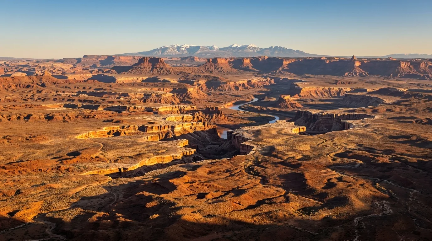
Island in the Sky, from the rim. A mesa top standing above two river canyons, with the White Rim bench a thousand feet below and the rivers a thousand feet below that. The views are drive-up. The water is not — there is one tap in the whole district.
Destination
From Moab
The character
What it costs you
Arches NP
~5 mi / ~10 min north on US-191
Short walks, huge crowds, the icons. NPS: "the town of Moab is only ten minutes away"
$30/vehicle, 7 days · no timed entry in 2026
Canyonlands — Island in the Sky
~40 min: 10 mi north on US-191, then 22 mi SW on UT-313
Mesa-top overlooks and short rim trails above the White Rim bench
$30/vehicle · no timed entry · one water tap
Dead Horse Point SP
~32 mi — same UT-313 corridor
A promontory 2,000 ft above a gooseneck of the Colorado. Pair it with Island in the Sky
$20/vehicle (up to 8) · 6 a.m.–10 p.m.
Canyonlands — The Needles
40 mi south on US-191, then ~35 mi west on UT-211
Banded spires, long strenuous hikes, ranger programs spring and fall. Sleep at that end
~75 mi / ~90 min each way — a separate trip (§04)
SR-128 river corridor
2–25 mi NE up the Colorado
Grandstaff, Fisher Towers, Castle Valley, Onion Creek, and most of the riverside BLM campgrounds
No fee, no gate — the pressure valve
Canyonlands — The Maze
Unpaved only; high-clearance 4WD; "2–6 hours by car" between districts
Genuine expedition terrain, and no water anywhere in the district
Out of scope for this issue — go prepared or don't go
Driving distances inside Arches from the entrance/visitor center, all official NPS figures: Balanced Rock 9.2 mi · The Windows Section 12 mi · Wolfe Ranch (Delicate Arch trailhead) 13.2 mi · Delicate Arch Viewpoint 14.2 mi · Devils Garden 18 mi. Driving distances and times to Moab from Salt Lake City, Denver or Grand Junction could not be verified for this issue and are deliberately not printed — see §11.
🔴 The five taps — and why Island in the Sky catches people out
Say this precisely, because the sloppy version ("there's no water in the parks") is wrong and the precise version is what keeps people alive: there is no water at any trailhead, on any trail, or at any overlook in either park. There are exactly five developed taps, all confirmed on NPS pages: Arches Visitor Center · Devils Garden Campground · Island in the Sky Visitor Center (year-round) · Needles Visitor Center (year-round) · Needles Campground (seasonal only). And NPS explicitly states there is no water at the Island in the Sky campground (Willow Flat), no water anywhere in the Maze, and no water at any trailhead in either park.
⚠️ The overlanding consequence, stated plainly: if you are camping at Willow Flat, you must carry every drop in. The visitor center tap is your last fill and it is not at your campsite — it's a drive away, and it's shut off in winter for anything beyond the year-round VC supply. This is the single most under-planned logistic in Canyonlands. Bulk fill for a rig happens in Moab. Note too that neither Canyonlands visitor center offers electric outlets — don't plan on charging there.
Fees & passes — 2026
Identical at both national parks: private vehicle $30 (7 days, vehicle + all occupants) · motorcycle $25 (7 days, up to 2 motorcycles / 4 people) · per person on foot or bike $15 · under 16 free.
Southeast Utah Parks annual — $55. Covers Arches, Canyonlands, Natural Bridges and Hovenweep for a year through the month of purchase. U.S. residents only.
America the Beautiful: $80 resident annual; $250 non-resident annual — note the residency-tiered pricing. Senior annual $20. Military, Access, 4th Grade and Volunteer passes free.
The math: if you're a U.S. resident doing both parks, the $55 pass pays for itself on the second gate. If you're Canadian or otherwise non-resident, you're comparing two $30 entries against a $250 pass — buy the two separate entries unless you're touring the whole country. Entrance fees are separate from and additional to every permit fee in §05.
Arrive before 8 a.m. or after 3 p.m. at Arches. That's now a traffic strategy, not a permit workaround — there is no permit
In summer "early" is earlier than you think: NPS says many trailhead lots fill by 7:30 a.m.
Entrance queues: if the line reaches the park sign the wait "can last up to an hour"; at capacity the park holds vehicles for temporary delays of three to five hours
Leave the RV or trailer in town — NPS says so directly. Park lots are tight and turning is genuinely difficult
Tune to 1610 AM in Moab for live park-access information, and check the park webcams before you drive up
Go to Canyonlands when Arches is full — no timed entry, no comparable queue, better solitude per mile
Go to BLM land when both are full — Corona Arch, Grandstaff, Hidden Valley and the SR-128 corridor have no fee, no reservation, no gate
Invert the classics: Mesa Arch mid-afternoon instead of sunrise, Delicate Arch at dawn instead of sunset, the Windows' back primitive loop instead of the front
Avoid the named peaks: Easter week, Memorial Day, Labor Day and the Utah Education Association (UEA) October break are NPS-named Arches crowd peaks
Dead Horse Point — the best view per unit of effort
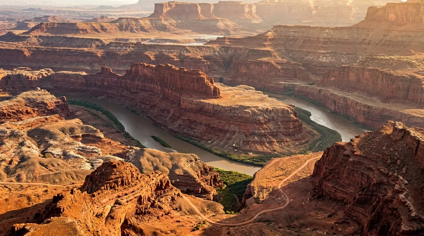
A promontory 2,000 feet above a gooseneck of the Colorado River, reached on the same UT-313 road as Island in the Sky — which is why they belong in the same day. The overlook is paved, short and effectively accessible from the parking area. Twenty minutes, or two hours if the light is doing something.
Hours: park 6 a.m.–10 p.m. year-round; visitor center 9 a.m.–5 p.m. daily (435-259-2614). The 6 a.m. opening makes this one of the few easy, legal sunrise perches in the region — and a far calmer alternative to the Mesa Arch tripod scrum.
Also here: the Intrepid Trail System — signed, graded, non-technical hiking and mountain-bike singletrack with on-site bike rentals. It is the beginner-and-intermediate answer to Slickrock, which is an expert ride that eats first-timers. Per-loop mileages aren't published in a form we could verify — get the trail map at the visitor center. And it's a mesa top in full sun with no water on the loops: treat a "short bike loop" here with hiking-grade water discipline.
Caution: the drop is 2,000 feet and portions of the rim beyond the developed overlook are unfenced. It is fiercely windy and completely exposed. And see §07 for the two camping rules here that hit overlanders squarely.
$20/vehicle · 6a–10pInternational Dark Sky ParkUnfenced 2,000 ft rim
03 / THE HIKES
The walks — and the one honest asymmetry in this section
Here's a distinction most guides paper over, and we won't: the NPS Arches hiking page serves its trail table dynamically and gives up no distances to a plain fetch, while Canyonlands publishes a full static official table. So every Canyonlands number below is official and stated flat. Every Arches number is the commonly published figure and is flagged as unverified where it appears — confirm those on the trailhead sign or the visitor center handout. That's a real difference in confidence and you deserve to know which is which. What isn't in doubt: none of these trails have water, most have no shade, and both parks tell you to be off them between 10 a.m. and 4 p.m.
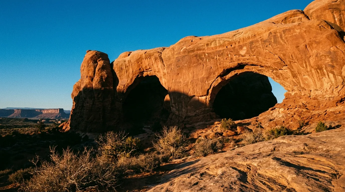
The Windows Section, 12 miles into Arches. The highest density of arches per step in the park — which makes it the highest density of people per step. Go at first light or in the last hour, and take the primitive back loop: it sheds most of the crowd for very little extra effort.
Arches — the roster
Distances in this block are [UNVERIFIED — confirm at the trailhead or visitor center] for the reason given above. The driving distances from the entrance are official.
The icon · and the hardest popular hike in the parkDelicate Arch
From the Wolfe Ranch trailhead, 13.2 miles in (official). Commonly published as ~3 miles round trip with ~480 ft of gain[UNVERIFIED], 2–3 hours, moderate-to-strenuous by Arches standards. The route is an open slickrock slab climb with no shade and no water, finishing on a narrow ledge traverse above a drop. Superb October through April.
The slab has no trail tread and no cairned handrail in places — in wind, rain or ice it is genuinely slippery, and the final ledge has unguarded exposure. In July and August this is a hazardous midday hike, full stop. It is also a crowd: NPS notes "it is not uncommon for hundreds of people to visit Delicate Arch at sunset." Go at dawn instead. Lot fills early and often.
~3 mi RT / ~480 ft [unverified]Moderate–strenuous · 2–3 hNo shade · no water · exposed ledge
Wolfe Ranch TH · 13.2 mi in open slickrock · dawn, not sunset
The two ways to see it without the climbLower & Upper Delicate Arch Viewpoints
The park deliberately provides two alternatives from the Delicate Arch Viewpoint lot, 14.2 miles in (official) — and they're the right call for anyone heat-limited, mobility-limited or short on time. The Lower viewpoint is a very short, essentially flat, wheelchair-accessible walk. The Upper viewpoint is a short, steeper stair-and-slickrock climb to a closer, higher angle. Commonly published as roughly 100 yards and ~0.5 mile round trip respectively [UNVERIFIED].
These are viewpoints, not substitutes — you're looking across a canyon, not standing under the arch. Bring a long lens and manage expectations, especially if you've talked someone out of the main hike.
Lower: flat & accessibleUpper: short stair climbDistances unverified
Delicate Arch Viewpoint lot · 14.2 mi in the heat-limited option
Easy for a mile — then it changes completelyDevils Garden & Landscape Arch
From the Devils Garden trailhead, 18 miles in at the end of the park road (official) — the largest and most contested lot in the park. Commonly published as ~1.9 mi RT to Landscape Arch, ~4.2 mi RT to Double O Arch, and a ~7.9 mi full loop including the Primitive Trail[UNVERIFIED — confirm on the NPS Devils Garden trail guide]. To Landscape Arch it's easy and near-flat on graded gravel, 45–60 minutes.
Everything past Landscape Arch changes character completely — slickrock fins, scrambling, exposure. People commit to the Primitive Loop on the strength of the easy first mile and find themselves on exposed fins they cannot reverse. Poor choice when wet or icy. And note: Landscape Arch is actively failing. It shed a large slab in 1991 and the ground beneath it has been closed ever since — you view it from the trail, and there is no legal way to stand under it. Don't scramble in for the photo.
Landscape Arch: easy, 45–60 minDouble O ~3 h · full loop 4–5 h [unverified]Beyond Landscape = fins & exposure
Devils Garden TH · 18 mi in graded gravel → fins
A span that is visibly running out of time. Landscape Arch shed a large slab in 1991 and the ground beneath it has been closed ever since. You view it from the trail. The easy graded path ends here — everything past it is fins, scrambling and exposure.
Most arches per step — and most people per stepThe Windows & Turret Arch
From the Windows Section, 12 miles in (official). Commonly published as a ~1 mile loop taking in North Window, South Window and Turret Arch, with a primitive loop option around the back [UNVERIFIED]. 30–60 minutes, easy with a short stepped climb. Year-round, and an NPS-named stargazing spot (§08).
Go at first light or in the last hour. The "primitive" back loop sheds most of the crowd for very little extra effort — take it. This is the single easiest crowd-inversion in the park.
Commonly published as ~0.5 mile round trip on flat sand from the Windows Section lot [UNVERIFIED]. 20–30 minutes, easy. One of the few Arches hikes with meaningful shade — the alcove under the spans is genuinely cooler.
Caution: the sand bowl tempts people onto the sloping rock at the base. It's steeper and slicker than it looks, and there's no easy way down once you're committed.
Sand Dune Arch & Broken Arch
Commonly published as ~0.3 mi RT to Sand Dune Arch and ~1.3 mi RT to Broken Arch, or a ~2 mi loop linking both from Devils Garden campground [UNVERIFIED]. Easy.
Sand Dune Arch is the best heat-refuge short walk in Arches — tucked in a shaded slot between fins and meaningfully cooler than the open park. The deep soft sand makes it slower than the mileage suggests. Broken Arch crosses open grassland with no shade at all — don't let the short distance fool you at 2 p.m. in July.
Park Avenue — and the mistake everybody makes
The first major stop past the entrance switchbacks, and usually the least contested lot in the park. A stepped descent into a corridor of fins between Park Avenue Trailhead and Courthouse Towers Viewpoint. Commonly published as ~1 mile one-way / ~2 miles round trip[UNVERIFIED], about an hour round trip, easy-moderate. Excellent in winter light.
It is not a loop. Walk it one-way and you need a second vehicle or a shuttle at Courthouse Towers. Most people walk down, realise there's no ride, and climb back out in the heat. Worth knowing: at least one Moab operator runs hiking shuttles as well as bike and river shuttles — which is exactly what turns a one-way walk like this into a sensible day (§09).
Easy–moderate · ~1 h RTQuietest lot in ArchesNot a loop — plan the return
🔴 Fiery Furnace — the one place in Arches you cannot just walk into
Entry requires either a ranger-led tour ticket or a self-guided permit, and both are confirmed: ranger-led $16 per person, self-guided permit $10 per person, and children under 5 are not permitted on either. These fees are in addition to park entrance. Booking: up to four months in advance online, or at the visitor center up to seven days before your visit if availability exists. Book through Recreation.gov and read the conditions attached to the specific ticket.
The terrain is a maze of sandstone fins with no marked trail — route-finding, scrambling and squeezing through gaps, roughly two miles of travel over 2–3 hours. People get genuinely lost in here. The fins look identical, there's no cell signal to fall back on, and the self-guided permit does not come with a guide — it comes with responsibility. If you are not confident in unmarked route-finding, take the ranger-led tour: it is $6 more and it is the right decision. It is also a fin maze with drainage channels and no marked exit — a bad place to be on a monsoon afternoon (§06).
⚠️ [UNVERIFIED] The park publishes no standing Fiery Furnace page we could retrieve, so we do not assert: the operating season for ranger-led tours (historically spring through fall, not year-round), the group size cap, whether a safety orientation or video is required before a self-guided permit is issued, or the minimum age for the ranger-led trip specifically. Confirm those with the park at 435-719-2299.
Canyonlands, Island in the Sky — the roster
Every distance and difficulty rating in this block is official, from the NPS Canyonlands trail table. No hedging needed. What does need saying: there is one tap in the entire district, at the visitor center, and none at any trailhead.
Mesa Arch at sunrise — and the tripod line you don't see in the photo. 0.6 miles, rated Easy by NPS, and the single most photographed spot in Canyonlands. In spring and fall the line forms in the dark, often an hour before first light, three and four deep along a genuine unfenced cliff edge.
0.6 mi · Easy · the honest versionMesa Arch — and the sunrise scrum
0.6 miles, rated Easy (official), 30 minutes. A cliff-edge arch framing the La Sals which at sunrise catches reflected light off the canyon wall below and glows orange along its underside. It is genuinely one of the great photographs in the American West.
This is not a peaceful sunrise. In spring and fall the tripod line forms in the dark, often an hour or more before first light, three and four deep along a short cliff edge. Arrive at dawn and you'll be behind a wall of people. Your real options: (a) commit fully and arrive 60–90 minutes early with a headlamp, (b) go in deep winter when the crowd thins dramatically, or (c) skip sunrise entirely and go mid-afternoon, when the arch is nearly empty and still spectacular — just not orange. Option (c) is underrated. And it's a real cliff edge, in the dark, with crowds: watch your feet, not your viewfinder.
0.6 mi · Easy · officialMid-afternoon = emptyUnfenced cliff edge in the dark
0.6 mi · 30 min sunrise crowd 3–4 deep
1.8 mi · Easy · walk to the far endGrand View Point
1.8 miles, Easy (official), 1–1.5 hours. An out-and-back along the canyon rim from the end of the paved scenic drive, with panoramic views the whole way. Rangers give geology talks here spring through fall, and NPS names it as a Milky Way photography location (§08).
Most visitors walk fifty metres from the parking lot, photograph the view and leave. The trail's whole point is the far end — the perspective at the point is dramatically better than at the lot, and you'll have it to yourself. Unfenced rim the entire way; keep children close.
1.8 mi · Easy · officialRanger geology talks spring–fallUnfenced rim throughout
1.8 mi · 1–1.5 h the far end is the point
0.6 mi · Moderate · and the sentence that mattersUpheaval Dome
0.6 miles, rated Moderate (official) — NPS: "a short but steep trail leads to a clear view into Upheaval Dome." 30–45 minutes to the first overlook; a second overlook lies further along. Interpretive exhibits lay out the two competing origin theories — meteorite impact versus salt dome.
The big one: the Syncline Loop, which circles the dome, is 8.1 miles, rated Strenuous, and NPS states plainly: "Most park rescues occur on this trail." Boulder scrambling and steep switchbacks. Do not drift onto it casually from the short overlook walk. That is the most consequential sentence in the entire Canyonlands trail table and it's worth reading aloud to whoever you're travelling with.
0.6 mi · Moderate · officialSyncline Loop 8.1 mi — most park rescues
0.6 mi to overlook Syncline Loop is a different day
Green River Overlook
A drive-up overlook, not a trail — minutes from the car for one of the great Colorado Plateau views, down onto the Green River's white rim benches. Effectively no difficulty, year-round.
It faces west — this is a sunset viewpoint, not a sunrise one. A lot of people arrive at dawn and wonder why everything is flat and grey.
Aztec Butte
1.4 miles, Moderate (official), 1–1.5 hours. A sandy wash that splits: the eastern fork climbs the butte for views, the western fork visits ancestral Puebloan granaries, which are viewing only.
The climb is on steep, exposed slickrock — harder than the mileage implies, unpleasant when wet. The granaries are archaeological sites: do not enter, touch, lean on or place anything in them. They have survived 800 years and can be destroyed by one person's hand.
Murphy Point
3.4 miles, Easy (official), about 2 hours — past a historic corral to views of Candlestick Tower, the Green River and the White Rim Road. Superb at sunset.
"Easy" here means flat, not sheltered — open mesa top, essentially no shade, no water, unfenced rim at the end. Don't confuse it with the Murphy Trail (10.8 mi, Strenuous), which drops 1,400 ft off the mesa. Similar names, radically different days.
Also worth knowing at Island in the Sky — all official NPS figuresWhite Rim Overlook 1.8 mi, Easy (best in late afternoon) · Whale Rock 0.8 mi, Moderate, with steep drop-offs · Neck Spring 5.6 mi, Moderate, a ranching-history loop · and Gooseberry Canyon 4.6 mi, Strenuous, described by NPS as "Island in the Sky's steepest trail" with a 1,400-ft descent. The pattern on this mesa is consistent: the short rim trails are genuinely short and genuinely easy, and the moment a trail leaves the rim it becomes a serious desert descent with a serious climb back out in the heat you were avoiding on the way down.
04 / THE NEEDLES & THE FREE COUNTRY
The 75-mile district, and the BLM land that saves your trip
Two things live in this section. First, The Needles — which is not a day-trip afterthought and is the most important logistical point in this whole issue. Second, the BLM and Forest Service country outside the park gates: no entrance fee, no timed entry, no reservation, and in peak season it is the pressure valve when the parks are full.
The Needles. Banded spires around desert grassland basins, 75 miles and ninety minutes from Moab before you walk a step — and the marquee hikes here are 5.8 to 10.8 miles and rated Strenuous. This district rewards people who sleep at that end.
🔴 Do the arithmetic honestly before you plan a Needles day
From Moab it is 40 miles south on US-191, then roughly 35 miles west on UT-211 — call it 75 miles and ninety minutes each way, before you have walked a single step. Then consider that the marquee hikes are 5.8 to 10.8 miles and rated Strenuous. A Druid Arch day from a Moab motel is a three-hour round-trip drive bolted onto a 10.8-mile strenuous desert hike — a twelve-hour day, most of it at maximum heat exposure in summer. Sleep at that end: the park campground, Needles Outpost, or BLM land nearby (§07).
⚠️ And note the standing closure from §00: as of 18 July 2026 the Elephant Hill 4WD road is CLOSED to motor vehicles and bicycles. Elephant Hill is also the trailhead for Chesler Park and Druid Arch — confirm foot and parking access separately on the NPS road-conditions page before you commit to the drive.
The good news at that end
Water: at the Needles Visitor Center, "water is available year-round."Fill everything there. The campground tap is seasonal only.
Ranger evening programs run April 7 – June 1 and September 15 – November 9 — which is a precise, useful signal of where the two good seasons actually sit.
Nearest services: Needles Outpost, 1.5 miles from the district entrance — a camp store with fuel, snacks, firewood, cold drinks, ice and rental gear, plus a bathhouse with "flush toilets, sinks, and pay showers."Campground open March 1 – November 15; store March 15 – November 15. Outside those dates there is nothing out here.
VC water year-roundOutpost: Mar 15 – Nov 15No cell coverage
Chesler Park & the Joint Trail
5.8 miles to the Chesler Park Viewpoint, rated Strenuous (official); the full Chesler Park / Joint Trail loop is 10.7 miles, Strenuous. 4–5 hours to the viewpoint, 6–8 for the loop. A desert grassland basin ringed by the banded spires that name the district, with the Joint Trail winding "through deep, narrow fractures in the rock" — a corridor so narrow you turn sideways.
Trailhead is Elephant Hill (see the closure note above); the access road is unpaved and the lot is small. Spring and fall — not a summer objective. Carry the NPS backcountry figure, 4 litres or more per person; there is none on the trail.
The Joint Trail is a slot. Slots and monsoon rain are an unacceptable combination — check the forecast, and do not enter if storms are building anywhere upstream (§06).
Druid Arch
10.8 miles, Strenuous (official), 6–8 hours. NPS: "this trail offers one of the most spectacular views in The Needles." It follows the bottom of Elephant Canyon with a steep final section — a ladder-and-scramble climb out of the canyon bottom to the arch.
Spring and fall only. In summer this is a serious heat-casualty risk. Most of the route travels a sandy wash bottom, which makes it both slow — deep sand saps you — and the worst possible place to be in a flash flood. The final climb catches people out: they arrive at five miles already tired and then meet the steepest ground of the day.
Cave Spring — the best short walk out here
0.6 miles, Easy/Moderate (official), 45 minutes. A loop visiting a historic cowboy line camp and prehistoric rock art, including two ladder sections. The best cultural-history stop in Canyonlands for the effort involved.
The ladders are real ladders on rock — not a problem for most people, but they rule the loop out for anyone with mobility or serious height issues, and they're slick when wet. The cowboy camp is an intact historic site and the rock art is irreplaceable: nothing is touched, nothing is moved.
Other Needles trails worth knowing — all official NPS figuresPothole Point 0.6 mi, Easy/Moderate · Slickrock 2.4 mi, Easy/Moderate with 360° views · Stone Storehouse 0.3 mi · Confluence Overlook11 mi, Strenuous, to a cliff 1,000 ft above the Green–Colorado junction · Peekaboo 10.8 mi, Strenuous, with two ladders and rock art · Salt Creek Canyon 22.5 mi, multi-day, permit required. Note the shape of that list: two short interpretive walks, and then a wall of double-digit strenuous days. There is very little in between out here, which is precisely why the Needles punishes people who drive out for an afternoon.
Outside the parks — no fee, no gate, no reservation
BLM and Forest Service land. When Arches is holding vehicles at the gate and every lot is full, this is where you go. Where BLM publishes a distance we state it; where it doesn't, we say so rather than borrowing a number from an aggregator.
The SR-128 river corridor. The Upper Colorado River Scenic Byway — Grandstaff, Fisher Towers, Castle Valley, Onion Creek and most of the riverside BLM campgrounds hang off it. No fee, no gate. Note the standing construction caution in §00: access may be affected through 31 October 2026.
3 mi RT · official BLM figure · cables and laddersCorona Arch
BLM states it plainly: "a moderately strenuous 3 mile round trip hike to the spectacular Corona Arch." Trailhead on the north side of UT-279, about 14 miles from Moab (4 mi north on US-191, then 10 mi on UT-279). 2–2.5 hours, no fee, and no water on route. Terrain is slickrock, a railroad track crossing, and sections with "mild exposure to heights… these sections include cables and ladders to assist you."
Regulations: "roped activities" are prohibited — no rope swings, no highlining — and hikers must stay on the designated trail. BLM reports the trail takes over 80,000 visitors a year and designated it a National Recreation Trail in May 2018, so this is not a secret. The cable-and-ladder section is genuinely exposed and is where nervous hikers turn around — scope it before committing children to it.
3 mi RT · official BLMNo fee · 2–2.5 hCables, ladders, exposure · no roped activities
UT-279 · ~14 mi from Moab 80,000+ visitors a year
The shadiest, coolest walk near townGrandstaff Canyon
BLM now manages this as Grandstaff Canyon — the page notes it was "formerly known as Negro Bill Canyon."Use the current name. BLM describes "a perennial stream within a canyon bordered by sheer walls of Navajo sandstone." The destination is Morning Glory Natural Bridge, given as 243 feet long — the sixth-longest natural rock span in the United States. Canyon mouth is off SR-128; the upper canyon is reachable from Sand Flats Road. 3–4 hours, moderate.
Distance [UNVERIFIED] — BLM publishes no mileage for this trail and we won't invent one (commonly given as roughly 4–5 miles round trip; confirm with the BLM Moab Field Office, 435-259-2100). The stream and cottonwoods make it the best summer-morning option on this list — but it is a narrow canyon with a stream, which is to say a flash-flood channel, and it requires repeated stream crossings that become the crux after rain. The SR-128 trailhead lot is small and overflows onto a blind highway bend: park properly or come back later.
Distance unverified — BLM publishes noneShade + water = the summer pickFlash-flood channel · wet feet
SR-128 · moderate · 3–4 h Morning Glory Bridge · 243 ft
Fisher Towers
Cutler-formation towers of dark, crumbling sandstone rising several hundred feet off the SR-128 river corridor, with close-up views of the towers and the Onion Creek area and distant views down to the Colorado and Castle Valley. 3–4 hours, moderate-to-strenuous — far more up-and-down than a map suggests.
Distance and gain [UNVERIFIED] — the BLM's own Fisher Towers page could not be retrieved (multiple URL variants 404'd) and no official mileage is published. Confirm at the trailhead register or the Moab Information Center.
Caution: the trail traverses steep dirt slopes above drops and there is a short ladder. When wet, the Cutler mud is genuinely treacherous. Spring and fall — brutal in summer, the rock radiates heat. This is also premier desert-tower climbing terrain and the rock is famously soft — guided or expert parties only.
Hidden Valley — the summer-evening hike
BLM rates it strenuous, with steep switchbacks up to "a spectacular hanging valley hundreds of feet above the valley floor," looking out over Moab Valley and the sandstone fins of Behind the Rocks. No fee. Access, in BLM's words: "drive 3 miles south from Moab on U.S. 191 and turn right onto Angel Rock Road. After two blocks, turn right onto Rimrock Road." It links to the Moab Rim 4WD trail and can be continued to the Colorado.
Distance [UNVERIFIED] — BLM publishes no mileage (commonly given as roughly 4 miles round trip to the pass).
The genuinely useful detail: BLM notes that "during the late afternoon, in the summer, this trail is largely in the shade of higher cliffs" — one of the few viable summer evening hikes near town. The opening switchbacks are relentless and unshaded in the morning, so it front-loads all the suffering. BLM lists mountain biking here though the trail is officially non-motorized; expect shared use.
🔴 Onion Creek, Castle Valley, Moonflower and the La Sals — where we deliberately publish lessCastle Valley is the broad red valley beneath Castleton Tower and the Priest and Nuns — one of the most photographed skylines in Utah, and visible from the paved SR-128 with no hiking at all. Onion Creek is a narrow, mineral-stained canyon road that fords the creek many times as it climbs toward the Fisher Towers massif. No BLM page for Onion Creek could be retrieved, so road length, the number of crossings and vehicle requirements are not asserted here[UNVERIFIED — BLM Moab Field Office, 435-259-2100]. Take this one seriously: a repeated water crossing in a narrow drainage is one of the most obvious flash-flood traps near Moab, and vehicles have been caught in it. Do not enter with storms anywhere in the forecast or visible over the La Sals.
Moonflower Canyon, off Kane Creek Boulevard, is a short cottonwood-shaded box canyon with a seep and a well-known rock art panel near the trailhead. No BLM page for it could be retrieved either and its camping status has changed in recent years — we assert nothing about fees, camping or hours [UNVERIFIED — confirm with the BLM Moab Field Office]. The rock art is at eye level, unfenced, beside a car park, and it has been vandalised: do not touch it, do not chalk it, do not add to it, and report damage in progress to the field office.
The La Sal Mountain Loop Road is the most under-used piece of local knowledge in Moab and in a heat wave it is the difference between a ruined trip and a good one. The La Sals rise directly east of town to over 12,000 feet; because temperature falls roughly 3–5 °F per 1,000 feet, climbing from Moab (~4,000 ft) into the aspen and spruce country around 8,000–9,000 ft can put you 20–25 °F cooler within an hour of leaving a 105 °F valley — into forest, running water and alpine meadow. The Forest Service page returned HTTP 403 and could not be read, so loop length, exact elevations and — critically — the winter closure dates are not asserted here[UNVERIFIED — Manti-La Sal National Forest, Moab/Monticello Ranger District]. The upper loop is not a year-round road; it holds snow and closes seasonally. It is also a mountain road — steep grades, tight corners, sections unsuited to long trailers — and afternoon thunderstorms build over the La Sals far more aggressively than over the desert. Those same storms are the source of the flash floods hitting the canyons below.
05 / THE 4X4
Honest vehicle requirements, and where a stock rig actually belongs
This is the section where being wrong hurts people, so read how it's built. Official BLM or NPS pages exist for only a few of these trails. Where the only published rating comes from the Red Rock 4-Wheelers — an Easter Jeep Safari club whose ratings are conservative and equipment-heavy relative to how casual drivers actually run these trails — it is labelled as such. Where the only source is the tourism bureau, that's labelled too. And where nothing could be sourced, we print nothing, because an under-rated route sends unprepared drivers in. That's the failure mode that kills.
Slickrock, at the angle photographs never convey. The famous Moab trails are not scenic dirt roads — Hells Revenge, Poison Spider Mesa and Top of the World are all rated 6 out of 10 by the local club, which by that standard means 35-inch tires and two traction devices. A stock rig on street tires belongs somewhere else, and there are good options.
RR4W rating
Terrain
Equipment the club says you need
1–2
County dirt road
High-clearance 2WD/4WD
3
Steps ≤12"
4WD mandatory, 33" tires recommended
4
Steps ≤18"
4WD and 33" tires required (35" a plus)
5
Steps ≤24", water ≤12"
4WD + 33" tires + working lockers
6
Steps ≤36", water >12"
4WD, 35"+ tires, and TWO traction devices required
7–8
Steps >48"
Winch, maximum clearance; vehicle damage likely
9
—
37–40" tires, winch
10
—
"Buggy territory. Street driven 4X4's should not attempt this trail."
Source: Red Rock 4-Wheelers [COMMUNITY]. It is the only published Moab scale that defines equipment per rating — which is exactly what a stock-vehicle owner needs. The blunt answer for a stock 4Runner or Wrangler on street tires with no lockers: by this scale, anything rated 5 or above is outside your capability. Hells Revenge, Poison Spider Mesa and Top of the World are all rated 6.
🔴 ELEPHANT HILL 4WD ROAD IS CLOSED — as of 18 July 2026
The NPS Canyonlands road-conditions page states verbatim: "Elephant Hill 4WD: CLOSED to motor vehicle traffic and bicycles."No reason, no start date and no reopening estimate is given, and the general conditions page lists no corresponding alert. We are not describing it as drivable, and neither should anyone else. Check nps.gov/cany/planyourvisit/road-conditions.htm before you assume anything has changed.
For context on what is closed: NPS describes it when open as "one of the most technical four-wheel-drive roads in Utah" — "steep grades, loose rock, stair-step drops, tight turns, and tricky backing." Vehicle limits are 21 feet long including racks and trailers, 85 inches wide, requiring high-clearance low-range 4WD, with a day-use permit, a daily cap of 24 vehicles and 12 mountain bikes, and no water at any campsite. This is the brutal one, and its closure removes the hardest legal route in the district — not a small change to anyone's plans. Total 4WD trail mileage [UNVERIFIED].
White Rim Road — the permit system, and getting it right
The signature multi-day route in the region: a 100-mile loop, 2–3 days by 4WD (3–4 by mountain bike), 15 mph speed limit. NPS: "driving the entire loop in one day is not advised." Vehicle requirement is unambiguous — "your vehicle must have high-clearance, four-wheel drive (low range)": low range is MANDATORY and AWD does not qualify. Maximum vehicle height 10 ft.
Can a stock 4x4 do it? Yes — if it has genuine low range. This is a clearance-and-commitment route, not a technical rock crawl: NPS calls it moderately difficult in good conditions, and challenging in bad weather on Shafer Trail, Lathrop Canyon, Murphy Hogback, Hardscrabble Hill and the Mineral Bottom switchbacks.
WATER: "There is no potable water along the White Rim Road." None. For 100 miles and 2–3 days. NPS minimum is 1 gallon per person per day — carry every drop, plus vehicle water and a margin for a breakdown. The daily cap of 50 vehicles means you may also be genuinely alone out there, with no cell service to call it in from.
Camping and group rules: 20 individual sites in 10 areas, 7–77 miles from the visitor center, max 15 people and 3 vehicles per site. Daily cap 50 vehicles/motorcycles + 50 mountain bikes. Max 3 vehicles and 15 bikes travelling together; larger groups must separate by 30 minutes or half a mile.Prohibited: ATVs, UTVs and OHVs; fires; pets. E-bikes are allowed.
Low range mandatory · AWD does not qualifyZero water for 100 miles50 vehicles/day capNo fires · no pets · no OHVs
Permit
When it's released
Cost
The thing people miss
Day use
8:00 a.m. MT ONE DAY in advance, bookable until 8:00 a.m. MT on the day of the trip. No long-range window, no lottery
$6 recreation.gov fee
25 of the 50 daily vehicle permits are held back for in-person, first-come-first-served issue at the visitor centers on the day of the trip, free of charge. Miss the online release and you show up early instead
Overnight
Seasonal blocks ~4 months ahead at 8:00 a.m. MT, first-come-first-served — not a lottery. Advance reservations close 3 days before trip start
$36 non-refundable reservation fee (includes the $6 rec.gov fee) + $5 per person per night
The $5 is refunded if you cancel or modify 3 or more days out; the $36 never is. Max 14 consecutive nights
Spring (Mar 10 – Jun 9)
Opens Nov 10
NPS warns "demand for overnight permits frequently exceeds the number available" in spring and fall
Summer (Jun 10 – Sep 9)
Opens Feb 10
Set an alarm for 8:00 a.m. Mountain Time on the release date
Fall (Sep 10 – Dec 9)
Opens May 10
Fall is the other pressure season
Winter (Dec 10 – Mar 9)
Opens Aug 10
The realistic window if you're planning late
⚠️ We do not publish a mandatory direction of travel. The commonly-repeated "the White Rim is one-way" claim could not be confirmed. The only directional language on the NPS page is a campsite table column header — a table ordering convention, not a regulation. Verify the direction rule in the permit conditions on recreation.gov rather than trusting any guide, including this one, on that point. Entrance fees are separate from and additional to the permit fee.
Shafer Trail + Potash Road — the stock-vehicle answer
NPS states verbatim: "You do NOT need a day-use permit on Potash Road or Shafer Trail." A permit is required once you continue past the junction onto the White Rim.
Shafer: 5.2 miles to the junction, descending 1,500 feet.Potash Road: unpaved, 35–40 miles from Shafer Trail back to Moab, 3+ hours.
Vehicle, in NPS's words:"high-clearance four-wheel-drive or AWD vehicles are highly recommended." Note carefully — NPS says recommended, and explicitly permits AWD. That is a materially lower bar than the White Rim's mandatory low range. We frame it from the official language rather than asserting a difficulty rating, because no official source rates it for stock vehicles specifically — but "recommended," AWD acceptable, no permit and no low-range requirement is consistent with a stock high-clearance 4x4 on street tires in dry conditions.
Status 18 Jul 2026: both open, with heavy washboarding at the start of Shafer and on the east side of Potash. Dogs are allowed on Shafer — unusual for an NPS road, and worth knowing.
No permit neededAWD explicitly acceptableThe best big-canyon 4x4 day without the commitment
Hells Revenge — and why we're telling you not to
~6.5 miles, 2–3 hours, launching straight out of Sand Flats. BLM's own words: "Only very experienced drivers with advanced vehicles should attempt it." Not suitable for ATVs. 15 mph limit, and staying on the marked trail is mandatory — off-trail driving is a Class A misdemeanor. Open year-round; BLM recommends spring and fall.
RR4W rating: 6/10[COMMUNITY] — 35"+ tires and two traction devices by that standard. The tourism bureau [COMMERCIAL] also states stock vehicles are not recommended here.
Verdict for a stock 4x4: don't. The official source and the community source agree, which is rare and worth respecting. Ride with a guide instead — the trail leaves from Sand Flats, where several operators run it daily, and you'll see more of it from the passenger seat than you would from behind a windshield you're terrified of scratching.
"Advanced vehicles" — BLMRR4W 6/10 [community]Guided is the right call
Fins & Things [COMMERCIAL/COMMUNITY]
No BLM page found. The tourism bureau gives 20 miles round trip, 9.4 miles of 4WD road, minimum 3 hours, difficulty "Difficult."RR4W rating: 4/10 — 4WD plus 33" tires by that standard, no lockers required.
The bureau says stock vehicles may manage it with good articulation — the only stock-vehicle statement found for it, and not an official source. The most plausible "first real Moab slickrock trail" for a capable stock rig, but the 4/10-versus-"Difficult" gap between the two sources is wide. Scout it, or go with someone who knows it.
Gemini Bridges [COMMERCIAL]
The tourism bureau gives 48 miles round trip, 14 miles of 4WD road, minimum 2.5 hours, difficulty "Easy." The standard easy scenic route — no official page could be found to confirm any of it.
[UNVERIFIED as to current status] — and note that Gemini Bridges sits inside the Labyrinth Rims / Gemini Bridges Travel Management Area, whose route status could not be confirmed (see the note below). Gemini Bridges is also a designated backcountry camping zone — marked sites only (§07).
Poison Spider Mesa & Top of the World [COMMUNITY]
Both carry an RR4W rating of 6/10 — outside stock capability by that standard. Length, time and current status are [UNVERIFIED] for both; Top of the World is a viewpoint route on Waring Mesa.
We publish the rating because it's the one figure with a defined equipment standard behind it, and nothing else — because nothing else could be sourced. If you want these trails, go with a guide or a local club, not a guidebook.
🔴 Long Canyon and Onion Creek — we publish nothing, and that's the pointNo official or commercial page could be found stating length, time or difficulty for either Long Canyon or Onion Creek. Both are commonly described as easy or moderate — which makes an error here more dangerous, not less, because an under-rated route sends unprepared drivers in. Onion Creek's many water crossings are a real hazard we could not source. We are not publishing figures for these two from memory. Check the Moab Motorized Travel Map or call 435-259-2100.
Also note: Long Canyon is a designated backcountry camping zone in the BLM visitor guide — camping there is marked-site-only (§07). And on the Labyrinth Rims / Gemini Bridges Travel Management Plan: the only extractable fact we could obtain is that the area "includes 22% of the available routes on BLM-managed public lands" in the travel map. No decision date, route closures or camping changes could be confirmed — the BLM ePlanning portal returned HTTP 403 on every attempt. This plan has been litigated and revised repeatedly. Do not rely on anything about its current status without calling the field office.
The travel-plan rule, in one line
The BLM rule is "stay on designated routes and trails" — and the authoritative map is the Moab Motorized Travel Map, not a phone app.
Carry it. It shows both the legal routes and the camping zones, which are two different things you need at the same time.
Off-trail driving on Hells Revenge is a Class A misdemeanor, and the same instinct applies everywhere else here: the desert crust and the archaeology don't recover.
Before any trail, check the NPS road-conditions page and the field office. Monsoon storms close 4x4 routes with no warning.
06 / SAFETY — READ THIS FIRST
Heat is the number-one killer here. Everything else is second.
This is the section to read before any trail, any 4x4 route and any night out. Moab looks manageable — paved roads, short walks, a town with a hospital ten minutes away — and that's exactly the trap. NPS puts the scale of it plainly: "each year, park rangers respond to hundreds of search and rescues in Arches due to the extreme conditions and hazards that come with being in canyon country." Not one or two. Hundreds. Lead with the heat and the water; everything else follows from them.
Heat & water — the official numbers
Both parks publish effectively identical guidance. Temperatures exceed 85°F between April and September, and July and August often exceed 100°F (38°C), which Canyonlands notes makes vigorous outdoor activity difficult.
Water, NPS: "at least 2–3 litres per person for front country hikes, and 4 litres or more for backcountry." For camping and vehicle travel the planning figure is blunter — a minimum of 1 US gallon (≈3.8 L) per person per day, and 1.5–2 gallons in genuine summer heat. NPS itself uses the one-gallon-per-person-per-day minimum for the White Rim. [The per-day camping figure is the standard desert-travel planning number, not an NPS quote — treat it as a floor, not a target, and add water for dogs, dishes and the vehicle.]
The rule worth putting on the fridge, from NPS: "When you're halfway through your water, you are halfway through your hike." Simple, and it prevents most incidents.
2–3 L front country · 4 L+ backcountry1 gal/person/day in camp
Why summer here is dangerous, not merely uncomfortable
Stated plainly: you are on bare slickrock with no shade, no water on any trail, and no water at all along the White Rim. Rock surface temperatures run far above air temperature, and the reflected heat off pale sandstone is relentless.
A vehicle breakdown on a 4x4 trail in July with the "normal" amount of water is a survival situation, not an inconvenience — and the canyons have no cell service to call it in from. The daily cap of 50 vehicles on the White Rim means you may also be genuinely alone.
Both parks' own rule: avoid being out between 10 a.m. and 4 p.m. That is a six-hour hole in the middle of every summer day, and it is not optional advice. Watch for dizziness, weakness or excessive sweating and treat them as a turnaround, not a rest stop. Eat salty snacks — water alone doesn't replace what you're sweating out, and hyponatraemia is a real risk on long hot days.
Off the trail 10 a.m. – 4 p.m.Salty snacks, not just water
🔴 Flash floods — and the sentence that is the whole problem
Monsoon season runs mid-July through September. NPS: "late summer brings monsoon storms that can trigger dangerous flash flooding." And then the line that matters most: "Flash floods can suddenly occur in the park, even when it's sunny." The storm that catches you is the one you cannot see, twenty miles upstream, often over the La Sals. Never cross a flooded wash — "even 6 inches of water can knock you off your feet." Turn around, don't drown.
The warning signs NPS names: a surge in the water, a change in water colour, an increase in debris, or the sound of rushing water. If you register any of these in a canyon, get to high ground immediately — do not try to outrun it downstream.
The specific places this matters most around Moab: the Joint Trail in Chesler Park (a genuine slot, no exits) · Elephant Canyon, the Druid Arch approach (miles of wash bottom) · Grandstaff Canyon (a narrow canyon with a perennial stream and repeated crossings) · Moonflower Canyon (a short box canyon that drains fast) · Onion Creek (a road that fords the same creek repeatedly) · and the Fiery Furnace (a fin maze with drainage channels and no marked exit).
The discipline: check the National Weather Service flash-flood forecast the morning of. If there is any convective activity forecast, pick a mesa-top hike instead — Grand View Point, Murphy Point, the Dead Horse rim. There are enough good high-ground options here that entering a slot on a monsoon afternoon is a choice, not a necessity. And unpaved roads "may require 4WD and could be impassable after summer storms."
Cell coverage — plan for none
NPS at Arches: "spotty cellular service can lead to getting lost, especially in remote areas of the park." Canyonlands uses the same language. The tourism bureau is blunter: "cell service is notoriously bad in many areas of Grand County." Recreation.gov confirms the Needles campground has no cell coverage at all.
The honest framing: phones typically work on mesas and fail in canyons. Mesa tops — Island in the Sky, the UT-313 corridor — generally have some signal; the White Rim is by definition below the rim, and the Needles and canyon-bottom stretches of SR-128 should be treated as no service.[UNVERIFIED — no source breaks coverage down by corridor, and we make no carrier-by-carrier claim.]
Texting sometimes works where voice calls don't. 911 calls provide automatic location coordinates if the call is held for about a minute. Both parks advise downloading offline maps in the NPS App before you go and carrying a paper map and compass — explicitly not cell-dependent apps.On a 2–3 day White Rim trip with no water and no signal, a satellite communicator is not optional gear.
Canyons = no servicePaper map + offline NPS AppCarry a satellite communicator
The hazards people don't budget for
Ice, not cold, is the winter hazard. NPS: "even light snow or ice can render local trails and roads impassable." Slickrock under thin verglas is genuinely unwalkable — Delicate Arch's final ledge and the Devils Garden fins are the specific danger spots. Microspikes are the single best winter item you can pack here
Unfenced rims everywhere. Grand View Point, Murphy Point, Mesa Arch in the dark, Dead Horse Point's 2,000-foot drop — no railings, and the crowds push people closer to edges than they'd choose alone
40-degree temperature swings. The Colorado Plateau sees "wide temperature fluctuations, sometimes over 40 degrees in a single day" — a 20°F dawn can be a 55°F afternoon. Layer in every season
Don't drink what you find. Potholes are entire fragile ecosystems and seeps are wildlife habitat — do not drink, swim in, wash in or dip containers into potholes. The Colorado carries a heavy silt and agricultural load. Carry your water from town
Archaeology is irreplaceable. Granaries at Aztec Butte, rock art at Cave Spring, Peekaboo and Moonflower — look, photograph, touch nothing. Moonflower's panel has already been vandalised
Pets: at Arches, roads and parking areas only — not on hiking trails. Pets are prohibited on the White Rim. BLM trails (Corona, Fisher Towers, Grandstaff, Hidden Valley) are pet-friendly — but a dog on hot slickrock has no boots and needs its own gallon
If it goes wrong
911.Moab Regional Hospital, 450 Williams Way — the emergency department is open 24 hours a day, 365 days a year (435-719-3500), a Level IV trauma center with digital imaging and lab on site. Urgent care on the same campus runs Mon–Fri 10 a.m.–8 p.m., Sat–Sun 10 a.m.–6 p.m., walk-in only, no appointments (holidays typically 10–6). Those two are the most solidly verified facts in the entire town-services picture — which tells you something about how thin the rest of it is (§09).
07 / THE CAMPING STRATEGY
Where to sleep — and the rules that changed under everyone
Three facts shape every camping decision in Moab, and all three catch experienced people out. Every BLM campground around Moab has no water and no electricity — universal, not "most."A portable toilet is legally required for all dispersed camping throughout Grand County. And the stay limit forces a 30-mile relocation after 14 days, not the standard 25. If your information about camping here is more than a few years old, it is wrong, and the penalties are real.
The Moab bed. Twenty-six BLM campgrounds ring the town along three corridors — and every one of them is dry. No water, no power, vault toilets, fire rings, tables and dumpsters. Come loaded, come with cash, and come with a toilet system.
🔴 THE TWO DEAD HORSE POINT RULES THAT HIT OVERLANDERS SQUARELY1. Camper vans and rooftop tents are BANNED at Wingate Campground. The park's own words: reservations "will be voided upon arrival, no exceptions." That rule is aimed squarely at the exact vehicles most readers of this guide drive. Book Kayenta instead, or don't book here. No amount of politeness at the gate changes it — "no exceptions" is the park's phrasing, not ours.
2. You cannot fill RV water tanks anywhere in the park. There is no well — the water table is too low — and the park trucks every drop up the mesa daily. Kayenta's page: "Water is not available to fill up RVs." Wingate's: "There is no water available for RV fillups anywhere at Dead Horse Point." Drinking water and restroom taps exist; tank fills do not. The park directs you to Moab or Green River on I-70 to fill — though it names no specific fill point, and neither do we (§09).
Dead Horse Point — the numbers
Kayenta Campground: 21 sites, 1 ADA (site 9), electric hookups on all 21 — 20/30/50 amp. Modern restrooms, shade structures, tables, fire rings, tent pads. Max 8 people and one unit per site. Check-in 3 p.m., out 12 p.m. RV length limit [UNVERIFIED — not stated].
Wingate Campground: 31 sites — 20 RV/tent with electric plus 11 hike-in tent-only, 2 ADA. RV sites take up to 56 feet.Dump station at the campground entrance — the only dump station verifiable anywhere in our research. Bathrooms with running water, dishwashing sinks, shade shelters. Four yurts. Unreserved sites go first-come. And the camper-van / rooftop-tent ban above.
Yurts: sleep 6 (queen bottom bunk, full top bunk, pullout futon), with heat, A/C, outlets, mini fridge, microwave and an outdoor propane grill with propane supplied. Bedding is NOT provided. Restrooms are a walk away. $20 extra-vehicle fee. A separate Moenkopi yurt area exists [UNVERIFIED — not researched].
Reservations: ReserveAmerica, 1-800-322-3770.The booking window is [UNVERIFIED] — no state park page states how far ahead booking opens and ReserveAmerica returned 403 to our checks. Confirm by phone.
Dead Horse Point — fees
Site type
Peak (Mar–Jun, Sep–Oct)
Off-peak
Kayenta RV sites
$60/night
$50
Wingate RV sites
$60/night
$50
Wingate hike-in tent
$45/night
$40
Yurts
$150/night
$100 in select periods incl. July–early Sept
Extra vehicle
$20/night
Day use: $20 per private vehicle (up to 8 people) · Utah senior 65+ $15 · motorcycle $10 each · bike-in/walk-in $10 per 4 people · commercial tours $5/person. Utah resident annual permits $125 (under 65) / $65 (65+). Camping fees include entry for one vehicle.
Note the direction of travel in that yurt line: the park cuts its yurt rate by a third in July and early September. That is the summer heat, priced.
Inside the national parks
Campground
Park · sites
Water
Reserve?
Season
Fee
Devils Garden Arches — the only one
NPS · 51 reservable (incl. 2 group + 1 accessible)
Yes — drinking water
Required Mar 1 – Oct 31; FCFS Nov 1 – Feb 28
Year-round
$25/night (1–10 campers) · group sites $75–$250 [confirm on recreation.gov]
Willow Flat Canyonlands — Island in the Sky
NPS · 12
NO WATER — carry every drop
FCFS only — not reservable
Year-round
$15
Needles (Squaw Flat) Canyonlands — The Needles
NPS · site count [UNVERIFIED]
Drinking water (seasonal) + hand pump
Loop B reservable 6 months ahead; Loop A FCFS
Loop A year-round; Loop B mid-Mar – mid-Nov
$20 (1–10 people)
Group sites Canyonlands, both districts
NPS
—
Reservable
—
$70–$225/night by capacity
Notes: Devils Garden's stay limit is unusually tight — no camper or their equipment may spend more than 7 days per month or 14 days per year in that campground. Plan around it. NPS also says "during this busy season, the campground is usually full every night" — with a six-month reservation window, it is the single hardest campsite to get in the Moab area. In winter it goes first-come, and you must download the Recreation.gov app before arriving in the park to use Scan & Pay — there is no signal to download it at the campground. Needles max combined vehicle + trailer length is 28 feet (the Wooden Shoe group site is 20 ft), with no hookups, no electricity, no showers, no dump station and no cell coverage.Willow Flat max RV length is [UNVERIFIED] — no source states a number; given 12 sites on a mesa rim, assume small. Needles total site count is [UNVERIFIED] — sources conflict (the reservation system returns 14 bookable across two loops; a search description says 11; neither is the campground total). Confirm by phone at 435-719-2313. Note also that the NPS camping pages for both Canyonlands districts are JavaScript shells that render empty to automated checks — if a page looks blank, that's the page, not the data.
The BLM ring — 26 campgrounds, all of them dry
🔴 The universal BLM rules — these apply to EVERY developed campground around Moab"No water or electricity is available in campgrounds." That is the BLM's own wording and it is universal, not "most." Every BLM campground around Moab is dry. What you do get: "vault toilets, fire rings, picnic tables and dumpsters are provided at all developed campgrounds." Most fees are $20/night per site; Horsethief is $25."Individual campsites are first come, first served and not reservable" — the only exceptions are Ken's Lake Loop A and Courthouse Rock sites 5 & 6, reservable on recreation.gov. Group sites are reservable 6 months to 8 days ahead. Generators 8 a.m.–8 p.m. Pets leashed. No firewood gathering or cutting — a permit is required, so bring your own. Payment is cash (U.S. only) or check to USDI-BLM at the kiosk; most sites take credit card.
⚠️ Fee-year caveat: the source document's landing page is titled "Moab Visitor Guide 2025" and the PDF filename is dated 2024. No fetched document states 2026 fees. The $20/$25 rates are current-as-published — confirm before relying on them. Individual campground open/close seasons are [UNVERIFIED] — the BLM guide gives no dates for any campground. Check per-campground pages on recreation.gov or call 435-259-2100.
Hwy 128 — the Colorado River corridor
The scenic one — cottonwoods and river frontage. Miles from Hwy 191 in brackets.
Campground
Mi
Sites
Max RV
Goose Island
1.4
19
40 ft
Grandstaff
3
16
24 ft, no trailers
Drinks Canyon
6.2
17
18 ft
Hal Canyon
6.6
11
24 ft
Oak Grove
6.9
7
18 ft, no trailers
Big Bend
7.4
33
40 ft
Upper Big Bend
8.1
8
18 ft
Upper Onion Creek
21
14
40 ft
Lower Onion Creek
22
19
24 ft
Fisher Towers
22
5
no RVs
Hittle Bottom
23
15
40 ft
Dewey Bridge
29
7
34 ft
Hwy 313 — the Island in the Sky approach
Campground
Mi
Sites
Max RV
Lone Mesa
9
0 individual / 5 group
50 ft
Horsethief
12
83
40 ft
Cowboy
18
7
no RVs
Horsethief at 83 sites is the big one — the pressure-relief valve when Devils Garden and Willow Flat are full, and on the right road for both Island in the Sky and Dead Horse Point. $25/night, and still no water.
Kane Creek Road
Campground
Mi
Sites
Max RV
King's Bottom
2.8
23
24 ft
Hunter Canyon
7.8
0 individual / 1 group
no RVs, gravel
Ledges A–E
10
98
30 ft, gravel
Sand Flats Recreation Area
The Slickrock and Hells Revenge basecamp, immediately east of town and co-managed by the county and BLM — the most convenient 4x4 camping in Moab.140 first-come sites plus 6 group sites (group sites reservable), loops labelled A–D and E–G. 3 miles from Hwy 191, gravel access, 34 ft max RV.
Day use and camping are separate fees: day use $10 per private vehicle for a 7-day pass, $5 for a bicycle or motorcycle, $35 annual pass.
It contains the trailheads for the Slickrock Bike Trail, Porcupine Rim and Hells Revenge — you can camp and be on the trail in minutes, which is the entire point of staying here.
⚠️ Camping fee conflict, flagged: BLM's own page says camping is $20/night per vehicle; the tourism bureau says $15/night and adds that the entrance booth is staffed March–October. Sources disagree, and the managing authority's own site refused every automated connection, so we could not break the tie. Take cash for both possibilities and confirm at the booth. Water and toilets specifically at Sand Flats are [UNVERIFIED] — it appears in the BLM developed-campground table, so the blanket no-water rule should apply, but treat that as inference. Assume no water.
Corrections to the campground lists circulating online"Moonflower" is a day-use / trailhead area on the map — not a campground with sites."Spring Site" does not appear in the official table at all. Hunter Canyon is group-only — there are no individual sites there. And conversely, most lists omit Grandstaff, Upper Big Bend, Fisher Towers and Dewey Bridge, which are real campgrounds with real sites. If a list you're using gets those wrong, assume it gets the dispersed-camping rules wrong too.
Dispersed camping — the rules almost everyone gets wrong
🔴 A PORTABLE TOILET IS LEGALLY REQUIRED — this is not a suggestion
Straight from the BLM Moab Visitor Guide: "Portable toilet systems are required for public land users throughout Grand County if no toilet is available." And: "A portable toilet system, or human waste disposal bag, is required for all dispersed camping." Then the disposal rule people miss: "Do not dispose of human waste bags in BLM dumpsters. Take human waste bags to the Moab Transfer Station located at 2295 S. Hwy 191 during business hours."
If you are dispersed camping around Moab without a portable toilet or WAG bags, you are in violation. Budget for the system and for the transfer-station run. This is the single most-ignored rule in the region and the one most likely to get a citation written.
Three zone types — know which one you're standing in
BLM: "Due to high visitation, many areas near developed campgrounds and the city of Moab are closed to dispersed camping." The visitor guide map defines three zones:
1. Camp-only-in-campground zones — no dispersed camping at all. The tourism bureau puts it as "within 20 miles of Moab, camping is only allowed in developed campgrounds" — note that the 20-mile figure is the tourism bureau's, not BLM's. The BLM map is the legal authority. Carry it.
2. Designated backcountry campsite zones — you may camp only in a marked site: "marked with a tent symbol on a brown post. Camping activities must remain in the boundaries of a marked site." Named areas include Dubinky Rd, Ten Mile Canyon, Hell Roaring Canyon, Mineral Canyon, Dalton Wells, Courthouse Rock, Gemini Bridges, Shafer Basin and Long Canyon.
3. Open dispersed — allowed only in "areas that have been previously disturbed by camping activities and that lie outside of a camp-only-in-campground zone or designated backcountry zone… do not expand on or create new dispersed camp sites."
Translation: "find a nice spot down a side track and pull in" is no longer legal across most of the Moab area. Get the map.
The stay limit is NOT the standard BLM rule
BLM Moab: "Camping on public land is limited to 14 days at a single location. After 14 days, you must relocate to a new site at least 30 miles away from your previous camp."
Generic BLM guidance says 14 days in any 28-day period with a 25-to-30-mile relocation. Use the Moab-specific 30-mile figure. Moving down the road to the next pullout does not reset your clock — and in a place this heavily patrolled, that's not a theoretical risk.
Fire
"Do not build new fire rings or create new dispersed campsites.""Do not gather or cut wood for campfires. Permits are required for wood cutting" — bring your own firewood. And: "it is your responsibility to know the current fire restrictions and follow restriction orders." A fire ban was in effect at our July 2026 check, including in established fire rings — bans here are seasonal and volatile, so check the day you travel (§00).
On fire pans: the Moab visitor guide does not mention them at all. General BLM guidance offers "existing fire rings or a fire pan" as advice, not a Moab mandate. We do not state that fire pans are required for land camping in Moab — that is typically a river-permit requirement. Don't repeat the claim without checking your specific permit.
The move that makes or breaks a Moab night
Four rules cover it. First, carry all your water — every BLM campground is dry, Willow Flat is dry, Sand Flats should be assumed dry, and Dead Horse Point will not fill your tanks. Fill in Moab, plan a gallon per person per day, and add a margin. Second, bring the toilet system — it's the law, and the transfer station at 2295 S. Hwy 191 is where the bags go. Third, come with cash — the BLM sites are cash or check at a kiosk (most take card, but "most" isn't "all"), and Sand Flats has an unresolved $15-versus-$20 fee question. Fourth, match the booking model: almost everything BLM is first-come, Devils Garden requires reservations March through October and fills every night, Willow Flat's twelve sites are first-come and should be assumed full by mid-morning in spring and fall, and Dead Horse Point books through ReserveAmerica by phone.
08 / THE NIGHT SHIFT
Dark sky — a legitimate reason to build a trip around a new moon
Both national parks and the state park are formally protected night-sky sites, and the numbers are worth knowing. Arches was certified an International Dark Sky Park in 2019, and under ideal conditions you can see roughly 2,500 stars with the naked eye there. This is the one activity in Moab that gets better in the months everything else gets harder.
Roughly 2,500 stars, naked eye, on a good night at Arches. Nearly 100% of the park's lighting fixtures are night-sky friendly, they're pointed down and shielded, and the trailheads stay dark. Night viewing is available every night from dusk to dawn — no ticket, no program required.
Where to shoot — Arches
NPS names four spots itself: Balanced Rock Picnic Area · The Windows Section · Garden of Eden Viewpoint · Panorama Point.
And gives the strategy: "travel northward away from Moab's lights for darker skies." The town's glow is the limiting factor at the park's south end, and NPS notes light pollution from nearby towns has increased in recent years.
Where to shoot — Canyonlands & Dead Horse
Canyonlands advises looking for "a high viewpoint or a wide open area with limited light interference (away from roads & buildings)" — and its own stargazing page features a Milky Way photograph taken at Grand View Point. Green River Overlook and Grand View Point are the obvious wide-horizon platforms.
Dead Horse Point State Park also holds International Dark Sky Park status — and its 10 p.m. closing gives you a legal, easy, guard-railed platform for early-evening work. Canyonlands is "a proud member of the Colorado Plateau Dark Sky Cooperative"; its own certification year is not stated on the page and we don't assert one.
Technique, from the parks
Allow 20–30 minutes for your eyes to adjust. Use a red light, not white — and remember that in a crowd at Mesa Arch, your white headlamp ruins forty other people's night. Bring a star chart, and check the Clear Sky Chart before going.
Both parks run ranger-led stargazing programs, and Canyonlands references the Southeast Utah Astrofest. Note that ranger programs at Arches are not available in winter.
When to go — plan around the moon, not the month
NPS: "You'll see the darkest skies during a new moon or when the moon is below the horizon," and "even the light from a thin crescent moon can make it more difficult to see fainter stars or even the Milky Way." Both parks publish a 2026 Night Sky Almanac with new-moon dates — use it rather than guessing. The Milky Way core season on the Colorado Plateau runs roughly April through September, which collides with the heat, so the practical sweet spot is late April–May and September–early October, on a new moon — dark, and warm enough to stand still at 2 a.m. without the daytime punishment. [That "best months" call is our inference from core visibility plus the parks' seasonal guidance — NPS publishes no best-months statement.]Winter gives the longest nights, the steadiest air and near-zero crowds, but no Milky Way core and overnight lows below freezing.
09 / PRACTICAL & SERVICES
The town — and the honest reason this section is short
Moab is the only resupply point for this entire region; the NPS says so directly, and there is no second chance at Island in the Sky. Which makes it deeply frustrating that this is the thinnest section in the issue. Moab's small businesses are heavily protected by anti-bot systems, and a large number of them could not be verified for this guide — several returned 403 Forbidden or DNS failures. Those businesses are almost certainly still operating. A 403 means "the server refused an automated request," not "closed." But we are not printing an address, a phone number or an opening hour we could not confirm. Where a category came back empty, it is stated as a gap and you are pointed at someone who can answer it.
🔴 Make the Moab Information Center your first stop, not an afterthoughtMoab Information Center (MIC), 25 E Center St, at the corner of Main and Center — open 7 days a week, 9:00 a.m.–4:00 p.m. Southeast Utah recreation information, current weather and road conditions, lodging, restaurant, tour and shuttle information, a gift shop with guidebooks and maps, free WiFi, clean restrooms, a 4K theater showing the 20-minute Welcome to Moab film, and a free lecture series April–November at 6 p.m.
The MIC is the answer to most of the gaps below. It is staffed, central, open daily, and holds exactly the local knowledge — current road conditions, which shops are open, who has propane — that no website reliably publishes. For public-land questions the other number is the BLM Moab Field Office, 435-259-2100. Park information: Canyonlands 435-719-2313 (offices at 2282 Resource Blvd) · Arches 435-719-2299.
Service
What we confirmed
Hours / detail
Hospital & ER
Moab Regional Hospital 450 Williams Way · 435-719-3500
Emergency department open 24 hours a day, 365 days a year. Level IV trauma center with digital imaging and lab on site
Urgent care
Moab Regional Hospital Urgent Care 450 Williams Way (same campus)
Mon–Fri 10 a.m.–8 p.m.; Sat–Sun 10 a.m.–6 p.m.; holidays typically 10–6. Walk-in only, no appointments
Groceries (co-op)
Moonflower Community Cooperative 39 East 100 North
Open 8 a.m.–8 p.m. daily. Bulk goods, local and regional produce, supplements, beverages; Datura Deli inside for breakfast, lunch and grab-and-go
Visitor information
Moab Information Center 25 E Center St
7 days a week, 9 a.m.–4 p.m. Road conditions, what's open, maps, free WiFi, restrooms
Human waste bag disposal
Moab Transfer Station 2295 S. Hwy 191
During business hours. Not in BLM dumpsters (§07)
Dump station
Dead Horse Point SP, at the Wingate campground entrance
The only dump station verifiable anywhere in our research. Note the park-wide RV fill ban (§07) — this is a dump, not a fill
Showers (at the Needles end)
Needles Outpost, 1.5 mi from the district entrance
Bathhouse with "flush toilets, sinks, and pay showers."Store Mar 15 – Nov 15; campground Mar 1 – Nov 15. This is a Needles-end service, 75 miles from Moab — not a Moab one
🔴 The gaps — categories we could NOT verify, and will not invent
Each is listed with what failed, so you can re-check it rather than wonder.
Fuel and propane — zero locations verified. The one chain locator we tried returned 403. No Moab fuel station or propane refill point is named in this guide. For a camping audience that is a significant gap; fill it with a phone call or at the MIC.
The main supermarket. Moab's principal full-size supermarket could not be verified — the chain's store-detail page dropped the connection and the store locator timed out. Only the co-op above is confirmed. We publish no address or hours for it.
Tire and auto repair — zero verified. The one locator we tried DNS-failed. For a slickrock-and-4x4 destination where sidewall cuts are a routine occurrence, this is the gap most worth closing before you drive out. Ask at the MIC on arrival, before you need it.
4x4 recovery and towing — nothing obtained. This is the single most important omission for this audience and we are not going to paper over it with a plausible-sounding name. Get a local recovery contact from the MIC or the BLM field office on day one, write it on paper, and remember that the canyons have no signal to call it from anyway (§06).
Gear shops — zero verified (two DNS failures, one TLS failure, one 403). Naming trap worth flagging: there is a similarly-named Arkansas-based outdoor chain that is not the Moab store — conflating them is an easy and embarrassing error, and we've seen it in print.
Laundry, public showers, potable water fill points and town dump stations — unusable. The commercial RV parks that would normally supply these are behind 403s, and the municipal recreation center's domain DNS-failed, so we make no claim about whether it offers public showers.
Driving distances and times to Moab from Salt Lake City, Denver or Grand Junction could not be verified from any source and no figures are supplied from memory. Same for rental cars and current airline service at Canyonlands Field (CNY) — the airport's own site was unreachable, and the one community source we found notes that service has been actively in flux, with a March 2026 recommendation to change carriers. Verify current routes before booking anything. Airport shuttles are by scheduled appointment only and operators must be Grand County authorized and insured — the authoritative operator list lives on a county site that refused every automated request.
An ownership change worth knowing about — and three URLs never to trustThree of Moab's best-known commercial RV parks have rebranded under Sun Outdoors, and their old domains now redirect. The redirects are verified — the rebrand is real — but every destination page returned 403, so no address, phone number, amenity, price or shower/laundry/dump-station detail for any of the three could be confirmed, and none is printed here. Older guidebooks and blog posts still using the legacy names are out of date.
⚠️ And three dead or hijacked domains that circulate widely in Moab write-ups. One long-established scenic-flight operator's old domain was dropped, re-registered, and now serves an online gambling site — the real business is at flyredtail.com. A second scenic-flight domain and a horseback ranch domain no longer resolve at all; the live horseback site is moabhorses.com. If a Moab guide sends you to a URL, check that it loads what it claims before you hand over a card.
The guided economy — and when hiring one is the right answer
Moab supports one of the densest concentrations of outfitters in the American West. Everything named below was verified on the operator's own website. We list what they do and what season they state — we publish no prices, because with one exception no operator published a headline rate we could retrieve, and a wrong price is worse than none.
4x4, Jeep & UTV
Moab Adventure Center — the broadest single booking desk in town: Hummer safaris, Jeep rentals, e-dirt-bike tours, park tours, rafting, canyoneering, climbing, horseback, zipline, balloon, scenic flights, jet boat. Hell's Revenge Hummer Feb–Nov; Arches morning tour year-round; full-day Colorado raft Mar–Oct; Westwater May–Sep.
Twisted Jeeps (Jeep and Gladiator rentals plus guided tours) · Cliffhanger Jeep & UTV Rentals (Rubicons and UTVs including modified builds; trail maps and GPS included) · Canyonlands Jeep and Car Rentals (Rubicons, Broncos and standard vehicles; trail guides and coolers included) · Moab Tour Company (guided and self-guided UTV, Jeep, dirt bike and ATV on Hell's Revenge, Fins & Things, Poison Spider Mesa, Hurrah Pass) · High Point Hummer & ATV (guided Hummer H1 tours, U-Drive UTV tours, UTV and roadster rentals).
Why this matters practically: if you want Hells Revenge and you're driving a stock rig, this is the answer (§05). Renting a properly-equipped vehicle or riding as a passenger costs less than one damaged rocker panel.
River — and the three classic sections
Moab Daily (Colorado): 13 miles, easy to advanced-beginner, suitable for children to seniors. March–October, no permit required for day trips. The Fisher Towers stretch — the scenic half-day everyone should do.
Westwater Canyon: 17 miles, intermediate, Class IV, the Skull rapid and Precambrian black rock. March–October.
Cataract Canyon (inside Canyonlands): 100 miles, advanced, 14 miles of rapids including the three Big Drops. March–October, permit required.
Verified operators: Sheri Griffith River Expeditions · Adrift Adventures of Moab (the clearest season statement of any Moab outfitter: river trips March–October, land tours year-round) · NAVTEC Expeditions · Red River Adventures (year-round, with a winter backcountry ski and ice-climbing programme) · plus national outfitters Western River Expeditions and O.A.R.S., neither of which is a Moab storefront.
Canyoneering & climbing — and why to hire here specifically
Moab Cliffs & Canyons (states "we are open year round") · Desert Highlights (all trips private; canyoneering, packrafting, remote slot canyons, multi-day camping trips) · Moab Desert Adventures (AMGA-certified guides, desert towers, Indian Creek) · Red River Adventures.
The reason to hire rather than wing it here: Moab canyoneering routes involve mandatory rappels into slots with no walk-out, and Fisher Towers and Castleton climbing is on notoriously soft rock. Both are unusually unforgiving of self-taught competence, and both sit inside the monsoon flash-flood window (§06).
Bikes, shuttles — and the one nobody knows about
Moab's two icons are Slickrock — expert-level, punishing, not a beginner ride — and The Whole Enchilada, a long point-to-point descent off the La Sals that requires a shuttle. If you want the beginner-and-intermediate answer instead, it's the Intrepid system at Dead Horse Point (§02).
Poison Spider Bicycles (largest rental selection; summer Jun 15–Sep 1 9–6, spring/fall 8–7 daily, winter 9–6) · Moab Cyclery (rentals, tours, shuttles for Whole Enchilada, Porcupine Rim, Mag 7, Raptor Route, Navajo Rocks, Moab Brands and Slickrock; daily 7 a.m.–6 p.m.; free early pickup Jun–Aug, a direct response to the heat) · Chile Pepper Bike Shop (closed July 8–21, 2026 for summer break) · Western Spirit Cycling Adventures (multi-day supported trips; 2026 and 2027 calendars posted).
Coyote Shuttle — bike shuttles, river shuttles, and, the least-known useful service in town, hiking shuttles into Canyonlands. That is what turns one-way routes — including the Park Avenue problem in §03 — into practical days. Opens mid-February, runs year-round, weather-dependent.
One well-known Moab bike-tour operator's server is live but returned 403 to every automated request — not dead, but nothing could be read, so we name no offerings or season for it.
Scenic flights & horseback — with the URL warning attachedRedtail Air Adventures — airplane tours over Arches and Canyonlands, helicopter tours, Monument Valley flights and charters, from Canyonlands Field Airport, 94 W Aviation Way; the operator claims sole permits to fly over all of Canyonlands and Arches, and references winter trips. Use flyredtail.com. Do not use the older, similarly-named domain — it was dropped, re-registered, and now serves an online gambling site.
Moab Horses — backcountry horseback trail rides on open range along the Colorado River, crossing Onion Creek and past film locations, roughly 35 minutes from downtown via Hwy 128; BLM- and Grand County-permitted, licensed and insured, plus on-site lodging. Rides frequently sell out — reserve ahead. They also post the active notice that SR-128 construction may affect access through 31 October 2026 (§00). The live site is moabhorses.com — the old ranch domain no longer resolves.
10 / TIMING
When to go — and the evidence, not the vibes
Anybody can tell you Moab is hot in summer. Here's something better: the local economy prices and schedules around it, and you can read the season off business behaviour. A bike shop closes for two weeks in July. The state park cuts its yurt rate by a third in midsummer. A rental shop offers free early pickup June through August. Those are people with money on the line telling you when the good months are.
Spring (March–May) — peak crowds, best temperatures
NPS gives spring daytime highs of 60–80°F (15–26°C) with lows around 30–50°F. Arches' busy season is March through October, and entrance waits "may exceed 60 minutes" across it.
Book everything. White Rim overnight permits for spring release November 10 (§05), Devils Garden fills every night, and the NPS-named crowd peaks — Easter week, Memorial Day, Labor Day and the UEA October break — are worth actively avoiding.
Easter Jeep Safari: a nine-day event run by the Red Rock 4-Wheelers out of the Spanish Trail Arena, running since 1967. 2027 dates are confirmed as March 20–28, 2027.The 2026 dates were not published on the club's site as we found it and we do not assert them. Whatever the dates, plan around it: during Safari week lodging, restaurants, fuel and campsites are saturated and the town's character changes completely. If you want quiet canyon country, that's the one week to avoid.
Also spring: highest water in the Colorado — the best big-water rafting, and the worst creek-crossing conditions on foot.
Summer (June–August) — the season that hurts people
Read this plainly. This is not "hot for a hike." This is a hazard. NPS states summer temperatures regularly exceed 100°F, and that from April through September they frequently exceed 85°F. Both parks' rule: avoid hiking between 10 a.m. and 4 p.m.
Why locals leave — the observable evidence: Chile Pepper Bike Shop closes July 8–21, 2026 for a summer break. Dead Horse Point discounts its yurts from $150 to $100 during July into early September. Moab Cyclery offers free early pickup June–August. Westwater rafting runs May–September while other trips run March–October. Businesses price and schedule around the fact that midsummer is the off-season for anyone with a choice.
What summer is still good for: dawn starts · shaded canyons (Grandstaff, Sand Dune Arch) · late-afternoon shade (Hidden Valley) · water — rafting and the river · altitude (the La Sal Loop, §04) · and stars, since the nights are warm and long-lit.
The practical rule: on the trail by first light, off it by 10 a.m., siesta or river or mountains until 5 p.m., back out for the evening. Anyone who says they'll "just start a bit early" and then hikes Delicate Arch at noon in July is describing a heat-illness case.
Fall (mid-Sept–October) — the best window, and it isn't close
NPS gives fall highs of 60–80°F with moderate overnight temperatures. The Needles' own ranger-program calendar tells you where the quality sits: September 15 – November 9.
Why it beats spring: same temperatures, monsoon largely finished, water low and creek crossings easy, and — after the first weeks of October — noticeably thinner crowds than April. Rafting still runs; most outfitters go March–October.
The catch: the UEA break in October is a named Arches crowd peak, and services begin winding down at the end of the month — Needles Outpost closes November 15.
If you can only go once: the last week of September through the third week of October. Second best: late April–May.
Winter (Nov–March) — quiet, cold, superb light
Arches winter highs average 30–50°F; Canyonlands gives highs 30–50°F and lows 0–20°F for November–March.
What closes: ranger programs at Arches are not available in winter, though the visitor center stays open daily except December 25. Needles Outpost is shut Nov 15 – Mar 1. Devils Garden goes first-come. Many operators run reduced schedules; one shuttle company opens mid-February.
The real hazard is not cold, it's ice. NPS: "even light snow or ice can render local trails and roads impassable." Slickrock under thin verglas is genuinely unwalkable — Delicate Arch's final ledge and the Devils Garden fins are the specific danger spots. Microspikes are the single best winter item you can pack here.
What you get: snow on red rock, the lowest sun angles of the year, empty trailheads, no entrance queue, and the darkest, longest nights for astrophotography.
🔴 Monsoon (mid-July–September) overlaps summer, and kills differently
It gets its own heading in §06 for a reason. "Flash floods can suddenly occur in the park, even when it's sunny." If there is convective activity in the forecast, take a mesa-top hike — Grand View Point, Murphy Point, the Dead Horse rim — and keep out of the Joint Trail, Elephant Canyon, Grandstaff, Moonflower, Onion Creek and the Fiery Furnace. Unpaved roads may become impassable with no warning, which for a 4x4 trip means the route you drove in on may not be the route available to drive out.
The season, on one line each
Window
What it's like
What it's for
March – May
Highs 60–80°F · peak crowds · entrance waits may exceed 60 min
Everything — but book it all, and dodge Jeep Safari and Easter
June – August
Often 100°F+ · off the trail 10 a.m.–4 p.m. · locals leave
Dawn, shade, water, altitude and stars. Nothing else
Mid-July – Sept
Monsoon — flash floods under blue sky
Mesa tops. Not slots, not washes, not Onion Creek
Mid-Sept – October
Highs 60–80°F · monsoon done · crowds thinning
The best window of the year
November – March
Highs 30–50°F, lows 0–20°F · ice, not cold, is the hazard
Empty trails, low sun, the longest dark nights
Any day, any season
In the park before 8 a.m. or after 3 p.m.; summer lots fill by 7:30 a.m.
The single highest-leverage habit here
And the pattern behind all of it: the Colorado Plateau sees wide temperature fluctuations, sometimes over 40 degrees in a single day. A 20°F dawn can be a 55°F afternoon. Layer in every season, including the hot ones.
11 / TRIP-READY
The departure check
Run it before you leave. Tap each item as it's done — these are the ten things specific to Moab that a general road-trip habit will skip. Almost all of them come back to three facts: there's no water out there, the rules about where you can sleep have changed, and the heat sets the clock.
Water loaded — 1 gallon per person per day, minimum2–3 L per person for front-country hikes, 4 L+ for backcountry, and 1.5–2 gal/person/day in real summer heat. Five taps exist across both parks and none of them are at a trailhead. Willow Flat, every BLM campground, and (assume) Sand Flats are dry.
Portable toilet or WAG bags aboardLegally required for all dispersed camping throughout Grand County where no toilet is available. Bags go to the Moab Transfer Station at 2295 S. Hwy 191 — never in a BLM dumpster.
BLM camping map — zones, not just roadsThree zone types: camp-only-in-campground, marked-site-only, and open dispersed. "Pull in down a side track" is no longer legal across most of the area. The Moab Motorized Travel Map shows legal routes AND camping zones.
Dawn plan — off the trail 10 a.m. to 4 p.m.Both parks say it explicitly, April through September. In the park before 8 a.m. or after 3 p.m.; in summer many trailhead lots fill by 7:30 a.m. Tune 1610 AM in town for live park access.
Elephant Hill closure and road conditions checkedElephant Hill 4WD was CLOSED to vehicles and bicycles as of 18 July 2026, with no reopening date — and it's also the Chesler Park / Druid Arch trailhead. Check the NPS Canyonlands road-conditions page before you drive 75 miles.
Arches entry status re-confirmed (no ticket in 2026)Timed entry is NOT required in 2026 — there's nothing to book. But it's been switched on and off yearly since 2022, so re-check nps.gov/arch within a week of departure. Fiery Furnace and Devils Garden campground DO still need reservations.
White Rim permit in hand — or a visitor-center planOvernight blocks release ~4 months ahead at 8 a.m. MT (Nov 10 / Feb 10 / May 10 / Aug 10), $36 + $5/person/night. Day-use releases 1 day ahead at 8 a.m. MT — and 25 of the 50 daily permits are held for walk-ins at the visitor centers, free.
Honest look at your vehicleWhite Rim needs high-clearance 4WD with LOW RANGE — AWD does not qualify. By the local club's scale, anything rated 5+ is outside a stock rig's capability, and Hells Revenge, Poison Spider and Top of the World are all 6. Shafer and Potash need no permit and NPS explicitly allows AWD.
Paper map, offline maps, satellite communicatorNPS warns twice that GPS misroutes people to both Canyonlands districts. Canyons have no signal. On a 2–3 day White Rim run with no water and no service, an inReach or Zoleo is not optional gear.
Fire status, cash, firewood — and a recovery contactA ban was in effect at our July 2026 check, including established rings; check the day you go. Bring firewood (gathering needs a permit) and cash for kiosks. And get a local tire/recovery contact from the Moab Information Center on day one — we could verify none, and you don't want to be sourcing one from a canyon with no signal.
0 / 10 confirmed — the water and the clock set the trip.
12 / QUICK ANSWERS
Asked at every Moab trailhead
Do I need a timed-entry reservation for Arches in 2026?
No. NPS states it plainly: "In 2026, advanced timed-entry reservations will not be required at Arches." The old timed-entry pages now return 404. There is no ticket to buy, no release time to set an alarm for, and no early-or-late workaround — because there is nothing to work around. You drive up, pay the entrance fee and go in. Two things at Arches are still reserved: the Fiery Furnace (permit or ranger-led ticket) and Devils Garden Campground (reservations required March 1 – October 31). Timed entry has been switched on and off yearly since 2022 — re-check nps.gov/arch within a week of departure.
How much water do I actually need?
NPS, both parks: at least 2–3 litres per person for front-country hikes and 4 litres or more for backcountry. For camping and 4x4 travel, plan a minimum of one gallon (≈3.8 L) per person per day, and 1.5–2 gallons in genuine summer heat — NPS uses that same one-gallon minimum for the White Rim. Temperatures exceed 85°F April–September and July and August often exceed 100°F. There is no water at any trailhead, on any trail or at any overlook in either park, none at Willow Flat campground, none anywhere in the Maze, and none along the entire 100 miles of the White Rim. The line to remember is the park's own: "when you're halfway through your water, you are halfway through your hike."
Do I really need a portable toilet to camp on public land here?
Yes — legally. The BLM Moab Visitor Guide: "Portable toilet systems are required for public land users throughout Grand County if no toilet is available" and "a portable toilet system, or human waste disposal bag, is required for all dispersed camping." Waste bags must not go in BLM dumpsters — take them to the Moab Transfer Station, 2295 S. Hwy 191, during business hours. If you're dispersed camping around Moab without a toilet system or WAG bags, you are in violation.
Can I just find a spot down a side track and pull in?
Across most of the Moab area, no — not any more. BLM: "due to high visitation, many areas near developed campgrounds and the city of Moab are closed to dispersed camping." There are three zone types and you must know which one you're in: camp-only-in-campground (no dispersed camping at all), designated backcountry zones where you may camp only in a site marked with a tent symbol on a brown post (Dubinky Rd, Ten Mile Canyon, Hell Roaring Canyon, Mineral Canyon, Dalton Wells, Courthouse Rock, Gemini Bridges, Shafer Basin, Long Canyon), and open dispersed, allowed only on previously disturbed sites outside the other two. And the stay limit is Moab-specific: 14 days at a location, then relocate at least 30 miles away — not the standard 25. Carry the BLM map; it's the legal authority.
Is there water and power at the BLM campgrounds?
No — at none of them. BLM's own wording is "no water or electricity is available in campgrounds," and that is universal, not "most." All 26 of them are dry. What you get: vault toilets, fire rings, picnic tables and dumpsters at all developed campgrounds. Most are $20/night; Horsethief is $25. Nearly all are first-come, first-served and not reservable — the only exceptions are Ken's Lake Loop A and Courthouse Rock sites 5 & 6. Bring cash or a check for the kiosk, bring your own firewood (gathering requires a permit), and generators run 8 a.m.–8 p.m. The $20/$25 rates come from a guide published before 2026 — confirm them.
Can I sleep in a camper van or use a rooftop tent at Dead Horse Point?
Not at Wingate. The park's own words: camper vans and rooftop tents are not permitted and reservations "will be voided upon arrival, no exceptions." That rule lands squarely on the vehicles most overlanders drive — book Kayenta instead, or camp elsewhere. Separately, you cannot fill RV water tanks anywhere in the park: there is no well, the water table is too low, and the park trucks every drop up the mesa daily. Wingate's page: "there is no water available for RV fillups anywhere at Dead Horse Point." Drinking water and restroom taps exist; tank fills don't. The park directs you to Moab or Green River on I-70.
How do White Rim permits work?
Both day-use and overnight trips need one. Overnight permits release in seasonal blocks about four months ahead at 8:00 a.m. Mountain Time — first-come-first-served, not a lottery: Nov 10 for spring, Feb 10 for summer, May 10 for fall, Aug 10 for winter. Cost: $36 non-refundable reservation fee plus $5 per person per night (the $5 is refundable 3+ days out; the $36 never is). Max 14 consecutive nights, and advance reservations close 3 days before the trip. Day-use permits release online at 8:00 a.m. MT one day in advance for a $6 fee — and 25 of the 50 daily vehicle permits are held back for in-person, first-come walk-ins at the visitor centers on the day, free of charge. Your vehicle must have high-clearance 4WD with low range; AWD does not qualify. No potable water on the entire 100-mile loop. We do not publish a mandatory direction of travel — the commonly repeated "one-way" rule could not be confirmed. Check the permit conditions.
Is Elephant Hill open?
No. As of 18 July 2026 the NPS Canyonlands road-conditions page states verbatim: "Elephant Hill 4WD: CLOSED to motor vehicle traffic and bicycles." No reason, no start date and no reopening estimate is given. It is also the trailhead for Chesler Park and Druid Arch, so confirm foot and parking access separately before committing to the 75-mile drive. Check nps.gov/cany/planyourvisit/road-conditions.htm every time.
Can my stock 4x4 handle the famous Moab trails?
Some trails, and not the famous ones. The Red Rock 4-Wheelers scale — the only published Moab scale that defines equipment per rating — puts Hells Revenge, Poison Spider Mesa and Top of the World all at 6 out of 10, which by that standard means 35"+ tires and two traction devices. BLM's own page says only very experienced drivers with advanced vehicles should attempt Hells Revenge. A stock 4Runner or Wrangler on street tires with no lockers is outside its depth on anything rated 5 or above. The realistic stock options:Shafer Trail and Potash Road, where NPS says high-clearance 4WD or AWD is "highly recommended" and no permit is required; and the White Rim itself if your vehicle has genuine low range. For Hells Revenge, hire a guide — it launches straight out of Sand Flats.
Is the Needles a day trip from Moab?
Not sensibly. It's 40 miles south on US-191 then roughly 35 miles west on UT-211 — about 75 miles and ninety minutes each way — and the marquee hikes are 5.8 to 10.8 miles rated Strenuous. A Druid Arch day from a Moab motel is a three-hour round-trip drive bolted onto a 10.8-mile strenuous desert hike. Sleep at that end: the park campground, Needles Outpost (store Mar 15 – Nov 15), or BLM land nearby. Good news once you're there — the Needles Visitor Center has water year-round. Fill everything.
When is the best time to go?
The last week of September through the third week of October, with late April–May second. Fall gives you the same 60–80°F highs as spring, the monsoon is largely finished, creek crossings are low, and crowds thin after early October. The evidence for avoiding midsummer isn't just the thermometer: a Moab bike shop closes July 8–21, 2026, Dead Horse Point cuts its yurt rate from $150 to $100 in July into early September, and a rental shop offers free early pickup June–August. That's the local economy telling you what midsummer is like.
Where do I fill up on fuel, water and propane in Moab?
We don't know, and we're not going to guess. Moab's small businesses sit behind aggressive anti-bot protection, and no fuel station, propane refill point, potable water fill, tire shop, gear shop or towing/recovery service could be verified for this issue — several sources returned 403 Forbidden or DNS failures. Those businesses are almost certainly operating; a 403 means the server refused an automated request, not that the door is locked. But a wrong address at the end of a tank of fuel is worse than an admitted gap. Make the Moab Information Center (25 E Center St, 9 a.m.–4 p.m. daily) your first stop — it holds exactly this knowledge — or call the BLM Moab Field Office at 435-259-2100. Confirmed: Moab Regional Hospital ER, 450 Williams Way, open 24/7/365, and the Moonflower co-op, 39 E 100 North, 8 a.m.–8 p.m. daily.
13 / WHAT WE COULD NOT CONFIRM
The honest gaps, all in one place
Every guide has these. Most don't print them. This issue was built with several authoritative hosts actively refusing automated access — the county site, the city site, the airport site, the Sand Flats managing authority, the state-park reservation system, the BLM planning portal and the solid-waste district all returned connection refusals or 403s. Anything flagged below should be re-checked against the linked official source before you rely on it. A confident wrong fee costs money. A confident wrong 4x4 rating or water figure costs more than that.
All Moab town services — the biggest gap, and the most importantNo source could be obtained for fuel stations, propane refill, groceries beyond the co-op, potable water fill points, town dump stations, laundry, public showers, tire repair, or 4x4 recovery and towing. Several hosts refused automated requests outright. These businesses are almost certainly operating — we simply could not verify them, so we name none of them. Fill the gaps at the Moab Information Center, 25 E Center St, or by phone to the BLM Moab Field Office, 435-259-2100. Confirmed only: Moab Regional Hospital and its urgent care, the Moonflower co-op, the Information Center itself, and the two park HQ numbers. Recovery and towing is the omission that matters most for this audience — get a local contact on day one.
Driving distances, times, and air serviceNo driving distance or time to Moab from Salt Lake City, Denver or Grand Junction could be verified and none is printed. Rental cars at Canyonlands Field (CNY) — unverified. Current airline service — unverified and actively in flux, with a March 2026 recommendation to change carriers noted in the one community source available; the airport's own site was unreachable. Grand Junction and Salt Lake City as alternate airports — no distances or drive times confirmed. Verify all of it before booking.
Arches trail distances — flagged individually, in placeThe NPS Arches hiking page loads its trail table dynamically and serves no distances to a plain fetch. Every Arches mileage in §03 is the commonly published figure, flagged where it appears — Delicate Arch ~3 mi/480 ft, the two viewpoints, Devils Garden ~1.9/~4.2/~7.9 mi, The Windows ~1 mi, Double Arch ~0.5 mi, Park Avenue ~1 mi one-way, Sand Dune ~0.3 mi, Broken Arch ~1.3 mi.Confirm at the trailhead sign or the visitor center handout. By contrast every Canyonlands figure in this issue is official, from the park's static trail table. That asymmetry is real and we've left it visible.
Fiery Furnace — fees confirmed, rules notThe fees ($16 ranger-led, $10 self-guided permit, no children under 5) and the booking window (4 months online, 7 days at the visitor center) are confirmed. The operating season, the group size cap, whether a safety orientation is required before a self-guided permit is issued, and the minimum age for the ranger-led trip could not be retrieved — the park publishes no standing page a plain fetch can read. Confirm with the park at 435-719-2299 and read the conditions on the specific Recreation.gov ticket.
Campground details that moveNeedles total site count — sources conflict (14 bookable across two loops in the reservation system, 11 in a search description; neither is the total). Call 435-719-2313.Willow Flat and Kayenta max RV lengths — not stated anywhere; assume small at Willow Flat. Dead Horse Point reservation window — no page states it and ReserveAmerica returned 403; call 1-800-322-3770.Individual BLM campground open/close seasons — the BLM guide gives none. The BLM fee year — the $20/$25 rates come from a guide whose landing page is titled 2025 and whose PDF is dated 2024; no fetched document states 2026 fees. Devils Garden's $25 comes from the NPS fee page; the reservation listing exposed no figure to us — confirm on recreation.gov.Moenkopi yurts at Dead Horse Point were not researched.
Sand Flats — the fee conflict we could not resolveBLM's own page says camping is $20/night per vehicle. The tourism bureau says $15/night. The managing authority's own site refused every automated connection, so we could not break the tie. Take cash for both possibilities and confirm at the booth. Water and toilets at Sand Flats specifically are unverified — it appears in the BLM developed-campground table so the blanket no-water rule should apply, but that's inference, not a quote. Assume no water.
4x4 trails where we deliberately publish nothingLong Canyon and Onion Creek: no official or commercial page could be found stating length, time or difficulty for either. Both are commonly called easy or moderate, which makes an error here more dangerous — an under-rated route sends unprepared drivers in. Onion Creek's many water crossings are a real hazard we could not source.Poison Spider Mesa and Top of the World: only a community difficulty rating (6/10) — length, time and status unverified. Gemini Bridges: tourism-bureau figures only, no official confirmation, and it sits inside a travel management area whose status is unknown. Elephant Hill's total 4WD mileage: unverified. Check the Moab Motorized Travel Map or call 435-259-2100.
The White Rim "one-way" rule — not publishedThe commonly repeated claim that the White Rim must be driven in one direction could not be confirmed. The only directional language on the NPS page is a campsite-table column header — a table ordering convention, not a regulation. We print no mandatory direction. Verify in the permit conditions on recreation.gov.
Fire — we print no ban status, and no fire-pan ruleRestrictions change without notice; a ban was in effect at our July 2026 check, including in established rings, and we assert nothing about the status on your dates. Separately: the Moab visitor guide does not mention fire pans at all. General BLM guidance offers "existing fire rings or a fire pan" as advice, not a Moab mandate — we do not state that fire pans are required for land camping here. They are typically a river-permit requirement.
The Labyrinth Rims / Gemini Bridges Travel Management PlanThe only fact we could extract: the area "includes 22% of the available routes on BLM-managed public lands."No decision date, route closures or camping changes could be confirmed — the BLM ePlanning portal returned HTTP 403 on every attempt. This plan has been litigated and revised repeatedly. Do not rely on anything about its current status without calling the field office.
Seasonal and event datesEaster Jeep Safari 2027 is confirmed as March 20–28, 2027. The 2026 dates were not published on the club's site as we found it and are not asserted here. The La Sal Mountain Loop Road's length, elevations and — critically — winter closure dates could not be read (the Forest Service page returned 403); the upper loop is not a year-round road.Fisher Towers, Grandstaff and Hidden Valley mileages are unpublished by BLM and are not printed. Moonflower Canyon's camping status has changed in recent years and no BLM page could be retrieved — confirm with the field office. Dead Horse Point's Intrepid per-loop mileages aren't published in retrievable form — get the map at the visitor center. Canyonlands' own Dark Sky certification year is not stated on its page and we assert none.
Three dead or hijacked domains — never trust themOne long-established scenic-flight operator's former domain was dropped, re-registered and now serves an online gambling site; the real business is at flyredtail.com. A second scenic-flight domain and a horseback ranch domain no longer resolve; the live horseback site is moabhorses.com. Three well-known commercial RV parks have rebranded under Sun Outdoors and the legacy names are stale, but every destination page returned 403 so no address, price or amenity for them is printed here. One established bike-tour operator's site returned 403 to every request — live, but unreadable, so nothing about it is claimed. If a Moab guide sends you to a URL, check what actually loads before you hand over a card.
Why this section exists
Anyone can write a guide that sounds certain. The hard part is knowing which of your numbers are real — and in a place where the county website refuses automated requests, the campground fee year is ambiguous, the famous 4x4 trails have no official ratings at all, and one long-trusted operator URL now points at a gambling site, plenty of them need a same-week check by a human. The null is the product. "We could not verify a single Moab tire shop or towing service — get one from the Information Center on day one" is a usable instruction. A confidently invented one, handed to someone with a shredded sidewall forty miles down Potash Road, is not.
🔒
The printable field guide
Everything above, condensed into a print-ready PDF built for the glovebox — for a place where the water stops at the edge of town, the shade stops at the trailhead, and the camping rules changed while nobody was looking. The 2026 entry reality, the five taps and the gallon-a-day math, the White Rim permit calendar, honest 4x4 vehicle requirements with the ratings labelled by source, the BLM campground ring and the Grand County dispersed rulebook, the dark-sky spots, the monsoon discipline, and the honest list of what nobody could confirm — on paper that works where the signal doesn't.
Water & heat planningThe 4x4 trails, honestly ratedWhite Rim permit calendar26 BLM campgroundsDispersed camping lawDark sky & monsoonThe departure check
$9.95 USD per guide · Instant access · Built by people who actually camp there
Trail Journal No. 035
Go farther. Camp lighter. Leave it better.
Every Trekkr Trail Journal is built like this one: custom logistics, honest trail beta, the camping and access detail, and the local knowledge that turns a good trip into the one your crew talks about for years — including, always, a plain list of what we could not confirm. New destinations drop all season long, from the BC corridors to the Oregon Cascades to the Colorado Plateau.
Get this guide — and every other Trekkr field guide, current and future — with the Adventure Passport. Read online or download for offline, plus your saved Adventure Builder trips.