Most people plan Yellowstone like a theme park and discover, somewhere around day two, that they've planned it like a country. 2.2 million acres, a 45 mph speed limit, a figure-eight road system, and a bison herd that closes the highway whenever it feels like it. Two of its great valleys perform at first light, which means the difference between seeing wolves and seeing a parking lot is entirely a function of where you slept. This issue is about the campgrounds, the road windows, the dawn habit — and the two hazards visitors consistently get backwards.
The rest of this journal is evergreen; this box is not. Yellowstone's real dangers are not the ones people arrive braced for. It isn't grizzlies, and it isn't the backcountry — it's a placid-looking bison in a developed area at mid-morning, and a crust of ground beside a boardwalk that looks like dirt. Everything below is dated to the day we checked it. Trust the live sources, not our date stamp — and read the full Safety section (§07) before you go.
Yellowstone is 2.2 million acres across three states — 97% Wyoming, 3% Montana, 1% Idaho — sitting on a live volcanic plateau between 5,300 and 11,000 feet. Every developed campground on this list sits at roughly 6,500 to 8,000 feet. NPS tells visitors plainly to expect "big temperature swings, rain, or snow during every month of the year." Snow has fallen here on the Fourth of July. The park is not hard because it is remote; it is hard because it is enormous, slow, crowded at the wrong hours, and full of animals that have the right of way.
Not which trail, not which geyser. Where you slept, and whether you could get there. Lamar and Hayden perform at first light. A 5:40 a.m. coffee at Slough Creek and a 7:30 departure from West Yellowstone are different holidays.
Five campgrounds are run by the concessioner on a 13-month window; seven are NPS and book on Recreation.gov exactly six months out. They do not talk to each other. This is the single most confusing thing about camping here (§08).
Thermal basins have killed more than twenty people. Three campgrounds outside Cooke City ban tents outright after a 2010 grizzly attack. The answer isn't fear — it's reading the rules and following them (§07).
Only one road in Yellowstone stays open to ordinary wheeled vehicles year-round: the North Entrance at Gardiner, Montana, through Mammoth and Tower Junction to the Northeast Entrance at Cooke City. Everything else closes to cars in winter. Inside the summer window, the interior segments open later than the entrances, and two high passes have their own much shorter season. Get these dates wrong and your route simply does not exist.
| Entrance | Gateway town | 2026 opens to cars | Closes |
|---|---|---|---|
| North | Gardiner, MT | Year-round | — |
| Northeast | Cooke City / Silver Gate, MT | Year-round (to Cooke City) | — |
| West | West Yellowstone, MT | April 17 | October 31 |
| East | Cody, WY (~52 mi, Sylvan Pass) | May 1 | October 31 |
| South | Jackson, WY, via Grand Teton NP | May 8 | October 31 |
| Interior segment | 2026 opens | Closes | Why it matters |
|---|---|---|---|
| West Entrance – Madison – Norris; Madison – Old Faithful; Mammoth – Norris; Norris – Canyon | April 17 | Oct 31 | The geyser-country core — the earliest the west side comes alive |
| East Entrance – Fishing Bridge (Sylvan Pass) | May 1 | Oct 31 | Historically the most volatile of the five; delayed openings and avalanche-control closures are normal |
| Canyon Village – Bridge Bay | May 1 | Oct 31 | Links Canyon to the lake |
| South Entrance – West Thumb; West Thumb – Old Faithful / Lake Village; Tower-Roosevelt – Tower Fall | May 8 | Oct 31 | A week later than Sylvan Pass — matters for a Teton-combined trip |
| Canyon Village – Tower Fall (Dunraven Pass) | May 22 | Oct 12 | The itinerary-breaker. Latest opening, earliest closing. Also the Mount Washburn trailhead |
| Beartooth Highway (US-212) & Chief Joseph Scenic Byway (WY-296) | ~May 22–23 | Mid-October (2026 closing date not announced) | The scenic approach to the Northeast Entrance — and Cooke City's east-side lifeline |
Roads typically open at 8:00 a.m. on opening dates, and all dates are weather-dependent — the April 17, 2026 openings were delayed by a winter storm. NPS states plainly that dates are "subject to change without advanced notice." Reconfirm within 72 hours of departure at nps.gov/yell or on (307) 344-2117.

NPS states that "around 50 miles of road separates popular destinations," the speed limit is 45 mph unless posted lower, and maximum RV length on park roads is 75 feet. The NPS-confirmed drive times worth planning against: West Entrance to Madison Junction, 30 minutes; Madison to Old Faithful, 35–45 minutes; Lake Village to Canyon Village, 35 minutes.
We are deliberately not printing a junction-by-junction mileage chart. The widely-reproduced one is internally consistent but we could not confirm it on an nps.gov page, and the same is true of the famous "142-mile Grand Loop" figure. Budget roughly 4–7 hours of pure driving for the full loop and realistically 10–12+ hours with stops — then read the mileage off the official park map.
The one to flag hard: each non-US resident aged 16 and over must pay an additional $100 per person unless they hold a Yellowstone Annual or America the Beautiful pass. That makes the $80 America the Beautiful pass pay for itself instantly for a single international visitor — buy it before you reach the gate. It's also the better buy for anyone combining Yellowstone with Grand Teton, since the South Entrance road runs through Teton anyway.
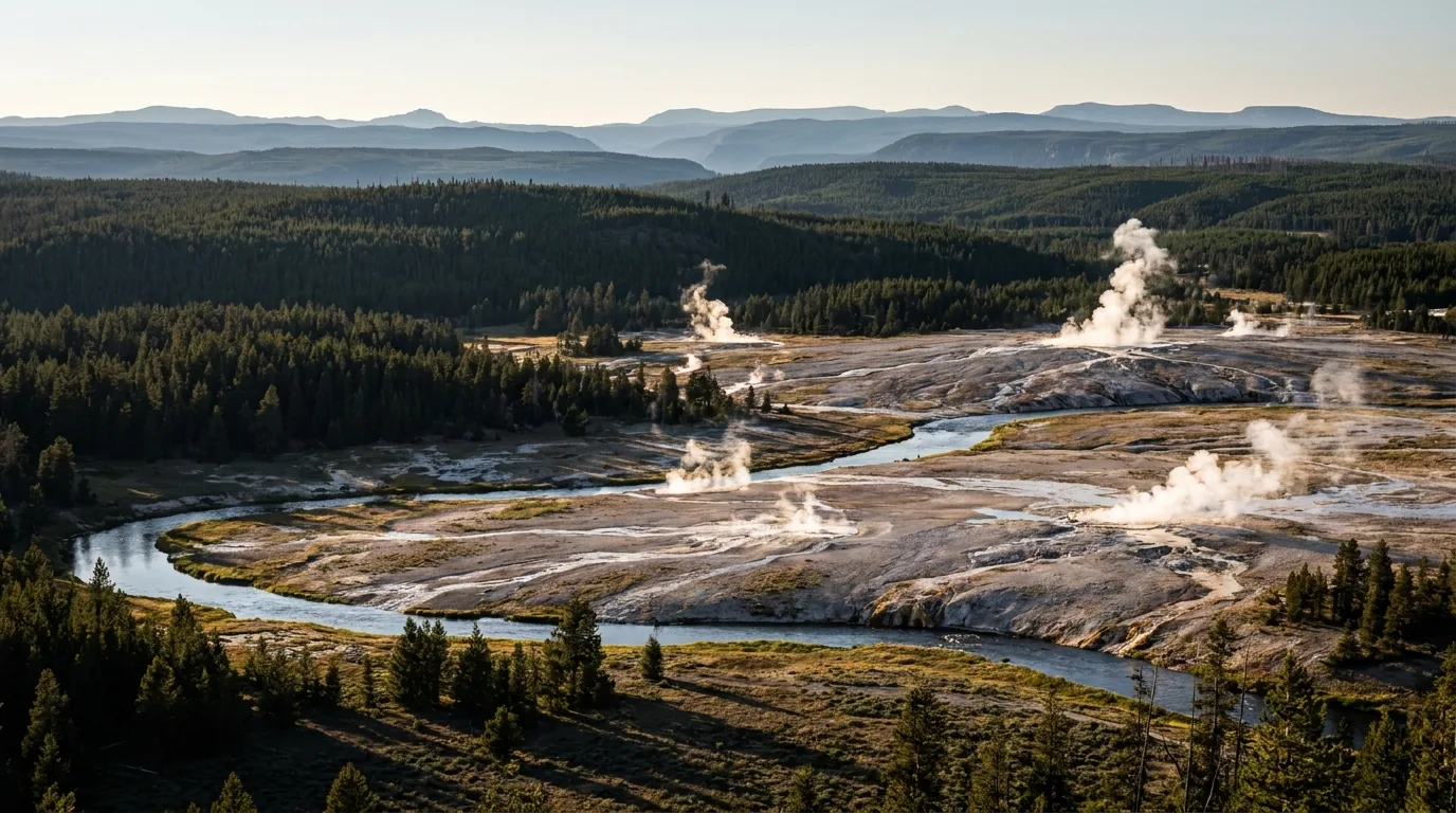
This is the half of Yellowstone people picture: the Upper, Midway, Lower and Norris basins strung along the Firehole corridor between Madison and Old Faithful. It is also where the parking problem is worst and where the single most avoidable disappointment lives — standing at ground level beside Grand Prismatic in a steam cloud, wondering where the rainbow went. Distances below are official NPS trail figures. Where NPS contradicts itself, we print both numbers and say so.
| Ranger-predicted geyser | Approximate interval | Where |
|---|---|---|
| Old Faithful | See the note above — sources disagree | Upper Geyser Basin |
| Grand | ~6.5 hours | Upper Geyser Basin |
| Riverside | ~6.5 hours | Upper Geyser Basin |
| Daisy | ~2 hours 45 minutes | Upper Geyser Basin |
| Castle | ~13.5 hours (major eruptions) | Upper Geyser Basin |
| Great Fountain | ~11.5 hours | Firehole Lake Drive — the only predicted geyser outside the Old Faithful area |
Six geysers are actively predicted by rangers. Everything else in the park erupts on its own schedule, and Steamboat — the world's tallest active geyser, with majors over 300 feet — is entirely unpredictable (§03, Norris).
1.2 miles (1.9 km) round trip, climbing 105 feet over 0.6 miles — gradual and well graded, to the purpose-built platform on the hillside above Midway. This is where every photograph of Grand Prismatic is taken from. Park at the Fairy Falls Parking Lot, 1 mile (1.6 km) south of Midway Geyser Basin — NPS describes that parking as "very limited." Allow 45–75 minutes including time on the platform.
Time this one against the light, not the crowds. This is the one thermal feature where you want the sun high — roughly 10 a.m. to 3 p.m. on a clear, warm day. Low morning light plus heavy steam hides the whole thing. On a cold or humid day you can do everything right and still see fog; build in the flexibility to come back on a warmer afternoon. Firm-surface trail, modest sustained grade — 105 feet over half a mile is a real climb for wheelchairs and for anyone with cardiac or respiratory limits.
A short boardwalk loop over the Firehole River and across the sinter terrace, past Excelsior Geyser Crater and Grand Prismatic itself. The colour ring comes from thermophiles — colourless and yellow microbes in the hottest water, orange, brown and green in the cooler margins. The trailhead has wheelchair-accessible parking, boardwalk and restrooms, making it one of the better accessible thermal stops.
Two honest notes. First, from the boardwalk you cannot really see Grand Prismatic — you're at ground level beside a very large pool venting steam, so you get colour at your feet and a lot of fog. Do the overlook as well. Second, NPS's own two pages give different diameters: the Grand Prismatic place page says 200–330 feet across and more than 121 feet deep; the Explore Old Faithful page says 370 feet. The park's sources disagree, so we print both. Parking here is the worst in the park — NPS states it is limited "especially 10 a.m.–6 p.m." Be there before 9 a.m. or after 6 p.m.
1.6 miles (2.6 km) there-and-back to a hillside bench looking straight down on Old Faithful — a categorically different experience from standing in the crowd at the benches. You can add 0.9 miles (1.4 km) by continuing west to Solitary Geyser, a frequent erupter, then dropping to the Geyser Hill boardwalk. From the Visitor Education Center, walk ~0.3 miles counter-clockwise along the boardwalk, turn right at the Geyser Hill sign, and find the trailhead just after the bridge over the Firehole River.
Time it to a predicted eruption and give yourself thirty minutes of margin, not fifteen — misjudge it and you'll be climbing while the eruption happens below you. Uphill with switchbacks; not accessible. This is the best-value ninety minutes at Old Faithful and almost nobody does it.
The Upper Geyser Basin's most photographed hot spring, and quietly its saddest: decades of coins and debris thrown into the pool clogged its vent, cooled the water, and shifted the colours from deep blue toward green and orange at the margins. It sits at the far end of the basin trail system, paved and boardwalked the whole way and essentially flat — one of the longest genuinely wheelchair-navigable routes in the park. Walking out you pass Castle, Grand, Riverside and Daisy, giving you several chances to intercept a predicted eruption. Allow 1.5–2.5 hours round trip.
Distance disclosure: it sits roughly 1.5 miles out from Old Faithful, so about 3 miles round trip — but NPS publishes no single clean point-to-point mileage for it on the pages we reviewed, so treat that as an estimate and check the basin map at the Visitor Education Center. People underestimate this walk because it's flat. At 7,300+ feet, in full sun, on a hot August afternoon, with no shade and no water on the trail, it hurts more than the map suggests. Carry water.
Two trail systems: Porcelain Basin, 3/4 mile of boardwalk and bare ground through open treeless terrain, and Back Basin, 1.5 miles through heavily wooded country. Allow 2–3 hours for both, 1 hour for Porcelain alone. Also here: the 1929–30 Norris Geyser Basin Museum (a National Historic Landmark) and the Museum of the National Park Ranger in the historic Norris Soldier Station.
Parking — the most precisely documented in the park: 143 total spaces, 17 oversized, 5 ADA. NPS states it "regularly fills during summer." Be there before 9 a.m. Mixed boardwalk and bare ground with grade changes down into both basins — less accessible than the Firehole basins.
In the Back Basin: the world's tallest active geyser, with major eruptions more than 300 feet high. And NPS is blunt — "Steamboat's minor and major eruptions are entirely unpredictable." Scientists do not understand what triggers it.
It resumed activity in 1961 after ~50 years dormant, went erratic, then began its current eruptive period on March 15, 2018 after a 3.5-year dormancy. Peak years were 2019 and 2020 at 48 eruptions each. Intervals run 3 days to several months with no discernible pattern. As of February 2026 it remained in its active phase with sporadic eruptions, and between majors it produces frequent minor eruptions of 10–40 feet. Plan to be delighted, not to schedule it.
The one stop where you see all four types of hydrothermal feature — geyser, hot spring, mudpot and fumarole — on a single loop, about 8 miles north of Old Faithful. The Fountain Paint Pot Trail is an easy 0.5-mile (0.8 km) boardwalk loop, under an hour, and the first part is wheelchair accessible and perfectly level — a genuinely good accessible option. Add 30–40 minutes for Firehole Lake Drive, the one-way side loop that holds Great Fountain Geyser.
Honest note: the mudpots are seasonal in character — thick and dramatic in spring when groundwater is high, thinner and less impressive by late summer. NPS flags parking here as limited, again "especially 10 a.m.–6 p.m."
A 200-foot (61 m) waterfall from the same trailhead as the Grand Prismatic Overlook. NPS gives either 5.4 miles (8.6 km) or 6.7 miles (10.7 km) round trip depending on route, 3–5 hours; from the Fairy Falls lot it's about 1.6 miles through young lodgepole to the falls, with an optional 0.6-mile extension to Spray and Imperial geysers. Rated easy and essentially flat. Combine it with the Overlook — same lot, one trip.
This is a documented grizzly area. NPS published a news release headed "Visitor injured by a grizzly bear while hiking near Fairy Falls; Always hike in groups of three or more." The easy rating and the parking lot lull people into hiking it solo with earbuds in. Groups of three or more, spray on your hip, make noise.
Twenty miles long, more than 1,000 feet deep, 1,500 to 4,000 feet wide, with the Upper Falls at 109 feet and the Lower Falls at 308 — nearly twice the height of Niagara. NPS suggests 1–2 hours for the canyon area, which is enough for a rim drive with stops. It is not enough to do both rims and the descent trails; budget half a day for that. Pets are not allowed on canyon trails, parking areas only.
South Rim Drive begins 2.3 miles south of Canyon Junction, leading to the Upper Falls viewpoints and to Artist Point — the canyon's signature view, with the Lower Falls framed at the head of the gorge and the ochre-and-cream walls running out toward you. From Artist Point the South Rim Trail runs 2.6 miles (4.2 km) there-and-back to Point Sublime: a nearly empty rim walk five minutes from the most crowded viewpoint in Yellowstone. Thirty minutes for Artist Point alone; 2 hours with the Point Sublime walk.
The Artist Point lot is one of the two or three worst in the park — it fills by mid-morning and stays full. Before 8:30 a.m., or after 6 p.m. Good news on access: the second viewing area at Artist Point is wheelchair-accessible, and it's the best accessible canyon view in the park.
A one-way scenic drive beginning 1.2 miles south of Canyon Junction, with four accessible overlooks — Lookout Point, Grand View, Inspiration Point and the Brink of the Lower Falls parking area. This is the rim for looking at the falls head-on and down into the canyon's most colourful walls. Allow 1–1.5 hours with stops; add 45 minutes if you descend to the Brink.
Because the drive is one-way, missing a lot means driving the whole loop again — an infuriating way to lose twenty minutes in August. Go early. NPS lists as wheelchair-accessible: the sidewalks at the Brink of Lower Falls parking area, and the path between Lookout Point and Grand View. Genuinely good by canyon standards.
A steep switchbacking descent off North Rim Drive to a railed platform directly at the lip where the Yellowstone River goes over the 308-foot Lower Falls. The volume and the noise at the brink is the most visceral thing in the park that isn't a geyser. 0.7 miles (1.1 km) out-and-back, 45–60 minutes: ten minutes down, thirty back up, and you will stop.
That 0.7-mile figure hides several hundred feet of vertical at 7,700+ feet, and everything you descend you must re-climb. This trail generates a steady stream of summer medical calls, most of them people who read "0.7 miles" and left their water in the car. NPS explicitly states the Brink of Lower Falls and Red Rock Point trails are not recommended for visitors with heart, lung or other health conditions. Take that at face value and enjoy the rim. The parking sidewalks are accessible; the trail is not.
Two of Yellowstone's most distinctive places sit at opposite ends of the park. Mammoth builds travertine terraces instead of silica geysers and changes on a timescale of months. Yellowstone Lake is the largest high-elevation lake in North America and looks like a summer lake in a way that gets people killed. Both are drive-up destinations with excellent accessible options — and both carry a specific hazard that isn't obvious from the parking lot.
Lower Terraces: a network of boardwalks and asphalt walkways at the base. Some boardwalk sections are wheelchair accessible, but the rest has stairs or steep grades, and transitions from asphalt to boardwalk may require assistance. Allow 45 minutes for the Lower Terraces alone, 1.5–2 hours for both levels.
Upper Terrace Drive: a short one-way loop above the terraces. For accessible views, enter the drive and park in the designated parking on the left; the boardwalk begins on the right. Continue 0.7 miles around to Orange Spring Mound, which has accessible parking and a short boardwalk to an exhibit.
Best light: late afternoon and early evening. The travertine is white and glares hard at midday; low sun brings out the orange and cream banding.
The stairs. The trail from the Lower to the Upper Terraces includes steep boardwalks and several hundred stairs, and NPS describes it as strenuous and not recommended for people with heart, lung or other health conditions. Visitors start up it casually from the bottom without realising they've committed. If stairs are a concern, drive to the Upper Terrace and walk down instead.
The elk in town. Mammoth village has a resident elk herd that grazes the lawns between the buildings. In the September–October rut, bull elk are aggressive and have charged and injured visitors; in spring, cow elk with calves are equally dangerous. The 25-yard rule applies to elk, and it applies on the sidewalk outside the hotel exactly as much as in a meadow. During peak rut, bugling is often frequent even midday.

The largest lake at high elevation (above 7,000 feet) in North America: 131.7 square miles of surface, 141 miles of shoreline, 20 miles long by 14 wide, average depth 140 feet, deepest point around 410 feet, elevation 7,733 feet.
The critical safety number: from May through October, average lake temperatures are only around or above 50°F (10°C). This is a lake that looks like a summer lake and will kill you like a winter one — survival time after a capsize is measured in tens of minutes, and there are no lifeguards anywhere in the park. Morning is calmest; afternoon wind on this lake is serious.
A 2.3-mile (3.7 km) loop out to a rocky point on the lake's north shore — easy, largely flat, with marmot colonies on the point and excellent lake views. About 1.5 hours. Unimproved trail with sand sections, so not wheelchair-rated, though Lake Butte Overlook and the Fishing Bridge area both offer drive-up lake views.
Storm Point closes seasonally for bear activity. This lakeshore is prime spring and early-summer grizzly habitat and it is one of the park's more frequently closed day hikes. We could not confirm the exact 2026 closure dates — check the Backcountry Conditions report before driving to the trailhead. And the point is named Storm Point for a reason: weather crosses this lake fast and the point is fully exposed.
The classic Yellowstone summit hike, to a fire lookout with interpretive exhibits at the summit shelter and 360-degree views over the caldera. 6 miles (9.6 km) round trip, 3–6 hours, rated STRENUOUS by NPS (a second NPS page gives 6.2 miles — trivial in practice). Trailhead: the Dunraven Pass lot, 4.5 miles (7.2 km) north of Canyon Junction; a second approach runs from Chittenden Road. Bighorn sheep are regularly seen on the upper slopes and July wildflowers are excellent.
NPS publishes neither an elevation gain nor a summit elevation on this trail page, so we print neither. Treat any figure you see elsewhere as unofficial. Access depends on Dunraven Pass being open — May 22 to October 12, 2026 — and even inside that window expect lingering snow into July.
The most scenically situated thermal area in the park: a compact basin sitting right on the shore of Yellowstone Lake, so you get steaming blue pools with the lake and the Absarokas behind them, including the famous Fishing Cone at the waterline. An easy, boardwalked 0.6-mile (1 km) trail, about 45 minutes. Facilities: information kiosk, vault/composting toilets, marked trail access.
Short, flat and fully boardwalked — one of the most accessible thermal basins in Yellowstone and the best choice for anyone with limited mobility who wants a real geyser-basin experience. Best at early morning or sunset: it faces east over the lake and low sun through steam over water is unmatched.
NPS's warning for this site is blunt: "Hydrothermal water can severely burn you." Stay on boardwalks, do not run or push, and supervise children at all times. The lakeside setting makes this feel like a beach walk. It is not.
Lamar and Hayden are the reason people come back to Yellowstone after they've seen the geysers once. They are not attractions with parking lots — they are long open valleys you drive slowly and glass with optics from pullouts, and they perform at first light and last light. Everything else in this guide can be rearranged. This cannot. If you want wolves, you sleep near the valley and you are in it before the sun is.
The broad glacial valley along the Northeast Entrance Road between Tower Junction and Cooke City, reliable for bison, elk, wolves and grizzly bears. The northern range is critical winter habitat for large animals, which is what supports the wolf packs.
You will very likely see wolves as distant moving dots, not as the close encounters in documentaries. A spotting scope is not optional equipment here; it is the equipment — 15× binoculars minimum, a 20–60× scope on a tripod ideally. And the single most effective strategy available to a visitor: find the cluster of tripods, park legally, walk up quietly, and ask. The regulars are in the same pullouts every dawn with serious optics and are, almost without exception, generous about letting a polite stranger look through a scope.
Some mornings there are no wolves. That is normal and not a failure of planning.
A broad open valley along the Yellowstone River between Canyon and Fishing Bridge. Bison live here year-round and congregate for breeding, with a central herd numbering around 1,300 animals. Its advantage over Lamar is simple logistics: it's on the lower loop, so it's an easy add to a Canyon or Lake day. Sixty to ninety minutes of slow driving with stops is a reasonable minimum.
Worth knowing: Yellowstone is the only place in the United States where bison have lived continuously since prehistoric times, it is the nation's largest bison population on public land, and it has not been hybridised through interbreeding with cattle. Wolves and grizzlies are the only large predators of adult bison.
Hayden Valley is also where visitors get hurt — see §07. Bison jams here are frequent and stop traffic for 20+ minutes; bison legally have the right of way and walk the road when they please.
And a real hazard nobody mentions: Lamar's road is narrow, has limited shoulders, and carries fast-moving traffic between two entrances. Standing on the pavement with a camera at dawn, in low light, in dark clothing, is genuinely dangerous. Stand behind your vehicle, not in the lane.
A side road and trail off the Lamar Valley road — superb wolf-watching country, a famous trout fishery, and the campground that is now the only in-park bed in the Lamar (§08). 3.4 miles (5.4 km) there-and-back, following a historic wagon trail toward the Absaroka-Beartooth Wilderness; an optional continuation adds 2.6 miles (4.2 km) to the second meadow, for 8.6 miles (13.6 km) total. Two to three hours to the first meadow, a full day to the second. Trailhead lot off the campground road — a rough gravel spur, and a small lot.
This is serious grizzly and wolf country — precisely the habitat quality that makes it good for watching is what makes it dangerous for walking. Groups of three or more, spray on the hip, noise on blind corners. Steep initial climb; not accessible. The first meadow is also a notorious mosquito factory in early summer.
A small, high, absurdly pretty lake near the Northeast Entrance. 1.2 miles (1.9 km) lollipop loop, 45–75 minutes. Otters are regularly seen here, and in early summer — roughly June, depending on the year — cutthroat trout run up the inlet stream in numbers you can watch from the bank. Morning is best for both.
The trailhead is a very small, unmarked-feeling pullout on the Northeast Entrance Road, easy to drive past, holding perhaps a dozen cars. Early or late. The climb from the pullout is short and genuinely steep — surprising for a "1.2 mile easy" hike — and this is bear country close to the road. The short distance tempts people to leave spray in the car. Don't.

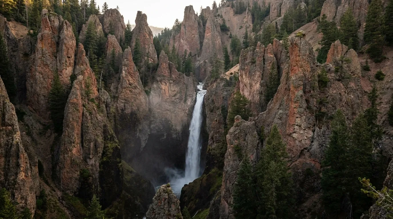
A 132-foot (40 m) waterfall dropping through eroded volcanic pinnacles, viewable from an overlook a short walk from the Tower General Store. Twenty to thirty minutes; add twenty for nearby Calcite Springs, which marks the terminus of the Grand Canyon of the Yellowstone with geothermal features and columnar basalt cliffs. Short paved walk to the overlook — reasonably accessible.
The trail to the base of Tower Fall is CLOSED. NPS: "The lower part of the trail is closed because of severe erosion." It has been closed for years, and people still arrive expecting to hike it because older guidebooks describe it. The overlook is the experience. An alternative 0.75-mile walk past the overlook gives views of Tower Creek meeting the Yellowstone River.
Note this stop sits on the Tower–Canyon segment over Dunraven Pass, open only May 22 – October 12 in 2026 — outside that window you approach from Mammoth. Also in this area: the Petrified Tree (ancient redwoods preserved 45–50 million years ago), Specimen Ridge (the largest concentration of petrified trees in the world), and the Lamar Buffalo Ranch buildings, survivors of the early-20th-century bison conservation effort and now a base for educational programmes.
People come to Yellowstone worried about grizzlies in the backcountry. What actually hurts them is a bison in a parking area at mid-morning, and ground beside a boardwalk that looks solid and isn't. This section is not filler and it is not padding — every figure in it comes from the National Park Service, including the incident record, and the pattern in that record is the whole lesson.
This is the counterintuitive fact visitors refuse to internalise, and NPS states it directly: bison "have injured more people in Yellowstone than any other animal" despite appearing calm, and they "can run 3x faster than humans."
The documented recent record, each one an official NPS news release: a 12-year-old injured on June 26, 2026 at about 9:15 a.m. near Mud Volcano, just north of Fishing Bridge, transported to hospital. A 47-year-old man gored in the Lake Village area on May 4, 2025 after approaching too closely. A man gored in the Upper Geyser Basin at Old Faithful at about 9:45 a.m. in 2025, after a large group of visitors crowded a bison. A man gored on June 10, 2025. A woman gored on June 1, 2024. Two gorings in three days in June 2022.
The pattern is the lesson. These are not remote backcountry maulings. They happen mid-morning, in developed areas — Old Faithful, Fishing Bridge, Lake Village — to people who walked toward an animal that looked placid, often because a crowd had already formed and it felt sanctioned. Crowds create a false sense of safety. A boardwalk is not a barrier.
If a bison charges: NPS says run away, and use bear spray if needed. Note that this is the opposite of bear guidance. Know which animal you are dealing with before you need to decide.
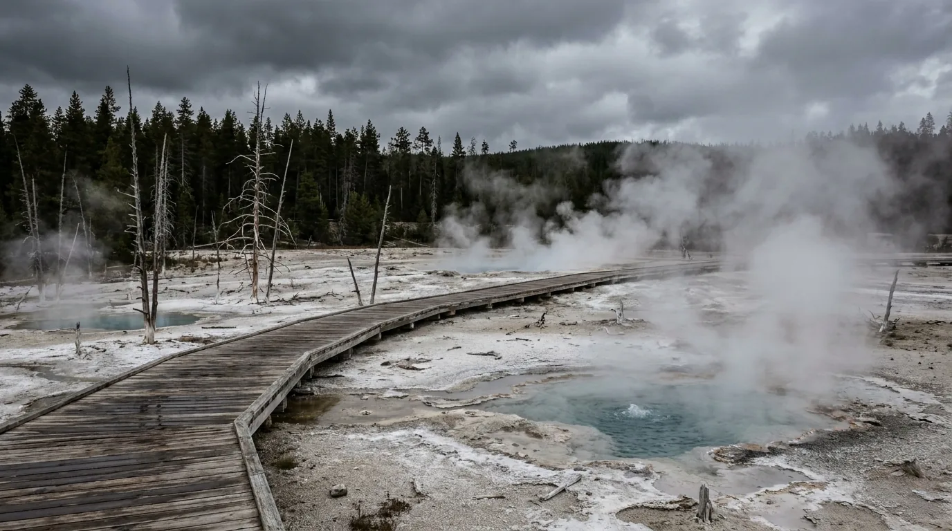
NPS: "More than 20 people have died from burns suffered after they entered or fell into Yellowstone's hot springs." And: the ground surrounding these features "may look solid, but it can be thin crust with super-heated water below." It looks like dirt. It is a lid. People have broken through and died.
Stay on boardwalks and designated trails — this is not a request about protecting scenery. Burns from thermal features are a common cause of serious injury and death. Hold children's hands. Don't run on boardwalks. Don't push. Falls from boardwalks into thermal water are a recurring injury mechanism, which is exactly why West Thumb's own signage says it.
Pets are prohibited on boardwalks and thermal trails. And never touch or scratch the microbial mats — the coloured margins are living organisms and take years to recover.
This is one of the starkest safety statistics in the National Park System, and it is free to act on: "Since 1970, 91% of the people injured by bears in Yellowstone were hiking alone or with only one hiking partner. Only 9% of the people injured by bears were in groups of three or more people."
1. Hike in groups of three or more. Group size is the single most effective bear-safety measure available to you. 2. Stay on maintained trails and make noise — especially near running water, in dense brush, and on blind corners. 3. Avoid hiking at dusk, dawn or at night. 4. Carry bear spray, know how to use it, keep it accessible.
In an encounter: DO NOT RUN. Running triggers pursuit. Stay 100 yards from any bear. Bear activity is current, not theoretical — the park reported its first grizzly sighting of 2026 in spring, hikers were injured by a bear in 2026, and a hiker was hospitalised after a grizzly encounter in September 2025. Male grizzlies emerge from hibernation in early March, females with cubs in April and early May — and females with cubs are the highest-risk encounter of all.
You have just read two pieces of official advice that pull against each other. Wildlife watching is best at dawn and dusk. NPS also tells you to avoid hiking at dawn and dusk. Both are correct, and the resolution is simple and worth stating out loud because a lot of visitors never square it:
Watch from the road at dawn. Hike mid-morning. Lamar and Hayden are roadside activities done from pullouts with optics — you are beside your vehicle, not in the brush. Then put your boots on once the light is up and the bears have moved off the open ground. That sequence gives you the wildlife and the trails without ever putting you in dense cover in low light.
Bear management areas close parts of the park seasonally to protect bears and people, and the closures change year to year — NPS adjusted the rules as recently as 2024. Check the Backcountry Conditions report before every hike, not just before the trip.
✈️ If you're flying in, you cannot bring it. Confirmed. TSA prohibits bear spray in both carry-on AND checked baggage. FAA rules permit only one self-defence spray of 118 ml (4 fl oz) or less with 2% or less tear gas, checked only — no commercially sold bear spray canister meets that limit. It also cannot be shipped by air as hazmat. This is exactly why the rental network exists, and why there is a kiosk in baggage claim at Jackson Hole Airport and vending machines at chambers of commerce in Bozeman and Belgrade. Fly-in visitors: plan to buy on arrival or rent, and plan to leave it behind. See §09 for where.
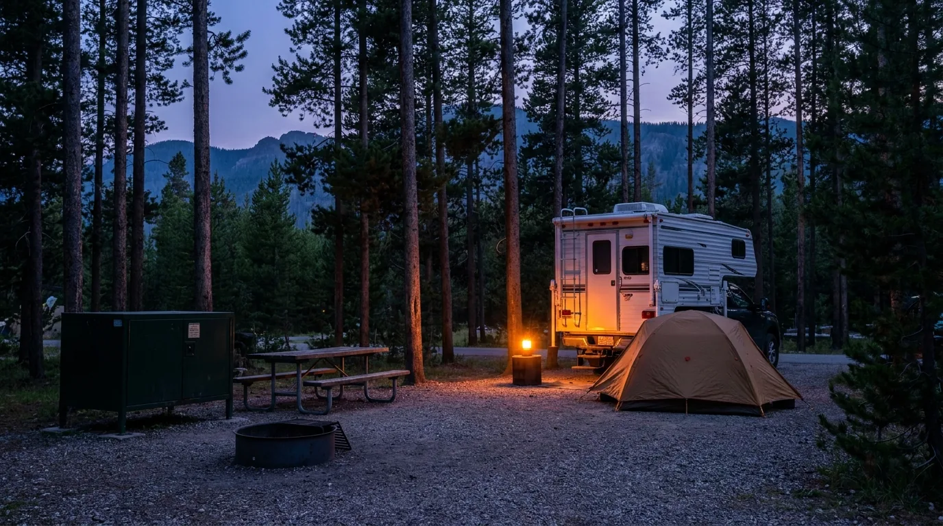
In frontcountry campgrounds: food, coolers, cookware and all scented items must be stored in a hard-sided vehicle or a bear box when not in immediate use — never left on a picnic table, never in a tent.
In the backcountry: each of the park's 293 backcountry campsites has either a food storage pole or a bear-resistant box, and you are required to use it at all times except when actively cooking or eating. Hanging requires at least 35 feet of rope — bring it. Keep your sleeping area at least 100 yards from your cooking, eating and food storage areas.
What counts as an attractant, quoted: "All odorous items such as empty food containers, water bottles which contained flavored drinks, lip balm, sunscreen, lotion, make-up, toothpaste, and medications must be stored the same way you store food and garbage." Sunscreen and lip balm go in the bear box. So does the empty Gatorade bottle. This is the rule people break.
Outside the park boundary the rules do not relax, they change hands. Custer Gallatin National Forest carries a food storage order in effect March 1 – December 1, 2026 across the Bozeman, Hebgen Lake, Gardiner, Yellowstone and Beartooth districts. There are three compliant methods: (1) a hard-sided vehicle or enclosed trailer with the windows closed; (2) an IGBC-certified container; (3) suspended at least 10 feet up and at least 4 feet from adjacent trees or poles. Violators may be cited and held civilly liable.
Spell this out for yourself before you pack: a soft-sided pop-up or a rooftop tent is NOT legal food storage, even at a campground where tent camping is allowed. Eagle Creek's per-site bear boxes near Gardiner solve it; the primitive sites do not. Shoshone National Forest carries its own orders — the specific 2026 rules vary by ranger district and we could not verify all of them, so check the district before you rely on any of it.
Drink only treated water — untreated surface water carries giardia and other parasites. Stream crossings are dangerous: park waters are "cold, fast, and more than thigh-deep," and NPS describes backcountry fords as "25 feet wide, 3 to 6 feet deep, extremely cold, and swiftly running." Hypothermia is a year-round risk and most cases occur at 30–50°F — not in a blizzard, but on a wet, windy 45°F afternoon in a cotton t-shirt.
Altitude sickness is common above one mile. Most of the park sits above 7,000 feet and so do most trails. Headache, nausea, shortness of breath, dizziness — descend if symptoms appear, and give yourself an easy first day.
Afternoon thunderstorms are routine, with gusty south-to-southwest winds and real lightning risk. That is why every exposed hike in this guide says start early. Winter weather is possible in any season — snow in July on the high passes is normal, not exotic. Snow lingers on trails until late May or June, and some mountain passes stay snow-covered until late July.
Pack a real sleeping bag and a warm layer in August. People shiver through July nights here every year because a forecast said 78°F and they packed for the daytime number.
Three in-park clinics, and only one is year-round: Mammoth Clinic, open year-round, 8:30 a.m.–5:00 p.m. in summer, ☎ 307-344-7965. Lake Clinic (summer only, 8 a.m.–8 p.m.) and Old Faithful Clinic (summer only, 7 a.m.–7 p.m.) run seven days a week in season; exact 2026 open and close dates were not confirmable.
These are clinics, not hospitals. Anything serious means a long ambulance ride or a helicopter, and from the park interior that is measured in hours. Nearest hospitals: Livingston MT (north), Big Sky/Bozeman MT (west), Cody WY (east), Jackson WY (south). Factor it into your risk tolerance for solo travel.
This is the section that actually saves you a trip. Yellowstone has twelve frontcountry campgrounds split between two reservation systems, and getting that wrong is why people arrive with no site. Five are run by the concessioner — the big, developed, expensive ones. Seven are NPS and book on Recreation.gov — the small, primitive, cheap ones. One of those seven, Pebble Creek, is closed for all of 2026. And the park is too big to basecamp in one spot and see everything comfortably, so pick your campground by what you came for, not by what's available.
| Concessioner campground | 2026 dates | Fee | Sites | RV limit | Hookups | Showers / laundry | Dump |
|---|---|---|---|---|---|---|---|
| Madison | May 1 – Oct 17 | $38 + tax | 276 | 60 ft | None | Nearest: Canyon (~45 min) | Yes |
| Fishing Bridge RV Park | May 8 – Oct 17 | $94 + tax | 310 | 95 ft | FULL — the only one | On site | Yes |
| Bridge Bay | May 15 – Sep 13 | $38 + tax | 431 | 60 ft | None | Nearest: Fishing Bridge | Yes |
| Canyon | May 29 – Sep 19 | $45 + tax | 272 | 40 ft | None | On site | Yes |
| Grant Village | Jun 26 – Sep 26 | $45 + tax | 429 | 50 ft | None | On site | Yes |
| Recreation.gov campground | 2026 dates | Fee | Sites | RV limit | Toilets |
|---|---|---|---|---|---|
| Mammoth | Year-round | $25 | 82 | 30 ft* | Flush + vault |
| Tower Fall | May 22 – Sep 27 | $20 | 31 | 30 ft | Vault |
| Indian Creek | Jun 12 – Sep 14 | $20 | 70 | 35 ft | Flush |
| Lewis Lake | Jun 15 – Oct 11 | $20 | 84 | 25 ft | Vault |
| Slough Creek | Jun 15 – Oct 12 | $20 | 16 | 30 ft | Vault |
| Pebble Creek | CLOSED FOR THE ENTIRE 2026 SEASON AND UNTIL FURTHER NOTICE — flood recovery work following the June 2022 floods. Formerly 27 primitive sites at 6,900 ft, 9 miles west of the Northeast Entrance. | ||||
*The Mammoth RV length data on the NPS page is internally inconsistent — a 30 ft figure sits alongside a 45 ft note — so check the specific site you're booking on recreation.gov. Park-wide maximum is 75 ft but individual sites are far shorter. None of the Recreation.gov seven has hookups, showers, laundry or a dump station. Vault or flush toilets and a water spigot is the entire amenity list.
And note Grant Village's June 26 opening. It is the last campground in the park to open and one of the shortest seasons, closing September 26. Anyone planning an early-June lake-and-Tetons trip around Grant needs a different basecamp — this is a July, August and early-September campground only.
Recreation.gov (the seven NPS campgrounds): reservations open exactly six months before your stay date, on a rolling basis. Set a calendar alarm. Slough Creek's 16 sites vanish within minutes.
The concessioner (the five big campgrounds): same 13-month window as in-park lodging. On the 5th of each month, reservations open for that entire same month of the following year — so on April 5, 2026 you book April 1–30, 2027. Online opens at midnight Mountain time; phone at 7:00 a.m. There is no waitlist and no way to book further out. One useful trick: if your stay begins in that 13th month, you may extend up to 4 additional continuous nights into the following month at the same lodge and room type before that month officially opens.
Mammoth is the exception — first-come, first-served from October 15 to April 1, and the only reliable walk-up option in the shoulder and winter seasons.
The blunt version: Yellowstone in summer is not a spontaneous trip if you want to sleep inside the park. Either plan 6–13 months out, or plan to stay in a gateway town and drive — and accept losing dawn.
Fishing Bridge RV Park, Canyon Campground and Grant Village Campground. That's the whole list. $5.45 + tax per shower in 2026; children 5 and under free with a paying adult. Two showers per site per night are included with a reservation at those three only.
Bridge Bay and Madison campers pay — their nearest facilities are Fishing Bridge and Canyon respectively, and Canyon is roughly 45 minutes from Madison. Old Faithful and Mammoth have no campground shower house; paid showers exist at Old Faithful Inn, Old Faithful Lodge and Mammoth Hot Springs Hotel, but we could not verify the fee, and there is no laundry at either location. Operating hours vary by date and include a midday cleaning closure — confirm at source.
Camping the northern range? Gardiner's laundromat-with-showers is usually the better answer than driving to Canyon.
In-park dump stations: Bridge Bay, Canyon, Grant Village, Madison and Fishing Bridge RV Park. There is none at Mammoth, Tower Fall, Slough Creek, Indian Creek or Lewis Lake.
Quoted from NPS: dump stations "may close when temperatures are below freezing." At 7,000–8,000 feet that means May and October are genuinely unreliable. If you're running an RV in shoulder season, do not plan your tank capacity around an in-park dump.
Dump station fees: no published 2026 figure exists on any official page, so we print none. Outside the park, Cody's city-run dump station is free and open year-round, with potable water May–September at $0.25 per 6 gallons — genuinely unusual, and worth routing for.
Generator hours are 8:00 a.m. to 8:00 p.m., prohibited from 8 p.m. to 8 a.m. This window is consistently stated and reliable.
Generators are permitted only at certain campgrounds — the NPS camping page marks Bridge Bay, Canyon, Fishing Bridge RV Park, Grant Village and Madison as generator campgrounds, and the primitive Recreation.gov sites — Slough Creek, Indian Creek, Lewis Lake, Tower Fall, Mammoth — generally prohibit them entirely.
A 60 dB limit is commonly cited but we could not verify it, and neither could we fully verify the per-campground permission list. Check your specific campground page on recreation.gov before relying on a generator.
The most useful fact here: about 25% of campsites are held for walk-ups. Walk-up permits are available in person at backcountry offices up to 2 days before your trip, debit or credit card only. If you missed the lottery and the reservation window, showing up in person two days out is a real strategy, not a long shot — especially midweek and outside the Lamar and Bechler hotspots. Offices: Mammoth, Tower, Bridge Bay, Grant Village, South Entrance, West Yellowstone and Bechler.
When the in-park campgrounds are full, and in July and August they are, the gateway towns are the answer. The USFS campgrounds are the value play. But this is the part of the guide where we print the least and hedge the most, deliberately: fs.usda.gov returned an error to every direct retrieval attempt during research, so most Forest Service fees and season dates on these corridors were recoverable only indirectly. We have omitted almost all of them rather than print a number we could not stand behind. What follows is what we can defend — including two safety rules that are not optional.
If you are tent camping and heading to the Northeast Entrance, you cannot stay at Soda Butte, Colter or Chief Joseph. With Pebble Creek closed, that leaves Slough Creek's 16 in-park sites or a campground further out on the Beartooth Highway. Plan it before you drive out there, because Cooke City is a long way from a second option.
Clearwater is the exact opposite — walk-in tent-only, so a hard-sided rig can't use it. Wapiti is the tent-friendly option in this valley, roughly 30 miles west of Cody by the historic Wapiti Ranger Station, with some electric sites and mandatory food storage in bear boxes. We could not confirm restrictions at Elk Fork, Big Game or Rex Hale — given that three campgrounds in this valley are confirmed hard-sided-only, assume any Wapiti Valley campground may carry the restriction until you verify otherwise. Wapiti Ranger District: (307) 527-6921.
One more Cody-side change that alters how you plan: Shoshone National Forest has suspended reservations — the corridor campgrounds are first-come, first-served, with a 16-day stay limit. That flips Cody-side planning from "book six months out" to "arrive early and have a backup."
Eagle Creek Campground (Custer Gallatin NF) — 20 sites (18 single, 2 double), $15 single / $30 double / $5 extra vehicle, open year-round, 2 miles northeast of Gardiner on Jardine Road at 6,100 ft. Vault toilets, fire rings, horse corrals, a bear box at every site, no hookups, no potable water, no dump. Max 48 ft RV, gravel road and unpaved sites. Site 6 is closed for beaver damage.
At $15 a night, open year-round, two miles from the North Entrance, this is the best camping value anywhere near Yellowstone for a self-contained rig or a competent camper. And a genuinely useful local detail: sites 19 and 20 are held for stock users until 4 p.m., then release first-come for one night — real value at a campground that routinely fills.
Canyon (Yankee Jim) — 15 sites, $10, year-round, roughly 13–15 miles north, no potable water, first-come. Bear Creek has no vehicle access due to flood damage — walk-in only. Timber Camp's fee and season we could not verify.
The biggest and most commercial gateway, 14 miles / 30 minutes to Madison Junction, with a real supermarket, gear shops, laundromats and an airport with seasonal service. The Custer Gallatin campgrounds around Hebgen Lake — Baker's Hole, Rainbow Point, Lonesomehurst, Cabin Creek, Beaver Creek — are bookable on Recreation.gov. We are not printing their 2026 fees; the figures we recovered came via indirect retrieval and could not be confirmed against the official pages. Book and price them at recreation.gov.
One safety-critical open item: Baker's Hole has historically been hard-sided-only because of grizzly activity, and we could not confirm its 2026 status. Confirm directly on the Recreation.gov listing before booking a tent site there. Do not assume.
The dispersed trap: free dispersed camping is very limited on the Hebgen Lake district and is mostly restricted to fee campgrounds and designated dispersed sites. Arriving expecting open dispersed camping near West Yellowstone is a genuine and common mistake. Elsewhere on Custer Gallatin the general rules are 16 consecutive days at one site, no permit, 100 ft from water, existing sites only, pack it out — under the food storage order in §07.
On Soda Butte's season, the sources disagree: one Forest Service figure gives July 1 – September 7, while the Recreation.gov listing describes it as roughly late June to Labor Day. We print both because we cannot tell you which is authoritative for 2026. Call the Gardiner Ranger District before you commit a drive to it — and remember it's hard-sided only regardless.
The park has just enough services to keep you alive and just few enough to punish poor planning. Two facts do most of the work: you can buy fuel at 2 a.m. in October with a credit card, and you cannot buy a week's groceries anywhere inside the boundary. Everything else follows from those.
Seven stations, at Mammoth, Old Faithful (Upper), Old Faithful (Lower), Canyon, Fishing Bridge, Grant Village and Tower-Roosevelt Junction. Two facts worth planning around: every station has diesel — unusual for a national park — and "all service stations offer 24-hour, year-round credit card fueling." The store closes seasonally; the card pump does not. Repair services are listed at Old Faithful, Grant Village and Fishing Bridge only.
Propane: two official NPS pages contradict each other, so take only the safe version — bulk refill is reliably available at Fishing Bridge and Grant Village; bottle exchange is widely available elsewhere. Anything more granular we could not settle. Call ahead before relying on a refill.
Yellowstone General Stores operates around a dozen retail locations across the villages. Set expectations honestly: these are convenience and camp stores — snacks, ice, basic camp food, souvenirs, at park pricing. They are not a grocery run.
Note the spread of 2026 closing dates: Bridge Bay and one of the Old Faithful stores close September 13, Grant September 27, Tower October 4, Canyon and Fishing Bridge October 18. A late-September trip finds a meaningfully thinner park than an early-September one.
Full supermarkets: Bozeman and Livingston MT to the north, Cody WY to the east, Jackson WY to the south, Idaho Falls ID to the west. Cody is the best provisioning stop of the five gateways.
NPS: "Cellular service is extremely limited in Yellowstone." Where there is any signal: the developed villages only — Mammoth, Old Faithful, Canyon, Grant Village, Lake Village, Tower-Roosevelt — plus Mount Washburn by line of sight and the Mammoth–Gardiner corridor.
Where there is none: Lamar Valley, Hayden Valley, Norris, Madison, Dunraven Pass, West Thumb and all backcountry — the majority of the park by area. Madison is a dead zone despite being a major junction and a major campground. Verizon is generally most reliable parkwide; AT&T is strongest at Canyon. Texting often works when calls won't, and village towers saturate in July and August.
In-park internet averages ~1.5 Mbps. Streaming does not work, and there is no WiFi at any campground in the park. Download offline maps before you enter. A claim circulating online that service covers "over 50 percent of the park" conflicts directly with the NPS language — disregard it.
Buying: sold at essentially every general store, gas station and park store in and around the park. We are not printing a purchase price — no official 2026 figure is published anywhere and the numbers circulating are secondary.
Renting — the sensible move for most visitors, and the only move for fly-ins. Bear Aware's published pricing is $16 for the first two days, dropping to $4/day after that, capped at $28. Rentals include a canister, holster, belt, a safety video and in-person instruction with an inert demo canister. A competing "start at $8" figure appears on the same operator's site — verify the tier structure at source. TrailQuipt publishes a comparable ladder from $16 for two days up to $28 for 8–14 days, plus resort tax and a refundable deposit.
In-park pickup: Canyon Village (kiosk by the Visitor Education Center, 307-828-1885) and Old Faithful (the Bear Aware yurt). Drop-off only: Fishing Bridge, Grant Village, Mammoth, Tower-Roosevelt, Madison Campground. Gateway pickup: West Yellowstone, Gardiner, Bozeman and Belgrade, Big Sky, Red Lodge, Jackson — and a kiosk in baggage claim at Jackson Hole Airport. Cooke City is drop-off only, and there is no verified rental operation in Cooke City — rent or buy in Gardiner. Canisters return to any of the operator's locations, so you can pick up in West Yellowstone and drop in Gardiner.
Park fishing is governed by an NPS permit, not a state licence. 3-day $40 · 7-day $55 · season $75. The season runs from the Saturday of Memorial Day weekend through October 31, with some waters on extended seasons. Anglers 16 and over need the permit, available on Recreation.gov.
State fishing licences are NOT valid and NOT required inside the park. And ignore the widely-circulated "$10 for 10 days / $20 season" figures that still appear on blogs — they are badly out of date. The numbers above are the NPS 2026 figures.
Note also that the park has closed fishing after 2 p.m. in 2026 on some waters because of warm water and low flows — check current conditions rather than assuming an all-day season. Outside the park, Cooke City General Store issues licences for Yellowstone, Montana and Wyoming in one stop, which is genuinely handy if you're fishing both sides of the boundary. Guided walk-wade rates quoted by operators run into the hundreds per day; we could not verify current pricing, so confirm with the shop.
So: if you are camping, you get a 30-day window. If you are day-tripping from a gateway town, you have no window. Walk up early, be flexible, and have a backup. The Old Faithful Inn Dining Room is worth the effort for the room itself — the log lobby is the point.
| Gateway town | Entrance | Year-round road? | Real grocery? | Hospital? | The character |
|---|---|---|---|---|---|
| Gardiner, MT | North | Yes — the only one | Yes | No — Livingston, which the chamber puts at 58 miles | A real working town at the Roosevelt Arch, no box stores. Laundromat with pay showers — the best answer on the northern range. The densest guide and rafting town of the five |
| West Yellowstone, MT | West | No — entrance closed to cars in winter | Yes | No — Big Sky ~50 mi | Biggest and most commercial, 14 mi to Madison. Two laundromats with showers, a year-round specialty gear shop, the best bear-spray rental market of the five. Snowmobile capital in winter |
| Cooke City / Silver Gate, MT | Northeast | Only through the park in winter | No — general stores only | None, and it's far | An outpost of roughly a hundred year-round residents. Two general stores, one confirmed fuel station at a premium, no verified public showers or laundry, no medical. Hard-sided camping only nearby |
| Cody, WY | East (~52 mi, Sylvan Pass) | No — Sylvan Pass closed in winter | Yes — supermarkets | Yes | A working Wyoming town and the best resupply of the five. Free year-round city dump station, 24-hour laundromats with RV parking, a long-established outdoor retailer. Public showers are the weak spot |
| Jackson, WY | South, via Grand Teton NP | No — closed roughly Dec–Apr | Yes — several | Yes | An expensive resort town — the cost-of-living gap against Cody is enormous. Best-served for groceries, bear spray and public showers, and it gets busier in winter for ski season, not quieter |
Distances: Cody is ~52 mi / about 1 hour to the East Entrance; Jackson is ~57 mi / about 1 h 15 to the South Entrance in clean summer conditions, driving north through Grand Teton — a figure that wildlife jams routinely blow out. You need park admission for Teton on that route, but an America the Beautiful pass covers both.
Yellowstone is functionally four different parks across the year, and picking the wrong season for what you want is the most common trip-planning mistake here. July draws 947,688 average visits — 23.57% of the year's visitation in a single month. November draws 14,323. Between those extremes sit two windows most people never hear about, when the park is closed to cars and closed to oversnow travel at the same time.
This is the answer for most people who camp. Far fewer people than July while most services still run, fall colour in the aspen and cottonwood, and the elk rut — mating season runs September to mid-October, beginning early September and peaking around the 20th. The best viewing is, surprisingly, right in the town of Mammoth Hot Springs, where cow elk gather all summer and bulls arrive to chase, fight, bugle and mate in the middle of town.
The catch, and it's real: sudden snow, and services thinning fast. Dunraven Pass and the Beartooth both close October 12 — earlier than the October 31 general closure, and earlier still if storms hit. Store closing dates run from September 13 to October 18. Best weeks, honestly stated: roughly September 8 to October 5 — after the Labor Day crowds break, during the rut, before the passes close, while most services still run.
Interior roads close for spring plowing from March 1, except Mammoth to the Northeast Entrance. Crews clear 198 miles of main road, 124 miles of secondary road and 125 acres of parking lots, plus 31 miles of the Beartooth Highway, every single spring.
What spring buys you: bear emergence — bears come out of dens hungry, searching for winterkill, and mothers with cubs emerge once baby bison and elk arrive, making this one of the best bear-viewing windows of the year. Baby animals. Very few people. And the spring bicycle window: before roads open to cars, cyclists can ride a 49-mile section of park roads from West Yellowstone once the plows have cleared the lanes. Car-free Yellowstone on a bicycle is a rare thing.
What it costs you: most roads and nearly all services closed, and some areas closed to all travel specifically because of bear emergence. Those closures are real and enforced.
Now the two windows nobody warns you about. November to mid-December, and mid-March to mid-April. In both, most of the park is closed to cars and closed to oversnow travel — you can neither drive in nor ride in. Only the North–Northeast road runs. November is the least-visited month of the year, and this is why. If you are planning a trip in either window, understand that you are planning a Gardiner-to-Cooke-City trip, and nothing more.
Why people do winter anyway: the northern range in winter is the best wolf-watching on earth — wolves visible against snow, elk and bison concentrated in the valleys, and Lamar as a wildlife theatre. Old Faithful in a snowstorm with a dozen people watching is a genuinely different experience from July. Mammoth Hot Springs Hotel is drivable because it's on the year-round road; the Old Faithful Snow Lodge operates December 16, 2026 – March 7, 2027 and is reachable only by oversnow travel. Twice-daily snowcoaches run between the two, driven by interpretive guides — so every mile is a guided tour.
| Window | What it's like |
|---|---|
| Apr – late May | Bears out, few people, most roads still shut |
| June | Everything opening; Grant not until Jun 26 |
| July – mid-Aug | Peak — July alone is 23.57% of the year |
| Sep 8 – Oct 5 | The sweet spot — rut, space, services |
| Oct 12 / Oct 31 | Passes close, then most roads close |
| Nov – mid-Dec | Dead zone — no cars, no oversnow |
| Dec 15 – Mar 15 | Guided oversnow only; one drivable road |
| Mid-Mar – mid-Apr | Dead zone — plowing, nothing open |
The pattern: the season is long but the useful hours in a summer day are short. Be parked at your headline stop by 8 a.m., do the walks and drives midday, and take the second window after 6 p.m. — Wyoming daylight runs well past 8.
This is an editorial synthesis, not an NPS itinerary — but every element in it is sequenced against two hard constraints: the figure-eight means you plan by loop, and the animals and the parking both reward the same 5 a.m. alarm. Split your nights: three at Madison for the geysers, then move to Canyon or Mammoth for the canyon and the valleys. Assume one 20-minute bison jam per day and stop resenting it.
Three rules that make all five days work: never plan a day that crosses the park twice — pick a loop. Eat at 11 or at 2, never at 12:30. And add construction time to every leg in 2026: up to 30 minutes for chip sealing, 15 at the Gardner River bridge, 10+ on Canyon–West Thumb on weekdays.
Run it before you leave. Tap each item as it's done — these are the ten things specific to Yellowstone that a general road-trip habit will skip. Almost all of them come back to three facts: the reservations are the bottleneck, the dawn start is the whole game, and the animals and the ground are more dangerous than they look.
Every guide has these. Most don't print them. Yellowstone is unusually well documented and unusually dynamic at the same time — geysers change behaviour, roads get chip-sealed, trails erode shut, and bear management areas open and close on a calendar. Everything below was last checked in mid-July 2026. A confident wrong number costs more than an admitted gap.
Everything above, condensed into a print-ready PDF built for the glovebox — for a park where most of the road network has no cell signal, the campgrounds book six to thirteen months out, and the difference between a great trip and a frustrating one is what time your alarm goes off. All twelve campgrounds with 2026 fees, dates and the two booking systems; the five entrances and the pass windows; the geyser basins and the canyon; dawn positions in Lamar and Hayden; the bison, thermal and bear safety reality with the actual incident record; the gateway towns; and the honest list of what nobody could confirm — on paper that works where the signal doesn't.
Every Trekkr Trail Journal is built like this one: custom logistics, honest trail beta, the camping and access detail, and the local knowledge that turns a good trip into the one your crew talks about for years — including, always, a plain list of what we could not confirm. New destinations drop all season long, from the BC corridors to the Oregon Cascades to the Alberta badlands to the Yellowstone plateau.
Unlock the Trail Journal Library