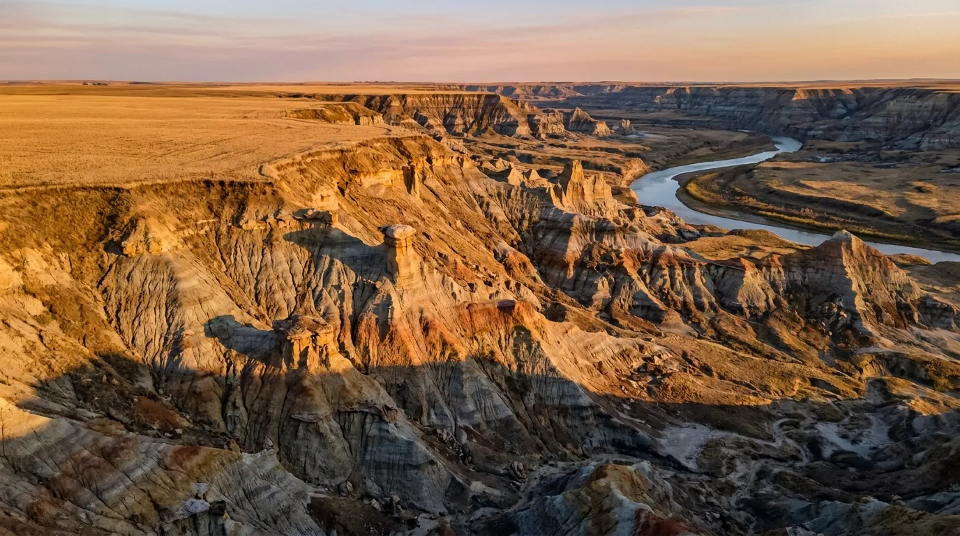
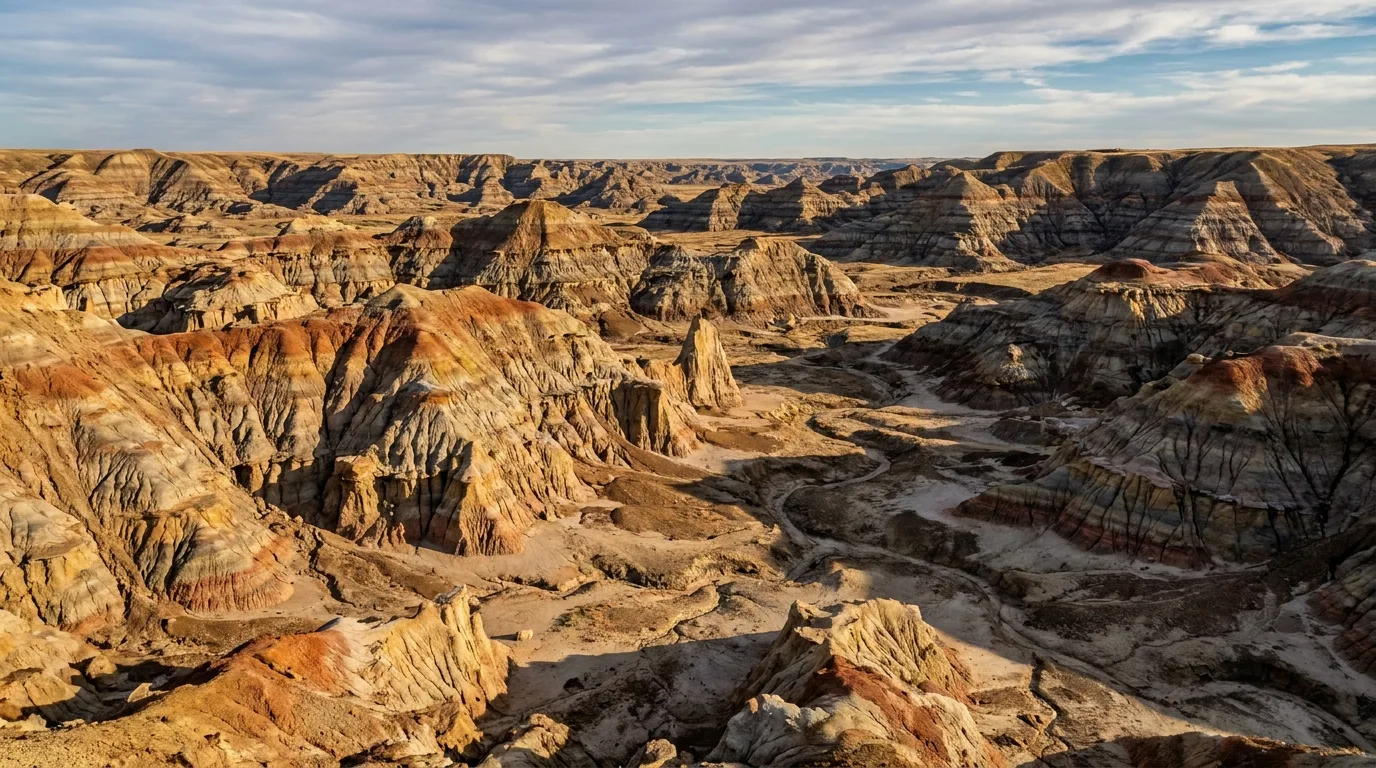
A 120-metre-deep trench of striped clay badlands, capped hoodoos and eroded coulees glowing in warm late light where the flat prairie splits open above the Red Deer River, Drumheller area Alberta, ultrarealistic photograph representative of the region
Trekkr Trail Journal · No. 030 · Alberta Badlands

Alberta BadlandsThe Red Deer River & Drumheller — The Complete Field Guide

Two hours from Calgary or Edmonton, the flat wheat prairie splits open without warning into a 120-metre-deep chasm of striped clay, capped hoodoos and 70-million-year-old bone. This is the anti-mountain-guide: no peaks, no snow, no alpine. The hazard here is the sun, not the summit — an open, shadeless moonscape where July and August highs reach ~35°C and there's essentially no shade anywhere. This issue is about respecting the heat, reading the badlands, and finding the hoodoos, coulees and cable ferries that nobody expects a short drive from the two big cities.

Alberta · Canada Drumheller · Red Deer River Dinosaur & Hoodoo Trails Royal Tyrrell Museum
~120 mDepth of the badlands trench below the prairie
~35°CJuly/August highs — no shade anywhere
~70 MaLate Cretaceous rock in the valley walls
Apr–Jun · SepShoulder seasons dodge the summer heat
Conditions verified 19 July 2026 · Heat is the headline hazard here · This block goes stale — the links don't

The badlands don't kill you with a cliff — they kill you with the sun

The rest of this journal is evergreen; this box is not. Unlike a mountain guide, there's no snow line and no alpine here — the threats are heat, water, slick clay, snakes and crumbling edges, and they're all worst in high summer. Everything below is dated to the day we checked it. Trust the live sources, not our date stamp — and read the full Safety section (§05) before you go.

  • HEAT & sun with zero shade is the #1 hazard — full stopOfficial Alberta Parks guidance for the badlands: July and August daytime temperatures can reach 35°C (95°F), and there is essentially no shade anywhere in this landscape. Carry at least 1 L of water per person hiking (realistically far more), SPF 30+ and a wide-brimmed hat, even on a 30-minute trail. People underestimate these "short easy trails" — the exposure and reflected heat off the pale clay are relentless. Hike dawn or dusk; avoid midday. (§05)
  • Flash floods in canyon & coulee floors — avoid them during and after heavy rainThe floors of Horseshoe Canyon, Willow Creek and Dry Island are drainage channels. Alberta Parks directs visitors to check Alberta River Basins for Red Deer River flow advisories before visiting; stay out of narrow canyon floors when rain threatens. (§05)
  • Rain turns the clay to grease — wait it outOfficial advice: the bentonite clay layers "become extremely slippery" when wet, so wait half a day to a full day after rain before hiking. Expect the rural clay roads at Dry Island and Tolman to become impassably slick in the wet. (§03, §05)
  • Prairie rattlesnakes are active roughly April to early OctoberAlberta's only venomous snake basks on sun-warmed sandstone and ledges. Stay on established trails, watch where you step over rocks, keep dogs leashed, observe from a distance and never handle one. Bites are rarely fatal (~20% are dry, no venom) but call 911 if bitten. (§05)
  • Unstable, unfenced canyon edgesThe rims at Horseshoe Canyon, Orkney Viewpoint and Dry Island are crumbling clay and sandstone with no railings — the ground can give way. Stay well back, and stay on trails to protect both yourself and the fragile formations. (§03, §05)
  • Fire bans & drought — check the live source, day-ofNo specific 2026 provincial fire ban was confirmable for this corridor at press time, and status changes daily. Check albertafirebans.ca and alberta.ca/fire-bans before you light anything. [VERIFY AT PUBLISH — status changes daily]
  • Bleriot Ferry season & Horseshoe Canyon accessThe free Bleriot cable ferry runs its 2026 season May 1 – Oct 30, 8 a.m.–11 p.m. daily — confirm no mechanical closures day-of. Horseshoe Canyon parking ($2, ~mid-May to Labour Day) has no known 2026 closure. [VERIFY AT PUBLISH — Kneehill County / Travel Drumheller]
Live sources · Alberta Parks — badlands safety (heat, clay, flood, critters) · albertafirebans.ca · alberta.ca/fire-bans · Kneehill County — Horseshoe Canyon · Travel Drumheller — Bleriot Ferry
In an emergency, 911. Camping reservations (where required) through shop.albertaparks.ca or 1-877-537-2757. This box was true at press and will not stay true — the sources above are the truth on the day you travel.
01 / THE HOOK

Central Alberta's otherworld, hiding under the wheat

Most road trips out of Calgary or Edmonton point west, to the mountains. This one points the other way — and the payoff is a surprise. The flat prairie gives no warning, then splits open into a striped desert of clay, capped hoodoos, coulees and bone. Carved by ice-age meltwater, it exposes 70-million-year-old Late Cretaceous rock, and the whole valley is a working paleontological landscape. This is dinosaur country in the literal sense.

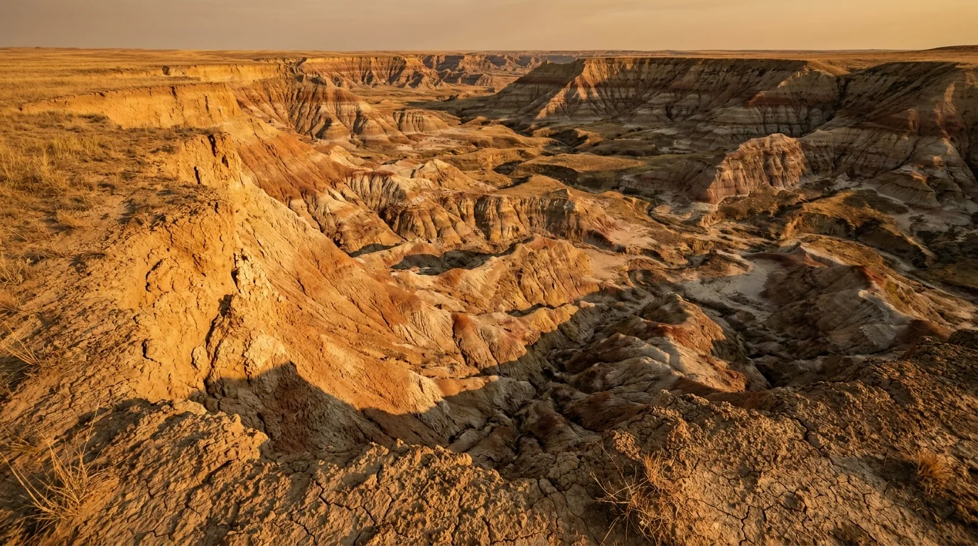
Layered stripes of grey, ochre and rust bentonite clay eroded into a rippled badlands slope with no vegetation, warm late-afternoon light, central Alberta, ultrarealistic photograph representative of the region
Seventy million years, laid bare. Meltwater at the end of the last ice age cut a 120-metre trench through the flat central-Alberta prairie, exposing striped Late Cretaceous clay, capped hoodoos and dinosaur bone — a strange, quiet, sculpted desert where the hazard is the sun, not the summit.

The surprise

The hook is that nobody expects it — the hiking, the hoodoos, the coulees and suspension bridges are a short drive from two big cities, yet feel like another planet. No peaks, no snow, no Icefields-Parkway crowds.

Dinosaur country

The Royal Tyrrell Museum holds one of the world's great fossil collections (§07), and the surrounding valley is a live dig site. The bone in the walls is why this place has a name.

History on the geology

Wayne's 11 one-lane bridges, the last cable ferry at Bleriot, the miners' swinging bridge at Rosedale, and the buffalo-jump cliffs at Dry Island layer human history straight onto the rock.

The way to think about the region — one hub, two loops, one shadeless rule This guide runs out of Drumheller, a town of ~8,000 in the bottom of the valley with full services — fuel, groceries, a hospital, hotels, restaurants and the "World's Largest Dinosaur" T-Rex viewpoint. Two signature driving loops fan out from it: the Dinosaur Trail (§02) northwest, tied together by the free Bleriot Ferry, and the Hoodoo Trail (§02) southeast through Rosedale and Wayne. The outlying anchors — Horseshoe Canyon, Dry Island — sit off the highways nearby. And Dinosaur Provincial Park (§04) is a world-class sidebar 2.5 hours southeast, not a Drumheller side-stop. One rule ties it all together: there's no shade out there, so fill up on fuel and water in Drumheller and hike in the cool of the day.
02 / THE CORRIDOR

The Red Deer River, and the two loops off Drumheller

The spine of this trip isn't a road — it's the Red Deer River, cutting its badlands trench through the prairie. Drumheller sits in the bottom of it, and two loops built around the river do most of the work: the Dinosaur Trail to the northwest and the Hoodoo Trail to the southeast. Fill up in town before you run them — the outlying stops have no services.

The Red Deer River winding in slow bends through deep eroded coulees and pale striped badlands walls, cottonwoods along the banks, warm evening light, central Alberta, ultrarealistic photograph representative of the region
The Red Deer River. The corridor that cuts the whole 120 m-deep badlands trench through the flat central-Alberta prairie. Everything in this issue hangs off it — the loops, the ferry, the coulees and the campgrounds.
🔴 Fill up in Drumheller — the loops have no services Drumheller has reliable fuel, groceries, a hospital and full services. The outlying stops — Dry Island, Little Fish Lake, the ferry roads — have none. Top up fuel and potable drinking water in town before you head out (most Alberta Parks campgrounds out here have no drinkable water — §07). And remember the loop-breaker: when the Bleriot Ferry isn't running, the Dinosaur Trail loop can't be completed without backtracking through town.
Loop / anchorRoadsThe characterKey stops
Dinosaur TrailHwy 838 (North) & Hwy 837 (South) A ~48 km loop NW of town, tied together by the Bleriot Ferry across the river Royal Tyrrell Museum · Midland PP · Bleriot Ferry · Orkney Viewpoint · Horsethief Canyon
Hoodoo TrailHwy 10 SE from Drumheller ~16 km through Rosedale and Wayne to the Willow Creek Hoodoos Star Mine Suspension Bridge · the Hoodoos · Wayne's 11-bridge road
Horseshoe CanyonHwy 9, ~17 km W of Drumheller Outlying anchor, managed by Kneehill County; rim platforms + canyon floor Rim viewpoints · descent trail · canyon arms
Dry Island Buffalo Jump~1 h N via Trochu / Huxley A deep, wild badlands canyon and the highest buffalo jump in Alberta. Day-use only Rim viewpoint · canyon descent · Tolman river area
Dinosaur Provincial Park~2.5 h SE, near Brooks UNESCO World Heritage badlands — a full day-trip / overnight of its own (§04) Sidebar, not a Drumheller side-stop

Key access roads: Hwy 9 (Calgary/Hanna axis, past Horseshoe Canyon), Hwy 56, Hwy 838/837 (Dinosaur Trail), Hwy 10 (Hoodoo Trail), Hwy 575/837 (to Orkney and the Bleriot area). Badlands "trails" are often informal — carry an offline GPS map.

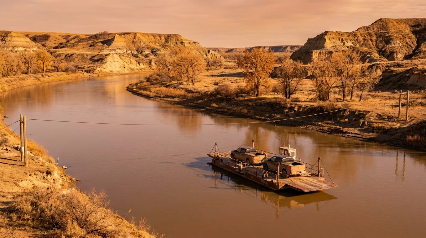
A small cable-guided river ferry carrying a couple of vehicles across the calm Red Deer River between badlands banks, warm light, Bleriot Ferry Alberta, ultrarealistic photograph representative of the region

The Bleriot Ferry — the loop's keystone

The Bleriot Ferry is a free, cable-guided river ferry — one of the last of its kind in Alberta — carrying a handful of vehicles across the Red Deer River on Hwy 838. It's what ties the two halves of the Dinosaur Trail together into a loop.

2026 season: Fri May 1 – Fri Oct 30, 8 a.m.–11 p.m. daily. Small capacity means short waits in peak season, and when it's not running you'll backtrack through town to close the loop. Confirm no mechanical closures day-of.

FreeMay 1 – Oct 30 · 8a–11pNot running = loop broken
03 / THE HIKES & FEATURES

Rim walks, hoodoos, coulees and a swinging bridge

These are the marquee stops — most of them short, most of them family-friendly, all of them exposed. Distances below come from official pages plus AllTrails/10Adventures and are flagged where the number isn't from an official source. Badlands trails are often informal, so carry an offline map. And every one of them shares the same caution: no shade, loose clay, and heat that punishes people who treat "easy" as "casual."

A cluster of capped sandstone hoodoos five to seven metres tall glowing warm orange at golden hour on a bare desert slope, boardwalk and stone steps below, Willow Creek Hoodoos Alberta, ultrarealistic photograph representative of the region
The Willow Creek Hoodoos at golden hour. Capped sandstone pillars, typically 5–7 m tall — a Provincial Historic Resource. Stay on the designated pathways: climbing on or defacing them carries fines up to $50,000 and/or up to a year in prison.
Layered badlands ridges and eroded clay gullies fanning out below unfenced rim viewpoints into a wide horseshoe-shaped canyon, warm late-afternoon light, Horseshoe Canyon Alberta, ultrarealistic photograph representative of the region
Horseshoe Canyon from the rim. The big Hwy 9 stop ~17 km W of Drumheller — wheelchair-friendly rim platforms, then a ~0.8 km descent to a floor with two ~5 km arms. No shade, loose clay, and unfenced edges that crumble.

The signature stop · rim in 5 min, floor for hoursHorseshoe Canyon — rim + floor

The big one on Hwy 9, ~17 km W of Drumheller: a large parking lot and viewing platforms at the rim (wheelchair-friendly / near-parking), then an official descent trail ~0.8 km one-way to the floor via steps and gravel path. From there it's choose-your-own-adventure — the two canyon arms run ~5 km each. Rim only is 30 minutes; a full floor exploration is 2–3 hours.

No shade, loose clay underfoot, unstable edges at the rim — and extremely slippery when wet (bentonite clay). Parking $2/visit, roughly May 12 – Labour Day, credit / tap-to-pay; no Parks Canada pass needed. [VERIFY AT PUBLISH — Kneehill County]

$2 parking (confirm at source)Rim: easy · Floor: easy–moderateNo shade · slick when wet
~0.8 km to floor (one-way)
arms ~5 km each · 30 min–3 h

The little desert · stay on the boardwalkWillow Creek Hoodoos Trail

On Hwy 10, ~15–16 km E of Drumheller, with a parking lot, pit toilets and a picnic shelter. A short, easy loop of stone steps and boardwalk sections winds around the capped sandstone hoodoos (typically 5–7 m tall). A small parking fee applies. The hoodoos are a Provincial Historic Resource.

Fully exposed "small desert" — hot, no shade, slippery clay when wet. Stay on designated pathways: climbing on or defacing the hoodoos carries fines up to $50,000 and/or up to a year in prison.

Short easy loop · boardwalk/stepsSmall parking feeDo not climb the hoodoos
Short loop · boardwalk + steps
fully exposed · ~30 min

The wild one · offline map essentialDry Island Buffalo Jump — viewpoint + canyon descent

About 1 h N of Drumheller (via Trochu/Huxley); the entrance road leads to a rim viewpoint and the Day Use Area. The rim has a ~50 m cliff — the highest buffalo jump in Alberta — and the central plateau stands ~200 m above the river. A ~2 km trail drops from the Day Use Area into the canyon, with many additional informal trails through coulees and native grassland; aggregator loops run 7.5–8.9 km. Moderate; 1–4 h depending how far you drop in. Day-use only.

Roads and trails are bentonite clay — dangerously slippery when wet; water is not available; bring an offline GPS map (easy to lose the informal trails). Rattlesnake habitat.

Descent ~2 km · loops 7.5–8.9 kmModerate · 1–4 hNo water · clay roads · snakes
Rim ~50 m cliff · plateau ~200 m
day-use only · offline map
A deep wild badlands canyon with a high sheer cliff dropping to a green river valley far below, native grassland on the plateau rim, warm light, Dry Island Buffalo Jump Alberta, ultrarealistic photograph representative of the region
Dry Island Buffalo Jump. A deep, wild badlands canyon ~1 h N of Drumheller — a ~50 m cliff (the highest buffalo jump in Alberta) with the plateau standing ~200 m above the river. Clay roads go impassable when wet; no water; rattlesnake habitat.
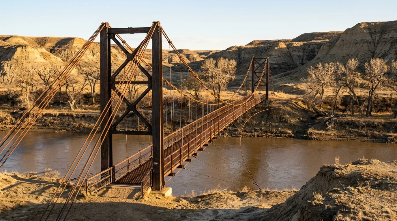
A long narrow pedestrian suspension bridge slung across the Red Deer River between low badlands banks, cables and towers catching warm light, Star Mine Suspension Bridge Rosedale Alberta, ultrarealistic photograph representative of the region

The Star Mine Suspension Bridge

At Rosedale, ~9 km SE of Drumheller off Hwy 10, with free roadside parking. A 117 m pedestrian suspension bridge across the Red Deer River — a historic 1931 coal-miners' crossing, reopened January 2024 after repairs. The walk to reach and cross it is short (~0.4 mi round trip), easy-to-moderate.

Caution: the trails on the far bank turn to deep mud when wet; otherwise it's good short badlands walking in dry weather.

117 m bridge · free parkingFar-bank trails: deep mud when wet
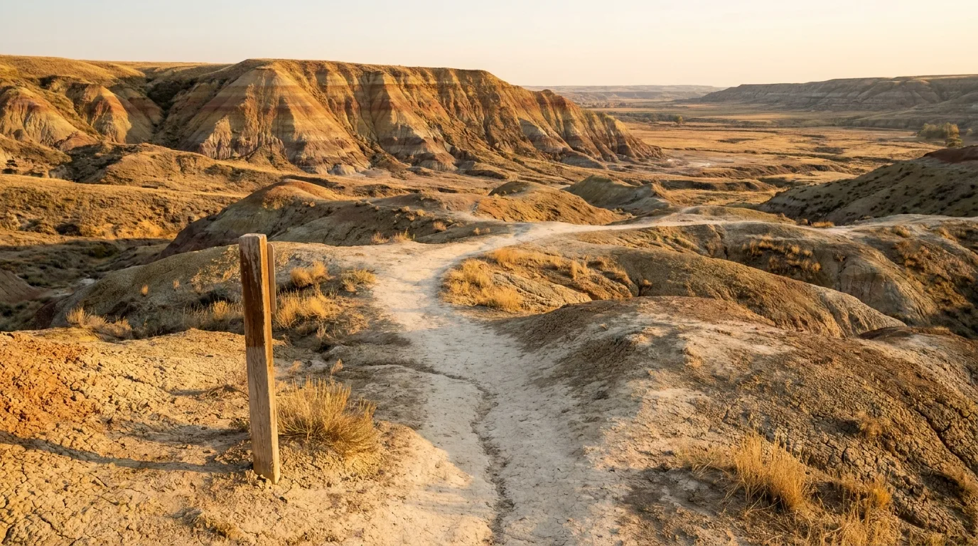
An easy interpretive trail with a wooden marker sign winding across open badlands hills below a low bluff, warm late light, Badlands Interpretive Trail Midland Provincial Park Alberta, ultrarealistic photograph representative of the region

Midland PP — Badlands Interpretive Trail

From the Royal Tyrrell Museum parking area (Hwy 838, N of Drumheller): a ~1.4 km easy loop, ~30–60 min, with 12+ interpretive signs on badlands geology and dinosaur history. The short interpretive paths by the museum connect straight into it.

Day-use only — no camping in Midland PP. Open and exposed; carry water even on this short loop.

~1.4 km loop · easy · 30–60 minExposed — carry water

Orkney Viewpoint

On the South Dinosaur Trail (Hwy 837) W of Drumheller, then a ~1 km rough dirt spur to a roadside overlook with a sweeping Red Deer River valley view. Minimal walking.

Caution: stay well back from the crumbling cliff edges — no railings, and the drop is straight down to the river valley.

Roadside overlook · ~1 km spurNo railings — unstable edge

Royal Tyrrell Museum grounds

Adjacent short interpretive paths connect the museum straight to the badlands and into the Badlands Interpretive Trail (above). The museum itself — one of the world's great fossil collections — is the anchor of the whole valley; hours and admission are in §07.

Short interpretive pathsMuseum details in §07
04 / SIDEBAR — DINOSAUR PROVINCIAL PARK

The world-class detour, 2.5 hours southeast

Dinosaur Provincial Park sits on the same Red Deer River and is the world-class badlands and fossil destination — a UNESCO World Heritage Site. But it's ~2.5 h southeast near Brooks (48 km NE of Brooks), a full day-trip or overnight of its own with a different basecamp. We treat it as a strong sidebar — an "if you have an extra day, or you're going home via the Trans-Canada" extension — not a Drumheller side-stop, because calling it one would mislead you on drive times.

Classic hoodoo and badlands terrain with layered eroded ridges and coulees stretching to the horizon under warm late-afternoon light, Dinosaur Provincial Park Alberta, ultrarealistic photograph representative of the region
Dinosaur Provincial Park. The best-documented badlands in the region — and the source of the safety guidance (rattlesnakes, extreme heat, slick clay) worth borrowing for the whole issue. Much of the park is a restricted Natural Preserve; the five public trails below are the self-guided options.

Coulee Viewpoint Trail

A ~0.9 km loop with a moderate short climb to a panoramic badlands overlook near the visitor centre.

Badlands Trail

A ~1.3 km loop into classic hoodoo/badlands terrain; easy-to-moderate and interpretive.

Trail of the Fossil Hunters

A ~0.9 km out-and-back to a historic quarry area; easy-to-moderate.

The rest of the park, and the caution that applies to the whole issue Two more self-guided options round out the five: the Prairie Trail and Cottonwood Flats Trail — short interpretive loops through prairie grassland and riverside cottonwoods respectively (three of DPP's five trails are wheelchair-accessible). Much of the park is a restricted Natural Preserve accessible only on guided programs. And the DPP safety line is the one to carry across this entire issue: rattlesnakes, black widow spiders, scorpions, cactus, extreme July/August heat (up to ~35°C), and clay that becomes "extremely slippery" after rain. Camping here requires reservations year-round — see §06.
And a footnote on the north — Tolman Bridge Near Dry Island, the Tolman Bridge area offers informal river and coulee walking around the Tolman East/West campgrounds and the Red Deer River crossing on Hwy 585 — a popular paddling put-in. It's an easy add-on to a Dry Island day.
05 / SAFETY — READ THIS FIRST

People underestimate the badlands

This is the section to read before any trail. The badlands look benign — short paths, gentle grades, a family destination — and that's exactly the trap. The terrain is desert-like with zero shade, and every year people get into trouble treating "easy" as "casual." Lead with the heat; the rest follows from it.

Heat, sun & water — the #1 killer of a badlands day

This is desert-like terrain with zero shade. Official Alberta Parks guidance: temperatures reach 35°C in July and August. Carry at least 1 L of water per person hiking (realistically far more), SPF 30+ and a wide-brimmed hat — even on a 30-minute trail.

People treat these as "short easy trails" and get into trouble because the exposure and reflected heat off the pale clay are relentless. The single best defence: hike dawn or dusk; avoid midday.

≥1 L per person · realistically moreDawn/dusk · never midday

Prairie rattlesnakes

Alberta's only venomous snake, active roughly April to early October on sun-warmed sandstone and ledges. Bites are rarely fatal, and ~20% are "dry" (no venom). They strike only if surprised or provoked, up to ~half their body length.

Official guidance: stay on established trails (easier to spot a basking snake), watch where you step over rocks (snakes can't hear footsteps), keep dogs leashed, observe from a distance, never handle. If bitten, call 911.

Active ~Apr–early OctStay on trail · leash dogs · 911
🔴 Flash floods & slick clay — the water hazards Canyon and coulee floors — Horseshoe, Willow Creek, Dry Island — are drainage channels. Avoid them during and after heavy rain, and check Alberta River Basins for Red Deer River advisories. After rain the bentonite clay becomes "extremely slippery," so wait half a day to a full day before hiking, and expect rural clay roads (Dry Island, Tolman) to become impassable. This is not a minor inconvenience — the slick clay is a genuine fall-and-vehicle hazard.

Unstable canyon edges

The rims at Horseshoe Canyon, Orkney and Dry Island are crumbling, unfenced clay and sandstone — stay well back; the ground can give way. Erosion cuts both ways: stay on trails to protect the fragile formations and yourself.

Other critters (mainly DPP / southern badlands)

Black widow spiders, scorpions, and prickly-pear / pincushion cactus. Don't touch, and watch where you sit or place your hands. Most concentrated at Dinosaur Provincial Park (§04), but worth the habit valley-wide.

06 / THE CAMPING STRATEGY

Where to sleep — and why you bring your own water

The camping here splits between free/first-come Alberta Parks sites right on the river and the bookings-required commercial and provincial parks. The one thread through nearly all of it: bring your own drinking water. Most of the Alberta Parks campgrounds out here have no potable water at all, and the ones with pumps often aren't drinkable. Where a fee couldn't be verified, we say so — never assume the number.

An overland rig with an awning at a quiet unserviced campsite among cottonwoods on a flat bench beside the Red Deer River, badlands walls rising behind, golden-hour light, Alberta, ultrarealistic photograph representative of the region
The area's beds. From free first-come sites on a river bench by the Bleriot Ferry to full-hookup commercial resorts near town — but come with all your drinking water and small bills, because the Alberta Parks sites out here mostly have none.
CampgroundOperator · sitesWaterReserve?Season 2026Fee (2026)
Bleriot Ferry
Dinosaur Trail
Alberta Parks · 28, unserviced None — bring own First-come May 14 – Aug 31 $25/night · exact cash/cheque only
Tolman East
Dry Island area
Alberta Parks · 40, unserviced Hand pump First-come ~mid-May – mid-Oct (confirm dates) $25/night unserviced
Tolman West
Dry Island area
Alberta Parks · 25, unserviced Hand pump First-come ~mid-May – mid-Oct (confirm dates) $25/night
Little Fish Lake PP Alberta Parks · 10, rustic Pump NOT potable — bring own First-come May 1 – Oct 31 Confirm at source [UNVERIFIED — likely ~$25]
Dinosaur PP
sidebar, ~2.5 h SE
Alberta Parks · 120+ (unserviced, powered, pull-through) + Comfort Camping Potable + showers on site Required year-round Reservable season Confirm at source [UNVERIFIED exact $ — book at shop.albertaparks.ca]
Dinosaur Trail RV Resort
commercial
Private · 221 + 7 cabins Yes (full & partial hookups) Yes ~May – end Sept Confirm at source [UNVERIFIED — call for 2026 rates]
Drumheller / Dinosaur Trail KOA
commercial
KOA / Summerhill · 221+ + cabins Yes, + pool Yes ~mid-May – early Sept Confirm at source [UNVERIFIED — call for 2026 rates]

Note: Midland PP is day-use only — no camping. Bleriot Ferry details are confirmed (28 unserviced sites, $25/night, May 14–Aug 31, FCFS, no potable water, exact cash/cheque only, seniors' discount eligible). Alberta Parks reservations: shop.albertaparks.ca or 1-877-537-2757 (summer 403-575-7857 for Bleriot).

The move that makes or breaks a badlands night Two rules cover it. First, bring all your drinking water — Bleriot Ferry has none, Little Fish Lake's pump is explicitly not safe to drink, and Dry Island has none. Top up potable water in Drumheller (rule of thumb: 4+ L per person per day in summer, more if hiking). Second, match the booking model to the site: the riverside Alberta Parks sites (Bleriot, Tolman, Little Fish Lake) are first-come-first-served and cash/cheque, so come with small bills; Dinosaur PP and the two commercial resorts take (and Dinosaur PP requires) reservations.

⚠️ Source honesty: exact 2026 nightly fees for Little Fish Lake PP, Dinosaur PP, and the two commercial resorts could not be verified — the official Dinosaur PP camping page returned a 403 error at our check. Those cells read "confirm at source." Book/verify Dinosaur PP at shop.albertaparks.ca; call the commercial parks for current rates. Tolman East/West exact 2026 open/close dates are listed by Alberta Parks as approximately mid-May to mid-October — confirm before you rely on a date.

07 / PRACTICAL & SERVICES

The museum, the ferry, the water, and the light

Drumheller is the hub for everything — fuel, groceries, medical, the Royal Tyrrell Museum — and the practical details below are what turn a good badlands day into an easy one. Most of it comes down to two habits: carry your own water, and travel in the cool, low-angled light of dawn and dusk.

An overland rig on a straight prairie highway approaching the rim where the flat farmland suddenly drops into striped badlands coulees, warm golden-hour light, central Alberta, ultrarealistic photograph representative of the region
The approach. The prairie gives no warning, then the road tips over the rim into the valley. Drumheller sits at the bottom with full services — fill fuel and potable water here, because the loops and the rural stops have none.

Royal Tyrrell Museum — 2026

Admission: Adults CA$25, seniors 65+ CA$16, youth 7–17 CA$12, family CA$55 (2 adults + kids, up to 8 total), children 6 & under free.

2026 deals: seniors free during Seniors' Week (June 1–7); youth 17 & under free June 19 – Sept 7; ages 18–24 get 50% off with photo ID.

Hours: May 15 – Aug 31 daily 9 a.m.–9 p.m.; rest of year 10 a.m.–5 p.m., closed Mondays (except holidays). Holiday closures Dec 21/24/25/28, 2026 & Jan 1, 2027.

Verify hours/admission at publish

Water, ferry, timing & families

  • Water is critical: most Alberta Parks campgrounds here have no potable water — carry all drinking water in; top up in Drumheller. Rule of thumb: 4+ L per person per day in summer, more if hiking
  • Bleriot Ferry: free; 2026 season May 1 – Oct 30, 8 a.m.–11 p.m. daily, Hwy 838. Short waits in peak season
  • Best light & safety: dawn and golden hour — coolest temps, best light on the striped clay, and lower snake activity than the afternoon heat
  • Family-friendly marquee stops: Willow Creek Hoodoos, Star Mine Suspension Bridge, Horseshoe Canyon rim, the Badlands Interpretive Trail, and the Tyrrell Museum (kids 17 & under free in summer 2026) — all easy and short
  • With kids: keep them close on the trail (snakes, edges) and heavily watered and sun-protected
A note for readers coming from the mountains If you're used to the Rockies, reset your instincts. There's no snow line, no altitude and no alpine start for weather here — instead the whole plan bends around heat and water. The best-season logic flips too: where the mountains peak in mid-summer, the badlands are most comfortable in the shoulder seasons — late April to June, and September into early October — which dodge the worst of the July/August heat while the hoodoos and coulees are just as striking. High summer still works, but it's a dawn-and-dusk game.
08 / TIMING

When to go — and when to hide from the sun

There's no snow gate to plan around here, so the calendar question is simpler than a mountain guide's — but the daily clock matters more. The season is long; the comfortable hours within a summer day are short.

The real risks, ranked

  • Heat, sun & dehydration — the #1 hazard. No shade anywhere; ~35°C July/August. Carry water, start at dawn
  • Slick bentonite clay after rain — wait half a day to a full day; rural clay roads turn impassable
  • Flash floods in canyon/coulee floors — avoid during and after heavy rain; check Alberta River Basins
  • Prairie rattlesnakes — active ~April–early October; stay on trails, leash dogs, 911 if bitten
  • Unstable canyon edges — crumbling, unfenced rims at Horseshoe, Orkney, Dry Island
  • No services on the loops — no fuel or water at the rural stops; sort it in Drumheller

When to go — by window

WindowWhat it's like
Late Apr – JunePrime shoulder — dodges the heat
July – AugustHottest (~35°C); dawn/dusk only
September – early OctPrime shoulder — cool, good light
Bleriot FerryMay 1 – Oct 30, 8a–11p daily
Horseshoe Canyon parking~mid-May – Labour Day (confirm)
Best hours, any dayDawn & golden hour before dusk

The pattern: the season is long but the summer days are short on comfortable hours. Shoulder seasons (late Apr–June, Sept–early Oct) are the sweet spot; in high summer, hike the cool ends of the day and rest through the midday heat.

~35°C in July/AugustShoulder seasons dodge the heat
09 / TRIP-READY

The departure check

Run it before you leave. Tap each item as it's done — these are the ten things specific to the Alberta badlands that a general road-trip habit will skip. Almost all of them come back to two facts: there's no shade and no water out there, and the clay changes everything when it's wet.

0 / 10 confirmed — the sun sets the schedule.
10 / QUICK ANSWERS

Asked at every Drumheller trailhead

Do I need a pass to hike Horseshoe Canyon?
No Parks Canada pass needed — it's managed by Kneehill County with a $2 parking fee (roughly mid-May to Labour Day, credit / tap-to-pay). Confirm the current fee and season on the Kneehill County page before you go.
Is it really that hot? Do I need water on a "short" trail?
Yes. July/August highs reach ~35°C with no shade anywhere. Alberta Parks says carry at least 1 L of water per person hiking — realistically bring far more, plus sun protection, even for 30-minute trails. Hike dawn or dusk and avoid midday. People get into trouble treating these short trails as casual; the exposure and reflected heat off the pale clay are relentless.
Are there rattlesnakes, and what do I do?
Yes — prairie rattlesnakes, active roughly April to early October. Stay on trails, watch your step over rocks, leash dogs, observe from a distance, don't handle. Bites are rarely fatal (~20% inject no venom) but call 911 if bitten. They're Alberta's only venomous snake and strike only if surprised or provoked.
Can I camp right by the Bleriot Ferry on the Dinosaur Trail?
Yes — the Bleriot Ferry campground (28 unserviced sites, $25/night, first-come-first-served, no water or hookups, exact cash or cheque only, roughly May 14 – Aug 31). Come with all your drinking water and small bills. Confirm the current fee and dates with Alberta Parks.
Is Dinosaur Provincial Park a day trip from Drumheller?
Not really — it's ~2.5 h southeast near Brooks. It's worth its own overnight, and camping there requires reservations year-round (book at shop.albertaparks.ca). Treat it as an extension — an extra day, or a stop on the way home via the Trans-Canada — not a Drumheller side-stop.
Is the Royal Tyrrell Museum free for kids in 2026?
Per the museum's 2026 information, youth 17 & under get free general admission June 19 – Sept 7, 2026, and children 6 & under are always free. Adults CA$25, family CA$55. Re-confirm hours, admission and the promo windows on the museum's official Hours & Admission page before you travel.
11 / WHAT WE COULD NOT CONFIRM

The honest gaps, all in one place

Every guide has these. Most don't print them. Fees, hours and ferry/campground season dates change yearly and were last confirmed mid-July 2026 — anything flagged below should be re-checked against the linked official page before you rely on it. A confident wrong fee costs more than an admitted gap.

Why this section exists Anyone can write a guide that sounds certain. The hard part is knowing which of your numbers are real — and in a place where campground fees live behind a booking portal that returned a 403 and the fire status resets every day, plenty of them need a same-week check. The null is the product. "The Dinosaur PP nightly fee wasn't retrievable — book at shop.albertaparks.ca" is a usable instruction. A confident wrong fee is not.
🔒

The printable field guide

Everything above, condensed into a print-ready PDF built for the glovebox — for a region where the shade runs out at the trailhead, the water stops at the edge of Drumheller, and the heat is the hazard nobody plans for. The Dinosaur Trail and Hoodoo Trail loops, the Bleriot Ferry timing, the hoodoos, Horseshoe Canyon and Dry Island, the Royal Tyrrell details, the campgrounds and the bring-your-own-water reality, the heat-and-snake safety plan, and the honest list of what nobody could confirm — on paper that works where the signal doesn't.

The two driving loops Hoodoos, canyons & the bridge Dinosaur PP sidebar The campgrounds Royal Tyrrell & the ferry Heat, snakes & flash floods The departure check
Unlock the PDF — $4.95
$4.95 per guide · Instant access · Built by people who actually camp there
Trail Journal No. 030

Go farther. Camp lighter.
Leave it better.

Every Trekkr Trail Journal is built like this one: custom logistics, honest trail beta, the camping and access detail, and the local knowledge that turns a good trip into the one your crew talks about for years — including, always, a plain list of what we could not confirm. New destinations drop all season long, from the BC corridors to the Oregon Cascades to the Alberta badlands.

Unlock the Trail Journal Library
↗ Read another issue — No. 021, Central Oregon: Bend & the Cascade Lakes
$4.95 per guide · Instant access · Built by people who actually camp there