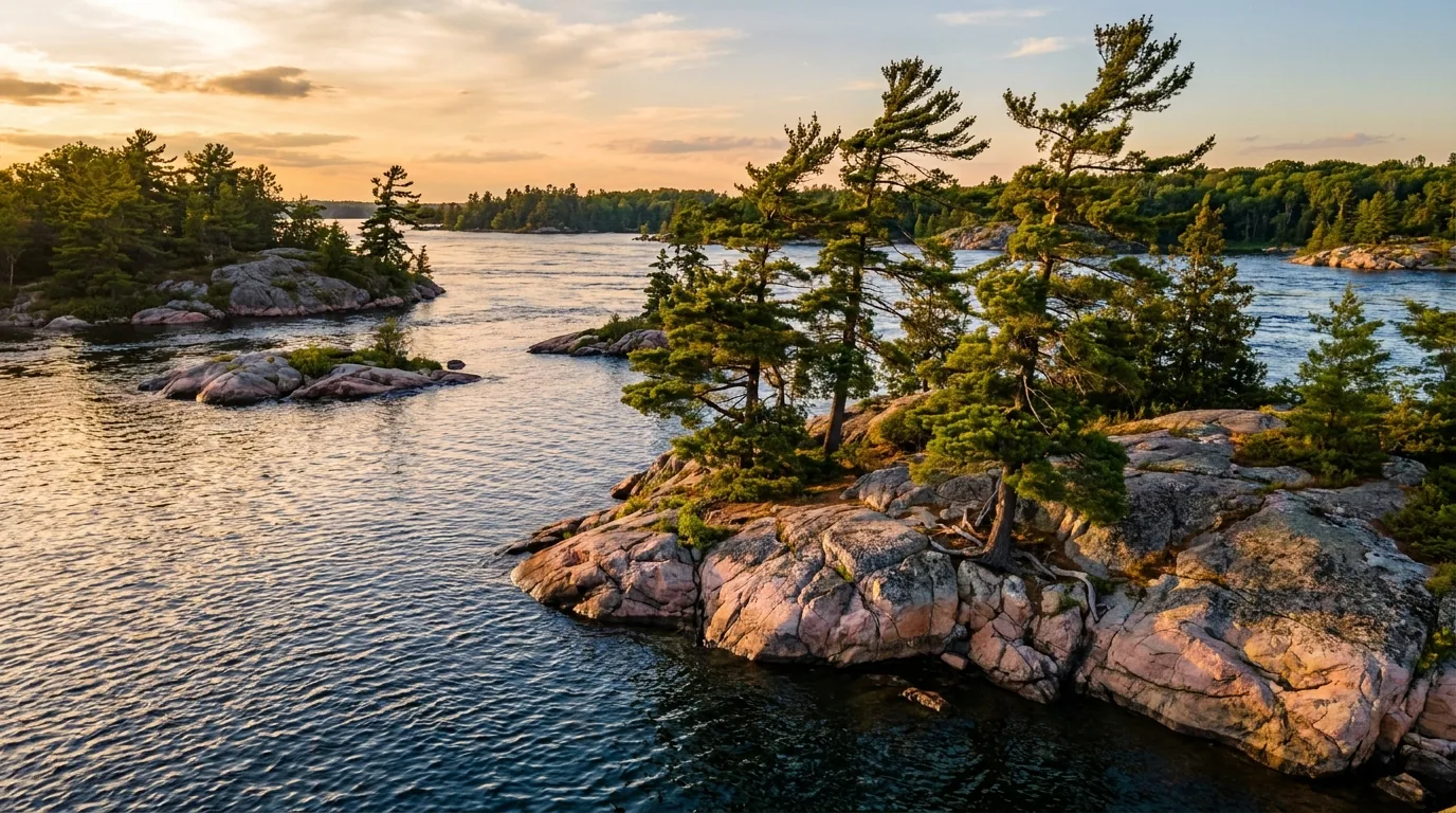
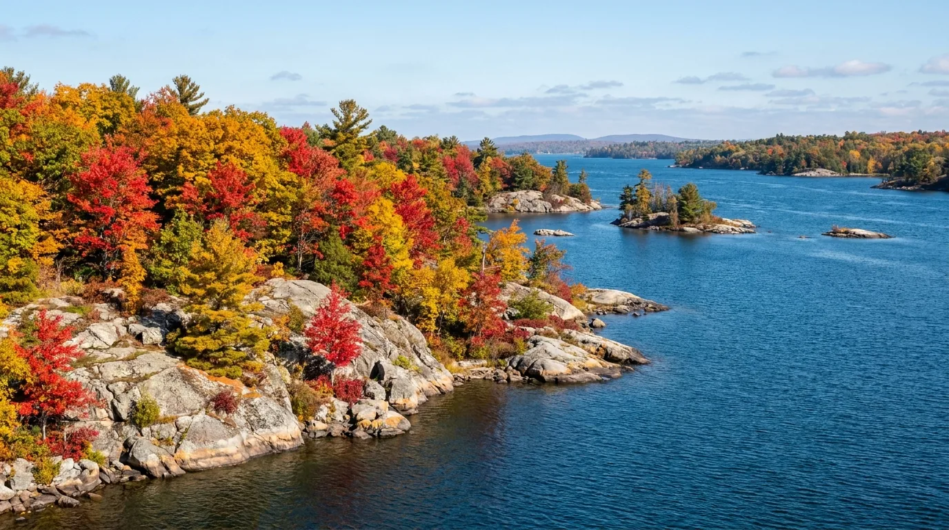
Windswept pines on pink-and-grey granite islands rising from the deep blue channels of the St. Lawrence River at golden hour, Thousand Islands and the Frontenac Arch Ontario, ultrarealistic photograph representative of the region
Trekkr Trail Journal · No. 060 · Thousand Islands & the Frontenac Arch

Thousand IslandsOntario — the granite islands of the St. Lawrence, the Frontenac Arch biosphere, boat-access island camping & the Rideau locks

Where the Canadian Shield dives under the St. Lawrence River and re-emerges as the Adirondacks, an ancient ridge of billion-year-old granite crosses the water and shatters into some 1,800 pine-topped islands. This is windswept rock and deep blue channels, a UNESCO biosphere that's one of the most biodiverse corners of Canada, boat-access island campsites, paddle-in Shield backcountry, and hand-operated 1830s canal locks. And one catch nobody plans for: the famous castles are in the United States — passport required.

Ontario · Canada St. Lawrence River · Frontenac Arch Boat-access island camping UNESCO biosphere & Rideau Canal
~1,800Granite islands and islets between Kingston and Brockville
2002UNESCO named the Frontenac Arch a biosphere reserve
PassportNeeded to land at the U.S.-side castles — they clear customs
Boat onlyEvery island campsite is boat-access; no water taxi from the park
Conditions verified 23 July 2026 · The border and the boat decide this trip before the trail does · This block goes stale — the links don't

Three things shape this trip: a passport for the castles, a boat for the islands, and a shipping channel that isn't yours

The rest of this journal is evergreen; this box is not. In the Thousand Islands the surprises are jurisdictional and logistical — the marquee castles sit in the United States (§05), the island campsites are boat-access only and book out (§07), and the main channel is a working international seaway (§06). Everything below is dated to the day we checked it. Trust the live sources, not our date stamp.

  • Boldt & Singer Castles are in the U.S. — bring a passport or NEXUSThe two famous castles (Boldt Castle on Heart Island, Singer Castle on Dark Island) are in New York State. Any cruise that lands at a castle clears U.S. Customs & Border Protection — every passenger needs a valid passport or NEXUS card, even sailing round-trip from Canada. View-only cruises that don't land do not. [VERIFY document rules with the cruise operator before booking a landing tour] (§04, §05)
  • Island campsites are BOAT-ACCESS ONLY — and 2026 booking is openEvery Thousand Islands National Park island site is reached by your own boat, a kayak/canoe, or a private water shuttleParks Canada runs no water taxi. The island oTENTiks (McDonald & Gordon Islands) and tent sites book through the Parks Canada system; 2026 island/oTENTik booking opened 2 February 2026 and summer fills fast. [VERIFY sites, fees and dates at parks.canada.ca] (§07)
  • The main channel is an active international shipping laneOcean-going freighters use the St. Lawrence Seaway and cannot stop or turn quickly. Cross channels quickly and at right angles, stay clear of the lanes, and treat wind, wake and current as real — open crossings between islands can build waves in minutes and currents run strong at the narrows. (§06)
  • This is established tick country — real Lyme riskThe Frontenac Arch and Thousand Islands are an established blacklegged (deer) tick area with real Lyme-disease risk, ticks active spring through fall. Wear long light clothing, use repellent, stay on trails, and do full-body tick checks after hiking. [VERIFY current local public-health advice] (§06)
  • Bugs, water and services run on a seasonBlack flies and mosquitoes peak mid-May to late June, worst in Frontenac's interior and wooded wetlands. Cruises, outfitters and most campgrounds run roughly May to mid-October; spring water is cold and some services aren't open yet. Frontenac PP stays open for four-season backcountry use. [VERIFY opening dates the week you go] (§07, §09)
  • The gray ratsnake is protected — and harmlessOntario's largest snake (up to ~2 m) lives on this granite. The Frontenac Axis population is threatened and legally protected; it is non-venomous and harmless to people. Don't handle or harass it, and slow down on warm roads where road mortality is a real threat. An awareness note, not a danger one. (§06)
Live sources · Parks Canada — Thousand Islands National Park · Ontario Parks — Frontenac PP · Ontario Parks — Charleston Lake · Parks Canada — Rideau Canal · CBSA (border documents)
In an emergency, 911. On the water, marine distress is VHF Channel 16. This box was true at press and will not stay true — the sources above are the truth on the day you travel.
01 / THE HOOK

Where the Shield crosses the river

Most of the Thousand Islands story is written in one rock. The Frontenac Arch is an ancient band of billion-year-old Precambrian granite — an exposed spur of the Canadian Shield — that dives under the St. Lawrence and re-emerges on the far shore as the Adirondacks. Where it crosses the water it shatters into some 1,800 islands and islets along ~80 km of river between Kingston and Brockville: windswept pine on pink-and-grey rock, deep clear channels, and a shoreline of storybook cottages and gilded-age castles. This isn't sandbar-and-marsh country. It's the great river running through bedrock. And because five forest regions meet here and the islands work as stepping stones between the Algonquin highlands and the Adirondacks, it's one of the most biodiverse regions in Canada and the last intact forest corridor in eastern North America — a UNESCO biosphere since 2002. Layered on top is a dense human story: Millionaire's Row, the castles, and the hand-operated Rideau Canal, a UNESCO World Heritage site in its own right.

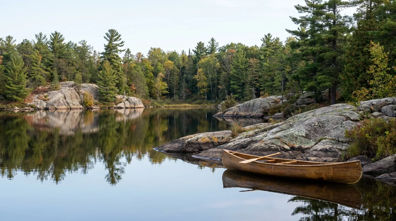
A calm clear backcountry lake ringed by Canadian Shield granite and mixed pine-and-hardwood forest with a canoe on the water, Frontenac Provincial Park Ontario, ultrarealistic photograph representative of the region
Frontenac Provincial Park — the Shield behind the river. Just inland from the islands, the Frontenac Arch rises into a maze of granite ridges and clear lakes with 100+ km of trail and paddle-in-only backcountry sites (§07). The islands are the famous face of this landscape; the Arch is its wild interior.

The payoff

Camp on your own granite island, paddle hidden channels, dive a preserved shipwreck, cycle a separated 37 km waterfront trail, and watch a boat lock through by hand on the 1830s Rideau Canal — all inside one biosphere, off Highway 401 (§04, §07).

The catch

The two iconic castles are in the United States. A cruise that lands at Boldt or Singer Castle clears U.S. Customs — bring a passport or NEXUS. And every island campsite is boat-access only, with no park water taxi (§05, §07).

The river

Beautiful and working at once: the main channel is an international shipping seaway. Freighters can't stop for a kayak, wind builds waves fast on open crossings, and currents run strong at the narrows. Respect it and it rewards you (§06).

The way to think about the region — a river of islands, a Shield interior, a canal, and a border down the middle The St. Lawrence River runs the length of it, and the Thousand Islands Parkway and Highway 401 run the Canadian shore from Kingston (the "Limestone City," western anchor) through Gananoque ("Gan," the main cruise town), Lansdowne / Ivy Lea (the international bridge and campgrounds), Mallorytown (nearest village to the national-park mainland) and Brockville (the eastern anchor and dive hub). Inland rises the Frontenac Arch — Frontenac and Charleston Lake Provincial Parks — and the Rideau Canal corridor with its hand-operated lockstations. Down the middle of the river runs the Canada–U.S. border: the marquee castles are on the New York side, and reaching them is a customs crossing (§05). One biosphere, several very different trips.
02 / GETTING THERE & ON THE WATER

Highway 401 gets you close — but the islands need a boat

Access here is a two-part problem. Getting to the shore is easy: Highway 401 is the spine, and the Thousand Islands Parkway is the scenic river-hugging alternative. Getting to the good part — the island campsites and hidden channels — means a boat, because Parks Canada runs no water transport. Sort the road first, then decide how you'll get off it and onto the water: your own boat, a rented or guided kayak, or a private shuttle. Here's how it worked for 2026; confirm current parkway exits and launch access before you rely on them.

A quiet waterfront parkway road hugging the shoreline of the St. Lawrence River with granite pine islands offshore, mature trees and a guardrail, Thousand Islands Parkway Ontario, ultrarealistic photograph representative of the region
The Thousand Islands Parkway — the scenic shore road. A ~37 km secondary road leaving Highway 401 to hug the river between Gananoque and Brockville, past Ivy Lea, Rockport and Mallorytown Landing. It carries the separated waterfront cycling trail and reaches most of the mainland access points — the slow, pretty way in.
Way in / accessWhat it isSeason / notesThe catch
Highway 401
the spine
Macdonald–Cartier Freeway: Kingston → Gananoque → Mallorytown → Brockville Year-round Fast but away from the water — you exit to the parkway or towns to actually see the river
Thousand Islands Parkway
the shore road
~37 km river-hugging road, Gananoque to Brockville, past Ivy Lea & Mallorytown Landing Year-round Carries the separated cycling trail; confirm the current 401 exits (reported ~647–685)
Mallorytown Landing
park mainland base
Thousand Islands NP visitor centre, boat ramp, day-use, oTENTiks (1121 Thousand Islands Pkwy) Seasonal (~May–Oct) The mainland gateway to island paddling — but the islands themselves are still a boat trip out
Public boat launches
how you reach the islands
Mallorytown Landing, Gananoque Municipal Marina, Portsmouth Olympic Harbour (Kingston), Brockville Seasonal Parks Canada runs no water taxi — own boat, rental, guided paddle or private shuttle
1000 Islands Int'l Bridge
to New York
Hwy 137 at Ivy Lea, crossing to Wellesley Island & I-81 in the U.S. Full border crossing Passport/NEXUS required — also the land route to Boldt Castle via the U.S. (§05)

Island park sites are boat-access only. If you don't have a boat, the practical options are a rented or guided kayak/canoe (see §08) or a private water shuttle. Confirm current parkway exits, launch access and any shuttle operators before you plan an island trip.

🔴 The single most common Thousand Islands mistake People book an "island campsite," drive to Mallorytown Landing, and then discover there's no ferry and no water taxi — the site is a paddle or a boat ride across open, freighter-travelled water. The clean plan: decide your boat before your date. Have your own vessel, book a guided paddle or rental from an outfitter, or arrange a private shuttle — and reserve the island site early (2026 island booking opened 2 February). Treat the crossing as real open water: check the marine forecast, wear a PFD, and file a float plan.

Fuel, services & resupply

Full fuel, groceries and services in Kingston, Gananoque and Brockville; more limited in Lansdowne and Mallorytown. Marine fuel is available at several Rideau lockstations and 1000 Islands marinas.

Cell coverage is generally good along the 401/parkway corridor and in towns, but weaker or patchy on the open river, on outer islands and in Frontenac PP's interior. Plan for dead zones in the backcountry.

Full services in the townsBackcountry dead zones

Getting here without a car

VIA Rail serves Kingston and Brockville stations (the Gananoque station is a short drive from town), and intercity bus (Megabus) runs the 401 corridor. Kingston and Gananoque are walkable once you're there, with cruise docks, kayak outfitters and downtowns close together.

For the islands and the Frontenac Arch interior, though, you'll still want a boat or a vehicle to reach the launches and trailheads.

VIA Rail: Kingston & BrockvilleMegabus on the 401
The 60-second access decision
  1. Here for the towns, cruises and the shore? Drive the 401, exit to the Thousand Islands Parkway, and base in Gananoque, Ivy Lea or Brockville. No boat needed.
  2. Want to camp on an island? Sort your boat first — own vessel, guided/rented kayak, or a private shuttle — then reserve the site early.
  3. Want the castles? Book a cruise, and if it lands at Boldt or Singer, bring a passport/NEXUS (§05).
  4. Want Shield backcountry? Drive to Frontenac PP (near Sydenham) or Charleston Lake; the interior is paddle-in or hike-in.
  5. Coming by train? Kingston or Brockville, then a local vehicle or outfitter for the water and the interior.
03 / TWO WORLDS, ONE BIOSPHERE

The river of islands, and the Shield interior

The Frontenac Arch Biosphere is really two landscapes that share one bedrock. There's the river — the granite islands, the channels, the cruises and cottages and castles, the open-water paddling. And there's the interior — the Shield rising inland into Frontenac and Charleston Lake Provincial Parks, with clear lakes, 100+ km of trail, and backcountry sites you reach by canoe or on foot. Most visitors only meet the river. Know both before you plan, because they ask for completely different gear and skills.

View from a rocky woodland lookout over a maze of granite pine islands and blue river channels below, Landon Bay lookout Thousand Islands National Park Ontario, ultrarealistic photograph representative of the region
The Landon Bay lookout, Thousand Islands National Park. An easy ~half-kilometre woodland walk (Landon's Bay, near Gananoque) to a viewpoint long regarded as the best natural overlook in the 1000 Islands. This is where the two worlds meet — Shield forest at your feet, the river of islands spread out below.

The river — islands, channels & castles

  • ~1,800 granite islands along ~80 km between Kingston and Brockville — pine on pink-and-grey rock, deep clear channels
  • The famous face: Millionaire's Row, Boldt & Singer Castles (U.S. side, §05), the Skydeck on Hill Island, and cruise towns Gananoque and Rockport
  • The water trips: sightseeing cruises, sea-kayaking the Admiralty and Lake Fleet groups, and shipwreck diving out of Brockville/Rockport
  • The camping: boat-access island oTENTiks and tent sites (Thousand Islands National Park), plus shore campgrounds at Ivy Lea and the KOAs
Boat & cruise countryOpen shipping water

The interior — Shield, lakes & trails

  • Frontenac Provincial Park (near Sydenham, north of Kingston): 54 interior campsites, 22 canoe-route lakes, 100+ km of looped trail — all hike-in or paddle-in, no car camping
  • Charleston Lake Provincial Park (near Lansdowne, in the biosphere): car camping and paddle-in interior sites, clear swimming water, Frontenac Arch trails like Tallow Rock Bay
  • The Rideau Canal corridor: hand-operated 1830s locks (Jones Falls, Chaffey's Lock) with heritage lockstation camping and mooring (§07)
  • The wildlife: a biological crossroads — rare reptiles and amphibians, including the threatened, protected gray ratsnake (§06)
Backcountry & canoe routesPermits & dead zones
A historic hand-operated stone canal lock station with green wooden lock gates and a stone arch dam, moored boats and heritage buildings, Rideau Canal Jones Falls Ontario, ultrarealistic photograph representative of the region

The Rideau Canal — a working monument through the middle

Threading inland from Kingston is the Rideau Canal — a 202 km slackwater canal engineered by the British military in 1826–1832, still hand-operated at many locks, and a UNESCO World Heritage Site jointly inscribed with the Kingston fortifications.

Stops like Jones Falls (with its ~60-ft Great Stone Arch Dam) and Chaffey's Lock offer heritage lockstation camping and overnight mooring (§07) — among the prettiest, most photographed places on the canal.

UNESCO World HeritageHand-operated 1830s locks
Which world for which trip First visit, short on time, or travelling with family? The river — a cruise, the parkway, Landon Bay, a shore campground — is the easy, iconic version. Want your own island night? That's boat-access camping (§07): sort a vessel and reserve early. Want quiet, wild and green? The Shield interior — Frontenac's paddle-in backcountry or Charleston Lake — is where you find it. Whichever you choose, remember the two worlds ask for different kit: PFDs, marine forecasts and open-water skills on the river; permits, trail sense and tick discipline in the interior.
04 / ON THE WATER & ON FOOT

Cruises, castles, paddling, diving — and where to just walk

The Thousand Islands are best met from the water, but you don't need to be an expert paddler to have the trip of the summer. There's a cruise for every appetite, a lookout you can reach in ten minutes, a rock amphitheatre that's held services since 1887, and, for divers, some of the best freshwater wreck diving in the world. Here's the honest menu — and the one recurring catch: several of the marquee stops (the castles) are across the border in the United States (§05).

A white triple-decker sightseeing tour boat cruising past granite pine islands on the blue St. Lawrence River near Gananoque, Thousand Islands Ontario, ultrarealistic photograph representative of the region
A sightseeing cruise out of Gananoque. The classic, low-effort way to see the islands and Millionaire's Row. Operators run short view-only loops up to longer tours that land at Boldt Castle — and it's that landing, on the U.S. side, that turns a boat ride into a customs crossing (§05). Choose your tour by whether you want to step off in the States.

On the water — cruises, paddling & diving

The river is the main event. Pick the level of effort — from a deck chair on a triple-decker to a two-day guided island paddle to a wreck dive — and mind the border on any castle-landing tour.

The guaranteed win · low effort, all the viewsSightseeing cruises (Gananoque & Rockport)

City Cruises Gananoque (historically the Gananoque Boat Line) runs 1-hour (Admiralty Islands), 3-hour (Boldt Castle / Millionaire's Row views) and 5-hour (Boldt Castle stopover) tours. Rockport Cruises adds 1-hour, 5-hour (Boldt admission) and 6-hour "Two Castle" (Boldt + Singer) tours from Rockport, past Zavikon Island and Millionaire's Row.

View-only cruises need no passport; any cruise that LANDS at Boldt or Singer Castle clears U.S. Customs — every passenger needs a valid passport or NEXUS (§05). Season roughly May–October. Confirm the document rules with the operator when you book.

1 / 3 / 5 / 6-hour optionsCastle landings = customsConfirm docs with operator
From Gananoque or Rockport
1–6 hours
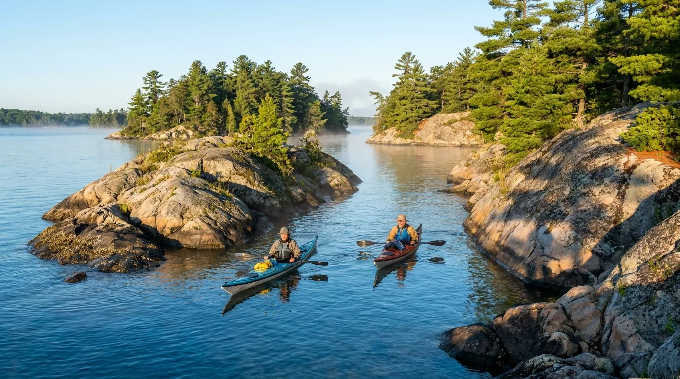
Two sea kayakers paddling through a narrow channel between granite pine islands on the calm blue St. Lawrence River, Thousand Islands Ontario, ultrarealistic photograph representative of the region
Sea kayaking the island channels. The classic way to reach the national-park campsites and the hidden narrows — guided or self-guided through the Admiralty and Lake Fleet groups. Beautiful, and serious: this is open water with shipping lanes, wind and current, so a first island paddle is a good place to hire a guide (§06, §08).

The hands-on way in · open-water skillSea kayaking the islands

Guided and self-guided paddling through the Admiralty and Lake Fleet groups — the classic way to reach island campsites and hidden channels. Outfitters in Gananoque run day tours, rentals and multi-day island camping trips, so you can build up from a half day to an overnight on the granite.

This is open water, not a lake. The main channel is an active shipping lane, and wind and current are real (§06). Wear a PFD, carry the required gear, watch the marine forecast, and consider a guide for a first island crossing.

Guided, rental or overnightOpen shipping water
Half day to multi-day
Guide recommended first time

The Caribbean of the North · specializedScuba diving the St. Lawrence wrecks

The river holds 200+ preserved shipwrecks in exceptional freshwater visibility — noted sites include the Rothesay, Lillie Parsons, Robert Gaskin, A.E. Vickery and Conestoga. Charters run out of Brockville and Rockport; the season runs roughly spring into fall.

Current and boat traffic are serious factors on many wrecks — dive with a local charter that knows the sites and the conditions, and carry appropriate certification and gear.

200+ wrecksCurrent & trafficCharters from Brockville
Charter dives, Brockville/Rockport
Certified divers
A grand gilded-age stone castle with Rhineland-style turrets and towers on a small green island viewed from the water, boats on the blue channel, Boldt Castle Heart Island Thousand Islands, ultrarealistic photograph representative of the region
Boldt Castle on Heart Island — magnificent, and American. The region's iconic gilded-age castle sits on the U.S. side near Alexandria Bay, New York. You can view it from a Canadian cruise without a passport, but stepping onto the island means clearing U.S. Customs — a valid passport or NEXUS is required (§05).
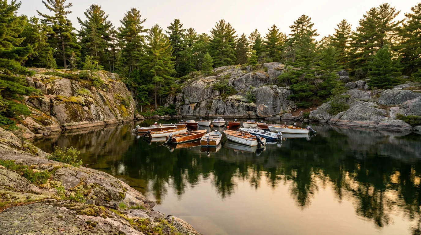
A sheltered natural rock amphitheatre cove ringed by granite and pines with small boats gathered on calm water, Half Moon Bay Bostwick Island Thousand Islands Ontario, ultrarealistic photograph representative of the region
Half Moon Bay — a rock amphitheatre reached only by water. On Bostwick Island in the Admiralty Group, this natural granite cove has hosted boat-in Sunday worship services since 1887. Like so much of the best of the islands, there's no road to it — you arrive by boat, paddle or the reported shuttle from Gananoque.

On foot & on shore — the walks and the odd wonders

Ten minutes to the best view · easyLandon Bay Lookout

Part of Thousand Islands National Park (Landon's Bay, near Gananoque). An easy ~half-kilometre woodland walk to a lookout long regarded as the best natural viewpoint in the 1000 Islands, with ~5 trails at the site. The high-reward, low-effort walk of the region.

Still Shield woodland — stay on trails and do a tick check afterward (§06). Watch footing on granite.

~0.5 km to the lookout~5 trails on site
Short woodland walk
Under an hour

A 140-year tradition on the rock · boat-inHalf Moon Bay

A natural rock amphitheatre on Bostwick Island (Admiralty Group) that has hosted boat-in, non-denominational Sunday worship services since 1887 (summer Sundays, reportedly ~4:00 p.m.). Reachable only by water, with a reported free shuttle from Water St. in Gananoque — one of the most unusual experiences in the islands.

Boat-access only — you need a vessel, a paddle or the shuttle. Confirm current service times and shuttle details before you go.

Since 1887Boat-access onlyConfirm times
Bostwick Island, by water
Summer Sundays

The Shield underfoot · moderateFrontenac & Charleston Lake trails

Frontenac Provincial Park has 100+ km of looped backpacking and day trails through Shield granite and lakes — premier backcountry hiking in eastern Ontario. Charleston Lake adds Frontenac Arch trails (the well-known Tallow Rock Bay and shorter interpretive loops) plus clear swimming and paddling.

Cell coverage is weak in Frontenac's interior and specific loop names vary — carry a map. Tick country — long clothing and checks (§06).

100+ km trail (Frontenac)Tallow Rock Bay (Charleston)Carry a map
Day hikes to backpacking
Frontenac Arch interior
More worth knowing 1000 Islands Tower / Skydeck — a 130 m observation tower on Hill Island (Canadian side, near the Ivy Lea bridge) with three decks over the islands. Mallorytown Landing — the national-park mainland hub: beach, boat ramp, exhibits, interpreters, playground and the gateway to island paddling. Fort Henry NHS & Kingston waterfront — a restored 1830s British fortress with Guard demonstrations and summer Sunset Ceremonies, plus the Limestone City's Martello towers and marina (§08). Cycling the Parkway Trail — a fully separated, paved ~37 km waterfront path from Gananoque to Butternut Bay, part of the Great Lakes Waterfront Trail, with a ~13 km on-road link into Brockville.
05 / THE BORDER & THE CASTLES — READ BEFORE YOU BOOK

The famous castles are in the United States

This is the one thing a Thousand Islands guide has to say loudly, because it catches people every summer: the two castles everyone comes to see — Boldt Castle and Singer Castle — are not in Canada. They sit on islands in United States territory, and any cruise that actually lands at one clears U.S. Customs & Border Protection. That means a valid passport or NEXUS card, even though you sail round-trip from the Canadian shore and come home the same afternoon. Here's the honest version, so nobody gets turned back at the dock.

Boldt Castle — Heart Island

The region's iconic gilded-age castle, near Alexandria Bay, New York. Reached on a 5-hour Gananoque stopover cruise or longer Rockport tours — or by land via the international bridge and the U.S. side.

Landing there is a U.S. Customs crossing. Every passenger needs a valid passport or NEXUS card.

U.S. territoryPassport / NEXUS

Singer Castle — Dark Island

The only 1000 Islands castle fully completed, furnished and lived in — visited on longer Rockport "Two Castle" cruises. Also on the U.S. side.

Same rule: a cruise that lands here clears U.S. Customs — passport or NEXUS for everyone aboard.

U.S. territoryPassport / NEXUS
🔴 The passport rule, plainly View-only cruises that do not land at a castle do not require a passport — you can photograph Boldt Castle from a Canadian boat with no document beyond what you'd carry anyway. Any cruise that lands at Boldt or Singer Castle (the 5-hour Gananoque stopover, the longer Rockport tours) clears U.S. Customs & Border Protection, and every passenger — adults and children — needs a valid passport or NEXUS card. Non-Canadian and non-U.S. travellers may also need a U.S. visa or ESTA. Confirm the exact document requirements with the cruise operator before you book a landing tour, and make sure everyone in your group actually has their documents in hand on the day.
The Canadian-side alternatives, if you don't want the border Plenty of the best of the islands is entirely on the Canadian side and needs no passport at all: a view-only cruise past Boldt Castle and Millionaire's Row, the 1000 Islands Skydeck on Hill Island, the Landon Bay lookout, Half Moon Bay, the whole island-camping and kayaking world, the Rideau Canal locks, and Fort Henry and the Kingston waterfront. You can build a full, rich trip and never cross the line — the castles are a bonus, not the whole show.
06 / SAFETY — READ THIS FIRST

The shipping channel, the current, the ticks, and the snake

The Thousand Islands aren't a hostile landscape, but the hazards here are specific and easy to underestimate because the setting looks so gentle. The first is the water: the main channel is a working international seaway with freighters, wind and current. The second is smaller and more insidious — ticks and Lyme disease, which are established here. The third is a conservation matter people misread as a danger: the harmless, protected gray ratsnake. Plan for all three and this is one of the safest great trips in Ontario.

The river — take the water seriously

The main channel is an active international shipping route. Ocean-going freighters use the seaway and cannot stop or maneuver quickly — and their wakes are large.

Cross channels quickly and at right angles, stay well clear of the shipping lanes, and never assume a freighter can see or avoid you. Open crossings between islands can build wind and waves in minutes, and currents around narrows and channels run strong.

Carry required safety gear, wear a PFD, file a float plan, and check the marine forecast. Marine distress is VHF Channel 16.

Active shipping laneWind, wake & current

Ticks & Lyme disease — real here

  • Established blacklegged (deer) tick area with real Lyme-disease risk across the Frontenac Arch and 1000 Islands
  • Ticks are active spring through fall, not just midsummer
  • Wear long, light-coloured clothing, use an appropriate repellent, and stay on trails
  • Do full-body tick checks after hiking or camping, and know the early Lyme signs

General public-health guidance — check current local advice before you go.

🔴 The insects, the weather, and the water levels Black flies and mosquitoes peak roughly mid-May to late June, worst in Frontenac PP's interior and wooded wetlands — plan repellent and timing. On the river, wind-driven chop can develop fast and afternoon thunderstorms build in summer; get off open water when a storm threatens. Water levels on the St. Lawrence are regulated but higher in spring with runoff, and currents at the narrows are always real.

Charleston Lake and Frontenac's interior lakes are calmer than the river, but still open water in wind. Match your route and your craft to the day's forecast, not your schedule.

A Canadian Shield granite shoreline blazing with red and gold autumn maple foliage above the blue St. Lawrence River channels, Thousand Islands and Frontenac Arch Ontario in fall, ultrarealistic photograph representative of the region
Autumn on the Frontenac Arch shoreline. Fall is the connoisseur's season — colour across the mixed forests, cooler bug-free hiking and quieter island sites. It's also the biosphere at its most obvious: five forest regions meeting on ancient granite, the reason this is one of the most biodiverse corners of Canada.

The gray ratsnake & species at risk

Ontario's largest snake (up to ~2 m), the gray ratsnake (eastern/"black ratsnake") lives on this granite. The Frontenac Axis population is threatened and legally protected — and it is non-venomous and completely harmless to people. This is an awareness note, not a danger one: don't handle or harass it, and watch for it on warm roads, where road mortality is a major threat. The park also protects at-risk turtles and other reptiles — obey posted closures, don't collect wildlife, and slow down in habitat areas.

Harmless & protectedSlow down on warm roads

Island camping & backcountry rules

Pack out all garbage — island sites have limited or no service. Use food lockers or hang food, use existing tent pads and fire pits only, and follow fire bans. Potable water is not available on most islands — bring or treat water.

Carry proof of reservation: Frontenac PP interior needs an Ontario Parks backcountry permit, national-park island sites need Parks Canada reservations (or self-registration for first-come sites), and Rideau lock camping/mooring needs a Parks Canada permit (§07).

Treat or carry waterPermits required
The one-paragraph safety brief Treat the main channel as open, freighter-travelled water — PFD, marine forecast, float plan, cross fast and square. Treat the forest as tick country — cover up, repel, check. Treat the wildlife as protected and wild — give it room, feed nothing, handle nothing. And treat the backcountry as a dead zone — carry a map, bring or treat your water, and tell someone your plan. None of it is exotic; all of it just has to be planned for.
07 / THE CAMPING STRATEGY

Island sites, Shield backcountry, shore campgrounds & the locks

Camping here sorts into four kinds, run by four different operators: the boat-access island sites and mainland oTENTiks of Thousand Islands National Park (Parks Canada), the paddle-in and drive-in provincial parks of the Shield interior (Ontario Parks), the shore campgrounds at Ivy Lea and the private KOAs, and the heritage lockstation camping on the Rideau Canal (Parks Canada). Fees below are approximate and flagged where we couldn't confirm them against an official rate page — treat every number as "confirm before you book," and reserve island and summer sites early.

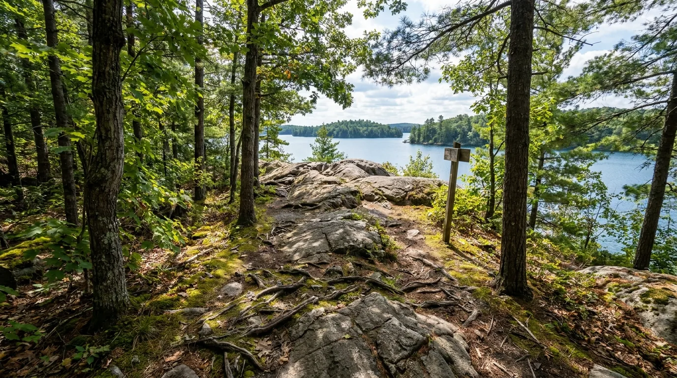
A forest hiking trail over granite bedrock and roots leading to a clear lake overlook in mixed Frontenac Arch woodland, Charleston Lake Provincial Park Ontario, ultrarealistic photograph representative of the region
Charleston Lake Provincial Park — the drive-in base in the biosphere. Car camping across four campgrounds (plus walk-in, waterfront and paddle-in interior sites), with electrical hookups, comfort stations and a clear lake for swimming and paddling. The easiest way to sleep inside the Frontenac Arch without a boat crossing.
CampgroundArea · operatorType / sitesAccessBookingReported fee*
Mallorytown Landing oTENTiks Thousand Islands NP · Parks Canada 5 oTENTiks (sleep up to 6) Car-accessible mainland Parks Canada (1-877-737-3783) ~$147.50 (2026); ~$110 w/ Canada Strong Pass Jun 19–Sep 7
Island oTENTiks McDonald & Gordon Is. · Parks Canada 5 total (3 McDonald, 2 Gordon) Boat-access only Parks Canada ~$147.50 (2026)
Island tent sites Thousand Islands NP · Parks Canada ~28 reservable + ~32 first-come Boat-access only Parks Canada + first-come backcountry fee (unconfirmed)
Frontenac PP interior Frontenac PP · Ontario Parks 54 interior sites, ~19 areas Hike-in / paddle-in Ontario Parks (up to 5 mo ahead) backcountry permit (unconfirmed)
Charleston Lake Charleston Lake PP · Ontario Parks ~230–248 sites, ~122 electric; yurts Drive-in (+ walk-in, boat-access) Ontario Parks car-camping rates (unconfirmed)
Ivy Lea Campground Lansdowne · St. Lawrence Parks Comm. ~146 sites + 4 camper cabins Drive-in / RV / waterfront stlawrenceparks.com unconfirmed
Kingston & Ivy Lea KOA Kingston / Lansdowne · KOA RV / cabin / tent Drive-in koa.com unconfirmed
Rideau — Jones Falls Rideau Canal · Parks Canada Lockstation tent sites + mooring Land & water Parks Canada permit / mooring permit fee (unconfirmed)
Rideau — Chaffey's Lock Rideau Canal · Parks Canada Lockstation tent sites + mooring Land & water Parks Canada permit / mooring permit fee (unconfirmed)

*Fees, site counts and seasons are compiled from Parks Canada, Ontario Parks and St. Lawrence Parks Commission listings and vary by source and by season. The ~$147.50 oTENTik and the ~25% Canada Strong Pass discount (Jun 19–Sep 7, 2026) were the most consistent figures; most other fees are shown "unconfirmed" and HST/reservation fees are typically extra. Book by site on the operator's system and read the actual price and access. Island sites are boat-access only; Frontenac's interior is paddle/hike-in. Numerous additional Rideau lockstations (Davis, Upper/Lower Brewers, Kingston Mills) offer first-come tent camping and mooring by permit — per-lock amenities unconfirmed.

Which base for which trip

  • Your own island night: the island oTENTiks (McDonald/Gordon) or island tent sites — boat-access, reserve far ahead, treat your water
  • Island experience, no crossing skills: the Mallorytown Landing oTENTiks — the national-park base, car-accessible, gateway to paddling
  • Drive-in family camping in the biosphere: Charleston Lake (electric sites, comfort stations, yurts) or Ivy Lea (waterfront, on the river)
  • Shield backcountry: Frontenac PP interior — paddle-in or hike-in, four-season, permit required
  • Heritage + boating: Rideau lockstation camping at Jones Falls or Chaffey's Lock — land or water access, mooring max 2 nights

Reservations & the rules that catch people out

2026 island/oTENTik booking opened 2 February 2026 and summer fills; Ontario Parks takes bookings up to 5 months ahead. Carry printed or electronic confirmation and proceed straight to your site.

Island sites are boat-access only with no park water taxi — sort your vessel first (§02). Most islands have no potable water and limited or no garbage service: pack out everything, use food storage, and follow fire bans.

The Ivy Lea check-in reportedly includes passes to Upper Canada Village or Fort Henry in main season — confirm when you book.

Boat-access, no water taxiReserve early
Leads we could not fully confirm Our research flagged, but did not confirm, some additional options: Gananoque- and Brockville-area private RV parks and Rideau-corridor conservation-authority campgrounds (Cataraqui Region CA). We list them only as leads — treat them as unverified until you check the operator directly (§13). We don't print a campground, fee or site count we couldn't stand behind.
08 / TOWNS & SERVICES

Gananoque runs the river; Kingston anchors the west

The Canadian shore is lined with towns that each do a job. Gananoque is the cruise-and-kayak capital — "Gan" — with the boat lines, an outfitter, a brewery and a riverside theatre. Kingston, the Limestone City, is the big western anchor with full services, Fort Henry and a walkable waterfront. Brockville anchors the east and the dive scene, and Lansdowne / Ivy Lea and Mallorytown are the small hamlets near the bridge and the national park. Plan your resupply around that spread — and note the operators below are real, but seasons and pricing change, so we link rather than quote.

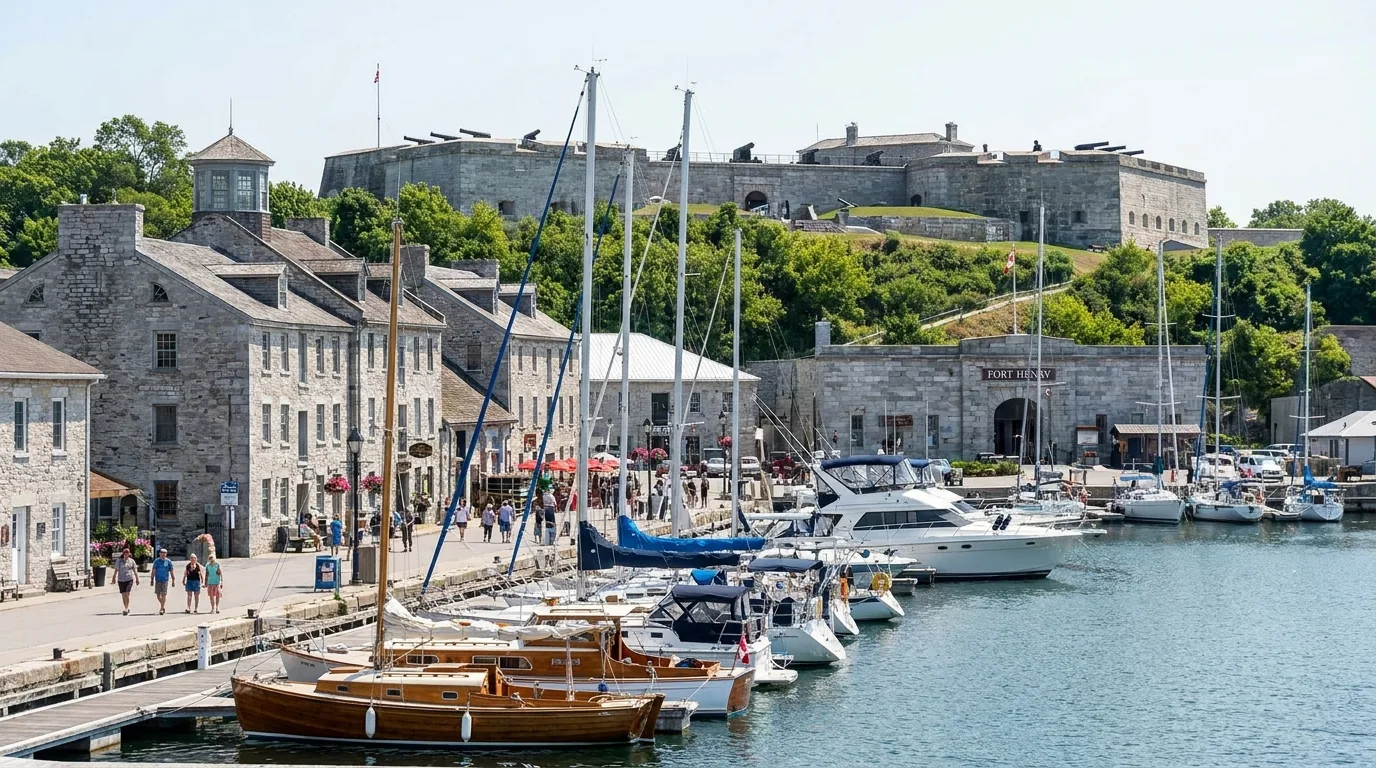
A grey-limestone historic waterfront town with a restored British stone fortress on a hill above the harbour and boats in a marina, Kingston Ontario waterfront and Fort Henry, ultrarealistic photograph representative of the region
Kingston — the Limestone City and Fort Henry. Canada's first capital and the western anchor of the region: grey-stone heritage streets, the Confederation Basin marina, the Martello towers, and the restored 1830s Fort Henry above the mouth of the Rideau Canal — part of the same UNESCO World Heritage inscription as the canal.

The river towns — Gananoque, Rockport, Ivy Lea

  • Gananoque ("Gan"): the primary cruise town — boat lines, the kayak outfitter, a brewery, a marina and the riverside Thousand Islands Playhouse. Walkable downtown
  • Rockport: the hamlet for Rockport Cruises (Boldt + Singer "Two Castle" tours) and river access east of Gananoque
  • Lansdowne / Ivy Lea: near the international bridge — the Skydeck on Hill Island, Ivy Lea Campground and the KOA
  • Mallorytown: nearest village to the national-park mainland (Mallorytown Landing); limited services, so top up in the bigger towns

Cruise, outfitter and theatre seasons run roughly May–October — confirm before you drive over.

The anchors — Kingston & Brockville

  • Kingston: the largest city and western anchor — full services, VIA Rail, Fort Henry, the Martello towers, Confederation Basin marina, RMC/Fort Frederick, and Portsmouth Olympic Harbour launch
  • Brockville: the eastern anchor, "City of the 1000 Islands" — the scuba-diving hub, a waterfront, VIA Rail and full services
  • Both have full fuel, groceries, hospitals and gear — use them to resupply before the islands or the Frontenac Arch interior
  • Frontenac PP is accessed near Sydenham, north of Kingston — the small gateway for the Shield backcountry

Confirm current hours and services before relying on them, especially outside summer.

Operators & services worth knowing — links, not prices All of the following came from official or tourism listings. Seasons, pricing and menus change annually, so we link rather than quote, and some URLs below we could not individually confirm (flagged). Contact any business directly and get consent before outreach (CASL).

On the water

  • City Cruises Gananoque (historically Gananoque Boat Line) — 1000 Islands sightseeing & Boldt Castle stopover cruises (cityexperiences.com/gananoque)
  • Rockport Cruises (Rockport) — castle & islands tours, Boldt + Singer "Two Castle" (rockportcruises.com)
  • 1000 Islands Kayaking Co. (Gananoque, 110 Kate St.) — guided sea-kayak tours, rentals, multi-day island camping trips (1000islandskayaking.com)
  • Dive Brockville Adventure Centre (Brockville) — shipwreck dive charters, roughly April–December (divebrockville.com)
  • 1000 Islands Tower / Skydeck (Hill Island, Lansdowne) — 130 m observation tower (URL unconfirmed)

On shore

  • Thousand Islands Playhouse (Gananoque) — live theatre in a historic riverside canoe club, with boat docking (1000islandsplayhouse.com)
  • Gananoque Inn & Spa (Gananoque) — waterfront historic inn and dining (gananoqueinn.com)
  • Gananoque Brewing Company (Gananoque) — local craft brewery, walkable downtown (URL unconfirmed)
  • 1000 Islands History Museum (Gananoque) — regional, Indigenous & natural-history museum (URL unconfirmed)
  • Fort Henry NHS (Kingston) — restored British fortress, Guard demos, dining (Parks of the St. Lawrence / URL unconfirmed)
  • St. Lawrence Parks Commission — Ivy Lea (Lansdowne) — provincial waterfront campground operator (stlawrenceparks.com)

We confirmed no operator pricing — any number you see elsewhere should come from the business. Phone numbers, hours and seasons change; check the current website before you drive over.

Getting there The region sits on Highway 401 in eastern Ontario. Kingston is ~2.5–3 hours from Toronto and ~2 hours from Ottawa; Gananoque and Brockville are a little further east along the 401. VIA Rail serves Kingston and Brockville, and Megabus runs the corridor. Confirm current drive times and any highway closures with live mapping before you travel.
09 / TIMING

When to go — summer for the water, fall for the connoisseur

The Thousand Islands run on a season. The cruises, outfitters and most campgrounds open roughly May and close around Thanksgiving, so the real choice is summer versus the shoulders. Summer is warmest and fullest — and busiest, so reserve early. Early fall is the quiet gem: colour on the Arch, no bugs, empty island sites. Spring is green and cheap but cold and buggy. Here's the honest breakdown, and the one-line answer if you just want a date.

Season by season, straight

  • Spring (May–early June) — quiet & green. Wildflowers, few crowds, cheaper. But water is cold, some services aren't open, spring runoff raises river levels, and black flies and mosquitoes peak mid-May to late June
  • Summer (late June–Aug) — peak. Warmest water, all cruises and outfitters running, best swimming. Also the busiest island sites (reserve well ahead) and the busiest boat traffic on the river
  • Fall (Sept–mid-Oct) — the connoisseur's window. Fall colour across the Frontenac Arch, cooler bug-free hiking, quieter island sites, diving continues. Cruise and campground seasons taper off around Thanksgiving
  • Winter (Nov–Apr) — largely shut. Cruises and most campgrounds close; Frontenac PP stays open for four-season backcountry. Ice on the river is hazardous and variable — not for casual travel

Crowd & booking strategy

  • Reserve island & oTENTik sites early. 2026 island/oTENTik booking opened 2 February; Ontario Parks takes bookings up to 5 months ahead
  • Go midweek and shoulder-season for quieter islands, easier launches and better cruise availability
  • Time hikes and interior trips to avoid the mid-May–late-June bug peak, or come prepared for it
  • Watch the marine forecast, not just the sky — wind decides whether an open crossing is on that day (§06)
  • For the castles, book a landing cruise (with passports) or a view-only one — either way, reserve summer sailings ahead
The one-paragraph answer Go in late June through August if you want warm water, the full run of cruises and outfitters, and island swimming — and reserve early, because the island sites fill. Go in September into mid-October if you'd rather have fall colour on the Arch, no bugs, quiet island sites and cooler hiking — the connoisseur's choice. Avoid mid-May to late June if black flies ruin your trip. Whichever you pick: reserve island sites ahead, sort your boat, check the marine forecast before any crossing, do your tick checks, and if you want the castles, bring the passports.
10 / THE SHAPE OF THE TRIP

Five ways to shape a Thousand Islands trip

Not one itinerary but a menu, because this region rewards very different trips. Base on the shore for cruises and cycling, paddle out to your own island, go deep into the Shield at Frontenac, follow the Rideau locks and Kingston's heritage, or dive the wrecks. Mix and match — but keep every open-water crossing tied to the forecast, reserve island sites early, and if a castle is on the list, carry the passports.

01

A — Cruise + parkway cycle weekend

  1. Base in Gananoque or at Ivy Lea Campground.
  2. Morning 3-hour sightseeing cruise past Millionaire's Row and Boldt Castle (view-only, no passport).
  3. Afternoon: pedal a stretch of the separated Thousand Islands Parkway Trail toward Ivy Lea/Rockport.
  4. Evening: Gananoque Brewing Co. and a show at the Thousand Islands Playhouse. Day 2: Mallorytown Landing + the Landon Bay lookout, optional Skydeck.
No passport neededEasy, 2 days
02

B — Island paddle & oTENTik overnight

  1. Rent or launch from 1000 Islands Kayaking in Gananoque (or self-launch at Mallorytown Landing).
  2. Paddle the Admiralty / Lake Fleet groups to a national-park island oTENTik or tent site (McDonald or Gordon Island).
  3. Overnight on the granite; return next day. Reserve island sites far ahead (opened 2 Feb 2026).
  4. Watch shipping channels, wind and weather; treat or carry your water. Guide recommended first time.
Open-water crossingReserve early
03

C — Frontenac paddle-in backcountry

  1. Enter Frontenac Provincial Park near Sydenham, north of Kingston.
  2. Canoe-and-portage through the interior lakes to a backcountry site (tent pad, privy, food locker).
  3. Layover day for the 100+ km trail network; true Shield wilderness.
  4. Backcountry permit required; four-season for experienced campers. Carry a map — interior is a dead zone.
Permit requiredModerate–advanced, 3 days
04

D — Rideau & Kingston heritage loop

  1. Base in Kingston: Fort Henry + the waterfront and Martello towers.
  2. Drive the Rideau corridor to Kingston Mills, Jones Falls and Chaffey's Lock to watch hand-operated locking and photograph the Great Stone Arch Dam.
  3. Camp or moor at a lockstation (permit / mooring max 2 nights).
  4. Optional Charleston Lake PP for a swim or paddle on the way back.
Easy, 2–3 daysUNESCO canal
05

E — Diver's long weekend

  1. Base in Brockville.
  2. Two days of charter dives on St. Lawrence wrecks (Lillie Parsons, Robert Gaskin and others) with Dive Brockville.
  3. Non-diving companions cycle the Parkway Trail or take a Rockport cruise.
  4. Evenings on the Brockville waterfront. Mind current and boat traffic on the wrecks (§06).
Certified diversSpecialized, 2–3 days
+

The castle add-on (bring passports)

  1. Add a Boldt Castle stopover (5-hour Gananoque cruise) or a Rockport "Two Castle" tour.
  2. Both land in the U.S. and clear customs — everyone needs a passport or NEXUS (§05).
  3. Non-Canadian/U.S. travellers may need a visa or ESTA.
  4. Confirm the document rules with the operator when you book.
Passport / NEXUSConfirm with operator
11 / TRIP-READY

The departure check

Run it before you leave. Tap each item as it's done — these are the ten things specific to the Thousand Islands and the Frontenac Arch that a general road-trip habit will skip. Most come back to three facts: the castles are across a border, the islands need a boat, and the river is a working seaway.

0 / 10 confirmed — the border and the boat come first.
12 / QUICK ANSWERS

Asked on every Thousand Islands dock

Do I need a passport to see the castles?
For a view-only cruise, no — you can photograph Boldt Castle and Millionaire's Row from a Canadian boat with no passport. But any cruise that LANDS at Boldt Castle (Heart Island) or Singer Castle (Dark Island) clears U.S. Customs — both are in New York State — and every passenger needs a valid passport or NEXUS card, even sailing round-trip from Canada. Non-Canadian/U.S. travellers may also need a visa or ESTA. Confirm with the cruise operator when you book.
How do I camp on an actual island?
The island sites in Thousand Islands National Park are boat-access only — Parks Canada runs no water taxi. Reach the McDonald and Gordon Island oTENTiks and the island tent sites by your own boat, a rented or guided kayak/canoe, or a private shuttle, launching from Mallorytown Landing, Gananoque or Brockville. Sites are rustic (docks or mooring, vault toilets, food storage, little or no potable water) and book through Parks Canada; 2026 island booking opened 2 February and summer fills. For a car-accessible base, use the Mallorytown Landing oTENTiks, Charleston Lake or Ivy Lea.
Is the St. Lawrence safe to kayak?
With respect and planning, yes — but it's serious open water, not a pond. The main channel is an active international shipping route: freighters can't stop or turn quickly and throw big wakes. Cross channels quickly and at right angles, stay clear of the lanes, wear a PFD, carry the required gear, file a float plan, and watch the marine forecast — wind can build waves in minutes and currents run strong at the narrows. For a first island trip, go with a guided outfitter.
When should I go?
Late June–August for the warmest water and the full run of cruises and outfitters (reserve island sites early — they fill). September to mid-October is the connoisseur's window: fall colour on the Frontenac Arch, no bugs, quiet island sites, diving still on. Spring is green and cheap but cold, with services not all open and black flies peaking mid-May to late June. Winter shuts most camping and cruises; Frontenac PP stays open for four-season backcountry.
What's the Frontenac Arch, and why is it a big deal?
It's an ancient ridge of billion-year-old granite — an exposed band of the Canadian Shield — that crosses the St. Lawrence and links the Algonquin highlands to the Adirondacks. Five forest regions meet here and the islands act as stepping stones for wildlife, making it one of the most biodiverse regions in Canada and the last intact forest corridor in eastern North America. UNESCO named it the Frontenac Arch Biosphere Reserve in 2002. Rare species live here, including the threatened, protected gray ratsnake.
Are ticks and Lyme disease a real risk here?
Yes. Eastern Ontario, including the Frontenac Arch and Thousand Islands, is an established blacklegged (deer) tick area with real Lyme-disease risk, ticks active spring through fall. Wear long, light-coloured clothing, use an appropriate repellent, stay on trails, and do full-body tick checks after hiking or camping. Check current local public-health advice before you go.
Is that big snake dangerous?
No. The gray ratsnake (eastern/"black ratsnake") is Ontario's largest snake — up to ~2 m — but it is non-venomous and completely harmless to people. The Frontenac Axis population is threatened and legally protected. It's an awareness note, not a danger one: don't handle or harass it, and slow down on warm roads where road mortality is a major threat.
How do I get there, and can I do it without a car?
Highway 401 is the spine (Kingston–Gananoque–Mallorytown–Brockville); the scenic Thousand Islands Parkway hugs the river for ~37 km with the cycling trail. VIA Rail serves Kingston and Brockville and Megabus runs the corridor, and the towns are walkable — but for the islands and the Frontenac Arch interior you'll still want a boat or a vehicle to reach the launches and trailheads. The 1000 Islands International Bridge at Ivy Lea is a full border crossing.
Can I reach Boldt Castle by land from Canada?
Yes — via the Thousand Islands International Bridge (Hwy 137 at Ivy Lea) across to Wellesley Island and the U.S. side near Alexandria Bay. That's a full border crossing (passport/NEXUS), and you're then on the American side. Most visitors instead reach the castle on a cruise stopover from Gananoque or Rockport — which still clears U.S. Customs on landing (§05).
13 / WHAT WE COULD NOT CONFIRM

The honest gaps, all in one place

Every guide has these; most don't print them. Fees, site counts, seasons and operator details in the Thousand Islands change year to year, and some we simply couldn't confirm against an official page. Everything below was compiled 23 July 2026 and should be re-checked against the linked official source before you rely on it. The hedges aren't hand-waving — each one tells you exactly what to verify.

Why this section exists Anyone can write a guide that sounds certain. The hard part is knowing which numbers are real — and in a region where a cruise stop crosses an international border, the island you booked is a paddle across a shipping lane, the fees change every season, and the forest carries Lyme, plenty of it needs a same-week check. The hedge is the product. "Confirm the passport rule with the operator," "sort your boat before your date," and "check the marine forecast before you cross" are usable instructions. A confident wrong answer here costs a family turned back at the customs dock — or a paddler caught out on open water.
🔒

The printable field guide

Everything above, condensed into a print-ready PDF built for the glovebox and the dry bag — for a region where the famous castles are across a border, the best campsites are a paddle across a shipping lane, and the forest carries ticks. The passport rule spelled out, the boat-access island camping decoded, the Frontenac Arch backcountry and the Rideau locks, the cruises and kayak and dive outfitters, the campgrounds by operator, the seasons and the safety brief, and the honest list of what nobody could confirm — on paper that works where the bars don't.

The passport rule, spelled out Boat-access island camping Frontenac Arch backcountry The Rideau locks Cruises, kayak & dive outfitters Campgrounds by operator The river safety brief The departure check
Unlock the PDF — $4.95
$4.95 per guide · Instant access · Built by people who actually camp there
Trail Journal No. 060

Go farther. Camp lighter.
Leave it better.

Every Trekkr Trail Journal is built like this one: custom logistics, honest trail and water beta, the camping and access detail, and the local knowledge that turns a good trip into the one your crew talks about for years — including, always, a plain list of what we could not confirm. New destinations drop all season long, from the Colorado Rockies to the Utah canyons to the Great Lakes & Shield.

Unlock the Trail Journal Library
↗ Read another issue — No. 051, Grand Canyon National Park
$4.95 per guide · Instant access · Built by people who actually camp there