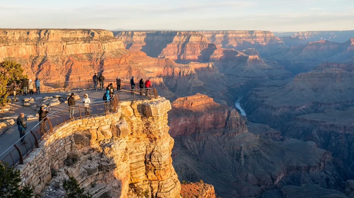
Vast layered red and ochre canyon walls receding in rows of buttes below the South Rim at first light with the Colorado River faint in the depths, Grand Canyon Arizona, ultrarealistic photograph representative of the region
Trekkr Trail Journal · No. 051 · Grand Canyon National Park

Grand CanyonArizona — the South Rim shuttle, the seasonal North Rim, the corridor trails & the inner-canyon heat

Everyone knows the view; almost nobody plans for what's under it. The Grand Canyon is really two parks — a busy year-round South Rim you cross by free shuttle, and a high, forested North Rim open only mid-May to mid-October and, for 2026, running without its historic lodge after a wildfire. Between them is a mile-deep inner canyon that is genuinely lethal in summer, where rangers plead with people not to hike to the river and back in a day. There's no reservation to enter — just shuttle logistics, a seasonal gate, permit quotas, and a heat clock that starts before dawn.

Arizona · USA South Rim · North Rim · Inner Canyon Free shuttles · car-free Hermit Road North Rim seasonal · ~15 May–mid-Oct
~1 mileVertical depth from rim to the Colorado River
105–115°FTypical summer temps at the canyon bottom — the trail is hotter
15 MayWhen the North Rim opened for the 2026 season
10a–4pStay off inner-canyon trails in peak summer heat
Conditions verified 23 July 2026 · The season and the heat decide the day before the trail does · This block goes stale — the links don't

Two things open this canyon: which rim is running, and the heat clock

The rest of this journal is evergreen; this box is not. At the Grand Canyon two things decide whether your plan works before you lace a boot — which rim and season you can actually use (§03), and the inner-canyon heat plus the backcountry-permit gate (§05). There is no timed-entry reservation to enter the park, but that does not mean you can wing it. Everything below is dated to the day we checked it. Trust the live sources, not our date stamp.

  • No entry reservation — but the South Rim runs on shuttles, and Hermit Road is car-freeYou do not need a timed-entry or day-use reservation to drive into the park. But in Grand Canyon Village you park once and ride free shuttles, and Hermit Road is closed to private vehicles roughly March through November (shuttle only). The South Kaibab Trailhead has no private parking either. [VERIFY shuttle windows at nps.gov/grca] (§02, §03)
  • North Rim is SEASONAL — and in 2026 it lost its lodgeThe North Rim opened for 2026 at 6 a.m. on 15 May and is snow-closed all winter. Critically: the historic Grand Canyon Lodge was destroyed by the 2025 Dragon Bravo Fire, so there was no in-park North Rim lodging for the 2026 season — food, fuel and water came from the North Rim Country Store and Jacob Lake, and the campground reopened during the season. [VERIFY North Rim status before the long drive] (§03)
  • The inner canyon is genuinely lethal in summerCanyon-bottom temperatures regularly hit 105–115°F, and the trail surface runs far hotter. Multiple hikers died of heat-related causes in June 2026 on the South Kaibab and North Kaibab trails. The Park Service urges people to stay off inner-canyon trails from about 10 a.m. to 4 p.m. in peak heat and never hike to the river and back in a day. (§05, §06)
  • Camping below the rim needs a permit — and water on the trails can failAny overnight below the rim (Bright Angel, Cottonwood, Havasupai Gardens) needs an advance Recreation.gov backcountry permit (four-month early-access lottery, then a rolling window). Phantom Ranch is a separate Xanterra lottery. Piped trail water is seasonal and prone to breaks — never assume it. [VERIFY current water status at the Backcountry Information Center] (§04, §05)
  • Monsoon storms build July–September — lightning on the rim, floods in the drainagesThe summer monsoon brings sudden afternoon thunderstorms: lightning on the exposed rims and flash floods in side canyons and washes. Fire restrictions on the surrounding Kaibab National Forest can also ban campfires and dispersed camping in a dry spell. [VERIFY the week you go] (§06, §07)
  • Havasu Falls is NOT in this park — and not bookable hereThe famous blue-green waterfalls at Supai are on the Havasupai Reservation, a separate tribal jurisdiction with its own permit system (havasupaireservations.com) — not the National Park Service, and not reachable from the rim trails in this guide. Don't show up expecting to walk there from the South Rim. (§05)
Live sources · NPS Grand Canyon — conditions & alerts · NPS — North Rim status · NPS — shuttle routes · NPS — backcountry permits · Recreation.gov · Kaibab National Forest
In an emergency, 911 (or dial the park at 928-638-7805). This box was true at press and will not stay true — the sources above are the truth on the day you travel.
01 / THE HOOK

Two rims, one abyss, and a summer that kills

The Grand Canyon is not one destination but three, stacked on top of each other. There's the South Rim — the busy, year-round, full-service side where 90% of visitors go, reached by free shuttle and lined with historic lodges. There's the North Rim — a thousand feet higher, cooler, forested in ponderosa and aspen, a four-hour drive around, open only in the warm months, and in 2026 running without the lodge that burned in 2025. And there's the inner canyon — a mile straight down, a genuine desert, hotter and drier than anything on the rim, where the trails are magnificent and, in summer, can kill you. Understand that the rim you're standing on and the canyon below it are two different climates, sort the shuttle and the permits, respect the heat, and it's the greatest hole on Earth. Underestimate the drop back up and it's a rescue.

A projecting rock overlook with a low stone-and-steel guardrail above a sheer drop, visitors small in frame looking out over vast striated canyon walls in warm golden-hour light, Mather Point South Rim Grand Canyon, ultrarealistic photograph representative of the region
Mather Point, ~7,000 ft. The first overlook most people ever see, a short walk from the South Rim Visitor Center and the shuttle hub. The railings end fast — the canyon edge is unfenced almost everywhere else, and falls are a real cause of death here (§06).

The payoff

One of the seven natural wonders of the world — 277 river miles of layered rock, world-class rim views at Mather, Hopi and Desert View, the corridor trails, and if you earn it, a night at Phantom Ranch by the Colorado River (§04, §05).

The heat

The rim is high desert; the inner canyon is a furnace. Bottom temps run 105–115°F in summer and the trail surface is hotter still. Every foot you descend, you have to climb back — in the heat of the day (§06).

The clock

Inner-canyon hiking is a dawn sport in warm months — be climbing out before mid-morning. Monsoon storms build most summer afternoons, with lightning on the rim and floods below. Start early or change the plan (§06).

The way to think about the region — one canyon, two rims, several gateways, and no road across the middle Nearly everyone bases on the South Rim around Grand Canyon Village (~7,000 ft): lodges, a visitor center, groceries, a clinic, and the free shuttle network that makes the whole rim car-free-friendly. The gateway town just outside is Tusayan (hotels, restaurants, an airport, a park-and-ride); Williams (~1 hr south, the Route 66 town with the railway) and Flagstaff (~1.5 hr) are the bigger bases. The North Rim (~8,200 ft) is a different world — higher, cooler, quieter, and a 215-mile / ~4-hour drive around by road even though it's ~10 miles across as the raven flies. Its gateways are tiny Jacob Lake and, in 2026, no in-park lodge at all. The two rims are joined for hikers only, by the corridor trails through the inner canyon (§04) — there is no bridge or road across for cars.
02 / GETTING AROUND THE SOUTH RIM

No reservation to enter — but you don't drive the rim, you ride it

Here's the thing first-timers get wrong: they picture driving from viewpoint to viewpoint. On the busy South Rim you mostly can't, and mostly shouldn't. Parking in the village fills by mid-morning in peak season, and the best of the western viewpoints — all of Hermit Road — is closed to private cars for most of the year. The park's answer is a free shuttle network. Learn the four routes and you stop fighting for parking and start actually seeing the canyon. Here's how it worked for 2026; confirm the exact seasonal hours before you rely on a first or last bus.

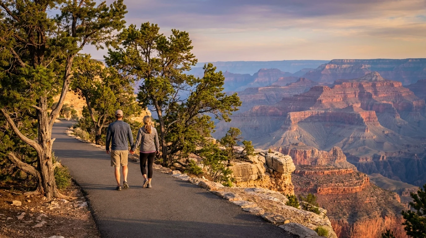
A flat paved rim-edge walking path with scattered juniper and pinyon pines, a couple strolling with the vast canyon opening to their right, soft late-afternoon light and distant blue-hazed buttes, Rim Trail South Rim Grand Canyon, ultrarealistic photograph representative of the region
The Rim Trail — the car-free spine of the South Rim. Mostly flat and much of it paved, it links the viewpoints from South Kaibab out to Hermits Rest, with shuttle stops the whole way so you can walk one direction and ride back. The single best way to see the rim without a parking fight.
Shuttle routeWhere it goesSeason / notesThe catch
Village (Blue)
the workhorse
Visitor Center, lodges, campgrounds, Market Plaza, Backcountry Info Center Year-round Your link between the parking, Mather Campground and the village hotels. Not a viewpoint route
Kaibab / Rim (Orange)
the sunrise route
Visitor Center to Yavapai, the South Kaibab Trailhead (Yaki Point) and rim viewpoints east Year-round The only way to reach the South Kaibab Trailhead — Yaki Point Road is closed to private cars
Hermit Road (Red)
the west viewpoints
Village west to Hopi Point, Pima Point and Hermits Rest — the great sunset overlooks Car-free ~1 Mar–30 Nov When it's running, private vehicles are barred from the whole road — you ride, or you walk the Rim Trail
Tusayan (Purple)
the park-and-ride
Between the town of Tusayan and the Visitor Center Seasonal (summer) Lets you leave the car in Tusayan and skip the entrance-gate queue; seasonal — confirm the dates

Shuttles are free with park entry (no ticket). First and last buses vary by season — typically the first bus is around dawn and the last returns about an hour after sunset. Confirm the current route map and seasonal hours at nps.gov/grca before you plan a sunrise or sunset around them.

🔴 The single most common South Rim mistake People drive up to the village at 10 a.m. in July expecting to park at a lodge and cruise Hermit Road — and find the lots full and the road closed to cars. The clean plan: arrive early, park once at the Visitor Center or your campground, and ride the shuttles. Better still, use the Tusayan park-and-ride in summer, or leave the car entirely and come in on the Grand Canyon Railway from Williams (§08). The rim is designed to be done without a car — fighting that is how a first morning gets wasted.

The entrance fee, and where it doesn't apply

Entry is by the standard national-park fee (per private vehicle, good for seven days, both rims) — or an America the Beautiful annual pass. The exact 2026 amount should be confirmed on the NPS fees page; we don't quote a figure we can't stand behind. There is no separate timed-entry reservation.

Fee-free days apply a handful of times a year; those are the busiest days, not the cheapest experience.

No timed-entry reservationConfirm the 2026 fee at the source

What the shuttle is not

It is a rim-transport system, not a trail permit. It gets you to the trailheads; it does not authorise camping below the rim (that's a backcountry permit, §05) or a bed at Phantom Ranch (that's a Xanterra booking, §05). And it does not run into the inner canyon — once you step off the rim, you are on your own two feet.

Desert View Drive (Highway 64 east, 25 miles to the Watchtower) is the exception — it's a normal drivable road with no shuttle, so the eastern viewpoints need your own vehicle.

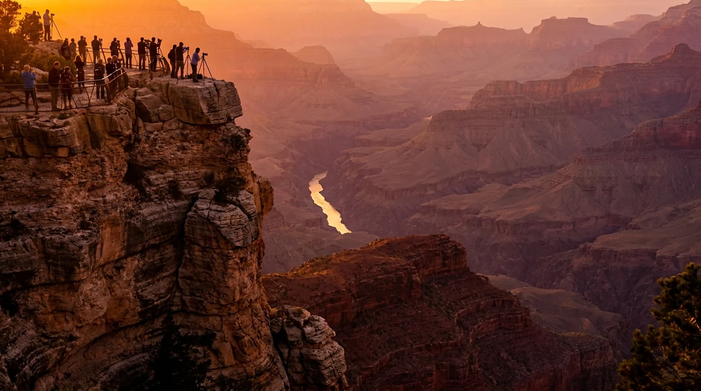
Sunset from a far-projecting rim viewpoint with silhouetted visitors watching the canyon glow orange and violet, the Colorado River catching light far below in the inner gorge, layered cliffs receding into warm haze, Hopi Point on Hermit Road Grand Canyon, ultrarealistic photograph representative of the region
Sunset from Hopi Point, on the car-free Hermit Road. From roughly March to November the whole road is closed to private vehicles — you ride the Red shuttle or walk the Rim Trail to reach these western overlooks. That's the trade: no parking fight, but you're on the bus's clock for the last ride down.
The 60-second South Rim decision
  1. Just here for the views and an easy walk? Park at the Visitor Center, walk to Mather and Yavapai, then ride the Rim Trail shuttles. No stress, no fee beyond entry.
  2. Want the classic sunset? Ride the Hermit Road (Red) shuttle to Hopi or Pima Point. Remember you can't drive it in season.
  3. Want a sunrise trail start? The Kaibab/Rim (Orange) shuttle is the only way to the South Kaibab Trailhead — there's no parking there.
  4. Driving in from Tusayan in summer? Use the Purple park-and-ride and skip the gate queue.
  5. Want the quiet eastern viewpoints? Drive Desert View Drive yourself to Grandview, Lipan and the Watchtower — no shuttle out there.
03 / THE TWO RIMS

South Rim, North Rim, and the reasons to choose

The two rims look at the same canyon and offer almost opposite trips. The South Rim is accessible, open all year, full of services and people. The North Rim is higher, cooler, greener, far quieter — and only reachable in the warm months, down a long highway, with drastically reduced services in 2026. Most people should start with the South Rim. But know what the North Rim is before you either skip it or drive four hours expecting the same thing.

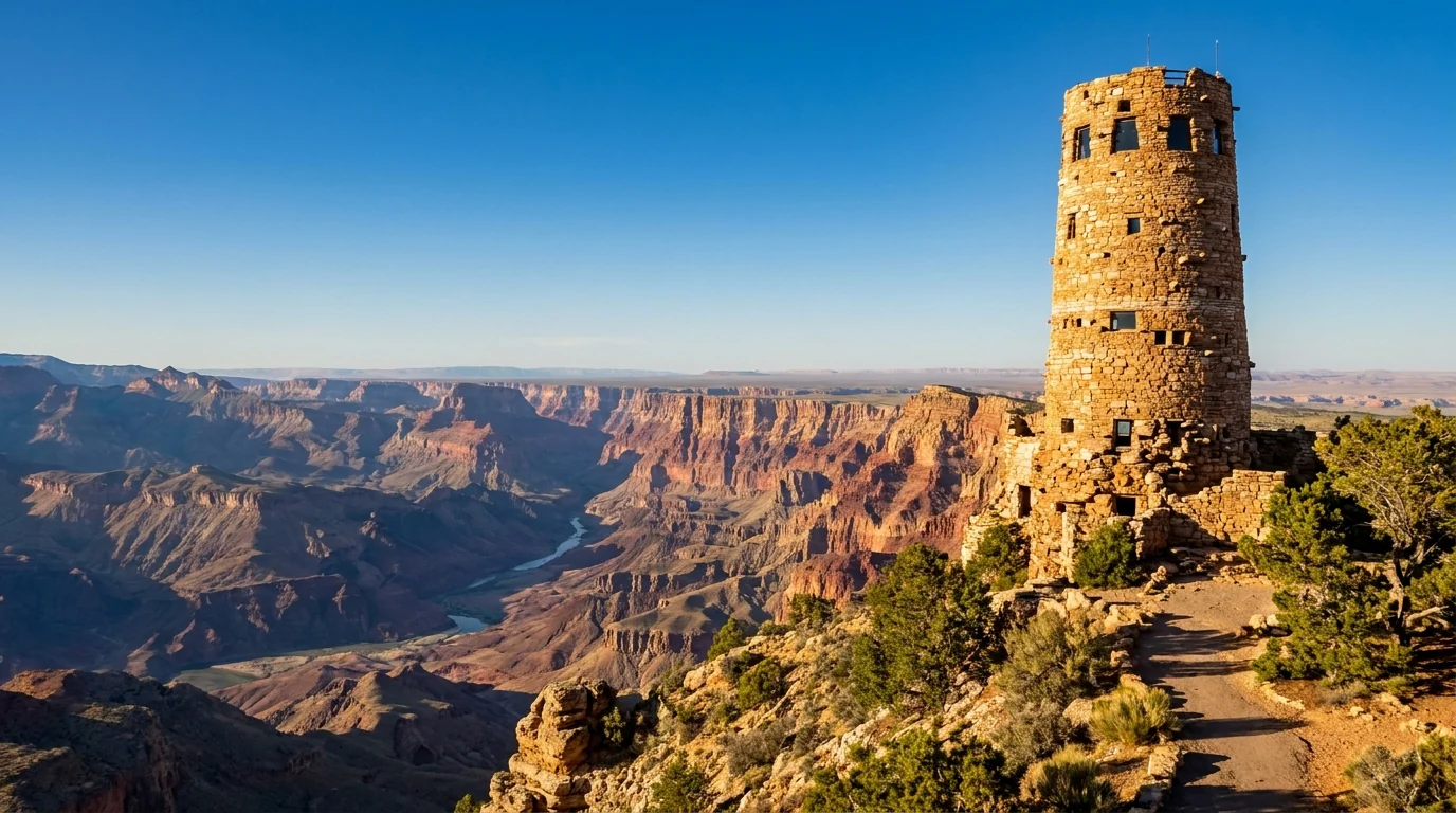
A tall round stone watchtower of stacked rough masonry standing on the canyon rim, wide views over the big bend of the Colorado River and the Painted Desert beyond, warm afternoon light on weathered stone, Desert View Watchtower Grand Canyon, ultrarealistic photograph representative of the region
The Desert View Watchtower, east end of the South Rim. Mary Colter's 1932 stone tower marks the eastern (Highway 64) entrance, 25 miles from the village. Drive Desert View Drive to reach it and the quiet overlooks — Grandview, Lipan — that the shuttles don't serve.

The South Rim — year-round, full-service

  • Open all year; ~7,000 ft. Snow and freezing nights in winter, hot inner canyon in summer
  • Everything is here: lodges, campgrounds, groceries, a health clinic, gear, guided trips, the visitor center and the shuttle network (§02)
  • The viewpoints: Mather and Yavapai (central), Hopi and Pima (Hermit Road, sunset), and Grandview, Lipan and Desert View east along the drivable Desert View Drive
  • The trailheads: Bright Angel (in the village) and South Kaibab (shuttle-only, off Yaki Point) drop into the canyon here
Open all year~7,000 ft

The North Rim — seasonal, and changed for 2026

  • Seasonal: opened 6 a.m., 15 May 2026; services typically wind down mid-October and the highway closes with snow, usually by early December. Closed all winter
  • 2026 reality: the historic Grand Canyon Lodge burned in the 2025 Dragon Bravo Fireno in-park North Rim lodging in 2026. Food, fuel and water at the North Rim Country Store and Jacob Lake; the campground reopened during the season
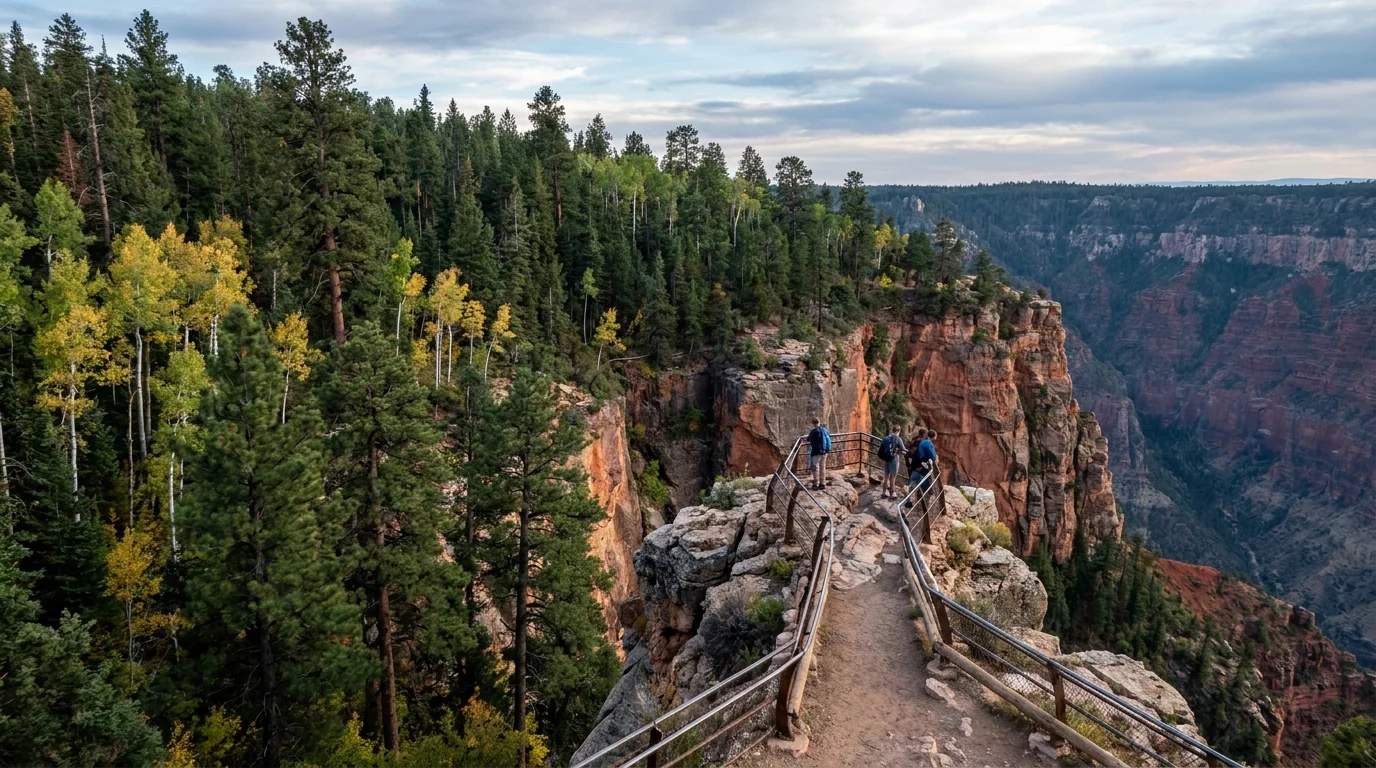
  • Higher and cooler (~8,200 ft, up to ~8,800 at Point Imperial); ponderosa, spruce-fir and aspen. The viewpoints are Bright Angel Point, Cape Royal and Point Imperial
  • Roads: Highway 67 in, plus the Cape Royal and Point Imperial roads — vehicles over 22 ft are prohibited on those two
Seasonal & snow-gatedNo in-park lodge 2026
Tall ponderosa pines and quaking aspens meeting an abrupt canyon edge with a narrow railed viewpoint spur reaching out to a rocky point high above red-rock depths, cooler high-elevation light, North Rim Grand Canyon, ultrarealistic photograph representative of the region

Getting to the North Rim — the long way is the only way

From the South Rim it's a ~215-mile, roughly 4-hour drive around the eastern end of the canyon via Cameron, Marble Canyon and Jacob Lake, then ~45 miles south on Highway 67 across the Kaibab Plateau. There is no shortcut for vehicles.

The only faster link is on foot: the corridor trails connect rim to rim through the inner canyon (a serious multi-day or shuttle-assisted trip, §04, §05).

Fuel and food are sparse up here — top off at Jacob Lake, and don't count on in-park services for 2026.

~215 mi / ~4 h by roadConfirm current North Rim services
Which rim for which trip First visit, short on time, or travelling off-season? The South Rim, easily — it's open all year, has the iconic views, and the best logistics. Want solitude, cooler air, forest and a road trip? The North Rim, in summer, knowing services are thin in 2026. Want to hike rim-to-rim? That's the inner canyon (§04, §05) — permits, heat discipline and a car shuttle or a very long day. Whatever you choose, remember the rim you stand on and the canyon below are two different climates — pack for both.
04 / THE HIKES

The corridor trails, honestly numbered — and where to turn around

Grand Canyon hiking is upside-down: you descend first, when you're fresh, and climb out last, when you're tired and hot. That single fact is why the canyon is dangerous, and why the smart move is to pick a turnaround, not a destination. The distances below come from the National Park Service and standard trail sources and are the best consensus figures we could find — but confirm at the trailhead board, budget far more time and water than a rim mile would suggest, and remember: going down is optional; coming up is not. All mileages are round trip unless noted.

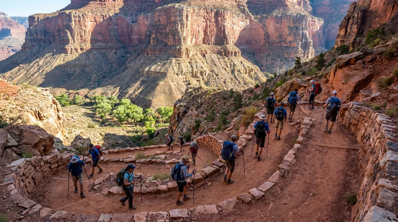
Hikers descending well-graded reddish dirt switchbacks cut into a steep canyon wall with a rock retaining wall, day packs and trekking poles, towering layered cliffs above and a green pocket far below, Bright Angel Trail Grand Canyon, ultrarealistic photograph representative of the region
Bright Angel Trail — the South Rim's forgiving corridor route. Well-graded switchbacks with seasonal water stops at the resthouses and Havasupai Gardens. The classic day-hike trail — but it's ~9.3 miles and 4,500 ft to the river one way, so day hikers pick a resthouse and turn around.

The South Rim corridor — the two big trails

Both drop from the South Rim toward the river and Phantom Ranch. Bright Angel has water and shade; South Kaibab has neither but bigger views. Distances from NPS — confirm at the trailhead.

The guaranteed win · water & shadeBright Angel Trail — day-hike turnarounds

Pick one and come back: Mile-and-a-Half Resthouse (~3 mi RT, ~1,120 ft), Three-Mile Resthouse (~6 mi RT, ~2,120 ft), or Havasupai Gardens (~9 mi RT, ~3,040 ft). Well-graded, with seasonal water and some shade, from the trailhead in Grand Canyon Village. The most forgiving way to taste the inner canyon.

Water is seasonal and pipeline breaks happen — confirm before you go and carry enough to get back without it. In summer, do not go past Three-Mile after mid-morning. The Plateau Point spur beyond Havasupai Gardens was reported closed through 30 June 2026 — confirm status.

~3 / ~6 / ~9 mi RT optionsSeasonal waterDistances per NPS
Turn around at a resthouse
Half to full day (estimate)
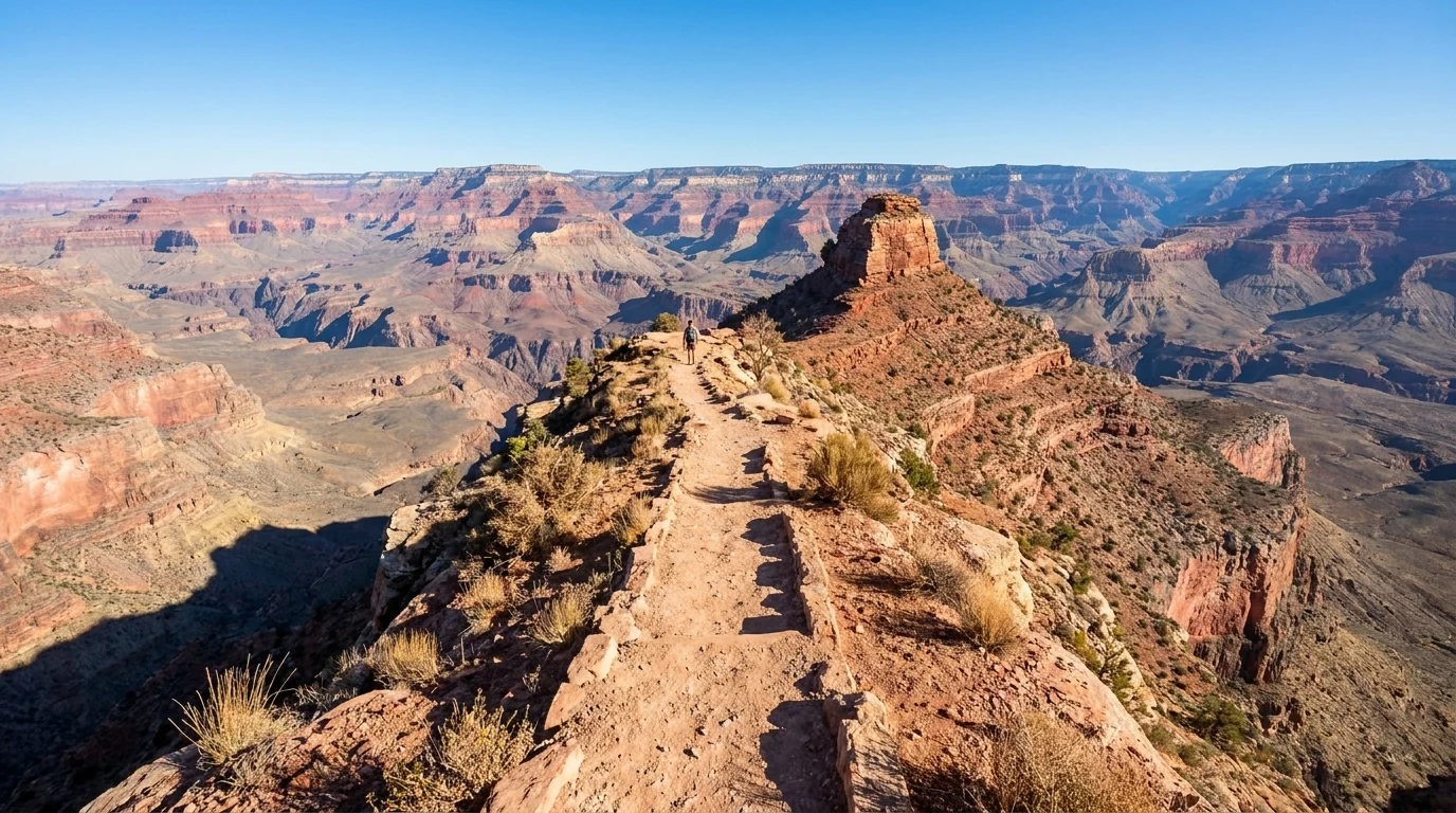
A narrow dusty trail following an open ridgeline into the canyon with dramatic drop-offs on both sides, big panoramic layered canyon views and no shade anywhere, harsh clear light and red rock, South Kaibab Trail Grand Canyon, ultrarealistic photograph representative of the region
The South Kaibab Trail — all view, no mercy. A ridgeline descent off Yaki Point with panoramas the whole way and no water and almost no shade. Reached only by shuttle. Superb going down in cool light; brutal climbing out in heat — most hikers pair it with Bright Angel for the return.

Bigger views, no water, no shadeSouth Kaibab Trail — day-hike turnarounds

Turnarounds: Ooh Aah Point (~1.8 mi RT), Cedar Ridge (~3 mi RT), Skeleton Point (~6 mi RT). A spectacular ridgeline descent off Yaki Point with panoramic views the whole way — but no water anywhere and almost no shade. Reached only by the Kaibab/Rim shuttle (no parking at the trailhead).

This is a descent route, not a summer climb. With no water and full sun it's brutal going up in heat — many hikers go down South Kaibab and up Bright Angel. Deaths have occurred here in the heat — carry all your water and turn around early.

~1.8 / ~3 / ~6 mi RTNo water · no shadeShuttle-only trailhead
Turn around at Cedar Ridge
2–4 h (estimate)

The easy option — and the North Rim's trail

Flat, paved in parts, all the viewsRim Trail (South Rim)

Up to ~13 mi one-way, minimal gain, from the South Kaibab area west to Hermits Rest. Mostly flat and much of it paved, hugging the canyon edge past viewpoint after viewpoint. Walk any stretch and ride a shuttle back. Portions near the village are wheelchair-accessible. The great low-effort, high-reward option.

Still ~7,000 ft with full sun and unfenced drops most of the way — carry water, wear a hat, and keep back from the edge. Easy to underestimate the altitude and exposure.

Flat · shuttle-supportedUnfenced edges
Walk a stretch, ride back
1 h to all day (estimate)

The North Rim's corridor · seasonalNorth Kaibab Trail

The North Rim's route into the canyon, reopened 15 May 2026 for foot traffic. Day-hikers commonly turn around at the Coconino Overlook or the Supai Tunnel (~2–4 mi RT); Roaring Springs is a very long, demanding day. It descends far faster than the South Rim trails.

Trail rehabilitation continued through the 2026 season after the Dragon Bravo Fire, and post-fire hazards can force closures — check current status. Seasonal water varies; never assume it. Cottonwood Campground (permit) sits ~7 mi down.

Supai Tunnel ~4 mi RTPost-fire trail workNorth Rim seasonal
Turn around at Supai Tunnel
2–4 h (estimate)
🔴 The one rule that matters most Do not attempt to hike from the rim to the Colorado River and back in a single day. The Park Service posts this everywhere, and people ignore it and die every year. It's a mile of vertical each way over 15+ miles, and the bottom is a furnace in summer. If you want the river, make it an overnight with a permit (§05) — or pick a resthouse turnaround and be happy with it. The canyon will still be there next trip.
DestinationTrailRound trip*Descent*Water / shade
Ooh Aah PointSouth Kaibab~1.8 mi~600 ftNone
Cedar RidgeSouth Kaibab~3 mi~1,120 ftNone (toilet)
Skeleton PointSouth Kaibab~6 mi~2,040 ftNone
Mile-and-a-Half ResthouseBright Angel~3 mi~1,120 ftSeasonal water, some shade
Three-Mile ResthouseBright Angel~6 mi~2,120 ftSeasonal water, some shade
Havasupai GardensBright Angel~9 mi~3,040 ftWater, shade, toilets
Supai TunnelNorth Kaibab~4 mi~1,400 ftSeasonal water (confirm)
Rim Trail (any stretch)Rim (flat)variesminimalVillage services only

*Distances and descents are NPS / standard trail figures — confirm at the trailhead board. Times are fit-hiker estimates and mean nothing in heat. Every figure assumes you climb back out; plan the return, not the descent. Inner-canyon water is seasonal and prone to failure — never assume it.

05 / THE INNER CANYON — READ BEFORE YOU HIKE DOWN

A mile down, a furnace at the bottom, and a permit to sleep there

The inner canyon is the real Grand Canyon — the river, Phantom Ranch, the ancient black rock of the gorge — and it's where the danger lives. It is a genuine desert, hotter and drier than the rim, and getting to it means descending a mile and then climbing it back, usually in the heat of the day. We're not going to romance a rim-to-river day hike, and we're not going to pretend the water's always on. Here's the honest version, and the permit reality that governs an overnight.

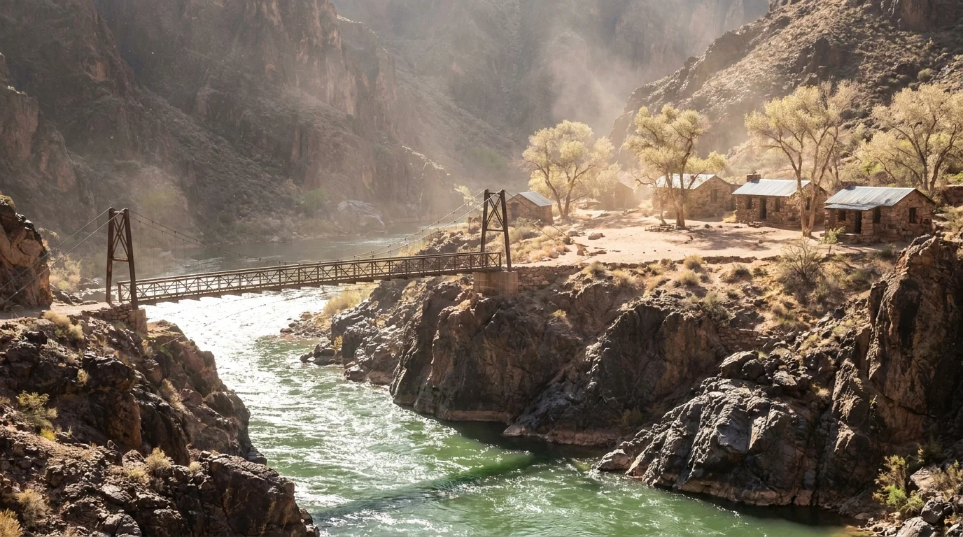
Jade-green Colorado River cutting through dark ancient schist walls, a footbridge and a cluster of stone cabins and cottonwoods on a sandy bench, harsh bright canyon-bottom light and heat shimmer, inner gorge near Phantom Ranch Grand Canyon, ultrarealistic photograph representative of the region
The inner gorge at the Colorado River, ~2,480 ft. Bright Angel Campground and Phantom Ranch sit on a sandy bench by Bright Angel Creek, reached only on foot, by mule or by raft. It's a green oasis — and in summer, an oven. Everything here is earned the hard way, twice.

The heat, plainly

The canyon bottom regularly runs 105 to 115°F in summer, and the trail surface can be 20–30 degrees hotter than the air. In June 2026, multiple hikers died of heat-related causes on the South Kaibab and North Kaibab trails within days of each other.

The Park Service response is blunt: stay off inner-canyon trails from about 10 a.m. to 4 p.m. in peak heat, hike early, carry plenty of water and salty food, and turn around before you're tired.

105–115°F at the bottomOff-trail 10a–4p in heat

The water reality

  • Bright Angel: seasonal water at the resthouses and Havasupai Gardens — when the pipeline is working
  • South Kaibab: no water at all, ever. Carry every drop
  • North Kaibab: seasonal water at points — confirm; post-fire conditions vary
  • The transcanyon pipeline breaks and the park shuts water off without much notice — check the current status at the Backcountry Information Center or nps.gov before you descend, and never build a plan on a spigot you haven't confirmed
The permit systems — two different doors below the rim

Backcountry permit (camping)

  • Required to camp anywhere below the rim — Bright Angel Campground, Cottonwood, Havasupai Gardens
  • Booked on Recreation.gov: a four-month early-access lottery, then a rolling window ~three months out
  • A small number of daily walk-in permits for Havasupai Gardens and Cottonwood are released the day before — a fallback, not a plan

Phantom Ranch (a bed, not a permit)

  • Cabins and dorms are booked through Xanterra in a lottery ~15 months ahead — not a backcountry permit
  • The only lodging below the rim; you still have to hike, ride a mule, or raft in
  • Meals and the famous canteen are reservation-based too — nothing down there is walk-up

Exact permit fees, quotas and the current lottery calendar change — confirm on the NPS backcountry page and Recreation.gov / grandcanyonlodges.com before you plan around either.

🔴 If you're hiking below the rim — the non-negotiables Start before dawn and be climbing out before mid-morning in warm months. Carry more water than you think and eat salty food with it — drinking water alone can cause dangerous hyponatremia. Never hike to the river and back in a day. Wear sun protection and wet your shirt and hat at every water source. Rest in shade during the 10 a.m.–4 p.m. window. Know that a rescue is not quick or guaranteed — there is often no cell service, and helicopters can't fly in high heat or storms. If you feel nauseous, dizzy or stop sweating, stop, get in shade, cool down and call for help — those are heat-illness red flags, not toughen-through-it moments.
A note on Havasu Falls / Supai The turquoise waterfalls you've seen photos of — Havasu Falls, Mooney Falls, Supai village — are not in Grand Canyon National Park. They're on the Havasupai Reservation, a sovereign tribal jurisdiction with its own permit system (havasupaireservations.com), its own trailhead (Hualapai Hilltop, hours from here), and a hard-won reputation for booking out instantly. They are not reachable from the rim trails in this guide, and this park's permits do not apply there. We flag it because people conflate the two constantly. If Havasupai is your goal, plan it as a separate trip through the Tribe directly.
06 / SAFETY — READ THIS FIRST

Heat, the edge, the monsoon, and the animals

Most of what goes wrong at the Grand Canyon comes down to four things, and only one of them is the drop everyone worries about. The first is heat and dehydration in the inner canyon — the leading way a fit person gets into lethal trouble here. The second is falls from the unfenced rim. The third is the summer monsoon: lightning up high, flash floods below. The fourth is wildlife-distance discipline, including the animal that bites more visitors than any other — which is not a predator. None of it is exotic. It just has to be planned for.

Heat & hydration — take this seriously

The inner canyon is the danger, and fitness does not protect you — strong hikers die here because they descend fast and can't climb out in the heat. Bottom temps hit 105–115°F; the trail is hotter.

Drink water AND eat salty food — water alone flushes your electrolytes and can cause hyponatremia, which mimics dehydration and is just as dangerous. Wet your clothes at every water source. Rest in shade midday.

Warning signs: nausea, dizziness, headache, confusion, or you stop sweating. Stop, cool down, get help.

Heat is the #1 killer hereSalt + water, not just water

The edge — falls are real

  • The rim is unfenced almost everywhere. Railings exist only at the busiest overlooks
  • Stay on trails and behind railings for photos. The rock is often loose and sloping, and a gust or a slip is all it takes
  • Watch children constantly and keep dogs leashed on the rim (dogs aren't allowed below the rim except service animals)
  • No selfie is worth it. People die here every year stepping back for a photo — treat every edge as a one-way drop

There is no barrier along most of the Rim Trail — use conservative distances and mind footing on loose rock.

🔴 The monsoon — lightning up high, flash floods down low From roughly July into September the Southwest monsoon builds sudden, violent afternoon thunderstorms. On the exposed rims and viewpoints that means lightning — get away from edges, isolated trees and open overlooks when a storm builds, and back to a vehicle or building. In the side canyons and washes it means flash floods — water can arrive from a storm you can't even see, so never camp or linger in a narrow drainage when rain threatens.

Dust storms (haboobs) can also cut visibility on the approach highways. Check the forecast, start early, and treat a building afternoon storm as the plan-changer it is — not something to push through above the rim or deep in a canyon.

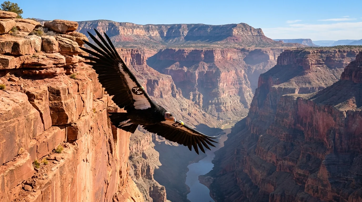
A California condor with enormous black wings and white underwing patches and a numbered wing tag soaring on thermals against layered red canyon walls and open sky above the rim, Grand Canyon Arizona, ultrarealistic photograph representative of the region
A California condor over the canyon. One of conservation's great comebacks, these tagged, nine-foot-wingspan birds are sometimes seen riding thermals along the South Rim. Watch from a distance and never leave food or trash out — human food and micro-trash are a genuine hazard to them.

Elk, condors & the animal that bites most

Elk and mule deer wander the South Rim village and can be aggressive — especially elk in the fall rut and around water. Give them room. But the animal that injures the most visitors is the rock squirrel: people feed them, get bitten, and it's the park's most common animal-bite. Never feed or approach any wildlife — it's illegal, it's dangerous to you, and it kills the animals over time.

Don't feed the squirrels — reallyGive elk wide room

Altitude, cold & winter on the rim

The rims are high — ~7,000 ft (South) to ~8,200–8,800 ft (North). Arriving from sea level, some people feel the altitude; hydrate and ease in. In winter the South Rim gets snow and ice — trails and pullouts can be treacherous, and the inner canyon can be icy up top and warm down low on the same day. The North Rim is closed and snowbound. Pack for the rim's cold even when the canyon floor is hot.

Rim snow & ice in winterTwo climates, one hike
Wildlife distance, briefly Standard NPS guidance: stay at least 25 yards / 23 m from most wildlife and never feed or approach anything, from a squirrel to an elk to a condor. If an animal changes its behaviour because of you, you're too close. Store food and trash securely at camp and in vehicles — ravens and rodents raid, and human food harms the animals. Confirm current wildlife guidance and any closures with the park, and treat every wild animal as wild.
07 / THE CAMPING STRATEGY

Two rims, the forest overflow, and permits for below the rim

Camping here sorts into four buckets: the developed park campgrounds on each rim (reserve early), the one in-park full-hookup RV park, the Kaibab National Forest grounds and free dispersed sites that catch the overflow, and the permit-only backcountry campgrounds below the rim (§05). Most developed sites want an advance Recreation.gov booking in peak season and fill months out. Book the South Rim early, know the North Rim is seasonal and reduced for 2026, and keep the forest as your fallback.

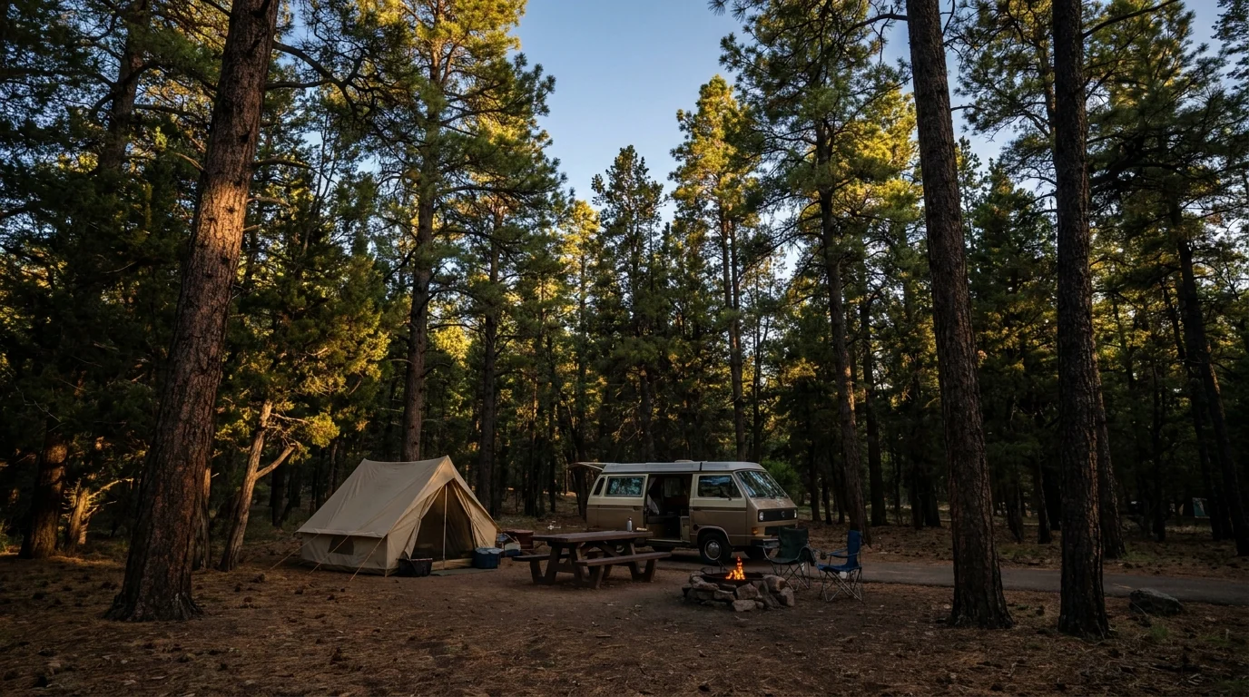
A quiet forested campsite with a tent and a small camper van among tall ponderosa pines and pinyon-juniper, a picnic table and fire ring, dappled evening light through the trees, Mather Campground South Rim Grand Canyon, ultrarealistic photograph representative of the region
Mather Campground — the South Rim base, in the pines. The main developed campground near Grand Canyon Village, walkable to the shuttle and a short ride from the rim. Tents and RVs up to ~30 ft, no hookups — and, like all the developed grounds here, it books out for peak season.
CampgroundArea · managerSitesSeason*BookingReported fee*
Mather South Rim · NPS ~327 year-round Reservation (peak) + first-come $30 + no hookups
Trailer Village South Rim · Delaware North year-round Reservation (visitgrandcanyon.com) ~$79–89 (full hookups; confirm)
Desert View South Rim (east) · NPS 50 ~mid-Apr – mid-Oct Reservation $30 + no hookups
North Rim North Rim · NPS seasonal (reopened in 2026 season) Walk-in early, then reservation fee unconfirmed 2026
Ten-X (Tusayan-Montane) Kaibab NF, S Rim gateway ~70 ~May – Sep First-come + some reservable ~$10 (confirm 2026)
DeMotte Kaibab NF, N Rim gateway 38 ~mid-May – mid-Oct Reservation $30 (confirm)
Jacob Lake Kaibab NF, N Rim gateway seasonal (~through Oct) First-come + reservable unconfirmed
Bright Angel Inner canyon · NPS year-round (lethal heat) Backcountry permit permit fees apply
Havasupai Gardens Inner canyon (Bright Angel) · NPS year-round (extreme heat) Permit + few daily walk-ins permit fees apply
Cottonwood Inner canyon (N Kaibab) · NPS reopened 15 May 2026 Permit + few daily walk-ins permit fees apply
Kaibab NF dispersed (S) Tusayan area · Kaibab NF where roads passable First-come, no booking Free
Kaibab NF dispersed (N) Kaibab Plateau · Kaibab NF seasonal (snow-gated) First-come, no booking Free

*Seasons, site counts and fees are compiled from NPS, Recreation.gov and Kaibab National Forest listings and vary by source and by season. Mather and Desert View at $30 were the most consistent; Trailer Village (full hookups), Ten-X, DeMotte, Jacob Lake and the 2026 North Rim fee are shown as "confirm" because listings disagreed or changed for 2026. Book by site on Recreation.gov / the concessioner and read the actual price and site type. Below-rim grounds are permit-only (§05).

Which base for which trip

  • South Rim, tents / small RV: Mather (book early) or Desert View (east end, quieter, seasonal). Both no-hookup
  • South Rim, big RV with hookups: Trailer Village is the only in-park full-hookup option — book through the concessioner well ahead
  • Overflow / budget near the South Rim: Ten-X in the Kaibab NF near Tusayan, or free forest dispersed sites
  • North Rim: North Rim Campground (seasonal, reduced 2026), or DeMotte / Jacob Lake in the forest — and remember there's no in-park lodge for 2026
  • Below the rim: Bright Angel, Havasupai Gardens or Cottonwood — permit only (§05)

Dispersed camping & the rules that catch people out

Free dispersed camping is allowed on Kaibab National Forest land on both rims — the classic overflow when the campgrounds fill. But: there is no camping in the national park outside the designated campgrounds, camp on existing sites at least 200 ft from water, pack out everything, and observe the 14-day limit.

Fire restrictions can ban campfires and dispersed camping entirely in a dry summer — the Kaibab NF posts its own orders, and the plateau is snow-gated in winter. Check the current order the week you go.

No dispersed camping inside the parkCheck fire stage weekly
Backcountry overnight permits — the below-rim system Every overnight below the rim — Bright Angel, Havasupai Gardens, Cottonwood — needs an advance backcountry permit from Recreation.gov: a four-month early-access lottery, then a rolling window about three months out, with a few daily walk-in permits held back for Havasupai Gardens and Cottonwood. Phantom Ranch beds are separate (a Xanterra lottery ~15 months ahead). Below-rim rules include pack-it-in-pack-it-out, no dogs (service animals aside), and strict heat and water discipline (§05, §06). Confirm the current permit calendar, quotas and fees on the NPS backcountry page and Recreation.gov before you plan an overnight.
08 / TOWNS & SERVICES

The South Rim has almost everything. The North Rim has almost nothing.

The South Rim is close to a small self-contained town — groceries, a clinic, lodges, gear, guided trips — backed by the gateway of Tusayan a mile out and the bigger bases of Williams and Flagstaff down the road. The North Rim is the opposite: tiny, seasonal, and in 2026 stripped of its in-park lodge, with services scattered thin across the Kaibab Plateau to Jacob Lake. Plan your resupply around that gradient, and remember fuel gets sparse fast on the way to the North Rim.

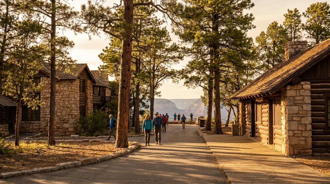
Rustic early-1900s stone-and-timber lodge buildings and a log-and-stone depot along a canyon-edge walkway with visitors strolling and tall pines framing a glimpse of the canyon, Grand Canyon Village South Rim, ultrarealistic photograph representative of the region
Grand Canyon Village, ~7,000 ft. The South Rim hub — historic lodges (El Tovar, Bright Angel), a visitor center, a grocery and deli at Market Plaza, a health clinic, and the shuttle routes that tie it together. Park once and walk or ride; this is the one place here that works like a small town.

South Rim & the southern gateways

  • In the park: groceries and a deli at Market Plaza, a general store, a health clinic, lodges, restaurants, a post office and a bank/ATM — more services than almost any other national park
  • Tusayan (1 mi south of the entrance): hotels, restaurants, fuel, an IMAX, an airport and the summer park-and-ride. The closest non-park base
  • Williams (~1 hr south): the Route 66 town and home of the Grand Canyon Railway — a car-free way into the park — plus motels, diners and an RV park
  • Flagstaff (~1.5 hr south): the big regional city for full resupply, hospitals, gear and an Amtrak/interstate hub

In-park lodging and Phantom Ranch book months ahead — reserve early or base in Tusayan / Williams. Confirm hours and current services before relying on them.

North Rim & the northern gateways

  • In the park (2026): no lodge after the Dragon Bravo Fire — food, fuel and water at the North Rim Country Store, plus the campground and the Backcountry Information Center. Treat services as minimal
  • Jacob Lake (~45 mi north, at the Hwy 89A/67 junction, ~7,900 ft): the Jacob Lake Inn — rooms, cabins, a cafe, a bakery, a store and fuel — is the essential waypoint
  • Kaibab Lodge (~5 mi from the entrance on Hwy 67): a seasonal cabin lodge with a restaurant, one of the closest beds to the rim in 2026
  • Medical: no hospital up here. Nearest full services and hospitals are a long way off (Kanab, UT and beyond) — carry a real first-aid kit and self-sufficiency

North Rim services were sharply reduced for 2026 — confirm what's open, and top off fuel at Jacob Lake before the long drive in.

Operators & services worth knowing — links, not prices All of the following are real, currently-trading businesses whose own websites we resolved. Season, pricing and menus change annually, so we link rather than quote. In-park lodges, mule trips, rafting and Phantom Ranch are run by the park concessioners.

South Rim / Tusayan / Williams

  • The Squire at Grand Canyon (74 AZ-64, Tusayan) — full-service resort hotel a mile from the entrance, with restaurants, a pool and a bowling alley
  • The Grand Hotel at the Grand Canyon (149 AZ-64, Tusayan) — upscale rooms with the Canyon Star Steakhouse & Saloon, indoor pool
  • Big E Steakhouse & Saloon (395 AZ-64, Tusayan) — Western steaks, ribs and pastas, now trading as Big E Spaghetti Western
  • We Cook Pizza & Pasta (605 N AZ-64, Tusayan) — casual family pizzeria, walk-ins welcome
  • Bright Angel Bicycles / Canyon Adventures (Visitor Center plaza) — the only in-park bike shop: rentals, guided rim tours and a cafe
  • Grand Canyon Railway & Hotel (233 N Grand Canyon Blvd, Williams) — historic daily train to the South Rim, hotel and RV park
  • Cruisers Route 66 (233 Historic Route 66, Williams) — mesquite-smoked BBQ, steaks and craft beer on the old highway

North Rim / Jacob Lake

  • Jacob Lake Inn (Hwy 89A & AZ-67, Jacob Lake) — the gateway waypoint since 1923: rooms and cabins, cafe and bakery, gift shop and fuel, ~45 mi from the North Rim
  • Kaibab Lodge (Hwy 67 near the North Rim entrance) — seasonal cabins with a restaurant at nearly 9,000 ft, ~5 mi from the park; one of the closest 2026 beds

North Rim businesses are seasonal (roughly mid-May to mid-November) — confirm opening before you drive up.

We confirmed no operator pricing — any number you see elsewhere should come from the business. Phone numbers and hours change; check the current website before you drive over.

Getting there For the South Rim, the common approaches are from Flagstaff (~1.5 hr via US-180 or US-89/Desert View) or Williams (~1 hr via AZ-64, or car-free on the Grand Canyon Railway). Phoenix is ~3.5–4 hours and Las Vegas ~4.5 hours by road; the nearest big airports are Flagstaff (FLG), Phoenix (PHX) and Las Vegas (LAS), with a small airport at Tusayan. The North Rim is a ~215-mile, ~4-hour drive around from the South Rim, or reached from southern Utah via Jacob Lake. Confirm current drive times and any highway closures with live mapping; desert highways here close for weather, wildfire and construction.
09 / TIMING

When to go — shoulder seasons win, and the heat decides

The Grand Canyon has one hard constraint and one clear sweet spot. The constraint is the inner-canyon heat, which turns summer hiking from hard to deadly, and the North Rim season, which only runs roughly mid-May to mid-October. The sweet spot is the shoulder seasons — spring and fall — when the rim is mild, the canyon is merely hot, and the crowds thin from their summer peak. If you want one answer, go in April–May or September–October and start your hikes at dawn.

Season by season, straight

  • Spring (Apr–May) — a great window. Mild rim temps, manageable inner-canyon heat, the North Rim opening mid-May. Rim nights still cold; some high water/services just coming online
  • Summer (Jun–Aug) — rim yes, inner canyon dangerous. Fine for viewpoints and the Rim Trail, but the inner canyon is lethal midday and the monsoon (Jul–Sep) brings lightning and flash floods. Busiest and hottest
  • Fall (Sep–Oct) — the best all-round window. Cooling canyon, stable weather, thinning crowds, the North Rim still open into mid-October. The prime time to hike below the rim
  • Winter (Nov–Mar) — quiet, snowy, South Rim only. The South Rim gets snow and ice and is beautiful and empty; the inner canyon is mild down low. The North Rim is closed. Carry traction and layers

Crowd & access strategy

  • Book lodging, Phantom Ranch and permits early. In-park beds and below-rim permits go months out; the Phantom Ranch lottery is ~15 months ahead
  • Start at first light — for cooler hiking, for parking, and to beat afternoon storms. The same move works three ways
  • Weekday and sunrise/sunset beat midday weekend — the rim is quietest at the edges of the day and the light is better anyway
  • Use the shuttles and park-and-ride rather than fighting for village parking (§02)
  • Off-season on the South Rim is a genuinely different, quieter, snowier trip — pack for it and it's a gift
The one-paragraph answer Go in April–May or September–October for the best balance of mild rim weather and survivable canyon heat — those are the windows this park rewards. If you only want rim views, any season works (winter is quiet and lovely on the South Rim). If you want to hike below the rim, go in the shoulder seasons and start before dawn. Whichever you pick: sort the shuttle, book any permit or bed early, carry far more water (and salt) than you think, be climbing out before mid-morning in the heat, and never try the river and back in a day. The North Rim is a summer-only bonus — and reduced for 2026.
10 / THE SHAPE OF THE TRIP

Four days on the South Rim, built around the heat

One workable shape, not the only one. It bases on the accessible South Rim, uses the shuttles instead of fighting for parking, saves any inner-canyon hiking for a dawn start, and offers the North Rim only as an add-on for a longer trip in season. Adjust freely — but keep every canyon hike early, pick a turnaround instead of a destination, and confirm the shuttle and water status before you count on them.

01

Day 1 — Arrive, park once, ride the rim

  1. Enter via Tusayan (use the summer park-and-ride) and park at the Visitor Center.
  2. Walk to Mather and Yavapai points and the Geology Museum; ride the Rim Trail shuttles to more overlooks.
  3. Sunset from Hopi or Pima Point on the Hermit Road (Red) shuttle — remember you can't drive it in season.
  4. Hydrate, get oriented, book tomorrow's early shuttle. No canyon descent today.
No permit neededShuttle everything
02

Day 2 — A dawn taste of the inner canyon

  1. First shuttle to the South Kaibab Trailhead (Kaibab/Rim route — the only way there).
  2. Descend to Ooh Aah Point or Cedar Ridge and climb back out before mid-morning. Carry all your water.
  3. Afternoon in shade — the village, the museums, or a nap. Judge yourself on that climb.
  4. Never push for the river. Turn around early and be glad you did.
Dawn startTurn around early
03

Day 3 — Desert View Drive, at your own wheel

  1. Drive Desert View Drive (Hwy 64 east) — no shuttle out here, so bring the car.
  2. Stops: Grandview, Lipan and the Desert View Watchtower at the east end (25 mi).
  3. Optional: a resthouse turnaround on Bright Angel earlier in the morning, with its seasonal water.
  4. Watch the afternoon sky — monsoon storms build; get off exposed points if lightning threatens.
Self-drive dayWatch the monsoon
04

Day 4 — The easy, big-view day

  1. Walk a long stretch of the Rim Trail and ride a shuttle back — flat, paved in parts, all the views.
  2. Ride into the park car-free on the Grand Canyon Railway from Williams if you based there.
  3. Bright Angel Bicycles / Canyon Adventures for a car-free rim bike if legs are tired.
  4. Last sunset, then out. Keep back from every unfenced edge.
Low effort, high rewardMind the edges
+

The North Rim add-on (in season)

  1. Only mid-May to mid-October: the ~215-mile, ~4-hour drive around via Jacob Lake.
  2. Base at DeMotte or the North Rim Campground, or Kaibab Lodge / Jacob Lake Innno in-park lodge in 2026.
  3. Views from Bright Angel Point, Cape Royal and Point Imperial (nothing over 22 ft on the last two roads).
  4. Top off fuel at Jacob Lake; services are thin. Confirm what's open before you drive.
Seasonal onlyReduced services 2026
+

The below-rim variant

  1. Only with an advance Recreation.gov backcountry permit (§05): a night at Bright Angel or Havasupai Gardens.
  2. Or a Phantom Ranch bed via the Xanterra lottery ~15 months out — separate from the permit.
  3. Down South Kaibab, up Bright Angel, a dawn start each way, salt-and-water discipline, shade midday.
  4. Shoulder seasons only for a first inner-canyon overnight — never a first-timer in summer heat.
Permit or Phantom Ranch booking requiredHeat discipline non-negotiable
11 / TRIP-READY

The departure check

Run it before you leave. Tap each item as it's done — these are the ten things specific to the Grand Canyon that a general road-trip habit will skip. Most come back to two facts: the rim and the canyon below it are two different climates, and the heat runs on a clock that starts before dawn and turns deadly by mid-morning.

0 / 10 confirmed — the heat sets the schedule.
12 / QUICK ANSWERS

Asked at every Grand Canyon trailhead

Do I need a reservation to enter the Grand Canyon?
No timed-entry or day-use reservation is required — you pay the standard entrance fee and drive in. But access runs on logistics: on the South Rim you park once and ride free shuttles, and Hermit Road is car-free roughly March–November. Lodging, mule rides and Phantom Ranch fill months ahead, and camping below the rim needs a permit. Confirm current shuttle windows and any pilot programs at nps.gov/grca.
Is the North Rim open, and is there lodging up there in 2026?
It's seasonal — it opened for 2026 at 6 a.m. on 15 May, winds down services in mid-October, and is snow-closed all winter. For 2026 the historic Grand Canyon Lodge was destroyed by the 2025 Dragon Bravo Fire, so there was no in-park North Rim lodging; food, fuel and water came from the North Rim Country Store and Jacob Lake, and the campground reopened during the season. It's a ~4-hour drive around — check the NPS North Rim page before you commit.
Can I hike to the Colorado River and back in one day?
No — the Park Service explicitly warns against it, and people die trying. It's ~a mile of vertical each way over 15+ miles, and the inner canyon runs 105–115°F in summer. Multiple hikers died of heat in June 2026. Make the river an overnight with a permit, or pick a resthouse turnaround. Rangers urge staying off inner-canyon trails 10 a.m.–4 p.m. in peak heat.
How do I camp below the rim or stay at Phantom Ranch?
Camping below the rim (Bright Angel, Cottonwood, Havasupai Gardens) needs an advance backcountry permit on Recreation.gov — a four-month early-access lottery, then a rolling window ~three months out, with a few daily walk-ins. Phantom Ranch cabins/dorms are different: a Xanterra lottery ~15 months ahead, not a permit. Two separate systems — budget for whichever applies, and either way you hike, ride a mule or raft in.
Is there water on the trails?
Sometimes — never assume it. Bright Angel has seasonal water at the resthouses and Havasupai Gardens; the South Kaibab has none; the North Kaibab has seasonal water at points. The transcanyon pipeline breaks and the park shuts water off without much notice. Check the current status at the Backcountry Information Center or nps.gov before you descend, and carry enough to climb out without a refill.
Which rim should I visit, South or North?
For a first visit, limited time, or off-season, the South Rim — open all year, iconic views, best logistics and services. For solitude, cooler forest air and a road trip, the North Rim in summer (knowing services are thin in 2026). They're ~10 miles apart across the canyon but a ~215-mile, ~4-hour drive by road. Most people should start with the South Rim.
Can I bring my dog?
On the South Rim, yes — leashed, above the rim. Leashed pets are allowed on the Rim Trail and in the developed areas and campgrounds (and there's a kennel in the village). Dogs are not allowed below the rim on any inner-canyon trail, or at Phantom Ranch, except service animals. Never leave a dog in a hot vehicle, and mind the heat and the unfenced edges.
When's the best time to go, in one sentence?
April–May or September–October — mild rim weather and survivable canyon heat, with the North Rim open in that window too. Summer is fine for rim views but the inner canyon is dangerous midday and the Jul–Sep monsoon brings storms; winter is quiet and snowy on the South Rim with the North Rim closed. If you're hiking below the rim, go in the shoulder seasons and start before dawn.
What actually kills people here?
Mostly heat and dehydration in the inner canyon, not falls — fit hikers descend fast and can't climb out in the heat. Falls from the unfenced rim are the next big one, often for a photo. Then monsoon lightning and flash floods. Plan the climb back, not the descent; carry salt and water; stay behind railings and off wet or loose edges; and get off exposed points when storms build.
Isn't Havasu Falls part of the Grand Canyon?
It's in the same great canyon system but not in the national park — the turquoise falls at Supai are on the Havasupai Reservation, a sovereign tribe with its own permit system (havasupaireservations.com) and its own trailhead hours away. This park's permits don't apply, and you can't reach it from the rim trails in this guide. If Havasupai is the goal, plan it as a separate trip through the Tribe directly.
13 / WHAT WE COULD NOT CONFIRM

The honest gaps, all in one place

Every guide has these; most don't print them. The Grand Canyon in 2026 is a fast-moving target — a rebuilt North Rim season, shifting water status, changed forest fees — so some numbers here are estimates, and we've flagged them in place. Everything below was compiled 23 July 2026 and should be re-checked against the linked official source before you rely on it.

Why this section exists Anyone can write a guide that sounds certain. The hard part is knowing which numbers are real — and at a canyon where the water can be off the day you descend, the North Rim rebuilt itself mid-season after a fire, the forest fees changed, and the heat kills fit people who ignore the clock, plenty of them need a same-week check. The null is the product. "Confirm the water status before you hike down" and "never try the river and back in a day" are usable instructions. A confident wrong answer here costs a dry trail at 110 degrees — or a life.
🔒

The printable field guide

Everything above, condensed into a print-ready PDF built for the glovebox — for a canyon where the rim and the abyss below it are two different climates, the water can be off the day you descend, and the signature hike is a route people die on in the heat. The South Rim shuttle system decoded, the seasonal North Rim and its 2026 reality, the corridor trails at honest turnarounds, the inner-canyon heat and water rules, the backcountry permits and Phantom Ranch, the campgrounds by area, the gateways, and the honest list of what nobody could confirm — on paper that works where the bars don't.

South Rim shuttle, decoded North Rim, seasonal & 2026-real Corridor trails, honest turnarounds Inner-canyon heat & water Backcountry permits & Phantom Ranch Campgrounds by area Gateways & services The departure check
Unlock the PDF — $4.95
$4.95 per guide · Instant access · Built by people who actually camp there
Trail Journal No. 051

Go farther. Camp lighter.
Leave it better.

Every Trekkr Trail Journal is built like this one: custom logistics, honest trail beta, the camping and access detail, and the local knowledge that turns a good trip into the one your crew talks about for years — including, always, a plain list of what we could not confirm. New destinations drop all season long, from the Colorado Rockies to the Utah canyons to the Desert Southwest.

Unlock the Trail Journal Library
↗ Read another issue — No. 036, Aspen & the Elk Mountains
$4.95 per guide · Instant access · Built by people who actually camp there