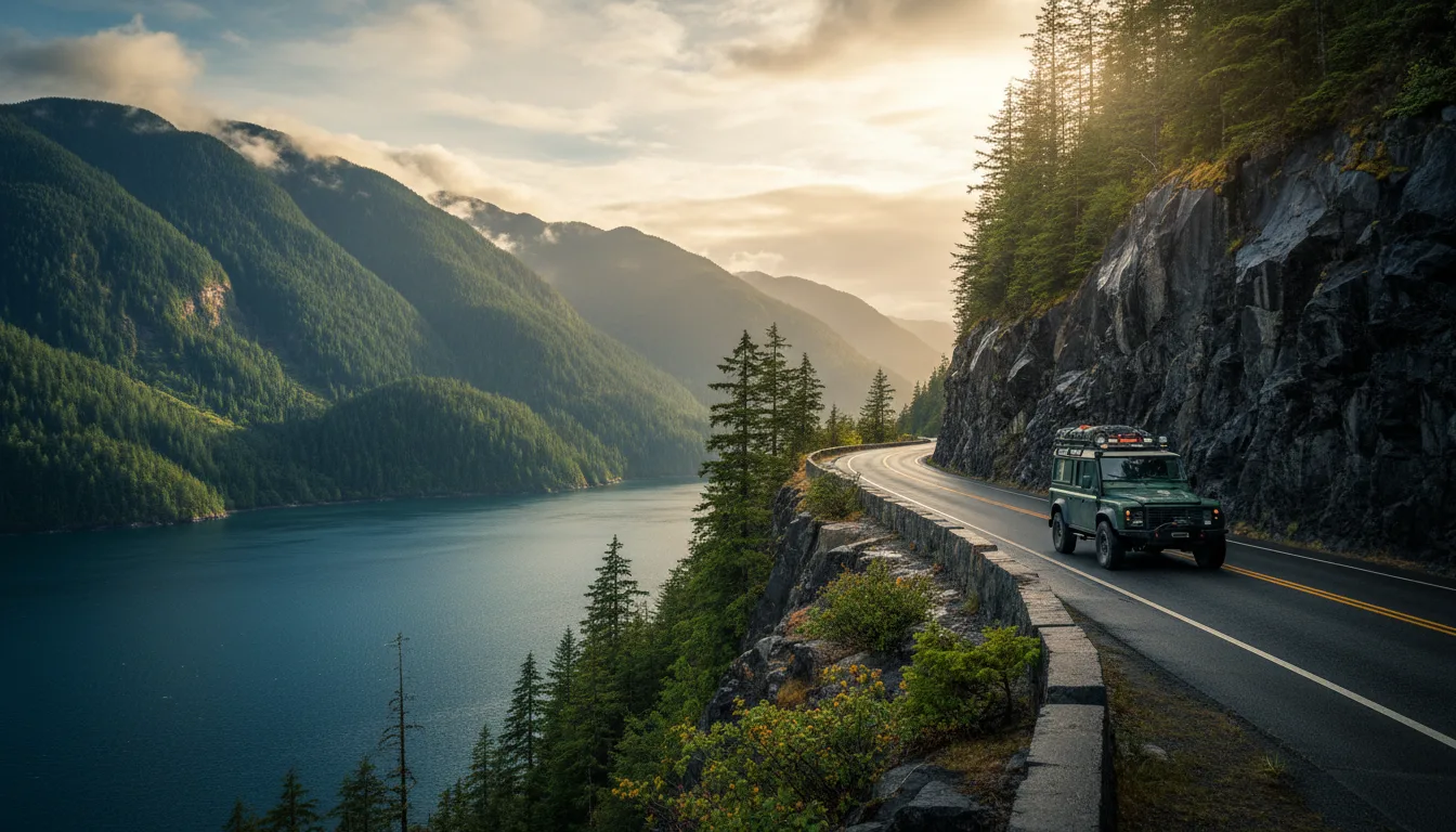
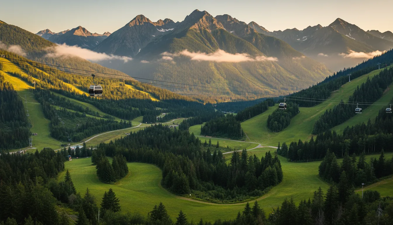
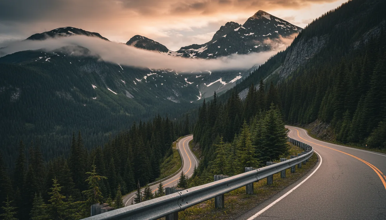
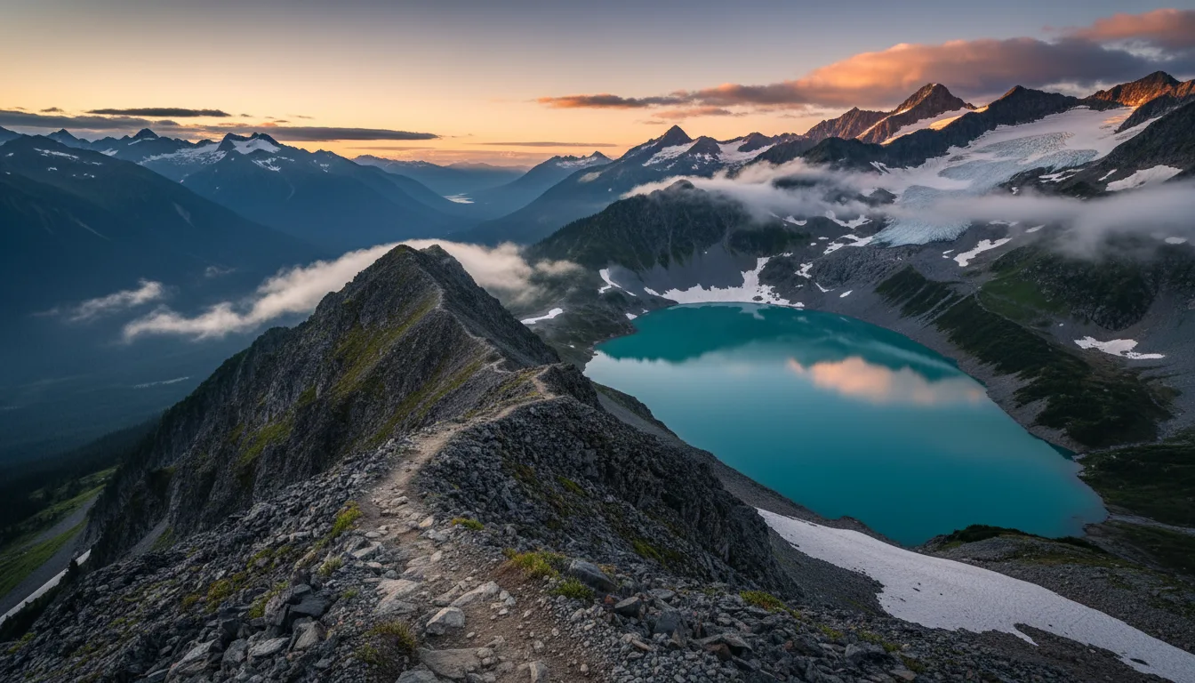
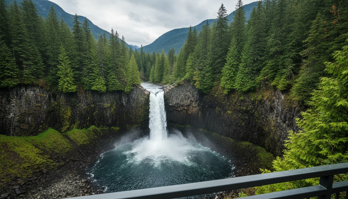
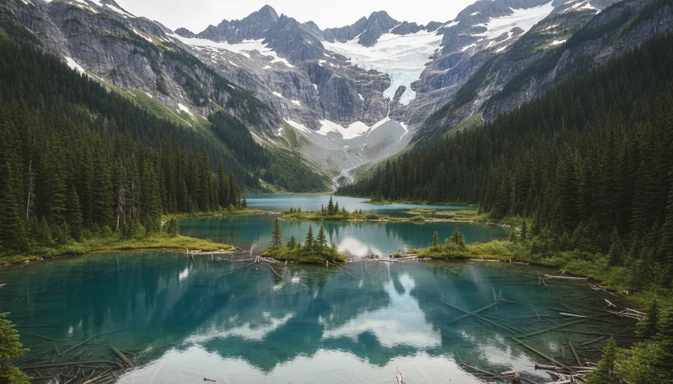
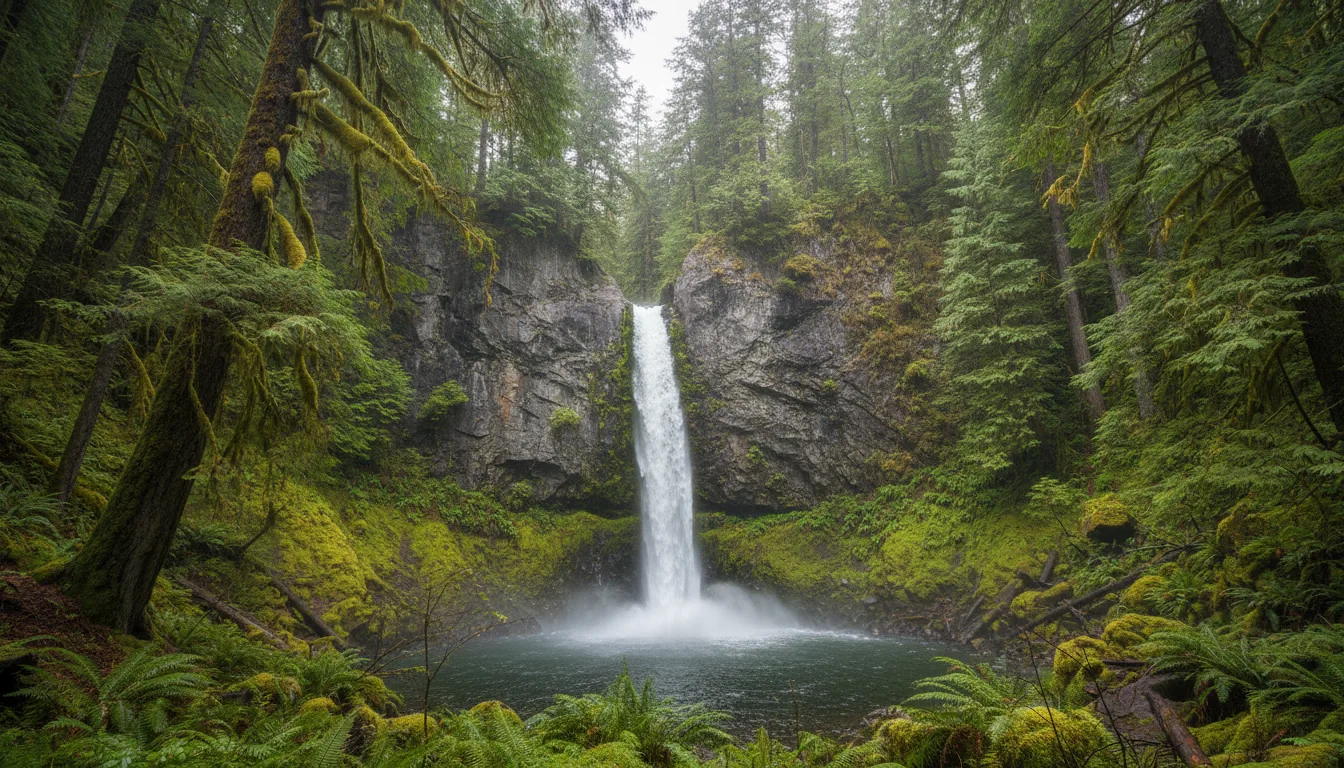
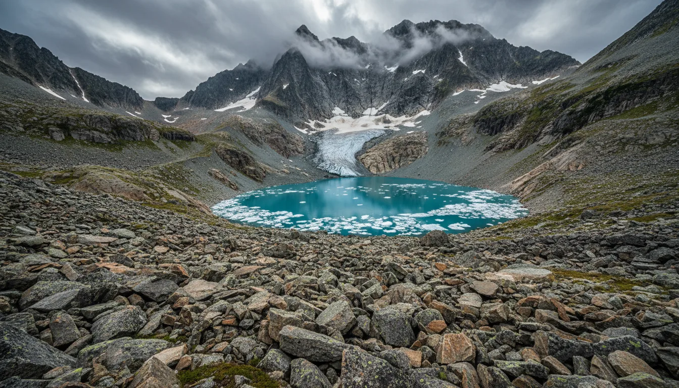
An overland rig on Highway 99 above Howe Sound with granite walls rising into cloud, the Sea-to-Sky corridor at golden hour, illustrative render in the series style
Trekkr Trail Journal · No. 011 · Sea-to-Sky

The Sea-to-SkySquamish · Whistler · Pemberton · Duffey Lake — The Complete Field Guide

Highway 99 runs from tidewater at Horseshoe Bay to the dry Interior at Lillooet, and it is the most spectacular road in southern British Columbia. It is also a corridor with no bypass, one 24-hour emergency department along its whole length, a hundred kilometres with no fuel at the far end, and three separate pass systems that catch people out in three different ways. This issue is about getting that right.

British Columbia · Canada Squamish · Whistler · Pemberton · Lillooet Hwy 99 from Horseshoe Bay Sequel to No. 010 · The Columbia Valley
124/7 emergency department between Vancouver & Lillooet
Mar 31Winter-tyre route end date — not April 30
~100–110 kmNo fuel, no food, no services over the Duffey
2Fire centres, two ban regimes, one highway
Conditions verified 18 July 2026 · Two fire centres, one highway · This block goes stale — the links don't

A corridor-wide campfire ban, a three-week park closure, and a road with no detour

The rest of this journal is evergreen; this box is not. Everything below is dated to the day we checked it, and the most perishable items on this corridor — fire bans, the Joffre closures, avalanche ratings, parking rates — change faster than any printed guide. Each item gives you the 60-second check as well as the snapshot. Trust the procedure, not our date stamp.

  • Fire: no campfires anywhere on the corridor, end to end (checked 18 Jul 2026)As verified on 18 July 2026 only: the Coastal Fire Centre had Category 1 prohibited from noon 16 July in the Sea to Sky district, with Category 2 and 3 prohibited centre-wide to 31 October; the Kamloops Fire Centre had Categories 1, 2 and 3 prohibited centre-wide, Category 1 from noon 10 July to noon 9 October. Net effect on the day we checked: no campfires from Horseshoe Bay to Lillooet. This corridor crosses a fire-centre boundary (§17) so you must check both — and municipalities ban independently on top. Penalties run $1,150 ticket → $10,000 administrative → $100,000 on conviction.
  • Joffre Lakes / Pipi7íyekw: two full park closures in 2026, and the dates are disputedThe Province announced the park fully closed to visitors 20–27 June 2026 and 8–30 September 2026. Líl̓wat Nation submitted longer identified Reconnection Periods that the Province did not adopt, including 23 August – 5 October. As of 18 July 2026 no agreement had been announced. A mid-September trip could hit a closure under either calendar. The full account, with both parties' own words, is in §14. Check the BC Parks Joffre Lakes advisories page within 48 hours of travel — BC Parks treats advisories, not the pass page, as the live source.
  • Rainbow Lake Trail (Whistler) is CLOSED — "early August" is not a hard dateThe Resort Municipality states the Rainbow Lake hiking trail is closed from June 1 until early August while the Gin and Tonic bridge and A-Frame bridge are replaced. It was closed as of 18 July. Older guidebooks all send people here. The Rainbow Falls Loop (2.1 km) is the substitute. Confirm at whistler.ca before you drive to the trailhead.
  • Rampart Ponds / Zig Zag Creek (Garibaldi): CLOSED INDEFINITELYA washed-out bridge roughly 1 km before Rampart Ponds. BC Parks' own trail PDF is unambiguous: "There are no alternate routes possible. BC Parks is advising visitors to not access this area." Rampart Ponds Campground is closed until further notice and there is no camping at Mamquam Lake. Nine Recreation Sites on this corridor are also closed, two of them for dangerous bear activity — see §11.
  • Water: Nairn Falls pumps out of order, Porteau Cove potable water unavailableNairn Falls' two hand pumps have been out of order since 1 July 2026 — there is no water in that park until they are repaired, and Nairn has no showers, no sani and no hookups either. Porteau Cove's potable water was also unavailable at time of writing. Both are live advisories that may have changed by the time you read this: re-check each park's page, and in the meantime carry your own water to both.
  • Mid-September 2026 is a genuine minefield on this corridorThree things collide. PEAK 2 PEAK closes 7 September. Joffre Lakes closes 8–30 September under the Province's dates, and from 23 August under Líl̓wat's. And the RBC GranFondo runs 12 September 2026, closing lanes between Vancouver and Whistler. Taylor Meadows campground is shut 1 September – 31 October every year regardless. If your trip is flexible, the last week of August or the first week of September is a much softer landing than mid-month.
Live sources · BC Parks — Joffre Lakes advisories · BC Wildfire Service map · fire bans & restrictions · DriveBC.ca · avalanche.ca
Report a wildfire 1-800-663-5555 or *5555 · report a poacher or a problem bear (RAPP) 1-877-952-7277 · HealthLink BC 8-1-1 · in an emergency, 911. This box was true at press and will not stay true — the sources above are the truth on the day you travel.
01 / START HERE

One road, no way around it

Highway 99 leaves the ferry terminal at Horseshoe Bay, runs the cliffs above Howe Sound to Squamish, climbs to Whistler, drops through the Green River canyon to Pemberton, and then does something most visitors are entirely unprepared for: it turns east, climbs about a kilometre in vertical, and crosses the Duffey Lake Road to Lillooet and the dry Interior. Horseshoe Bay to Highway 97 is 377 km, 234 miles. In that distance you pass through coastal rainforest, a ski resort, a farming valley, an alpine pass and Interior Douglas-fir canyon country hot enough to have recorded 46.8 °C.

This is the sequel to No. 010, and it is our third issue over the line into British Columbia. But where the Columbia Valley was about a rulebook that flips at a provincial border, the Sea-to-Sky is about something simpler and harder: a single road with no alternative. A crash near Mount Garibaldi once closed this corridor bidirectionally for roughly eight hours. There is no detour of comparable length. If Highway 99 shuts, you wait — and everything north of the closure is cut off from the corridor's only 24-hour emergency department. That fact shapes the driving advice, the medical advice and the itinerary advice in this issue, and it is why we lead with an early start rather than a clever route.

How to use this journal Read §02 and §03 first — the corridor's driving doctrine and the three separate pass systems, in the order you need to book them. Then go where your trip lives. Driving through? §02, §08 and §19 are your issue. Hiking? §04 through §07 for the zones, §12 for the objectives table. Camping? §10 and §11. Travelling in shoulder season or winter? §18, and read §00 again on the day. Everywhere in this issue, where our sources were blocked, undated, contradictory or simply silent, this guide says so out loud and prints no number. Roughly a third of the objectives on the Duffey side have no authoritative statistics in existence — that is not a gap more searching closes, and we would rather hand you the absence than a confident guess. §24 consolidates every one of them.
The land, named first This corridor runs through the territories of the Sḵwx̱wú7mesh Úxwumixw (Squamish Nation), whose language is Sḵwx̱wú7mesh sníchim; the Líl̓wat Nation (Lil̓wat7úl), whose language is Ucwalmícwts; N'Quatqua at the head of Anderson Lake; and the wider St'át'imc. Joffre Lakes is Pipi7íyekw. Mount Currie is Ts̓zil. We handle this material in §14 with the sourcing it deserves — everything attributed, nothing paraphrased from oral history, and no editorial position taken on a live disagreement between a Nation and the Province. It matters that they are named at the top, not the bottom.
02 / THE CORRIDOR

The driving doctrine

Four segments, one road, and a set of habits that matter more here than on almost any other highway in the province. Start early — not to beat traffic, but because there is no way around a closure. And know that the winter-tyre date on this route is not the one you think it is.

SegmentDistanceCharacterWhat it demands
Horseshoe Bay → Squamish ~48 km Cliffside along Howe Sound; winding, not steep Patience. The scenery is the hazard — use the pullouts, not the lane
Squamish → Whistler ~58 km Sustained climb to about 670 m Nothing technical. But a closure here severs everything north from the only 24/7 ER
Whistler → Pemberton ~32 km Descent through the Green River canyon Your last easy driving. Fuel and groceries in Pemberton
Pemberton → Lillooet (the Duffey) ~99–110 km The crux. Cayoosh Pass, the highest point on Hwy 99 Full tank, low gear on the descents, no cell service. Budget 2.5–3 hours (§08)
Full Highway 99 377 km / 234 mi Horseshoe Bay to Highway 97 A day's drive with no stops, or the spine of a week

Source honesty: the segment distances above are Wikipedia-derived and approximate. We could find no BC Ministry of Transportation distance or grade table for this route — an absence worth knowing, since it means every "official" segment figure you see elsewhere is also unofficial. The 377 km total is the one figure with consistent sourcing. Posted speeds run roughly 80–100 km/h on the Sea-to-Sky section and 60 km/h through towns; the Duffey is posted 60 km/h throughout, with advisory speeds as low as 20 km/h in the steepest sections.

Correction №2 · Highway 99 is a MARCH 31 winter-tyre route Most drivers assume winter tyres are required in BC until April 30, because that date applies on a great many provincial routes. It does not apply here. The Ministry of Transportation's own route-designation maps show both Horseshoe Bay → Pemberton and Pemberton → Duffey → Lillooet as October 1 – March 31 routes. That is a genuine month of difference, in your favour, on a corridor where the shoulder seasons are long. Two honest caveats: both PDFs carry a March 2021 revision stamp, and the generic sign artwork printed on the maps themselves still reads "Oct 1 – Apr 30." The posted sign on the road is the legal control — read it as you enter the designated section, and let it override anything printed here or anywhere else. The legal minimum is 3.5 mm tread, either M+S or the 3-peak mountain/snowflake symbol, and at least two matching winter tyres on the primary drive axle even on a 4x4 or AWD. The fine is $121.

Why you start early — and it isn't traffic

The usual advice is to leave early to beat the Vancouver weekenders, and it's true as far as it goes: late Sunday afternoons bring southbound stop-and-go starting south of Squamish. But that's an inconvenience. The real argument is structural. This corridor has no bypass. A single crash closes it — a two-vehicle collision near Mount Garibaldi produced a documented bidirectional closure of roughly eight hours. An early start doesn't beat congestion so much as buy you the daylight and the slack to absorb a closure you cannot drive around.

We have no data on Whistler peak hours or on what time trailhead lots fill, beyond the Stawamus Chief (8–9 a.m. on summer weekends) and Joffre (both lots full early on summer weekend mornings). We're not going to invent the rest.

The road is safer than it was — and that isn't the local view

The Horseshoe Bay–Squamish road opened 7 August 1958 as the "Seaview Highway," cost $11 million and was partly gravel. It was long known in the press as the "Killer Highway" — that's press framing, not a sourced local name. The Sea-to-Sky Improvement Project, a P3 worth $600 million, ran 2003 to October 2009 on time and on budget: 100 km upgraded, 16 km of median barrier, 20 km of new passing lanes, 48 new bridges and interchanges, and 219 retaining walls. Collisions fell from roughly 215 a year to 73 in 2010, a 66% drop, with head-ons down 80%.

Two honesty notes. A widely circulated "574 collisions a year" baseline is roughly 2.7× the Ministry's own figure and reconciles with nothing — we don't print it, and neither should anyone else. And "solved in 2009" is not how locals see it: the Squamish mayor was publicly calling for further upgrades after a 2024–25 fatal crash.

The 60-second road check — do this the morning you leave
  1. Open DriveBC.ca and filter to Highway 99. Look for closures first, delays second.
  2. If you're travelling October to April, check for avalanche control windows — planned daytime closures on the Duffey are normal, not exceptional, and the SLRD posts local notices.
  3. Note whether anything is closed between you and Squamish General (§19). That's the medical question, not just the driving one.

DriveBC is a JavaScript application and its camera IDs change — if you're saving camera links for a trip, re-click every one before you rely on it. We deliberately print no camera URLs in this guide for exactly that reason.

03 / THE THREE PASS SYSTEMS

What to book, and in what order

Three separate systems govern access on this corridor, they work differently from each other, and the single most common visitor error is getting two of them backwards. Book them in the order below — the windows open at wildly different times, and one of them opens two days out at 7 a.m. in a place with no cell service.

The error almost everyone makes Joffre Lakes passes are PER PERSON. Garibaldi passes are PER VEHICLE. BC Parks' wording on Joffre is explicit — "Each person requires a pass" — with a maximum of four per transaction. A Garibaldi pass covers the vehicle and up to 12 people. People routinely turn up at Joffre with one pass for a carful, and buy four Garibaldi passes they didn't need. Passes are free, so the only cost of getting it wrong is your day.
SystemWhat it coversWhen it opensThe catch
1 · Camping reservations
Book first
BC Parks frontcountry (Alice Lake, Porteau Cove, Nairn Falls, Birkenhead) and all Garibaldi and Joffre backcountry Three months before arrival, 7:00 a.m. PT, bookable until 5:00 p.m. PT on the arrival date It is three months for 2026, not four. The "four month window" is still all over the blogs and it is wrong. Garibaldi has no first-come inventory anywhere, park-wide, year-round
2 · Day-use passes
Two days out
Joffre Lakes (per person, max 4/transaction), Garibaldi — Diamond Head, Rubble Creek, Cheakamus Lake (per vehicle, up to 12 people) Released two days before your visit, from 7:00 a.m. PT, at reserve.bcparks.ca. Free Cancellations are re-released, so checking the night before genuinely works. But get the Joffre pass before you drive — there is no signal on the Duffey
3 · Lift tickets
Not a park pass
Whistler Blackcomb sightseeing and Bike Park; Sea to Sky Gondola; and — the trap — alpine access above the Whistler Village Gondola Sold by the operators, not BC Parks Whistler Blackcomb: "Access from Whistler Village Gondola to Musical Bumps and Garibaldi Provincial Park boundary area requires a valid lift ticket." You cannot ride up and walk into the park free

The 2026 day-use pass calendar

  • Joffre Lakes — 11 May – 25 Oct 2026, PER PERSON. Subject to the closures in §00 and §14
  • Garibaldi, Diamond Head & Rubble Creek — Fri/Sat/Sun/Mon plus holidays, 12 June – 12 Oct 2026, per vehicle
  • Garibaldi, Cheakamus Lakeevery day 13 June – 7 Sept, then Fri–Mon only, 8 Sept – 12 Oct. Cheakamus has its own start date and a mid-season rule change — the one most people miss
  • No pass required at all: Stawamus Chief · Shannon Falls · Brandywine Falls · Nairn Falls · Duffey Lake
  • Exempt from passes: overnight-reservation holders, BC Parks volunteers, First Nations whose territories overlap the park, and park-use permit holders

The 7 a.m. trap, and what it costs you

Tourism Pemberton advises getting your Joffre pass before arriving, because "cell service is unavailable once you start climbing Duffey Lake Road." Pair that with the release rule and the trap is obvious: a pass that drops at 7 a.m. two days out, in a place with no signal, is useless to anyone planning on the fly. If Joffre is on your itinerary, it is the one thing you set an alarm for at home.

And a pass is not a parking space. BC Parks permits parking in the designated lots only — highway parking is prohibited — and both lots fill early on summer weekend mornings. A valid pass and a full lot is a real outcome.

Free · reserve.bcparks.caNo signal on the Duffey
Backcountry fees, 2026 — and a new charge Garibaldi and Joffre are both on BC Parks' four-park "iconic backcountry" list and both increased for 2026: $25 per adult, $5 per youth, per night, plus a $6 transaction fee per pad per night. Garibaldi's Elfin Lakes shelter is $30 adult / $10 youth. And new for 2026, a non-resident fee of $20 applies — per party per campground in the frontcountry, but per person per trip in the backcountry, which is the more expensive reading for a group. It does not apply to children or youth, and it does not reach group sites until 2027. Transaction fees are $6/night/site to an $18 maximum, $6 to change, $6 to cancel, $5 for the call centre — all non-refundable. A second vehicle is 50% of the base rate, capped at $12.
04 / SQUAMISH

Granite, wind, and the last hospital that never closes

Squamish is the corridor's practical capital: the best resupply, the serious gear shop, 300-plus kilometres of free singletrack, 1,500-plus climbing routes, and the only emergency department between Vancouver and Lillooet that is open at three in the morning. It is also where the granite starts.

A vast granite monolith rising straight from the forest above a coastal inlet, the Stawamus Chief above Squamish, illustrative render in the series style
The Stawamus Chief. Three summits, a relentless granite staircase with ladders and chains, and a free lot that fills by 8–9 a.m. on summer weekends.

The Chief — and an honest warning

BC Parks' official one-way figures: First Peak 1.5 km / 540 m · Second Peak 1.7 km / 590 m · Third Peak 1.8 km / 630 m. Short numbers that badly undersell the effort — this is a relentless granite staircase with ladders, chains and real exposure, and BC Parks warns that "Rockfalls can occur at any time." Injuries happen on tired descents, and the summit slabs are unfenced and lethal when wet.

Skip it if you have knee trouble, a fear of heights, or a toddler on your back. Parking is free and the lot fills 8–9 a.m. on summer weekends; overflow runs north on both sides of Hwy 99, and BC Parks states "illegally parked vehicles will be towed."

BC Parks publishes no official times for the Chief. Roughly 3–4 h return for First Peak and 5–6 h for all three are widely used estimates — treat them as ours, not the park's.

Shannon Falls — nobody should skip it

335 m, BC's third-highest waterfall, reached by a 350 m walking trail from a paved lot, with a 1.5 km connector from the Chief lot. No pass required. Peak flow is May–June; by late August it's a relative trickle, which is worth knowing if it's the centrepiece of your day.

It is also the corridor's defining water-safety lesson. In July 2018 three people died here: one slipped from rocks at the top into strong current and was swept over a 30-metre ledge — and two of the three deaths were would-be rescuers. The full treatment is in §16. Stay behind the railings, and if someone goes in, call rather than follow.

335 m · no passStay off the wet rock
A gondola cabin rising above coastal forest toward a ridge-top suspension bridge over an inlet, the Sea to Sky Gondola, illustrative render in the series style

The Sea to Sky Gondola

A private operator, and the corridor's easiest access to a genuine alpine viewpoint. 2026 hours: June – 13 Sept daily 9–8 (last down 9); 14 Sept – 12 Oct Mon–Thu 9–6, Fri–Sun 9–8; 13–30 Oct Mon–Fri 9–4, Sat–Sun 9–5.

2026 day tickets, window / online: Adult $81.95 / $73.95 · Senior $76.95 / $68.95 · Youth $51.95 / $43.95 · Child 6–12 $37.95 / $29.95 · Family $191.95 / $165.95 · under 5 free. Buy online — that's an $8 swing per adult.

Summit trails: Spirit Loop 400 m / 20 min · Panorama Loop 1.3 km · Wonderland Lake 1.6 km · Highline 1 km · Sparky's Spin 2 km · Neverland 2 km · Al's Habrich Ridge 5.8 km return, 3–6 h · Sky Pilot Valley 10 km return · Skyline Ridge 17.8 km, 6–8 h.

The operator publishes no elevation gain for any summit trail. We're not inventing them. If gain matters to your planning, carry a map.

The Sea to Summit Trail — up only

6.5 km one way / 918 m gain / 3–5 h / Advanced, on the operator's own figures — third parties say up to 7.5 km, and we use the operator's 6.5. A download ticket is $25, or $20 online via QR. The operator describes it as "an advanced single-track trail with some steep and challenging sections" and is explicit that it is not suitable for descending — this is a walk up and a ride down, by design.

Climbing — and the falcon closures

1,500+ routes across Murrin, Shannon Falls, the Malamute, the Chief and the Smoke Bluffs. Smoke Bluffs is the right call for anyone who isn't already a multi-pitch climber; the Grand Wall is a serious objective, not a "try climbing" outing. Peregrine falcon closures run 15 March – 31 July and the routes change every year — in 2026, per the Squamish Access Society as of 28 May: Grand Wall from Pitch 4 (Split Pillar) up, Black Dyke, Europa, Millenium Falcon, The Gauntlet, Sunset Strip, Memorial Crack and Ledge, Karen's Math, and the top of Long Time No See. Lower Grand Wall, Western Dihedrals and Bellygood Ledge and above stayed open. Closures lift when juveniles fledge, expected end of July. Always check squamishaccess.ca before racking up. Commercial guiding needs a park-use permit, and Angel's Crest has rockfall debris up high.

Squamish and Whistler mountain biking are different sports — don't book the wrong one Squamish is 300+ km of free, unlifted singletrack built and maintained by the volunteer-run SORCA — pedal-access, rooty, technical (Rupert is the technical end; Diamond Head has the longest descents). SORCA has publicly flagged a budget deficit, and the $50 membership is an honest ask if you ride there. Whistler is a paid, lift-served bike park: full-face and armour, gravity riding. Both are excellent. They are not substitutes, and a rider who books one expecting the other has a bad week.
Two Squamish objectives with no official source — flagged, not hidden High Falls Creek and Watersprite Lake are both genuinely good and both have no land-manager source for any statistic. High Falls Creek: blog consensus is roughly an 11 km loop, ~613 m, ~4.5 h, about 26 km up Squamish Valley Road, parking past the BC Hydro station; it has fixed chains on cliff sections and you should descend the logging-road loop rather than downclimbing them. Watersprite: a BCMC-built trail (their 10-person hut is members-only) with figures ranging from ~10 km/650 m to ~17 km/665 m — the spread is where you can park, not two different trails. Mamquam FSR is roughly 8 km of rough road and the upper lot wants 4×4/AWD plus clearance; otherwise add several kilometres each way. July–October, the finest quiet alpine cirque near Vancouver, and not a rental-sedan objective. Every number in this box is unverified and we're telling you so.
Kiteboarding at the Squamish Spit (Pepahím̓) — read the membership rule A world-class thermal venue, and not a learn-to-kite spot. 2026 operator rates: Adult season pass $400 (the $350 earlybird closed 14 May); Youth U21 $200; membership alone $90/$45; day pass $65 without membership, $40 with. The rule that catches people: "This membership… is required to be on the island — regardless of how you get there." You cannot walk on free. Staffed roughly 15 May – 15 September.
The car-free option — and 2026 dates that the District's own page gets wrong BC Transit Squamish Route 5 (South Park) serves the Adventure Centre, the Sea to Sky Gondola, the Stawamus Chief and Sp'akw'us Feather Park, connecting to downtown — the corridor's one genuinely useful car-free option. Per BC Transit's official release of 25 May 2026, the service change takes effect 8 June, and service is free every Saturday, Sunday and statutory holiday from 8 June to 7 September 2026, including a new OnDemand service that is also fare-free at weekends. Note: squamish.ca was still serving the 2025 release (9 June – 1 September) when we checked — if you land on the District's page, you are reading last year's dates.
05 / GARIBALDI

The park that runs the length of the corridor

Garibaldi Provincial Park is the reason most people come here on foot: a turquoise lake dammed behind a lava wall, a volcanic plug you are told not to climb, and 236 backcountry sites that are all — every one, year-round — reservation-only. There is also one document that beats everything else written about this park, and we'd rather you had it than had us.

A vivid turquoise alpine lake beneath glaciated peaks with a dark volcanic spire beyond, Garibaldi Lake and Black Tusk, illustrative render in the series style
Garibaldi Lake. Roughly a cubic kilometre of water, 250 m deep, held behind a lava dam with no surface outlet — and the geology story in §15 is the corridor's best.
Use the source document, not the website BC Parks maintains a Garibaldi Provincial Park Trail Information PDF, updated 19 May 2026, which is segment-by-segment, dated, and is what BC Parks itself points visitors to. It is the best single source in this entire issue — and it contradicts BC Parks' own web pages in at least three places. Where they disagree, we follow the PDF, and so should you. Handing over the real document is what a paid guide ought to do: the Garibaldi trail information PDF. The three conflicts we resolved in its favour: the Diamond Head access road (the webpage says paved to the lot; the PDF says 5 km of gravel with potholes, 4×4 recommended), the Elfin Lakes gain (webpage 600 m; PDF segments total 700 m), and the Opal Cone gain (webpage 250 m; PDF 460 m). Treat the webpage's Diamond Head figures as unreliable throughout.

Rubble Creek — Garibaldi Lake, Black Tusk, Panorama Ridge

The trailhead is 37 km north of Squamish / 19 km south of Whistler, then 2 km of paved Daisy Lake Road. Official PDF segments: lot → 6.5 km Junction 6 km / 770 m · Junction → Garibaldi Lake campground 3 km / 130 m · Junction → Taylor Meadows 1.5 km / 180 m · Taylor → Black Tusk Junction 2 km / 180 m · Black Tusk Jct → viewpoint 4.4 km / 300 m (difficult, very steep) · Black Tusk Jct → Helm Pass 2 km / 100 m · Helm Pass → Panorama Ridge 3.2 km / 330 m (Type IV, undefined, steep).

Returns computed by arithmetic on those official segments — our sum, not BC Parks' published figure: Garibaldi Lake 18 km / 900 m · Taylor Meadows 15 km / 950 m · Black Tusk viewpoint ~27.8 km / ~1,430 m · Panorama Ridge ~29.4 km / ~1,560 m. That independently lands on the widely circulated 30 km / 1,563 m, which is good corroboration — but we cite the segments, not the blog.

The honest danger, in BC Parks' own words

Panorama Ridge is nearly 30 kilometres with a Type-IV final stretch, and parties routinely start late and end up descending steep switchbacks in the dark. Realistic estimates — ours, since BC Parks publishes no times — are 10–12 h for Panorama and 5–7 h for Garibaldi Lake.

On Black Tusk, BC Parks is unambiguous, and we'll quote it rather than soften it: "Travel beyond the viewpoint is not recommended as it may result in serious injury or death."

Snow-free is typically mid-July, with a practical window of late July to September. And there is no camping at the Rubble Creek lot — it sits inside a civil defence zone, and BC Parks' instruction is "Do not camp, stop or linger while travelling through the zone." That includes overnight in the parking lot. The reason why is in §15, and it's the best story on this road.

Taylor Meadows is closed for the entire autumn — every year Taylor Meadows campground closes 1 September – 31 October, every year, for bear activity (its booking window runs 1 November – 31 August). That kills the whole fall-colour season at Taylor Meadows, and it is probably the single most guide-relevant fact in this section — and the one most often missed, because a booking system that simply shows no availability reads as "sold out," not "closed." Plan Garibaldi Lake instead for an autumn overnight. Related: Red Heather has high bear activity in September and October, and Red Heather campground is winter-camping only, 1 December – 30 April.
Garibaldi backcountry campgroundCapacityWhat to know
Garibaldi Lake50 tent padsConfirmed twice — structured data and the PDF map. The autumn alternative to Taylor Meadows
Taylor Meadows40 tent padsPlus marked overflow and 2 food caches. CLOSED 1 Sept – 31 Oct annually
Elfin Lakes campground35 tent padsReservations required year-round
Elfin Lakes shelter33 people11 double + 11 single bunks. $30 adult / $10 youth. Also on the three-month booking window
Russet Lake20 tent padsFood hangs summer only
Helm Creek · Wedgemount · Red Heather30 · 20 · 15Red Heather is winter-only (1 Dec – 30 Apr), with a warming hut, woodstove and firewood provided — no camping in the hut
Rampart Ponds · Cheakamus Lake · Singing Creek12 · 8 · 6Rampart Ponds is CLOSED INDEFINITELY — bridge washout, no alternate route, and no camping at Mamquam Lake

236 backcountry sites park-wide. Reservations are required year-round, park-wide — there is no first-come inventory anywhere in Garibaldi, and no cash option. A camping reservation covers your access; day-trippers need their own day-use pass, and the two are separate systems. Cooking shelters at Red Heather, Garibaldi Lake and Taylor Meadows are day-use — sleeping in them is not allowed. All water must be filtered, boiled or treated. Park-wide and year-round: no motorised vehicles, no dogs, no fires and no drones. Biking is permitted only to Cheakamus (as far as Singing Creek) and on Diamond Head (as far as Elfin Lakes). Toilet paper is at trailheads only, and there is no garbage service.

Diamond Head / Elfin Lakes

Lot → Red Heather 5 km / 450 m; Red Heather → Elfin 6 km / 250 m; total 11 km one way / 700 m, which BC Parks calls 3–5 h one way. Elfin → Opal Cone 6.5 km / 460 m; Elfin → Saddle/Gargoyles 2.5 km / 330 m, steep and unmaintained. Biking is permitted as far as Elfin Lakes. The access road's final 5 km is gravel with potholes and the PDF recommends 4×4. Chains are mandatory above the chain-up area in winter.

Cheakamus Lake — the easiest big payoff

3.5 km / 90 m to the campground, rated Easy, plus 4 km / 50 m more to Singing Creek. This is the corridor's best reward-per-effort walk and it is ideal for families and for bad knees. The barrier is the road, and it is badly understated everywhere else: 7 km of rough gravel FSR, and BC Parks states "Vehicles with 4X4 are recommended." People take rental sedans up it. Note too that Cheakamus needs a day-use pass daily in high season, unlike Rubble Creek and Diamond Head. No fires.

Wedgemount Lake — short on the map

2 km of improved gravel (not plowed in winter), then 6 km one way / 1,200 m — Difficult, Type IV. Blogs say 7 km one way; we use the PDF's 6 km. That is a 20% average grade — the steepest maintained trail in this issue — with a boulder field near the top. Short on the map, brutal in the legs, and that mismatch is exactly why it hurts people. No official time; roughly 4–6 h up and 3–4 down, as an estimate.

Singing Pass, Russet Lake — and the lift-ticket rule that catches hikers Lot 5 → Singing Pass junction 11.5 km / 1,200 m; junction → Russet Lake 3 km / 250 m; Musical Bumps 3.5 km / 100 m. There is no bridge at Harmony Creek — extreme caution. And the rule people don't expect: Whistler Blackcomb states that "Access from Whistler Village Gondola to Musical Bumps and Garibaldi Provincial Park boundary area requires a valid lift ticket." Free access exists only on designated routes — on Whistler, Singing Pass; on Blackcomb, the Bench Climb → South Route between 5:00 and 9:30 a.m., or the North Route. Camping on the Spearhead Traverse needs a wilderness permit. Hikers who assume they can simply walk up and traverse get turned around.
06 / WHISTLER

Everything exists, and everything costs more

Whistler has four grocery stores, a laundromat with a deadline, the corridor's most expensive parking, an alpine trail network with one major trail closed, and a health centre that is not what the search results say it is. It also has a sightseeing season that technically runs to 20 September and practically ends on the 7th.

A resort village below two glaciated peaks with a gondola line crossing a deep green valley, Whistler in late summer, illustrative render in the series style
Whistler. The corridor's only resort town — and the one place where a printed price goes stale fastest. Every dollar figure here is date-stamped for that reason.
"The season runs to 20 September" is true and misleading The two figures you'll see quoted are not in conflict — they describe different lifts. Per Whistler Blackcomb's official hours page: Whistler Mountain 16 May → 20 September 2026; Blackcomb Mountain 13 June → 7 September; PEAK 2 PEAK Gondola 16 May → 7 September. So yes, you can sightsee until 20 September — but only on the Whistler side via the Village Gondola, and PEAK 2 PEAK, which is the thing most visitors are actually going for, is finished on 7 September. Creekside Gondola runs 20 June – 23 September as "Bike Park only, No Sightsee Access." If PEAK 2 PEAK is the point of your trip, 7 September is your real deadline, not the 20th.

Parking — and a live demonstration of why blogs can't be trusted on money

From the Resort Municipality's own parking page: Day Lots 1–3 (standard) $4/hr, $21/day (8am–5pm) · Day Lot 3 oversize $5.25/hr, $45/day · Day Lots 4 & 5 $3.50/hr, $13/day. Blogs and campervan sites are currently circulating $15 / $10 / $39 — stale, and wrong. Use whistler.ca and nothing else.

Rules that bite: no parking in Day Lots 1–5 or the Oversized Lot between 3 and 6 a.m., 1 November – 31 March. The Oversized Lot has a 24-hour maximum stay, 1 April – 31 October. And the municipal page is explicit: "Sleeping in vehicles not permitted on Whistler roads, municipal parking lots or on private property."

Two honesty notes. Our own two research passes disagreed on these figures — one read $21/$13/$45 from the municipal page directly, another recorded $18/$10 with meters at $2.75/hr as of 19 January 2026. We print the figures read directly off whistler.ca and we're telling you there was a discrepancy: check the municipal page before you budget. Separately, a campervan blog quotes a "$100/night fine" for sleeping in a vehicle. The municipal page confirms the prohibition but states no amount, so we don't print one. Free reserved lots are a winter program, not a summer one — there is effectively no free Village parking in summer.

The municipal trails

  • Rainbow Lake — 16 km loop / 850 m / minimum 6 h. CLOSED from 1 June until "early August" 2026 for bridge replacement (§00). No dogs, no bikes, no swimming — it's the municipal water supply. Camping is banned at the lake, permitted 2.2 km on at Hanging Lake. Rainbow Falls Loop (2.1 km) is the substitute
  • Mount Sproatt / Into the Mystic — 8.6 km climb, 985 → 1,650 m (665 m), which the municipality calls "2-3 hours up and another 2-3 to descend." With a Twist 3.3 km · Pot of Gold 3.7 km. E-bikes and dogs banned above the Flank Trail
  • Skywalk — 13.8 km, hiking only, starting at 1,100 m. No official gain published — we print none
  • Train Wreck — 2.6 km return / 71 m. Gravel, 1.5 m wide, over a 27 m suspension bridge, paved parking off Jane Lakes Road. All ages and abilities, an hour, free, genuinely odd, photographs beautifully — and one of the corridor's few good wet-weather options
  • Ancient Cedars — 1,000-year-old redcedars up roughly 4–4.5 km of the Cougar Mountain logging road; a 2WD car makes it slowly, high clearance strongly preferred. No official source exists, and the two common figures disagree by nearly 2× on elevation gain (~175 m vs ~315 m). We won't print one confident number. It's a forest hike, not a viewpoint hike

The Bike Park, 2026

Zone dates, from trade press rather than the operator: Fitzsimmons 15 May – 12 Oct · Garbanzo 13 Jun – 23 Sep · Creekside 20 Jun – 23 Sep · Peak Zone TBD, planned through 13 Sept. Early- and late-season 1-day tickets: Adult $53 / Youth–Senior $46 / Child $31. Peak pricing is not confirmed and is materially higher — do not extrapolate from those numbers. This is paid, lift-served, full-face-and-armour riding.

Two events will saturate accommodation: Crankworx, 24 July – 2 August, and the inaugural UCI World Cup downhill, 25–27 September. Book far ahead or avoid those windows entirely.

Resupply, laundry and showers

Four grocery stores. Laundry: Southside Suds, 2102 Lake Placid Road, 8am–3pm — and the rule that catches people out, your last wash must start by 2pm or your load is locked in overnight. Showers: Meadow Park, $5 for 30 minutes.

Whistler has everything and charges for all of it. If budget matters, resupply in Squamish or Pemberton and treat Whistler as a place you pass through. The Whistler Blackcomb alpine network runs to 50+ km of trails, the Creekside Gondola has been upgraded to 10-person cabins, and the Peak Express — the lift for the Cloudraker Skybridge and Raven's Eye — was targeting mid-June for 2026. No Summer Alpine Experience prices were confirmed, so we publish none.

07 / PEMBERTON & MOUNT CURRIE

The last real resupply — treat it as mandatory

Pemberton is a farming valley that happens to sit at the last road junction before a hundred kilometres of nothing. It has one full grocery store, one auto-parts shop, a sani-dump that has moved, no RV hookups at all, and a health centre that shuts at 8:30 in the evening. Everything you need for the Duffey, you buy here.

What Pemberton has

  • Pemberton Valley Supermarket, 7438 Prospect St, 8am–9pm dailythe last full-service grocery before Lillooet
  • RND Auto (NAPA), 7456 Prospect Rd. No Home Hardware, no Canadian Tire — if you need a part or a tool, this is it
  • Pemberton Brewing Co (seven days, four-season patio); Blackbird Bakery is the landmark
  • The visitor centre has moved → Information Kiosk, 7424 Frontier St, Thu–Sun 9–5, May–October. Older listings send you to the wrong building
  • No RV hookups in Pemberton at all. Tourism Pemberton states it plainly: "Pemberton does not have hook-up RV sites. The nearest location for these will be in Whistler and Lillooet"
Dated snapshot · verified 18 July 2026

The sani-dump has moved to 1950 Venture Place, soft-launched 14 May 2026, and is currently free pending a power connection for the pay station. The old visitor-centre sani-dump is decommissioned — ignore stale listings that still send you there. "Free" here is a temporary state of a half-finished installation, not a policy: expect to pay by the time you read this, and carry the means to.

Mount Currie and Líl̓wat Station

Líl̓wat Station, 121 Lillooet Lake Road — a Chevron including diesel, a well-stocked store, restrooms and a Canada Post outlet. Operated by Líl̓wat Retail Operations and opened in 2019, it sits right at the turn, and it is your final fuel before the Duffey. There is no supermarket, hardware store, laundromat or public showers here, and its hours are not published.

How to be a good visitor here Mount Currie is a residential First Nations community, not a service stop. Buy your fuel and your snacks, be a good customer, and don't treat the community as an attraction. That's the whole instruction.

Nearby on foot: Nairn Falls — 3 km return, platform at 1.5 km, "at least one hour," a 60 m waterfall, flat, five minutes from town on a paved lot with no pass required. The trail follows a traditional Líl̓wat route. BC Parks warns of "steep banks and drop-offs" above a fast, cold river. It is the best hour-for-payoff stop between Whistler and the Duffey — and the consolation prize if you can't get a Joffre pass.

The Hurley FSR — and who the Province says to ask

The Hurley runs Pemberton → Gold Bridge: 53 km of gravel, a pass at 1,371 m, about 2.5 hours in ideal conditions. It is the one forest road on this corridor where every source agrees: higher-clearance 4x4 only, and "2WD not recommended." The Province's own wording is "Closed to automobile traffic during the winter. Road is maintained for snowmobile traffic only."

Here's the finding that matters: the Province publishes no opening date, no closing date and no status feed — it explicitly directs people to isurvivedthehurley.com. That is not "some blog." It is the resource the managing agency itself names as the source of truth, and you should use it accordingly. A community post of 26 June 2026 reported the road graded full length and in good shape, with washboard starting on the Gold Bridge switchbacks — open for 2026. Note also that Hurley Branch 02 (locally "Tenquille Branch 12") is deactivated, 4WD only.

Objectives with no numbers — and we won't invent them

Semaphore Lakes: no usable distance or gain exists in any source. Access is the story — it needs the Hurley, summer only, steep and rough, high clearance. Very high reward per kilometre. Cerise Creek / Keith's Hut: a memorial cabin at roughly 1,650 m, with no confirmed summer statistics; the winter approach is commonly 1.5–2.5 h. It is primarily a winter objective and the gateway to Anniversary Glacier, Matier, Joffre Peak, Slalok and Spetch — "Only those with avalanche training and proper gear should recreate in this area." Blowdown Pass: blog-only figures of roughly 9 km return / ~550 m / ~5 h, high point 2,165 m; it's a mine road, and how far you drive decides how far you walk, which is why the numbers vary.

Marriott Basin and Rohr Lake: both routes are confirmed to exist, and no distance, gain or time is published by any source we could find. We are not estimating them. Carry a map, or treat them as unmeasured. This is a genuine absence, not a research failure.

08 / THE DUFFEY

The crux — Cayoosh Pass to Lillooet

Pemberton to Lillooet is roughly 100 to 110 kilometres with no fuel, no food, no services of any kind and no cell signal for most of it. It crosses the highest point on Highway 99. Budget two and a half to three hours, fill your tank before you start, and understand the one thing that hurts people here — which is not the climb.

A narrow mountain highway switchbacking down a steep forested valley toward a long turquoise lake, the Duffey Lake Road, illustrative render in the series style
The Duffey Lake Road. Posted 60 km/h throughout, with advisory speeds as low as 20 km/h — the number that conveys this road's character better than any grade figure.
The most important safety line on this road Descend in low gear. Every source that discusses this road corroborates the same consequence: brake overheating on the descents. Signed grades are in the mid-teens percent, with sections locals describe as steeper, and there is a runaway lane. We are deliberately not printing a grade percentage. Three figures circulate — 18%, "15% for 5 km," and 13% — from a newspaper opinion column, iOverlander and a TripAdvisor forum. They disagree with each other, none is official, and no Ministry grade table for this road exists. The percentage is not the useful part anyway. The useful part is: gear down before the descent, not during it, and if you smell your brakes you have already left it too late.

The shape of the road

  • Cayoosh Pass, about 1,275 m — the highest point on Highway 99. From Pemberton at roughly 200 m that's about 1,075 m of climb
  • Posted 60 km/h throughout, with advisory speeds as low as 20 km/h in the steepest sections and a truck advisory of 10 km/h on the switchbacks
  • Signed "Caution, extreme grades next 13 km." Narrow, twisting, few pullouts in the steep sections, single-lane bridges and decreasing-radius corners
  • Two different descents, at opposite ends. The steep drop into Lillooet and the long switchback descent at the Pemberton end are not the same piece of road — check which direction any advice refers to, including ours
  • Per a local columnist, "Rocks fall on the road almost daily." Treat that as colour, not a measurement — but drive as though it's true

Cayoosh Pass elevation is unconfirmed: some sources say 1,275 m, others 1,291 m, and the Province's own "Elevations of Major Summits & Passes" page omits Highway 99 entirely. Likewise no official distance figure exists for Pemberton–Lillooet, which is why we write "roughly 100–110 km" rather than a false precision.

RVs and trailers — the honest answer

Sources genuinely conflict on whether you should take a big rig over the Duffey, and rather than pick a side we'll tell you what we found: there is no official BC prohibition and no official advisory either way. That absence is itself a meaningful finding — the road is legal and is routinely driven by rigs of every size.

Which makes the risk competence-dependent, not categorical. The question isn't whether your vehicle is allowed; it's whether you can manage brakes and gear selection on a long steep descent in a heavy vehicle. If you have done it before, you know. If you haven't, the Duffey is a poor place to learn — and there is no fuel, no services and no cell signal to bail you out.

No official RV advisory existsLegal · routinely driven
Avalanche control is routine here, not exceptional On 26 March 2025 a partial avalanche on Path 51 closed Highway 99 north of Pemberton overnight; contractors ran a heli-bombing operation and reopened single-lane alternating. The SLRD posts local closure notices, and its archive shows scheduled daytime control windowsplanned closures are normal. The hazard zone runs from 36 km north of Pemberton to 39 km south of Lillooet. We have no data on typical frequency or duration, so you will not read "the Duffey usually closes X times a winter" in this guide — nobody publishes that. What you should take from it: there is no alternate route of comparable length, so a closure means hours, not minutes.
15 November 2021 — why this road gets treated seriously About 42 km south of Lillooet, a debris flow swept five to seven vehicles off the highway; the mass "dropped more than 600 metres to the highway, in seconds," with roughly 50 vehicles trapped between two slides. Five people died — Brett Diederichs, Anita Hadzic, Mirsad Hadzic, Kevin Heffner and Steven Taylor — and one body was never recovered. (Wikipedia still says four; the figure is five.) CBC reported "unmistakable evidence that the event began at an old, insufficiently deactivated logging road," and a class action alleged the province had known of the risk for at least 20 years. The road reopened to essential travel on 20 November and closed again on 1–2 December after a further debris flow, hours after reopening. The framing that matters for planning: this corridor's mass-movement hazard is year-round, not a winter problem. The 2019 Joffre Peak rock avalanches were in May; this debris flow was in November.
Assume no signal — and know which device still works Treat the entire Pemberton → Lillooet stretch as no service. We will not print "the dead zone starts at km X," because nothing supports it — and the wider finding is more useful than any coverage map: there is no published Government of BC list or map of highway cellular dead zones, and no funded cellular project on Highway 99 or the Duffey could be found across four official funding sources. Nobody has announced a fix. About 62% of BC's ~15,000 km of primary and secondary highways had cellular service as of January 2026, and the 2023 $75M announcement named Highways 16 and 14 — not Highway 99. The only official confirmation of a specific gap is BC Parks stating that Joffre Lakes has "no cell service" and "no emergency services." Device detail is in §19 — including the one distinction worth buying on.
09 / BASECAMPS BY ZONE

The four provincial parks, and three corrections

Four BC Parks campgrounds anchor this corridor, and the commonly published facts about three of them are wrong. One "has a campground" that doesn't exist, one has nearly twice the sites everyone lists, and the booking window everybody quotes is a month too long. The fees below come from the regulated fee schedule — the best fee sourcing we have ever had on a BC issue.

A camp set among tall coastal firs with a rig and an awning, evening light through the trees, illustrative render in the series style
The corridor's beds. Four provincial parks, a scattering of Recreation Sites, and exactly three serviced 50-amp options in 377 kilometres.

Correction № 1 · Brandywine Falls has NO campground

Verified as a negative, not as missing data: zero site counts in structured data, an empty camping-types record, no park areas, no reservation URL, and absent from the reservation system. It is day-use only, gated 1 May – 31 October, and campfires are never permitted. The "Book camping" button on its page is global navigation that appears on every BC Parks page — almost certainly why aggregators and old guidebooks still list a campground here. It had one years ago. It does not now.

Correction № 2 · Alice Lake is 95 sites, not 55

BC Parks' page reads "55 vehicle-accessible campsites and one group camping area with electrical hook-ups" — and the trailing clause governs the phrase, so 55 is the electrified count. Loop A holds 54 and Loop B 41, for 95, which the reservation system's own map data independently confirms. BC Parks' own prose elsewhere says 96, so we publish 95 with this footnote rather than silently picking one.

Correction № 3 · The booking window is THREE months

For 2026 the BC Parks window opens 7:00 a.m. PT exactly three months before arrival, and you can book until 5:00 p.m. PT on the arrival date. It applies to frontcountry, backcountry and the Elfin Lakes shelter alike. The "four month" figure is still everywhere in blogs and is wrong for 2026 — set your alarm a month later than the internet tells you.

ParkSites & seasonPeak / shoulder / winterThe thing to know
Alice Lake
~13 km N of Squamish, paved
95 sites (11 doubles; 17 & 18 wheelchair-accessible), 12 walk-in/cycle-in, 2 group sites (44 capacity each). 13 Mar – 1 Nov 2026 $51 / $35 / —
walk-in $33.50, cycle-in $23 · sani $5 · seniors $25.50 (walk-in $16.75)
54 electrified, 30-amp. Free hot showers in two buildings — the only corridor park with free showers. Takes big rigs: 87 of 96 equipment-bearing sites accept over 32 ft. Usually full even on weekdays July–September
Porteau Cove
On Howe Sound
44 vehicle + 16 walk-in = 60, plus 2 Olympic Legacy cabins. Year-round — full service 1 Mar – 11 Nov, partial 12 Nov – 28 Feb $51 / $51 / $18
walk-in $29 / $20 / $18 · sani $5 · dock $2/m · buoy $12/vessel/night · seniors $25.50
The only park here with NO shoulder discount. All 44 electrified 30-amp. Hard cap: 7 nights per person per year, enforced. An active rail line borders the park — expect noise. NOT a big-rig park — see below
Nairn Falls
Just south of Pemberton
92 sites (7 doubles, no pull-throughs), all reservable — no first-come inventory. 15 May – 30 Sept 2026 $32 / $22 / —
seniors $16 · no sani, shower or hookup fees listed, because none exist
No hookups, no showers, no sani. Pit toilets only — BC Parks: "There are no flush toilets." Water is two hand pumps, and they are out of order (§00). Max 2 vehicles/site, no overflow, no gatehouse. Off-season the gate is locked but you may walk in and camp free with no services
Birkenhead Lake
17 km gravel off Hwy 99 near D'Arcy
91 total = 78 reservable (1–78, 8 doubles) + 13 first-come high-density. No pull-throughs, no gatehouse — check the board and self-select. 15 May – 30 Sept 2026 $22 flatno seasonal split at all
sani $5 · seniors $11, and only from the day after Labour Day to 14 June
Best water setup on the corridor: pressurised treated potable at the main campground, the high-density area and the sani. Pit toilets only, no showers, no hookups. The 17 km gravel road, not site size, is what limits big rigs. Nearest store is Mount Currie, ~50 km south — a genuine resupply callout

Two findings worth real money

Porteau Cove's walk-in sites are 43% cheaper at peak — $29 against $51 for a vehicle site. That is the biggest value gap on the corridor. The trade: max 4 people, 1 tent, benches rather than tables, and a walk-in area with 2 pit toilets and no flush.

Birkenhead is $22 flat with no peak/shoulder differential — genuinely unusual. Birkenhead and Brandywine are both absent from the schedule's 59-park high-use list (Alice Lake is #1, Nairn Falls #39, Porteau Cove #44), which is the signature of exclusion from the 2026 increase. We can confirm exclusion from the increase mechanism; we cannot claim the rate is "unchanged from 2025" without pulling a 2025 schedule, so we don't.

Big rigs — the correction that matters most

Porteau Cove is the real big-rig constraint on this corridor, and being fully electrified disguises it. Read from the live reservation system: only 21 of 81 equipment-bearing sites accept over 32 ft, and the median site length is 35 ft. A fully serviced park is not automatically a large-vehicle park. Alice Lake is the big-rig answer here — 87 of 96 equipment-bearing sites take over 32 ft. Birkenhead's numbers are generous too (76 of 91), but its 17 km of gravel is the real filter, and its thirteen 18-ft-only entries are the first-come high-density area.

We are not printing a maximum length for Nairn Falls. The reservation system returns a perfectly uniform 40 ft across all 94 records, which is the signature of a system default rather than a survey, and it contradicts a secondary source saying 32 ft. Nairn's max length stays unconfirmed — this is the one case where the live system should not be trusted, and we'd rather tell you that than pass on a number we don't believe.

Group sites, the electrical fee, and one true absence Alice Lake group camping: $120 base per site per night (peak and shoulder alike) plus $5 per adult with a 15-adult minimum — a $75 floor — $1 per youth, free under 6. Two sites, 44 capacity each. Porteau Cove has NO group campsite, and that's a true absence confirmed two ways, not missing data. On the $8 electrical fee: flag it as a different legal category. The schedule's footnote reads "Additional Service Plus fees apply for full-service electrical hook-ups," and Service Plus fees are set by agreement between the Ministry and park operators, not by regulation — so $8 is well-sourced (stated identically on the Alice Lake and Porteau Cove pages, 30-amp, charged whether you use it or not) but can change without any amendment to the fee schedule. Treat it as an operator fee sitting alongside the regulated table, not inside it.

Fee sourcing: every provincial-park dollar figure above comes from BC Parks' regulated recreation user fee schedule — fees set by the Minister under the Park Act, in a per-park, per-season table — cross-checked against the park CMS pages, with no contradictions found. The season definition is the schedule's own wording, not our inference: "Increased fees are in effect from June 15 to Labour Day, 2026. Off season fees are in effect through shoulder season and winter," with a footnote that where no winter rate is listed and the park is open, the shoulder rate applies. This closes a gap that limited issues 009 and 010, where we withheld BC Parks per-night fees entirely.

10 / REC SITES & THE FREE OPTION

Recreation Sites — and the badge you must never trust

Recreation Sites and Trails BC runs the cheap, cash-only, self-register beds on this corridor. The data below is primary — pulled from the government app's own backing API — and it contains a defect so serious that repeating it would send buyers to closed sites. Nine sites on this corridor are closed right now. Two of them for dangerous bears.

Never print the "Open" status badge — and here's why The RSTBC status badge reads Open for every single site we pulledincluding nine whose own closure text says otherwise, two of them dangerous-bear closures. The badge is worthless. Read the closure text, not the status. A paid guide that repeated that badge would send its buyers to closed sites, and possibly to a site closed because a bear was entering tents. Two further dataset caveats: there is no water field in the RSTBC dataset at all, so potable water is null everywhere — not "confirmed none" (site-wide guidance is that most rec sites have no potable water and no garbage service); and a recorded site count of 0 means "not recorded," not zero sites.

Access disclosure: sitesandtrailsbc.ca returns an empty shell to a plain fetch. Everything here was obtained by rendering the site in a real browser and through its own official backing API — the government app's datastore. Nothing in this section comes from a blog or an aggregator. (In issue 010 we could not get past this and named no rec sites at all; this time we could.)

Cal-Cheak — the strongest dispersed option for larger rigs

First, a common confusion: Cal-Cheak is a Recreation Site, not a BC Park. It sits about 3 km north of Brandywine Falls Provincial Park, which is why people mix them up. 63 sites across 4 areas, maintained, $18, self-register at the yellow box, with a validity window of 1 May – 31 Oct 2026 — current-season and trustworthy. Closed 1 Nov – 1 April.

Easiest access in this section: off Highway 99 just past Callaghan Road, cross the tracks onto Daisy Lake FSR, first site about 100 m in. No 4WD noted. The site's own wording: "Many sites are large enough for RVs, but no power or sewage." One catch — it sits inside the Resort Municipality of Whistler, so municipal campfire bans can apply independently of the fire centre.

The Duffey / Cayoosh cluster — best access on the corridor

Four sites on Cayoosh Creek, all directly off paved Highway 99 with no forest road at all — the most van- and trailer-friendly group here. All maintained, all with toilets and tables, water null, all $15 with a validity window of 1 May – 12 Oct 2026 — the most trustworthy fee data in this entire issue.

Cinnamon (11 sites) · Cottonwood (17) · Gott Creek (7) · Rogers Creek (14). Cinnamon and Gott Creek are flagged cash only — assume cash at all four. All are described as "mostly forested, small to medium sized units"not big-rig. Rogers Creek has two Highway 99 entrances.

All four still carry a fossil line reading "fees will be in effect beginning in 2016." Ignore it — the current validity dates above are what govern.

Closed right now — nine sites, two for dangerous bears Squamish Valley is mostly shut. Cat Lake (48 sites) — CLOSED INDEFINITELY, bear entering tents. Levette Lake (9 sites) — CLOSED INDEFINITELY, dangerous bear (its fee validity is current for 2026, which is exactly how a stale "Open" badge fools you). Squamish Riverside — CLOSED, flooding. High Falls — CLOSED, flooding. Squamish-Elaho and Hideaway — ACCESS CLOSED since 5 September 2025, a Squamish River FSR washout at Mud Creek, 21 km. Elsewhere: Owl Creek (15 sites, paved access 4 km past Mount Currie, "large open sites, good for RVs" — the best big-rig candidate in the Pemberton area) is CLOSED pending hazard-tree falling. Lizzie Lake — "road washed out, no estimated time of rebuild."

Two notes. Hideaway is culturally significant to the Squamish Nation — no cutting, digging or structures. And a useful road detail from the Cat Lake record: left turns onto Hwy 99 southbound from Cheekeye FSR are prohibited. Re-check every one of these before you drive to it; closures lift, and this list is dated 18 July 2026.

Still open, and worth knowing

  • Chek Canyon, 32 sites"access road steep, AWD recommended," mostly walk-in. Currently the only open Squamish Valley rec site of any size
  • Kwotlenemo (Fountain) Lake, 24 sites across 4 areas, $15, current 2026 validity, past Lillooet — "the 4 sites can accommodate all sizes of rigs," the only site in this entire issue that explicitly says all rig sizes
  • Lillooet Lake (In-SHUCK-ch FSR), all self-register cash: Strawberry Point 27 drive-in sites, with a rare hard published limit — "RV or trailer up to 20 feet" — beach day-use only, no facilities · Twin One Creek 15, garbage pickup, two entrances of which the first is steep, and "two or three sites can accommodate an RV" · Driftwood Bay 10, drive-in, beach group area · Lizzie Bay 15
  • Blackwater Lake 6 sites, unmaintained, no fee, dock but no ramp · Tenquille Lake–Hawint 9 sites, hike-in, reservation only through the Pemberton Wildlife Association, $25, co-managed by RSTBC and the Líl̓wat Nation · Chain Lakes, 4x4 recommended, "still very steep," active logging, hike-in tents · Starvation Lake, hike-in, 4x4 to the trailhead

Fees, day-use and filing things correctly

Rather than print stale per-site figures, the honest line for RSTBC on this corridor is: $15–$18 a night, cash, self-register — confirm at the box. We show validity dates only where they're current. Several are not: Cat Lake's fee validity is 2023 (three years stale), the four Lillooet Lake sites are 2025, and Lizzie Bay shows $15 with a 2024 validity — two years stale and a different amount from its neighbours, so do not treat $15 as its 2026 rate.

Day-use only, keep them out of your camping plan: Brohm Lake ("not recommended for campers and larger vehicles"), Alexander Falls (no camping, no fires — but an excellent paved-access stop with a wheelchair-accessible viewing platform), Anderson Beach (no camping, no vehicles, currently closed).

Verified NOT rec sites — they're BC Parks, don't file them wrong: Alice Lake, Callaghan Lake, Birkenhead, Duffey Lake. And the one "Duffy Lake" record you may find in the RSTBC system is near Kamloops — an entirely different lake.

Crown land, and the friendliest forest road here Squamish Valley / Squamish River FSR is the most approachable forest road on this corridor — 2WD accessible in dry conditions on the lower sections, turning opposite the Alice Lake access road, with a rec site at 5.5 km. Dispersed Crown-land camping runs along much of it: no facilities, no fee, 14-day maximum stay, and no fires during a ban. The standing instruction from every source: do not attempt it in wet conditions without checking road status. Note that the washout closures listed above affect parts of this same road system. On the Callaghan, our data is thin — the only thing confirmed is Whistler Olympic Park RV & Campground, 39 sites. On Pemberton Meadows we found no usable data at all, so this guide says nothing about it rather than padding with inference.

Forest service roads change every year with logging, washouts and deactivation. Every FSR surface and clearance claim in this section is secondary-sourced — verify before you commit a vehicle to any of them.

11 / HOOKUPS & SERVICED SITES

The structural fact: there is nothing between Whistler and Lillooet

If you need power, water and a dump station, this corridor gives you three options in 377 kilometres — and a gap of roughly 130 km with none. That gap contains the hardest driving on the route. Plan the serviced nights around it, not through it.

The single most useful sentence in this section There is no private or municipal serviced campground between Whistler and Lillooet — the entire Duffey Lake Road stretch. Tourism Pemberton states it directly: "Pemberton does not have hook-up RV sites. The nearest location for these will be in Whistler and Lillooet." Only three verified 50-amp options exist on the whole corridor: Whistler RV Park, Riverside Resort, and Cayoosh Creek in Lillooet. There is no Village of Pemberton municipal campground, no confirmed Líl̓wat Nation-operated campground, and the District of Squamish operates no municipal campground either — its camping page is regulatory, prohibiting camping on municipal streets, lands and parks. The only sani-dumps in the Pemberton area are the Pemberton dump station (§07) and Birkenhead Lake.

One thing we will not say: Nairn Falls sits on land of deep Líl̓wat significance and its trail follows a traditional Líl̓wat route, but the park is BC Parks-operated — it is not a Nation-operated campground, and describing it as one would be wrong.

WhereOperatorWhat's thereRate currency
Whistler RV Park Whistler Year-round. 15/30/50-amp, water, sewer, pull-throughs, free dump station, potable fill. Full-hookup $75–94 (1 May–1 Oct), $70 winter, $95–105 holidays, $1,350 for 30 days; small tent/RV $30–57. 2-night weekend and 3-night long-weekend minimums. The only corridor accommodation with snowmobile/ATV in-out ⚠️ Rates undated. No park-wide max length; site caps exist only for unserviced sites (#1–3 ≤27 ft, #4 ≤40 ft, #5 ≤25 ft, group #206 ≤25 ft)
Riverside Resort Whistler (Parkbridge) Year-round, 30–50 amp, water, fire pits, dump station, cabins/chalets/yurts, 40 acres on Fitzsimmons Creek, paved 🔴 Site count contested (101 vs 156) and Parkbridge states neither — we print no number. No rates published anywhere
Cayoosh Creek
100 BC-99, Lillooet
Municipal — District of Lillooet, operated by Cedar & Spruce Consulting 30 & 50 amp, potable water, flush toilets, hot showers (facility new as of 2023), sani dump, playground, free WiFi, Gold Panning Reserve, borders the Fraser. The first full-service, big-rig-capable stop north of Whistler and the anchor for the Duffey leg Now publishes rates — see below. ❌ Site count still null — the operator says only "over two dozen sites"
Klahanie Squamish Year-round. Tent $50–99 weekday / $57.50–125.24 weekend; RV non-serviced $60–85, power+water $65–125 ⚠️ Rates undated → unconfirmed as current. Site count, amperage, sewer, dump and max length all null
Paradise Valley Squamish Unserviced $55, full hookup $75, group $375 minimum. Potable water yes, pay showers ⚠️ Rates undated
Squamish Valley Campground Squamish $20/person, $5/vehicle, $10 RV (no hookups), $15 day visit. No hookups, no potable water (bottled sold at the office), outhouses, no showers 🔴 Gate hours strictly enforced — Sun–Thu 12–5:30pm, Fri–Sat 12–10pm. "Arrivals before/after hours will not be allowed entry"
Mamquam River Squamish (non-profit charity) Drive-in $20, walk-in $10, winter self-serve $20. No hookups, no potable water. Booking opens 1 March, max 2 sites per booking 2026-dated fees — one of only three operators on the corridor that dates its prices. No tenting 1 Oct – 1 May (high wind risk)
Fraser Cove Lillooet 15-amp $50, 30-amp $60, beach tent $40, cabin $275 (2-night min). Season 1 May – 30 Sept. No 50-amp 2026-dated. Explicitly "NO SANI DUMP"
Texas Creek Lillooet 5 RV sites, 1 May – 1 Oct. Max trailer 20 ft, motorhome 34 ft — a rare hard number. Cold outdoor shower for campers; hot showers only for B&B/cabin guests ⚠️ 2024 rates ($50 power / $40 without) — stale. Also "NO SANI-DUMP"

Cayoosh Creek — new rates, and a dead figure to ignore

Dated snapshot · rate card read 18 July 2026

Low season (15 May – 11 Jun, and 14 Sep – 13 Oct, excluding the May long weekend): Power & Water $50 · Non-serviced $35 · Tents $35. High season (12 Jun – 13 Sep): $55 / $40 / $40. Season runs roughly 15 May – 13 Oct 2026, which we derive from the rate windows rather than from a stated season.

The circulating "Apr 1 – Oct 30" season is dead — don't use it. Two honesty notes on the rates themselves: the windows carry no year. They're consistent with 2026 and the site says "now open for the season," but that's weaker evidence than the explicitly 2026-dated Fraser Cove and Mamquam River cards. And the site count remains null — the District's own page 404s and CivicWeb has nothing, which is a notable gap for a municipal facility.

Sani-dumps, and rate currency across the corridor

Verified sani-dumps, whole corridor: Alice Lake $5 · Porteau Cove $5, open all year · Birkenhead $5 · Whistler RV Park, free · Riverside Resort · Cayoosh Creek · and the Pemberton dump station at 1950 Venture Place (§07). Explicitly absent at Fraser Cove and Texas Creek — both say so outright — and Nairn Falls has none.

On rate currency, the pattern is worth stating plainly: only three private operators date their prices — Mamquam River and Fraser Cove to 2026, and Texas Creek to 2024, which is stale. Klahanie, Whistler RV Park, Paradise Valley and Squamish Valley publish undated rates. Riverside, Cayoosh Creek and Willows publish none at all in any dateable form. Every BC Parks figure in §09, by contrast, is regulated-schedule sourced and current. That asymmetry is why the provincial parks carry hard numbers in this guide and the private parks carry caveats.

Named elsewhere, not verified here — so not recommended These appear in other listings and we could not stand them up: MTN Fun Basecamp (the District of Squamish confirms it exists, but its official page publishes nothing and the two circulating rate ranges disagree) · Moha RV & Mobile Park (may be residential rather than a campground) · Retasket Lodge & RV Park · Willows in Lillooet (full-service claimed, every other field null — verify before relying on it) · Seton Lake (no RSTBC record; BC Hydro-managed but unverified). And one we treat as contradicted rather than merely unverified: Helmers Organic Farm, since Tourism Pemberton's own directory omits it while stating that Pemberton has no hookup RV sites. Circulating site counts we won't repeat: Whistler RV Park "150," Klahanie "100," and the Paradise Valley counts.

No phone numbers, emails or street addresses were recorded for the private operators in this issue's research, so we print none rather than pull them from a directory. And max vehicle length is not published by any of the eleven private and municipal parks — nor is access-road surface. Phone ahead if either governs your rig.

12 / ON FOOT

The day objectives, ranked by what they'll actually cost you

Everything below is one table so you can match an objective to the day you've got. Where a figure is official we say whose it is; where it's our arithmetic on official segments we say so; and where nothing exists, the cell says so rather than carrying a guess. That last category is bigger than you'd expect.

Hikers on a high ridge above a vast turquoise lake with glaciated peaks beyond, Panorama Ridge above Garibaldi Lake, illustrative render in the series style
Panorama Ridge. About 29.4 km and 1,560 m by our sum of BC Parks' own segments — a genuine 10–12 hour day that people routinely start too late.
ObjectiveDistanceGainEffortAccess & source
Shannon Falls350 m trail Anyone Paved lot, no pass. BC Parks. Peak flow May–June
Train Wreck (Whistler)2.6 km return71 m Anyone Paved parking off Jane Lakes Rd. Municipal figures. One of the few good wet-weather options
Nairn Falls3 km returnNot published Easy Paved lot, no pass. BC Parks: "at least one hour." 60 m falls. The Joffre consolation prize
Brandywine FallsNo official km Easy/moderate Paved lot, no pass. 10–20 min one way, covered footbridge, 70 m falls. Gate closed off-season (foot access only)
Cheakamus Lake3.5 km one way (+4 km to Singing Creek)90 m Easy 🔴 7 km rough gravel FSR, BC Parks says 4×4 recommended. Day-use pass required daily. Garibaldi PDF. Best payoff-per-effort on the corridor
Joffre Lakes (Pipi7íyekw)🔴 No official distance exists~400 m (official) Harder than marketed Paved, per-person pass. Lower Lake is "an easy, five-minute walk." Closures — see §00 and §14. No cell from Lillooet Lake onward
Stawamus Chief — First Peak1.5 km one way540 m Strenuous Free lot, fills 8–9 a.m. summer weekends. BC Parks. Second 1.7 km/590 m · Third 1.8 km/630 m. Ladders, chains, real exposure
Mount Sproatt / Into the Mystic8.6 km climb665 m (985→1,650 m) Moderate Municipal: "2-3 hours up and another 2-3 to descend." E-bikes and dogs banned above the Flank Trail
Sea to Summit Trail6.5 km one way918 m Advanced Operator figures. 3–5 h. Explicitly not suitable for descending — download $25, or $20 online via QR
Garibaldi Lake (Rubble Creek)18 km return900 m Long day Paved. Per-vehicle pass, Fri–Mon. Our sum of BC Parks' segments. No official time; 5–7 h is our estimate
Elfin Lakes (Diamond Head)11 km one way700 m Long day / overnight Final 5 km gravel, 4×4 recommended (PDF). BC Parks: 3–5 h one way. Biking permitted to Elfin
Wedgemount Lake6 km one way (12 km return)1,200 m Difficult · Type IV 2 km improved gravel, not plowed in winter. Garibaldi PDF (blogs say 7 km — use 6). ~20% average grade, the steepest maintained trail here
Black Tusk viewpoint~27.8 km return~1,430 m Very long Our sum of official segments. BC Parks: travel beyond the viewpoint "may result in serious injury or death"
Panorama Ridge~29.4 km return~1,560 m Very long Our sum of official segments; final stretch is Type IV, undefined, steep. Realistically 10–12 h (our estimate — BC Parks publishes none)
Rainbow Lake (Whistler)16 km loop850 m Min 6 h 🔴 CLOSED 1 June until "early August" 2026. No dogs, bikes or swimming — municipal water supply
Ancient Cedars · Skywalk · High Falls Creek · Watersprite · Semaphore · Marriott Basin · Rohr Lake 🔴 No authoritative figures exist for these. Ancient Cedars' two sources disagree by nearly 2× on gain; Skywalk publishes 13.8 km but no gain; High Falls Creek and Watersprite have no land-manager source at all; Semaphore has no usable distance or gain anywhere; Marriott Basin and Rohr Lake have nothing — no distance, no gain, no time, from any source. See §04, §07 and §24. Carry a map, or treat them as unmeasured.
Joffre Lakes is marketed as easy. It isn't. The 400 m gain is the only official figure BC Parks publishes — there is no official distance, and the ubiquitous "10 km round trip" is not an official number, so you won't find it in this guide. Past Middle Lake the trail steepens and BC Parks describes the final stretch as "narrower and rougher." Roughly 4–5 h return is our estimate, not the park's. The water is glacier-fed and dangerously cold — swimming is not recommended, and BC Parks publishes no temperature for it (nor for any water body on this corridor, which is why you'll see no numbers in §16). Above Upper Joffre, BC Parks states "we strongly discourage scrambling further uphill" — people get hurt on the moraine chasing photographs. Vehicle access may be snow-blocked November to May, and there is no cell service from Lillooet Lake onward.

Do not plan on a bus. The Cayoosh shuttle has not run since 2019, Parkbus did not operate in 2024 or 2025, and 2026 is unconfirmed. We won't promise you transit that may not exist.

A slender waterfall dropping from a basalt lip into a deep forested bowl, viewed from a wooden platform, Brandywine Falls, illustrative render in the series style

The easy wins — and one that has killed people

Four stops on this corridor give you a genuine payoff for almost no effort, and they're what saves a trip when the weather closes in or the passes are gone: Shannon Falls (350 m), Brandywine Falls (10–20 minutes each way to a 70 m waterfall over a covered footbridge), Nairn Falls (3 km return, flat) and Train Wreck (2.6 km return, 71 m, all abilities). None needs a pass. All have paved parking.

But easy is not the same as safe, and Brandywine is the case in point. BC Parks is blunt: "There is no access to the lower falls area. The canyon is extremely unsafe." People have died going off-trail here. Nairn Falls carries a similar warning — "steep banks and drop-offs" above a fast, cold river — and Shannon Falls is where three people died in July 2018 (§17). The railings on these short walks are doing more work than the ones on the hard trails.

Brandywine's gate closes off-season, leaving foot access only. And note the §09 correction: Brandywine Falls has no campground despite what aggregators say — it is day-use only, and campfires are never permitted there.

Where the "route exists but nobody measured it" problem comes from Roughly a third of the objectives on the Duffey side of this corridor have no authoritative statistics in existence. That's not a gap that more searching closes — BC Parks doesn't publish times for anything here, and several of these routes sit outside any park at all. We had two options: send someone to walk them with a GPS, or publish the absence honestly. This issue does the second, and marks every instance. If you want numbers for Marriott Basin or Rohr Lake, they will have to be yours.
13 / OFF THE TRAIL

Rafting, and one subject we refuse to cover

Not everything here is a hike. There's Class III–IV whitewater, a world-class kiteboarding venue, and an Olympic sliding track the public can ride. There's also a topic where getting it wrong in a paid guide is a genuine liability, and we'd rather tell you we skipped it.

Rafting

The Elaho runs Class III–IV, with Canadian Outback, Squamish Rafting Co and Sunwolf operating. Squamish Rafting Co's 2-day Elaho departures for 2026: 20 June, 9 and 17 July, 9 August, 3 September. The Green River is Class II–III with Wedge Rafting, ages 10+.

The Green River season is reported as 18 April – 27 September, but that's third-party and unverified. And no 2026 rafting prices were confirmed for any operator, so we publish none. Note that the Elaho is also the river behind this corridor's most instructive drowning case — read §16 before you book.

The 2010 Olympic venues, still open

Creekside hosted all 10 alpine events, and the Dave Murray Downhill — 853 m of vertical — is now a public black diamond on a standard lift pass. Whistler Olympic Park in the Callaghan was built for $119.7M; summer 2026 park access and hiking are free, and a winter cross-country day ticket is $37.50. The Whistler Sliding Centre — 1,450 m and 16 turns, built for C$105M, nearly double budget — sells public skeleton at $263.94 ($55 for Canadians aged 16–20), and sightseeing is free.

The Olympic Village became Cheakamus Crossing: it housed 3,500 athletes, was deliberately built to convert, and is now 221 employee-restricted homes plus 151 restricted rentals, with a district energy system cutting neighbourhood emissions by 95%.

Fishing — we deliberately did not research this to publishable depth A licence is required and it is separate from any park pass; tidal and non-tidal rules differ; and regulations vary by water body and change annually. That's everything we can tell you responsibly. Wrong fishing regulations in a paid guide are a real liability, and rather than pad this section with generalities we're telling you plainly that this issue does not cover fishing, and that you should get your regulations from the province for the specific water you intend to fish. Issue 010 covered the BC licence and FWID mechanics if you need the framework.
The Squamish Lil'wat Cultural Centre Opened July 2008 at 4584 Blackcomb Way, Tue–Sun 10–5, closed Mondays. It is Indigenous-owned, with 90%+ Indigenous staff, its legal name is The Spo7ez Cultural Centre and Community Society, and its board is split three Squamish and three Líl̓wat. It rests on a 2001 Protocol Agreement that the SLCC itself calls "the only agreement of its kind in Canada." Admission at time of writing: Adult $25 / Youth $12 / Family $50, and free for Squamish and Lil'wat members and for Indigenous Peoples with a Status Card.

Those prices and hours carry no published effective date, so we print them as "at time of writing, confirm before travel" rather than as 2026 rates. If you visit one thing on this corridor that isn't a trailhead, make it this.

14 / THE NATIONS

Whose territory this is

This corridor runs through the territories of the Sḵwx̱wú7mesh Úxwumixw and the Líl̓wat Nation, and through a live disagreement between a Nation and the Province over when a provincial park should be closed. We report that disagreement factually, quote both parties in their own words, and take no side. Nothing in this section is paraphrased from oral history.

A chain of intensely turquoise glacier-fed lakes stepping up a valley beneath a hanging glacier, Pipi7íyekw / Joffre Lakes, illustrative render in the series style
Pipi7íyekw. BC Parks records the name as meaning "a camping place where storage houses were, in the St̓atímcets language."

The names, spelled as the Nations spell them

  • Sḵwx̱wú7mesh Úxwumixw — the Squamish Nation. Language: Sḵwx̱wú7mesh sníchim. Council: Nexwsxwníw̓ntm ta Úxwumixw
  • Líl̓wat / Lil̓wat7úl — the Líl̓wat Nation. Language: Ucwalmícwts
  • Pipi7íyekw — Joffre Lakes · Ts̓zil — Mount Currie, "mountain that slides"
  • N'Quatqua — band office at the head of Anderson Lake · St'át'imc — eleven communities

Note the underlined ḵ and x̱, the combining mark in l̓, and the 7 as a glottal stop — these are letters, not typos, and they should survive copy-editing. One thing worth flagging when you read official sources: BC Parks renders the name as "Líĺwat," which does not match the Nation's own spelling of Líl̓wat. Where we quote BC Parks below we preserve their text; everywhere else we use the Nation's.

The Nations, in their own published terms

The Squamish Nation's territory covers 6,732 km² and 23 villages; the modern Nation was formed by the 1923 amalgamation of 16 families.

The Líl̓wat Nation describes itself as "an Interior Salish people… a separate and distinct nation with cultural and kinship ties to the St̓át̓y̓emc Nation." Territory is 791,131 ha — we use the Nation's own figure; third parties say 797,131. Ancestors were confined to 10 reserves totalling 2,930 ha. Mount Currie is home to roughly 1,495 of 2,275+ members. Governing principles are Nt̓ákmen (Ways of Our Ancestors) and Nx́ekmen (Our Laws).

N'Quatqua's site foregrounds the Declaration of the Lillooet Tribe, 10 May 1911.

Sourcing note: statimc.net returned a server error throughout our research, so all St'át'imc material here comes from statimc.ca — a different organisation. And N'Quatqua's own statements on Joffre exist only via joint statements quoted in media, never from an N'Quatqua-hosted document — we flag that rather than treat media paraphrase as the Nation's direct voice.

🔴 Joffre Lakes 2026 — the Province's dates, and Líl̓wat's

The operative, enforced closure is the Province's. Per BC Government news release 2026ENV0022-000507, verbatim, the park is fully closed to visitors:

  • "June 20 until 27, 2026, for National Indigenous Peoples Day and summer solstice celebrations"
  • "Sept. 8 until 30, 2026, for fall harvesting celebrations and National Day for Truth and Reconciliation"

These closures have run annually since 2023 and are connected to the Líl̓wat Nation and N'Quatqua reconnecting with the territory. They are a stewardship decision, not an inconvenience, and this guide does not frame them as one — though the September closure does cover most of the larch and fall-colour window, and an unaware traveller's itinerary will not survive it.

Separately, and importantly: Líl̓wat has asserted longer Reconnection Periods that BC Parks has not recognised. In April 2026 Líl̓wat submitted identified Reconnection Periods of 19 April – 11 May, 20–27 June, and 23 August – 5 October — three periods totalling roughly 75 days, against the Province's 31. Líl̓wat released a statement saying trust with the Province has been broken and that B.C. announced different dates "without any further engagement or discussion with Líl̓wat." Ku̓kwpi7 Skalúlmecw Dean Nelson: "These dates were not requests." The Nation's most recent primary statement, 13 July 2026: "We are the original and ongoing k̓wezúsmin̓ (caretakers) of Pipi7íyekw."

Negotiations broke down the previous year over the same question — in 2025 the Nations sought 22 August – 23 October and the province set 2 September – 3 October, citing conservation, public access and "preserving Labour Day weekend availability." The Nations' joint statement then: "The province's imposed dates are a fraction of the schedule advanced by our Nations… For us, this land is not about recreation, it is about food security and the wellness of our people." On BC Parks' own page, Ku̓kwpi7 Skalúlmecw Dean Nelson is quoted: "Joffre Lakes Park lies within the unceded territories of the Líĺwat Nation and N'Quatqua… The establishment of Joffre Lakes Park has served to protect this unique and beautiful place from impacts of industrial activities. However, it also disrupted our traditional use and access to these lands." There is also an active legal challenge arguing the closures potentially violate the Charter.

As of 18 July 2026, no agreement had been announced. What that means for you, practically: a mid-September trip could hit a closure under either calendar, and so could anything from late August onward. Re-check before any late-August-to-October trip. This guide reports the disagreement and takes no position on it.

🔴 The trap: the campground is "open until 15 November" Joffre Lakes' Upper Joffre Lake Campground operates 15 June – 15 November 2026 (reservable to 14 November). That window straddles the Province's 8–30 September full park closure — and straddles even more of Líl̓wat's asserted 23 August – 5 October. A reader who sees "open until 15 November" will not infer that three-plus weeks in the middle are closed. Put the two facts side by side, which is why they are side by side here. The campground itself: 26 tent pads, reservation required all season with no first-come, 4.5 km hike in, 1 urine-diversion toilet, 1 bear cache, gravel pads sized for small backcountry tents only, no campfires, pack out all waste. Pads are not assigned — first to arrive picks.
How to check the closure in 60 seconds
  1. Open bcparks.ca/joffre-lakes-park/ and read the advisories — BC Parks treats advisories, not the pass page, as the live source.
  2. Do not rely on the day-use pass page. It does not list these dates; it says only that the park "is scheduled to be closed to visitors periodically during this time" and points you to advisories.
  3. Do this within 48 hours of travel, and again if your trip falls anywhere between late August and October.
Woodfibre LNG — the same discipline, applied The mill at Woodfibre operated 1912–2006 and was only ever reachable by boat. Woodfibre LNG was more than 65% complete in mid-2026, targeting late 2027. We report the positions and attribute each: the emissions figure in circulation is the proponent's own; My Sea to Sky is the organised opposition, and its 2025 Federal Court challenge was rejected. And one verified, genuinely notable fact that belongs in any account of this project: the Squamish Nation conducted what it describes as the first legally-binding Indigenous-led environmental assessment in Canada (2013–15), producing 25 binding conditions and winning real design changes — seawater cooling replaced by air cooling, a 9 km tunnel protecting the river and estuary, and the compressor station relocated to Swiy'át. Proponent, regulator, the Nation's independent assessment and the opposition's litigation outcomes: each attributed, none endorsed.
15 / HISTORY

A lava dam, a railway forty years late, and Mile 0

Four stories worth knowing on this road: the landslide that drew a legal boundary and is still a live hazard, a railway named to attract British money that reached its destination four decades behind schedule, a ski resort whose founding date is a documented marketing error, and the most garbled fact in corridor history.

The Barrier and Rubble Creek — the best story here, and a live hazard The mechanism is an ice-contact lava dam. Lava from Clinker Peak ponded against Pleistocene glacial ice, chilled and stalled — then was left unsupported when the ice retreated. Pseudo-pillow and radiating columnar joints are the diagnostic evidence, and the structure is at least 250 m thick at the headwall. Garibaldi Lake is impounded behind it — 250 m deep, roughly 1 km³, with no surface outlet; water drains through subterranean channels that lubricate the dam's base.

Two independent lines converge on late 1855 for the great slide: dendrochronology (Moore & Mathews 1978, CJES 15(7):1039–1052 — "the slide occurred in the fall or winter of 1855–1856"), and Major William Downie's report to Governor Douglas of 2 October 1858, "the Indians say this was overflowed three years ago" — which rests on Indigenous oral testimony relayed by Downie, and we note that rather than launder it. The "spring of 1856" date is a tourism claim unsupported by the dendrochronology, and we don't print it. The slide travelled 4.6 km, dropped 1,060 m, exceeded 20 m/s and was probably complete within ten minutes. Volume roughly 25 million m³ — and the "33,000,000 cubic yards" you'll see elsewhere is the same number in imperial units, not a competing estimate.

The condemnation — and the date most accounts miss

In March 1973, Mr Justice Thomas Berger dismissed a developer's appeal: "On a human time scale, there is a risk here… It is a substantial risk… The Approving Officer adopted a policy of safety first. I think he was right to do so." The Crown's expert was Professor Bill Mathews of UBC — the same Mathews of Moore & Mathews. In July 1978 an advisory panel found treatment impractical but did not recommend evacuation. On 29 May 1980, Order in Council 1185/80 designated a civil defence zone, appropriated $7 million for buyouts and prohibited development. The 1855 runout literally drew the legal boundary.

It went badly for the residents. Only 38 of 84 properties had sold by March 1981; the BC Ombudsman found "serious deficiencies in the planning" and that owners "could not be called willing sellers because of the unfair pressure upon them to sell." Residents once blockaded the Premier's train. The last of them left in 1986.

It is still a live hazard, and that's why §05 tells you not to sleep at the Rubble Creek lot. BC Parks: "Do not camp, stop or linger while travelling through the zone." We handle the "Squamish would be obliterated" and 120-metre-wave material carefully — it traces to a university scenario exercise via press coverage, not a peer-reviewed hazard assessment, and the same sources describe the probability as extremely low.

The railway, and what's ending

The PGE was founded 27 February 1912 to link the Interior to tidewater at Squamish, and was named for a loose association with England's Great Eastern Railway to attract British investment. It reached Prince George in 1952 — forty years late, earning the period nicknames "Province's Great Expense" and "Prince George Eventually." (Note: it's often said the railway connected neither namesake — but Squamish is tidewater, so that line is wrong.)

The 2004 CN transaction was a LEASE, not a sale — the Province kept the right-of-way, railbed and track, on 60 years plus a 30-year renewal, under a $1 billion headline. (The "990-year lease" figure is a minister's characterisation, not a contract term.)

Highest-rot item in this issue · as of 18 July 2026

CN is discontinuing the Squamish and Lillooet Subdivisions, and Rocky Mountaineer's Rainforest to Gold Rush will not run in 2027 — 2026 is the final season. By the time you hold this guide there will likely be no scheduled passenger rail and no through freight north of Squamish. ⚠️ The press release returned a 403 to us, so this rests on trade press — verify it before you plan a rail trip around it.

The Cheakamus derailment, 5 August 2005: nine cars, roughly 40,000 L of sodium hydroxide into the river. The TSB found the train stringlined with improperly configured distributed power and inadequate crew training following CN's acquisition of BC Rail. 500,000+ fish killed. CN pleaded guilty in 2009 and was fined $400,000. Wikipedia has this wrong twice — it dates the event to 2010 and inflates the total to $750,000.

Whistler — two corrections worth being loud about

The valley was originally Summit Lake, renamed Alta Lake around 1910. The peak was London Mountain — British surveyors, London-like fog — and became informally "Whistler" in the 1920s after the hoary marmot's alarm call, officially renamed 27 August 1965. Indigenous names predate all of it: Cwítima / Kacwítima (Líl̓wat) and Sk̲wik̲w (Squamish).

Correction one: GODA's winning Canadian Olympic nomination was for 1976, not 1968 — it was removed once Montreal got the Summer Games, and they had lost 1968 and 1972 to Banff. Correction two: Whistler Mountain officially opened 15 January 1966, not 1965. The "1965" claim traces to a 1985 marketing error that the museum itself has documented — a "20th birthday" that was really the 19th.

Myrtle and Alex Philip came up the Pemberton Trail in August 1911 — three days, of which two were on foot (not "a three-day hike") — and bought 10 acres for $700 in 1913. The museum contradicts itself on Rainbow Lodge's opening, so we use "completed in 1914 and taking its first guests the following season." The PGE reaching the valley cut travel to about nine hours, which is what made the lodge viable. And the lodge did not simply burn and vanish: the main building burned 21 April 1977, but the cabins survived and housed young Whistler workers until around 1987, when the municipality expropriated for public waterfront — now Rainbow Park.

The first resort municipality in Canada

Blackcomb opened 4 December 1980 — the mayor cut the ribbon with a chainsaw. Some colour: 20th Century Fox had bought Aspen with Star Wars profits, and Hugh Smythe pitched Blackcomb to the studio with "It doesn't cost as much as a movie, so you guys should do it." Vail's acquisition completed 17 October 2016 at C$17.50 cash plus 0.097294 Vail shares per Whistler Blackcomb share.

You'll see a "C$1.4 billion" price for that acquisition quoted widely. It appears in no primary source, so we don't print it as the price.

RMOW was incorporated 6 September 1975 with fewer than 1,000 residents — the first resort municipality in Canada, created by standalone statute. The decisive provision was escape from standard borrowing limits; the trade-off was extraordinary provincial control, to the point that the minister could enact the official community plan by regulation.

Britannia Mine ran 1904–1974 and produced 650,000 tons of copper; the museum's own careful wording is "the largest copper mine in the British Commonwealth in the late 1920's, early 1930's." Mill No. 3 is a National Historic Site. After closure it became the worst point source of metal pollution in North America; a $15.5M treatment plant now removes 250,000+ kg of contaminants a year.

Correction №6 · Lillooet is Mile 0 of the Cariboo Road, running north This is the single most garbled point in corridor history, so here it is precisely. Lillooet was Mile 0 of the original Cariboo Road running NORTH (1861–62) — not of the Douglas Road. The Douglas Road ran to Lillooet, counting from Port Douglas, with Lillooet as its northern terminus. Two further wrinkles that almost never survive retelling: the original 1862 Mile 0 datum was Parsonville, across the Fraser, shifting to Main Street only after the 1889 bridge; and BC Geographical Names states that "Mile Zero" is not an official name. But the counting is real and still on the map — 70, 100 and 150 Mile House all count from Lillooet. The cairn was erected in 1939 per the District and Visit Lillooet (Wikipedia-derived sources say 1958 — we go with 1939 and footnote the alternative).

We do not print the cairn's inscription wording. No source we found quotes it, and inventing plaque text would be exactly the kind of small confident fabrication this guide exists to avoid. Photograph it when you're there. Field gotcha: a modern bridge south of town means historic mileages now understate by about two miles.

The gold rush, the Duffey, and a potato The 1858 Fraser rush brought roughly 30,000 people through Victoria, then a town of about 500. The Colony of BC has two correct founding dates — 2 August 1858 (imperial establishment) and 19 November 1858 (Douglas sworn in at Fort Langley, Douglas Day) — and both are right, so we give both. The Douglas Road / Lakes Route ran Port Douglas → Lillooet Lake → Pemberton Portage → Anderson Lake → Seton Portage → Lillooet, and the Short Portage carried British Columbia's first railway — mule-drawn tramcars. It was built from August 1858 by 500 miners in two teams of 250; the Royal Engineers resurveyed and improved it in 1859 but did not build the original.

The Duffey itself opened as a logging road to recreation in 1972, the province took control in 1979, it was paved in 1990–91 at a cost of $22.5 million, and became part of Highway 99 in 1992. Pemberton is named for HBC surveyor-general Joseph Despard Pemberton; John Currie homesteaded in the late 1870s; and Birkenhead River village sites are roughly 5,500 years old. The seed-potato industry works because mountain isolation blocks aphid-borne virus — Control Zone 1945, Virus Free Station 1965, and a claimed world-first commercial virus-free seed area in 1967 (the 1965-versus-1967 dating is disputed). No outside seed potatoes may be planted in the valley, and that binds home gardeners too. A neat throughline: Líl̓wat adopted the potato well before the Cariboo rush — potatoes reached BC via Fort Langley in 1827 — and Captain Graham's militia burned Nlaka'pamux potato fields during the 1858 Fraser Canyon War. Same crop, same decade, opposite ends of the story.

16 / WILDLIFE

The folklore is wrong

"Play dead for a grizzly, fight back for a black bear" is the most repeated piece of bear advice in North America, and it is not what the provincial sources say. Response keys to the bear's behaviour, not its species. Get that one thing right and the rest of this section is detail.

Correction №3 · Defensive vs predatory — not black vs grizzly Both provincial sources key the response to what the bear is doing, not what it is:
  • DEFENSIVE — you surprised it, it's a sow with cubs, or it's on a carcass — and you are knocked down: lie still, face down, hands behind your neck, feet spread so you can't be rolled.
  • PREDATORY — it's stalking you, following you, or entering your tent: fight with everything you have — face, eyes, nose — regardless of species.
  • Never run.

The species heuristic fails precisely where it matters most: a predatory black bear is the scenario where "fight back" is right and "it's only a black bear" gets people hurt, and a defensive grizzly encounter is survivable by doing the correct thing rather than the remembered thing.

The honest odds, and why species still matters a little

BC Parks confirms grizzlies in both Joffre and Garibaldi. The Stein-Nahatlatch grizzly unit — IUCN Critically Endangered — is "capped by the Duffy Lake portion of Highway 99," and Squamish-Lillooet is a separate unit. With populations this small spread over enormous areas, an encounter is unlikely — but not zero, and the consequence profile differs.

The mechanism is worth understanding because it tells you where to make noise: grizzlies evolved in treeless country and charge and assert; black bears evolved in forest and climb or flee. So surprising a grizzly is the more dangerous event, and noise-making on blind, brushy, loud-water sections matters more east of Pemberton. Identify by structure, not colour: shoulder hump, dished face, small ears, long claws.

We deliberately print no population numbers. The figures in circulation conflict (one pairing gives 22 and 46, another 24 and 59), and they come from an NGO rather than from the province. A number that precise, sourced that loosely, would be false confidence — the useful facts are the unit boundary, the endangerment status and the behaviour.

Bear spray, and food storage

  • Legal up to 500 ml. Effective range 5 m (the cloud reaches about 10 m)
  • Carry it in a holster reachable with your dominant hand — never in a pack. Spray you have to stop and dig for is spray you don't have
  • A canister left in a hot vehicle in Lillooet is a real rupture risk — take it with you or keep it cool
  • Prohibited on commercial airlines, including in checked bags. Fly-in visitors must buy locally — plan for it
  • BC Parks, verbatim: "Secure all attractants in a locked vehicle, hard-sided trailer, bear-proof cannister, or bear-resistant locker, where provided." and "Always keep your vehicle locked… bears have been known to open car doors." A soft-top or canvas vehicle does not count as hard-sided
  • Fines reach $200,000 under the Park Act, $500,000 administrative, and $25,000 for illegal feeding

Report a problem bear: RAPP 1-877-952-7277, 24/7. Print the full number — the #7277 shortcut is TELUS-only. One honesty flag: BC Parks' Garibaldi page does not mention food caches at Garibaldi Lake, Taylor Meadows, Elfin, Russet or Helm. Users widely report them; they are officially unconfirmed, so plan your food storage as though they aren't there.

Cougars — and the advice directly contradicts the bear advice
BearCougar
Eye contactAvoid staringMaintain it
Turning awayBack away, keeping the bear in viewNever turn your back
Playing deadCorrect for a defensive attackNever
Getting large and loudEscalates a defensive bearThe primary deterrent

Identify the animal before you act — this is the one place where doing the "safe generic thing" is actively wrong, because there isn't one. Pick up children and small pets immediately; children are disproportionately at risk.

Wildlife on the road — and the moose exception

ICBC recorded 12,519 wildlife crashes in 2024. Deer collisions peak 6pm–midnight and 6–9am, and deer and moose peak in opposite seasons — deer in May and November, moose November to February. A November Duffey run sits in the worst overlap of both. Deer are 75–80% of collisions; moose are only about 7% but are disproportionately lethal — 450–500 kg, dark coats, and eyes above your headlight beam, so they don't reflect.

The advice genuinely conflicts, and we won't blend it into mush. The BC government says "Never swerve suddenly… brake firmly and stay in your lane." The Wildlife Collision Prevention Program says "If you have to choose between swerving or striking a moose, consider swerving." Both are published positions; the moose exception is why. Deer whistles do not work.

Local detail most guides miss: five elk have been struck on Hwy 99 since 2012, four killed. Roosevelt elk were reintroduced to the Squamish Valley in 2007 and Elk Crossing signs went up 15 May 2015. And mitigation here is thinner than readers assume — no wildlife fencing, overpass or underpass was found documented anywhere on Highway 99. (Issue 010's Columbia Valley has a 34 m overpass; this corridor has nothing comparable on record.)

Ticks — the species split maps onto the drive

This is a case where one undifferentiated "ticks in BC" paragraph would misinform readers at both ends of the corridor. Coastal (Squamish, Whistler): Ixodes pacificus — the Lyme vector. Interior (Pemberton → Duffey → Lillooet): Dermacentor andersoni — not a Lyme vector, but it carries tularemia and Rocky Mountain spotted fever and causes tick paralysis. Different risk, different watch-fors, same trip.

Actual Lyme risk is low: 0.7% of Ixodes tested positive in 2025, with 42 confirmed human cases province-wide and only 12 locally acquired. Peak season is March–June, so a mid-July trip is past peak but well inside the season. Submit photos to eTick.ca — that's identification, not pathogen testing.

17 / COLD WATER

Flotation solves cold shock. It does not solve wood.

This is the most transferable safety content in the issue, and it contains one instruction that reverses what almost everyone has been taught. Hypothermia is not what kills most people in cold water — and a full PFD, wetsuit and helmet did not save a 17-year-old on the Elaho.

A very tall waterfall dropping down a mossy granite wall into a pool surrounded by coastal forest, Shannon Falls, illustrative render in the series style
Shannon Falls. The corridor's defining teaching case — in July 2018 three people died here, and two of the three were would-be rescuers.

1-10-1, and what actually kills

The rule, verbatim: "1 minute to control your breathing, 10 minutes to get yourself out… up to 1 hour before hypothermia sets in." Most drownings occur in water under 20 °C.

Hypothermia is NOT what kills most people. Cold shock — the gasp reflex and hyperventilation at 600–1000% above normal — and then swim failure kill first, in the opening minutes. And the part people refuse to believe: swimming ability does not protect you. Research finds that many strong swimmers cannot swim 2–3 metres in cold water, even to save their own lives.

The calibration trap on this corridor: low-elevation Alta Lake is genuinely comfortable for summer swimming. Green Lake and every glacial river are not. Visitors calibrate on the first and then enter the second.

BC Parks publishes no numeric water temperature for any water body on this corridor — all its language is qualitative. So you will find no temperature figures anywhere in this guide. Anyone quoting you a specific degree figure for Joffre, Garibaldi Lake or Green Lake is not reading it off a land-manager source.

The Elaho case — why gear wasn't enough

In 2005 a 17-year-old was rafting the Elaho wearing a life jacket, a thermal wetsuit and a helmet. She vanished, and was found minutes later trapped beneath a log, where she had drowned.

That case carries more instructional weight than any statistic in this section, and the lesson is exact: full PFD, wetsuit and helmet did not prevent death by strainer entrapment. Flotation solves cold shock. It does not solve wood.

Strainers form on the outside of bends, where erosion undercuts the bank and drops trees into the current. That's where to look for them, and where not to swim.

Correction №5 · Strainer technique REVERSES the standard defensive swim position Everyone who has done a swiftwater course knows the defensive position: on your back, feet downstream, toes up. That is exactly wrong for a strainer, and it will kill you. Feet-first into wood draws the body under.

If contact is unavoidable: flip onto your belly, face downstream, and swim AT the strainer — aggressively, gaining more speed than the water. Then grab it with extended arms, pull up and over, and kick to clear. You are trying to get your body on top of the obstacle rather than under it, and the only way to do that is to arrive with momentum. It feels insane. Do it anyway.

The numbers, and an honest counterpoint

BC coroners data 2015–2025: drowning deaths peaked at 120 in 2023 and were 93 in 2025. 86% male. 40% of closed investigations had alcohol and/or drugs as a contributing factor, and that trend is rising.

The corridor figure worth printing: the North Shore / Coast Garibaldi health area saw 11 deaths in 2025 — 3.2 per 100,000, double the provincial 1.6 — and has run consistently 1.5–2× the provincial rate across the decade.

The honest counterpoint: no Sea-to-Sky river appears in the province's named-rivers list. These are low-frequency, high-consequence waters — not statistical death traps. The elevated rate is real; the absolute numbers are small. Both things are true, and a guide that gave you only one of them would be selling you fear or complacency.

Lifejacket law — and Whistler's stricter local rule

Federal law requires carriage, not wear, for adults — only children must actually wear one. That's the law most people are operating under, and the reported BC wear rate is 25–34%.

The RMOW's local rule is stricter, and it captures tubers — a PFD is required "while in a boat, inner tube, paddle board, raft or other flotation device." If you are floating the River of Golden Dreams on an inner tube, the federal carriage rule is not the rule that applies to you.

And back to Shannon Falls, because it is the case that teaches the most: two of the three people who died in July 2018 were would-be rescuers. If someone goes into moving water, the instinct to follow them in is the thing most likely to double the death toll. Call, throw, reach — do not go.

18 / FIRE

One highway, two fire centres

This is the finding most guides miss entirely, and it produces confident wrong answers. Squamish, Whistler and Pemberton are in the Coastal Fire Centre. From the Duffey summit eastward to Lillooet you are in the Kamloops Fire Centre. Separate bans, different rules, different dates — and municipalities ban independently on top of both.

Correction №4 · The corridor crosses a fire-centre boundary The trap is specific: the Coastal Fire Centre lists "Sea to Sky" as one of its forest districts, so readers reasonably infer that all of Highway 99 is Coastal. It is not — that district stops at the height of land. East of there you are under a different fire centre publishing a different set of prohibitions with different effective dates. Two further layers sit on top: BC Wildfire Service prohibitions apply OUTSIDE municipal boundaries, so Squamish, Whistler, Pemberton and Lillooet each need a separate municipal check (this is what catches people at Cal-Cheak, which sits inside the RMOW); and some places never permit fires at all.

No official source gives a km marker for the fire-centre boundary. Cayoosh Pass is a reasonable inference and it is not a sourced statement, so we print no marker. If you are camping anywhere near the height of land, check both centres and assume the stricter applies.

How to check fire status in 60 seconds — do this the day you light anything
  1. Open the BC Wildfire Service bans & restrictions page and check the Coastal Fire Centre — note the Sea to Sky district specifically, which can differ from the centre as a whole.
  2. Check the Kamloops Fire Centre as well if any part of your trip is east of the Duffey summit. Do not assume it matches Coastal.
  3. If you're inside a municipality — Squamish, Whistler, Pemberton, Lillooet — check that municipality's own page too. BCWS prohibitions stop at the municipal boundary.
  4. Remember the permanent bans regardless of what the map says: Brandywine Falls (never), Joffre Lakes (never), all Garibaldi backcountry (never).

Under a Category 1 ban, CSA/ULC-approved stoves and portable apparatus with a flame under 15 cm remain legal — which is the difference between a hot dinner and a cold one, and worth knowing before you leave the stove at home. There are three Wildfire Act categories; a Category 1 ban is the one that stops campfires.

Dated snapshot — verified 18 July 2026 ONLY. This WILL change.

Coastal Fire Centre: Category 1 prohibited from noon 16 July 2026 in the Sea to Sky district; Categories 2 and 3 prohibited centre-wide, to 31 October. Kamloops Fire Centre: Categories 1, 2 and 3 prohibited centre-wide, Category 1 from noon 10 July to noon 9 October. Net effect on 18 July 2026: no campfires anywhere on this corridor, end to end.

Penalties: $1,150 ticket → $10,000 administrative penalty → $100,000 on conviction. Report a wildfire: 1-800-663-5555, or *5555 from a cell.

If you are reading this after a rescission, this box is wrong and the procedure above is right. That is the whole reason it's in a dated box instead of the body text.

Why the Lillooet end burns differently Past fires give the shape of it: 2023 Casper Creek (~10,982 ha), 2023 Downton/Gun Lake (9,393 ha, 43 properties destroyed), 2015 Elaho (12,523 ha) and 2015 Boulder Creek (6,365 ha). The Lillooet end sits in very dry Interior Douglas-fir, and the combination of steep dry canyons plus cured grass produces fast upslope runs and short warning times. That is a materially different fire environment from the coastal rainforest at the Squamish end — another reason the two-fire-centre split isn't bureaucratic pedantry but a real description of two different landscapes.
19 / WINTER & AVALANCHE

The premier backcountry zone in southern BC — and how to look it up

The Duffey corridor is the serious winter destination on this road. It is also where the single most useful piece of advice we can give you is about a search method rather than a snowpack, because Avalanche Canada has stopped using the region names everyone bookmarked.

A steep boulder-strewn alpine basin holding a small glacial lake below a hanging glacier, Wedgemount Lake, illustrative render in the series style
Wedgemount. 1,200 m in 6 km — about a 20% average grade, and the mismatch between a short map distance and a brutal reality is exactly why this trail hurts people.
Learn the map lookup, not a region name Avalanche Canada no longer uses fixed forecast regions — in its own words, "There are no longer fixed forecast regions or region names." There are now 92 foundational subregions grouped daily depending on conditions. "Duffey" is itself a named subregion, and it has historically been grouped into South Coast Inland — NOT Sea to Sky, which is exactly the wrong guess most people make. The instruction that survives the next redesign: learn to look up your objective by map or coordinates at avalanche.ca, not by a bookmarked region name. A bookmark you set this year may point at nothing next year.

The hazard is year-round, not winter-only

This is the framing point that changes how people plan. The 2019 Joffre Peak rock avalanches were in May — two catastrophic north-face landslides on 13 and 16 May 2019 that became debris flows down Cerise Creek. The debris flow that killed five people was in November (§08). Mass-movement hazard on this corridor does not politely confine itself to the ski season.

The most recent fatality: Joffre Peak, 24 February 2026. A solo splitboarder triggered a very large wind slab at about 2,400 m; the crown was roughly 150 cm, it ran about 1,500 m, size 3.5. It was the fourth Canadian avalanche fatality of the 2025–26 season and the third in BC that week.

The Garibaldi trail PDF notes avalanche and glacier hazard year-round. Take that literally.

Gear, and the rule about the shovel

Verbatim, because paraphrasing it weakens it: "Everyone in your group needs an avalanche transceiver, a shovel, and a probe. One or two of the three isn't good enough—you've got to have them all."

The shovel must be metal. Plastic won't break avalanche debris — set snow is not like the snow in your driveway, and this is a detail that gets skipped in kit lists written by people who haven't dug.

Chains are mandatory above the chain-up area October to May, even if the road looks clear, on the Diamond Head access. Check avalanche.ca daily, not once at the start of a trip. Whistler patrol: 604-905-2324.

On Cerise Creek and Keith's Hut, the standing guidance is blunt: "Only those with avalanche training and proper gear should recreate in this area." This section is not a substitute for that training.

Winter camping, and what closes Red Heather campground is reservable 1 December – 30 April and has a warming hut with a woodstove and firewood provided — but no camping in the hut. Meanwhile the access roads for Cheakamus, Singing Creek, Helm Creek and Wedgemount are not maintained in winter, and Wedgemount's 2 km of improved gravel is not plowed. Porteau Cove is the only corridor provincial park open year-round (full service 1 Mar – 11 Nov, partial 12 Nov – 28 Feb), with its winter rate at $18 and showers closed until 1 March. Whistler RV Park and Riverside Resort are the year-round serviced options.

The 2026–27 winter day-use pass parks and dates have not been published, so we forecast none. And remember §02: this is a March 31 winter-tyre route, not April 30 — but the posted sign governs.

20 / FUEL, RESUPPLY & MEDICAL

Whistler is not a 24-hour ER

This is the single most important safety fact in the issue, it contradicts what search engines and directories will tell you, and it is the reason we put the medical section next to the fuel section rather than at the back. There is one 24/7 emergency department between Vancouver and Lillooet, and it is in Squamish.

🔴 Correction №1 · The most important correction in this guide Squamish General is the ONLY 24/7 walk-in Emergency Department between Vancouver and Lillooet.

Whistler is not a 24-hour ER. Search engines and directories widely say "open 24/7." Vancouver Coastal Health's own site does not. VCH publishes a dedicated Emergency Department page for Squamish and no equivalent page for Whistler; Whistler's A–Z service list contains no Emergency Department entry at all. VCH's own wording: "For urgent and emergency care between 10 p.m. and 8 a.m., call our phone number to speak with an after-hours physician."

Overnight in Whistler it is phone-first. Serious injury after 10pm → call 9-1-1. Do not drive to Lorimer Road. The building may be dark, and the twenty minutes you spend finding that out are twenty minutes an ambulance could have been moving.

And the corridor consequence: leaving Pemberton eastbound after 8:30pm means no open facility behind you until Squamish (~100 km) and none ahead until Lillooet (~100 km). Combine that with §02 — a Squamish–Whistler closure cuts everything north off from the corridor's only 24/7 emergency department. That is a medical fact as much as a traffic one.

FacilityAddressPhoneERHours
Squamish General38140 Behrner Dr(604) 892-5211 Yes24/7 — the only one on the corridor
Whistler Health Care Centre4380 Lorimer Rd(604) 932-4911 No ED page exists8am–10pm. Phone-first overnight — call 9-1-1
Pemberton Health Centre1403 Portage Rd604-894-6939 No ED listed8:30am–8:30pm
Lillooet Hospital951 Murray St250-256-4233 Yes — Level 1 Community24/7 published — but see the caveat below
Standing caveat — read this before you use the table above In a life-threatening emergency call 9-1-1 FIRST. Do not drive to a facility assuming it is open. Hours on this corridor change with less than 24 hours' notice. Three specific flags: Lillooet ER temporary closures are real — check Interior Health's media centre and alerts page before relying on it; every VCH page currently carries a job action banner with no stated end date; and Whistler inpatient and stretcher claims could not be confirmed on vch.ca, so we don't repeat them. HealthLink BC on 8-1-1 is 24/7 nursing advice and genuinely useful for "is this bad enough to drive to Squamish?" — and equally useless in a dead zone, which is most of the Duffey.

Three absences worth planning around: no named Lillooet pharmacy could be identified at all — assume no late-night pharmacy north of Squamish and carry your whole trip's medication plus a buffer. There is no 24-hour emergency vet on the corridor. And air ambulance is requested via 9-1-1 (there is no public helicopter number), is weather- and daylight-dependent in a steep narrow valley, and we did not research its billing — do not assume the free-SAR policy below extends to it.

⛽ The most important logistics fact on this road

Pemberton → Lillooet over the Duffey is roughly 100–110 km with NO fuel, NO food and NO services of any kind, plus no cell for most of it. Budget 2.5–3 hours. Top off in Pemberton, or at Líl̓wat Station in Mount Currie, regardless of what the gauge says.

And state it affirmatively: no 24-hour fuel was confirmed in ANY town on this route. Assume there is no overnight fuel between Vancouver and Lillooet and plan your arrival times accordingly. Likewise, propane refill could not be confirmed at any named retailer in any town — Squamish is your best bet (Canadian Tire on Queensway and the Hwy 99 Chevrons are the reported options), but phone ahead rather than arrive empty.

No fuel · no food · no servicesNo overnight fuel anywhere

Satellite — the one distinction worth buying on

A suspended modern Garmin inReach keeps SOS for up to 12 months. A suspended ZOLEO does not transmit anything — including SOS. If you seasonally suspend your subscription, that is the single most actionable purchase difference on this corridor.

iPhone Emergency SOS via satellite works in Canada (14+, iOS 16.1+, free for two years), and the Duffey at roughly 50.4°N is well within range. But Roadside Assistance via satellite is NOT available in Canada — a flat tyre on the Duffey has no satellite roadside option, only an SOS you shouldn't be using for a flat. Apple's own documentation names canyons as a blocker: move to the widest sky window you can find — a gravel pullout, a bridge deck, a gravel bar — before triggering.

SPOT Gen4 is ONE-WAY — you press and then wait blind, with no confirmation that anyone heard you. SPOT X is the two-way alternative.

Cancellation procedures differ by device, so learn yours specifically — we won't write one generic instruction that's wrong for your unit. Search and rescue in BC is free. BCSARA: "[We] do not believe in charging anyone for search or rescue in the province of BC, regardless of the reason." Garmin's "financially responsible for rescue fees" language is a global disclaimer, not a BC-specific charge — but as above, don't extend the free-SAR policy to air ambulance, which we didn't research.

Squamish — the best resupply on the corridor

Three full supermarkets: Save-On (1301 Pemberton Ave, 7–9), Nesters (710 Hunter Pl, 7:30–9), Your Independent Grocer (1900 Garibaldi Way). Valhalla Pure Outfitters, 1200 Hunter Pl #805 — the serious gear stop, and it rents avalanche gear, backcountry skis, snowshoes and kayaks. Canadian Tire at 1851 Mamquam Rd (an aggregator gives 1900 Garibaldi Way — that's the grocery store's address, a data error). Breweries: Howe Sound (est. 1996, brewpub and inn), Backcountry, A-Frame. Adventure Centre at 38551 Loggers Lane, daily 8:30–4:30. Showers via the Brennan Park pool drop-in.

Not good for: confirmed overnight fuel, reliable coin laundry, or casual overnight vehicle camping in town.

Lillooet — last services for a long way

Dated snapshot · 18 July 2026

A Save-On-Foods opened at 155 Main St on 16 July 2026 — two days before this research. That is the same address as the long-standing Buy-Low, and both are Pattison banners, so it is almost certainly a conversion — but no source states that, so we don't either. Treat Lillooet as having one full supermarket at 155 Main St, and expect "Buy-Low" listings to be stale.

Hardware: TimberMart, True Value (189 Main), Winner's Edge (644 Main). No Canadian Tire, no NAPA. Fuel is the best-served category — Chevron at 1117 Hwy 99 S with diesel, Esso at 704 Main, plus four more. Lillooet Brewing Co occupies a former feed store. The visitor centre has moved into the museum at 790 Main St. Cayoosh Creek Campground, 100 BC-99 — hot showers, flush toilets, 30/50 amp, potable water, sani-dump (§11).

Almost every Lillooet listing is directory-sourced with no published hours — arrive during weekday business hours if anything matters. Fountain Flats Trading Post, 14 km north of Lillooet, reportedly has gas, a store and a Tim Hortons; that's secondary-sourced, so don't plan a tank around it.

Smaller stops — and one road that isn't the road you think Britannia Beach has restaurants, shops and EV chargers, but fuel is NOT confirmed — don't plan on it. Brackendale is northern Squamish, famous for its winter eagle counts. D'Arcy has blog-sourced services only — treat it as emergency-only. Birken — nothing confirmed. And a navigational warning worth its own line: the Birken/D'Arcy road is NOT the Duffey and does not connect through to Lillooet. If your mapping app offers it as an alternative, it is not one.
Heat in Lillooet — and the alert system changed for 2026 Lillooet's all-time high is 46.8 °C on 29 June 2021; the 2021 heat dome took the top three slots and beat an 80-year-old record by 2.4 °C. But the overnight lows are the real story — five consecutive days above 43 °C with lows never dropping below 20 °C. The danger is cumulative, because the body never gets a chance to shed the load. The provincial toll was 619 heat-related deaths between 25 June and 1 July 2021, and 98% of them occurred INDOORS.

That last figure is the most important line in this box for an overlanding audience. Someone sleeping in a vehicle, a rooftop tent or a camper is in the indoor risk category, not the outdoor one. Plan shade, ventilation and an exit strategy for a heat event the way you'd plan for a storm.

Do NOT use the old "Heat Warning vs Extreme Heat Emergency" language — that two-tier system is retired, and BC's Heat Alert and Response System now uses yellow / orange / red. Many health-authority and news pages still carry the retired wording, so you will encounter it; it's out of date. Interior Health, worth quoting: "Fans do not work to lower body temperature for older people at temperatures over 35 degrees Celsius."

Numbers on paper — the ones that work without a signal Emergencies 911 · Squamish General 604-892-5211 (ER 24/7) · Whistler Health Care Centre 604-932-4911 (8am–10pm) · Pemberton Health Centre 604-894-6939 · Lillooet Hospital 250-256-4233 · HealthLink BC 8-1-1 · BCSARA 1-800-461-9911 / 250-374-5937 · Provincial Emergency Coordination Centre 1-800-663-3456 · report a problem bear (RAPP) 1-877-952-7277 · report a wildfire 1-800-663-5555 or *5555 · Whistler ski patrol 604-905-2324.
21 / THE KIT

What this corridor specifically demands

Most of this is a normal BC loadout. What's different here is driven by four facts: there is no signal for a hundred kilometres, there is no fuel for the same hundred, there is one hospital, and the water is cold enough to disable a strong swimmer in under a minute.

Overhead flat lay of corridor kit: a satellite communicator, bear spray in a hip holster, a metal avalanche shovel, tyre plug kit and a paper map, illustrative render in the series style
The Sea-to-Sky loadout. A satellite communicator and a full tank do more for you on this road than any amount of gear — because the corridor's real hazard is distance from help.

The paperwork & the booking

  • Day-use passes booked at reserve.bcparks.ca — per person for Joffre, per vehicle for Garibaldi. Free, released 7:00 a.m. PT two days out
  • Joffre pass secured before you leave signal — there is none once you start climbing the Duffey
  • Camping reservations made on the three-month window (not four), 7:00 a.m. PT. Garibaldi has no first-come inventory anywhere
  • Budget for the $20 non-resident fee if applicable — per party per campground frontcountry, but per person per trip in the backcountry
  • Cash for the Recreation Sites — $15–18, self-register, and assume cash-only on the Cayoosh cluster
  • The Garibaldi trail information PDF downloaded to your phone before you lose signal — it's better than the website

The drive

  • A full tank leaving Pemberton or Mount Currie. ~100–110 km with no fuel, no food, no services
  • Satellite communicator — and know whether yours keeps SOS while suspended (inReach does; ZOLEO does not)
  • Winter tyres 1 Oct – 31 Mar on this route: 3.5 mm tread, M+S or 3-peak, two matching on the drive axle even on AWD. Read the posted sign
  • Brakes you trust, and the discipline to gear down before the descent, not during it
  • Chains if you're going above the Diamond Head chain-up area Oct–May, even if the road looks clear
  • Good spare and a plug kit — the Cheakamus (7 km), Diamond Head (5 km), Hurley (53 km) and Mamquam FSRs are all gravel
  • DriveBC checked the morning you leave. No bypass exists — a closure is hours, not minutes
  • Paper map or offline maps. The Birken/D'Arcy road does not connect through to Lillooet

Camp, bears & water

  • Bear spray in a hip holster, dominant hand, one per adult — never in a pack. Grizzlies confirmed in both Joffre and Garibaldi
  • Your own potable water. Nairn Falls' pumps are out, Porteau's water was unavailable, and RSTBC sites have none recorded anywhere
  • A stove — CSA/ULC stoves stay legal under a Category 1 ban, and there was a corridor-wide ban at press
  • Hard-sided storage for food. A soft-top or canvas vehicle does not count as hard-sided, and Garibaldi's food caches are officially unconfirmed
  • Filter, boil or treat all backcountry water — Garibaldi's instruction, park-wide
  • PFD if you go anywhere near the water — and note the RMOW rule covers inner tubes and paddleboards, not just boats
  • Winter: transceiver, probe, and a METAL shovel. All three, everyone, every time — plastic won't break debris
  • Shade and ventilation for the Lillooet end. 98% of the 2021 heat-dome deaths were indoors — a camper counts as indoors
22 / TRIP SHAPES

Four ways to run this corridor

Built around the constraints rather than around a wish list: where the serviced beds are, where the fuel is, what closes when, and the fact that the only 24-hour hospital sits at the southern end. Each shape names what you must book and what will ruin it.

Read this before you pick dates — mid-September 2026 is a minefield Three things collide in the same fortnight. PEAK 2 PEAK closes 7 September (the "season runs to 20 September" figure only covers the Whistler-side Village Gondola). Joffre Lakes closes 8–30 September under the Province's dates — and from 23 August under Líl̓wat's asserted period. The RBC GranFondo runs 12 September 2026, closing lanes between Vancouver and Whistler. And Taylor Meadows is shut 1 September – 31 October every year regardless of any of it. If your dates are flexible, the last week of August or the first week of September avoids most of this; late July avoids all of it except the fire bans.
01

The long weekend — Squamish base

  1. Fri: Horseshoe Bay → Squamish (~48 km). Set up at Alice Lake (free hot showers, the only park here with them) or take Porteau Cove's walk-in sites at $29 against $51.
  2. Sat: Stawamus Chief at first light — the free lot fills 8–9 a.m. First Peak is 1.5 km and 540 m, and the descent is where people get hurt. Shannon Falls after (350 m trail, best flow May–June).
  3. Sun: Sea to Sky Gondola (buy online, an $8 saving per adult) with Al's Habrich Ridge, or ride the free weekend Route 5 bus and leave the vehicle parked entirely.
  4. Mon: Home before the Sunday-afternoon southbound crawl, or after it.
Book: Alice Lake, 3 months out No day-use pass needed Falcon closures Mar 15 – Jul 31 if climbing
02

The Garibaldi overnight

  1. Book first, everything else after. Garibaldi is reservation-only park-wide, year-round, with no first-come anywhere — three-month window, 7:00 a.m. PT.
  2. Day 1: Rubble Creek lot (paved, per-vehicle pass Fri–Mon) → Garibaldi Lake campground, 9 km in, ~900 m. 50 tent pads. Do not linger at the lot — it's a civil defence zone (§15).
  3. Day 2: Panorama Ridge from camp, or Black Tusk to the viewpoint and no further — BC Parks says beyond it "may result in serious injury or death."
  4. Autumn variant: Taylor Meadows is closed 1 Sept – 31 Oct. Book Garibaldi Lake instead — the booking system will show no availability at Taylor and it reads like "sold out," not "closed."
$25/adult + $6/pad + $20 non-resident per person Snow-free typically mid-July No dogs, no fires, no drones
03

The full corridor — Horseshoe Bay to Lillooet

  1. Night 1 — Squamish. Alice Lake or Porteau Cove. Resupply properly here; it's the best on the road, and Valhalla Pure rents what you forgot.
  2. Night 2 — Whistler or Cal-Cheak. Whistler RV Park for 50-amp, or Cal-Cheak ($18, self-register, RV-capable, closed 1 Nov – 1 Apr) if you'd rather not pay resort prices. Laundry at Southside Suds must start by 2pm.
  3. Night 3 — Nairn Falls or Birkenhead. Nairn is 5 minutes from Pemberton but has no water at present, no showers, no sani, pit toilets only. Birkenhead has the corridor's best water — behind 17 km of gravel.
  4. Day 4 — the Duffey. Fill up in Pemberton or Mount Currie. 100–110 km, 2.5–3 hours, no fuel, no food, no signal. Low gear on the descents.
  5. Night 4 — Lillooet. Cayoosh Creek — 30/50 amp, hot showers, sani-dump, the first full-service stop north of Whistler. $55/$40/$40 high season.
Only 3 verified 50-amp options in 377 km Nothing serviced between Whistler & Lillooet Two fire centres — check both
04

The family week — no summit fever

  1. Base at Alice Lake. Free hot showers, 54 electrified sites, big-rig friendly (87 of 96 sites over 32 ft), paved access, 13 km north of Squamish. It fills even on weekdays July–September, so book on the three-month window.
  2. Shannon Falls (350 m) and Brandywine Falls (10–20 min each way, covered footbridge) — two waterfalls, no passes, minimal walking.
  3. Train Wreck — 2.6 km return, 71 m, a 27 m suspension bridge, paved parking, all ages and abilities. The best wet-weather day on the corridor.
  4. Cheakamus Lake3.5 km, 90 m, rated Easy: the biggest payoff for the least effort here. The only barrier is 7 km of rough gravel where BC Parks recommends 4×4. Day-use pass needed daily in high season.
  5. Nairn Falls (3 km return, flat, 60 m falls) and the Squamish Lil'wat Cultural Centre for the day it rains properly.
Book Alice Lake early — fills midweek Cheakamus pass required every day Steep drop-offs at Nairn & Brandywine
A note on the shape we didn't write There is no "Duffey backcountry" itinerary in this issue, and that's deliberate. The winter and shoulder-season objectives out there — Cerise Creek, Keith's Hut, Marriott Basin, Rohr Lake, Blowdown, Semaphore — are the best in southern BC, and most of them have no published distance, gain or time from any source we could find. An itinerary built on numbers we invented would be worse than no itinerary. If that's your trip, §07 and §19 give you what's real: the access, the avalanche lookup method, the gear rule, and the honest statement that the measurements don't exist.
23 / CORRIDOR-READY

The departure check

Run it the night before. Tap each item as it's done — these are the twelve things that are specific to this corridor, and that a general BC habit will skip.

0 / 12 confirmed — the corridor has no bypass.
24 / QUICK ANSWERS

Asked at every Hwy 99 pullout

Does Whistler have a 24-hour ER?
No — and this is the most important safety fact on the corridor. Squamish General (38140 Behrner Drive, 604-892-5211) is the only 24/7 walk-in Emergency Department between Vancouver and Lillooet. The Whistler Health Care Centre on Lorimer Road runs 8am–10pm. Vancouver Coastal Health publishes a dedicated Emergency Department page for Squamish and no equivalent for Whistler, and Whistler's own A–Z service list contains no Emergency Department entry. VCH's wording: "For urgent and emergency care between 10 p.m. and 8 a.m., call our phone number to speak with an after-hours physician." So overnight it is phone-first: serious injury after 10pm, call 9-1-1 — do not drive to Lorimer Road. Search engines and directories widely say Whistler is open 24/7; VCH's own site does not. Note also that leaving Pemberton eastbound after 8:30pm means no open facility behind you until Squamish (~100 km) and none ahead until Lillooet (~100 km).
When do I legally need winter tyres on Hwy 99?
October 1 to March 31 — not April 30. Most drivers assume April 30 because it applies on many BC routes. The Ministry's own route-designation maps show both Horseshoe Bay–Pemberton and Pemberton–Duffey–Lillooet as October 1 – March 31 routes. Two honest caveats: both PDFs carry a March 2021 revision stamp, and the generic sign artwork printed on the maps still reads Oct 1 – Apr 30 — the posted sign on the road is the legal control, so read it. Legal minimum: 3.5 mm tread, M+S or the 3-peak mountain/snowflake symbol, and at least two matching winter tyres on the primary drive axle even on a 4x4 or AWD. Fine $121.
Is Joffre Lakes open in 2026?
Not for all of the season. The Province announced two full closures in news release 2026ENV0022-000507: "June 20 until 27, 2026, for National Indigenous Peoples Day and summer solstice celebrations" and "Sept. 8 until 30, 2026, for fall harvesting celebrations and National Day for Truth and Reconciliation." The park is fully closed to visitors on those dates. Separately, Líl̓wat Nation submitted identified Reconnection Periods in April 2026 covering 19 April – 11 May, 20–27 June and 23 August – 5 October; the Province announced different dates, and Líl̓wat stated this was done "without any further engagement or discussion with Líl̓wat." As of 18 July 2026 no agreement had been announced. Treat the Province's dates as the operative enforced closure, understand that a mid-September trip could hit a closure under either calendar, and check the BC Parks advisories page within 48 hours of travel. Note too that the campground's operating window (15 June – 15 November) straddles the September closure — "open until November" does not mean open throughout.
Can I have a campfire?
Check on the day, and note that this corridor crosses a fire-centre boundary — most guides miss it. Squamish, Whistler and Pemberton are Coastal Fire Centre; from the Duffey summit east to Lillooet is Kamloops Fire Centre. Separate bans, different rules, different dates. The trap: Coastal lists "Sea to Sky" as a forest district, so people assume all of Hwy 99 is Coastal — it is not, and no official source gives a km marker for the boundary, so we print none. BCWS prohibitions also apply outside municipal boundaries, so Squamish, Whistler, Pemberton and Lillooet each need a separate check. As verified 18 July 2026 only: Coastal had Cat 1 prohibited from noon 16 July in the Sea to Sky district with Cat 2 and 3 centre-wide, and Kamloops had Cat 1/2/3 centre-wide — no campfires anywhere on the corridor. That was true at press and will not stay true. Fires are never permitted at Brandywine Falls, Joffre Lakes, or anywhere in the Garibaldi backcountry. Under a Cat 1 ban, CSA/ULC stoves and portable apparatus with a flame under 15 cm remain legal.
Do I need a day-use pass — and is it per person or per vehicle?
This is the most common visitor error on the corridor, and people get it backwards. Joffre Lakes is PER PERSON — BC Parks states "Each person requires a pass", max four per transaction — running 11 May – 25 Oct 2026. Garibaldi is PER VEHICLE, covering up to 12 people: Diamond Head and Rubble Creek Fri/Sat/Sun/Mon plus holidays, 12 June – 12 Oct 2026; Cheakamus Lake every day 13 June – 7 Sept, then Fri–Mon only 8 Sept – 12 Oct. Passes are free and released two days before your visit from 7:00 a.m. PT at reserve.bcparks.ca; cancellations get re-released, so checking the night before genuinely works. No pass at all for the Stawamus Chief, Shannon Falls, Brandywine Falls, Nairn Falls or Duffey Lake. Get the Joffre pass before you arrive — Tourism Pemberton advises that "cell service is unavailable once you start climbing Duffey Lake Road." And a pass is not a parking space: highway parking is prohibited and both Joffre lots fill early.
Where's the last fuel before the Duffey?
Pemberton, or Líl̓wat Station at 121 Lillooet Lake Road in Mount Currie — a Chevron with diesel, a well-stocked store, restrooms and a Canada Post outlet, right at the turn. Pemberton to Lillooet is roughly 100–110 km with no fuel, no food and no services of any kind, plus no cell for most of it; budget 2.5–3 hours. Top off regardless of what the gauge says. No 24-hour fuel was confirmed in any town on this route, so assume no overnight fuel between Vancouver and Lillooet. Mount Currie is a residential First Nations community rather than a service stop — buy your fuel and snacks, be a good customer, and don't treat the community as an attraction.
25 / WHAT WE COULD NOT CONFIRM

The honest gaps, all in one place

Every guide has these. Most don't print them. This is the consolidated list of what we could not stand up, what we deliberately withheld, and where the numbers you'll see elsewhere come from — because on a road with no signal and no bypass, a confident wrong number costs more than an admitted gap.

Numbers we deliberately did NOT print — and why No Duffey grade percentage. Three figures circulate (18%, "15% for 5 km", 13%) from an opinion column, iOverlander and a TripAdvisor forum. They disagree, none is official, and no Ministry grade table exists. We describe the consequence — brake overheating, descend in low gear — instead. No "574 collisions a year." That baseline is ~2.7× the Ministry's own and reconciles with nothing; merging it with the 66% reduction combines two datasets. No C$1.4 billion Vail acquisition price — it appears in no primary source. No Mile 0 cairn inscription — nobody quotes it, and inventing plaque text is exactly the failure this guide exists to avoid. No numeric water temperature for any water body — BC Parks publishes none for this corridor; all its language is qualitative. No km marker for the cell dead zone and no km marker for the fire-centre boundary — nothing supports either. No distances for Marriott Basin or Rohr Lake — the routes exist; no source publishes a single statistic. No "10 km" for Joffre — only the 400 m gain is official. No $100 Whistler sleeping fine — the prohibition is confirmed, the amount is not. No grizzly population figures — the circulating pairs conflict and come from an NGO, not the province. No max vehicle length for Nairn Falls — the live system's uniform 40 ft across all 94 sites is a system default, not a survey.
Why this section exists Anyone can write a guide that sounds certain. The hard part is knowing which of your numbers are real — and on this corridor, a surprising number of them aren't, because BC Parks doesn't publish trail times, the Ministry doesn't publish grades for this road, and several of the best objectives sit outside any park's jurisdiction. The null is the product. If you're standing at a trailhead with no signal, "the park doesn't publish this, carry a map" is a usable instruction. A confident wrong number is not.
🔒

The printable field guide

Everything above, condensed into a print-ready PDF built for the glovebox — for a corridor where the signal dies for a hundred kilometres and there's no way around a closure. The three pass systems and the order to book them, the emergency-department correction, the March 31 winter-tyre rule, the two fire centres, the bear response that isn't the folklore, the strainer technique that reverses what you were taught, every phone number that matters, and the honest list of what nobody publishes — on paper that works where the signal doesn't.

The three pass systems The ER correction Camping & regulated fees Two fire centres Bear, cougar & cold water Departure check Emergency numbers
Unlock the PDF — $4.95
$4.95 per guide · Instant access · Built by people who actually camp there
Trail Journal No. 011

Go farther. Camp lighter.
Leave it better.

Every Trekkr Trail Journal is built like this one: custom logistics, honest trail beta, the camping and access detail, kit lists and the local knowledge that turns a good trip into the one your crew talks about for years — including, always, a plain list of what we could not confirm. New destinations drop all season long; this is our third over the line into British Columbia.

Unlock the Trail Journal Library
↗ Read the previous issue — No. 010, Kootenay Rockies & the Columbia Valley
$4.95 per guide · Instant access · Built by people who actually camp there