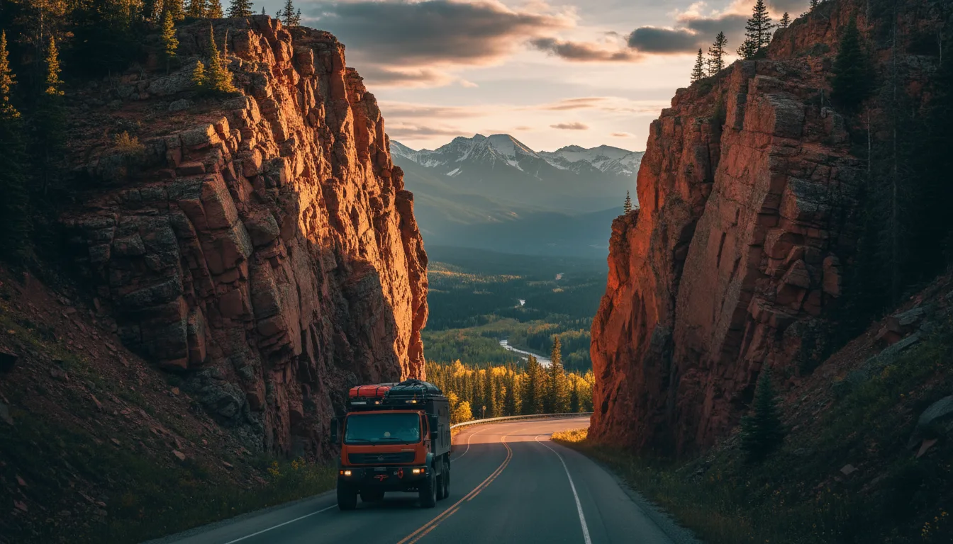
Overland rig descending Highway 93S through the red-walled Sinclair Canyon toward the broad Columbia Valley at golden hour
Trekkr Trail Journal · No. 010 · Kootenay Rockies & the Columbia Valley

The Columbia ValleyKootenay Rockies — The Complete Field Guide

Drive Highway 93S out of Banff, over the Continental Divide, and down through the red gates of Sinclair Canyon. This is where the Rockies go soft — a broad, warm valley of hot springs, a river that runs the wrong way, and bighorns grazing the village greens. Same range you left in Alberta; a different province, and a rulebook that flips. And at the end of the road, you can soak in it.

British Columbia · Canada Radium · Invermere · Fairmont In from Banff on Hwy 93S Sequel to No. 009 · The Elk Valley
~135 kmBanff to the hot springs
320 kmThe river runs north first
34 mWidest overpass in BC (outside the national parks)
0Hours you change your clock
Conditions verified 17 July 2026 · Note: the Columbia Valley keeps Mountain Time, same as Alberta · This block goes stale — the links don't

A fire-restriction summer, a closed trail, a mountain highway that closes without warning

The rest of this journal is evergreen; this box is not. Cross the Divide on Highway 93S and the paperwork is BC's, not Alberta's — and some of it is dated to the day. Check the live sources below before you commit to anything downpage.

  • Fire: Southeast Fire Centre — Cat 2 & Cat 3 already prohibited (checked 10–17 Jul 2026)As of 10–17 July 2026 the Southeast Fire Centre (which covers the Columbia Valley outside the national park) had Category 1 campfires still permitted, but Category 2 open fires prohibited from noon 10 July and Category 3 prohibited since about 21 May, running to noon 31 October or until rescinded. A full Category 1 campfire ban later in summer is near-certain — do not plan a trip around a campfire. Check the day you leave: the BC Wildfire Service map, or Southeast Fire Centre 250-318-7715. Inside Kootenay National Park, fires are Parks Canada's rules — designated pits and a ~$17/day permit — separate from the fire centre.
  • Kootenay NP: the Numa Creek trail is CLOSED until further noticeA bridge washout / debris closure on Numa Creek affects some Rockwall exits. This one is undated in our source — confirm current trail status with the Kootenay NP visitor centre 250-347-9505 (Parks Canada 1-888-773-8888) before planning a Rockwall traverse. High sections of the Rockwall stay snowbound into early-to-mid July and close again with autumn snow late September into October.
  • Hwy 93S closes for avalanche, rockslide and construction — check DriveBC on the dayThe Banff–Radium road is paved and maintained year-round, but in 2026 alone a February rockslide closed Hwy 93S (and the Radium pools), and a March avalanche-control closure followed; summer construction in Sinclair Canyon was causing delays of up to ~45 minutes into October. There is no printed guide that can predict it. DriveBC.ca (Hwy 93) is the live authority; the direct Parks Canada Kootenay status URL 404s, so use the park homepage and 511 Alberta as well.
  • New for 2026–27: BC's WILD system + Fish & Wildlife ID (FWID)Before you can buy any BC fishing licence you must create a free Fish & Wildlife ID in the new WILD system; from 1 April 2026 your FWID number plus photo ID is your proof, with no paper licence. Set it up before you leave home — Highway 93S through the park has essentially no cell signal to do it roadside. (See §17 for the full licence detail.)
  • Radium Hot Springs pools: OPEN for 2026, renovation completeThe roughly $29-million Aquacourt renovation was substantially finished in October 2024; the pools are open for the 2026 season with no closure. Fees and hours update annually — confirm at 1-800-767-1611 before you build a soak into the day.
Live sources · BC Wildfire Service map · BC fire bans & restrictions · DriveBC.ca · BC freshwater fishing
Southeast Fire Centre 250-318-7715 · Kootenay NP visitor centre 250-347-9505 · Radium pools 1-800-767-1611 · in an emergency, 911. This box was true at press and will not stay true — the sources above are the truth on the day you travel.
01 / START HERE

Cross the Divide, and the Rockies go soft

This is the sequel to No. 009. That issue crossed the Crowsnest into the Elk Valley and laid out the whole Alberta-to-BC rulebook: the dead Alberta fishing licence, the camping surcharge, the fire regime, the clocks that don't change. This issue takes the other classic crossing — the one most road-trippers make from Banff — and confirms that same rulebook for a different, warmer valley. From the Banff townsite you run Highway 1 to Castle Junction, turn onto Highway 93S, climb over Vermilion Pass (1,651 m — the Continental Divide, which here is the Alberta–BC line), and drop southwest down the Kootenay and Sinclair valleys to Radium Hot Springs. Banff to Radium is about 135 km, roughly an hour and three-quarters. The peaks soften as you go, the valley opens out, and at the bottom there is a hot spring in a red-walled canyon.

The Columbia Valley is where the Rockies stop being severe. It is a broad, sunny trench of lakes and wetlands and golf courses, warm enough to swim in, with two hot-springs resorts, a lake that holds a skating world record, bighorn sheep grazing the streets of Radium, and a river that — improbably — flows north for 320 km before it turns around. It is also, the moment your tyres cross Vermilion Pass, a different province with a different rulebook. Your Alberta fishing licence stops working. Kootenay National Park wants a federal Parks Canada pass, not your Alberta provincial one. Camp at a BC provincial park and every Alberta plate pays a $20 surcharge. The one mercy: unlike almost everywhere else you'd cross into BC, you don't touch your clock.

How to use this journal Read §02 first — it's the whole thesis on one page: what flips at the Divide and what it costs. Then go where your trip lives. Here for the soak? §03, the hot-springs double bill, gets the most room. Driving in from Banff? §04 is the road, the park and the fire scars. Camping? §11 through §14 — the federal park, the provincial parks and their $20 surcharge, and the free Crown-land option all live there. Everywhere in this issue, where our sources were blocked, down, or unverifiable, this guide says so out loud — because in a province whose rules you don't live under, the honest gap is worth more than a confident guess.
The land, named first This valley is the territory of the Ktunaxa (Kootenai) Nation, including the Akisq̓nuk First Nation at Windermere, and of the Shuswap Band (Secwépemc) near Invermere — neighbours whose communities sit side by side in the upper Columbia. The Ktunaxa have lived across this part of the Rockies for thousands of years; the Paint Pots ochre beds in Kootenay National Park (§06) were a source of ceremonial ochre long before there was a highway. We handle the Ktunaxa and Shuswap material in §16 with the sourcing it deserves, and we do not invent ceremonial detail; it matters that they are named at the top, not the bottom.
02 / THE RULEBOOK FLIP

What changes at the Divide

One province behind you, another ahead, and the same rock in between. This is the sequel's whole premise, confirmed for this valley: a side-by-side of what you're used to in Alberta and what actually applies once you're over Vermilion Pass. Every row is unpacked later; this is the map.

The thingAlberta side (Banff)BC / Columbia Valley side (here)Where
Park pass Parks Canada pass for Banff (a federal park) Still Parks Canada — Kootenay NP is also federal. The same Discovery Pass covers both. The BC provincial-park rules apply only outside the national park §04, §13
Fishing licence Your Alberta sportfishing licence Alberta licence invalid. Buy a BC freshwater licence, and register an FWID in the WILD system first — before you leave, because there's no cell on 93S §17
Camping fee National-park rate at Banff; provincial rate elsewhere Parks Canada rate inside Kootenay NP; BC Parks rate + a $20 non-resident surcharge on every Alberta plate at provincial parks; Crown-land dispersed free but capped at 14 days §11–14
Free / dispersed camping PLUZ + Public Lands Camping Pass; Kananaskis Conservation Pass Rec Sites and Trails BC + free Crown-land dispersed — no pass, no permit, firm 14-day limit §14
Fire bans Alberta advisory / restriction / ban, by Forest Area Category 1/2/3 by Fire Centre outside the park (Southeast Fire Centre; check + 250-318-7715). Inside Kootenay NP, Parks Canada rules + the $17 permit §00, §12
The clock Mountain Time Still Mountain Time — the Columbia Valley stays aligned with Alberta. No change. (Almost everywhere else in BC is Pacific, −1 hr.) §18
Liquor & cannabis All-private liquor retail Government BC Liquor Stores + private; cannabis 19+, banned in most parks §18
The two that actually catch you out Most of these rows are inconvenience. Two are the ones an Alberta habit genuinely gets wrong: the fishing licence and the park pass. An Albertan who wets a line here on their Alberta licence is fishing illegally, and the FWID that now gates every BC licence has to be set up before you leave home — there is no cell signal on Highway 93S to do it at a trailhead. And Kootenay National Park is federal, so a BC provincial pass does you no good at the gate. The comforting flip that offsets them: you never change your clock.
03 / THE HOT SPRINGS

The Rockies go soft — and you can soak in it

This is the reason this issue exists: two hot-springs resorts, twenty minutes apart, one public and one private, that turn the end of a hard mountain drive into a soak. Radium sits inside the national park in a red-rock canyon; Fairmont, down the valley, holds the largest natural mineral pools in Canada.

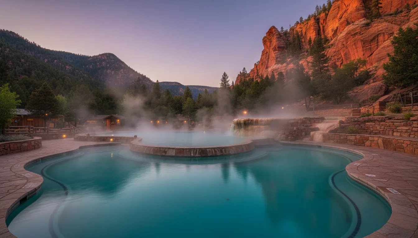
Steaming hot-springs pool set in a narrow red-rock canyon at dusk, Radium Hot Springs, illustrative render in the series style
Radium Hot Springs. The Aquacourt pools sit in the red walls of Sinclair Canyon inside Kootenay National Park — a $29-million renovation complete, and open for 2026.

Radium — Parks Canada, in the canyon

Run by Parks Canada and set right in the red gates of Sinclair Canyon inside Kootenay National Park, Radium is the public option. The hot pool runs about 37–40 °C; there's a separate, deeper cool swimming pool. The Aquacourt building is a Classified Federal Heritage Building, and it has just come through a roughly $29-million renovation — substantially finished October 2024 — so it is open and refreshed for 2026, which settles the "is Radium open?" question people keep asking.

The name is geological, not scary: Radium is named for trace radon ("radium emanation") in the water. The radioactivity is negligible — a soak amounts to less than the dose off an old luminous watch dial.

Inside Kootenay NPHot 37–40 °CRenovation complete

Fairmont — private, and the biggest pools in Canada

Down the valley, Fairmont Hot Springs is a private resort — and it holds the largest natural mineral pools in Canada. The hot pool sits around 39 °C, with public pools near 32 °C and 30 °C. You don't have to be a resort guest: walk-up day passes are sold to the public, roughly Adult $25 / Youth–Senior $22 / Family $77, with a late-night rate around $8; pools open about 8am–10pm.

Private resort · day passesHot ~39 °C
Two things to get right before you pack the towel One: the Radium fees change every year and Parks Canada altered its structure for 2026 — from 1 January 2026 it dropped group rates, punch cards and gift cards. As a planning figure, single entry is roughly $19.75 adult / $17.25 senior or youth / $64.25 family, with a day pass near $28.75 adult, and summer hours around 8:30am–10pm — but confirm all of it at 1-800-767-1611 before you rely on a number. Two — and this one's a genuine trap: there is a Fairmont Hot Springs resort in Montana with the same name and completely different rules (reservation-only, with 2026 pool construction). Everything in this guide refers only to the BC resort at fairmonthotsprings.com. Don't let the Montana one leak into your plan.
And a few holes to soak in besides Two more soaks sit within reach, both covered later where their access lives: Lussier Hot Springs — natural, free, undeveloped riverside pools at about km 17.5 of the Whiteswan Lake FSR (§13) — and the golf. The Columbia Valley Golf Trail strings roughly a dozen courses from Radium to Fairmont, Greywolf at Panorama the marquee among them, if your idea of "the Rockies going soft" runs to a fairway rather than a fault line.
04 / THE DRIVE

Highway 93S — the first road across the Central Rockies

The classic approach from Alberta is also a piece of history: the Banff–Windermere Road was the first motor road driven across the Central Canadian Rockies, and Kootenay National Park exists because BC traded land to get it finished. You drive through fire scars and down a red canyon to reach the valley.

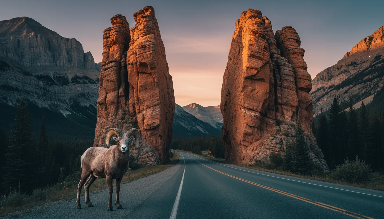
Tall red-rock canyon gates with a bighorn ram standing on the roadside, Sinclair Canyon, illustrative render in the series style
Sinclair Canyon, the south gate. Highway 93S threads red-rock walls to reach Radium — and bighorn stand on the road here. Slow down; don't stop in the canyon.

The park that a road built

Kootenay National Park was created in 1920 under the Banff–Windermere Road Agreement: BC ceded a strip of land roughly 8 km on each side of the planned road — about 1,600 km² — in exchange for the federal government finishing the highway. The road itself was completed in 1922 and officially opened in 1923, and it was the first motor road across the Central Canadian Rockies (the Kicking Horse route through the field followed a few years later). So the park is, in a real sense, the price of the road.

The "first across the Central Rockies" wording is a superlative worth keeping precise — it's the Central Rockies specifically, and the 1922/1923 dates are the completed/opened distinction. Both are as our sources framed them.

The road, honestly

Banff townsite → Hwy 1 to Castle Junction → Hwy 93S southwest over Vermilion Pass (1,651 m, the Continental Divide and the AB–BC line) → down the Kootenay and Sinclair valleys through Sinclair Canyon to Radium's south gate. Reckon about 135 km and 1 h 45 — some sources quote ~105 km, which is low; 135 is right. It's paved, 90 km/h, maintained year-round. But it's a mountain highway: expect the seasonal avalanche and rockslide closures and construction from §00, and no cell signal for most of it.

Banff→Radium ~135 kmNo cell signal

You drive through the burns

Kootenay is a fire park, and the road shows it. You pass through the scars of the 2003 Tokumm–Verendrye fire (roughly 16,000–17,400 ha, about 41% high-severity), and the park also carries the 2017 Verdant Creek fire (~18,017 ha) and the older 1968 Vermilion Pass burn (~1,500 ha), the last of which the Fireweed Loop interprets at the Divide. Standing dead timber and a floor of fireweed isn't damage to drive past quickly — it's the park's actual ecology.

The federal-pass gotcha

Because Kootenay is a federal national park, you need a Parks Canada pass — a day pass around $11 adult (2026 figure, confirm), or a Discovery Pass at roughly $75.25 adult / $151.25 family that covers all the Rockies national parks for a year. Coming from Banff you likely already hold one. Parks Canada advertised free admission 19 June – 7 September 2026 and a 25%-off camping promo in the same window — verify both before you count on them. Your BC provincial pass is no use at this gate.

05 / THE RIVER

The river that runs the wrong way

The Columbia is the fourth-largest river in North America by volume, and it starts here — at the bottom of this valley, in a lake near Canal Flats. Then it does something that reads like folklore but is simply true: it flows north for 320 km before it ever turns toward the ocean.

North first, then the Big Bend

The Columbia rises at Columbia Lake, near Canal Flats, at about 820 m, and instead of heading for the Pacific it flows north — roughly 320 km — straight up the Rocky Mountain Trench through Windermere Lake, Invermere and Golden. Only up near the Selkirks does it swing around the "Big Bend" and finally turn south for the ocean. Stand at Columbia Lake and the river at your feet is running away from the sea it's bound for.

"Big Bend" here means the BC loop around the Selkirks — not Washington's Big Bend country downstream.

Canal Flats, and the canal that barely worked

Canal Flats is named for the 1889 Baillie-Grohman Canal, which briefly linked the Columbia and Kootenay rivers. It's a quirk of geography: the Kootenay passes within about 1.25 miles of Columbia Lake but sits roughly 11 feet higher. The canal was a near-total failure — only two vessels ever transited it: the Gwendoline in 1894, and the North Star in 1902. And on that last passage, Captain Frank Armstrong simply dynamited the lower lock gates to squeeze his sternwheeler through.

1889 canal · 2 vessels ever
A true story that reads like a tall one This is the kind of history we'd normally flag as folklore and debunk — except it's documented and it happened. A canal that linked two great rivers and was used twice; a riverboat captain who blew up the locks rather than wait. It's real, and it's the sort of thing worth pulling over at Canal Flats to stand and look at, knowing the water in front of you starts a 2,000 km journey to the Pacific by first heading the opposite way.
06 / ON FOOT

Kootenay National Park hikes

Kootenay packs a full range into one park: a 30-minute slot canyon, a family boardwalk, the ochre Paint Pots, a classic larch lake under a cliff wall, and a multi-day traverse of the Rockwall. The distances below come straight from Parks Canada's own day-hike page and are solid — but one trail is closed, and two others we could not verify at all.

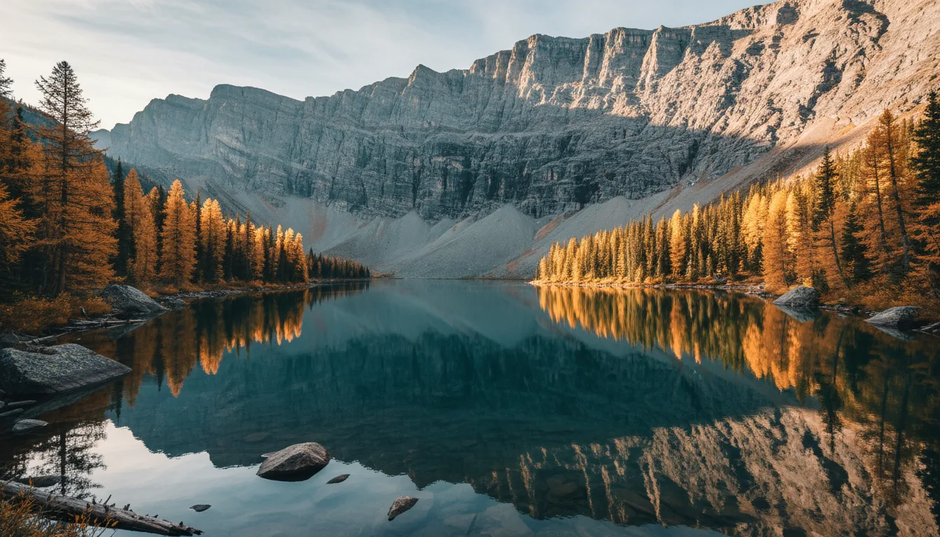
An alpine larch lake beneath a long grey cliff wall in autumn gold, Floe Lake and the Rockwall, illustrative render in the series style
Floe Lake & the Rockwall. The classic Kootenay objective — larch, a green lake, and a grey wall of rock. A long day out, or the front door to a multi-day traverse.
TrailOne-wayElevationReturn timeTrailhead (from Radium)
Marble Canyon0.9 km+65 m30 min89 km N — blue-green slot canyon
Paint Pots1.0 km+35 m40 min86 km N — iron-ochre springs, historic Ktunaxa ochre site
Stanley Glacier4.9 km+405 / −115 m~3 hrStanley Glacier lot, 91 km E
Dog Lake7 km loop+195 m2.5 hr28 km N
Sinclair Canyon2.8 km+350 m2 hrAbove the Radium pools
Redstreak Creek2.3 km+200 m1.5 hr6 km E of Radium
Floe Lake10.8 km+1,120 m7 hr / 2 days72 km E — the classic larch + Rockwall lake
The Rockwall (multi-day)54.1 km+3,405 / −3,500 m3–5 daysPaint Pots ↔ Floe Lake, point-to-point; 5 backcountry campgrounds
Kindersley Pass10 km+1,250 mDifficult, full dayHwy 93S SW of Radium

Distances and elevations above are from Parks Canada's Kootenay day-hike page (one-way distance; the "time" column is for the return) — a reliable land-manager source. Easy and family options not tabled: Olive Lake (0.3 km accessible boardwalk, 12 km N), Valleyview (1.3 km from Redstreak campground), and the Fireweed Loop (0.2 km at the Continental Divide, interpreting the 1968 burn).

Closed, snowbound, and two we couldn't verify The Numa Creek trail is CLOSED until further notice (bridge washout/debris), which affects some Rockwall exits — our source for this is undated, so confirm with the Kootenay NP visitor centre at 250-347-9505. The Rockwall's high sections stay snowbound into early-to-mid July and close again with autumn snow late September into October. And two trails you may see named elsewhere — Kaufmann Lake (a long backcountry route, not on the day-hike list) and a standalone "Juniper Trail" — we could not verify, so we've deliberately printed no distances for them. Phone the visitor centre before building a day around either.
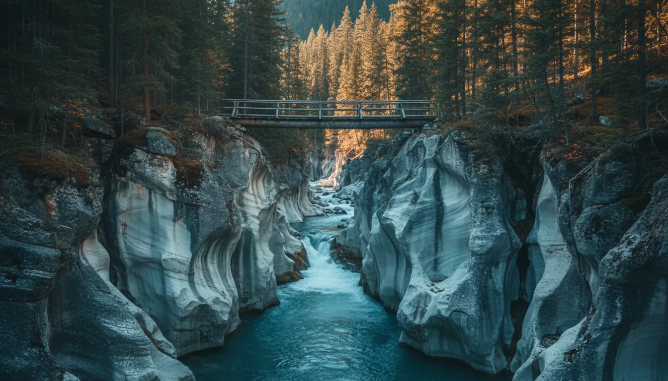
A deep blue-green glacial slot canyon crossed by a log footbridge, Marble Canyon, illustrative render in the series style

The three short ones worth stopping for

Marble Canyon is a 30-minute walk over footbridges above a deep blue-green glacial slot — the highest-value-per-minute stop in the park. The Paint Pots, a kilometre in, are cold iron-ochre springs that stain the ground orange and red; this was a source of ceremonial ochre for the Ktunaxa, and it's handled with that in mind in §16. And Olive Lake's 300 m accessible boardwalk is the one everyone in the vehicle can do.

Between them they make a half-day of short stops on the drive in — no commitment, and no need for the weather or the snowpack to cooperate.

07 / THE LAKE TOWN

Invermere & Lake Windermere

Invermere is the valley's hub — the full-grocery, full-service town on the shore of a warm, shallow lake. In summer it's a beach town; in a good winter it clears a skating trail across the lake that once held a Guinness world record.

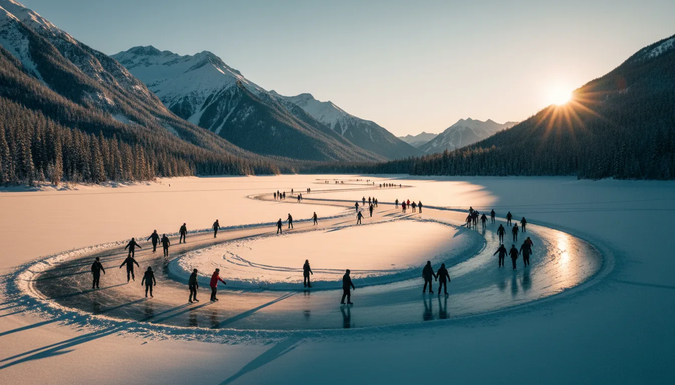
Skaters on a long cleared ribbon across a frozen mountain lake in winter, the Lake Windermere Whiteway, illustrative render in the series style
The Lake Windermere Whiteway. A record-holding skating ribbon of roughly 30 km when the ice cooperates — skate, ski and fat-bike lanes across a frozen mountain lake.

The Whiteway — the world-record ice

The Lake Windermere Whiteway was certified by Guinness on 14 February 2014 as the world's longest naturally frozen skating trail, at 29.98 km. Maintained by the Toby Creek Nordic Club, it carries separate skate, ski and fat-bike lanes, with access from Kinsmen Beach in Invermere and Windermere Beach and a roughly $5 donation. Treat "the record-holding ~30 km trail" as the honest description — it's entirely weather-dependent, and length and opening vary year to year with the ice.

~30 km · weather-dependent

The summer lake, and the town

In summer, Lake Windermere is a warm, shallow lake — beaches, paddleboarding, boating, the easy centre of a valley holiday. Invermere is the full-service hub: a Sobeys at 750 4th Street, AG Valley Foods at 906 7th Avenue, fuel, and the valley's 24-hour hospital (§18). If you're stocking up, fixing something, or need care, this is the town you do it in — services thin out fast north and south of here.

08 / THE WETLANDS

The Columbia Wetlands — paddle-only, and internationally protected

Running the length of the valley beside the highway is one of the longest undisturbed wetland systems in North America — a Ramsar Wetland of International Importance, a Pacific Flyway stopover, and, because power boats are banned, a place you can only really see from a canoe.

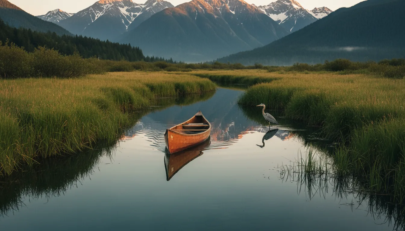
A canoe drifting a glassy wetland channel among reeds and herons with mountains beyond, the Columbia Wetlands, illustrative render in the series style
The Columbia Wetlands. Roughly 180 km of channels and marsh along the Rocky Mountain Trench — power boats and water-skiing prohibited, so it stays quiet enough for herons.

A Ramsar site, and why it's quiet

The Columbia Wetlands were designated a Ramsar Wetland of International Importance on 5 June 2005 (Ramsar #1463) — Canada's 37th. The system runs roughly 180 km along the Trench from Columbia Lake toward Donald and Mica, and is described as one of the longest undisturbed wetlands in North America (that superlative is attributed, not our measurement). Crucially, power boats and water-skiing are prohibited — this is paddle-only water, which is exactly why it stays wild.

Honesty flag: the official Ramsar information page (RSIS) returned a 502 error when we checked, so the area figure often quoted (~16,969 ha) comes from strong secondary sources, not the primary record. Re-verify the hectares if you need an exact number.

The birds

It's a Pacific Flyway corridor: reported to see 250-plus migrating species and to support 300-plus nesting pairs of Great Blue Heron. Paddle the flatwater channels — from access points around Wilmer and Invermere — among reeds, herons and ospreys, and you're moving through one of the more important bird habitats in this part of the continent. Slow, silent, and closed to the motorboats that would otherwise own it.

Pacific FlywayPaddle-only
09 / THE HIGH COUNTRY

Panorama, and the Bugaboo spires

West of the valley the Purcell Mountains rise into a resort with a top-ten North American vertical and, beyond it, some of the most serious alpine granite on the continent. One is a lift ticket; the other is emphatically not a hike.

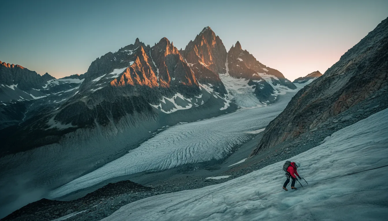
Sharp granite spires above a glacier, Bugaboo Provincial Park, climber's country, illustrative render in the series style
The Bugaboos. Granite spires over 3,000 m — Snowpatch, Bugaboo, Howser. World-class alpine climbing, and, in BC Parks' own words, for experienced, well-equipped climbers only.

Panorama Mountain Resort

Up Toby Creek from Invermere, Panorama is a big resort: around 2,975 acres, 135 runs, 10 lifts, and a vertical of 1,300 m (4,265 ft) — one of the top-ten verticals in North America. In summer it runs a bike park from late June into mid-September, and Greywolf is the marquee golf course. One 2026 note to confirm: reports of no lift above the Mile 1 Express to the Hopeful trails — check current lift status with the resort before you plan on it.

Vertical 1,300 mGreywolf golf

Bugaboo Provincial Park — not a casual hike

Bugaboo Provincial Park protects granite spires over 3,000 m — Snowpatch, Bugaboo, Howser — that are world-class alpine climbing and mountaineering objectives. BC Parks is blunt that this is for experienced, well-equipped climbers only, not a day-hike. The Conrad Kain Hut (built 1972, run with the Alpine Club of Canada, sleeps about 35) closes 16 November – 30 April for avalanche season. This is base camp for a serious range, not a viewpoint stroll.

The road in — and a piece of local lore, flagged as lore Access is the Bugaboo Forest Service Road: about 50 km of gravel from Highway 95 at Brisco (~25 km north of Radium), drivable late spring to late fall. It's an active logging road — lights on — and the rough final stretch favours ground clearance, though 4WD isn't strictly required. One thing we will not state as fact: the well-known story that porcupines chew vehicle brake lines at the trailhead, so climbers wrap their rigs in chicken wire, is real local lore but does not appear on the BC Parks page. Treat it as a story worth knowing, not a verified instruction — though a look under the vehicle never hurt anyone. (The Bugaboos are also the birthplace of commercial heli-skiing via CMH; cite CMH for that.)
10 / SHORT STOPS

Hoodoos, and the sea monster's ribs

Between the big objectives are the quick ones — a set of sandstone pinnacles above Columbia Lake with a Ktunaxa story attached, and a boardwalk beside a turquoise pool. Worth a stop, not a day.

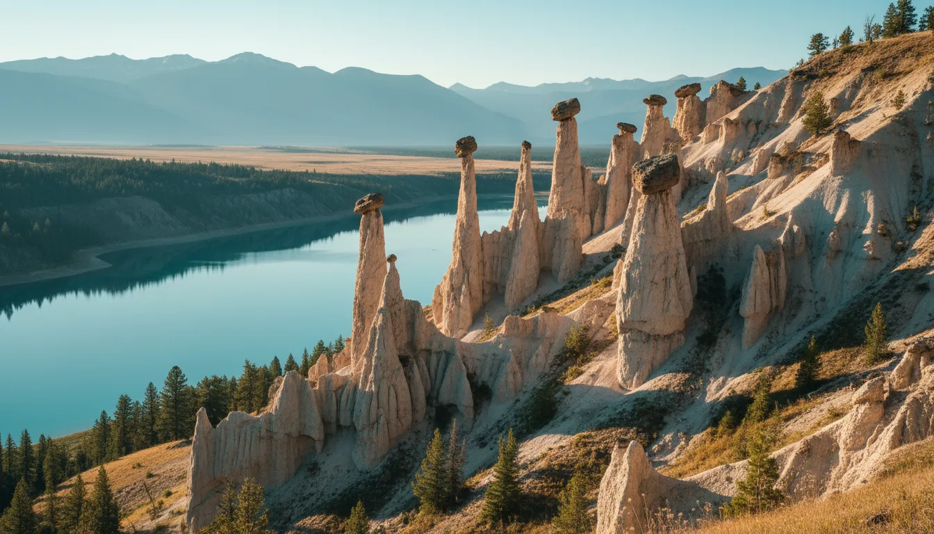
Pale sandstone hoodoo pinnacles above a turquoise lake, the Dutch Creek Hoodoos above Columbia Lake, illustrative render in the series style
The Dutch Creek Hoodoos. Sandstone and glacial-till pinnacles on Hwy 93/95 just south of Fairmont — and, in Ktunaxa story, the ribcage of a sea monster.

The Dutch Creek Hoodoos

Just south of Fairmont, where Dutch Creek meets Highway 93/95, a run of sandstone and glacial-till pinnacles rises above the road. You can view them from the highway bridge below, or hike roughly 3 km up an old Westside Road to a viewpoint over Columbia Lake (that trail figure is approximate — confirm locally). The surrounding conservation area is habitat for badger and Lewis's woodpecker.

The story, attributed

In Ktunaxa oral tradition, the hoodoos are the ribcage of the sea monster Yawuʔnik̓. We record that as a story belonging to the Ktunaxa, attributed and not embellished — we don't invent ceremonial detail around it. It's a good thing to know standing under the pinnacles, told plainly, the way it should be.

Nearby, Olive Lake back up in the park (§06) gives you the turquoise-pool boardwalk stop; between the two you have the valley's easy wins.

11 / NATIONAL-PARK CAMPING

Camping inside Kootenay National Park

Three Parks Canada campgrounds run down the park, from the big serviced base above Radium to two smaller unserviced grounds further in. Fees here are Parks Canada's, not BC's — and the year on them wasn't confirmed, so treat every dollar figure as approximate and check at booking.

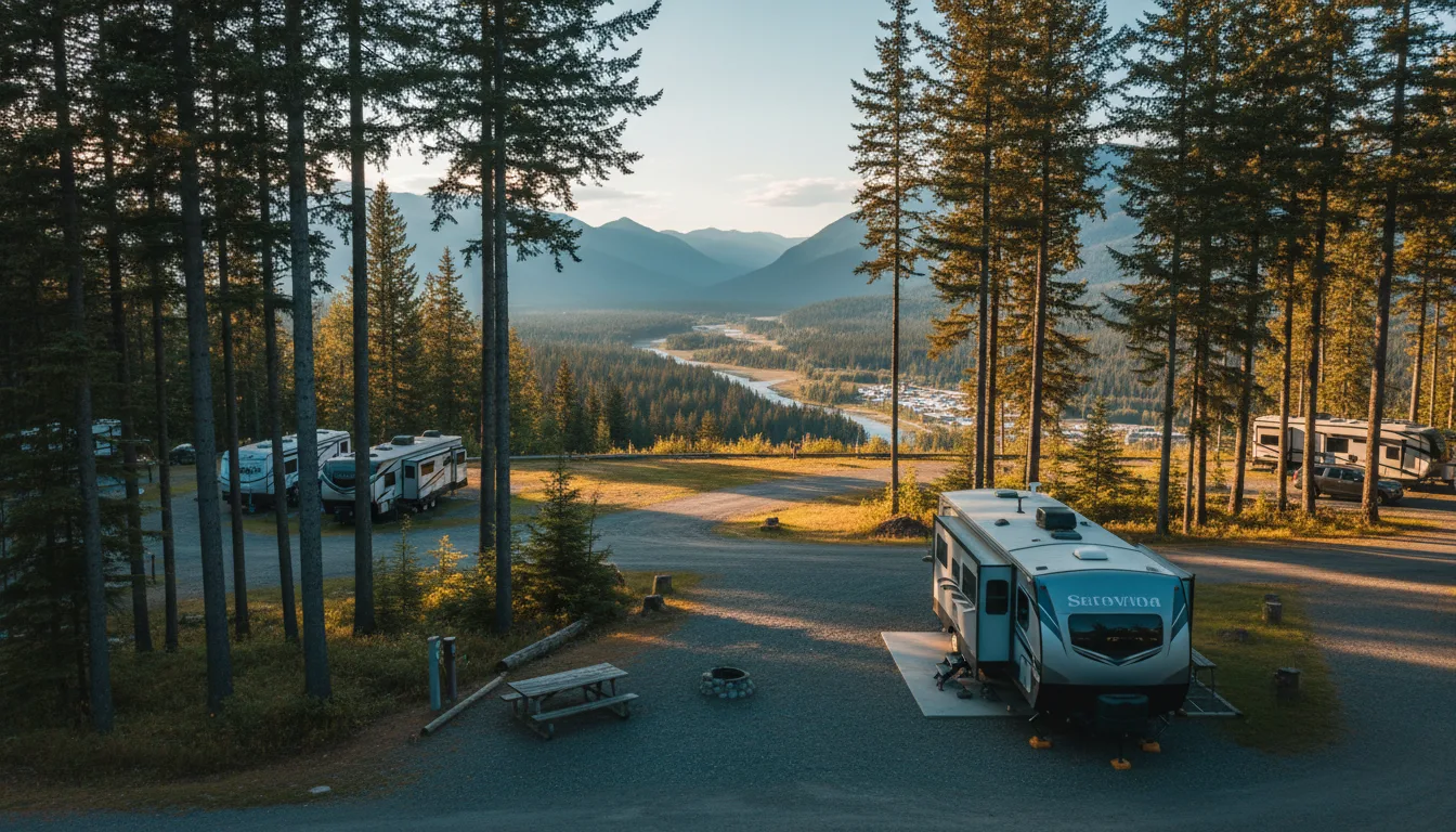
A forested RV and vehicle campground on a bench above a valley, Redstreak campground above Radium, illustrative render in the series style
Redstreak, above Radium. The park's big one — 242 sites and the only Kootenay campground with hookups, on a forested bench 2.5 km above the village.

Redstreak

2.5 km above Radium — the big one, and the only NP campground with hookups. 242 sites (10 oTENTik, 50 full hookup, 38 electrical, 144 unserviced). Season 6 May – 12 Oct 2026, all reservable at reservation.pc.gc.ca. Sani dump, potable water, showers.

Fees (year unconfirmed, approx): unserviced ~$34 · electrical ~$40 · full hookup ~$47.25 · oTENTik ~$147.50. Confirm at booking.

McLeod Meadows

On the Kootenay River, about 27 km south of Radium. 88 unserviced sites, season 4 Jun – 13 Sep 2026, reservable. Sani dump, potable water, flush toilets, no showers.

Fee (year unconfirmed, approx): unserviced ~$26.75. Confirm at booking.

Marble Canyon

Sub-alpine, at the north end of the park by the canyon. 60 unserviced sites, season 18 Jun – 7 Sep 2026, reservable. Sani dump, potable water, no showers.

Fee (year unconfirmed, approx): ~$26.75. Confirm at booking.

The fire permit, the promo, and the backcountry Inside the national park a campfire needs a Parks Canada fire permit — about $17 per day — which is separate from your camping fee and follows Parks Canada's rules (designated firepits), not the BC fire centre. Parks Canada also advertised a 2026 promo of free park admission plus 25% off camping, 19 June – 7 September 2026 — verify it before you count on it. Backcountry sites (the Dolly Varden / backcountry options) aren't on the frontcountry page; confirm those directly at 250-347-9505. And all the Kootenay fees here are flagged approximate because the source didn't state the year explicitly — check the current figure when you reserve.
12 / BC PARKS CAMPING

Provincial parks, and the $20 on your plate

Outside the national park, the provincial parks are the other serviced option — Dry Gulch right by Radium, Premier and Whiteswan further out, the last of them home to a free natural hot spring. And new for 2026, every Alberta plate pays a surcharge to camp in any of them.

The $20 non-resident surcharge — new for 2026, aimed at you BC Parks now adds a $20 non-resident surcharge per stay (not per night) for anyone who can't show BC residency — on reservations, first-come sites and backcountry alike, for stays from 15 May 2026. It hits every Alberta plate at Dry Gulch, Premier Lake, Whiteswan and every other BC provincial campground. Bring proof of BC residency or pay it. Note this is a provincial-park charge — it does not apply inside Kootenay National Park, which is federal.

Dry Gulch Provincial Park

Just 4.5 km south of Radium — the closest provincial campground to the hot springs. The BC Parks page doesn't state a current site count, season or fee, and the operator is EK Parks Ltd, 250-422-3003. We're deliberately not printing a site count — confirm it with the operator.

Premier Lake Provincial Park

About 72 km north of Cranbrook, in via 12 km of paved-then-gravel road. 57 sites, no drive-throughs, reservable. Fees aren't stated on the page — confirm at booking, and add the $20 surcharge.

Whiteswan Lake Provincial Park

In via ~25 km of the Whiteswan FSR (gravel). Roughly 115 sites across several campgrounds — Alces Lake (sani dump), Packrat Point, Inlet Creek, Home Basin — and home to Lussier Hot Springs, natural and free, around km 17.5.

The ~115 count wants a primary re-check, and the ~$20–23 fees are aggregator-only — verify at camping.bcparks.ca.

Source honesty: the 2026 BC Parks fee schedule PDF wouldn't render for us, so we've held back exact per-night dollar figures for these parks rather than print a number we couldn't read — get the clean schedule from camping.bcparks.ca before you budget. Two nearby parks sit on the edge of this guide's scope: Kikomun Creek (on Lake Koocanusa, closer to No. 009's ground) and Height of the Rockies (backcountry only). Bugaboo Provincial Park is backcountry-only too (§09) — not a drive-in RV option.

13 / THE FREE OPTION

Rec Sites, and BC's free Crown land

This is what Albertans come to BC for: free dispersed camping on Crown land, no pass and no permit, the same framework as No. 009. The trade is a firm 14-day limit and no facilities — and, this time, a government website that wouldn't load, so we won't name the sites.

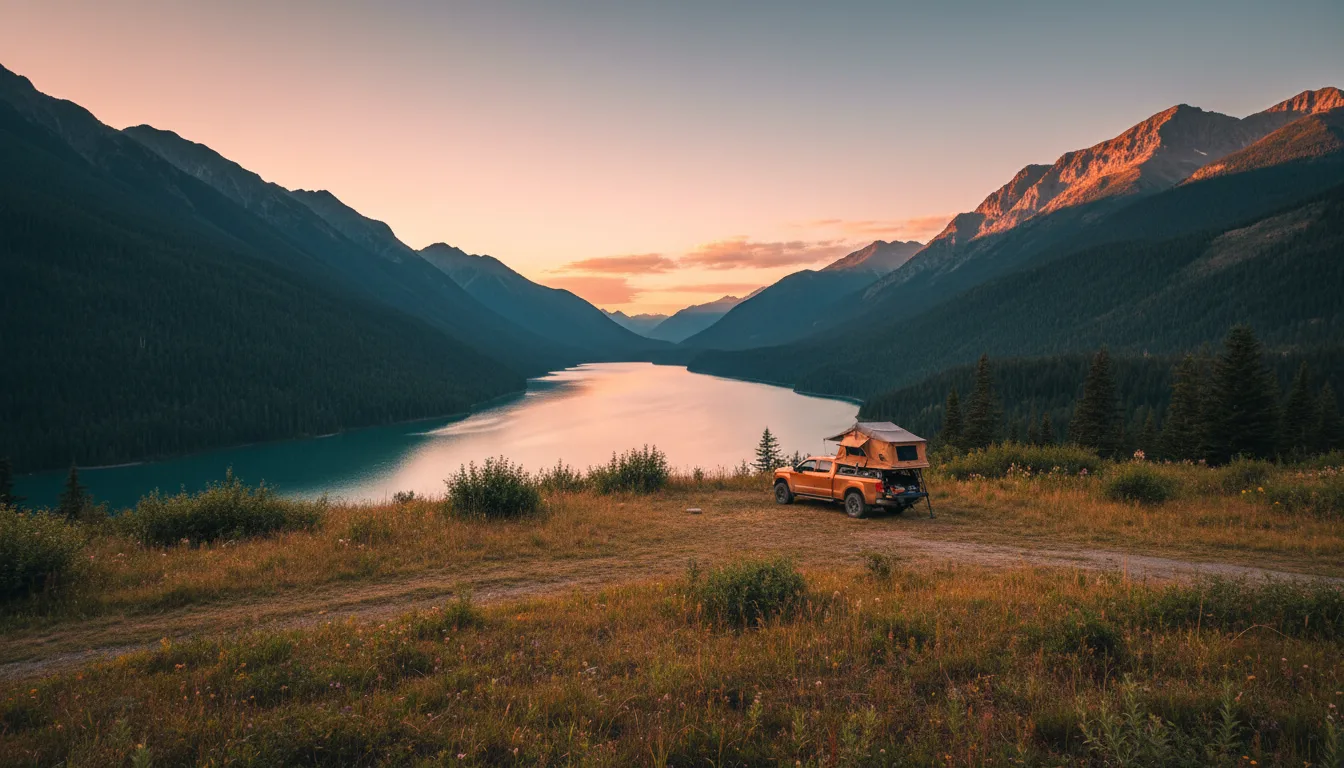
A free dispersed camp on a grassy bench above a long trench lake with no facilities, illustrative render in the series style
The free wild. BC Crown-land dispersed camping costs nothing and needs no permit — but the clock runs at 14 consecutive days, there's no potable water, and you pack everything out.
Source honesty — the government's own site returned nothing, so we name no sites sitesandtrailsbc.ca is JavaScript-only and returned an empty page on every attempt. It's the authoritative government source for Rec Sites, and we could not read it — so this guide deliberately prints no named rec sites, no coordinates and no site counts. A wrong free-camp location is the worst defect a guide like this can have. What we can tell you honestly is the corridors known for dispersed and rec camping in this valley — the Whiteswan and Lussier FSR area, Wilmer and Westside Road by the Wilmer wetlands, the Horsethief and Toby Creek FSRs, and Cross River / Settlers Road near the Kootenay NP boundary — and to open the RSTBC map in a real browser, or phone Rec Sites and Trails BC, to get the actual sites before you commit.

BC Crown-land camping rules

  • Free short-term dispersed camping on unreserved, unrestricted Crown land — no fee, no permit, no booking (excludes tenures, parks and sensitive areas)
  • 14 consecutive days maximum, then relocate — the same limit as Alberta, and no PLUZ-style pass and no Kananaskis-style pass exists in BC
  • RSTBC manages 1,200+ recreation sites province-wide — typically a fire ring and a pit toilet, and no potable water. Bring your own
  • At managed rec sites: 14-day max, pay any posted fee, fires 0.5 m × 0.5 m in the ring, keep water and a hand tool, never leave a fire unattended, out cold, pack everything out

The comparison worth making — vs Alberta

There is no BC equivalent of the Kananaskis Conservation Pass or the Public Lands Camping Pass. BC Crown-land dispersed camping is free and permit-free — which sounds like a clean win over Alberta until you add up the trade-offs: a firm 14-day limit, the $20 non-resident surcharge the moment you want a serviced BC Parks site, fire rules run by Category and Fire Centre, and no potable water at the free sites. Free to camp, then — but you pay in self-sufficiency and in the surcharge.

14 / SERVICED SITES

Private RV parks

When you want hookups, laundry and a dump station instead of self-sufficiency, the valley's private RV resorts fill the gap — and none of them carries the BC Parks non-resident surcharge. Verify open-status and hookups on each operator's own site before you rely on it.

ParkWhereWhat's thereConfidence
Fairmont Hot Springs RV Resort Fairmont 290 sites (217 full hookup, 65 pull-thru), 15/30/50A, laundry, pool, walk to the springs; on-site sani dump. Spruce Grove Campground also on-property High · fairmonthotsprings.com/rv
RidgeView Resort 7274 Radium Valley Rd, Radium Full-service RV, 100+ acres, paved, fits big rigs, 30+ years operating High · ridgeviewresort.ca / 1-800-663-9906
Canyon RV Resort 5012 Sinclair Creek Rd, Radium RV sites near the canyon and the pools Medium · verify operator/hookups
Edgewater Hilltop Par 3 Golf & RV 5585 Hwy 95, Edgewater RV sites with a par-3 course attached Medium · verify operator/hookups
Raven's Nest / Valley's Edge / Quinn Creek Wetlands / valley / Golden–Radium A mix of glamping, camping and RV options along the valley Medium · verify each before relying on it
Dump, water & propane — verify the addresses Confirmed sani dumps: the three national-park campgrounds (Redstreak, McLeod Meadows, Marble Canyon) and Fairmont Hot Springs RV Resort; Whiteswan's Alces Lake has one at medium confidence. Potable water is at the three NP campgrounds; the free rec sites have none, so bring your own. Radium, Invermere and Fairmont have retail propane, but we couldn't vendor-verify specific addresses — phone ahead, and cross-check sanidumps.com. The general rule holds: fill fuel and propane in Invermere before any FSR or backcountry leg.

More operators are listed at columbiavalley.com and travelcolumbiavalley.com. We've kept this table to operators we could name with confidence; unverified names don't go in this guide.

15 / WILDLIFE

Bighorns in the streets, and the widest overpass in BC

Radium's signature isn't a peak — it's the bighorn herd that grazes the village greens and the highway slopes. For decades the highway south of town was a killing zone for them; now a record-width wildlife overpass carries them safely across.

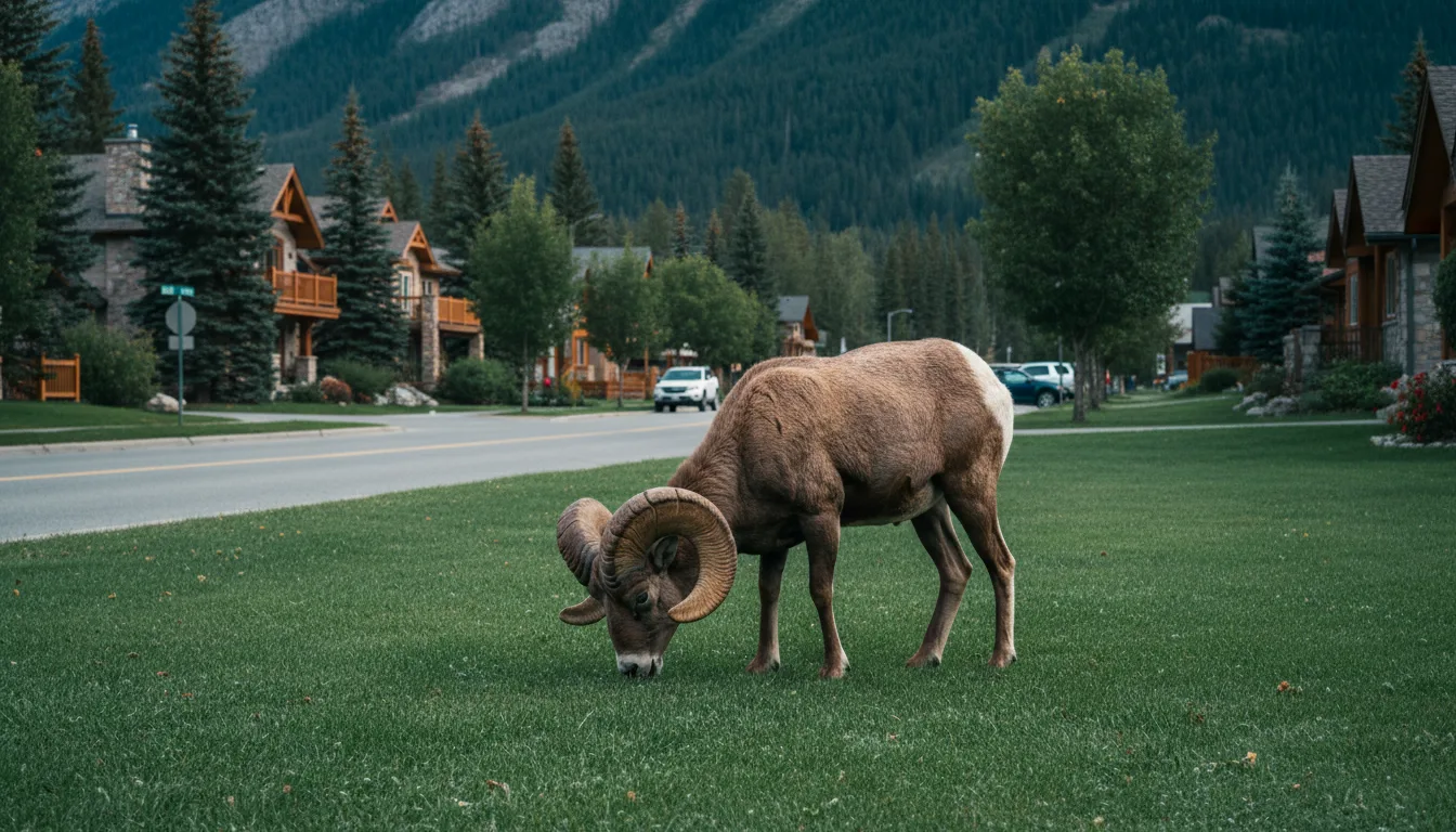
A bighorn ram grazing on a village green beside a roadside in the town of Radium, illustrative render in the series style
The Radium–Stoddart herd. Bighorn graze right in the village — on lawns, highway slopes and golf courses. They're the reason to drive Sinclair Canyon and Mile Hill slowly.

The herd that lives in town

The resident Radium–Stoddart bighorn herd grazes inside the village of Radium Hot Springs — on lawns, highway verges and golf courses. They are genuinely urban sheep, and Mile Hill, just south of Radium, was for decades a bighorn "killing zone" where the highway cut straight through their range.

Drive Sinclair Canyon and Mile Hill accordingly: bighorn stand on the road at the south gate. Slow down, and don't stop in the canyon itself.

The 34-metre overpass

The fix is a new wildlife overpass at Mile Hill, 34 m wide — the widest in BC outside the national parks — linking park land on the east to the Columbia Wetlands on the west. It's built for the whole cast that uses this corridor: bighorn, badger, bear, cougar, deer and elk. It's in operation as of 2026. This valley is a working piece of the north–south wildlife corridor down the Rocky Mountain Trench, and the overpass is what keeps it connected across the highway.

34 m · widest outside the parks
16 / HISTORY & THE PEOPLE

The first post, and the first peoples

Europeans entered the whole Columbia basin here, at a fur post above Invermere in 1807. But the valley was Ktunaxa and Shuswap land for thousands of years before that, and remains their territory now — named properly, and framed as they frame it.

The Ktunaxa, the Akisq̓nuk and the Shuswap Band

This is the territory of the Ktunaxa (Kootenai) Nation, including the Akisq̓nuk First Nation on Lake Windermere, and — unusually — of the Shuswap Band (Secwépemc) near Invermere, whose community sits alongside the Ktunaxa in the upper Columbia. The Paint Pots ochre beds (§06) were a source of ceremonial ochre, and the Dutch Creek Hoodoos (§10) carry the Ktunaxa story of the sea monster Yawuʔnik̓.

We name these Nations at the top of the guide and here, attribute their stories to them, and do not invent ceremonial detail — including no unsourced "legend" about the hot springs. The reconciliation framing isn't a footnote; it's how this land is properly described.

Kootenae House & David Thompson

In 1807, the mapmaker and fur trader David Thompson built Kootenae House near present-day Invermere — the first fur-trade post on the Columbia and the point of European entry into the whole Columbia basin. It was made a National Historic Site in 1934. (Parks Canada uses the spelling "Kootenae House.")

The valley's more recent shape — the park and the road of §04 — came out of the 1920 land-for-road deal. Coal, canals, fur and highways: the Columbia Valley has been a corridor for everyone who ever tried to cross this stretch of the Rockies.

17 / FISHING

The Alberta licence that stops at the Divide

The fishing rule is the same one No. 009 spelled out, and it catches Albertans here too: your Alberta licence is worthless in BC, the FWID that now gates every BC licence has to be set up before you leave, and whether these particular valley waters are "classified" is something we could not verify — so we won't tell you they aren't.

The FWID, before you leave home

Your Alberta licence doesn't work here — you need a BC freshwater licence. New for 2026–27, from 1 April 2026, you must first create a free Fish & Wildlife ID (FWID) in the WILD system; after that your FWID number plus photo ID is your proof, with no paper licence. The trap: set the FWID up before you leave home, because Highway 93S has no cell signal to do it roadside, and you don't want to discover that at the river.

Non-resident (Albertan) fees, 2026–27, pre-tax and approximate: annual ~$62.87 · 8-day ~$41.15 · 1-day ~$22.86. Single barbless hook mandatory on all Region 4 streams, year-round.

Classified waters — what we won't claim

The famous Classified Waters — the ones needing an extra river-specific stamp — are mostly in the Elk and southern Kootenay (the Elk, St. Mary, Skookumchuck, Bull, Wigwam), which No. 009 covers. For this valley's waters — the upper Columbia, Lake Windermere, Whiteswan, Premier — we could not verify whether any carry a classification, so we will not tell you they're class-free. Lakes usually aren't classified, and Whiteswan is largely no-fishing except a short seasonal outlet-stream section. Confirm the specifics with FrontCounter BC, 1-877-855-3222, before you cast.

The single strongest gotcha in this issue Two Alberta habits get you here: your fishing licence doesn't work, and Kootenay National Park is federal (a Parks Canada pass, not your provincial one). Set up the FWID before you leave — there's no cell on 93S to do it later. The single comfort that offsets both: you never change your clock — the Columbia Valley runs Mountain Time with Alberta.
18 / FUEL, MEDICAL & THE SMALL PRINT

Where the help is, and the rules that don't fit elsewhere

Invermere has the hospital and the groceries; the national-park drive has no signal at all; and the small BC-versus-Alberta details — the clock, the cannabis, the dog — sit here too. The safety-critical numbers are verified; the small-town hours change, so call.

WhereEmergency careFuel & suppliesField notes
Invermere Invermere & District Hospital, 850 10th Ave · 250-342-9201 · ER listed 24 hours The valley hub: Sobeys, AG Valley Foods, fuel (Crossroads Esso, 548 Hwy 93/95), pharmacies Small rural ER — can divert; call ahead. Stock up here
Radium / Fairmont / Canal Flats Nearest ER is Invermere Radium (Mountainside Market + gas), Fairmont (Mountainside Market), Canal Flats (village) Fuel up before FSRs or backcountry; stations open and close
Golden Nearest ER at Invermere or on to Cranbrook Full services, about an hour north The top-of-valley resupply if you're heading to the Big Bend
Cranbrook East Kootenay Regional Hospital · ER 24/7 Full regional services The nearest major hospital — about 1.5 hr south

Time zone — the good news

You do not change your clock coming from Banff. The BC government explicitly lists Radium Hot Springs, Invermere, Golden, Cranbrook, Kimberley, Fernie, Sparwood and Elkford as staying on Mountain Time, aligned with Alberta and exempt from BC's permanent-Pacific move — you keep switching UTC-7 in winter and UTC-6 in summer, same as home. Councils could change it in future; as of 2026 they haven't.

Cell signal & the FSRs

Valley towns are fine; Highway 93S through Kootenay National Park is largely no signal, and the FSRs — Bugaboo (~50 km gravel from Brisco), Toby Creek beyond Panorama, Westside Road, the steep radio-controlled Whiteswan FSR — are dead zones. We couldn't verify a carrier map, so assume no signal off the highway, carry a satellite communicator, and leave a trip plan.

Cannabis, liquor & dogs

Cannabis: legal at 19+, but no smoking or vaping in BC provincial or municipal parks except designated sites, and Kootenay NP has Parks Canada's rules. Liquor: government BC Liquor Stores plus private (not grocery). Dogs: on-leash in BC Parks frontcountry (some backcountry bans), and on-leash at all times in Kootenay National Park.

Numbers on paper Emergencies 911 · Kootenay NP visitor centre 250-347-9505 (Parks Canada 1-888-773-8888) · Radium pools 1-800-767-1611 · Invermere & District Hospital 250-342-9201 (ER 24h) · Southeast Fire Centre 250-318-7715 · report a wildfire 1-800-663-5555 or *5555 · FrontCounter BC (fishing) 1-877-855-3222 · EK Parks (Dry Gulch operator) 250-422-3003 · DriveBC.ca (Hwy 93) · 511 Alberta · reservation.pc.gc.ca · camping.bcparks.ca.
19 / THE KIT

What crosses the Divide with you

Most of this rig is the same as any Rockies trip. What's different is the paperwork you need because you crossed a provincial line — the BC licence and FWID, the federal park pass — and the water and swim kit for a valley that's actually warm.

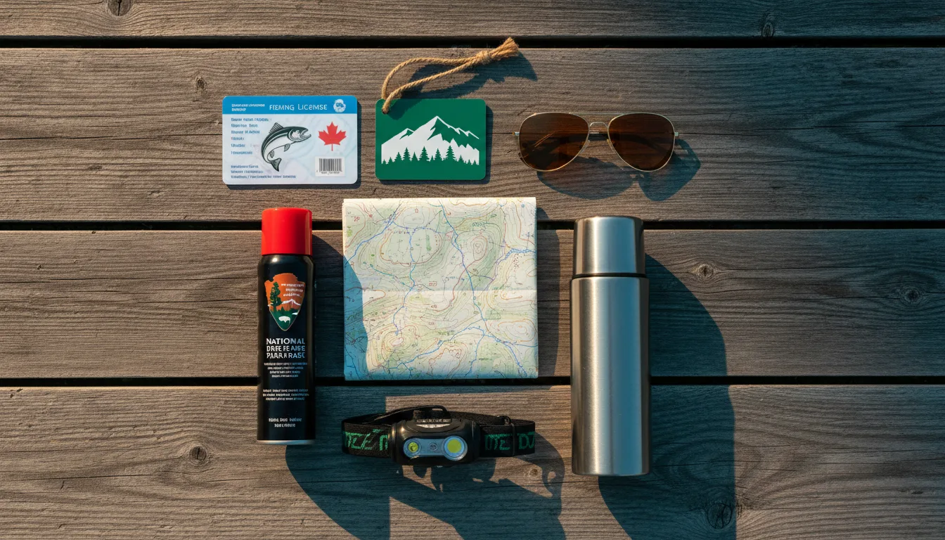
Overhead flat lay of cross-provincial overlanding kit: a BC fishing licence card, a Parks Canada pass, bear spray and a map, illustrative render in the series style
The cross-provincial loadout. The BC licence and FWID, the federal Parks pass, and swim kit for the hot springs — the things an Alberta trip forgets going the other way.

The BC paperwork

  • FWID registered in BC's WILD system before you leave home — the gate to buying any fishing licence, and there's no cell on 93S
  • BC freshwater licence (non-resident) — Alberta's is invalid
  • Parks Canada pass for Kootenay NP (a Discovery Pass covers all the Rockies parks) — a BC provincial pass is no good here
  • Proof of BC residency, or the willingness to pay the $20 BC Parks non-resident surcharge at provincial parks
  • Reservation (reservation.pc.gc.ca for the NP campgrounds; camping.bcparks.ca for provincial)
  • Cash or card for the ~$17/day fire permit inside the park, and rec-site fee envelopes

The drive & the roads

  • DriveBC (Hwy 93) checked the morning you leave — 93S closes for rockslide, avalanche and construction
  • Satellite communicator + a trip plan left with someone — no signal on 93S or the FSRs
  • Good full-size spare + plug kit for the Bugaboo, Toby Creek and Whiteswan gravel
  • High-clearance vehicle for the rough FSR stretches; 4WD not strictly required for Bugaboo
  • Fuel + propane topped in Invermere before any backcountry leg
  • Winter tyres if travelling the shoulder seasons — the same BC law No. 009 flags on Hwy 3

Camp, water & the soak

  • Bear spray on the hip, one per adult — genuine bear, cougar and grizzly corridor; food stored properly
  • Your own potable water for rec sites and Crown land — there is none out there
  • Swim kit and a towel — this valley is warm, and the hot springs are the whole point
  • Fire discipline: check the Southeast Fire Centre before striking a match; assume a Cat 1 ban is coming, and carry the ~$17 permit inside the park
  • 8 L of water + a hand tool if you do get a legal fire, per BC rules
  • Binoculars for the wetlands herons and the Radium bighorn
20 / DIVIDE-READY

The departure check

Run it the night before you leave Banff. Tap each item as it's done — this is the province-line stuff that an Alberta habit skips on the way over Vermilion Pass.

0 / 10 confirmed — the Divide is watching.
21 / QUICK ANSWERS

Asked at every 93S crossing

Is Radium Hot Springs open in 2026?
Yes. The pools (Parks Canada, inside Kootenay National Park in Sinclair Canyon) finished a roughly $29-million Aquacourt renovation — substantially complete October 2024 — and are open for 2026 with no closure. Hot pool about 37–40 °C, plus a separate cool swimming pool. Single-entry fees are roughly $19.75 adult / $17.25 senior or youth / $64.25 family, day pass ~$28.75 adult, and from 1 January 2026 Parks Canada dropped group rates, punch cards and gift cards. Confirm fees and hours (summer ~8:30am–10pm) at 1-800-767-1611.
Can I fish here with my Alberta licence?
No — it's worthless in BC. You need a BC freshwater licence, and new for 2026–27 you must first create a free FWID in the WILD system; from 1 April 2026 your FWID plus photo ID is your proof, no paper licence. Set it up before you leave home, because Highway 93S has no cell signal. Non-resident fees run roughly $62.87 annual / $41.15 for eight days / $22.86 for one day, single barbless hook on all Region 4 streams. Whether the upper Columbia, Windermere, Whiteswan or Premier waters are "classified" we could not verify — confirm with FrontCounter BC at 1-877-855-3222.
Do I need a BC Parks pass for Kootenay National Park?
No — it's federal, so you need a Parks Canada pass, not a BC provincial one. A day pass is about $11 adult (2026, confirm); a Discovery Pass (~$75.25 adult / $151.25 family) covers all the Rockies national parks. Parks Canada advertised free admission 19 June – 7 September 2026 — verify before you rely on it. The BC provincial rules and the $20 non-resident camping surcharge apply only at BC Parks sites like Dry Gulch, Premier and Whiteswan.
Do I change my clock?
No. The BC government lists Radium, Invermere, Golden, Cranbrook, Kimberley, Fernie, Sparwood and Elkford as staying on Mountain Time, aligned with Alberta and exempt from BC's permanent-Pacific move. You keep switching UTC-7 in winter and UTC-6 in summer, same as home — so no time change into the Columbia Valley, unlike almost everywhere else you'd cross into BC.
Can I have a campfire?
Check before you go, and don't count on it. Outside the park, BC bans fires by Category and Fire Centre; in the Southeast Fire Centre as of 10–17 July 2026, Category 1 campfires were allowed but Category 2 and 3 were already prohibited, and a full ban later in summer is near certain. Confirm at the BC Wildfire Service map or the Southeast Fire Centre (250-318-7715). Inside Kootenay National Park, fires follow Parks Canada's rules — designated pits and a ~$17/day permit.
Is Fairmont Hot Springs the one in Montana?
No. This is Fairmont Hot Springs in British Columbia — a private Columbia Valley resort with the largest natural mineral pools in Canada, selling walk-up day passes to non-guests (roughly $25 adult / $22 youth or senior / $77 family, pools ~8am–10pm). There's an identically-named resort in Montana with completely different rules; don't mix them up. Everything here refers only to the BC resort at fairmonthotsprings.com.
22 / VERIFY BEFORE DEPARTURE

The final word lives here

This is a guide to a province whose rules you don't live under, built partly from sources that were blocked, down, or year-ambiguous. Where that's true, we said so in place — and here's the consolidated list of what to confirm, and where the honest gaps are.

What we couldn't read — open these yourself sitesandtrailsbc.ca (the government Rec Sites source) is JavaScript-only and came back empty, so this guide prints no named rec sites, coordinates or counts — browse it live or phone Rec Sites and Trails BC. The Ramsar RSIS page for the Columbia Wetlands (#1463) returned a 502, so the ~16,969 ha figure is secondary — re-verify the hectares. The 2026 BC Parks fee PDF wouldn't render, so we held back exact per-night provincial-park dollar figures — get the schedule from camping.bcparks.ca. Kootenay NP fees weren't explicitly dated to 2026, so every NP dollar figure here is approximate — confirm at booking. And whether the upper-Columbia valley waters are classified for fishing was unverifiable — we won't claim they aren't.
🔒

The printable field guide

Everything above, condensed into a print-ready PDF built for the glovebox — for the crossing from Banff where doing the Alberta thing gets you a BC surprise. The rulebook-flip table, the hot-springs double bill, the federal-versus-provincial pass, the camping surcharge, the fire and licence rules, the river that runs the wrong way, every phone number that matters and the Divide-ready departure check, on paper that works where the signal doesn't.

Rulebook-flip table Radium & Fairmont Camping & the $20 Fire & licence rules Departure check Emergency numbers
Unlock the PDF — $4.95
$4.95 per guide · Instant access · Built by people who actually camp there
Trail Journal No. 010

Go farther. Camp lighter.
Leave it better.

Every Trekkr Trail Journal is built like this one: custom logistics, honest trail beta, the hot-springs and camping detail, kit lists and the local knowledge that turns a good trip into the one your crew talks about for years. New destinations drop all season long — this is our second over the line into British Columbia.

Unlock the Trail Journal Library
↗ Read the first BC crossing — No. 009, The Elk Valley & Fernie
$4.95 per guide · Instant access · Built by people who actually camp there