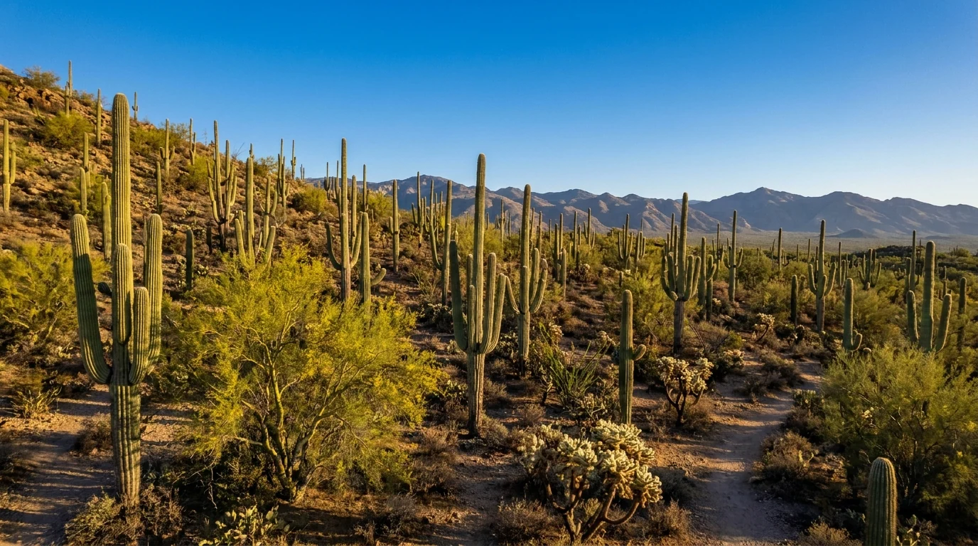
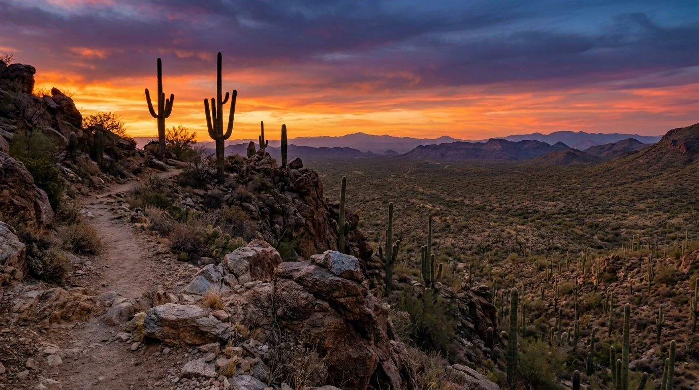
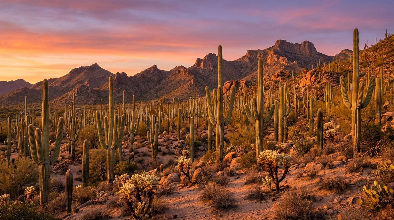
A vast forest of towering saguaro cacti on a rocky desert bajada glowing orange at sunset with jagged mountains behind, Sonoran Desert near Tucson Arizona, ultrarealistic photograph representative of the region
Trekkr Trail Journal · No. 055 · Saguaro & the Sonoran Desert

Saguaro & the SonoranDesert, Arizona — Tucson, Mt Lemmon, Sabino Canyon & Organ Pipe

There are two Saguaro National Parks, one on each side of Tucson, and a mile-high sky island between them where you can stand in pine forest thirty degrees cooler than the cactus below. What decides this trip isn't a reservation or a pass — it's the season. From June through September the low desert is genuinely lethal, so the sane window is October through April. Read the heat, respect the monsoon, use Mt Lemmon and dawn as your escape hatches, and southern Arizona gives you giant-cactus forests, petroglyphs, a canyon shuttle, and one of the great — and most remote — deserts in the country.

Arizona · USA Saguaro West & East · Tucson Mt Lemmon · Sabino Canyon · Catalina SP Best Oct–Apr · lethal summer heat
105°F+Low-desert summer highs — plan Oct–Apr; hikers die on exposed trails
2Saguaro districts, one each side of Tucson — and NO campground in either
~9,100 ftMt Lemmon — 20–30°F cooler; the Catalina Highway sky-island escape
DawnThe only time to hike the desert floor in the hot months. Storms build after noon
Conditions verified 23 July 2026 · In this desert the SEASON decides the day before the trail does · This block goes stale — the links don't

One gate opens this desert: the season — and in summer it can kill you

The rest of this journal is evergreen; this box is not. In the Sonoran Desert the thing that decides whether your plan works isn't a reservation — it's when you come. The low desert around Tucson is beautiful and mild from October to April and genuinely dangerous from June to September (§02, §06). Layered on that: the summer monsoon, seasonal campgrounds that flip open and shut with the heat, and a remote border monument with its own status. Everything below is dated to the day we checked it. Trust the live sources, not our stamp.

  • LETHAL summer heat — plan October through AprilLow-desert highs run 105–115°F from roughly June through September, and people die of heat on exposed Tucson-area trails most years. In the hot months, hike the desert floor only at dawn, carry far more water than you think, and escape up to Mt Lemmon (§05, §06). The sweet spot is the cool season. Check the NWS Tucson forecast and any Excessive Heat Warnings before any low-desert plan.
  • Monsoon storms, roughly July–September — lightning, flash floods, dustThe North American Monsoon brings sudden afternoon thunderstorms with lightning, torrential rain, flash floods in washes and canyons, and dust storms (haboobs). Don't camp or park in a wash, never cross a flooded wash ("turn around, don't drown"), and get off exposed high ground when storms build (§06). [VERIFY DAY-OF — NWS Tucson]
  • There is NO developed campground inside Saguaro National ParkNeither district has car/RV camping. The only in-park camping is backcountry wilderness sites in the Rincon Mountains (permit, on foot) (§07). Everyone else camps outside the park — Gilbert Ray, Catalina State Park, or the Coronado NF grounds up Mt Lemmon. Entrance to Saguaro was $25/vehicle (7 days, both districts) — confirm current fees at nps.gov/sagu. (§02, §07)
  • Campground seasons flip with the heat — check before you count on oneGilbert Ray closes for summer (reported Sep 1–Apr 30 open, closed May–Aug); the high Mt Lemmon grounds (Rose Canyon, Spencer Canyon) close and gate for winter; Molino Basin is a cool-months ground closed in summer heat. Twin Peaks (Organ Pipe) and the Rincon backcountry are year-round. [VERIFY the specific ground's season before you drive to it] (§07)
  • Mt Lemmon is the escape valve — but the top can be snowy in winterThe Catalina Highway climbs ~6,000 ft to conifer forest ~20–30°F cooler than the valley — Tucson's summer refuge (§03). In winter the summit can be snowy and icy, high campgrounds close, and chains/closures are possible. Check Coronado NF / ADOT for road and weather status either season. (§03)
  • Organ Pipe is a remote border monument — check its status firstThe monument's core (Kris Eggle Visitor Center, Twin Peaks Campground, Ajo Mountain Drive) is open and visited, but the NPS periodically closes southern border roads and runs construction; for 2026 it listed border-road closures and roadwork on part of South Puerto Blanco Drive (§05). It's ~2 hrs SW of Tucson with minimal services. [VERIFY at nps.gov/orpi before you go — carry water and fuel]
Live sources · Saguaro NP — alerts & fees · NWS Tucson — heat & monsoon · Gilbert Ray Campground (Pima County) · Catalina State Park · Coronado National Forest · Recreation.gov · Organ Pipe — conditions
In an emergency, 911. This box was true at press and will not stay true — the sources above are the truth on the day you travel.
01 / THE HOOK

Two cactus forests, a sky island, and a desert that runs on a clock

The saguaro is the whole idea here — the giant, many-armed cactus that lives up to two centuries, grows only in the Sonoran Desert, and stands in forests thick enough to walk through. Tucson sits in the middle of the best of it, with a national-park district on each side: the denser Tucson Mountain District to the west, and the bigger, wilder Rincon Mountain District to the east, whose peaks climb out of cactus into pine. Ringing the city are the Santa Catalina Mountains and Mt Lemmon — a "sky island" you can drive from desert to conifer forest in an hour. It is a landscape of astonishing range and one hard rule: the low desert is a cool-season place, deadly in summer, best from October to April. Time it right and you get cactus forests, canyon pools, petroglyphs, a mile-high forest escape, and a borderland monument few people ever see.

A dense stand of giant multi-armed saguaro cacti covering a desert hillside under the Tucson Mountains, warm morning light and clear sky, Saguaro National Park Tucson Mountain District Arizona, ultrarealistic photograph representative of the region
Saguaro West, the Tucson Mountain District. The denser, more accessible of the park's two halves — the Bajada Loop gravel drive, the Signal Hill petroglyphs, and classic saguaro forest under the Tucson Mountains. There is no campground here or in the East district; you camp outside the park (§07).

The payoff

Two saguaro forests, the canyon pools of Sabino and Romero, Hohokam petroglyphs, a mile-high forest on Mt Lemmon, and the organ-pipe cactus of a remote border monument (§03, §04, §05).

The heat

Tucson sits near 2,400 ft in the low desert. Summer highs of 105–115°F make the desert floor a dawn-only place from late spring to early fall — this is the single fact that shapes the whole trip (§02, §06).

The escape

The Catalina Highway climbs ~6,000 ft to Mt Lemmon, 20–30°F cooler than the valley. When the desert bakes, you go up; when the summit's snowed in, you stay low. The mountain is the region's thermostat (§03).

The way to think about the region — one city, two park districts, one mountain, and a distant monument This guide runs out of Tucson (~2,400 ft): a full-service city with an international airport, hospitals, deep gear and grocery options, and a serious food and cycling culture. West of town, past Gates Pass, sit Saguaro West (Tucson Mountain District), Tucson Mountain Park / Gilbert Ray and the Arizona-Sonora Desert Museum. East of town is Saguaro East (Rincon Mountain District), rising into wilderness. North, the Santa Catalina Mountains hold Sabino Canyon, Catalina State Park, and the Catalina Highway up to Mt Lemmon and Summerhaven. Far to the southwest, ~2 hours down toward the border, is Organ Pipe Cactus National Monument (§05). Sort the season first — everything else is built around the heat and the monsoon (§02).
02 / THE SEASON DECIDES EVERYTHING

The desert runs on a calendar and a clock

If you take one thing from this issue, take this. Most guide regions are gated by a reservation or a pass; this one is gated by the weather, and the stakes are your safety. The low Sonoran Desert is close to perfect from October through April and genuinely lethal from June through September. Inside the hot season there's a daily clock too: hike at dawn, escape the afternoon. Learn the calendar and the clock and the whole trip falls into place; ignore them and the desert doesn't care how fit you are.

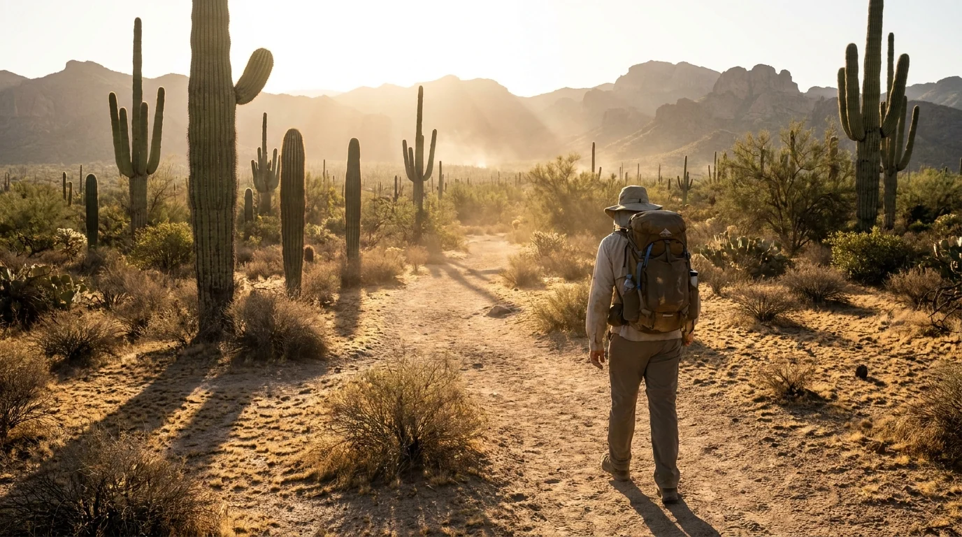
A lone hiker with a large hydration pack walking a sandy desert trail among saguaro at first light, hard low sun and long shadows, heat-hazy mountains, Sonoran Desert near Tucson Arizona, ultrarealistic photograph representative of the region
Dawn is the desert's business hours in summer. In the hot months the only safe time on the desert floor is first light — start before sunrise, be done by mid-morning, and carry more water than feels reasonable. By late morning the trails empty for a reason (§06).
SeasonLow desert (Tucson, Saguaro, Organ Pipe)Mt Lemmon / high countryThe move
Oct – Apr
the sweet spot
Warm, sunny days (60s–80s°F), cold nights; the desert at its best. Peak visitor season Cool to cold; snow possible up top mid-winter; high campgrounds gated/closed Camp and hike the desert. This is when to do Saguaro, Sabino, Organ Pipe and the low trails
Jun – Sep
the dangerous season
105–115°F highs, direct sun, little shade. Heat illness and deaths on exposed trails. Gilbert Ray closed 20–30°F cooler; pleasant; the summer refuge. High campgrounds open Go up, or go at dawn. Hike the desert only at first light; spend the day on Mt Lemmon
Jul – Sep
monsoon overlay
Afternoon thunderstorms: lightning, flash floods, dust storms. Dramatic, and deadly if ignored Same storms build over the peaks; get off high exposed ground when they do Do everything early. Off exposed ground by noon; never enter a wash when rain threatens (§06)

Temperatures are typical ranges, not guarantees — check the current NWS Tucson forecast and any Excessive Heat Warning before any low-desert plan. The monsoon's start and strength vary year to year.

🔴 The single most common desert mistake People treat the Sonoran Desert like a national park they can hike any time of day — and they underestimate the heat because the air is dry and they don't feel themselves sweating. A late-morning summer hike on an exposed saguaro trail with one small bottle of water is how visitors end up in serious trouble, and how some don't come back. The heat is the hazard here the way altitude is in the Rockies. Plan around it: cool season if you can, dawn starts if you can't, water in quantity always, and Mt Lemmon in your back pocket for the hot part of the day.
The 60-second season decision
  1. Coming October–April? You've got the good window — camp and hike the desert freely, just carry water and watch for cold nights and rare winter storms up high.
  2. Coming June–September? Treat the desert floor as dawn-only. Do Saguaro, Sabino and Organ Pipe at first light; spend the heat of the day up on Mt Lemmon or indoors.
  3. Is it monsoon season (roughly July–Sept)? Do your outdoor plans early, watch the sky, and stay out of washes and off exposed high ground when storms build.
  4. Want to camp? Confirm the ground is actually open for your season (Gilbert Ray shuts in summer; the high Mt Lemmon grounds shut in winter) — §07.
  5. Only have summer? Front-load Mt Lemmon and dawn hikes, and consider that Organ Pipe and the low desert are brutal — plan a lighter, cooler, higher trip.
03 / THE DRIVES

The Catalina Highway, the loop drives, and Gates Pass

You'll do a lot of this region from the driver's seat, and the roads themselves are half the show. One is a paved sky-island byway that climbs through six life zones in under thirty miles. Two are cactus-forest loop drives in the park's two districts. One is a dramatic sunset pass into the west-side desert. None of them are hard driving — but each has a rule, from RV limits to washes that flood, that's worth knowing before you go.

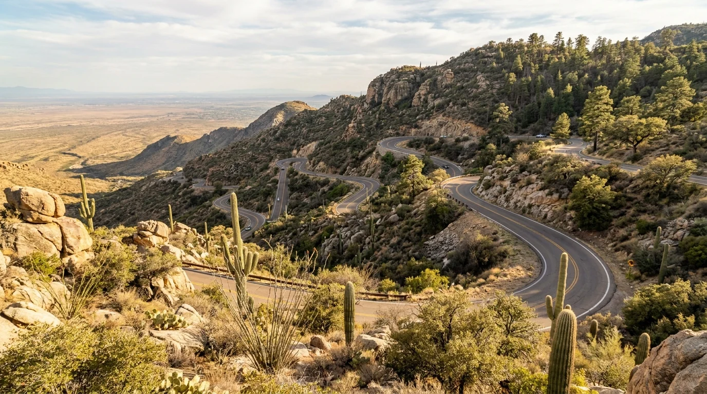
A paved mountain highway switchbacking up a rugged hillside where saguaro give way to pine, a long hazy view over the valley, Catalina Highway up Mount Lemmon near Tucson Arizona, ultrarealistic photograph representative of the region
The Catalina Highway (Sky Island Scenic Byway), climbing Mt Lemmon. About 25–27 paved miles and ~6,000 ft from Sonoran Desert to conifer forest — one of the fastest ecological transects in North America. Windy Point, Rose Canyon and Summerhaven are the stops; the top can be snowy in winter.

Catalina Highway — the sky-island escape

  • What it is: the paved General Hitchcock Highway from Tucson's NE edge up to ~9,100 ft near the Mt Lemmon summit and the village of Summerhaven
  • Why it matters: the top runs ~20–30°F cooler than the valley — the summer refuge — passing desert, oak, pine and mixed conifer on the way
  • The stops: Windy Point Vista (~6,400 ft, hoodoos and the big view), Rose Canyon (lake and campground), and Summerhaven (store, Cookie Cabin, trailheads)
  • Winter reality: snow and ice up high, high campgrounds gated, occasional closures — check Coronado NF / ADOT before you drive up in the cold months
  • Fuel: top off in Tucson. Summerhaven has a store but treat the mountain as no-services for fuel
~20–30°F cooler up topSnow/ice possible in winterCheck road status

The park loop drives — cactus by car

Bajada Loop Drive (Saguaro West): a graded gravel loop (~6 mi) through the densest saguaro stands, linking Signal Hill and short trailheads. Fine for most cars when dry; washes can run in monsoon.

Cactus Forest Loop Drive (Saguaro East): an 8-mile paved one-way loop through the Rincon district's cactus flats — easy, scenic, and the base for the East-side trails and the wilderness trailheads.

Loop distances are widely-cited figures; confirm current one-way directions, gravel conditions and any monsoon washouts at the visitor center.

West: gravel, dry-weatherEast: 8-mi paved loop
A rocky desert mountain saddle overlooking an endless sea of saguaro cactus and distant ranges, silhouetted cacti against a fiery sunset, Gates Pass Tucson Mountains Arizona, ultrarealistic photograph representative of the region

Gates Pass — the west-side sunset gateway

The narrow, winding road over Gates Pass in the Tucson Mountains is the scenic way toward Saguaro West and the Desert Museum, and one of the region's classic sunset spots — a ramada overlook above a sea of cactus.

It's closed to large RVs, trailers and buses — the switchbacks are too tight. Big rigs must go around via Ina Road or Ajo Way. Parking at the overlook fills for sunset; arrive early.

Note the pass road has gates that can be closed overnight — it's a day-use scenic route, not an after-dark shortcut.

No large RVs / trailersSunset parking fills early

Ajo Mountain Drive — the Organ Pipe loop (plan it separately)

Far to the southwest, the Ajo Mountain Drive is the signature ~21-mile mostly-gravel loop through Organ Pipe Cactus National Monument, winding beneath the Ajo Range through stands of organ pipe and saguaro. It's a half-day of driving from Tucson just to reach the monument, so it's a trip of its own, not a side road (§05).

Confirm the monument's current road status before you go — the NPS periodically closes border-area roads and runs construction (§05). Carry water and fuel; this is remote country.

~21-mi gravel loopCheck Organ Pipe status first
04 / THE HIKES

The roster — cactus flats, canyon pools, and the cool high country

Southern Arizona hiking splits cleanly by elevation, which is really by season: the low desert trails (Saguaro, Sabino, Catalina State Park) are cool-season or dawn-only outings, while the Mt Lemmon trails are your summer hiking. The distances below come from land-manager and trail-guide sources and are the best consensus we could find — treat them as planning estimates to confirm at the trailhead. And read the safety section (§06) first: on the desert floor, water and timing matter more than the numbers.

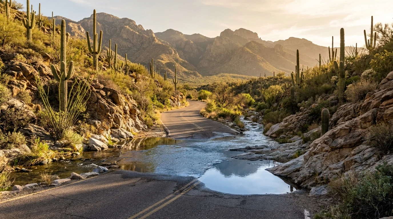
A desert canyon with a clear creek and small pools crossing a paved road, saguaro-studded rocky slopes rising on both sides under the Santa Catalina Mountains, Sabino Canyon Tucson Arizona, ultrarealistic photograph representative of the region
Sabino Canyon — the accessible classic. A riparian canyon at the base of the Santa Catalinas, with creek crossings, pools and saguaro slopes. An electric shuttle (the Sabino Canyon Crawler) runs the paved canyon road; you can ride up and walk down, or hike to Seven Falls up Bear Canyon. Forest day-use fee applies; the shuttle is a separate ticket.

The low desert — cool-season or dawn-only

All near the valley floor, so all subject to the heat rule (§06). Wonderful October–April; first-light only in the hot months. Carry far more water than the distance suggests.

The easy win, either districtSaguaro paved & nature trails

Short, flat interpretive loops, well under 1 mi. Both districts have easy paved and gravel nature trails among the giant cactus — the Desert Ecology and Cactus Forest trails (East) and the Desert Discovery Nature Trail (West). The best low-effort way to stand inside a saguaro forest, and good for all ages.

Still full desert exposure with little shade. Morning is the move; even a short loop is unpleasant and risky in mid-day summer heat. Watch for rattlesnakes and never touch a cactus.

<1 mi · easy · paved optionsBoth districts
Short loops · minimal gain
30–60 min (estimate)

Canyon, creek and a shuttle you can lean onSabino Canyon

Walk the paved canyon road (~3.8 mi one-way) along Sabino Creek, or ride the electric shuttle up and stroll down. For a bigger day, Seven Falls up Bear Canyon is a popular ~8 mi round trip to a string of pools. Creek crossings can be wet after rain.

Flash-flood country in monsoon — the creek can rise fast; don't cross a flooded wash. Full sun on the open stretches; go early. The forest day-use fee (or Interagency pass) is required, and the shuttle is a separate ticket.

Road ~3.8 mi one-waySeven Falls ~8 mi RTDistances are estimates
Road walk or shuttle · Seven Falls ~8 mi RT
2–5 h (estimate)
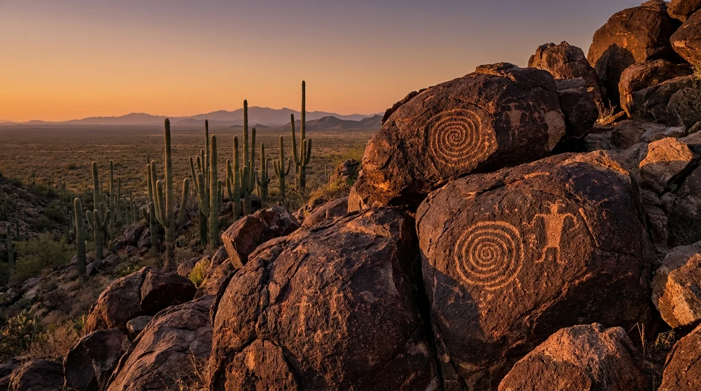
Ancient spiral and figure petroglyphs pecked into dark desert-varnished boulders on a small hill, saguaro and desert plain behind under warm low light, Signal Hill Saguaro National Park Arizona, ultrarealistic photograph representative of the region
Signal Hill, Saguaro West. A quarter-mile walk off the Bajada Loop Drive to a boulder field of Hohokam petroglyphs — spirals and figures pecked into desert varnish centuries ago. Best in low-angle morning or evening light. Look, photograph, and never touch the rock art.

Granite pools at the foot of the CatalinasRomero Pools (Catalina State Park)

~5.6 mi round trip · a rocky, exposed climb from Catalina State Park to a set of granite pools and small falls that run after winter and monsoon rains. Moderate, with a steady rocky ascent once past the flats. Distance is a widely-cited estimate — confirm at the trailhead. A cool-season favorite.

Fully exposed and hot by mid-morning — an early start is the plan, not advice. Carry a lot of water. The pools are seasonal; don't count on water to filter, and never rely on desert water sources.

~5.6 mi RTExposed · hot by mid-morningCatalina State Park
~5.6 mi round trip · rocky climb
3–5 h (estimate)

The sky island — your summer hiking

Up the Catalina Highway (§03), 20–30°F cooler. These are the hikes to do when the desert floor is an oven — pine forest, granite, and real shade.

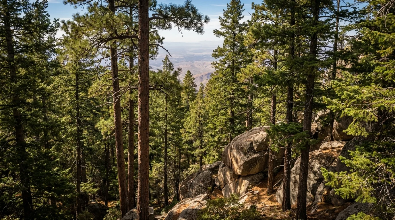
A cool ponderosa pine and mixed-conifer forest on a high mountaintop with granite outcrops and a distant hazy view of desert far below, Mount Lemmon summit Santa Catalina Mountains Arizona, ultrarealistic photograph representative of the region
Mt Lemmon's conifer forest, near 9,000 ft. An hour from the saguaro and a different world — ponderosa and mixed conifer, granite domes, and cool air. Marshall Gulch, Aspen Draw, the Meadow Trail and the Butterfly Trail leave from near Summerhaven and the ski area. This is where you hike in July.

The cool forest loop near SummerhavenMarshall Gulch area

A popular shaded loop (~3–4 mi) from the Marshall Gulch picnic area above Summerhaven, linking creek, forest and a saddle with views. Moderate, cool, and often the first choice for a summer leg-stretch up high. Distances vary by source and route — confirm locally.

Even up high, afternoon thunderstorms build in monsoon — start early and get off exposed saddles when storms threaten. Nights are cold at this elevation; carry a layer.

~3–4 mi loop · cool forestDistance unconfirmed
~3–4 mi loop · moderate
2–3 h (estimate)

A real Rincon wilderness objective — permit for overnightRincon high country (Saguaro East)

From Saguaro East, trails like Douglas Spring and the routes toward Manning Camp climb from cactus into pine over many miles and thousands of feet — serious backcountry with the park's only campsites (permit, §07). Big, remote, and mostly a spring/fall proposition.

Long, waterless and hot low down; the upper country is cold and can be snowy in winter. This is planned backpacking, not a casual day hike. Confirm distances, water and permits with the Rincon Mountain Visitor Center.

Multi-day · big elevationPermit for overnightCarry all water
Multi-mile / multi-day
Overnight (estimate)
HikeWhereRound trip*Season to do itNotes
Saguaro nature trailsWest or East district<1 miOct–Apr / dawnPaved options; full desert exposure
Signal Hill petroglyphsSaguaro West (Bajada Loop)~0.5 miOct–Apr / dawnHohokam rock art; don't touch
Sabino Canyon roadSanta Catalinas (NE Tucson)~7.6 mi RT (or shuttle)Oct–Apr / dawnShuttle + fee; flash-flood in monsoon
Seven Falls (Bear Canyon)Sabino / Bear Canyon~8 miOct–Apr / dawnCreek crossings; pools seasonal
Romero PoolsCatalina State Park~5.6 miOct–Apr / dawnExposed, rocky; hot by mid-morning
Marshall Gulch loopMt Lemmon / Summerhaven~3–4 miSummer / anyCool forest; the summer choice
Rincon high countrySaguaro East wildernessmulti-daySpring / fallPermit for overnight; carry water

*All distances are consensus estimates from land-manager and trail-guide pages, not a single official table. Confirm at the trailhead. On the desert floor, the numbers matter less than the timing and the water — read §06 before any hike here.

05 / ORGAN PIPE — READ BEFORE YOU GO

A magnificent monument on the border — with a status to check first

Organ Pipe Cactus National Monument is one of the most beautiful desert parks in the country, and the only place in the US where the organ pipe cactus grows wild. It's also remote — about two hours southwest of Tucson — and sits right on the international border, which means it comes with realities most parks don't. We're not going to romance it and we're not going to scare you off. Here's the honest version so you can decide and plan properly.

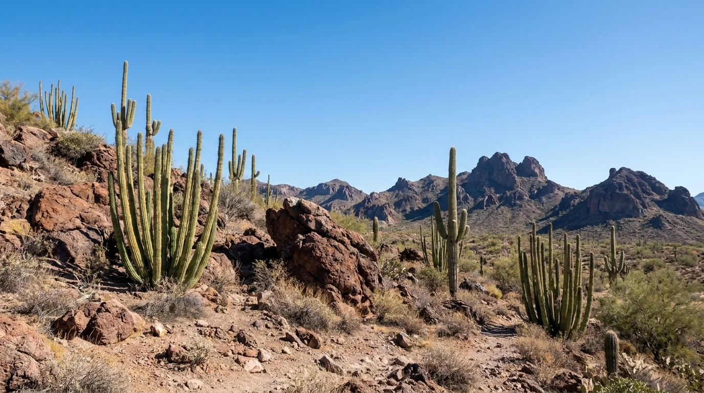
Clusters of tall multi-stemmed organ pipe cactus and saguaro on a rocky desert slope beneath jagged volcanic mountains, remote empty landscape under a big clear sky, Organ Pipe Cactus National Monument Arizona, ultrarealistic photograph representative of the region
Organ Pipe Cactus National Monument, near the Ajo Range. The many-stemmed organ pipe cactus reaches its US limit here. The developed core — Kris Eggle Visitor Center, Twin Peaks Campground and the Ajo Mountain Drive — is open and visited; the surrounding border country is remote and partly restricted.

What's open, plainly

The monument's core is a normal national-park experience: the Kris Eggle Visitor Center on AZ-85, the year-round Twin Peaks Campground (~208 sites, flush toilets, solar showers, dump station; §07), the Ajo Mountain Drive loop, and hiking trails from the developed area.

The nearest gateway is tiny Ajo to the north; the border crossing at Lukeville sits just south of the visitor center. Fill up on fuel and water before you arrive — services are minimal.

Visitor center + Twin Peaks CG openAjo Mountain Drive

The border reality — check status first

  • Southern border roads are periodically closed. For 2026 the NPS listed closures of the West and East Border Roads (Lukeville area) and crossover roads — verify current status
  • Construction happens. The NPS noted roadwork on part of South Puerto Blanco Drive with possible traffic stops — follow crew directions
  • It's remote and hot. This is deep low desert — the heat rules (§06) apply hard, and there's no quick help. Carry water and fuel
  • Keep to open roads and areas, carry ID, and read the monument's Desert Safety page before you go

Border-zone status changes without notice — the dates above are what the NPS listed at press. Confirm current road and safety status at nps.gov/orpi before you drive down.

🔴 The honest bottom line on Organ Pipe Thousands of people visit Organ Pipe every cool season and have a superb, safe trip — it is a legitimate, spectacular national-park unit, not a no-go zone. But it is remote border desert, and treating it casually is the mistake. Go in the cool season, check the current NPS conditions and any border-road closures before you leave, carry far more water and fuel than a normal park day, keep to open roads and developed areas, and don't push into restricted border country. Do that, and the Ajo Mountain Drive at golden hour among the organ pipes is one of the finest desert experiences in the Southwest.
06 / SAFETY — READ THIS FIRST

Heat, water, the monsoon, and the things with spines and fangs

Four things account for most of what goes wrong in the Sonoran Desert, and the first two are the same thing twice: heat and water. The third is the summer monsoon — lightning, flash floods and dust storms that turn a beautiful afternoon violent. The fourth is the desert's wildlife and its plants, which reward respect and punish carelessness. None of it is exotic; all of it has to be planned for, and in this desert the planning is what keeps you alive.

Heat & water — the desert's altitude

Low-desert summer highs of 105–115°F, relentless sun, almost no shade, and dry air that hides how much you're sweating — this combination causes heat exhaustion and fatal heat stroke on Tucson-area trails every year. It is the number-one hazard here.

Symptoms to bail on: headache, dizziness, nausea, cramping, confusion, or when you stop sweating. Get to shade, cool the body, drink — and if confusion sets in, that's an emergency.

In the hot months, the desert floor is a dawn-only place. Turn around early. Descend the heat by going up Mt Lemmon.

Heat is the #1 killer hereDawn-only in summer

What actually works

  • Carry far more water than you think — think in gallons per person per hot day, not bottles
  • Replace electrolytes, not just water; eat salty snacks
  • Start at first light and be done by mid-morning in the hot season
  • Sun cover: hat, long light sleeves, sunscreen. Shade is a resource you won't find on trail
  • Never rely on desert water sources — pools are seasonal and unreliable. Turn around at half your water
  • Tell someone your plan; cell service is patchy off the main roads

This is standard desert-safety guidance, not a substitute for judgment or a doctor. When a heat warning is posted, move plans to dawn or to Mt Lemmon.

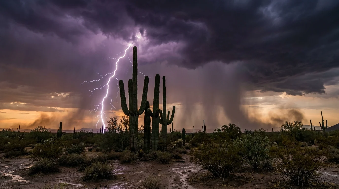
A dramatic summer monsoon thunderstorm over the desert with a bolt of lightning striking behind a stand of tall saguaro cactus, dark storm clouds and rain curtains, Sonoran Desert Arizona, ultrarealistic photograph representative of the region
The monsoon, roughly July–September. Sudden, violent afternoon storms bring lightning, flash floods and dust. Beautiful from a safe distance, deadly if you're in a wash, on a summit, or driving into a wall of dust. Do outdoor plans early and watch the sky (§02).
🔴 The monsoon rules — lightning, flash floods, dust From roughly July through September, storms build in the afternoon and can turn a dry wash into a wall of water in minutes, miles from where the rain fell. Never camp or park in a wash. Never cross a flooded wash on foot or by vehicle — "turn around, don't drown." Get off exposed high ground (Windy Point, any summit or ridge) when a storm is building, and if you're caught in the open in lightning, avoid lone trees and high points and crouch low. If a dust storm (haboob) hits while driving, pull completely off the road, stop, turn off your lights, and take your foot off the brake so no one follows your taillights into a stopped car.

The upside: monsoon light and desert blooms are spectacular, and the temperatures ease. You just have to run your day early and respect the sky.

Rattlesnakes, Gila monsters & scorpions

This is rattlesnake country, most active in the warm months and around dawn and dusk. The rule: watch where you put your hands and feet, stay on trails, never reach onto a ledge you can't see, and give any snake a wide berth. Most bites happen when people try to handle or kill one — don't. Shake out boots and check under gear in camp. Gila monsters and scorpions are around too; the same "look, don't touch" rule covers them. If bitten, stay calm, keep the limb still and get to a hospital — Tucson has full ERs.

Cactus, javelina & the plants that bite back

The desert's most reliable injury is cactus. Never brush against a cholla ("jumping cactus") — the segments detach and drive in hard — and carry a fine comb and tweezers to remove spines. Keep dogs leashed and out of the cactus. Javelina (peccaries) travel in groups and can be defensive, especially with dogs around; give them space and never feed them. Store food and trash securely in camp — javelina, coyotes and rodents will work a loose cooler.

Wildlife distance, briefly Keep well back from all wildlife, never feed or approach, and leash dogs on the trails and in camp — a loose dog and a rattlesnake, or a loose dog and a group of javelina, is a bad outcome. The desert's animals aren't out to get you; nearly every bad encounter starts with someone getting too close, reaching where they can't see, or trying to handle something wild. Confirm any site-specific pet and wildlife rules with the land manager — national-park, county, state-park and Forest Service rules differ across this patchwork.
07 / THE CAMPING STRATEGY

No campground in the park — so camp by corridor and by season

Here's the fact that trips people up: Saguaro National Park has no developed campground in either district. The only in-park camping is backcountry wilderness sites in the Rincon Mountains, on foot, with a permit. Everyone else camps outside the park — and the good options sort into corridors, each with its own season. The valley-floor grounds (Gilbert Ray, Catalina State Park) are cool-season places; the Mt Lemmon grounds are summer places; Organ Pipe and the Rincon backcountry run year-round. Match the ground to your month before you book.

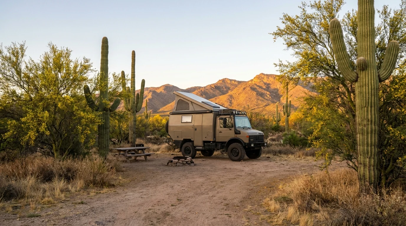
An overland camper with a rooftop tent parked at a quiet desert campsite ringed by giant saguaro and palo verde, warm golden evening light on the mountains behind, a picnic table and fire ring, Tucson Mountain Park Arizona, ultrarealistic photograph representative of the region
The camping strategy is corridor-by-corridor. A Tucson Mountain Park (Gilbert Ray) site puts you next to Saguaro West; a Mt Lemmon Forest Service site puts you in cool pines when the desert bakes. There is no big in-park campground — read the season on every ground before you tow anything to it.
CampgroundCorridor · managerSitesSeason*BookingReported fee*
Gilbert Ray Tucson Mtn Park · Pima County 130 (+ few tent-only) Sep 1 – Apr 30 (closed summer) Reservation only ~$20 RV / $10 tent
Catalina State Park Santa Catalinas · AZ State Parks 120 (electric + water) year-round Reservation ~$50 (electric+water) confirm
Rose Canyon Mt Lemmon · Coronado NF 73 ~Apr–Oct/Nov (closed winter) Half reservable / half first-come unconfirmed
Spencer Canyon Mt Lemmon · Coronado NF 66 ~Apr–Oct (weather) Reservation/first-come unconfirmed
Molino Basin Catalina Hwy (4,500 ft) · Coronado NF 37 (+ group) cool months (closed summer) First-come ~$20 (reported)
General Hitchcock Catalina Hwy (~6,000 ft) · Coronado NF 12 tent-only ~May 1 – Oct 31 (weather) First-come ~$20 (reported)
Twin Peaks Organ Pipe Cactus NM · NPS ~208 (34 tent-only) year-round Reservation ~$20 + park entry confirm
Alamo Canyon Organ Pipe Cactus NM · NPS 4 tent-only (primitive) year-round Reservation ~$16 + park entry confirm
Saguaro Wilderness Rincon Mtns / Saguaro East · NPS 21 backcountry (6 CGs) year-round (hike-in) Permit (Recreation.gov) ~$8/site (reported)
Peppersauce N Catalinas / Oracle · Coronado NF not confirmed year-round (~4,700 ft) First-come unconfirmed

*Seasons, site counts and fees are compiled from the NPS, Pima County, Arizona State Parks, Coronado National Forest and Recreation.gov listings and vary by source and season. Several are shown as "confirm" or "unconfirmed" because the listings disagreed or we could not resolve a figure. Book by site on the operator's system and read the actual price, hookups and season. Coordinates for Rose Canyon, Twin Peaks and Alamo Canyon could not be resolved and are listed as unverified in the dataset.

Which corridor for which trip

  • Saguaro West + the Desert Museum: Gilbert Ray in Tucson Mountain Park — the closest developed base, 30-amp electric, no showers, closed in summer.
  • North Tucson, Catalinas & Sabino: Catalina State Park — full electric+water sites, showers, great trails from camp; year-round and books up in the cool season.
  • Beat the summer heat: the Mt Lemmon grounds — Rose Canyon, Spencer Canyon (cool pines, summer only), or Molino Basin / General Hitchcock on the way up.
  • Organ Pipe: Twin Peaks (full facilities, year-round) or primitive Alamo Canyon — plan it as its own remote trip (§05).
  • Inside Saguaro: only the Rincon backcountry — permit, on foot, carry all water. No car camping in the park at all.

Dispersed & the rules that catch people out

There's no dispersed camping inside Saguaro NP, Tucson Mountain Park or the state park — those are developed-site or permit only. Dispersed camping exists on Coronado National Forest and some BLM ground, but it's rule-bound (stay limits, distance from water and roads, existing sites) and fire restrictions can ban campfires and dispersed camping outright in a dry spring.

Summer heat closes the valley-floor grounds; winter closes the mountain grounds. Always confirm a specific campground's current season and any fire order before you drive to it.

No dispersed in the parksCheck fire stage + season
Backcountry permits — the Saguaro Wilderness system Every overnight inside Saguaro National Park is in the Rincon Mountain wilderness: 21 designated sites across six backcountry campgrounds (Douglas Spring, Manning Camp and others), reached only on foot, often many miles and thousands of feet up. An advance permit from Recreation.gov is required (reported around $8 per site per night), and there is no reliable water — you plan your water like a desert crossing. This is real backpacking, mostly a spring/fall proposition; the high sites can be cold or snowy in winter. Confirm sites, water, fees and the current permit process with the Rincon Mountain Visitor Center / Recreation.gov before you plan an overnight.
08 / TOWNS & SERVICES

Tucson has everything. The mountain and the border have almost nothing.

This region runs from a half-million-person city to a mountaintop village to a border hamlet, and the services drop off fast as you leave Tucson. The city is full-service, affordable by resort-town standards, and a genuine food and cycling destination; Summerhaven on Mt Lemmon is tiny and partly seasonal; Ajo and Lukeville near Organ Pipe are remote outposts. Resupply in Tucson, and treat everywhere else as a place you arrive already stocked.

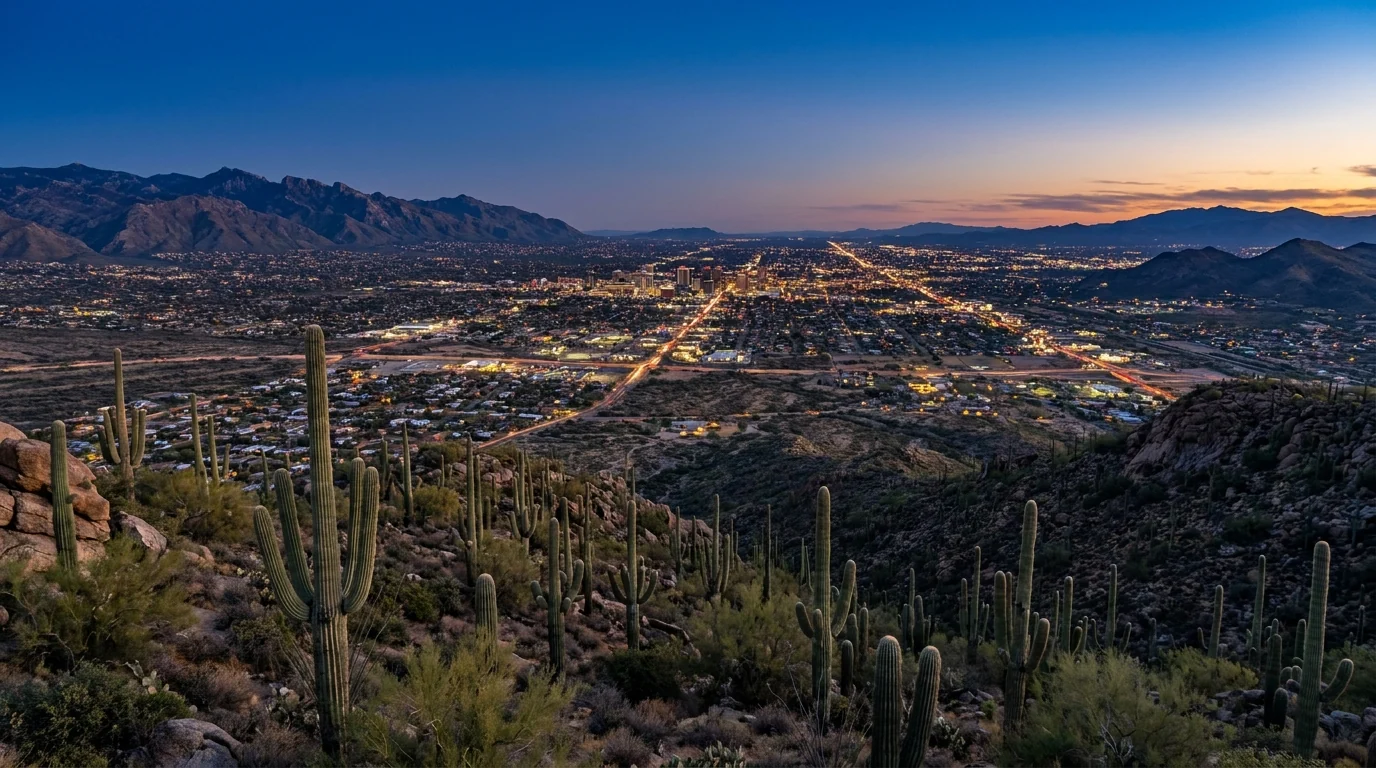
A low desert city spread across a wide valley at dusk with mountain ranges on every horizon, saguaro-covered foothills in the foreground and city lights beginning to glow, Tucson Arizona, ultrarealistic photograph representative of the region
Tucson, ~2,400 ft. The gateway between the two Saguaro districts — full groceries, hospitals, an international airport (TUS), deep outdoor-gear and bike shops, and some of the best Mexican food in the country. Everything you need to base a Sonoran Desert trip.

Tucson — the full-service base

  • Groceries & fuel: full supermarkets and stations citywide — stock up here for the mountain, the parks and especially Organ Pipe
  • Gear & bikes: outdoor and bike shops in town; Fair Wheel Bikes rents road, gravel, mountain and e-bikes for Mt Lemmon, Gates Pass and the desert loops
  • Guides & shuttles: Southwest Guided Adventures and Southwest Discoveries run guided desert and sky-island hikes; the Sabino Canyon Crawler runs the canyon shuttle
  • Medical: full hospitals and ERs in Tucson — a real advantage in a region where the outdoor hazard is heat
  • The Desert Museum: the Arizona-Sonora Desert Museum west of town is the best primer on everything you'll see — plants, animals and the desert itself

Business hours and offerings change; confirm current websites before relying on them. The Desert Museum's hours shift by season (earlier in the hot months).

Summerhaven, Ajo & the edges

  • Summerhaven (~7,700 ft, Mt Lemmon): a general store, the Cookie Cabin, a few lodgings and the ski area nearby — a lunch stop and cool base, not a resupply. Rebuilt after the 2003 Aspen Fire; much is seasonal
  • Oro Valley / Catalina foothills: north-Tucson suburbs with full services right by Catalina State Park and Sabino Canyon
  • Ajo (near Organ Pipe): a small historic town ~2 hrs SW — limited fuel, food and lodging. The nearest real services to the monument; stock up before you go further
  • Medical: no hospital on Mt Lemmon or at Organ Pipe. Tucson is the nearest full care for the whole region

Confirm current Summerhaven and Ajo services before you rely on them — much is seasonal, and the drive to Organ Pipe is long and remote.

Operators worth knowing — links, not prices All of the following are real, currently-trading businesses whose websites we resolved. Season, pricing and offerings change, so we link rather than quote. Operators working on Forest Service or park land hold the relevant authorizations.

Tucson & the desert

  • Arizona-Sonora Desert Museum (2021 N Kinney Rd) — world-renowned desert zoo, botanical garden and natural-history museum next to Saguaro West
  • Southwest Guided Adventures (Tucson) — guided hikes, bike tours, bike rentals and trailhead shuttles across the Sonoran Desert and sky islands
  • Southwest Discoveries (Tucson) — half-day to multi-day guided hikes with a geology, botany and conservation focus
  • Fair Wheel Bikes (1110 E 6th St, Tucson) — locally owned bike shop and rentals since 1973; road, gravel, MTB and e-bikes for Mt Lemmon and beyond

Santa Catalinas & Mt Lemmon

  • Sabino Canyon Crawler (5700 N Sabino Canyon Rd) — the emission-free electric shuttle through Sabino Canyon; ticket separate from the forest day-use fee
  • Mount Lemmon Ski Valley (10300 E Ski Run Rd) — the southernmost ski area in the US; winter lifts when snow allows, a year-round sky-ride and the Iron Door Restaurant
  • Mt. Lemmon Cookie Cabin (Summerhaven) — giant cookies and pizza at ~8,000 ft, the classic reward at the top of the drive
  • Mt. Lemmon General Store & Gift Shop (Summerhaven) — the only store for 30 miles: supplies, firewood, food and gifts

We confirmed no operator pricing — any number you see elsewhere should come from the business. Hours and seasons change; check the current website before you drive over. (We dropped one well-known Tucson gear shop from this list because its storefronts appear closed for 2026.)

Getting there Tucson International Airport (TUS) is right in town; Phoenix Sky Harbor (PHX), ~1.5–2 hours north on I-10, is the big hub with the most flights. Saguaro West and the Desert Museum are west of the city (via Gates Pass or Ina Rd); Saguaro East is on the east side; the Catalina Highway to Mt Lemmon leaves from the NE edge; Organ Pipe is ~2 hours southwest via AZ-86 and AZ-85 through Ajo. Confirm current drive times and any monsoon road closures with live mapping; desert washes and dust storms close roads seasonally.
09 / TIMING

When to go — and it's the whole ballgame here

Most regions have a best season; this one has a safe season. The single most important planning decision you'll make is when to come, because the low desert swings from perfect to lethal across the year. Inside the good window there are grace notes — spring wildflowers, monsoon drama, the sky-island summer escape — but the frame is simple: the desert floor is a cool-season place, and summer belongs to Mt Lemmon and the dawn.

Season by season, straight

  • Winter (Dec–Feb) — prime, and quiet up high. Mild, sunny desert days and cold nights; the best hiking and camping on the floor. Mt Lemmon can be snowy and its high campgrounds are closed — the trade is a snowy day-trip if you want one
  • Spring (Mar–Apr) — peak, with wildflowers. Warm days, and in a wet year the desert blooms — poppies, lupine, brittlebush and saguaro flowers into May. The most popular window; book campgrounds well ahead
  • Early summer (May–Jun) — the heat arrives. The hottest, driest stretch before the rains; the desert floor becomes dawn-only. Gilbert Ray closes; Mt Lemmon opens up as the escape
  • Monsoon (Jul–Sep) — dramatic and dangerous. Afternoon storms, flash floods, dust, and slightly eased temperatures. Spectacular light and desert green — run every plan early and stay out of washes (§06)
  • Fall (Oct–Nov) — the desert reopens. Heat breaks, crowds return, campgrounds refill. A superb, stable window very much like spring without the flowers

Crowd & heat strategy

  • Book cool-season campgrounds early. Catalina State Park and Gilbert Ray fill on winter and spring weekends; the Mt Lemmon grounds fill on summer weekends
  • Start everything at first light. It buys you cool air, parking, and the safety margin against both heat and afternoon storms. The one move that fixes the most
  • Use Mt Lemmon as your thermostat — desert in the cool morning, mountain in the hot afternoon
  • Weekday beats weekend at the parks, Sabino Canyon and on the Catalina Highway, especially when Tucson escapes the heat en masse
  • Watch a wet vs dry winter — spring wildflower displays depend on it; follow Arizona wildflower reports rather than trusting a fixed date
The one-paragraph answer Come October through April. That's the window this desert is built for — warm days, cold nights, safe hiking on the floor, and the parks and Organ Pipe at their best. March–April adds the chance of wildflowers; December–February trades a snowy Mt Lemmon for the quietest desert. If you can only come in summer, treat the desert floor as dawn-only, live on Mt Lemmon for the heat of the day, and respect the monsoon — do everything early and stay out of the washes. Whichever you pick: sort the season first, carry far more water than you think, and let the heat, not the map, set your schedule.
10 / THE SHAPE OF THE TRIP

Five days, built around the heat and the two districts

One workable shape for the cool season, not the only one. It bases in Tucson, hits both Saguaro districts and Sabino at their cool-morning best, escapes up Mt Lemmon, and treats Organ Pipe as an optional remote add-on. In summer, run the same skeleton but do every desert item at dawn and spend the afternoons up the mountain. Adjust freely — just keep the desert to the mornings, and confirm campground seasons and Organ Pipe's status before you count on them.

01

Day 1 — Arrive, stock up, learn the desert

  1. Resupply in Tucson — water, fuel, food, sun cover. Everything downstream is stocked from here.
  2. Afternoon at the Arizona-Sonora Desert Museum and out to Gates Pass for sunset over the west-side cactus.
  3. Base at Gilbert Ray (cool season) or Catalina State Park; confirm your ground is open for the season.
  4. Set alarms early — desert days here start at first light.
No permit neededStock up in Tucson
02

Day 2 — Saguaro West, at dawn

  1. First light on the Bajada Loop Drive, the Signal Hill petroglyphs and a short nature trail among the giants.
  2. Off the desert floor before the heat; afternoon in shade or on a plan-B up high.
  3. Carry far more water than the short distances suggest — this is exposure, not effort.
Dawn start$25 park pass (7 days)
03

Day 3 — Sabino Canyon & the east side

  1. Early into Sabino Canyon — ride the Crawler up and walk down, or push toward Seven Falls.
  2. Later, the Cactus Forest Loop Drive in Saguaro East and an easy nature trail.
  3. Watch the sky in monsoon season; don't cross a flooded wash. Off exposed ground by early afternoon.
Forest fee + shuttle ticketFlash-flood aware
04

Day 4 — Up the Catalina Highway to Mt Lemmon

  1. Drive the Sky Island Byway — stop at Windy Point, Rose Canyon, and Summerhaven.
  2. Hike a cool forest loop (Marshall Gulch), then cookies and pizza at the top.
  3. Camp up high in summer (Rose/Spencer Canyon) or back in the desert in the cool season. Check winter road status.
20–30°F cooler up topWinter: check road/closures
05

Day 5 — Catalina State Park or a slow morning

  1. Early hike to Romero Pools from Catalina State Park, or an easy foothills loop.
  2. Beat the heat back to camp or town by mid-day; a Tucson food afternoon is the reward.
  3. Set turnaround times and honour them — the desert punishes "just a bit further."
Dawn startDay-use fee
+

The Organ Pipe add-on

  1. Only in the cool season, and only after checking current NPS status and border-road closures (§05).
  2. It's a ~2-hour drive each way via Ajo — plan an overnight at Twin Peaks, not a day trip.
  3. Carry extra water and fuel; drive the Ajo Mountain Drive and keep to open roads.
  4. Remote border desert — treat the heat rules (§06) as absolute here.
Check status before drivingRemote · carry water & fuel
11 / TRIP-READY

The departure check

Run it before you leave. Tap each item as it's done — these are the ten things specific to the Sonoran Desert that a general road-trip habit will skip. Most come back to one fact: here the heat and the season decide your day before the trail does, and water and timing keep you safe where fitness won't.

0 / 10 confirmed — the season sets the schedule.
12 / QUICK ANSWERS

Asked at every Tucson trailhead

When should I visit?
October through April. The low Sonoran Desert is genuinely dangerous in summer — highs of 105°F-plus from June through September, and people die on exposed desert trails every year. The cool season is close to perfect: warm days, cold nights, thinner crowds. If you must come in summer, hike the desert floor only at dawn, carry far more water than you think, and escape the heat by driving up to Mt Lemmon (~20–30°F cooler). Watch for monsoon storms July–September.
Can I camp inside Saguaro National Park?
Not in a car or RV. There's no developed campground in either district. The only in-park camping is backcountry: 21 designated wilderness sites in the Rincon Mountains, reached on foot with an advance Recreation.gov permit (reported ~$8/site/night) and all your own water. Everyone else camps outside the park — Gilbert Ray in Tucson Mountain Park, Catalina State Park, or the Coronado NF grounds up Mt Lemmon. Book the popular ones ahead in the cool season.
Is Mt Lemmon really that much cooler?
Yes. The Catalina Highway climbs ~6,000 ft from desert to conifer forest near the ~9,100-ft summit, and sources put the top around 20–30°F cooler than the valley — Tucson's summer escape. The flip side: in winter the summit can be snowy and icy, the high campgrounds (Rose Canyon, Spencer Canyon) close, and it holds the southernmost ski area in the US. Check road and weather status before driving up in either season.
How dangerous is the summer heat, honestly?
Dangerous enough to change the whole plan. Summer highs of 105–115°F, direct sun, little shade, and dry air that hides your sweat cause heat exhaustion and fatal heat stroke on Tucson-area trails every year. The rules: hike at dawn and be done by mid-morning in the hot months, carry far more water than feels necessary (plus electrolytes), turn around early, and never rely on desert water. When it's hot, move hiking up to Mt Lemmon or to first light. The desert floor is a morning-only place from late spring to early fall.
What do I do about the monsoon?
From roughly July–September, sudden afternoon storms bring lightning, flash floods and dust storms. Do outdoor plans early. Never camp or park in a wash; never cross a flooded wash on foot or by vehicle ("turn around, don't drown"). Get off exposed high ground (Windy Point, any summit) when storms build. If a dust storm hits while driving, pull fully off the road, stop, turn off your lights and take your foot off the brake. The storms are spectacular from safety — just run your day early.
Is Organ Pipe safe to visit?
Its core — the visitor center, Twin Peaks Campground and the Ajo Mountain Drive — is open and visited, and it's a spectacular, legitimate national-park unit. It's also remote border desert ~2 hours SW of Tucson, and the NPS periodically closes certain southern border roads and runs construction (it listed closures and roadwork for 2026). Go in the cool season, check nps.gov/orpi for current status first, carry extra water and fuel, keep to open roads and developed areas, and treat it as the remote trip it is.
Do I need to worry about rattlesnakes?
Respect, not fear. Rattlesnakes are most active in warm months and around dawn/dusk. Watch where you put hands and feet, stay on trails, never reach onto a ledge you can't see, and give any snake a wide berth. Most bites happen when people try to handle or kill one — don't. Shake out boots and check gear in camp. Gila monsters and scorpions follow the same "look, don't touch" rule. If bitten, stay calm, keep the limb still, and get to a Tucson ER.
What's the deal with the two Saguaro districts?
Saguaro NP has two halves on opposite sides of Tucson. The Tucson Mountain District (West) is denser and more accessible — the Bajada Loop gravel drive, Signal Hill petroglyphs, the Desert Museum nearby. The Rincon Mountain District (East) is bigger and wilder — the 8-mile paved Cactus Forest Loop at the base, then mountains rising into pine and the park's only (backcountry) campsites. One $25/vehicle pass (7 days) covers both. They're about 45 minutes apart.
Can I bring my dog?
Partly. National-park rules are strict — in Saguaro NP dogs are generally limited to paved roads and pullouts, not the trails. But the region is a patchwork: dogs are allowed on many Coronado National Forest, county and state-park trails on leash (Catalina State Park, Sabino Canyon, Mt Lemmon). Keep them leashed, carry extra water for them, mind hot ground on their paws, and be very careful around cactus, rattlesnakes and javelina. Confirm the specific land manager's pet rules — they differ across this region.
How much water is "enough"?
More than you'd guess. In cool weather, a liter or two for a short hike; in the heat, think in gallons per person per day, and carry it — you will not find reliable water in this desert. A common rule for summer desert hiking is at least a liter per hour of activity, more in extreme heat, plus electrolytes. Drink before you're thirsty, turn around when you've used half, and if you're rationing water you've already made a planning mistake. Water is the whole game here.
13 / WHAT WE COULD NOT CONFIRM

The honest gaps, all in one place

Every guide has these; most don't print them. This region mixes national-park, national-forest, county, state-park, private and border land, with fees and seasons set separately and a couple of remote spots that public map data couldn't pin — so more numbers here are estimates than we'd like, and we've flagged them in place. Everything below was compiled 23 July 2026 and should be re-checked against the linked official source before you rely on it.

Why this section exists Anyone can write a guide that sounds certain. The hard part is knowing which numbers are real — and in a desert with five kinds of land manager, seasons that flip with the heat, a border monument whose roads open and close, and a summer that genuinely kills the careless, plenty of them need a same-week check. The null is the product. "Confirm the campground is open for your season" and "check Organ Pipe's status and carry double the water" are usable instructions. A confident wrong answer here costs a closed gate — or, on a 110-degree afternoon, a great deal more.
🔒

The printable field guide

Everything above, condensed into a print-ready PDF built for the glovebox — for a desert where the season decides your day before the trail does, the heat is the hazard, and the signal fades between the cactus. The two Saguaro districts and why there's no campground in the park, the campgrounds by corridor and season with reported 2026 fees, the Catalina Highway sky-island escape, Sabino and the low-desert hikes at honest numbers, the monsoon and heat rules told straight, remote Organ Pipe with its current status — and the honest list of what nobody could confirm. On paper that works where the bars don't.

Season & heat, decoded Two Saguaro districts Campgrounds by corridor & season The hike roster Catalina Hwy & Mt Lemmon Monsoon & heat safety Organ Pipe, told straight The departure check
Unlock the PDF — $4.95
$4.95 per guide · Instant access · Built by people who actually camp there
Trail Journal No. 055

Go farther. Camp lighter.
Leave it better.

Every Trekkr Trail Journal is built like this one: custom logistics, honest trail beta, the camping and access detail, and the local knowledge that turns a good trip into the one your crew talks about for years — including, always, a plain list of what we could not confirm. New destinations drop all season long, from the BC corridors to the Oregon Cascades to the desert Southwest.

Unlock the Trail Journal Library
↗ Read another issue — No. 036, Aspen & the Elk Mountains
$4.95 per guide · Instant access · Built by people who actually camp there