Rocky MountainNational Park & Estes Park, Colorado — The Complete Field Guide
Ninety minutes from Denver sits a park with 12,183 feet of paved road, five drive-in campgrounds, a Fourteener the Park Service refuses to call a hike, and one detail that decides your entire trip before you ever touch a trail: the permit. In 2026 there are two timed-entry tiers with different hours — and the Bear Lake Road one starts at 5 a.m., which quietly kills the "just go early" plan on the one road everybody wants. This issue is about winning the reservation, sleeping at altitude without wrecking day two, and being below treeline by noon.
Colorado · USAEstes Park · Grand LakeTrail Ridge & Bear Lake RoadsTimed entry May 22 – Oct 2026
12,183 ftTrail Ridge Road — highest continuous paved road in the US
5 a.m.When the Bear Lake Road permit starts being enforced
14,259 ftLongs Peak — a climb, not a hike, per NPS
NoonBe below treeline by then. Storms build after
Conditions verified 20 July 2026 · The permit is the headline hazard here · This block goes stale — the links don't
In this park, the reservation fails before the legs do
The rest of this journal is evergreen; this box is not. Rocky is no longer a drive-up-and-go park — three systems (timed entry, parking, and weather closures on the high roads) decide whether your plan works, and all three change week to week. Everything below is dated to the day we checked it. Trust the live sources, not our date stamp — and read the permit section (§02) before you book anything else.
Timed entry is in force — and there are TWO different permitsPer NPS, standard timed entry runs 9 a.m.–2 p.m. daily and covers everything except the Bear Lake Road corridor. Timed Entry + Bear Lake Road runs 5 a.m.–6 p.m. daily and covers everything including Bear Lake, Glacier Gorge, Sprague Lake and Moraine Park. Buying the wrong one is the classic first-timer mistake. $2 non-refundable Recreation.gov processing fee, on top of your entrance fee. (§02)
Our two dossiers disagree on the end date — check itOne source has the system running 22 May – 18 October 2026 across the board; the other splits it, with standard timed entry ending 12 October and the Bear Lake tier running to 18 October. The start date (22 May 2026) is consistent. [VERIFY AT PUBLISH — nps.gov timed-entry page is authoritative] (§02)
🔴 TIMBER CREEK 2026 — TWO SOURCES DISAGREE. CONFIRM BEFORE YOU BOOK THE WEST SIDEThis is the most consequential unresolved fact in this issue. A January 2026 NPS news release announced Timber Creek — the park's only west-side campground — would close at noon on Monday 10 August 2026 for a sewer system rehabilitation project and stay shut through the end of the season. A late-June 2026 update reports the project was rescheduled out of this season, that Timber Creek stays open, reservations run through 4 October, and it closes for the season at noon 5 October 2026. The January release is still live; the June update supersedes it but was not directly fetchable. We will not pick one for you. If the August closure holds, the entire Grand Lake side of the park has zero NPS campground and your fallback is Forest Service, Arapaho NRA or private ground — with the nearest in-park alternative 60+ miles away over a seasonal road. [VERIFY BEFORE YOU BOOK — recreation.gov Timber Creek listing + nps.gov/romo camping page] (§08)
Wild Basin Road was scheduled closed 21–23 July 2026The full two-mile section to the trailhead, for gravel, grading and drainage work. Separately and every summer: staff physically close vehicle access when the lots fill — "most weekends in the summer," in the park's own words. No shuttle serves Wild Basin. (§05)
Trail Ridge Road opened 28 May 2026 — and can close any day, in any monthNPS states plainly that temporary closures "can go into effect at any time, based on weather and conditions." It closes for snow in June, July and August, not just the shoulders. Call the recorded status line, (970) 586-1222, the morning you drive. Old Fall River Road opened 4 July 2026. (§04)
USFS fire restrictions outside the park — the sleeper trip-killerOur dossier recorded Stage 2 restrictions on the Canyon Lakes Ranger District from 2 July 2026 through 31 December 2026, with restrictions also in place on Boulder and Clear Creek. Under Stage 2, camping is limited to campgrounds and designated dispersed sites and campfires are effectively out. If your plan was "free dispersed camping with a fire," check the live page before you commit. [VERIFY AT PUBLISH — stages escalate and de-escalate in-season] (§08)
Elk rut meadow closures, 1 September – 31 OctoberHorseshoe Park, Upper Beaver Meadows, Moraine Park, Harbison Meadow and Holzwarth Meadow close to off-road, off-trail foot and horse travel between 5 p.m. and 10 a.m. — precisely the hours the elk are best. You watch from the road. [VERIFY AT PUBLISH — dates are from the most recent published notice; confirm the 2026 order] (§07)
The park where the reservation is harder than the trail
Rocky is 90 minutes from a major international airport, which is exactly its problem and exactly its appeal. Roughly 4.2 million people came through in 2024. July alone has topped 900,000 in a record year. The park's answer is a reservation system, and the result is a place where a strong hiker with no permit gets less done than a moderate one who booked in March. Learn the systems and this is one of the great alpine parks in North America — three lakes in under four miles, a paved road at 12,183 feet, and bull elk bugling in the meadows every September.
Bear Lake, 9,475 ft. A half-mile loop with 20 feet of gain and the busiest trailhead in the park. The lot is, in the park's own words, "often full by 9 a.m." — and the permit covering this road is enforced from 5 a.m., which is the single fact that reshapes most first-time itineraries.
The payoff
The Nymph–Dream–Emerald chain delivers three alpine lakes in 1.8 miles one-way and 605 feet of gain (§05). Nowhere else on the Front Range gives that much scenery for that little mileage — which is also why it's crowded.
The altitude
Park roads run 7,800 to 12,183 ft, and campgrounds sit at 8,160 to 9,500 ft — you're sleeping at altitude, not just visiting it. Fitness does not protect you (§07).
The clock
Most thunderstorm activity comes after noon, and 11 miles of the signature road plus every good summit sits above treeline with no shelter. Start at first light or change the plan (§07).
The way to think about the region — two towns, one road between them, and a permit on top
This guide runs mostly out of Estes Park (~7,500 ft) on the east side: a genuinely full-service town with real grocery stores, a 23-bed critical access hospital, hardware, laundromats and a dozen outfitters. Grand Lake (~8,400 ft) anchors the west, and it is much smaller — one real grocery store, no hospital, a boardwalk of largely seasonal businesses (§11). The two are joined by Trail Ridge Road (§04), which is closed roughly mid-October to late May, so in winter the east and west sides are two separate trips. Layered over all of it is the timed-entry permit system (§02) — book that first, then build the trip around it.
02 / THE PERMIT SYSTEM
Two permits, two clocks, and one that defeats "just go early"
If you take one thing from this issue, take this. From Friday 22 May 2026 into October, you cannot drive into Rocky during the middle of the day without a timed-entry permit reserved in advance on Recreation.gov. An entrance pass is not enough. An America the Beautiful pass is not enough. And there are two different permits with two different enforcement windows — buying the wrong one is the classic first-timer mistake.
Permit
Hours enforced
What it covers
2026 window
Timed Entry the standard one
9 a.m. – 2 p.m. daily
All park areas except the Bear Lake Road corridor — Trail Ridge Road, Alpine Visitor Center, the west side and Grand Lake, Wild Basin, Lumpy Ridge, Longs Peak, Lily Lake, East Inlet
From 22 May 2026. End date: our sources say 12 Oct or 18 Oct — confirm
Timed Entry + Bear Lake Road the one everyone wants
5 a.m. – 6 p.m. daily
Everything, including the Bear Lake Road corridor — Bear Lake, Glacier Gorge, Bierstadt, Sprague Lake, Moraine Park
From 22 May 2026. End date: 18 Oct per our sources — confirm
Cost: $2 non-refundable, non-transferable Recreation.gov processing fee per reservation — this is not your entrance fee, which is separate. You must pass the entrance station inside your 2-hour slot; once in, stay as long as you like.
🔴 Read the Bear Lake window again — 5 a.m.
Everywhere else in the park, the standard permit doesn't bite until 9 a.m., so arriving at dawn legitimately skips the system — the pre-9 a.m. Trail Ridge run is the best free move in this park. On Bear Lake Road it does not work. That permit is enforced from 5 a.m., before dawn. If you want Dream Lake at sunrise — and sunrise is genuinely when you want it — you need the + Bear Lake Road permit in hand. There is no on-site sales window and no "just this once": without one you are turned around at the entrance station and told to come back outside the window.
When reservations release
All on Recreation.gov at 8:00 a.m. MDT on the release day, for the following month's block:
1 May → dates 22 May – 30 June
1 June → dates 1–31 July
1 July → dates 1–31 August
1 August → dates 1–30 September
1 September → dates 1–18 October
Plus the one that saves flexible travellers: additional permits release first-come, first-served at 7:00 p.m. MDT the night before your arrival date. Set an alarm, be logged in, have the date and permit type pre-selected.
7 p.m. next-day drop = your realistic path
Who is exempt — the camper's edge
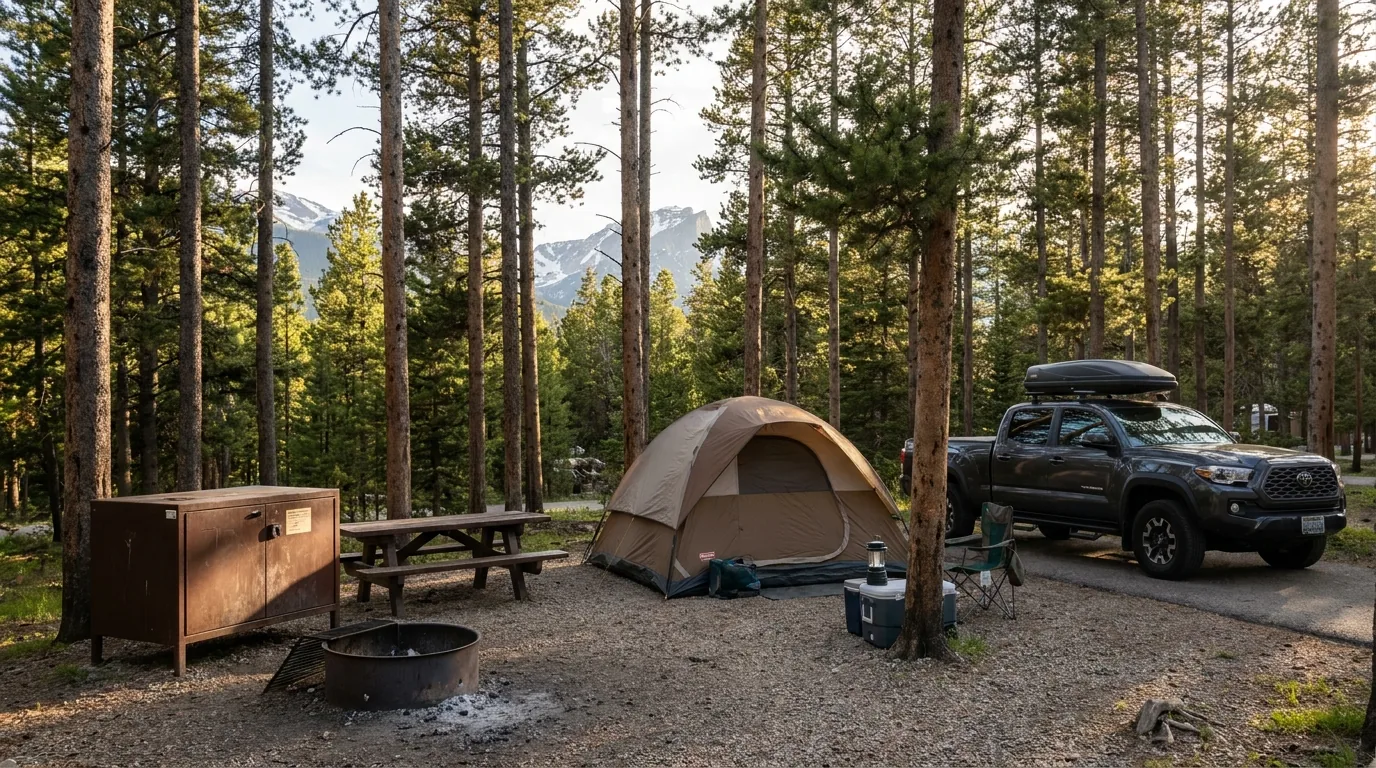
Campground reservation holders at Aspenglen, Glacier Basin, Moraine Park or Timber Creek — your camping reservation includes timed entry, and it bundles the Bear Lake Road tier, which is the tier everyone actually wants
Wilderness overnight backpacking permit holders — the permit serves as timed entry
Horseback riding reservation holders
Cyclists and pedestrians — no timed entry needed at all
Commercial Use Authorization and Special Use Permit holders
The 1 p.m. trap: your camping reservation admits you from 1 p.m. on your first day, not 9 a.m. If you want to hike the morning you arrive, book a separate timed entry for it. Budget the $2.
Entrance fees & passes (2026) — separate from the permit
The park is open 24 hours a day, 365 days a year; timed entry controls when you may drive in, not whether the park is open. Entrance stations are credit/debit card only — no cash. Private vehicle $30 for 1 day / $35 for 7 days; motorcycle $25 / $30; individual on foot or bicycle $15 / $20. RMNP annual pass $70. America the Beautiful annual $80 for US citizens and residents, $250 for non-US residents. Senior annual $20, senior lifetime $80. Military annual, Access Pass and 4th Grade Pass are free. 2026 fee-free days: 16 Feb, 25 May, 14 June, 3–5 July, 25 Aug, 17 Sept, 27 Oct, 11 Nov — and note that fee-free does not mean permit-free, so the 3–5 July window is a brutal permit scramble.
⚠️ Canadians and other non-US residents, read this before you budget. The 2026 NPS fee page describes an additional $100 per person fee for non-US residents aged 16+, waived if you hold an Annual or America the Beautiful pass. If that holds, two people at $100 each is $200 versus a single $250 non-resident America the Beautiful annual covering every US national park for a year. We are not printing this as settled: it is a new-style fee and the implementation detail — per visit or per year, and collected where — is not fully spelled out. Confirm on nps.gov/romo/planyourvisit/fees.htm before you plan around it.
The 60-second permit decision
Are you camping inside the park? Then you need no timed entry at all — but you can't enter before 1 p.m. on arrival day. Book a separate permit if you want that morning.
Do you want Bear Lake, Glacier Gorge, Sprague Lake or Moraine Park? You need Timed Entry + Bear Lake Road, and it's enforced 5 a.m.–6 p.m. There is no early workaround.
Everything else — Trail Ridge, the west side, Wild Basin, Longs Peak, Lily Lake? Standard timed entry, 9 a.m.–2 p.m. Arrive before 9 a.m. or after 2 p.m. and you need nothing.
Missed the month's release? Be online at 7 p.m. MDT the night before, logged in, with the date and tier pre-selected.
Struck out entirely? Spend the day at Lily Lake, the Estes Park Riverwalk, the Aerial Tramway or the Stanley — none of which need a park permit (§11).
03 / THE HIGH ROADS
Trail Ridge, Old Fall River, and Bear Lake
Three roads do most of the work in this park, and each has a different rule set. One is the highest continuous paved road in the United States and can gate shut in July. One is one-way, gravel, uphill, and bans anything over 25 feet. One is open year-round and carries the strictest permit window in the park. Know which is which before you plan a day around any of them.
Trail Ridge Road, topping out at 12,183 ft. Forty-eight miles between Estes Park and Grand Lake, climbing roughly 4,000 ft, with about 11 miles running above treeline near 11,500 ft. Allow at least half a day. It will take far longer than 48 miles should.
Trail Ridge Road — the dates
Opened for 2026: Thursday 28 May 2026. The Alpine Visitor Center and Trail Ridge Store opened Friday 29 May
Previous winter closure: closed to through travel Friday 14 November 2025
Typical pattern: NPS states the road is closed "from approximately mid-October through late-May." It opened 30 May in 2025 and closed 25 October in 2024
Long-run records: earliest opening 7 May (2002), latest 26 June (1943), average winter closure 23 October — but the NPS historical table stops at 2009 and was last updated 2015, so treat these as long-run averages, not a 2026 prediction
Plowing begins mid-April, with east- and west-side crews meeting at the Alpine Visitor Center
Opened 28 May 2026Historical figures, not forecasts
The closure behaviour that ruins itineraries
NPS states it directly: "Temporary road closures can go into effect at any time, based on weather and conditions." The road can be open at breakfast, gated by lunch, and open again by dinner.
It closes for snow in June, July and August. This is not a shoulder-season-only phenomenon. Early in the season expect ice from overnight melt-and-refreeze even in late May and June.
Call the recorded status line before you commit: (970) 586-1222. It's updated around the clock.
Can gate shut in any month970-586-1222
What it's like up top
NPS compares tundra conditions to "those found in the Canadian or Alaskan Arctic" — typically 20–30 °F colder than Estes Park or Grand Lake, with high wind and intense UV. People step out of a warm car in shorts at 12,000 ft and are genuinely shocked. Bring a real jacket, a hat and sunscreen for a driving day.
About 200 alpine plant species compress their entire life cycle into a ~40-day growing season. A single boot print off-trail can take decades to heal — stay on the path. Wildlife up here: pika, marmot, ptarmigan, bighorn sheep.
There is no fuel anywhere on Trail Ridge Road — or anywhere inside the park. Start full, from Estes Park or Grand Lake.
20–30 °F colder than town40-day growing season — stay on trailNo fuel in the park
The stops along the top, west to eastForest Canyon Overlook (11,716 ft) — a short paved walk to a railed overlook into a deep glacially-carved canyon with the Gorge Lakes beyond; brutally wind-exposed, small pullout that fills at midday. Rock Cut / Tundra Communities Trail (trailhead 12,050 ft) — 0.5 mi one-way, 200 ft gain to the Toll Memorial; paved and short, but it is half a mile at 12,000+ ft, so budget 45–60 minutes and expect to breathe hard. It is also the single most lightning-exposed easy walk in the park: no shelter, no trees, highest ground around. Alpine Visitor Center (11,796 ft) — the highest-elevation visitor center in the National Park Service, with the Trail Ridge Store, café, restrooms and ranger contact; the park notes its rangers are well acquainted with acute mountain sickness, which is a warning, not a joke. Milner Pass / Continental Divide (10,758 ft) at Poudre Lake — the classic sign photo and the Ute Trail access, on the west slope past the visitor center, so easy to run short on daylight or fuel if you tack it on late.
The Alpine Ridge Trail ("Huffer's Hill") leaves the Alpine Visitor Center lot as a steep stepped climb to a viewpoint. We are not printing a distance, gain or step count for it — NPS does not publish those figures and we won't invent them. Alpine Visitor Center opening dates track Trail Ridge Road's; confirm at nps.gov/romo visitor centers.
Old Fall River Road — different rules entirely
One-way uphill, gravel and dirt, from the Endovalley Picnic Area up to Fall River Pass and the Alpine Visitor Center at 11,796 ft. Built 1913–1920 — the park's first auto route over the mountains, and closed entirely from 1950 to 1960 after avalanche damage.
On the length, our sources conflict and we're saying so: the NPS "Things To Do" description gives 9.4 miles; the NPS scenic-drive narrative page gives 11 miles. Both are NPS. We are not picking one — plan for the longer figure and confirm at the source.
Hard vehicle rules: vehicles over 25 feet and any vehicle towing a trailer are prohibited. Speed limit 15 mph, grades reach 16%, no guard rails, narrow switchbacks and limited visibility in the trees.
2026 opening: Saturday 4 July 2026, typically running through early-to-mid October. Standard timed entry (9 a.m.–2 p.m.) applies. Earliest recorded opening: 6 June 1935.
9.4 mi vs 11 mi — both NPSOver 25 ft / towing: prohibitedOpened 4 July 2026
🔴 One-way means no bailout — and your brakes pay for it
Old Fall River Road is fine for most 2WD passenger cars in dry conditions, but understand the commitment: once you start, you finish at 11,796 ft. There is no turning around and no shortcut off. Then you descend Trail Ridge Road afterward, which is a 4,000-foot drop that will cook brakes if you ride them — descend in a low gear, not on the pedal. And don't attempt it with a passenger who hates drop-offs; there are no guard rails and the exposure is continuous. Parking at the Alpine Visitor Center and Rock Cut fills early and is not friendly to anything long.
Bear Lake Road — the year-round one
Open year-round, 9.2 paved miles, climbing 8,200 → 9,475 ft, entered 0.2 mi past the Beaver Meadows entrance. Snow and ice are possible in winter and spring, and Colorado's Traction Law can activate, requiring snow/mud-rated tyres or approved traction devices.
This is the corridor carrying the 5 a.m.–6 p.m. permit tier (§02), the free shuttle system, and the park's four most-hiked destinations. It is also where the parking problem is worst: the Bear Lake lot is "often full by 9 a.m. each day" in the park's own words, and Glacier Gorge is a smaller lot that fills earlier still — where roadside parking gets vehicles towed.
Open year-roundBear Lake lot full by 9 a.m.Glacier Gorge: towing enforced
The free shuttle — and everything it does not serve
Two free in-park routes run off the Park & Ride Transit Hub on Bear Lake Road, across from Glacier Basin Campground, about 5.2 miles up from the junction — the largest lot on the corridor and the sane default. The Bear Lake Route runs roughly 6:30 a.m.–7:30 p.m., every 10–15 minutes, to Glacier Gorge and Bear Lake. The Moraine Park Route runs roughly 7 a.m.–7:30 p.m., once per hour — miss it and you wait an hour — serving Sprague Lake, Glacier Basin, Hollowell Park, Moraine Park Campground, Cub Lake and the Fern Lake bus stop. Note the 7:30 p.m. bus does not serve the Glacier Gorge or Bear Lake stops. A separate Hiker Shuttle links the Estes Park Visitor Center to Park & Ride for $2 per reservation (up to 4 tickets) via Recreation.gov, reservation required.
⚠️ What the shuttle does NOT serve: Wild Basin, Longs Peak Trailhead, Lily Lake, Trail Ridge Road, Old Fall River Road, Alpine Visitor Center. Every one of those is drive-yourself. The published shuttle season runs roughly 23 May – 19 October, and the Hiker Shuttle's 2025 pattern was daily late May to 1 September then weekends only into mid-October — both flagged [UNVERIFIED for 2026]; confirm exact dates before building a car-free day. The Bierstadt Lake Trailhead stop was listed as service-unavailable at our check.
04 / THE HIKES
The trail roster, at the park's own numbers
Every distance and elevation gain below comes from the park's own List of Hiking Trails and Distances & Elevations tables — these are one-way figures unless stated, and they are the numbers rangers use. Times are fit-hiker moving estimates at altitude and are not NPS figures — NPS does not publish hiking times for most trails, so treat every time here as a consensus estimate, not a promise. And budget generously: a rule of thumb is 1.5× to 2× your sea-level time above 9,000 ft, and more on your first day.
Dream Lake — 1.1 mi one-way, 425 ft of gain. The Hallett Peak reflection is a sunrise subject; by mid-morning the wind is up and the mirror is gone. The photo you saw online was taken at 5:45 a.m., which is why the Bear Lake permit starting at 5 a.m. matters so much.
The Bear Lake corridor
Everything here leaves from the Bear Lake Trailhead (9,475 ft) and is served by the free Bear Lake shuttle. All of it sits inside the + Bear Lake Road permit zone (§02).
The guaranteed win · and the busiest half-mile in the parkBear Lake Loop
0.5 mi around the lake · 20 ft of gain per the NPS trail list. Largely flat and hard-packed — the closest thing in the park to a sure thing, with a full ring of peaks around the water. The park's Bear Lake page elsewhere cites 0.7 mi for the loop; a minor internal NPS discrepancy, and either way it's under a mile. Year-round, but snow-packed and icy November to May, when microspikes are genuinely necessary rather than optional.
If solitude matters to you at all, do it at sunrise or skip it — by 10 a.m. it is a slow-moving conga line. The lot is often full by 9 a.m. and far earlier on a July or September weekend; plan on before 6 a.m. or take the shuttle.
0.5 mi loop · 20 ftEasy · shuttle servedBusiest trail in the park
0.5 mi loop · 20 ft gain 20–40 min with stops (estimate)
The altitude reality check nobody plans forNymph Lake
0.5 mi one-way · 225 ft of gain. Short but it climbs steadily from the first step. The pond lilies that give it its name are a mid-to-late summer feature. Year-round with traction.
Everyone treats Nymph as a warm-up and blows past it. It is also the first place unacclimatized visitors discover that 9,500 ft is real. If 225 feet of gain has you gasping, that's your body telling you Emerald Lake will be harder than the mileage suggests. Listen to it — that information is worth more than the lake.
0.5 mi · 225 ftEasy–moderateYour altitude test
0.5 mi one-way · 225 ft gain ~20–30 min up (estimate)
The sunrise shot · check the bridge closure firstDream Lake
1.1 mi one-way · 425 ft of gain. Moderate. Year-round, but the trail holds hard snow well into June, and ice-out on the lake is typically late spring or early summer — confirm at the NPS Trail Conditions page rather than trusting a date.
A bridge replacement above Nymph Lake has caused temporary closures affecting access to Dream, Emerald and Haiyaha. Verify current status before you commit your one good morning to it. The Hallett Peak reflection is a sunrise subject only — by mid-morning the wind is usually up.
1.1 mi · 425 ftModerateBridge work — verify access
1.1 mi one-way · 425 ft gain ~45–60 min up (estimate)
Emerald Lake — 1.8 mi one-way, 605 ft of gain. The end of the Nymph–Dream–Emerald chain: three alpine lakes in under four miles round trip. The lake sits in a wind-funnel cirque under Hallett and Flattop and can be 20 °F colder and blowing hard while the trailhead was pleasant.
The park's signature short hikeEmerald Lake
1.8 mi one-way (3.6 mi round trip) · 605 ft of gain. Moderate. The Nymph → Dream → Emerald chain is the best scenery-per-mile in the park and the reason the Bear Lake lot fills before dawn. Popular year-round, but snow and ice on the final section persist into early summer — the last pitch below the cirque is where people in trail runners start sliding.
Bring the shell layer you were tempted to leave in the car. And budget properly: this 3.6-mile round trip genuinely takes many fit visitors three hours at this altitude. Reckon 2–3 hours with photo stops (estimate, not an NPS figure).
1.8 mi · 605 ftModerate · shuttle servedCold wind-funnel cirque
1.8 mi one-way · 605 ft gain 2–3 h round trip (estimate)
The green lake · and don't promise anyone the colourLake Haiyaha
2.1 mi one-way · 745 ft of gain. Moderate, and the last stretch is a boulder scramble to reach the water, not a groomed path. Summer through early fall is the realistic window — the boulder field is genuinely hazardous under snow or ice.
On 28 June 2022 a large rockfall came off the south slope of Hallett Peak into Upper Chaos Canyon. The grinding dumped enormous quantities of rock flour — glacier-style silt — into the lake, and Haiyaha turned milky sea-green as the suspended particles scattered blue and green light. NPS notes the deformation had been building since the early-to-mid 2000s and accelerated from 2018.
How long the colour lasts is unknown — it depends on ongoing slide activity and how fast the particles settle, so don't promise anyone turquoise. Chaos Canyon has reopened, but the park explicitly warns the talus slopes and rocks there are unstable and may continue to slide. Don't scramble west of the lake casually.
2.1 mi · 745 ftModerate + boulder scrambleUnstable talus in Chaos Canyon
2.1 mi one-way · 745 ft gain 3–4 h round trip (estimate)
The corridor's true summit dayFlattop Mountain
4.4 mi one-way (8.8 mi round trip) · 2,849 ft of gain. Strenuous — the only real summit day from Bear Lake, topping out on the Continental Divide with onward access to Hallett Peak. Mid-July through September for mostly snow-free travel; snowfields linger on the upper trail well past when the lower lakes are clear.
The top half is above treeline and fully exposed, with no water and no shelter on the upper mountain. This is a hike where the noon-thunderstorm rule (§07) is not advice, it's the plan — start at first light or don't start. Shuttle served, but the last Bear Lake bus is 7:30 p.m. and it's a long walk down if you miss it.
4.4 mi · 2,849 ftStrenuous · above treelineNo water, no shelter up top
4.4 mi one-way · 2,849 ft gain 6–8 h round trip (estimate)
Glacier Gorge
All from the Glacier Gorge Trailhead (9,240 ft), shuttle served on the Bear Lake route. The lot is small, fills before Bear Lake's, and roadside parking gets vehicles towed. Take the shuttle from Park & Ride and stop thinking about it.
The most-hiked waterfall in the parkAlberta Falls
0.8 mi one-way · 160 ft of gain. Easy, and a good first-day objective. Year-round, with peak flow in the late-spring and early-summer snowmelt — roughly late May into June. By late August it's noticeably thinner.
The rock beside the falls is wet, polished and deceptively slick. People scramble out for photos and slip. There is no railing and the drop is real.
0.8 mi · 160 ftEasySlick polished rock, no railing
0.8 mi one-way · 160 ft gain ~45 min round trip (estimate)
Arguably the best effort-to-payoff in the parkMills Lake
2.8 mi one-way (5.6 mi round trip) · 750 ft of gain. Moderate, with Longs Peak and Pagoda framed at the head of the gorge. Late June through October for dry trail; the slabs near the outlet ice over early.
The final approach crosses open granite slabs — wonderful in dry weather, genuinely dangerous when wet or verglassed, and there is nothing to grab.
2.8 mi · 750 ftModerateGranite slabs when wet
2.8 mi one-way · 750 ft gain 3–4 h round trip (estimate)
A destination in its own right — and the decision pointThe Loch (Loch Vale)
3.0 mi one-way · 990 ft of gain. Moderate, and also the mandatory first act of Sky Pond. Late June to October for dry trail; a snow-travel objective otherwise.
The Loch is where a lot of parties realise they don't actually have the time or the legs for Sky Pond. That's fine — it's a beautiful place to stop. Deciding that at the Loch rather than at Timberline Falls is the difference between a good day and a headlamp descent.
3.0 mi · 990 ftModerateYour honest turnaround point
3.0 mi one-way · 990 ft gain 3–4 h round trip (estimate)
Sky Pond — 4.9 mi one-way, 1,710 ft of gain. To reach it you climb the wet rock chute beside Timberline Falls: running water, permanent slime, and a fall consequence. It is hands-on climbing, not hiking — and the chute is the crux on the way down too, tired, with wet boots.
Strenuous, with a mandatory scrambleSky Pond
4.9 mi one-way (~9.8 mi round trip) · 1,710 ft of gain. To reach Sky Pond you must climb the wet rock chute beside Timberline Falls. It is widely described as a Class 3-ish move, but NPS publishes no rating for this route, so treat that number as community consensus rather than fact — and treat the move as harder than the number implies. The window is mid-July through September; earlier, the chute holds snow and ice and becomes a genuine mountaineering problem.
The chute is the crux on the way down too, tired, with wet boots. If anyone in your party is uneasy going up it, they will be worse coming down. Turn around at the Lake of Glass if the chute looks wrong — this is the most common serious-injury scramble in the corridor.
4.9 mi · 1,710 ftMandatory wet-rock scrambleCrux on the descent
4.9 mi one-way · 1,710 ft gain 7–9 h round trip (estimate)
The deepest walk-in point of the gorgeBlack Lake
5.0 mi one-way (10 mi round trip) · 1,430 ft of gain. Strenuous but non-technical, ending in a cirque ringed by Longs, Pagoda and McHenrys. July to September; the upper gorge holds snow late and the cirque is a cold sink.
The section above Ribbon Falls climbs steep wet rock and stays snowy longest. And be honest with yourself about the arithmetic: ten miles at 10,000+ ft is a much bigger day than ten miles at home.
5.0 mi · 1,430 ftStrenuous · non-technicalSnow lingers longest here
5.0 mi one-way · 1,430 ft gain 6–8 h round trip (estimate)
Wild Basin — the quiet corner with a hard access rule
🔴 The Wild Basin rule you must plan around
The Wild Basin entrance sits at 8,390 ft, about 13.2 miles from the Beaver Meadows Visitor Center, up a narrow historic dirt road. No shuttle serves Wild Basin — you drive, or you don't go. And park staff physically restrict vehicle access when the parking areas fill and congestion warrants, which happens most weekends in the summer, in the park's own wording. Practically: be at the entrance station at or before 7 a.m. on a summer weekend, or expect to be turned back and to walk the road. Separately, Wild Basin Road was scheduled closed 21–23 July 2026 for grading, gravel and drainage work — verify current road notices. Good news for permits, at least: Wild Basin sits outside the Bear Lake Road corridor, so the standard timed entry covers it.
Three waterfalls for one hikeOuzel Falls
2.7 mi one-way (5.4 mi round trip) from the Wild Basin Ranger Station (8,500 ft) · 950 ft of gain. Moderate, passing Copeland Falls and Calypso Cascades on the way. Late spring through fall, with peak water in the snowmelt season roughly late May into June — which is also when the bridges are most slippery.
Wet log bridges and spray-slick rock the whole way, waterfall viewpoints with no railings, and polished granite beside Ouzel. Wild Basin is also prime moose habitat — 120 feet minimum, and see §07.
2.7 mi · 950 ftModerateNo shuttle · moose country
2.7 mi one-way · 950 ft gain 3–4 h round trip (estimate)
The big day in Wild Basin · one of the least-crowded hard hikes on the east sideBluebird Lake
6.0 mi one-way (12 mi round trip) · 2,478 ft of gain. Strenuous. Mid-July through September — the upper basin holds snow late and the final headwall is the last thing to melt out.
The final climb is a steep rocky headwall that is easy to lose in poor visibility, and the basin is above treeline and exposed. Twelve miles and 2,478 feet with a six-mile walk-out means your turnaround time is non-negotiable — set it before you leave the car. And no shuttle: twelve miles plus a possible road walk if you arrive late is a brutal combination, so this hike demands a genuinely early start for parking reasons alone.
6.0 mi · 2,478 ftStrenuous · exposed basinNo shuttle · set a turnaround
6.0 mi one-way · 2,478 ft gain 8–10 h round trip (estimate)
The easy wins
Sprague Lake
A 0.8-mile wheelchair-accessible loop, flat, with Continental Divide views; the turnoff sits at 8,690 ft. Shuttle served on the Moraine Park route — hourly, mind the schedule. Requires the + Bear Lake Road permit. Year-round, and an excellent easy snowshoe in winter.
The honest read: it's the best sunrise reflection in the park, which means the small lot has photographers in it before dawn. Later in the day it's crowded and the reflection is gone. And it is still 8,690 ft — visitors read "accessible loop" as "effortless" and get winded.
0.8 mi accessible loop30–45 min (estimate)
Lily Lake
A 0.8-mile (1.3 km) level, hard-packed loop, strollers permitted, at 8,880 ft, about 7 miles south of the Estes Park Visitor Center on Hwy 7. Vault toilet, picnic tables, observation pier. Views of Longs Peak, Mount Meeker and Twin Sisters. No shuttle.
The underrated fact: Lily Lake sits outside the Bear Lake Road corridor and is reached from Hwy 7 without passing an entrance station, making it one of the best options on a day you couldn't get a permit. Confirm the current permit treatment for the Lily Lake area before relying on that. Small lot, no overflow, fully exposed — a poor choice with storms building.
0.8 mi loop · minimal gainLikely no-permit option — confirm
Destination
Trailhead
One-way
Gain
Shuttle?
Bear Lake loop
Bear Lake (9,475 ft)
0.5 mi
20 ft
Yes
Nymph Lake
Bear Lake
0.5 mi
225 ft
Yes
Dream Lake
Bear Lake
1.1 mi
425 ft
Yes
Emerald Lake
Bear Lake
1.8 mi
605 ft
Yes
Lake Haiyaha
Bear Lake
2.1 mi
745 ft
Yes
Flattop Mountain
Bear Lake
4.4 mi
2,849 ft
Yes
Alberta Falls
Glacier Gorge (9,240 ft)
0.8 mi
160 ft
Yes
Mills Lake
Glacier Gorge
2.8 mi
750 ft
Yes
The Loch
Glacier Gorge
3.0 mi
990 ft
Yes
Sky Pond
Glacier Gorge
4.9 mi
1,710 ft
Yes
Black Lake
Glacier Gorge
5.0 mi
1,430 ft
Yes
Ouzel Falls
Wild Basin RS (8,500 ft)
2.7 mi
950 ft
No
Bluebird Lake
Wild Basin RS
6.0 mi
2,478 ft
No
Longs Peak summit
Longs Peak RS (9,300 ft)
8.0 mi (see §06)
4,885 ft
No
Tundra Communities / Toll Memorial
Rock Cut (12,050 ft)
0.5 mi
200 ft
No
Lily Lake loop
Lily Lake (8,880 ft)
0.8 mi loop
minimal
No
Sprague Lake loop
Sprague Lake (8,690 ft)
0.8 mi loop
minimal
Yes (hourly)
All figures from the NPS List of Hiking Trails and Distances & Elevations tables, one-way unless stated. Times quoted in the entries above are consensus estimates for fit hikers at altitude, not NPS figures — NPS does not publish hiking times for most trails.
05 / LONGS PEAK — READ BEFORE YOU DECIDE
The park refuses to call it a hike. Neither will we.
Longs Peak is 14,259 ft, the only Fourteener in the park, and the most consequential decision in this issue. The National Park Service's own framing is blunt: this is "not a hike" but "a climb that crosses enormous sheer vertical rock faces," with narrow ledges, loose rock, and steep cliffs where "an unroped fall would likely be fatal." We are not going to soften that, and we are not going to sell it to you.
Longs Peak, 14,259 ft. The trail ends at the Boulder Field, roughly five miles in. From there the Keyhole Route begins, marked by red-and-yellow bull's-eyes painted on the rock — and the final 1.5 miles is the most difficult and hazardous section of the entire route.
Metric
Figure
Note
Distance to summit
7.5 mi or 8.0 mi one-way
NPS states both. The Keyhole FAQ says 7.5 mi; the trail table says 8.0 mi. We are not picking one — both round to ~15–16 miles round trip
Elevation gain
4,885 ft
NPS trail list
Round trip
~15 miles
NPS Keyhole FAQ
Round-trip time
10–15 hours
NPS Keyhole FAQ — this one is an official figure
Trailhead
Longs Peak Ranger Station, 9,300 ft
9.0 mi from Beaver Meadows Visitor Center
Summit
14,259 ft
~50% less oxygen than sea level
Technical rating
None published
NPS has deliberately stopped assigning technical ratings, stating they are "subjective and influenced by rapidly changing conditions." Treat the widely-quoted "Class 3" as unverified against NPS — and treat the route as harder than the number implies
The route, in sections
The trail goes to the Boulder Field, roughly five miles in. From there the actual Keyhole Route begins, marked by red-and-yellow bull's-eyes painted on the rock. The park warns not to rely on GPS for this.
Past the Keyhole notch come the Ledges, the Trough, the Narrows and the Homestretch. The final 1.5 miles is the most difficult and hazardous section of the entire route.
There are no water sources on route. Carry 3–4 quarts minimum, plus high-energy food, layered clothing, sturdy footwear, storm gear, a headlamp, map and compass, and first aid. Cell coverage is unreliable.
When it's actually "in season"
Mid-July through mid-September is the window with the most snow-free conditions.
Outside it, NPS is direct: "For most of the year, Longs Peak is in winter conditions, which requires winter mountaineering experience." That is not "harder." It is a different sport, requiring an axe, crampons, and the skills to use them. And even in season, winter-like conditions can arrive on any given day.
The alpine start is not optional. The park says to start before sunrise: most of the route is above treeline and you need to be back below treeline before afternoon thunderstorms develop. "Attempting the summit in the afternoon greatly increases your risk."Common practice is a 1–3 a.m. departure, but that specific hour is climber consensus — NPS says only "before sunrise."
🔴 Why people die here — the park's own analysis, and the most useful thing on this page
Longs Peak has a long, documented fatality record, and NPS maintains individual incident releases for deaths on the Keyhole Route, on the Longs Peak Trail, and below the Ledges. Three patterns run through them:
Most accidents happen on the DESCENT, when fatigue sets in. Summiting is not the finish line — it is roughly the halfway point of the danger. Plan your energy, water and daylight for a full round trip, not for the top.
Many have fallen while shortcutting or continuing on after losing the route. When you can't find the next bull's-eye, the correct action is to stop and backtrack until you can — not to improvise upward.
People have died or been seriously injured because they travelled alone or split from their group. Solo travel is never recommended here, per NPS.
A specific cumulative death count for Longs Peak is widely circulated online. We are not printing one — NPS does not publish a running total, and a number we can't source has no business in a guide you paid for.
Who should not attempt Longs Peak
Without hedging:
Anyone not acclimatized — arriving from sea level within 48 hours is a recipe for altitude sickness at 14,000 ft
Anyone uncomfortable with heights or exposure. The Narrows and Ledges have consequential drops with no protection. If exposure makes you freeze, this route will find that out at the worst possible moment
Anyone who has not done a hard 10+ mile mountain day recently. Fifteen miles and ~4,885 ft is a big day even without the scrambling
Anyone who can't commit to a pre-dawn start and being off the summit by mid-morning
Anyone going solo, per NPS
Anyone who can't turn around. The mountain will be there next year
In snow conditions — which is most of the year — anyone without winter mountaineering skills and equipment
Parking and permits: the Longs Peak Trailhead lot is small and fills overnight — climbers arriving at 2 a.m. routinely find it full. NPS does not publish a fill time for this lot, so treat that as reported experience rather than an official figure. No shuttle serves Longs Peak. No timed-entry permit is needed for a pre-9 a.m. arrival, and you will be arriving well before 9 a.m.
Before you go: check the Longs Peak Conditions Report and the webcam, both linked from the park's Longs Peak page.
NPS: "an unroped fall would likely be fatal"Accidents cluster on the descentMid-July – mid-Sept window
06 / SAFETY — READ THIS FIRST
Altitude, the noon rule, and the animals
Three things account for most of what goes wrong here, and none of them is a cliff. The first is altitude, which people from sea level consistently underestimate. The second is the afternoon thunderstorm, which is the most important operational rule in the park in summer. The third is wildlife distance rules that are legally enforceable, not etiquette. The park's own perspective is worth carrying: the risk of a lightning strike is greater than the risk of a mountain lion attack. Storms deserve more of your planning attention than predators do.
Altitude — take this seriously
Park roads run 7,800 to 12,183 ft. Most trailheads start above 7,800 ft. Campgrounds sit at 8,160 ft (Moraine Park) to 9,500 ft (Longs Peak) — you are sleeping at altitude, not just visiting it. At the top of Trail Ridge Road there is roughly 35% less oxygen than at sea level; on the summit of Longs Peak, about 50% less.
Acute mountain sickness can start as low as 8,000 ft and affects as many as 20% of people travelling from sea level above 8,000 ft — regardless of fitness. Being an athlete does not protect you. Symptoms: headache, shortness of breath, fatigue, loss of appetite, nausea, poor sleep.
Park guidance: high altitude raises the risk of dehydration, severe sunburn and mountain sickness, and worsens existing health conditions. Drink several quarts of water per day. Reapply sunscreen often. If symptoms develop, descend immediately — descent is the treatment, and there is no toughing it out.
AMS starts as low as 8,000 ftFitness is not protection
What actually works
Hydrate aggressively. Water is the single highest-leverage intervention — the air is dry and thin and you lose water just breathing
Go easy on alcohol and caffeine for the first days; both hinder adjustment
Replace electrolytes, not just water. Low- or no-sugar sports drinks carry the right salt balance
Do not plan a big hike on day one or two. Arrive, walk something flat, let your body work
Sleep low. Night one in Estes Park (~7,500 ft) or Moraine Park (8,160 ft) rather than Longs Peak Campground (9,500 ft) is standard advice and it is good advice
Budget 1.5× to 2× your sea-level time above 9,000 ft, and more on day one — a rule of thumb, not an official figure
If you fly into Denver (5,280 ft) and drive straight to a 9,500-ft tent site the same evening, you have gained 4,200 ft in a few hours, and you will probably sleep badly and feel rough. Note: this altitude guidance comes from the park's partner/tourism sites rather than an nps.gov medical page. It matches standard wilderness-medicine advice, but treat it as general information — talk to a doctor if you have cardiac or respiratory conditions.
🔴 The afternoon thunderstorm rule — be below treeline by noon
This is the most important operational rule in the park in summer, and the park's reasoning is simple: most thunderstorm activity occurs after noon, so start summit hikes early and be back below treeline before storms develop. Weather can go from sunny to "windy and wet within a matter of minutes." Roughly 11 miles of Trail Ridge Road and every good high trail sit above treeline with no shelter of any kind.
If you are caught above treeline in lightning: avoid summits and isolated features, and crouch on your heels — do not lie flat. Carry raingear, map and compass, a flashlight, sunglasses, extra layers and a first aid kit even on a short hike.
This is not theoretical. The park has issued releases on injuries from a lightning strike near Lake Haiyaha — a two-mile hike, not a summit. And hypothermia is a year-round risk here, not a winter one. Stay warm, stay dry.
The autumn elk rut, September into October. Bulls bugle, gather harems and spar in the open meadows — the park's biggest annual wildlife spectacle. It is also a roadside, long-lens activity, because the meadows close to off-trail travel from 5 p.m. to 10 a.m. through the whole season.
Legal viewing distances — these are enforceable
Animal
Minimum distance
Elk, bighorn sheep, mule deer
75 feet (23 m) — about two bus lengths
Moose, black bears, mountain lions
120 feet (36 m) — about three bus lengths
"If wildlife reacts to you, you are too close." Harassing or feeding wildlife is illegal in all national parks — and so is calling, clicking, whistling or making noises of any kind to attract wildlife. Bugling back at a bull is illegal harassment.
Habituated animals lose their fear of people, become aggressive, and often end up destroyed. The 75-foot rule is not about your safety alone.
The rut, and the closures that bite
Peak season: September through October, with the peak generally mid-September to mid-October. Best viewing at dawn and dusk in Moraine Park, Horseshoe Park, Upper Beaver Meadows, Sheep Lakes, and on the west side Harbison and Holzwarth Meadows plus the Kawuneeche Valley.
Beginning 1 September and running through 31 October, the meadows at Horseshoe Park, Upper Beaver Meadows, Moraine Park, Harbison Meadow and Holzwarth Meadow are closed between 5 p.m. and 10 a.m. to all travel on foot or horseback off established roads and trails — exactly the hours the elk are best.
In practice: during the rut you watch from the road, the pullouts and established trails — not from the grass. Bring binoculars, pull fully off the road, stay in or beside your vehicle, never position yourself between a bull and his harem or between any animal and its escape route. Rutting bulls are unpredictable, aggressive and fast; cows with calves are dangerous too.
Meadows closed 5 p.m. – 10 a.m., 1 Sep – 31 OctConfirm the 2026 order
Moose — 120 feet, and you run
Most common in the Kawuneeche Valley on the west side and around the Wild Basin willow carrs. They look placid and are not — a moose that lays its ears back or raises its hackles is about to charge. Unlike with bears, you run from a moose, and you put a solid tree or vehicle between you and it. Confirm the park's exact moose guidance on the NPS moose page before you rely on the specifics.
Black bears — and food storage that is citable
Rocky has black bears, not grizzlies. Never approach; keep children close; travel in groups. If a bear approaches, stand tall and make loud noises — shout, clap, clang pots. Fight back if attacked (black-bear guidance, which differs from grizzly protocol). Never try to retrieve anything a bear has taken. Report all encounters to a ranger.
Store food in your vehicle's trunk, out of sight, windows fully closed, or in site-provided storage lockers; trash goes in wildlife-proof containers. Unattended food, coolers and cookware are subject to confiscation and citation.
🔴 Your dog cannot go hiking with you here — state it plainly
Per NPS: "Pets are prohibited on ALL Rocky Mountain National Park trails, tundra, and meadows." Dogs are also not allowed in visitor centers, non-motorized areas, or wilderness trails. The entire list of where a leashed dog may go — leash 6 feet maximum — is: established roads, parking areas, established campgrounds, and picnic areas. That's it. Pets must be quiet, waste must be packed out, and pets may not be tied to vehicles, trees or other objects, nor left unattended in a vehicle where it endangers the animal or disturbs the public. Individually trained service animals are permitted; emotional support animals are not service animals under the ADA and are held to the pet rules.
Do not gamble on this. It is among the most enforced rules in the park, and violations can bring citations, fines, and a mandatory appearance before a U.S. Magistrate Court in Denver. It catches out people arriving from national forest land, where dogs are welcome on trail.
So what do you actually do? Camp with the dog and hike without it — legal and normal. Or board it in Estes for the days you want a big hike: the park operates no kennels but notes daycare, boarding and vets are available nearby. Confirmed Estes options include Animal Hospital of the Rockies, 453 Pine River Ln, (970) 586-4703 — boarding $40/night, $30 for a second dog in the same kennel; Elena's Barking Lot Inc., (970) 586-0340, home-style, overnight boarding 365 days a year; and Estes Park Pet Lodge, 1260 Manford Ave, (970) 586-9282. The median Estes boarding rate was reported at roughly $50/night as of March 2026 — a third-party figure, so confirm when you book. Surrounding national forest land has far more permissive dog rules, but confirm specific trail rules with the relevant USFS ranger district.
07 / THE CAMPING STRATEGY
Five campgrounds, one closure fight, and no showers anywhere
Booking a night inside the park solves the hardest logistics problem in Rocky: your camping reservation includes timed entry, and it bundles the Bear Lake Road tier that everyone else is fighting for at 8 a.m. on release day. If you can get a site, get the site. Four of the five are reservation-only through Recreation.gov; one is the park's only first-come, first-served ground. And none of them — not one — has a shower.
A site inside the park is the whole game. It bundles the Bear Lake Road timed-entry tier, puts you on the free shuttle, and takes the 8 a.m. permit scramble off your calendar entirely — but it only admits you from 1 p.m. on arrival day, and it comes with no shower.
Campground
Side · elev.
Sites
2026 season
Booking
RV limit
Hookups · water · dump
Moraine Park
East · 8,160 ft
244 (49 electric)
21 May – 19 Oct 2026
Reservation (year-round)
40 ft total
Electric (20/30/50 amp) at 49 sites · water yes · dump yes
Glacier Basin
East, Bear Lake Rd · 8,500 ft
150 (73 tent-only) + group loop
21 May – 8 Sep 2026
Reservation
35 ft (group loop 21 ft)
None · water yes · dump yes
Aspenglen
East, Fall River · 8,200 ft
52 (13 tent, 5 walk-to)
21 May – 28 Sep 2026
Reservation
30 ft
None · water yes · no dump (nearest Moraine Park)
Timber Creek the only west-side option
West, Grand Lake · 8,900 ft
98 (30 tent-only)
DISPUTED — see the warning below
Reservation
30 ft
None · water yes + RV freshwater fill · dump yes
Longs Peak
East, Hwy 7 · 9,500 ft
26 — TENTS ONLY
2 Jul – 8 Sep 2026
First-come, first-served
n/a
None · NO WATER · no dump · vault toilets
🔴 TIMBER CREEK 2026 — we will not pick a side for you. Confirm before you book.
This is the single most consequential unresolved fact in this issue, and it decides whether the west side of the park has any NPS camping at all.
Source A — NPS news release, January 2026. Timber Creek closes at noon on Monday 10 August 2026 for a sewer system rehabilitation project (manhole replacement, pipe spot repairs, pipe lining) and remains closed through the end of the 2026 season.
Source B — an update dated late June 2026. Following a review of updated project timelines, the closure was called off for this season: construction will not begin in 2026, Timber Creek stays open, reservations run on recreation.gov through 4 October, and the campground closes for the season at noon on 5 October 2026. That page returned a 403 to direct fetch and was read from the indexed listing.
The January release is still live. The June update supersedes it, and is probably right — but "probably" is not good enough when the downside is arriving on the west side with nowhere to sleep. Timber Creek is the only campground on the west side of RMNP. If it is shut, that side of the park has zero in-park campground capacity, everyone spills into a much smaller inventory of Forest Service and commercial ground around Grand Lake and Granby, and the nearest in-park alternative is 60+ miles away over Trail Ridge Road, which is itself seasonal and can gate shut without notice.
What to do: confirm on the recreation.gov Timber Creek listing and the nps.gov/romo camping page before you make any west-side plan, and have a Grand Lake-area fallback identified either way. If both sources still disagree when you check, call the park: 970-586-1206.
2026 fees
Standard non-electric site: $35/night — Moraine Park, Aspenglen, Glacier Basin, Timber Creek
Electric site: $55/night — confirmed for Moraine Park's 49 electric sites
Glacier Basin group sites: $50–$70/night
Longs Peak: $30/night
⚠️ One fee we will not state as fact: the NPS camping page also lists $55 electric pricing for Aspenglen and Timber Creek, while recreation.gov's Aspenglen and Timber Creek listings describe no hookups at all. Those two sources contradict each other. Book by site and read the site type on the listing — don't assume an electric site exists at either.
The hookup gotcha
Half the blog posts online still say "there are no hookups at any RMNP campground."That is out of date. Moraine Park now has 49 electric sites (20/30/50 amp) at $55/night.
What remains true: there is no water or sewer hookup anywhere in the park. Electric only, at specific numbered sites, and the electric sites are the first to go. Filter for site type when you book.
Also current: Moraine Park's fresh-water RV fill is out of service — the dump station itself works, the fill doesn't. Plan your water elsewhere.
49 electric sites at Moraine ParkNo water/sewer hookups anywhere
Which loop suits which rig
Big rig, trailer, 5th wheel (35–40 ft total):Moraine Park is your only option — the only campground taking 40 ft, the only one with electric, the only one with an on-site dump station and the largest at 244 sites. Paved roads, flush toilets, free shuttle stop to the Bear Lake corridor. It is also the only campground open in winter (Loops A, B, C, E, first-come)
Mid-size to 35 ft wanting trailhead access:Glacier Basin, 5 miles up Bear Lake Road, with a shuttle stop to Bear Lake, Glacier Gorge and Bierstadt. 150 sites in loops A–D. Max 8 people, 2 vehicles per site. Generators in Loops A, B and part of C only, 7:30–10 a.m. and 4–8:30 p.m., prohibited in Loop C sites 76–104 and the group loop. Group loop sites 1–13 are tent-only, nothing over 21 ft. Firewood sold 5–8 p.m.
Small rig, van, 30 ft and under, east side:Aspenglen, 52 sites off the Fall River (US 34) entrance. Quiet and small, but no dump station — plan to use Moraine Park's
West side:Timber Creek on the Colorado River, 30 ft limit, dump station and RV freshwater fill — subject to the closure dispute above
Tent, alpine, no frills:Longs Peak, 9,500 ft, 26 sites, no water at all, first-come. Bring every drop you'll drink
Booking mechanics — and the one first-come option
Standard sites release 6 months in advance on Recreation.gov, and some inventory opens 1–2 weeks prior to arrival — worth a check even when everything looks gone. Check-in 1 p.m., check-out 12 noon, 7-night maximum stay during peak season.Food storage boxes are provided at each site at Moraine Park; this is bear country and food storage is not optional (§06).
Longs Peak is the park's only first-come, first-served campground: 26 tent-only sites, 2 July – 8 September 2026, $30, no drinking water, vault toilets, and the highest campground in the park at 9,500 ft. Community reporting is consistent that it fills by early afternoon in summer — it's the staging camp for the Keyhole Route and alpine-start climbers grab it — but that timing is consensus, not an NPS statement. In winter, Moraine Park's A/B/C/E loops also go first-come.
Camping outside the park
Olive Ridge Campground (USFS)
The closest Forest Service campground to the Wild Basin / Longs Peak side. 8,350 ft, 56 sites in three loops (DIPP, SNEE, PIKA) — 26 RV-suitable, 30 tent-suitable. $29/night single, $58/night double, extra vehicle $8/night. Reservation via Recreation.gov.
"Water is not available at Olive Ridge." Vault toilets, picnic tables, fire rings, trash service, firewood sales. No dump station, no showers, no hookups. On CO Hwy 7 between Allenspark and Meeker Park, 15 miles south of Estes Park, 14 miles from the park entrance. Sites must be occupied within 26 hours or they revert to first-come.
Season dates unverified — confirm on the Forest Service Olive Ridge page.
Meeker Park Overflow (USFS) — the cheap fallback
29 first-come, first-served sites for tents, campers, trailers and small RVs. $14/night, senior and access pass discounts apply. June through September, near Allenspark, with the Longs Peak Trailhead about 2 miles north. Picnic tables, fire rings, portable toilets only. No drinking water, no electricity, no hookups, no dump station, no showers. 14-day limit.
This is the play for Longs Peak climbers who can't get one of Longs Peak Campground's 26 first-come sites — $14, two miles from the trailhead, no lottery to win.
Exact 2026 open/close dates and the $14 rate are unverified — confirm on the Forest Service page.
🔴 Dispersed camping and fire restrictions — the sleeper trip-killer
Dispersed camping is legal on Arapaho & Roosevelt National Forest land, but the rules are specific. On the Canyon Lakes Ranger District: camp within 300 feet of most Forest Service roads and some Larimer County roads, on National Forest System land; along the busy Manhattan, Long Draw and Peterson Lake roads, only at numbered marked sites; no camping within ¼ mile of Highway 14, within ¼ mile of lower Stove Prairie Road, or within ¼ mile of upper Larimer County Road 63E; and your vehicle must be within 300 ft of the road and at least 100 ft from water or meadows. On the Boulder Ranger District, a designated-dispersed order applies at Winiger Ridge / 68J — designated sites only.
But for summer 2026 that is largely academic. Our dossier recorded Stage 2 fire restrictions on the Canyon Lakes Ranger District from 12:01 p.m. on 2 July 2026 through 31 December 2026, with restrictions also in place on the Boulder and Clear Creek districts. Under Stage 2, camping is prohibited except in campgrounds and designated dispersed sites, and fires are prohibited except in Forest Service-designated campgrounds and sites — practically, no campfires, gas or liquid-fuel devices only, in a cleared area. If your plan was "free dispersed camping with a fire in the national forest," Stage 2 kills both halves of it on the districts flanking the park.
⚠️ Restrictions escalate and de-escalate through the season, and the Boulder district listing showed both a Stage 1 and a Stage 2 alert at our check — we could not determine which was operative. Check fs.usda.gov/r02/arp/alerts/fire-restrictions the week you go, for your specific site.
Wilderness & backcountry permits
Every overnight in RMNP's wilderness requires a permit. Reservations open 1 March at 8:00 a.m. MST on Recreation.gov for the summer season — log in before the drop; the system holds your inventory for 15 minutes while you pay. Permits must be picked up in person to be activated, as early as 30 days before your trip start date. Winter permits (Nov–Apr) are first-come, in person only — no advance reservations. A wilderness permit doubles as your timed entry permit.
On the fee, our sources conflict and we're saying so: the NPS wilderness backpacking page states a $10 per permit administrative fee; the park's own system-implementation release describes a tiered fee of $36 (1 May – 31 Oct) and $10 (1 Nov – 30 Apr). Budget $36 for a summer trip and verify at checkout on Recreation.gov.
Bear canisters are mandatory, 1 April – 31 October. A commercially made, hard-sided, lockable, carry-in/carry-out bear-resistant canister is required for all wilderness overnights, and NPS requires you to bring the canister into the Wilderness Office to obtain your permit — they check. All food, scented items and garbage go in it, stored on the ground well away from camp (NPS pages give both "200 feet" and "70 adult steps" — same intent; use 200 ft). Rent or buy in Estes Park or Grand Lake.
Wilderness Office
Address
Phone
Hours
Beaver Meadows (east / Estes Park)
1000 US Hwy 36
970-586-1242
Year-round, 7:00 a.m. – 3:30 p.m. daily
Kawuneeche (west / Grand Lake)
16018 US Hwy 34
970-966-0394
15 May – 30 Sep, 7:00 a.m. – 3:30 p.m. daily; closed in winter
Group size limits and specific backcountry fire rules were not confirmable in our research — see the NPS Wilderness Camping Guide before you plan a group trip.
08 / TOWNS & SERVICES
Estes Park has everything. Grand Lake does not.
Getting this wrong is the classic west-side mistake. Estes Park (~7,500 ft) is a genuinely full-service town — real grocery stores, a hospital, hardware, laundromats, a dozen outfitters — and for an east-side camping trip you never need to leave it. Grand Lake (~8,400 ft) is a charming boardwalk town at the far end of Trail Ridge Road with one real grocery store, no hospital, and a lot of seasonal businesses. Plan your resupply around that asymmetry.
Estes Park, ~7,500 ft. The east-side hub at the junction of US-34, US-36 and CO-7, immediately outside the Beaver Meadows and Fall River entrances. Full groceries, fuel, propane, hardware, gear rental, urgent care and a 23-bed hospital — and the town's whole shower plan for campers, in one strip mall.
🔴 The shower plan — because no RMNP campground has one
This matters more than it sounds. Moraine Park, Glacier Basin, Aspenglen and Timber Creek do not have showers. On a four-night trip that is the whole hygiene question, and the answer is one address:
Dad's Maytag Laundry & Showers, 457 E Wonderview Ave, Estes Park · (970) 586-2025. Public showers in private stalls, towels available, in the same strip centre as Safeway (northwest corner) — so you can do the big grocery shop, swap a propane cylinder and get clean in one stop. Reported showers $8 with no time limit, washers $1.50, dryers $1.25, open 7 days and generally not past 8 p.m.
⚠️ Those prices and hours come from directory listings, not the business's own site, and are unverified for 2026 — call before you drive over with a towel and a fistful of quarters. Two other Estes laundromats exist — Estes Park Laundracenter (National Park Village) and Village Laundry — but neither had hours or services confirmable from a business-owned source, and we're not printing details we couldn't stand behind.
On the west side there is no confirmed standalone public laundromat with public showers in Grand Lake. The practical workaround is Elk Creek Campground & RV Park (now operating as the Grand Lake / RMNP KOA Journey), about half a mile northwest of town, which has showers, restrooms, laundry, a dump station and a general store — showers free to registered campers. Non-guest access is not confirmed. Call first.
Estes Park — groceries, fuel & propane
Safeway, 451 E Wonderview Ave (Stanley Village) — the big shop. Full supermarket, pharmacy, AmeriGas propane exchange, and its own fuel station. This is where you do the real resupply
The Country Market of Estes Park, corner of Moraine Ave & Marys Lake Rd — locally owned, and physically on the road to the Beaver Meadows entrance, which Safeway is not. Made-to-order deli sandwiches, soup, hot coffee: the trailhead-lunch stop. Also firewood, ice, charcoal and propane
Sinclair — 860 Moraine Ave (on the way to Beaver Meadows) and 1110 Woodstock Dr
Shell — 534 S Saint Vrain Ave, on the CO-7 side, with a car wash
Propane refill/delivery: Ferrellgas, Estes Park. A refill location at 561 Big Thompson Ave is also listed but unverified — call before driving over with a 20 lb tank; refill (as opposed to swap) availability in Estes moves around
There is no fuel inside Rocky Mountain National Park. Fill in Estes (east) or Grand Lake (west) before you drive Trail Ridge.
Estes Park — hardware, gear & medical
Ace Hardware of Estes Park, 561 Lone Pine Dr, (970) 586-8656 — reported Mon–Sat 8–6, Sun 9–5. Tarps, straps, the bolt you sheared
Estes Park Mountain Shop — in business since 1986, 15,000 sq ft, the town's largest outdoor retailer and the deepest rental department in the Estes Valley: climbing gear, fly fishing, snowshoes and traction spikes in winter, e-bikes. Indoor climbing wall. Go here if you need to rent
The Warming House — since 1983, two floors of hiking and backpacking kit, best known for boot fitting, on the road toward Beaver Meadows. Go here if your boots are wrong — it's the one thing you cannot fix yourself on a trip
Scot's Sporting Goods — outdoor retail plus guided fly fishing. Kirks Fly Shop, 230 E Elkhorn Ave — full retail fly shop and outfitter
Estes Park Health Urgent Care, 420 Steamer Dr, (970) 577-4500 — reported Mon–Sat 8 a.m.–8 p.m., with on-site X-ray. UCHealth Estes Valley Medical Center / Estes Park Health is a 23-bed critical access hospital with a 24-hour ambulance service, emergency department, helipad, radiology and surgical services
Read the medical picture plainly: a 23-bed critical access hospital handles a broken ankle, altitude sickness, stitches and stabilisation. Anything genuinely serious gets flown or driven to Loveland or Fort Collins — roughly an hour down Big Thompson Canyon in good conditions. Urgent care hours are reported, not confirmed for 2026.
Grand Lake — what's actually there, and what isn'tGroceries:Mountain Market, 400 Grand Ave, (970) 627-3470 — a locally owned specialty grocery and butcher with produce, premium cut meat, craft beer and wine. Reported Mon–Fri 7 a.m.–8 p.m., Sat 7 a.m.–7 p.m., Sun 9 a.m.–8 p.m. This is essentially the town's grocery store, singular. Fuel: a Conoco at the entrance of town, corner of US-34/Trail Ridge Rd and West Portal Rd, with other stations listed in the wider Grand County area. Gear: boat and lake rentals, snowmobile and side-by-side rental, small retail — there is nothing here equivalent to the Estes Park Mountain Shop.Medical: no hospital in Grand Lake. Nearest full services are down-valley in Granby, Kremmling or Winter Park.
⚠️ Grand Lake hours, the station list, and the nearest specific medical facility are unverified — confirm before you rely on any of them. And a seasonality warning: a meaningful share of Grand Lake's boardwalk businesses are summer-and-winter operations that shut or cut to weekends in April–May and late October–November. If you arrive in Grand Lake on a Tuesday in early May, assume you are cooking your own dinner.
The west side's burn scar — set expectations honestly
The East Troublesome Fire ignited 14 October 2020, ran about 18 miles, and reached the west side of the park a week later. It burned 193,812 acres — the second-largest fire in recorded Colorado history — forcing the evacuation of Grand Lake on 21 October and most of the Estes Valley on 22 October. Combined with the Cameron Peak Fire, roughly 30,000 acres, about 9% of RMNP, was affected. On the west side, 31 miles of trail, 18 backcountry campsites and 13.5 miles of road were in the burn area.
Because the fire was wind-driven and fast, assessment teams believe the soils were less severely cooked than in a slower burn, and native sedges are rebounding from surviving root systems. But park scientists have publicly framed full recovery in decades, not years.
So: parts of the Kawuneeche Valley and Grand Lake's backyard are standing burn — grey snags, open sightlines, little shade, and real hazard-tree and flash-flood risk inside the scar. Some people find it bleak; some find it the most interesting landscape in the park. It is not "ruined," but it is not what the pre-2020 photos show, and you should know that before you drive over Trail Ridge expecting them.
Getting there
From
Route
Distance
Time
Denver
I-25 N to Exit 217, via Boulder / US-36
66 mi
1.5–2 hrs
Denver
I-25 N to Exit 243, via CO-66
71 mi
1.5–2 hrs
Denver
Peak to Peak Scenic Byway (CO-72/CO-7)
108 mi
2.5–3 hrs — the scenic one
I-70 W of Denver
US-40 → Granby → US-34 → Grand Lake
61 mi
1.5–2 hrs
Denver International (DEN) is the nearest major airport. There is no public transit from DEN to the park, but commercial shuttle service runs DEN → Estes Park, and the seasonal Bustang service links Denver to the Park & Ride Transit Hub on select dates.
NPS publishes no Boulder- or Fort Collins-specific drive times. Practically, Boulder is the midpoint of the US-36 route (~40 mi / ~1 hr) and Fort Collins reaches Estes via US-34 through Big Thompson Canyon (~45 mi / ~1 hr 15) — verify with current mapping, as the canyon road has its own closures.
Which entrance for what
Entrance
Best for
Beaver Meadows US-36 · Estes Park
The main east entrance. Bear Lake Road, Moraine Park & Glacier Basin campgrounds, Beaver Meadows Visitor Center + Wilderness Office, Trail Ridge eastbound
Fall River US-34 · Estes Park
Aspenglen Campground, Old Fall River Road, the Alluvial Fan, Endovalley
Grand Lake US-34 · Grand Lake
The west entrance. Timber Creek, Kawuneeche Visitor Center + west Wilderness Office, Colorado River headwaters, moose country. Quieter than the east
Wild Basin CO-7 · Allenspark
Wild Basin trails (Calypso Cascades, Ouzel Falls). Small, no campground, no shuttle, road closed 21–23 July 2026
Longs Peak CO-7 · Meeker Park
Longs Peak Trailhead and Longs Peak Campground
Approach-town rule: do your big-box shopping in Loveland (US-34 / Big Thompson Canyon) or Longmont (US-36 via Lyons), your specialty gear at REI in Fort Collins or Boulder — there is no REI in Longmont or Estes Park — and treat Estes as top-up plus anything genuinely local. Lyons is the last stop before the canyon climb and good for a sandwich, not a full resupply.
🔴 Cell coverage — assume dead, and book from townEstes Park (town): usable service, but network congestion is real — reports of good early-morning coverage degrading badly after about 7:30 a.m. in peak season. Bear Lake Road corridor: poor, intermittent at Bear Lake — do not plan on it.Trail Ridge Road: very limited to nonexistent, with sporadic signal at some high points. Valleys, forest and all backcountry trails: no service.
The practical consequence: download offline maps and your Recreation.gov permit confirmation before you enter the park. If your 7 p.m. next-day timed-entry booking plan depends on cell service at a campground, it will fail — book from town. And note the NPS warning that "GPS devices may provide inaccurate directions inside the park"; take the free paper map at the entrance station.
⚠️ The coverage detail above comes from crowdsourced aggregators, not carrier or NPS data. Treat it as directional, not as a coverage map.
Water, dump stations & propane, in one place
Dump stations in the park:Moraine Park, Glacier Basin, and Timber Creek (subject to §07's closure dispute). Aspenglen has none — nearest is Moraine Park. Longs Peak has none. RMNP does not advertise general day-use dump access for non-campers
Moraine Park's fresh-water RV fill is out of service. The dump works; the fill doesn't
Potable water fill: the Town of Estes Park water fill station, 375 Community Drive, credit/debit card or prepaid account — the reliable municipal fill
In-park drinking water: Moraine Park, Glacier Basin, Aspenglen and Timber Creek (which also has an RV/trailer freshwater fill). Longs Peak has no water at all
Town dump stations: an Estes Park Campground RV Dump Station at 5295 Highway 7 is reported as year-round, paved, two holes, with a rinse hose, fresh water fill, propane, trash and recycling on site — the one-stop for RVers. Elk Horn RV Park, 554 Marys Lake Rd, also has a year-round fee dump station
⚠️ We are not printing a dump fee. A ~$7 figure for the Hwy 7 station is user-reported, not quoted by the operator. Several other Estes dump-station addresses circulate in a crowd-maintained RV directory rather than from the businesses themselves — directory-sourced dump stations are the single most commonly wrong data point in RV guides. Call ahead.
Operators worth knowing — links, not prices
All of the following are real, currently trading businesses. Season, pricing and trip menus change annually, so we link rather than quote — and our research confirmed no operator pricing at all, so any number you see elsewhere should come from the operator. Operators working inside RMNP must hold an NPS commercial authorization.
Climbing, guiding & wildlife
Colorado Mountain School, 341 Moraine Ave — founded in Estes Park 1981, states it is the largest guide service in Colorado with more AMGA-certified guides than any other in the state. Half- and full-day guided rock climbing with no experience or gear needed, multi-day courses, avalanche education, winter ice and ski programs. Year-round
Yellow Wood Guiding — private RMNP wildlife, photo, hiking and snowshoe tours, strictly limited to 4 guests, NPS-authorized. Their morning tours start before sunrise and evening tours run past sunset, explicitly to beat crowds and afternoon storms — that's a professional's read on the problem, and you should copy the schedule even if you don't book
Horseback, fishing, 4x4, water
Sombrero Stables — riding in Estes since 1958, with three stables: Estes Park (970-586-4577, year-round), Moraine Park inside RMNP (970-586-2327) and Glacier Creek inside RMNP (970-586-3244) — both in-park stables summer-only. Remember a horseback reservation exempts you from timed entry
National Park Gateway Stables, at the Fall River entrance, (970) 586-5269 — guided rides from 1 hour to all day, capped at six riders per guide
Kirks Fly Shop (20+ years, also backpacking and llama trekking) and Scot's Sporting Goods for guided fly fishing
Green Jeep Tours and Wildside 4x4 Tours for guided off-road and sightseeing
Rafting is not on the Big Thompson — there is no commercial whitewater through Estes Park. The runs are on the Cache la Poudre, Colorado's only federally designated Wild & Scenic river, reached by shuttle, and it's a snowmelt-dependent late-spring-to-summer season. Rapid Transit Rafting is the only Estes company running round-trip transport to the Poudre (about 1 hr 20 min each way)
West side:Trail Ridge Marina (Shadow Mountain Lake — pontoons, kayaks, fishing gear and licences, sunset cruise) and Grand Lake Marina & Boaters Choice (since 1972). On The Trail Outfitters for side-by-sides in summer and snowmobiles in winter — Grand Lake bills itself the "Snowmobile Capital of Colorado"
A few names surfaced only in aggregator listings and are not carried here as directory leads until each is confirmed to have a current site: Estes Angler, Sasquatch Fly Fishing, Peak to Plains Guiding Service, A1 Wildwater Rafting, Ride Colorado, Park Supply Hardware.
The Stanley Hotel, and the character of Estes
The Stanley opened 4 July 1909, built by Freelan Oscar Stanley of Stanley Steamer fame. Stanley came to Estes Park in 1903 hoping the dry air would help his tuberculosis; it did, and in 1907 he started building a piece of East Coast society on a hillside above town. It was reportedly among the first fully electrified hotels in the country.
The fame is borrowed. On 30 September 1974, Stephen King and his wife — driving toward Grand Lake — were stopped by a blizzard and stayed in room 217. The Stanley became the model for the Overlook in The Shining (1977) and the shooting location for the 1997 miniseries. Kubrick's 1980 film was not shot there.
The honest version: the building is genuinely beautiful and the view down the valley is worth the drive up the hill. The ghost-tour industry around it is a well-run tourist product, not a historical experience, and it is priced accordingly. Tours sell out, especially in October. You can walk the grounds and the lobby, take the photo, have a drink and leave satisfied without booking anything — and visitors expecting to see the maze or the Overlook's interiors leave disappointed, because those were sets and other locations.
We are not printing tour or parking prices. Our sources gave a night-tour figure and a parking figure that we could not confirm for 2026 — check the hotel's own ticketing page.
The no-permit day, and eating
Estes Park Riverwalk — a roughly 1-mile paved riverside path through downtown along the Big Thompson (joined by the Fall River), behind the Elkhorn Avenue shops, starting from the Estes Park Visitor Center, 500 Big Thompson Avenue. Free, flat, no permit, open year-round, with George Hix Riverside Plaza at the confluence. This is the best storm-afternoon, altitude-recovery, no-permit activity in the region — and the right answer when the tundra is under a thunderhead. Walk from the Visitor Center; downtown parking is its own sport.
Estes Park Aerial Tramway, 420 East Riverside Drive — operating since 1955, a ~5-minute ride each way to the summit of Prospect Mountain, 8,708 ft, with 360° views to Longs Peak and the Divide. No park pass required, which makes it a strong no-permit-day option. Two real cautions: only 57 parking spaces, so arrive early or walk from downtown; and the operator posts a peanut allergy warning — peanuts and shells are on the ground at the summit because visitors feed the chipmunks. If anyone in your party has a serious peanut allergy, that is a real consideration.
Eating, briefly and honestly. In Estes: Notchtop Bakery & Cafe for the pre-trailhead carb load; The Country Market deli counter for the best-value lunch in town; Ed's Cantina & Grill (long-time local Mexican by the riverwalk, and easier to get a table than you'd think on a July evening); Smokin' Dave's BBQ; Rock Cut Brewing Company for the after-hike beer; Bird & Jim on Moraine Ave for the nicest dinner in town. In Grand Lake: Sagebrush BBQ & Grill, full-service in the heart of town and open year-round, which in Grand Lake is genuinely notable; and Fat Cat Cafe on the boardwalk for a hearty breakfast and a weekend buffet.
⚠️ Mountain-town restaurants change hands and hours constantly, and we could not confirm current hours or operating status for any of them, or tramway seasons and pricing for 2026. Check before you drive. Downtown Elkhorn Avenue is a tourist strip and bumper-to-bumper in July — base yourself so you can avoid it at 4 p.m., do errands at the Stanley Village/Safeway end of town, and Estes is an excellent basecamp. Fight the downtown traffic daily and you will hate it.
09 / TIMING
When to go — and the one answer if you only get one trip
Rocky's calendar is dominated by a single gate: Trail Ridge Road, closed roughly mid-October to late May, which splits the park into two separate trips for half the year. Layered on top are visitation patterns that make a Tuesday a materially different park from a Saturday. If you want one answer, here it is: go the second or third week of September.
Season by season, straight
Spring (April–May) — mud season. Don't. Trail Ridge is closed and the Alpine Visitor Center with it. Low trails are snow, then mud, then postholing; high trails are full winter. Town businesses in both Estes and Grand Lake are at their thinnest. Late May is the wildcard — snowpack decides whether Memorial Day gets you a road over the top or a gate at Many Parks Curve. Go anyway if you want an empty park and don't care about the alpine
Summer (June–August) — everything open, everyone here.July is the single busiest month; a record July logged 976,042 visitors, with a recent typical July around 734,000 and August around 656,000. Annual visitation ran about 4.2 million in 2024. Wildflowers: low elevations peak late June into early July, subalpine mid-July, alpine tundra mid-July into early August — and the whole schedule shifts a week or two with snowmelt. Afternoon thunderstorms are the defining hazard (§06)
Fall (September – mid-October) — the best time to go. Elk rut, aspen turning, Trail Ridge still open, summer families back at school, and usually the most stable weather of the year. But note this is itself a secondary visitation spike driven by rut-watchers and leaf-peepers: quieter than July, not empty. First snow can arrive in September — carry winter layers regardless of the forecast
Winter (mid-October – March) — quiet, cold, half the park behind a gate. The east and west sides become two separate trips; you cannot drive between them through the park. Estes stays open year-round with full services; Grand Lake pivots to snowmobiling and gets far quieter. Snowshoeing on the east side is excellent and genuinely uncrowded, with Bear Lake Road open year-round
Crowd strategy — the levers that actually work
Weekday versus weekend is the biggest single lever you have. A Tuesday in July is a materially different park from a Saturday in July. If your dates are flexible at all, spend that flexibility on midweek
Best weeks: the two weeks after Labor Day; the last week of June (Trail Ridge open, schools not fully out); early October if Trail Ridge is still up
Avoid: the week around 4 July — fee-free days on 3–5 July make the permit scramble brutal — and every Saturday and Sunday in July and August
Start genuinely early. Sunrise starts are standard practice here, and they buy you both the parking space and the safety margin against afternoon storms. It is the same move twice
Use the shuttles. Park at the Estes Park Visitor Center or the in-park Park & Ride and ride in; it solves the trailhead-lot problem outright
Where crowds thin: the west side (Grand Lake / Kawuneeche) is dramatically quieter than the Bear Lake corridor; Wild Basin is quieter than the US-36 core; and anything more than about three miles from a trailhead sheds most of the traffic anywhere in the park
The one-paragraph answerGo the second or third week of September. Trail Ridge is still open, the tundra is accessible, the elk are bugling in the meadows at dawn, the aspen are turning, the summer families are back at school, and the weather is usually the most stable of the year. If you must go in summer, go the last week of June or the first week of August — and if you specifically want the alpine wildflower bloom above 11,000 ft, go mid-July and accept the crowds. Avoid mud season (April–May) and the week around 4 July. One caveat to hold onto: September means the elk rut, and the rut means the meadow closures from 5 p.m. to 10 a.m. (§06) — plan on watching from the pullouts with a long lens, and you'll have the best week of the year.
10 / THE SHAPE OF THE TRIP
Five days, built around altitude and the permit
This is one workable shape, not the only one. It does two things deliberately: it spends the first day low so your body can work, and it front-loads the permit-hungry Bear Lake corridor to a sunrise slot before parking becomes a problem. Adjust the order freely — but keep day one easy and keep every alpine start early.
01
Day 1 — Arrive low, do almost nothing
Resupply in Loveland or Longmont on the way up; top-up and propane at Safeway, Estes Park.
Check in to camp at Moraine Park (8,160 ft) or a bed in Estes (~7,500 ft) — not Longs Peak Campground at 9,500 ft.
Walk the Estes Park Riverwalk, flat and free, no permit.
Evening: elk watching in Moraine Park from the road. 75 feet minimum.
Drink several quarts of water. Go easy on the beer. This is the day that decides how day three feels.
No permit needed for the RiverwalkSleep low
02
Day 2 — The Bear Lake chain, at sunrise
You need the + Bear Lake Road permit — enforced from 5 a.m. There is no early workaround (§02). Campers: your reservation covers it.
Park at Park & Ride and take the shuttle (from ~6:30 a.m., every 10–15 min), or be in the Bear Lake lot before 6 a.m.
Nymph → Dream → Emerald — 1.8 mi one-way, 605 ft. Verify the Nymph Lake bridge work hasn't closed access.
Down by late morning. Afternoon: Sprague Lake accessible loop, or town.
Judge yourself honestly on the climb to Nymph. That's your data for day four.
+ Bear Lake Road permit requiredSunrise or shuttle
03
Day 3 — Trail Ridge Road, top to bottom
Call (970) 586-1222 before you commit. The road can gate shut in any month.
Enter before 9 a.m. and you need no permit at all — this is the best free move in the park.
Stops: Forest Canyon Overlook (11,716 ft), Rock Cut / Tundra Communities Trail (0.5 mi, 200 ft — and half a mile at 12,000 ft is not "easy"), Alpine Visitor Center (11,796 ft), Milner Pass.
Full tank before you start. No fuel anywhere in the park. Real jacket, hat, sunscreen — 20–30 °F colder up there.
Off the tundra by early afternoon. Allow at least half a day for 48 miles.
Free before 9 a.m.Storm rule applies to driving too
04
Day 4 — The big one, whichever you've earned
Now you're acclimatized. Pick one: Sky Pond (4.9 mi, 1,710 ft, mandatory wet-rock scramble), Flattop Mountain (4.4 mi, 2,849 ft, fully exposed above treeline), Black Lake (5.0 mi, 1,430 ft, non-technical), or Mills Lake (2.8 mi, 750 ft) if the legs said no.
Start at first light. Be below treeline by noon — this is the plan, not advice.
Glacier Gorge lot fills before Bear Lake's, and roadside parking gets towed. Shuttle.
Set a turnaround time before you leave the car, and honour it.
First light startBelow treeline by noon
05
Day 5 — Wild Basin, or the west side
Wild Basin: standard timed entry only, but no shuttle and staff close the road when the lots fill — most summer weekends. Be at the entrance by 7 a.m. Ouzel Falls, 2.7 mi / 950 ft, past Copeland Falls and Calypso Cascades.
Or the west side: over Trail Ridge to the Kawuneeche Valley and Grand Lake — moose country, dramatically quieter, and standing burn scar from the 2020 East Troublesome Fire. Set expectations (§08).
If you're camping the west side, confirm Timber Creek's 2026 status first (§07) and have a Grand Lake fallback either way.
Shower and laundry at Dad's Maytag, 457 E Wonderview, on the way out.
Wild Basin: no shuttle, road closes when fullConfirm Timber Creek
+
The Longs Peak variant
Only if you meet every condition in §05 — acclimatized, exposure-tolerant, recently fit for a hard 10+ mile mountain day, not solo, pre-dawn start, and genuinely able to turn around.
Insert it as day 5 or later, never earlier. Sleep at least two nights at altitude first.
Stage at Longs Peak Campground (26 tent sites, first-come, no water, 2 Jul – 8 Sep) or Meeker Park Overflow ($14, ~2 mi from the trailhead).
Lot fills overnight. 3–4 quarts of water minimum, map and compass, headlamp, storm gear.
Mid-July to mid-September only, unless you are a winter mountaineer with the kit and the skills.
A climb, not a hikeAccidents cluster on the descent
11 / TRIP-READY
The departure check
Run it before you leave. Tap each item as it's done — these are the ten things specific to Rocky that a general road-trip habit will skip. Most of them come back to two facts: the permit decides your day before the trail does, and the weather up here runs on a clock that starts at first light and closes at noon.
Right permit, right tier, right dayStandard timed entry is 9 a.m.–2 p.m. and does NOT cover Bear Lake Road. For Bear Lake, Glacier Gorge, Sprague Lake or Moraine Park you need Timed Entry + Bear Lake Road, enforced 5 a.m.–6 p.m. Missed the monthly release? Be online at 7 p.m. MDT the night before.
Entrance pass sorted — it's separate from the permitThe $2 Recreation.gov processing fee is not your entrance fee. Entrance stations are credit/debit only, no cash. Non-US residents: check the 2026 per-person fee question on the NPS fee page before you budget.
Timber Creek status confirmed, if you're going westTwo sources disagree on whether it closed 10 August 2026 or stays open to 5 October. Check recreation.gov and nps.gov, call 970-586-1206 if they still conflict, and have a Grand Lake fallback either way. It's the only NPS campground on that side.
Trail Ridge Road called, day-of(970) 586-1222, the recorded status line. It closes for snow in June, July and August too — not just the shoulders. Old Fall River Road is one-way uphill gravel, opened 4 July 2026, and bans anything over 25 ft or towing.
Night one booked LOWEstes Park (~7,500 ft) or Moraine Park (8,160 ft), not Longs Peak Campground at 9,500 ft. AMS starts as low as 8,000 ft and affects up to 20% of people from sea level regardless of fitness. Nothing big on day one or two.
Below-treeline-by-noon plan for every high dayMost thunderstorm activity comes after noon, and 11 miles of Trail Ridge plus every good summit sit above treeline with no shelter. Start at first light. If caught out: avoid summits and isolated features, crouch on your heels, don't lie flat.
Full tank, and water carriedThere is no fuel anywhere inside the park — fill in Estes or Grand Lake. Longs Peak Campground has no water at all; Olive Ridge and Meeker Park have none either. Drink several quarts a day at altitude.
Offline maps and permit confirmation downloadedCell service is poor on Bear Lake Road, near-nonexistent on Trail Ridge, and absent in the backcountry. If your 7 p.m. next-day booking plan needs signal at a campground, it fails. Book from town. NPS also warns GPS gives inaccurate directions in the park — take the paper map.
Dog plan settled before you leave homePets are prohibited on ALL park trails, tundra and meadows — roads, parking areas, campgrounds and picnic areas only, 6 ft leash. Camp with the dog and hike without it, or book boarding in Estes. Violations can bring a mandatory court appearance in Denver.
Fire restrictions and closures checked this weekUSFS Stage 2 restrictions were recorded on the districts flanking the park for 2026 — no campfires and designated sites only. Also check the elk rut meadow closures (5 p.m.–10 a.m., 1 Sep–31 Oct) and Wild Basin road notices before you build a day around either.
0 / 10 confirmed — the permit sets the schedule.
12 / QUICK ANSWERS
Asked at every Estes Park trailhead
Do I need a timed entry permit if I have an America the Beautiful pass?
Yes. They're two entirely different things. Your park pass pays the entrance fee; the timed entry permit ($2 non-refundable Recreation.gov processing fee) reserves your slot to drive in during the restricted hours. You need both — and without the permit you're turned around at the entrance station. There's no on-site sales window.
Can I just show up at 6 a.m. and skip the permit?
For most of the park, yes — standard timed entry doesn't start until 9 a.m., so the pre-9 a.m. Trail Ridge run is the best free move here. For Bear Lake Road it does not work: that permit is enforced from 5 a.m. Bear Lake, Glacier Gorge, Sprague Lake and Moraine Park are the one corridor where the pre-dawn trick fails.
I'm camping in the park. Do I need a timed entry permit?
No — a reservation at Aspenglen, Glacier Basin, Moraine Park or Timber Creek includes timed entry, and it bundles the harder-to-get Bear Lake Road tier. But it only admits you from 1 p.m. on your arrival day. If you want to hike that morning, book a separate timed entry for it. Wilderness backpacking and horseback riding reservations also serve as timed entry; cyclists and pedestrians need nothing.
Is Timber Creek open in 2026? Where do I camp on the west side?
Our sources disagree, and we won't guess for you. A January 2026 NPS release said it closes at noon on 10 August 2026 for sewer rehabilitation and stays shut through the season. A late-June 2026 update says the project was rescheduled out of this season, the campground stays open, reservations run through 4 October, and it closes for the season at noon on 5 October. The January release is still live. Confirm on recreation.gov and nps.gov before you make any west-side plan, and call 970-586-1206 if they still conflict. This matters because Timber Creek is the only NPS campground on the west side — if it's shut, that half of the park has zero in-park capacity and the nearest alternative is 60+ miles away over a seasonal road.
Is there anywhere to plug in an RV inside the park?
Yes, and most blogs get this wrong. Moraine Park has 49 electric sites (20/30/50 amp) at $55/night. There is still no water or sewer hookup anywhere in the park. Note that the NPS camping page also lists $55 electric pricing for Aspenglen and Timber Creek while recreation.gov describes no hookups at either — book by site and read the site type. Moraine Park is also the only campground taking 40 ft, the only one with an on-site dump station, and the only one open in winter.
Can I get a first-come, first-served site?
One place inside the park: Longs Peak Campground — 26 tent-only sites, 2 July – 8 September 2026, $30, no water, at 9,500 ft. Everything else in the park is reservation-only, though in winter Moraine Park's A/B/C/E loops go first-come. Outside the park, Meeker Park Overflow (USFS, $14, 29 sites, ~2 miles from the Longs Peak trailhead) is first-come and is the play for climbers who miss out.
Should I attempt Longs Peak?
Only if you're acclimatized, comfortable with exposure, recently fit for a ~15-mile day with 4,885 ft of gain, willing to start before sunrise, not going alone, and genuinely prepared to turn around. NPS calls it a climb rather than a hike and warns "an unroped fall would likely be fatal."Mid-July to mid-September is the window; the rest of the year it's a winter mountaineering objective. And know the pattern: most accidents happen on the descent, when fatigue sets in. Note NPS gives both 7.5 and 8.0 miles to the summit on different pages — both round to ~15–16 miles round trip.
When is the elk rut, and where do I watch it?
September through October, peaking mid-September to mid-October, at dawn and dusk in Moraine Park, Horseshoe Park, Upper Beaver Meadows and — west side — Harbison and Holzwarth Meadows and the Kawuneeche Valley. But those meadows are closed to off-road, off-trail foot and horse travel from 5 p.m. to 10 a.m., 1 September through 31 October, so the best evening elk viewing of the year is a roadside, long-lens activity.75 feet minimum from elk, always — and calling, clicking or bugling to attract them is illegal harassment.
Can I bring my dog on the trails?
No. Per NPS, "pets are prohibited on ALL Rocky Mountain National Park trails, tundra, and meadows." Leashed dogs (6 ft max) are allowed only on roads, in parking areas, campgrounds and picnic areas — that's the entire list. Emotional support animals are not service animals under the ADA and are held to the pet rules. Violations can bring citations, fines and a mandatory appearance before a U.S. Magistrate Court in Denver. Camp with the dog and hike without it, or board it in Estes.
Where do I shower if I'm camping?
No RMNP campground has showers. On the east side the answer is Dad's Maytag Laundry & Showers, 457 E Wonderview Ave, Estes Park, (970) 586-2025 — public showers with private stalls, in the same strip centre as Safeway, reported at $8 with no time limit. That price is from a directory listing, not the business, and is unverified for 2026 — call first. On the west side there's no confirmed standalone public shower facility in Grand Lake; the workaround is the Grand Lake / RMNP KOA (Elk Creek), though non-guest access isn't confirmed.
When's the best time to go, in one sentence?
The second or third week of September — Trail Ridge still open, tundra accessible, elk bugling at dawn, aspen turning, families back at school, and usually the most stable weather of the year. If you must go in summer, aim for the last week of June or the first week of August; for the alpine wildflower bloom, mid-July and accept the crowds. Avoid April–May mud season and the week around 4 July.
Why does everyone say be below treeline by noon?
Because most thunderstorm activity occurs after noon, and roughly 11 miles of Trail Ridge Road plus every high trail sits above treeline with no shelter. Start summit hikes at first light. If caught out: avoid summits and isolated features, and crouch on your heels — don't lie flat. This isn't theoretical: the park has issued releases on injuries from a lightning strike near Lake Haiyaha, a two-mile hike, not a summit. As the park frames it, the risk of a lightning strike is greater than the risk of a mountain lion attack.
13 / WHAT WE COULD NOT CONFIRM
The honest gaps, all in one place
Every guide has these. Most don't print them. Fees, hours, road dates and closure schedules change yearly and were last confirmed mid-July 2026 — anything flagged below should be re-checked against the linked official page before you rely on it. In a park where two official sources actively contradict each other about a campground closure, a confident wrong answer costs more than an admitted gap.
Timber Creek's 2026 status — the big oneA January 2026 NPS news release says the campground closes at noon on 10 August 2026 for sewer rehabilitation and stays shut through the season. A late-June 2026 update says the project was rescheduled out of this season, the campground stays open, reservations run through 4 October, and it closes for the season at noon on 5 October — but that page returned a 403 to direct fetch and was read from an indexed listing. The January release is still live. We are not picking one. Confirm on recreation.gov Timber Creek and nps.gov/romo camping, and call 970-586-1206 if they still disagree. Timber Creek is the only NPS campground on the west side.
Two internal NPS distance conflicts we print rather than resolveOld Fall River Road is 9.4 miles on the NPS "Things To Do" description and 11 miles on the NPS scenic-drive narrative page — both NPS. Longs Peak is 7.5 miles to the summit on the Keyhole FAQ and 8.0 miles on the trail table — both NPS; both round to ~15–16 miles round trip. There is also a minor Bear Lake loop discrepancy (0.5 mi on the trail list, 0.7 mi on the Bear Lake page). We carry both figures in each case rather than choosing.
Timed-entry end dateOne dossier has the system running 22 May – 18 October 2026 across the board; the other splits it, with standard timed entry ending 12 October and the + Bear Lake Road tier running to 18 October. The start date (22 May 2026) is consistent across both. Verify on the NPS timed-entry page.
Wilderness permit fee — $10 or $36The NPS wilderness backpacking page states a $10 per permit administrative fee; the park's own system-implementation release describes a tiered $36 (1 May – 31 Oct) and $10 (1 Nov – 30 Apr). These conflict. Budget $36 for a summer trip and verify at checkout on Recreation.gov. Group size limits and specific backcountry fire rules were not confirmable — see the NPS Wilderness Camping Guide.
Electric-site pricing at Aspenglen and Timber CreekThe NPS camping page lists $55 electric pricing for both, while recreation.gov's Aspenglen and Timber Creek listings describe no hookups at all. Only Moraine Park's 49 electric sites at $55 are confirmed by both. Book by site and read the site type on the listing.
The non-US resident feeThe 2026 NPS fee page describes an additional $100 per person fee for non-US residents aged 16+, waived with an Annual or America the Beautiful pass. We are not printing this as settled — it is a new-style fee and the implementation detail (per visit or per year, and collected where) is not fully spelled out. Confirm at nps.gov/romo fees before you budget, especially if you're Canadian and weighing the $250 non-resident annual pass.
USFS campground dates, fire stage, and the Boulder district ambiguityOlive Ridge season dates and Meeker Park Overflow's exact 2026 open/close dates and $14 rate are unverified — confirm on the Forest Service pages. Our recorded Stage 2 restriction on Canyon Lakes (2 July – 31 December 2026) and on Boulder/Clear Creek is a snapshot: stages escalate and de-escalate in-season, and the Boulder district listing showed both a Stage 1 and a Stage 2 alert at our check, so we could not determine which was operative. Check the live fire-restrictions page the week you go.
Hiking times, altitude pacing, and every "fills by" claimNPS does not publish hiking times for most trails, so every time in §04 is a fit-hiker consensus estimate, not an official figure — as is the "1.5× to 2× your sea-level time" rule of thumb. Likewise unverified against NPS: that Longs Peak Campground fills by early afternoon, that the Longs Peak trailhead lot fills overnight, the 1–3 a.m. alpine-start convention (NPS says only "before sunrise"), and the Class 3 ratings commonly attached to Sky Pond's Timberline Falls chute and the Keyhole Route — NPS has deliberately stopped assigning technical ratings. We also do not print a Longs Peak cumulative death count, because NPS publishes no running total.
Shuttle dates, visitor centre hours, and the Lily Lake permit questionThe published shuttle season (~23 May – 19 October) and the Hiker Shuttle's daily-then-weekends pattern are 2025 patterns flagged unverified for 2026. The Bierstadt Lake Trailhead stop showed as service-unavailable at our check. NPS visitor-centre hours are served dynamically and were not readable as static text — check the NPS visitor centers page. And we could not confirm the current entrance/permit treatment of the Lily Lake area, so its status as a no-permit option should be verified before you rely on it.
Every business hour, price and operator rate on this pageThis is the most volatile category in the guide, and none of it is quoted from an operator. Unverified for 2026: Dad's Maytag's $8 shower and laundry prices and hours (directory-sourced, not from the business); Estes Park Health Urgent Care hours; Ace Hardware hours; Mountain Market (Grand Lake) hours and the Grand Lake fuel-station list; the Ferrellgas Big Thompson Ave refill location; every restaurant's hours and current operating status; the Estes Park Aerial Tramway's 2026 season and pricing; Stanley Hotel tour and parking prices. We confirmed no guided-operator pricing whatsoever — that's why §08 links to operators instead of quoting them. We also print no dump-station fee: the ~$7 figure circulating for the Hwy 7 station is user-reported, and several Estes dump addresses come from a crowd-maintained RV directory rather than the businesses. Call ahead.
Wildlife, altitude and cell-coverage sourcingThe park's moose-specific behavioural guidance should be confirmed for exact wording on the NPS moose page. The elk rut meadow closure dates are from the most recent published notice and should be confirmed against the 2026 order at NPS area closures. The altitude guidance in §06 comes from the park's partner and tourism sites rather than an nps.gov medical page — it matches standard wilderness-medicine advice, but it is general information, not medical advice. The cell coverage detail is from crowdsourced aggregators, not carrier or NPS data.
Why this section exists
Anyone can write a guide that sounds certain. The hard part is knowing which of your numbers are real — and in a park where the National Park Service publishes two different distances for its own most famous climb, where a January closure notice and a June reprieve are both live on the internet at once, and where the fire stage resets through the season, plenty of them need a same-week check. The null is the product. "Two sources disagree about Timber Creek — confirm on recreation.gov and have a fallback" is a usable instruction. "Timber Creek is closed" would have sent someone to the west side of a national park with nowhere to sleep.
🔒
The printable field guide
Everything above, condensed into a print-ready PDF built for the glovebox — for a park where the reservation fails before the legs do, the signal dies at the trailhead, and the weather runs on a clock that closes at noon. Both permit tiers and their different hours, every campground with 2026 fees and the closure fight over Timber Creek, the trail roster at official NPS distances and gains, Longs Peak told the way the Park Service tells it, Trail Ridge and Old Fall River, the elk rut rules, the shower plan, and the honest list of what nobody could confirm — on paper that works where the bars don't.
Both permit tiers, decodedAll five campgrounds, 2026The trail roster at NPS numbersLongs Peak, straightTrail Ridge & Old Fall RiverElk rut & wildlife lawEstes & Grand Lake servicesThe departure check
$9.95 USD per guide · Instant access · Built by people who actually camp there
Trail Journal No. 031
Go farther. Camp lighter. Leave it better.
Every Trekkr Trail Journal is built like this one: custom logistics, honest trail beta, the camping and access detail, and the local knowledge that turns a good trip into the one your crew talks about for years — including, always, a plain list of what we could not confirm. New destinations drop all season long, from the BC corridors to the Oregon Cascades to the Colorado Front Range.
Get this guide — and every other Trekkr field guide, current and future — with the Adventure Passport. Read online or download for offline, plus your saved Adventure Builder trips.