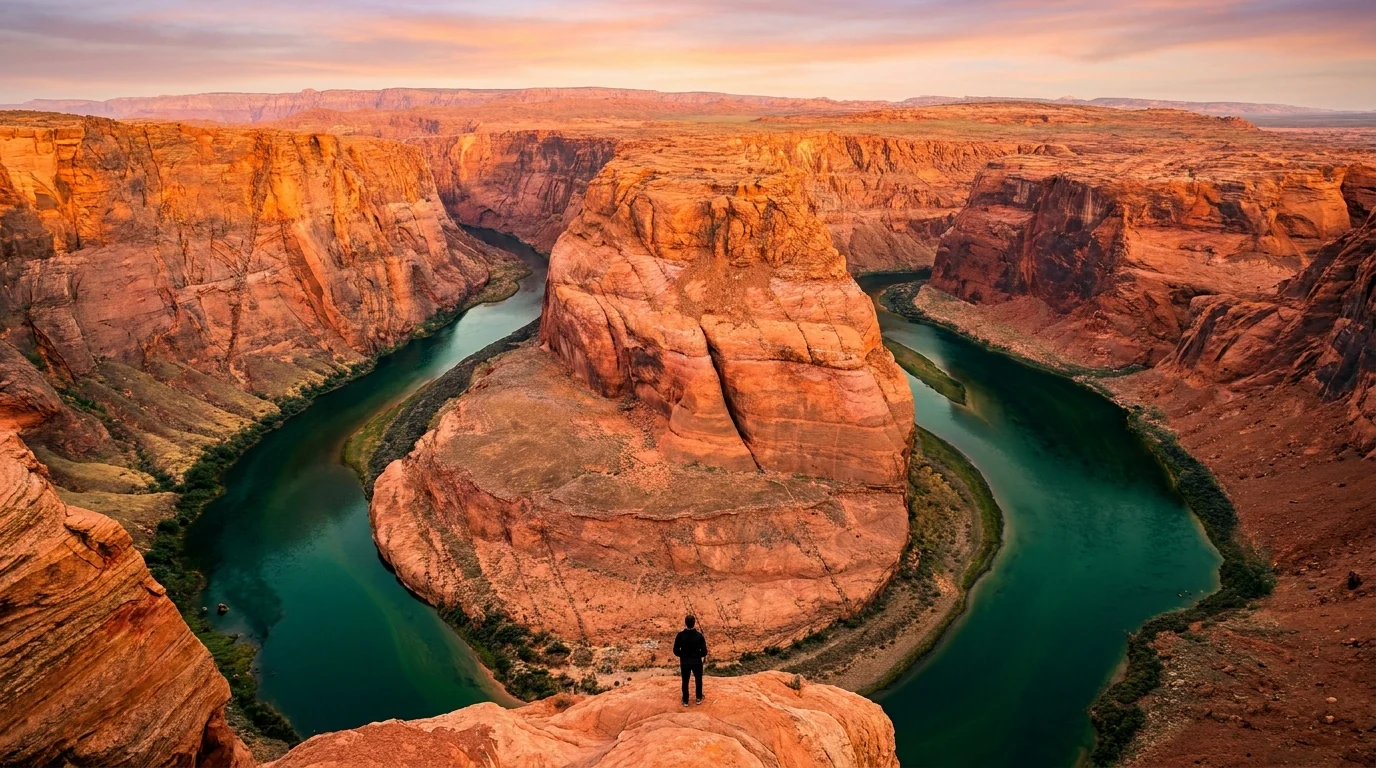
Aerial view at sunrise of the Colorado River curving in a deep 270-degree horseshoe bend through orange sandstone cliffs with emerald-green water far below, Horseshoe Bend near Page Arizona, ultrarealistic photograph representative of the region
Trekkr Trail Journal · No. 053 · Page, Lake Powell & Antelope Canyon

Page & Lake PowellArizona — Antelope Canyon, Horseshoe Bend, Glen Canyon Dam, Lees Ferry & Rainbow Bridge

The most photographed water and rock in the Southwest, and almost none of it works the way a first-timer assumes. Lake Powell is at a historic low, so which boat ramp even works changes with the water. Antelope Canyon is on Navajo land and you cannot enter it without a Navajo guide — a rule written by a flash flood that killed eleven people. Horseshoe Bend is a paid city parking lot and a shadeless cliff-edge walk. Get the heat, the monsoon and the tribal jurisdiction right, and Page is one of the great weeks in the desert.

Arizona · USA Page · Wahweap · Antelope Point · Lees Ferry Glen Canyon NRA · Navajo Nation Antelope Canyon: guided tours only
~3,523 ftLake Powell surface — about 22% full, a historic low (mid-2026); ramps close as it drops
11 livesLost in the 1997 Antelope Canyon flash flood — why it's Navajo-guided-only
$10 / carHorseshoe Bend parking (City of Page) — federal park passes not accepted
+1 hourThe Navajo Nation runs on Daylight Time in summer; Page does not
Conditions verified 23 July 2026 · The lake level and the flood risk decide the day before the trailhead does · This block goes stale — the links don't

Two gates open this region: the water level, and the guided-only canyon

The rest of this journal is evergreen; this box is not. Around Page, two things decide whether your plan works before you fill a water bottle — how low Lake Powell is and which ramp still launches a boat (§04), and the fact that Antelope Canyon can only be entered on a Navajo-guided tour and gets cancelled when it storms (§02, §05). Both change week to week and even day to day. Trust the live sources, not our date stamp.

  • Lake Powell is at a historic low — ramp access changes with the waterIn mid-2026 the reservoir sat around 3,523 feet, roughly 22% of capacity, near record lows. As it drops, launch ramps close, shorten or move to temporary auxiliary ramps. For stretches of 2026 the operable ramps were the Wahweap Stateline auxiliary and Bullfrog North, with Antelope Point on valet launching; Wahweap Main sat below the NPS 3,545-ft minimum. [VERIFY DAY-OF — nps.gov/glca; we assert no ramp as open] (§04)
  • Antelope Canyon — Navajo-guided tours only, and weather can shut itUpper, Lower and Canyon X are all on Navajo Nation land: no independent entry, no self-guided hiking — you must book a tour with an authorized Navajo operator (§02). Tours run on Navajo Nation time (Daylight Saving) — an hour ahead of Page in summer — and are cancelled without notice when flash-flood risk is high (§05). Book ahead; peak days sell out. (§02, §05)
  • Monsoon season (roughly July–September) — flash floods and heat togetherAfternoon thunderstorms can dump rain miles away and send a wall of water through a dry slot or wash with no warning under a blue sky. This is the season Antelope tours pause and desert washes turn lethal. It overlaps the hottest part of the year — plan water and timing for both. [VERIFY — NWS flash-flood outlook for the Page area] (§05, §06)
  • Horseshoe Bend is a City-of-Page fee lot — passes don't workParking was about $10 per car for 2026, collected by the City of Page, and federal park passes are not accepted. Open sunrise to sunset; the walk is exposed and shadeless (§04). [VERIFY — horseshoebend.com/parking-fees]
  • Glen Canyon entrance fee + Navajo Nation rules both applyLake Powell / Glen Canyon NRA charges a standard NPS entrance fee (America the Beautiful pass valid). East and south of Page you're on the Navajo Nation — a separate jurisdiction with its own permits, an alcohol ban, and areas closed to non-guided visitors. (§06)
  • Rainbow Bridge boat access depends entirely on the waterThe boat trip from Wahweap or Antelope Point runs only at workable lake levels, and the walk from the dock has grown longer as the lake fell. [VERIFY it's operating — lakepowell.com] (§04)
Live sources · Glen Canyon NRA — conditions & lake level · Glen Canyon NRA — camping · Navajo Parks — Antelope Canyon · City of Page — Horseshoe Bend parking · Lake Powell Resorts & Marinas
In an emergency, 911. This box was true at press and will not stay true — the sources above are the truth on the day you travel.
01 / THE HOOK

One town, four bucket-list sights, and none of them casual

Page is a small town built for a dam, sitting where the Colorado River, a shrinking reservoir and the Navajo Nation all meet — and it happens to put four of the Southwest's most famous scenes within an hour of each other. Antelope Canyon's light beams, Horseshoe Bend's river loop, Lake Powell's flooded red-rock canyons, and Glen Canyon Dam itself. What the postcards leave out is that each one comes with a real constraint: the canyon is guided-only tribal land that floods, the lake is dropping out from under its own boat ramps, the Bend is a shadeless cliff, and the whole place bakes in a summer heat that kills the unprepared. Plan around those, and it's an easy, spectacular basecamp week.

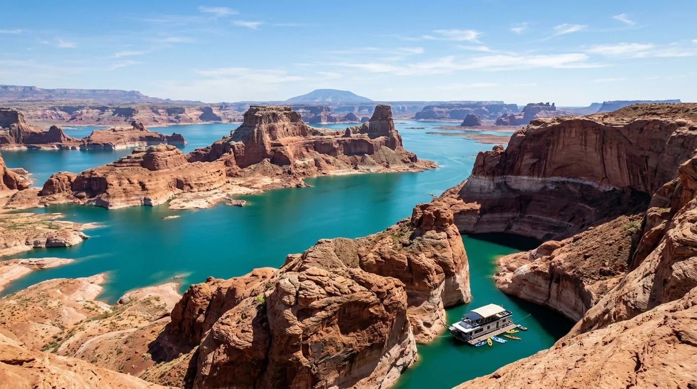
A turquoise reservoir winding between towering red-rock buttes under a big blue sky, with a pale white mineral bathtub ring high on the canyon walls showing dropped water levels, Lake Powell Glen Canyon Arizona, ultrarealistic photograph representative of the region
Lake Powell, Glen Canyon. The flooded red-rock canyons are stunning — and the pale "bathtub ring" high on the walls tells the real story: the reservoir is near historic lows, and the water keeps moving away from the ramps and docks built for a fuller lake (§04).

The payoff

Four world-famous scenes in one basecamp: Antelope Canyon's sculpted slots, Horseshoe Bend, Lake Powell's canyons and Glen Canyon Dam, with Lees Ferry and Rainbow Bridge close by (§02, §04).

The heat

This is low desert. Summer highs routinely top 100°F with no shade at Horseshoe Bend or on the trails. Heat is the most common way a Page trip goes wrong — carry far more water than feels sensible (§06).

The catch

Antelope Canyon is guided-only Navajo land that floods; the lake's ramps open and close with the water; and monsoon storms cancel tours. Nothing here is truly walk-up-and-go — book and check ahead (§02, §04, §05).

The way to think about the region — one town, three land managers, and a lake going down Almost everything runs out of Page (~4,300 ft), a compact town with full groceries, fuel, a hospital and lodging. But the sights sit on three different jurisdictions: Glen Canyon National Recreation Area (the National Park Service — Lake Powell, Wahweap, Lone Rock, Lees Ferry), the Navajo Nation (Antelope Canyon and land east/south, with its own permits, alcohol ban and clock), and the City of Page (Horseshoe Bend's parking). Glen Canyon Dam itself is federal (Bureau of Reclamation). Sort your Antelope Canyon tour first because it books out and is weather-dependent (§02), check the lake and ramp status before you tow a boat (§04), and build the rest of the week around the heat and the afternoon storm clock.
02 / ANTELOPE CANYON — GUIDED TOURS ONLY

You cannot walk into Antelope Canyon. Here's how it actually works.

If you take one thing from this issue, take this. Antelope Canyon is on the Navajo Nation, not in a national park, and it is closed to independent visitors. There is no trailhead you hike from, no gate you pay at and walk through — every visit is a guided tour booked in advance with an authorized Navajo operator, who drives you in and walks you through. That rule exists because of a 1997 flash flood that killed eleven people (§05). Here is the shape of it, and how to choose between Upper, Lower and Canyon X.

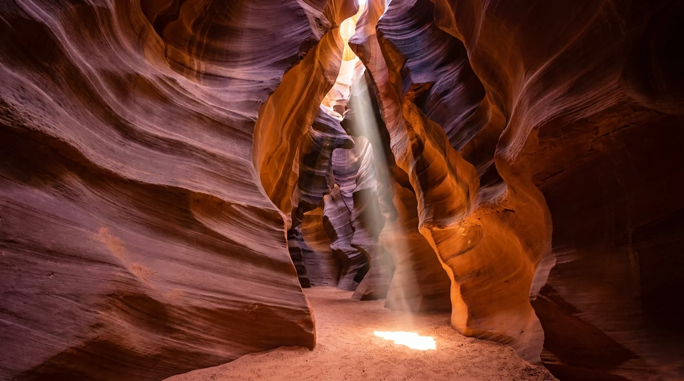
Interior of a narrow sandstone slot canyon with smooth flowing curved walls glowing orange and gold, a single shaft of midday sunlight beaming down onto the sandy floor, Upper Antelope Canyon Navajo Nation Arizona, ultrarealistic photograph representative of the region
Upper Antelope Canyon — "The Crack." The famous light beams appear around midday in the sunniest months. It is flat and walk-in easy, but it is also the busiest and priciest, and — like all of Antelope Canyon — reachable only on a guided Navajo tour. Book ahead; midday beam slots sell out first.
Which canyonThe experienceAuthorized operators*The catch
Upper Antelope
the light beams
Flat, sandy, walk-in; the classic beams around midday late spring–early fall Several Navajo operators, incl. Antelope Canyon Navajo Tours, Antelope Slot Canyon Tours (§08) Busiest and most expensive; beam-hour slots book out weeks ahead
Lower Antelope
stairs & ladders
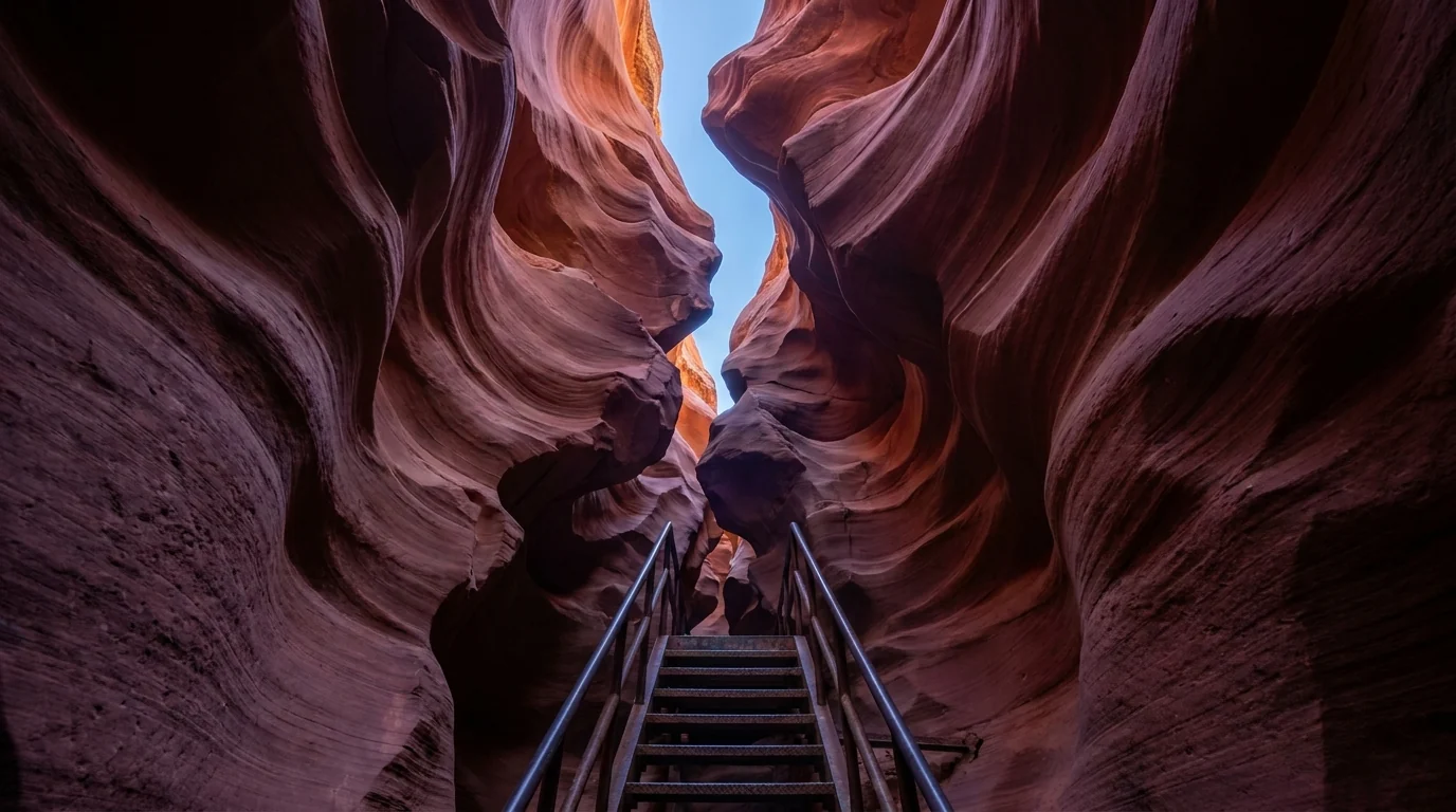
Narrower, deeper, entered by steep metal stairs and ladders; often cheaper Ken's Tours and Dixie Ellis' Lower Antelope Canyon Tours — the only two (§08) Not for mobility or claustrophobia concerns; steep ladders
Antelope Canyon X
the quieter option
Same drainage, fewer people, a good plan-B when Upper/Lower are full Taadidiin Tours — the sole operator, on AZ-98 SE of Page (§08) Some short stairs; still a guided tour, still books ahead

*Operators listed are real, currently-trading Navajo businesses whose own websites we resolved (§08). The Navajo Nation sets the authorized-operator list and it can change — confirm your operator is currently authorized, and confirm prices and times on their site.

🔴 The single most common Antelope Canyon mistakes Three of them, over and over. One: showing up expecting to hike in yourself — you can't; it's guided-only and you must book. Two: getting the time zone wrong — tours run on Navajo Nation time, which observes Daylight Saving; the rest of Arizona (including Page) does not, so in summer the Navajo Nation is an hour ahead. Set your phone carefully and ask the operator which clock your booking is on, or you will miss the tour. Three: assuming a booking is weatherproof — tours are cancelled without notice when flash-flood risk is high (§05), so build slack into the plan and don't schedule it for your last few hours in town.
Looking up inside a deep narrow slot canyon with sculpted wavy red-orange sandstone walls twisting toward a thin ribbon of blue sky, a steep metal stairway descending into shadow, Lower Antelope Canyon Page Arizona, ultrarealistic photograph representative of the region

Upper vs Lower vs X — how to choose

  • Want the beams and easy walking? Upper, midday, sunniest months — accept crowds and higher price
  • Want value and drama, and you're mobile? Lower — the stairs and ladders are the fun, but skip it if stairs or tight spaces are a problem
  • Want fewer people? Canyon X via Taadidiin Tours, or book Upper/Lower on a weekday well ahead
  • Bringing a bag or tripod? Rules are strict and change — most tours now ban large bags, and tripod/"photo" tours have largely been discontinued. Confirm what you can carry with your operator

We deliberately quote no tour prices or times — they're set by each operator and each season. Book on the operator's own site (§08).

The 60-second Antelope Canyon decision
  1. First move: book a tour in advance with an authorized Navajo operator — you cannot go in on your own, and popular slots sell out.
  2. Set the clock: confirm whether your booking time is Navajo (Daylight) time or Page time. In summer they differ by an hour.
  3. Pick the canyon: Upper for beams and easy walking, Lower for value and ladders, Canyon X for fewer people.
  4. Build slack: don't book it for your last hours in town — monsoon storms cancel tours, and you want a backup day.
  5. Check the bag rules: most tours restrict what you can bring; sort it before you arrive so you're not turned away at the meeting point.
03 / LAKE POWELL — THE HONEST WATER REPORT

A shrinking reservoir, and the ramps that close as it drops

Lake Powell is a reservoir, not a natural lake, and it has been shrinking. Drought and Colorado River management have pushed it near historic lows, which changes the trip in concrete ways: boat ramps that worked for decades now end in dry sand, marinas extend temporary auxiliary ramps, and access you read about in an old guide may simply be gone. This is the part of a Page trip most likely to blow up if you don't check it fresh — so we'll tell you the shape of it and then send you to the live source, because the number changes every week.

What "historic low" means for you

In mid-2026 the lake sat around 3,523 feet — roughly 22% of capacity. For a boater that means fewer usable ramps, longer hauls to the water, and changed navigation as old channels shallow out. For a shore visitor it means the beach at Lone Rock is farther from the water and the walk to Rainbow Bridge is longer.

The National Park Service has been building lower-elevation ramps and adjusting access season by season. Which specific ramp is open on your date is the one fact you must verify — we won't assert it here because it moves.

~22% full (mid-2026)Verify ramp status day-of

The launch situation, roughly

  • Wahweap: the main ramp has been below the NPS 3,545-ft minimum; launching shifted to the Stateline auxiliary ramp nearby
  • Antelope Point: public ramp access is limited; valet launching at the marina has been the motorized option at low levels
  • Bullfrog (far north, Utah): Bullfrog North has been among the operable ramps — but it's 2+ hours from Page
  • The rule: check nps.gov/glca before you tow a boat to Page. People arrive with a trailer and find nowhere to launch

All ramp specifics above are the reported 2026 situation and change with the water — confirm live.

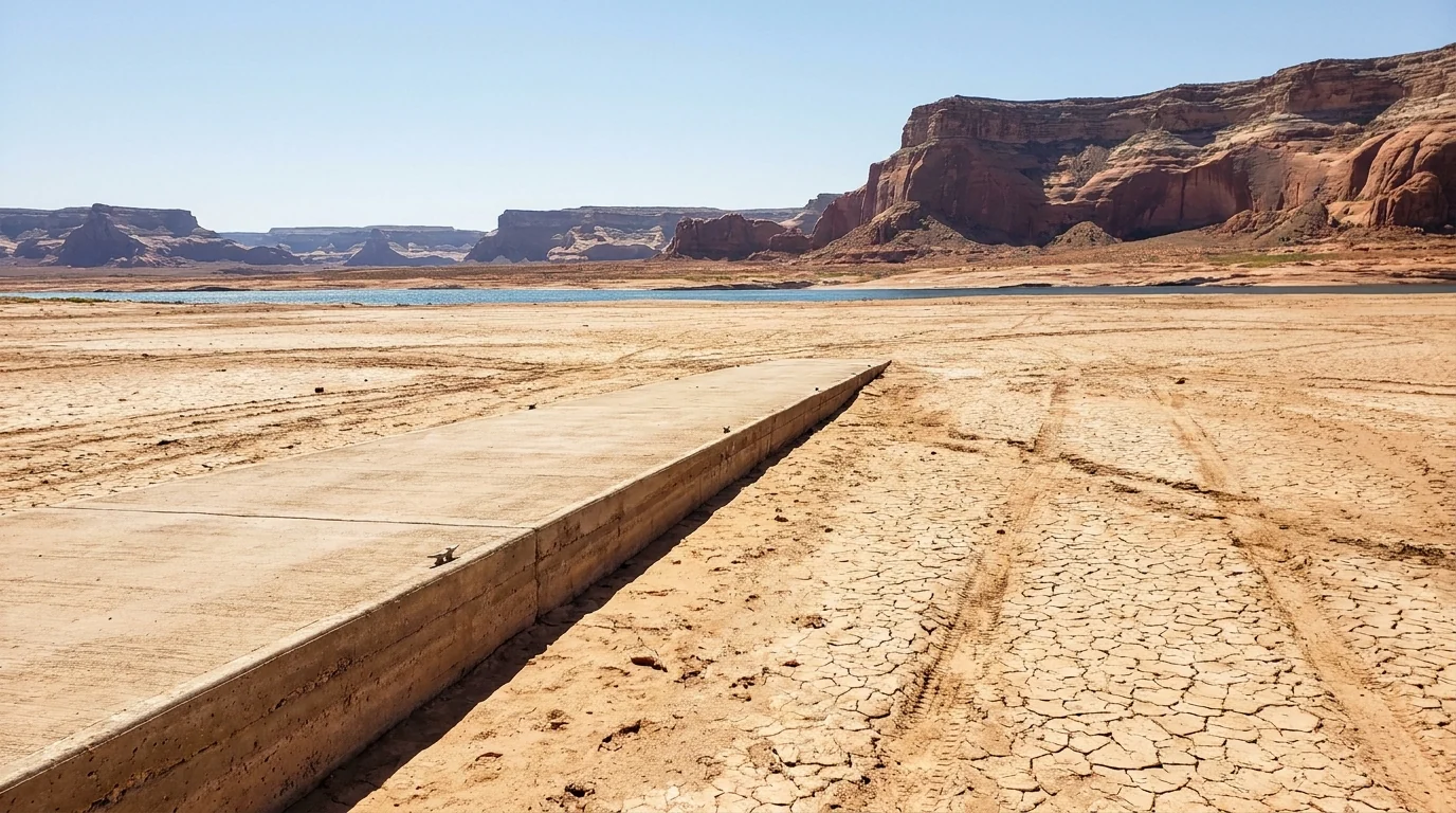
A long concrete boat launch ramp ending far short of a receded reservoir shoreline, wide expanse of cracked mud and sand between the ramp and the distant blue water, red sandstone cliffs beyond, low water at Lake Powell Arizona, ultrarealistic photograph representative of the region
The reason to check first. As Lake Powell drops, ramps built for a full reservoir end well short of the water. Motorized launching has moved onto temporary auxiliary ramps, and some ramps are simply closed. Never assume the ramp in an old guide still works — Glen Canyon NRA posts current status.
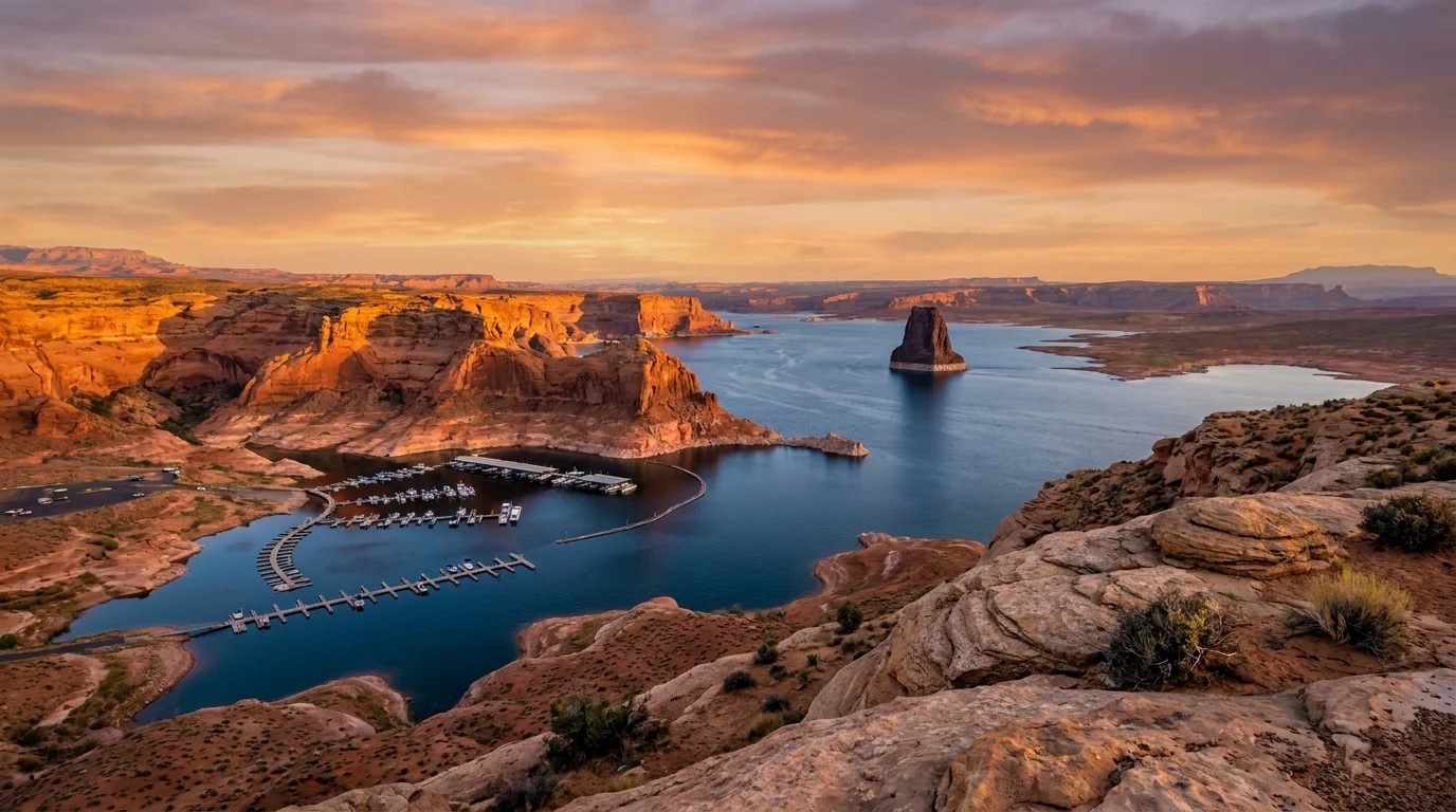
An elevated overlook at golden hour above a marina and the blue arms of a red-rock reservoir with a solitary dark sandstone monolith rising from the water in the distance, Wahweap Bay Lake Powell Arizona, ultrarealistic photograph representative of the region

If you're not bringing a boat

You can still have the lake without a trailer. Wahweap Overlook gives the classic view over the marina and Lone Rock. Lone Rock Beach is drive-on sand for a swim (§07). Kayak and paddleboard outfitters launch from Antelope Point into the water-filled Antelope Canyon lake arm — a different feature from the slot canyon, and a lovely paddle (§08).

Houseboats and boat tours run through the Wahweap concessioner, including scenic dam cruises and — water permitting — trips toward Rainbow Bridge (§04, §08). Confirm what's running for your dates.

Kayak the Antelope Canyon lake armWahweap Overlook = easy view
04 / THE SIGHTS

Horseshoe Bend, the dam, Lees Ferry & Rainbow Bridge

Beyond Antelope Canyon and the lake, four more sights anchor a Page week — one a shadeless cliff-edge overlook, one an engineering monster with a free view, one the launch pad for every Grand Canyon raft trip, and one of the largest natural bridges on Earth reached only by boat or a hard hike. Distances and fees below are the best current figures we could confirm; where a number moves — parking fees, dam-tour prices, boat-tour operation — we say so and point you to the source.

The famous river loop · a paid city lotHorseshoe Bend Overlook

~1.5 mi round trip · minimal gain · no shade. A short walk over sand and slickrock to the cliff edge above the Colorado's 270-degree bend, about 1,000 feet below. Parking is run by the City of Page (~$10/car in 2026; motorcycles less, commercial more), and federal park passes are not accepted. Open sunrise to sunset year-round.

The rim is mostly unrailed and the drop is sheer — hold on to children and stay back. There is no shade and no water on the trail; it is brutal at midday in summer. Go early or near sunset.

~1.5 mi RT · easyUnrailed cliff · no shade$10/car · passes not accepted
~1.5 mi round trip · minimal gain
45–90 min with photos (estimate)
A tall curved concrete arch dam spanning a deep red sandstone gorge with the green Colorado River flowing out below and a steel arch bridge crossing downstream, a large reservoir behind, Glen Canyon Dam near Page Arizona, ultrarealistic photograph representative of the region
Glen Canyon Dam, 710 ft. The concrete arch that created Lake Powell, just above Page. The Carl Hayden Visitor Center beside it has exhibits, an observation deck and guided dam tours (reported around $5 — confirm). The US-89 bridge gives a free look straight down the canyon (§08).

Every Grand Canyon raft trip starts hereLees Ferry & Navajo Bridge

~45 miles from Page via US-89A. Lees Ferry is the launch for Grand Canyon rafting and a blue-ribbon trout tailwater below the dam — cold, clear, year-round. On the way, Navajo Bridge at Marble Canyon lets you walk the historic 1929 span for a 470-foot look down, and it's one of the best places anywhere to see wild California condors. The Lonely Dell Ranch historic site sits just up the road.

The Lees Ferry campground and ramp fill on launch days. Don't approach or feed condors at the bridge — they're critically endangered. The river water is cold even in summer.

~45 mi from PageRafting put-in · trout fisheryCondors at Navajo Bridge
Day trip from Page
Allow 3–5 h with stops (estimate)
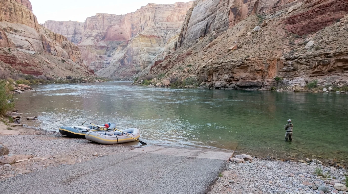
A calm stretch of the cold green Colorado River between soaring buff and red canyon walls, a boat ramp and rafts on a gravel bank in the foreground, an angler wading the clear water, Lees Ferry Marble Canyon Arizona, ultrarealistic photograph representative of the region
Lees Ferry, below Glen Canyon Dam. The only place for hundreds of miles where you can drive to the Colorado at river level. It's the Grand Canyon rafting launch, a renowned trout reach, and the trailhead for the Lonely Dell Ranch and Cathedral Wash. The 54-site campground here is first-come (§07).

A natural wonder, reached only by boat or a hard hikeRainbow Bridge National Monument

One of the world's largest natural bridges, up a side canyon of Lake Powell. From Page it's a long boat trip from Wahweap or Antelope Point plus a walk from the courtesy dock — and as the lake dropped, the dock moved farther from the bridge, lengthening the walk. The only other way in is a strenuous multi-day backcountry hike across Navajo land by permit.

Boat-tour operation depends entirely on the water level — confirm it's running before you count on it. Rainbow Bridge is sacred to the Navajo and other tribes; visitors are asked not to walk under the arch.

Boat access from PageDepends on lake levelSacred — don't walk under
Full-day boat trip (water permitting)
or multi-day permit hike
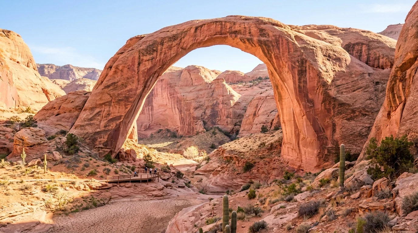
An enormous graceful natural sandstone arch spanning a desert side canyon, salmon and pink stone glowing in afternoon light with a small boardwalk viewing area far below for scale, Rainbow Bridge National Monument Utah, ultrarealistic photograph representative of the region
Rainbow Bridge, up an arm of Lake Powell. Sacred to the Navajo, Hopi, Paiute and other tribes, who ask that visitors view it from the platform and not walk beneath it. Access is by boat from Page when the water allows, or by a long backcountry hike across the Navajo Nation with a tribal permit.
05 / FLASH FLOODS & THE MONSOON — READ BEFORE YOU GO

Why the slot canyons are guided-only, and the sky can kill from miles away

The single most important safety fact around Page is not the heat or the cliffs — it's water, in a place that looks bone dry. Slot canyons and desert washes drain enormous areas, and a storm you cannot see, miles upstream, can send a wall of water and debris through a dry slot in minutes, under a blue sky overhead. That is exactly what happened in Antelope Canyon in 1997, and it is why the canyon is guided-only today. Understand this before you set foot near any narrow canyon in monsoon season.

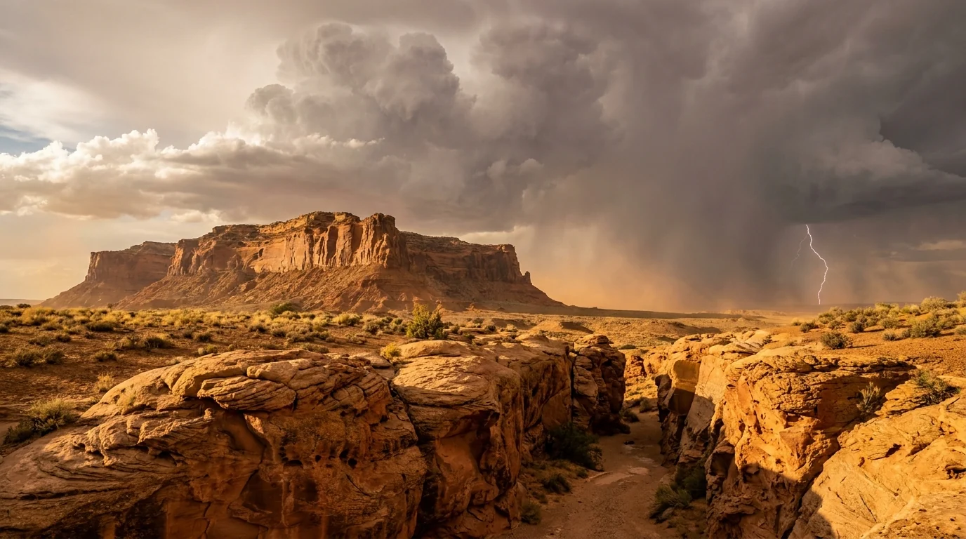
A dramatic summer monsoon thunderstorm building over red-rock desert mesas near a slot canyon, dark clouds and a distant curtain of rain and lightning, warm sunlit sandstone in the foreground, northern Arizona high desert, ultrarealistic photograph representative of the region
The monsoon, roughly July–September. Afternoon storms build fast and drop rain over a wide area. Water funnels into slots and washes and arrives downstream as a sudden flood — often where it isn't raining at all. This is the season Antelope Canyon tours are cancelled and desert driving gets dangerous.
🔴 The 1997 Antelope Canyon flash flood — the reason for the rule On 12 August 1997, a thunderstorm dropped rain miles upstream of Lower Antelope Canyon. A wall of water estimated at around eleven feet high surged through the slot and swept a group of hikers off their feet; eleven people died. Not a drop of rain was falling on them at the time. In the aftermath the Navajo Nation tightened control of the canyon — warning systems, and the requirement that every visit be led by an authorized Navajo guide. When a tour is cancelled for weather, that is this history at work — do not argue with it, and do not try to enter on your own.

How flash floods actually behave

  • They arrive with no local warning — the storm can be miles away and out of sight; the sky above you can be clear
  • They move fast and carry debris — logs, rocks and mud, not just water; a slot gives you nowhere to climb
  • Washes and dip crossings flood toonever drive into a flooded wash; "Turn Around, Don't Drown" is the rule
  • Monsoon season is roughly July–September — check the forecast and the flash-flood outlook every day you're near a canyon

What this means for your plan

  • Take tour cancellations seriously — if a Navajo operator pulls a tour for weather, that's the system working. Build a backup day
  • Don't hike unguided slots or washes in monsoon season unless you truly understand the drainage and forecast
  • Watch the sky and the water — rising or muddying water, a roar, or debris upstream means get out and up, now
  • Shoulder seasons dodge most of this — spring and mid-to-late fall have far lower flood risk (§09)
06 / SAFETY — READ THIS FIRST

Lethal heat, unrailed cliffs, cold rivers, and a sovereign nation

Aside from flash floods (§05), four things account for most of what goes wrong around Page, and the deadliest is the most boring: heat. Then the cliff edges that have no railings, the deceptively cold river water below the dam, and the fact that a big share of the region is a separate country with its own laws. None of it is exotic — it just has to be planned for, in a landscape that punishes people who treat a desert like a park.

Heat — the number-one danger

Page is low desert. Summer highs routinely exceed 100°F, and Horseshoe Bend, the slot approaches and most trails have no shade. Heat exhaustion and heat stroke build fast and kill.

Carry far more water than you think — a gallon per person per day is a starting point in summer. Add electrolytes, a hat and sun cover, and do the exposed sights at dawn or near sunset, not midday. Watch kids and older travellers closely.

100°F+ summers · no shade1 gal/person/day minimum

Cliffs & cold water

  • Horseshoe Bend and the dam overlooks are mostly unrailed — the drop is fatal. Stay back from the edge and hold children; people have died posing for photos
  • The Colorado below the dam is dam-release cold year-round — dangerous for swimming and a real hypothermia risk if you go in
  • Soft sand strands vehicles at Lone Rock and on backroads — carry recovery basics and don't drive off pavement without airing down and knowing the way out
  • Lake Powell drowning risk is real — wear a life jacket; cold water and open water catch strong swimmers out
🔴 The Navajo Nation is a separate jurisdiction — travel it as a guest Antelope Canyon and much of the land east and south of Page are on the Navajo Nation, a sovereign tribal government with its own laws and permits. Practical rules: you cannot enter Antelope Canyon without an authorized Navajo guide (§02); alcohol is prohibited across the Navajo Nation; stay on tour routes and do not wander onto, camp on, or remove anything from tribal land without permission; ask before photographing people; and remember the Navajo Nation observes Daylight Saving Time while the rest of Arizona does not — in summer it runs an hour ahead of Page, which is how people miss tours. Treat it as visiting another nation, because you are.
The desert basics, briefly Fuel up in Page before long drives — services are thin toward Lees Ferry, the North Rim and out on the Navajo Nation. Cell coverage drops fast away from town and is gone in the canyons; download offline maps and your tour confirmations. Afternoon lightning and dust storms (haboobs) come with the monsoon — if a wall of dust hits while driving, pull fully off the road, stop, and take your foot off the brake. And in this heat, a breakdown is a medical emergency — carry extra water in the vehicle, always.
07 / THE CAMPING STRATEGY

Lakeside sand, a concession RV park, and the river down at Lees Ferry

Camping around Page splits three ways: the National Park Service grounds inside Glen Canyon NRA (Wahweap, the primitive Lone Rock Beach, and Lees Ferry down on the river), the private full-hookup parks in and around town, and a scatter of small primitive areas. The two most consistent facts we could confirm are the fees at Lees Ferry ($26) and Lone Rock Beach ($14/vehicle); most private-park rates move by season, so we send you to book direct. Note that Lone Rock's drive-on beach keeps receding as the lake drops.

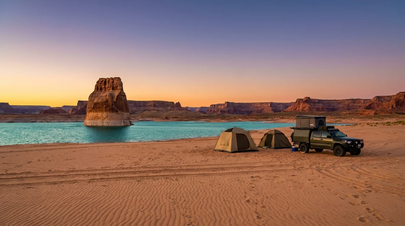
A broad sandy beach sloping to a turquoise bay with a tall isolated sandstone rock jutting from the water, a few tents and an overland vehicle parked on the sand under a warm evening sky, Lone Rock Beach Lake Powell Utah, ultrarealistic photograph representative of the region
Lone Rock Beach, Wahweap Bay. Drive-on sand camping just over the Utah line — pick your own spot, no marked sites, $14 per vehicle plus the park entrance fee. Soft sand strands vehicles, there's no drinking water at the beach, and the falling lake has pushed the shoreline steadily farther out.
CampgroundArea · managerTypeHookupsBookingReported fee*
Wahweap RV Park & Campground Wahweap · Aramark (NPS concession) RV park + dry sites Full (RV park); none (dry loop) Reservation — lakepowell.com full hookup ~$100 reported (confirm)
Lone Rock Beach Wahweap Bay, UT · NPS (GLCA) Primitive beach (drive-on) None First-come $14/vehicle + entrance fee
Lees Ferry Campground Lees Ferry / Marble Canyon · NPS Developed (54 sites) None First-come $26/night + entrance fee
Page Lake Powell Campground Page (849 Coppermine Rd) · private Full-service RV + tent + glamping Full (20/30/50-amp) Reservation — pagelakepowellcampground.com varies by season (confirm)
Antelope Point RV Park Antelope Point · private Full-hookup RV Full Reservation unconfirmed
Roam America Horseshoe Bend Page · private Cabins + deluxe RV Full Reservation unconfirmed
Beehive Campground Wahweap side · NPS (GLCA) Primitive (~6 sites) None First-come unconfirmed
Stateline Campground Stateline / Big Water, UT · NPS Primitive (small) None First-come unconfirmed
Under Canvas Lake Powell–Grand Staircase Big Water, UT · private Upscale safari-tent glamping None (not for RVs) Reservation (seasonal) premium — confirm

*Fees and details are compiled from NPS, the Wahweap concessioner and private-park and travel listings and vary by source and season. Lees Ferry ($26) and Lone Rock ($14/vehicle) were the most consistent; Wahweap full-hookup (~$100) was reported but not confirmed. Beehive and Stateline are leads from listing sites — locations, fees and site counts are UNCONFIRMED and we set their coordinates to null. Book NPS sites at the ramp/board or via the concessioner; book private parks direct.

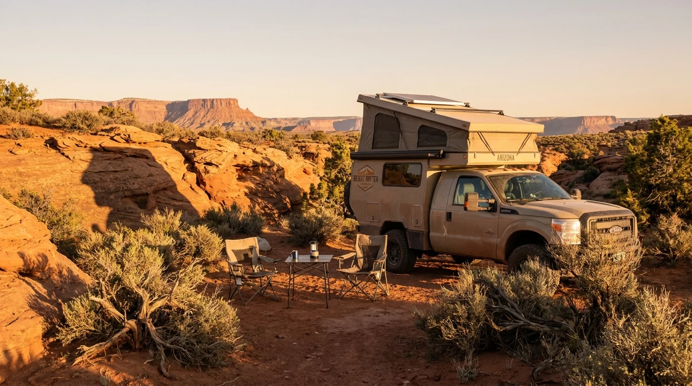
An overland camper rig with a rooftop tent at a quiet desert campsite among red sandstone and sparse brush, camp chairs set out, warm low sunlight raking across the rock, high desert near Page Arizona, ultrarealistic photograph representative of the region
Basecamp near Page. A town park for full hookups, a river site at Lees Ferry, or a night on the sand at Lone Rock — pick the one that fits your rig and your route. In summer, shade and power for air conditioning matter more here than a view; in spring and fall you can camp anywhere comfortably.
Which base for which trip Sights-and-tours week in town: Page Lake Powell Campground or Roam America for full hookups, pool and A/C power minutes from Horseshoe Bend and the Antelope tour meeting points. Lake life: Wahweap RV Park for the marina and boat tours, or Lone Rock Beach for drive-on sand and a swim. River and rafting: Lees Ferry, down on the cold Colorado, first-come and busy on launch days. Note the entrance fee: the NPS sites at Wahweap, Lone Rock and Lees Ferry are inside Glen Canyon NRA, so a park entrance fee (or America the Beautiful pass) applies on top of the camping fee. Confirm current fees and whether any site is affected by low-water access before you rely on it.
08 / PAGE & THE OPERATORS

Page has what you need — and the guides are the whole point

Page is the one full-service town for a long way in any direction: groceries, fuel and propane, a hospital, lodging, gear and every tour desk you'll need. Because Antelope Canyon and the best of the lake are guided or concession-run, the operators below aren't a nice-to-have — they're how you actually get in. All are real, currently-trading businesses whose own websites we resolved; the Antelope Canyon operators are Navajo-owned or Navajo-authorized. Seasons and prices change, so we link rather than quote.

Page town — the full-service basics

  • Groceries & fuel: Page has full supermarkets, several gas stations and propane — fill up here before Lees Ferry, the North Rim or long Navajo Nation drives, where services are sparse
  • Medical: Page Hospital is a real advantage — the nearest full services for a wide radius. In the heat, that matters
  • Lodging & food: a full range of hotels and restaurants in town; book ahead in peak season, when Page fills
  • Getting there: Page Municipal Airport (PGA) has limited service; most drive from Flagstaff (~2.5 h), Las Vegas (~4.5 h) or the Grand Canyon South Rim (~2.5 h)

Store names, hours and drive times shift — confirm against live mapping and current listings before you rely on them.

Antelope Canyon — Navajo operators

  • Ken's Tours Lower Antelope Canyon — one of two authorized Lower operators; ladder-and-stair tours (Indian Rte 222)
  • Dixie Ellis' Lower Antelope Canyon Tours — the other authorized Lower operator, next door
  • Antelope Canyon Navajo Tours — Upper Antelope, Begay-family land, Navajo guides
  • Antelope Slot Canyon Tours — Navajo-owned Upper Antelope tours, check-in in downtown Page (148 6th Ave)
  • Taadidiin Tours — the sole operator of Antelope Canyon X, on AZ-98 SE of Page

Confirm your operator is currently on the Navajo Nation authorized list, and book on their own site.

On the water & the river — links, not prices All real, currently-trading businesses whose websites we resolved. Season, pricing and trip menus change annually, so we link rather than quote.

Lake & slot-canyon water

  • Lake Powell Resorts & Marinas (Aramark, NPS concessioner) — Wahweap marina, powerboat and houseboat rentals, lodging, scenic dam cruises and Rainbow Bridge boat tours (water permitting)
  • Lake Powell Paddleboards & Kayaks — family-run Page outfitter; kayak and SUP tours and rentals launching from Antelope Point into the Antelope Canyon lake arm (a different feature from the slot)

The Colorado River

  • Wilderness River Adventures (199 Kaibab Rd, Page) — the smooth-water Horseshoe Bend / Glen Canyon float below the dam down to Lees Ferry, plus multi-day Grand Canyon whitewater expeditions
  • Carl Hayden Visitor Center (NPS/Reclamation) — start point for guided Glen Canyon Dam tours; exhibits and a free dam-and-canyon overlook

We confirmed no operator pricing — any number you see elsewhere should come from the operator. Phone numbers and hours change; check the current website before you drive over. Alcohol is banned on the Navajo Nation; plan accordingly on guided land.

09 / TIMING

When to go — dodge the heat and the monsoon, catch the beams

Page has one great strength and two hard hazards, and the calendar decides which you get. The strength is the Upper Antelope Canyon light beams, at their best around midday in the sunniest months. The hazards are lethal summer heat and the July–September monsoon that floods the slots. The trick is that the beams peak in the same season as the danger — so if you can, split the difference toward the shoulders, and if you must come in summer, front-load your days to dawn.

Season by season, straight

  • Spring (April–May) — the sweet spot. Warm days, cool mornings, low flood risk, and Antelope light is already strong. Water is cool for the lake but comfortable for everything else. Busy but not brutal
  • Summer (June–August) — beams and crowds, but dangerous. Peak light beams and peak visitors, and also 100°F+ heat and the monsoon (Jul onward) that cancels tours and floods washes. Doable if you start at dawn, hydrate hard and build backup days (§05, §06)
  • Fall (September–October) — the other sweet spot. Heat eases, the monsoon fades through September, crowds thin, and the light is still good. Arguably the best all-round window
  • Winter (November–March) — quiet and cold. Fewest people and lowest prices; some tours and boat services run reduced schedules, and beams are weak/absent. Cold nights, but clear and calm days

Crowd & heat strategy

  • Book Antelope Canyon well ahead — beam-hour and weekend slots sell out; a backup day covers a weather cancellation (§02)
  • Do exposed sights at dawn or sunset — Horseshoe Bend and the trails are miserable and risky at midday in summer
  • Weekdays beat weekends at every tour and overlook, and dramatically so in summer
  • Check the lake level before a boat trip — ramp access is the thing most likely to change your plan (§04)
  • Watch the monsoon forecast daily in summer — it decides whether the slots and washes are safe
The one-paragraph answer Go in spring (April–May) or fall (September–October) for the best balance of good light, tolerable heat and low flood risk. Come in summer only if you'll play by summer's rules — dawn starts, a gallon of water each, backup days for weather, and a hard respect for the monsoon. Whenever you go: book your Antelope Canyon tour ahead and confirm which clock it's on (Navajo Daylight time in summer), check the Lake Powell level before towing a boat, and treat the heat and the flash-flood risk as the real dangers they are.
10 / THE SHAPE OF THE TRIP

Four days, built around the tour slot and the heat

One workable shape, not the only one. It fixes the Antelope Canyon tour first because it's the least flexible piece, front-loads the exposed sights to dawn, and keeps a backup day in case weather cancels the canyon. Adjust freely — but keep every exposed sight early, confirm the lake level before any boat plan, and never treat the Antelope tour as weatherproof.

01

Day 1 — Arrive, resupply, sunset at the Bend

  1. Settle into your base in Page; buy water and supplies, fuel up.
  2. Confirm your Antelope Canyon tour time and which clock it's on (Navajo Daylight time in summer).
  3. Late afternoon: walk Horseshoe Bend near sunset — cooler, better light, and you scout the parking.
  4. Check tomorrow's forecast for heat and any flash-flood watch.
No tour needed todaySunset = cooler Bend
02

Day 2 — Antelope Canyon (your booked slot)

  1. Arrive early at your operator's meeting point — on the correct clock.
  2. Take the guided tour: Upper for beams, Lower for ladders, Canyon X for fewer people (§02).
  3. If it's cancelled for weather, that's the system working — use your backup day (Day 4).
  4. Afternoon in the shade or at the Carl Hayden Visitor Center; save exertion for cooler hours.
Guided tour — booked aheadWeather may cancel
03

Day 3 — The lake or the river

  1. Lake day: check the ramp/level (§04), then a boat tour, kayak from Antelope Point, or a swim at Lone Rock.
  2. River day instead: the Horseshoe Bend / Glen Canyon float, or drive to Lees Ferry & Navajo Bridge (condors) — fuel first.
  3. Glen Canyon Dam tour or the free dam overlook if you want the engineering story.
  4. Hydrate; keep the hard sun off the middle of the day.
Pick lake or riverConfirm lake level first
04

Day 4 — Backup day / Rainbow Bridge / move on

  1. If the canyon got cancelled, this is your second shot.
  2. Water permitting, the Rainbow Bridge boat trip — confirm it's running (§04).
  3. Or a quiet second look at a favourite at dawn, then roll toward the Grand Canyon, Zion or Monument Valley.
  4. Top off water and fuel before any long desert leg.
Backup for the canyonRainbow Bridge = water-dependent
+

The boater's variant

  1. Only after you've confirmed a usable ramp on nps.gov/glca (§04) — do not tow a boat on faith.
  2. Houseboat or powerboat from Wahweap or valet at Antelope Point; wear life jackets.
  3. Navigation has changed with low water — carry current charts and go slow in narrowed channels.
  4. Watch the afternoon monsoon sky; get off the open water when storms build.
Confirm ramp before towingLife jackets · current charts

Pairs well with

  1. Page sits on the Grand Circle — easy to chain with the Grand Canyon (No. 051), Monument Valley (No. 054), or Zion & Bryce.
  2. All are hot and dry in summer — carry the same water discipline everywhere.
  3. Watch for the Arizona / Navajo / Utah time-zone quirks as you cross between them.
  4. Fuel is the constraint on the long legs — fill in the towns, not on the reservations.
Grand Circle basecampMind the time zones
11 / TRIP-READY

The departure check

Run it before you leave. Tap each item as it's done — these are the ten things specific to Page, Lake Powell and Antelope Canyon that a general road-trip habit will skip. Most come back to three facts: the canyon is guided-only and time-sensitive, the lake is dropping out from under its ramps, and the desert heat and monsoon are the real dangers.

0 / 10 confirmed — the tour and the water level set the schedule.
12 / QUICK ANSWERS

Asked at every Page tour desk

Can I visit Antelope Canyon on my own?
No. Antelope Canyon — Upper, Lower and Canyon X — is on Navajo Nation land and open only on a guided tour with an authorized Navajo operator. There's no self-guided hiking and no independent entry. Book ahead through operators such as Ken's Tours or Dixie Ellis' Tours (Lower), Antelope Canyon Navajo Tours or Antelope Slot Canyon Tours (Upper), or Taadidiin Tours (Canyon X). Tours run on Navajo (Daylight Saving) time — an hour ahead of Page in summer — and are cancelled without notice when flash-flood risk is high.
Is Lake Powell too low to launch a boat in 2026?
It depends on the day and the ramp. The lake has been near historic lows (~3,523 ft, ~22% full in mid-2026), and most ramps have closed, shortened or moved to temporary auxiliary ramps. For stretches of 2026 the Wahweap Stateline auxiliary and Bullfrog North ramps were operable, with Antelope Point on valet launching; Wahweap Main sat below the NPS 3,545-ft minimum. It changes weekly — check nps.gov/glca before you tow a boat to Page.
How much is Horseshoe Bend, and is it hard?
Parking is run by the City of Page (~$10/car in 2026; federal passes not accepted), open sunrise to sunset. The walk is ~1.5 miles round trip on an exposed, shadeless path — easy in cool weather, punishing at midday in summer. Most of the rim is unrailed above a ~1,000-ft drop, so hold children and stay back from the edge. Go at dawn or near sunset for the heat and the light.
What's the Navajo Nation time-zone thing?
Arizona does not observe Daylight Saving Time — but the Navajo Nation does. So in summer, the Navajo Nation (where Antelope Canyon is) runs an hour ahead of Page. Antelope tours are on Navajo time, and people miss them by using their phone's Page time. Ask your operator which clock your booking is on, and set an alarm accordingly.
Why is Antelope Canyon guided-only?
Partly because it's on tribal land, and partly because of a 1997 flash flood that swept through Lower Antelope Canyon and killed eleven people — with no rain falling on them at the time. Afterward the Navajo Nation required that every visit be led by an authorized Navajo guide, and added warning systems. When a tour is cancelled for weather, that history is the reason — don't try to go in alone.
Can you still see Rainbow Bridge?
Usually, but low water has made it harder. It's reached from Page by a long boat trip up Lake Powell plus a walk from the dock — and as the lake dropped, the dock moved farther from the bridge, so the walk got longer. Boat-tour operation depends on the water level; confirm it's running with the Wahweap concessioner. The alternative is a strenuous multi-day backcountry hike across Navajo land by permit. Rainbow Bridge is sacred to the Navajo and other tribes — visitors are asked not to walk under the arch.
When should I go?
Spring (April–May) or fall (September–October) for the best balance of good light, tolerable heat and low flash-flood risk. Summer has the famous Upper Antelope light beams but also 100°F+ heat and the monsoon — doable if you start at dawn, carry a gallon of water each, and hold a backup day. Winter is quiet and cold with reduced tours and weak beams.
Do I need water shoes or special gear for the canyons?
For the standard Upper, Lower and Canyon X tours, closed-toe shoes are fine — Upper is flat sand; Lower and X involve stairs and ladders. Bag rules are strict and have tightened: most tours ban large bags and backpacks, and dedicated tripod/photography tours have largely been discontinued. Confirm exactly what you can bring with your operator before you arrive so you're not turned away at the meeting point.
Is there an entrance fee, and does my park pass work?
Two different systems. Glen Canyon NRA (Lake Powell, Wahweap, Lone Rock, Lees Ferry) charges a standard NPS entrance fee and the America the Beautiful pass is valid. But Antelope Canyon is Navajo tribal land — you pay the tour operator (which includes a Navajo permit fee), and federal passes don't apply. And Horseshoe Bend is a City of Page lot where federal passes are also not accepted.
13 / WHAT WE COULD NOT CONFIRM

The honest gaps, all in one place

Every guide has these; most don't print them. Around Page the biggest moving target is the lake itself — the level, and which ramp is usable, change week to week — and tribal-land access, tour prices and fees all shift by season. So we've flagged the soft numbers in place. Everything below was compiled 23 July 2026 and should be re-checked against the linked official source before you rely on it.

Why this section exists Anyone can write a Page guide that sounds certain. The hard part is knowing which numbers are real — and here the reservoir is dropping out from under its own ramps, the headline canyon is sovereign tribal land you can't enter alone, and a clear-sky flood can kill in a slot in minutes. Plenty of the numbers need a same-week check. The null is the product. "Check nps.gov before you tow a boat," "book a Navajo guide and confirm which clock it's on," and "carry a gallon of water each" are usable instructions. A confident wrong answer here costs a wasted day at a dry ramp — or worse, in a flooding wash.
🔒

The printable field guide

Everything above, condensed into a print-ready PDF built for the glovebox — for a place where the reservoir is dropping out from under its ramps, the headline canyon is guided-only tribal land that floods, and the signal dies at the trailhead. The Antelope Canyon guided-only system and the time-zone trap decoded, the honest Lake Powell water-and-ramp report, Horseshoe Bend's fee and cliff-edge reality, Glen Canyon Dam and Lees Ferry, Rainbow Bridge access told straight, the campgrounds by area with 2026 realities, the heat and monsoon rules, and the honest list of what nobody could confirm — on paper that works where the bars don't.

Antelope Canyon, decoded Lake Powell water & ramps, honestly Horseshoe Bend, straight Glen Canyon Dam & Lees Ferry Rainbow Bridge access Campgrounds by area, 2026 Heat & monsoon rules The departure check
Unlock the PDF — $4.95
$4.95 per guide · Instant access · Built by people who actually camp there
Trail Journal No. 053

Go farther. Camp lighter.
Leave it better.

Every Trekkr Trail Journal is built like this one: custom logistics, honest trail beta, the camping and access detail, and the local knowledge that turns a good trip into the one your crew talks about for years — including, always, a plain list of what we could not confirm. New destinations drop all season long, from the Desert Southwest to the Colorado Rockies to the BC corridors.

Unlock the Trail Journal Library
↗ Read another issue — No. 036, Aspen & the Elk Mountains
$4.95 per guide · Instant access · Built by people who actually camp there