Pacific RimTofino · Ucluelet · Port Alberni · Strathcona — The Complete Field Guide
Highway 4 crosses Vancouver Island from Parksville to the open Pacific, and it is the only practical way in. In June 2023 a wildfire closed it and cut the entire west coast off — no alternate route, fuel rationing within five days. Everything in this issue sits downstream of that one fact: one road, no bypass, and a ferry booking that does not save you.
British Columbia · CanadaTofino · Ucluelet · Port Alberni · StrathconaNuu-chah-nulth territorySequel to No. 011 · The Sea-to-Sky
1Road in — and effectively no alternate route
7–14 °COcean temperature, including summer
~126 kmPort Alberni to the coast with no fuel
20 mLocal-tsunami assembly elevation — the number to remember
Conditions verified 18 July 2026 · Highway 4 open · Two trail closures · This block goes stale — the links don't
The road is open, a park-wide fire ban is on, and two named trails are shut
The rest of this journal is evergreen; this box is not. Everything below is dated to the day we checked it, and the most perishable items on this coast — the highway, fire bans, trail closures, wolf warnings, Tofino's water stage and the snow line in Strathcona — change faster than any printed guide. Each item gives you the 60-second check as well as the snapshot. Trust the procedure, not our date stamp.
Highway 4 is OPEN in both directions (checked 18 Jul 2026)We queried the BC Open511 traffic API — the machine-readable feed behind DriveBC — pulled all 257 active provincial events and filtered for Highway 4. There is no closure, no Cameron Bluffs single-lane alternating section and no major delay event. Five Highway 4 events are active and all five are severity MINOR: utility work on Alberni Highway (Jul 30 only), the standing oversize-vehicle restriction (see §02), two River Road shoulder closures (to Aug 1 and Aug 31), and a geotechnical investigation at the Tofino end of Campbell Street (Jul 20 only). None is a full closure. This is the single item on this page most worth re-checking before you drive.
A park-wide FIRE BAN is in effect inside Pacific Rim National Park ReserveFlagged on Parks Canada's own activities and trail-conditions pages as of 16 July 2026. Separately, the BC Coastal Fire Centre states verbatim: "Category 1 Campfire — Prohibited in Manning Park, the Chilliwack, Sea to Sky and South Island forest districts effective 12 p.m. (noon) on July 16, 2026," with Category 2 and 3 open fires prohibited throughout the entire Coastal Fire Centre. 🔴 We are deliberately NOT telling you whether Tofino, Ucluelet or Port Alberni sit under that Category 1 ban, because we could not confirm from an official source which forest district they fall in — see §02. Assume the stricter reading and check. Campfires are never permitted in the Strathcona backcountry or at the Nism̓aakqin hot springs, ban or no ban.
Schooner Cove Trail — CLOSED until further noticeConfirmed on Parks Canada's official trail-conditions page, self-dated 16 July 2026. Do not plan it, and be aware that a great deal of guidebook and blog content still lists it as an available hike. ⚠️ The reason circulating — major storm damage, with Parks Canada working with Tla-o-qui-aht First Nation on the area's future — comes from a social-media post rather than the main site, so we report the closure as confirmed and the reason as unverified. Also live: Combers Beach boardwalk in disrepair (Caution), Shorepine Bog limited access, trail work in progress, and Nuu-chah-nulth Trail open with construction work in progress.
Wolf warnings in effect on multiple trails — and Parks Canada's advice is "leave dogs at home"As of 16 July 2026, wolf warnings were posted for ʔapsčiik t̓ašii, Halfmoon Bay, South Beach, Rainforest Trail A and Willowbrae, with a bear warning also noted on ʔapsčiik t̓ašii. This is not historical colour — Parks Canada reports "an increasing level of habituation and bold behaviour from wolves" and documents wolves preying on large, leashed dogs. The full treatment is in §18, and the headline is Parks Canada's own: not "leash your dog" but leave it at home.
Strathcona: Karst Creek Trail CLOSED, and the conditions report is six weeks oldBC Parks' Strathcona trail report is dated 5 June 2026 — six weeks stale at time of writing, and snow conditions in June bear little resemblance to mid-July. As of that date: Karst Creek Trail was CLOSED — "TRAIL CLOSED due to hazardous conditions including a rockfall hazard upstream. Keep off trail" — and park-wide, "Hikers can generally expect to find snow conditions above 1250 - 1350m." Mount Albert Edward above Circlet Lake was still snow-covered with route-finding skills necessary. Everything in §08 tagged to that date needs re-checking. Also live in the traffic feed: Quinsam River Bridge on Highway 28 is single-lane with traffic lights 24/7 through 31 July 2026.
Tofino is in Stage 1 water conservation, and it started a month earlier than last yearWater Conservation Stage 1 has been in effect since Tuesday 12 May 2026, and as of 26 June 2026 Stage 1 remained in effect as the District entered its busiest time of year. In 2025 Stage 1 began 10 June and lifted 16 September. A month-earlier start is a signal, not noise. For overlanders the practical consequence is blunt: do not plan on topping up a large freshwater tank in Tofino in summer. Fill in Port Alberni on the way in. ⚠️ tofino.ca timed out on repeated direct fetches, so our confidence is high on the stage and dates and moderate on the restriction detail — re-read the live page.
Highway 4 leaves Highway 19 at Parksville, threads Coombs and the old-growth pinch point at Cathedral Grove, climbs the Alberni Summit, drops into Port Alberni, and then runs west for roughly two hours along Sproat Lake, the Taylor River and Kennedy Lake to a junction where you turn left for Ucluelet or right for Tofino. It is the longest east–west route on Vancouver Island, and it is the only practical one.
This is the sequel to No. 011. Where the Sea-to-Sky was about a single road with no alternative, the Pacific Rim is about the same structural fact taken to its conclusion — because on Highway 99 a closure meant hours, and here it has meant months of disruption and a whole coast on fuel rationing. In June 2023 the Cameron Bluffs wildfire closed Highway 4 completely, and within five days Port Alberni and the west coast were rationing fuel and panic-buying groceries. There is no comparable detour. That is not history; it is the planning assumption this entire issue is built on.
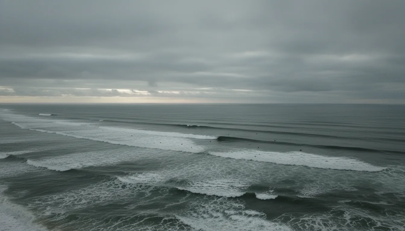
The second thing to understand is that the ocean here is not a beach holiday. Parks Canada publishes a water temperature range of 7 °C to 14 °C — including summer — states that all beaches are unsupervised with no lifeguards, and recommends a 4 mm wetsuit as the summer minimum. Rip currents and cold water, not bears and not wolves, are what actually kill visitors on this coast, and §16 gives them the space that reality deserves.
How to use this journal
Read §02 and §03 first — the highway and the ferries, in the order you have to solve them. Then go where your trip lives. Driving in? §02, §03 and §21. Camping? §09 and §10. Surfing or beach-walking? §11, §14, and then §16, which is not optional. Going in the water at all, or planning to be in Tofino or Ucluelet overnight? §16 and §17. Heading to Strathcona or after Della Falls? §08. Everywhere in this issue, where our sources were blocked, undated, contradictory or simply silent, this guide says so out loud and prints no number. Parks Canada publishes no elevation gain and no hiking time for a single trail in the Long Beach Unit — we print none either. §26 consolidates every gap in one place.
The land, named first
This route runs through Nuu-chah-nulth territory — fourteen Nations represented by the Nuu-chah-nulth Tribal Council. On the coast: ƛaʔuukʷiʔatḥ (Tla-o-qui-aht), ʕaaḥuusʔatḥ (Ahousaht), Hesquiaht, Toquaht and Yuułuʔiłʔatḥ (Ucluelet First Nation). Around Port Alberni: Hupačasath and Tseshaht. Meares Island is Wanačas Hiłḥuuʔis Tribal Park, declared in 1984. The word "Reserve" in Pacific Rim National Park Reserve is not about wildlife — it is a legal marker that the land question here was never settled. We handle all of this in §19 with the sourcing it deserves: names in each Nation's own orthography, everything attributed, no sacred or ceremonial narrative retold as travel colour, and no position taken on a live dispute. It matters that they are named at the top, not the bottom.
02 / HIGHWAY 4
The single point of failure
Everything about travelling to Tofino and Ucluelet is downstream of one structural fact: there is one road, and effectively no way around it. Understand what that means before you understand anything else about this trip — including your ferry booking, which does not help.
🔴 The defining access fact of this regionIf Highway 4 closes while you are on the coast, you are not driving out in any reasonable timeframe.
The Alberni-Clayoquot Regional District's own closure page describes the only fallback, and it describes it honestly. The detour between Port Alberni and Lake Cowichan "uses forest-service and privately owned industrial roads." It "has narrow sections, sharp curves, single-lane bridges and challenging terrain." It "will take about 4 hours with potentially slow moving traffic." Conditions "will be dusty," you should "expect rough gravel patches,""there is no cell phone network coverage," and there are "limited amenities for fuel, food, washrooms and emergency services."
That is not a detour in the sense most drivers mean. It is a resource-road escape route through country with no services and no signal, and in a real closure it carries an entire region's traffic. Plan your food, fuel, water and medication buffers on the assumption that you cannot leave.
⚠️ Stale-source flag, and it matters: that ACRD page was last updated 30 August 2023. It is authoritative for what the detour is like and it is not a current status page. Do not cite it for today's conditions — use DriveBC or the Open511 feed for that.
June 2023 — what actually happened
The Cameron Bluffs wildfire closed Highway 4 completely and severed the only practical road link to Tofino, Ucluelet and the whole west coast. It reopened first to single-lane alternating traffic, and then to two full lanes at 5 p.m. on 31 August 2023.
The consequence on the ground is the part worth carrying: Port Alberni and the coast went to fuel rationing and panic buying within five days. Not weeks — five days. That is the single best argument for the fuel discipline in §21, and it is why this guide treats "top off in Port Alberni" as a rule rather than a suggestion.
Sourced to BC Gov News releases on the reopening, and to Ha-Shilth-Sa — the Nuu-chah-nulth Tribal Council's own newspaper — for the rationing.
Kennedy Hill is fixed — stop reading the old trip reports
The Kennedy Hill Safety Improvement Project rebuilt roughly 1.5 km of highway beside Kennedy Lake, about 14 km northeast of the Tofino/Ucluelet junction. It widened the road to two full lanes with paved shoulders and roadside barrier on the lake side, removed the sharp blind corners and reduced the existing 12% grade. Work began April 2018 and it opened to two-way traffic in winter 2022/23. Budget ran from $38 million to $54 million.
Older trip reports describing Kennedy Hill as a white-knuckle single-lane crawl are out of date. Don't let stale fear-content shape your plan.
⚠️ Honesty flag: the official ministry project page returned HTTP 504 on repeated attempts, so every figure in this card — the 1.5 km, the 12% grade, the 14 km, the budget and the opening date — comes from secondary reporting (CBC and Ha-Shilth-Sa), not from the ministry. The substance is well corroborated; the sourcing is not primary, and you should know that.
🔴 The oversize-vehicle trap — the one that will actually bite an overlander
Buried in the live traffic feed as a "minor" construction event is a standing restriction, not a temporary one. Any vehicle or load over 3.2 m (10'6") wide on the Alberni Highway section of Highway 4 is under a daytime travel restriction and must travel between 9 p.m. and 5 a.m., and must contact the Permit Centre first. The feed's own wording: "Vehicles/loads over 3.2m in width must contact Permit Centre for instructions at 1-800-559-9688. Daytime travel restriction, must travel between 9pm-5am."
It has been in force since February 2024 and the ministry's own next-review date is March 2027, so it is very likely live for a 2026 trip. Most rigs are under 3.2 m wide — but wide campers, slide-out fifth wheels and anything carrying an oversize load need to plan around a nighttime-only crossing. Measure your actual width, including mirrors and anything bolted to the sides.
We print that phone number because it is a government permit line, not a business. This guide records no phone numbers, emails or street addresses for campgrounds or businesses anywhere — only emergency and government numbers.
Westbound sequence on Hwy 4
What it is
What it demands
Parksville → Coombs
Leaving the east-coast retail corridor
Last big-box shopping. Buy alpine and technical gear here or earlier — the coast is a surf town, not an outfitter
Cathedral Grove / MacMillan Prov. Park
Old growth right at the shoulder
🔴 A notorious pinch point: no real parking and pedestrians crossing the highway between the two lots. Slow down and expect someone to step out
Alberni Summit
The climb over
Nothing technical. Recurring hazard-tree removal work happens along this stretch
Port Alberni
🔴 LAST FUEL. LAST WATER. LAST FULL RESUPPLY.
The Tseshaht Market on the western edge of town is described as "the last Full-Service Gas Station between Port Alberni & the West Coast communities of Ucluelet & Tofino." Fill everything
Sproat Lake → Taylor River → Kennedy Lake
~126 km, ~2 hours, zero services
No fuel, no food, no washrooms. Highway 4 follows the shore of Kennedy Lake for roughly 19 km
Kennedy Hill
Rebuilt, now two full lanes
~14 km from the junction. The horror stories are obsolete
Tofino / Ucluelet junction
Left for Ucluelet, right for Tofino
Still no fuel until you reach a town
Drive times — the tourism board's own figures
From Tourism Tofino, verbatim: Departure Bay ferry terminal "just under 3 hrs" · Duke Point ferry terminal "3 hrs" · Port Alberni "2 hrs" · Downtown Victoria "4 hrs, 20 min" · Campbell River "3 hrs, 20 min."
🔴 These are dry-road, no-traffic times. In July and August the Tofino–Ucluelet corridor is heavily congested, and any minor incident on a road with no alternate backs up for hours. Budget generously, and start early for the same reason you would on any corridor with no bypass — not to beat traffic, but to buy slack you cannot buy later.
⚠️ Distances here are weaker than the times. Highway 4's 162 km total and the 126 km Port Alberni→Tofino figure are secondary — Wikipedia and route-aggregator sourced — and we could not verify either against a ministry source. The 2 hr time is corroborated by Tourism Tofino; treat the kilometres as approximate.
Winter tyres, and one honest caveat
Tourism Tofino states: "If you visit anytime between October 1 and March 31, you must have winter tires or carry chains." That matches the standard BC designated-highway rule and is very likely correct.
⚠️ But it is sourced from a tourism board, not from the ministry regulation, and we did not verify the designation segment by segment along Highway 4. The posted sign on the road is the legal control — read it as you enter the designated section, and let it override anything printed here or anywhere else. (Issue No. 011 has the same instruction for Highway 99, where the end date is 31 March rather than 30 April; do not assume one route's dates apply to another.)
The 60-second road check — do this the morning you leave, and again before you leave the coast
Open DriveBC.ca and filter to Highway 4. Look for closures first, delays second.
If DriveBC's map is not loading for you, hit the Open511 events API directly — it is the same data in machine-readable form, and it is what we used. DriveBC's mobile events pages return an empty JavaScript shell to anything that isn't a full browser.
Check the BC Wildfire Service map. Highway 4's worst historical failure mode is fire, not snow, and it happens in summer.
Ask the question that actually matters: is anything between you and Port Alberni? That is where the fuel, the water and the referral hospital are (§21).
⚠️ 2026 wildfire status is genuinely unconfirmed in this issue. Our query against the BC Wildfire Service ArcGIS active-fires service returned zero features, which we do not trust as a true "no active fires" reading — it is far more likely our filter did not match the layer's status values. Treat wildfire status as unknown and check the live map yourself. And a correction while you're there: the Wesley Ridge wildfire that search engines surface as though it were current ignited 31 July 2025, near Cameron Lake, and was later downgraded to "being held." It is a 2025 event. Do not read it as an active 2026 fire.
The fire-ban question we are refusing to answer for you
A campfire ban was in effect at press and it splits this region in two — which is genuinely useful trip-planning information. The Coastal Fire Centre's official wording: "Category 1 Campfire — Prohibited in Manning Park, the Chilliwack, Sea to Sky and South Island forest districts effective 12 p.m. (noon) on July 16, 2026," with Category 2 and 3 open fires prohibited centre-wide. Secondary reporting adds that the prohibition runs until 31 October 2026 or until rescinded, and that Category 1 campfires remain permitted in the Campbell River, North Island Central Coast, Haida Gwaii and Sunshine Coast forest districts.
The planning insight: the Strathcona / Gold River / Campbell River side of this itinerary may still permit campfires while the Tofino / Ucluelet / Port Alberni side does not. That is worth knowing when you decide where the fire-side nights of your trip go.
🔴 But we will not tell you that Tofino, Ucluelet or Port Alberni are banned, because we could not confirm it. The Alberni-Clayoquot area is administered under the South Island Natural Resource District following district amalgamation, which would place it under the ban — but the official page lists districts without a map we could read, and district naming has changed over time. The Campbell River exemption is clearly stated; the west-coast status is our inference and we are not publishing an inference as a fact. Check the Coastal Fire Centre page yourself, and assume the stricter reading until you have. Note separately that a park-wide fire ban was confirmed inside Pacific Rim National Park Reserve on 16 July 2026 — that one is not in doubt.
03 / THE FERRIES
A reservation is for a sailing, not for a road
Three mainland–Island crossings, one identical tariff, a 5% surcharge nobody quotes, a per-foot overlength charge that ambushes overlanders, and an asymmetric booking rule that catches people travelling westbound through Horseshoe Bay. And the sentence that should sit above all of it: a confirmed sailing plus a Highway 4 closure still equals not arriving.
🔴 The 5% fuel surcharge is not in any published fare
Every number in this section comes straight from the official BC Ferries fare guide PDF, "Version #26-05, Fares Effective June 16, 2026" — downloaded and parsed rather than taken from a summary. The PDF states verbatim: "A 5% Fuel Surcharge will be applied at time of payment to the Net Fares listed above except on Stowage fare."Every quoted figure below is pre-surcharge. Add 5% to get what you actually pay. The public fares web page carries no inline prices at all — it is a JavaScript calculator — which is precisely why the tariff PDF is the document to trust.
One-way tariff (pre-surcharge)
At Terminal
Prepaid
Saver
Passenger, 12+
$21.00
$21.00
$15.00
Passenger, 5–11
$10.50
$10.50
$7.50
Passenger, under 5
FREE
FREE
FREE
Standard vehicle to 20 ft (6.1 m)
$89.00
$89.00
$34.00–$84.00
Extra length over 20 ft, PER FOOT
$8.00
$8.00
$7.00
Motorcycle
$44.50
—
—
Identical across all three mainland–Island routes: Tsawwassen–Swartz Bay, Tsawwassen–Duke Point, Tsawwassen–Departure Bay and Horseshoe Bay–Departure Bay all carry the same posted one-way tariff. ⏳ ROT WARNING: BC Ferries reprices roughly twice a year — the archive shows 8 Apr 2026, 15 Oct 2025, 1 Apr 2025 and 13 Mar 2025 — so this table will be wrong by roughly spring 2027.
The per-foot charge is the overlander's line item
A 24 ft rig pays $32 more each way than a 20 ft one, before surcharge. That is the charge that ambushes people, and it is the one you can actually plan around. Measure your rig properly — including bike racks, spare tyre carriers and anything hanging off the back. BC Ferries charges the length it measures, not the length on your registration.
Worked example · our arithmetic on official per-unit rates
Two adults in a 22 ft van, one way, At Terminal: $89.00 vehicle + (2 ft × $8.00 = $16.00 overlength) + (2 × $21.00 passengers = $42.00) = $147.00, plus 5% fuel surcharge = $154.35. Round trip ≈ $308.70.
⚠️ This is our arithmetic from official per-unit rates, not a package price BC Ferries publishes. Verify with their fare calculator before you budget on it.
🔴 The asymmetric rule people get wrong
Horseshoe Bay → Departure Bay requires prepaid booking. The reverse does not.
The tariff PDF makes this concrete in a way the marketing copy doesn't: on the Horseshoe Bay → Departure Bay page, the entire "At Terminal" column for vehicles reads N/A — there is no walk-up vehicle tariff at all. On the reverse page, "At Terminal" is $89.00 and available normally. BC Ferries' own wording: "As of October 15, 2025, all customers travelling by vehicle from Horseshoe Bay to Nanaimo (Departure Bay) will need to book and pay in advance, in one direction only."
The driver is Horseshoe Bay terminal construction reducing capacity. Tourism Ucluelet's advisory page states it plainly: "Due to the construction ferries will be operating at a limited capacity. Reservations will be REQUIRED."
Practical implication: if you are heading to the Island via Horseshoe Bay, you must have prepaid. Tsawwassen–Duke Point is the better overlander choice anyway — it lands you at Nanaimo's south end, closest to the Highway 4 turnoff at Parksville, and it still accepts walk-up.
Three booking models — and one contradiction we are not going to resolve for youSaver is the cheapest, is prepaid, and is locked to a specific sailing with no flexibility — vehicle fares run $34.00–$84.00 against the $89.00 standard, which is a genuine saving if your schedule is rigid. Prepaid is the full fare paid up front. And the tariff PDF describes a third: "Customers looking to book ahead, but not prepay, can purchase a separate reservation fee costing $20, and pay the At-Terminal tariff on departure" — holding a spot while preserving flexibility.
⚠️ But BC Ferries' general fares web page separately says "Fares are paid in full at the time of booking, (no separate reservation fee applies)." These two official statements appear to conflict. The PDF is the tariff document and is the more authoritative instrument; the web copy is most likely describing only the standard prepaid flow. We are flagging it rather than asserting one, because we could not resolve it. If the $20-hold model matters to your plan, confirm it with BC Ferries directly before you count on it.
⚠️ Also unresolved: secondary sources describe Saver as "not available from Horseshoe Bay - Nanaimo (Departure Bay) one direction only" as of 15 Oct 2025 — consistent with the prepaid rule, but we could not isolate a clean primary statement of Saver availability by route. Treat it as probable, not confirmed.
🔴 What a reservation actually buys youA reservation is for a sailing. It is not for a road. This is the sentence to hold in your head while you book. A confirmed Tsawwassen–Duke Point crossing gets you onto Vancouver Island; it does nothing whatsoever about the 162 km of Highway 4 between Parksville and the coast, and it is worth nothing at all if that highway is closed. People plan this trip backwards — ferry first, highway as an afterthought — and the highway is the fragile link, not the ferry. Book the sailing, then check the road, and keep checking it. See §02 for the 60-second procedure and for what happens when the road goes.
04 / THE PARK RESERVE
A fee, not a gate — and in 2026, not even a fee
Pacific Rim National Park Reserve is three separate units, one of them the beach everyone comes for. Its access model is the thing existing guides get most consistently wrong: there is no toll booth on Highway 4, the fee is per person and per day rather than per vehicle, and for essentially the whole of the 2026 peak season it is waived entirely.
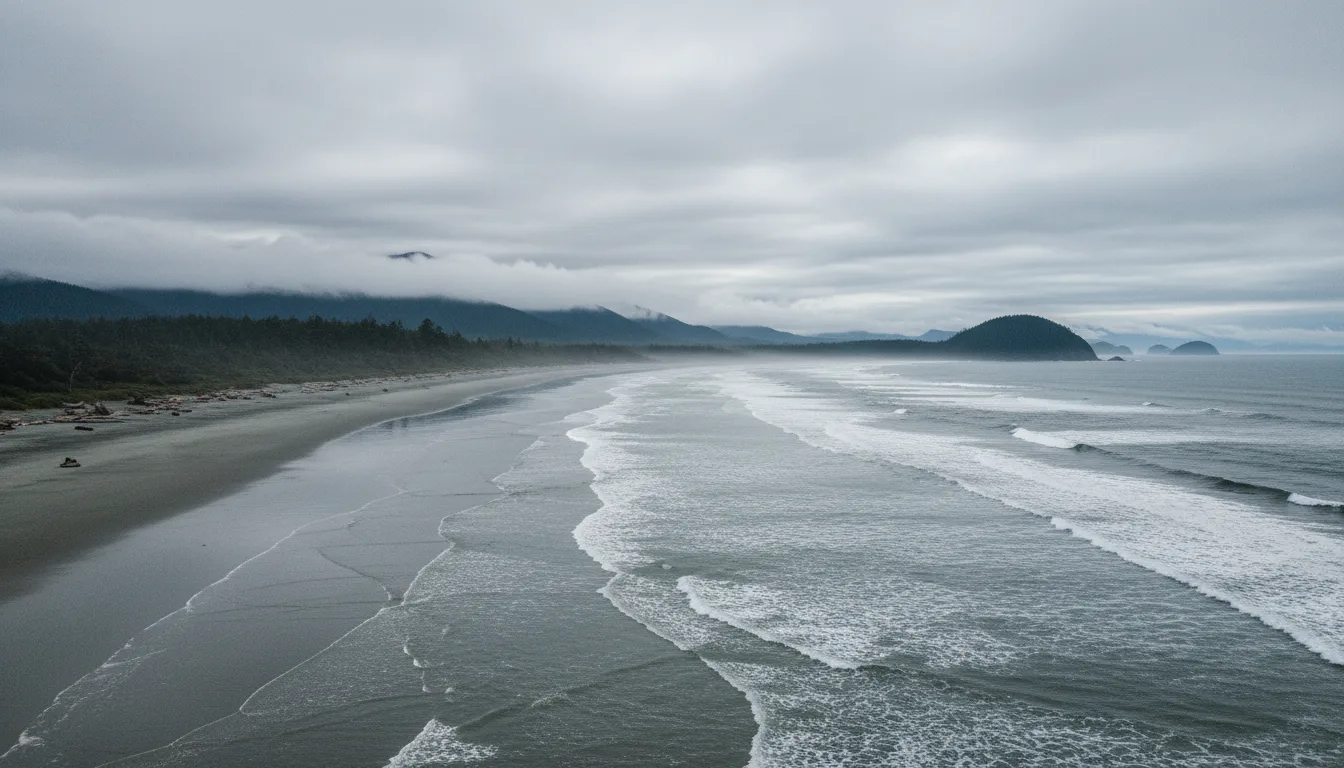
Long Beach. Roughly ten kilometres of open coast — and Parks Canada is explicit that every beach here is unsupervised, with no lifeguards or surf guards on duty.
🔴 Correction №1 · Entry is FREE for most of the 2026 season
Parks Canada's official Pacific Rim fees page states: "Free admission and 25% off camping and overnight stays with Parks Canada from June 19 to September 7, 2026" under the Canada Strong Pass.
That window covers essentially the entire peak season. A July or August 2026 visitor pays nothing for park entry, and gets a quarter off camping. Any guide telling you to buy a day pass or a Discovery Pass for a summer 2026 Pacific Rim trip is costing you money.
⏳ ROT WARNING, and it is a hard one: the Canada Strong Pass is a dated, one-season programme that expires 7 September 2026. Parks Canada also resets fees annually, typically on 1 January. This entire section is wrong after that date — which is exactly why the standard fee table sits below it rather than being dropped. ⚠️ Note too that the fee page carries a 3 December 2025 modification date and does not label its rates "2026" anywhere; and we did not independently verify the full scope of what the Canada Strong Pass waives at this park beyond the wording quoted above.
🔴 Correction №2 · It is a per-person day-use fee, not a gate
There is no toll booth on Highway 4 entering the park. The highway runs straight through the park reserve, and driving through to Tofino without stopping does not require a pass. The fee is a per-person, per-day charge, and enforcement works by display of a valid pass in your parked vehicle at trailheads, beach lots and day-use areas. Parking and using the park is what triggers it.
The practical consequence people miss: a family of four pays four times, not once. This is the opposite of the per-vehicle model used for several BC provincial day-use passes, and getting the two backwards is a common and expensive error.
⚠️ Honesty split: the per-person, per-day fee structure IS confirmed by the official fee table. The "no gate / enforcement by display at parking lots" characterisation is our synthesis of how Parks Canada operates this site, corroborated by visitor discussion but not a verbatim Parks Canada statement we were able to read. Confirm on Parks Canada's "What type of pass should I buy?" page if the mechanism matters to you.
The three units, and what "Reserve" means
The park reserve has three units: the Long Beach Unit (the highway corridor, the beaches and the day trails), the Broken Group Islands in Barkley Sound (boat and kayak access only), and the West Coast Trail (§13). They are not adjacent and they are not interchangeable — a plan that says "Pacific Rim" without naming a unit is not a plan.
And the word that matters: a national park Reserve is land managed as a national park but subject to unresolved Indigenous land claims that Canada has accepted for negotiation. The Canada National Parks Act is explicit that "the application of this Act to a park reserve is subject to the carrying on of traditional renewable resource harvesting activities by aboriginal persons." Nuu-chah-nulth harvesting rights continue inside it — written into the statute, not granted as a concession. The word is not about wildlife. It is a legal marker that the land question here was never settled. Full treatment in §19.
⚠️ Parks Canada's own history pages returned HTTP 404 on two attempts, so the park's commonly cited 1970 establishment date and "Canada's first national park reserve" status are secondary-sourced only and we do not assert them as verified. The statutory meaning of "Reserve" above is primary — it is quoted from the Act.
Parks Canada fee (applies outside the free window)
Price
Note
Daily admission — Adult
$12.25
Per person, per day
Daily — Senior
$10.75
Daily — Youth, 17 and under
FREE
Year-round, not just in the promo window
Daily — Family / Group
$24.50
The efficient option for a carful
Annual — Adult / Senior / Family
$60.50 / $51.50 / $120.75
Pacific Rim only
Discovery Pass — Adult / Senior / Family
$83.50 / $71.50 / $167.50
All Parks Canada sites for a year
Long Beach camping — serviced, electricity
$40.00 / night
25% off in the Jun 19 – Sep 7 2026 window
Long Beach camping — unserviced
$34.00 / night
With washroom buildings, toilets and showers
oTENTik
$147.50 / night
Sleeps 6, no pets
Group camping, Long Beach
$8.75 per person
8–24 people
Backcountry
$15.00 per person per night
West Coast Trail
$208.50 per trip per person
Permit + orientation. Ferries are extra — see §13
⚠️ Naming trap worth knowing: the Parks Canada fee table uses the unit name "Long Beach", never "Green Point." Green Point is the campground within the Long Beach Unit, and the fee page never uses the words "Green Point" at all. That the "Long Beach" camping lines are Green Point's rates is our inference from the park geography — it is consistent and near-certain, but it is an inference and we are flagging it. Reservation services: $11.50 online, $13.50 by phone.
The one thing worth doing when you arrive
Parks Canada publishes hazard maps identifying "hazardous currents and 'no go' zones" for Cox Bay, Florencia Bay, Green Point, Long Beach and Wickaninnish Beach, and those maps are posted at beaches and trailheads. 🔴 Read the sign at the beach entrance. It is the highest-value, lowest-effort safety action available to you on this entire trip, it costs nothing, and it is beach-specific in a way no guide written in advance can be. §16 explains why it matters so much.
The Kwisitis Visitor Centre operates 1 June – 7 September 2026, 9:30 a.m.–7:30 p.m. Note that Wickaninnish appears in Parks Canada's surf-hazard mapping but we could not retrieve an official Wickaninnish Beach page with distances, so none appear here. Likewise Long Beach's commonly cited ~10 km length is secondary — we could not find Parks Canada stating a length.
05 / TOFINO
Extreme prices, no spare beds, and a water deficit
Tofino is the reason most people make this drive, and it is also the single most constrained place on the route. Its accommodation scarcity is policy rather than accident, its summer water supply runs a deficit by design of geography, and its minimum-stay rules cost visitors more than its headline rates do. This is the unglamorous version.
What Tofino is good for — and what it is not
Good for: groceries at the Tofino Co-op, fuel, surf shops and rental gear, restaurants, water taxi and float plane charters out to Ahousaht, Hesquiaht and Hot Springs Cove, and the Tribal Parks Allies businesses (§19).
NOT good for: budget accommodation · spontaneity in summer · technical mountaineering or backcountry gear — this is a surf town, and if you are carrying on to Strathcona you buy alpine kit before you come · quiet · parking · and filling a large freshwater tank.
No municipal campgroundNo free camping anywhere in the DistrictFill water in Port Alberni
🔴 The scarcity is a policy, not an accident
Tofino operates an active "Limits to Growth" policy explicitly tied to water supply. The town's supply constraint is structural, and it is the reason hotel inventory does not simply expand to meet demand the way it would elsewhere.
The trap is the minimum stay, more than the headline rate. Two- and three-night minimums are common in peak season, which turns a "just one night in Tofino" plan into a booking you cannot make at any price. Reported drivers of the pricing: a weak Canadian dollar drawing US visitors, increased domestic demand, and structurally limited supply in a tightly protected area.
Ucluelet, about 40 minutes south, is materially cheaper and is the release valve most itineraries should use. Port Alberni is cheaper again and is a legitimate base for day trips if your trip is more driving than beach.
🔴 We print no nightly rates. Every accommodation figure we found came from travel-content sites and booking aggregators — not operators, not the District — and rate data of that provenance rots within months. Print the structure, not the price: book months ahead for July–August, expect multi-night minimums, and treat Ucluelet or Port Alberni as your fallback base.
🔴 Tofino's water — verified current, and directly relevant to your rigTofino's water comes from creeks on Meares Island. The District's Water Master Plan identifies a deficit in raw water supply during the busy, dry months, when Maximum Day Demand exceeds the flow rate from the source creeks. This is not a hypothetical constraint — it is the annual operating reality of the town.
Dated snapshot · read 18 July 2026
Water Conservation Stage 1 has been in effect since Tuesday 12 May 2026, and as of 26 June 2026 Stage 1 remained in effect as Tofino entered its busiest time of year. In 2025, Stage 1 ran from 10 June and was lifted 16 September — so 2026 started roughly a month earlier. Operational improvements plus sufficient rainfall in 2024 and 2025 kept the community at Stage 1 all summer without escalating; that is a good record, not a guarantee.
What Stage 1 means: the focus is awareness and voluntary reduction, to reduce the risk of stricter stages later in the season. Outdoor watering is restricted to specific methods — hand-held hose with an automatic shut-off nozzle, watering can, sprinkler or drip irrigation. Permitted under Stage 1: hand-watering food plants, rinsing equipment such as bicycles and boats, and limited vehicle washing or power washing provided water is used efficiently.Indoor use is unrestricted at Stage 1, but reduction is encouraged. Businesses must prominently display water conservation information — so if your accommodation has a sign about it, that is the bylaw working.
For overlanders specifically: do not plan on topping up a large freshwater tank in Tofino in summer. Fill in Port Alberni on the way in. Check the District's page for the current stage before you arrive — this will change within the year.
⚠️ Method disclosure: tofino.ca timed out repeatedly on direct fetch — three attempts, socket closed and 60-second timeouts. The Stage 1 status above is assembled from District-authored page titles and summaries plus local newspaper reporting, not from reading the full live page end to end. Confidence is high on the stage and the dates, moderate on the restriction detail. Re-verify on the live page.
The Tribal Parks Allies fee on your bill is not an error
If a Tofino business adds a 1% Ecosystem Service Fee to your hotel stay, surf lesson, tour or restaurant meal, that is the Tribal Parks Allies programme working exactly as designed — a voluntary programme under which businesses operating in ƛaʔuukʷiʔatḥ territory collect the fee on behalf of the Tla-o-qui-aht Nation. It is a real, Nation-run mechanism, not a surcharge mistake. Full treatment, including where the money goes and how the Nation describes the programme in its own words, is in §19. We print no business list — the Allies roster changes, and tribalparks.com is the place to check it.
06 / UCLUELET
The efficient base — and the best cliff walk on the coast
Ucluelet is cheaper, quieter and, for anyone travelling in a vehicle they need to resupply, structurally better organised than Tofino. It also has the Wild Pacific Trail, on which the two most official-looking sources disagree about every single distance — which is a useful lesson in what "official" means.
🔴 The single most efficient resupply on the west coast
The Ucluelet Co-op is a genuinely full-service hub: groceries, produce, deli, meat department, hardware, family fashions, garden centre, a pharmacy with a pharmacist, and a gas bar with a C-store.
Hardware and a pharmacy under the same roof as fuel and groceries is a rare combination anywhere, and out here it makes Ucluelet the most time-efficient stop on the coast. If you have a list with a fuse, a prescription and a bag of ice on it, this is the one place that closes all three in a single stop. Worth saying explicitly, because most guides treat Ucluelet as Tofino's quieter cousin rather than as the better logistics town.
NOT good for: surf-culture selection and restaurant breadth (Tofino wins both), the big-name beaches (Long Beach sits between the two towns and is closer to Tofino), and late-night anything.
⚠️ Laundry and public showers in Ucluelet are NOT verified, and we will not assert availability. This is part of a broader gap: laundry, showers and dump stations are unverified for every town in this issue — a genuine hole for an overlanding audience, listed in §26.
⚠️ The Wild Pacific Trail — two official sources, and they disagree on every distance
This is a clean, instructive example of what happens when you assume "official" means "consistent." The Wild Pacific Trail Society and the District of Ucluelet both publish trail figures, both look authoritative, and they do not match on a single section.
Section
Wild Pacific Trail Society
District of Ucluelet
Lighthouse Loop
2.6 km loop
2.5 km
Ancient Cedars
1 km loop
1.5 km
Big Beach → Rocky Bluffs
5 km one way
Big Beach 1 km; Brown's Beach 3 km
Terrace Beach Interpretive
0.5 km one way
—
Artist's Loop
—
0.5 km branch
Total
~8 km
"approximately 6.5 km plus extensions"
Which is more authoritative? The District of Ucluelet is the land manager and the municipal government, so formally it wins. But the Wild Pacific Trail Society builds and maintains the trail and publishes the more granular section breakdown. We print the Society's numbers and tell you the municipality lists slightly different figures — which is the honest resolution when two credible sources disagree and neither is obviously wrong.
🔴 Neither source publishes elevation gain or hiking times, so this guide publishes none. Every "45 minutes, 30 m gain" figure you will see for this trail is user-generated. Confirmed from the District: the trail is "easy-to-navigate," "accessible to all ages and abilities," with benches at several points, and no bikes, horses or motorised vehicles. Trailheads and parking: Coast Guard Road (two areas), He-Tin-Kis Park on Peninsula Road, Marine Drive at Matterson Drive, and the Blackrock Oceanfront Resort area on Marine Drive. ⚠️ No fee is mentioned on the municipal page — free access is near-certain for a municipal trail, but absence of a stated fee is not the same as a confirmed free trail.
Hitacu, across the inlet, is a community — not a viewpointHitacu sits directly across Ucluelet Inlet from the District of Ucluelet and is the community of the Yuułuʔiłʔatḥ Government, which describes itself in its own words as "a modern treaty government." It is a living community, not a photo stop, and it should be treated the way you would treat any residential neighbourhood you do not live in. The treaty point matters beyond courtesy, too: Yuułuʔiłʔatḥ is a treaty nation and Tla-o-qui-aht and Ahousaht are not — and that difference is the entire reason Pacific Rim is a national park Reserve. §19 has it in full.
07 / PORT ALBERNI & THE ALBERNI VALLEY
The decision point for the whole west coast leg
Port Alberni is not scenic and it is not on the ocean in any sense that matters to a beach trip. It is something more useful: the last place you can fix a vehicle, fill a water tank, buy at mainland-ish prices and reach a referral hospital before 126 kilometres of nothing. Treat the stop as mandatory.
🔴 Fill everything here
There is no fuel on Highway 4 between Port Alberni and the coast. None. Roughly 126 km and two hours with zero services — nothing at Sproat Lake, nothing at Kennedy Lake, nothing at the Tofino/Ucluelet junction until you reach a town.
The Tseshaht Market on the western edge of Port Alberni is described by the Alberni Valley Chamber of Commerce as "the last Full-Service Gas Station between Port Alberni & the West Coast communities of Ucluelet & Tofino." It is signed and unmissable westbound. Per this issue's house rules we record no address or phone for it — you will not need one.
Water is the second half of the instruction, and it is the half people skip. Tofino is in Stage 1 water conservation (§05) and is not a place to fill a large tank in summer. Port Alberni is the fuel-and-water decision point for the entire west coast leg.
Last fuel · 126 km of nothingLast practical water fillFull-size supermarkets · hardware · auto parts
What the town is, and is not
Good for: the last full-service town before the west coast. Full-size supermarkets, hardware, auto parts and mechanics, fuel at mainland-ish prices, and West Coast General Hospital — the referral hospital for the entire west coast (§21). This is where you fix the vehicle, fill the water and buy the things Tofino will charge triple for.
NOT good for: ocean access in the Pacific Rim sense — it sits roughly 40 km up an inlet — and it is not a scenic base. Nobody's holiday photos are from here. That is precisely why it is cheap and available when Tofino is not.
Port Alberni is on Tseshaht and Hupačasath territory. Tseshaht has led public investigative work at the former Alberni Indian Residential School site on its territory. §20 treats that with the care it requires, and points you to the Nation's own site rather than to news summaries.
⚠️ The MV Frances Barkley service into Barkley Sound runs from here and is the classic Alberni Valley excursion, but we did not verify its schedule or season this pass and print no sailing days. Parksville and Qualicum Beach are the last big-box retail corridor before you turn west — a characterisation that is general knowledge and unsourced, so treat it as one line rather than as verified fact.
1964 — the reason Port Alberni belongs in a safety chapter, not just a fuel one
Port Alberni is 40 km inland from open ocean, and in 1964 it was the worst-hit place in Canada. The Good Friday earthquake off Alaska on 27 March 1964 — magnitude 9.2–9.3, the most powerful earthquake ever recorded in North America — sent waves up the roughly 40 km Alberni Inlet around midnight. The narrow inlet amplified the wave. The first struck at 2.44 m. One hour later a second, larger wave of 3.05 m hit. Fifty-five homes were washed away and 375 damaged; bridges were destroyed, cars tossed, homes pulled off foundations. There were no fatalities.
The lesson transfers directly to your trip: inlet geometry amplifies tsunami waves, and being "not on the coast" is not the same as being safe. And the second wave was the bigger one, an hour after the first — which is exactly why the modern instruction is to stay on high ground until authorities say otherwise, rather than going back to look. Full treatment in §17, and the history in §20.
Bamfield — this contradicts what most guidebooks say, in both directions
🔴 The Bamfield road is no longer the raw gravel logging road forum posts describe — but it is also not paved asphalt, and the distinction matters. From the Huu-ay-aht First Nations' own project page: the Bamfield Main Road Reconciliation Project applied a chip seal surface — not traditional asphalt pavement — over roughly 76 km between Port Alberni and Bamfield/Anacla, ribbon-cut 10 October 2023.
Huu-ay-aht's own wording, quoted rather than paraphrased because it is the operative instruction: "The Bamfield Main is still an active industrial logging road and road users are travelling on the Bamfield Main at their own risk." · "Please be aware of the road signage and obey the speed limit of 60 km/hr." · "Please drive with your headlights on and drive with extreme caution." And already reported as of July 2024: "Bamfield Main Road is experiencing chip seal breaking away from the road between KM 0-26."
Chip seal over a logging grade is not a highway. It retains the alignment, sightlines, grades and industrial traffic of a resource road, and the surface is degrading. Headlights on, 60 km/h, yield to loaded trucks.
⚠️ We could not reach the operator's own active-hauling page (wfproadinfo.com returned an SSL handshake error). That page is the single best source for "is hauling active this week" and for the road's radio channel, and we could not read it. Check it manually before you drive Bamfield Main.
🔴 Why we print NO resource-road radio channel for any road in this region
BC uses a standardised bank of Resource Road (RR) channels, assigned geographically, with published channel-assignment maps. Roads are signed at the entrance with the applicable channel. Calling protocol is to announce your position at marked kilometre boards, and loaded trucks have right of way. That much is safe to state.
The government's own resource-road radio channel map page returned HTTP 504 Gateway Timeout, so we could not read the channel assignments — and we are therefore not publishing a channel number for any road here. This is deliberate, and it is the kind of null that matters: publishing a wrong radio channel is actively dangerous. It puts a driver on the air believing they are announcing to oncoming log trucks when nobody can hear them, which is worse than carrying no radio at all.
The instruction that survives: read the channel off the sign at the road entrance, every time. Do not pre-programme from a third-party list.
Related, and also contradicting common knowledge: the Pacific Marine Road (Port Renfrew ↔ Lake Cowichan) is fully paved, the last gravel section sealed roughly a decade ago. But paved is not easy — it is described as single lane in each direction with some one-lane bridges, tight corners, narrow sections and a bumpy surface. ⚠️ This is travel-guide and tourism-board sourced only; we could not confirm the paving status against a ministry or regional-district source. Corroboration across independent sources is decent; it is not primary.
08 / STRATHCONA, HIGHWAY 28 & DELLA FALLS
Real mountains, a worse fuel trap, and a waterfall you cannot walk to
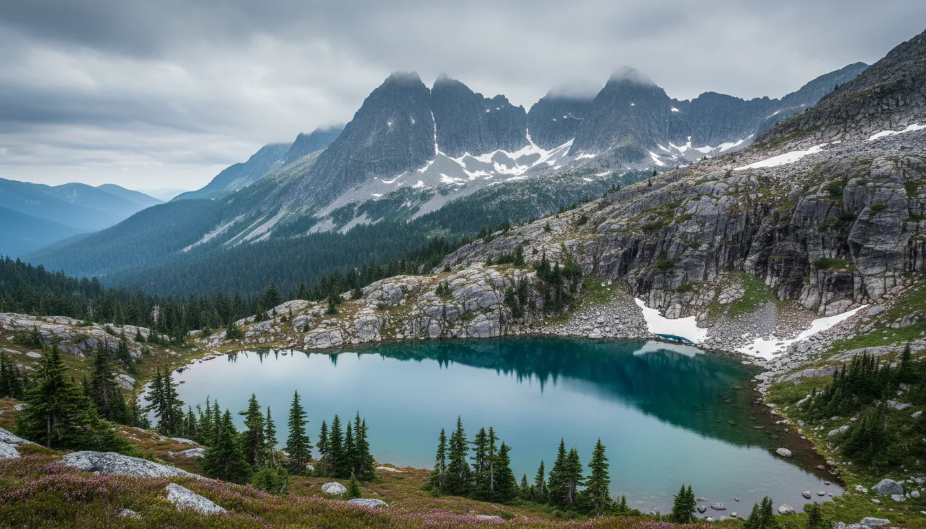
Strathcona is the alpine counterweight to the coast, and it demands a completely different kit and a completely different attitude. It also contains the region's most misunderstood objective: Della Falls, which people plan as a hike and which is not reachable from any road.
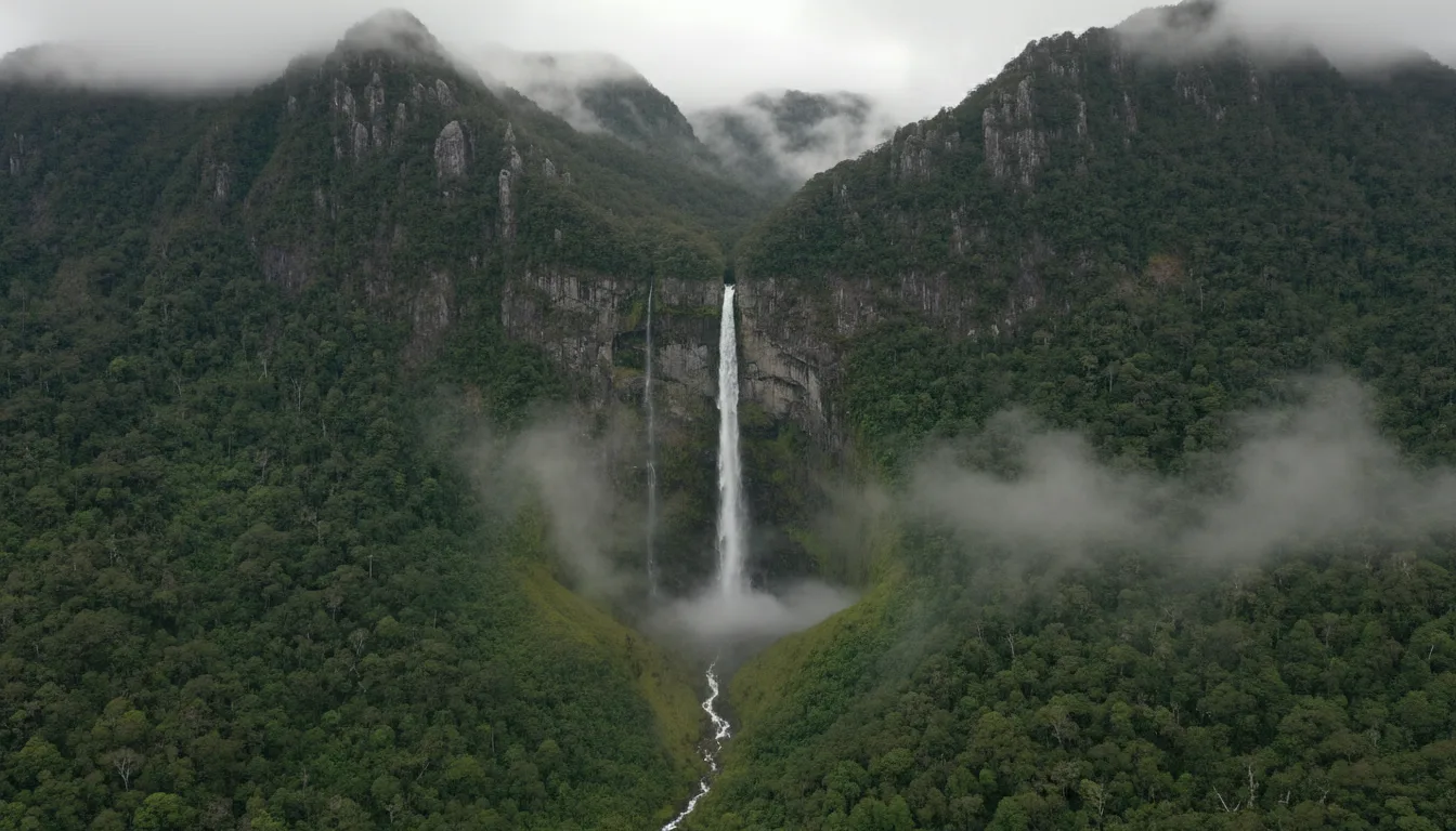
Buttle Lake. Reached by Highway 28 from Campbell River — 99 km with no gas stations and, by every account we found, no phone signal after you leave town.
🔴 The Highway 28 fuel trap is worse than the Highway 4 oneThere are no gas stations between Campbell River and Gold River. Highway 28 is 99 km total. Touring sources are consistent that you should top off fuel AND propane AND fresh water in Campbell River before heading west, because services get sparse fast — and there are no grocery stores beyond Gold River in either direction.
Mobile service is limited outside the village of Gold River and through the Strathcona corridor — that much comes from BC Parks' own material. One touring source describes "zero phone signal on this route after leaving Campbell River." ⚠️ That specific claim is blog-sourced and not carrier-verified, and the 99 km figure is Wikipedia via search summary, not a ministry source — but the direction of travel is not in doubt, and a satellite messenger is the correct tool for this leg regardless of whose number you believe.
🔴 Live constraint from the traffic feed, 18 July 2026:Quinsam River Bridge — "Bridge maintenance. Starting Thu Apr 2 until Fri Jul 31. Expect delays on Quinsam bridge, single lane traffic with the use of traffic lights 24 hrs 7 days a week. The bridge has been reduced to a single lane." That runs through 31 July 2026 and affects everyone driving to Strathcona or Gold River.
🔴 Della Falls — the access IS the story
BC Parks confirms: 440 metres over three cascades, one of Canada's highest waterfalls — and that it "requires boat access to Great Central Lake trailhead."
There is no road to the trailhead. You cross Great Central Lake by boat or water taxi, or paddle it yourself, and only then do you start walking. People plan this as a day hike and then discover, sometimes at the lake shore, that the trailhead is on the far side of a large lake.
The dependency deserves explicit emphasis: this is a multi-day trip requiring a boat booking on both ends. Missing your pickup means you are around 42 km from a road, at the far end of a lake, with no way to walk out in any sensible timeframe. Build slack into the return date, not into the outbound one.
BC Parks' own rules and cautions:"No fires are permitted in campsites along Della Falls Trail." And on the forest itself: "This is an old growth forest with natural hazards. Campers/hikers should be exercising conservative decision making during stormy weather conditions" — which is BC Parks telling you about falling limbs and trees without using the words.
⚠️ What we could not confirm and are therefore flagging rather than asserting: the trail is commonly given as ~16 km one way to the base of the falls, following Drinkwater Creek on old logging grades with bridges and a cable car crossing — secondary sources only, not confirmed on a BC Parks page we could load (one source measured 15.99 km). The water taxi's ~42 km run and ~55 minute duration are operator and blog sourced. Treat all three as approximate.
Strathcona trail (Buttle Lake area)
Distance, one way
Elevation gain
Time, one way
BC Parks' own notes
Elk River
11 km
600 m
5 h
Moderate valley hiking; campsites at Butterwort Flats (6 km) and the upper gravel bar (9 km)
Bedwell Lake
6 km
600 m
3.5 h
"Excellent viewpoints." No campfires at Bedwell Lake
Flower Ridge
6 km
1,250 m
5 h
"Steep and rough till you reach the open alpine ridge; water can be scarce"
Crest Mountain
5 km
1,250 m
4 h
Steep; "excellent views above 1,300 metres"
Marble Meadows
6.6 km
1,250 m
6 h
Moderate to challenging
🔴 Flower Ridge and Crest Mountain both gain 1,250 m — and Crest Mountain does it in 5 km. That is roughly a 25% average grade. These are not casual day hikes, and this guide will not present them in the same breath as a 1 km rainforest boardwalk. If you have spent your trip on the coast walking flat beaches, understand that you are changing sports, not just locations. Unlike Pacific Rim, BC Parks does publish distances, gains and times for these — a genuine difference in data quality between the two agencies, and the reason this table exists here and nowhere else in the issue.
⚠️ Strathcona conditions — dated 5 June 2026, and that matters enormously
BC Parks' Strathcona trail report is dated 5 June 2026 — six weeks stale at time of writing — and it explicitly says "Revised updates will be posted as information becomes available."Snow conditions in June bear little resemblance to mid-July. Everything below is presented as of that date and must be re-checked.
Park-wide, 5 June:"Hikers can generally expect to find snow conditions above 1250 - 1350m while snow may remain at lower elevations in shaded forested areas, and in north facing slopes and valleys. Extreme caution is needed in travelling in snow covered areas at this time while conditions are difficult and snow equipment may still be required."
🔴 KARST CREEK TRAIL — CLOSED:"TRAIL CLOSED due to hazardous conditions including a rockfall hazard upstream. Keep off trail." Do not list it as available, and note that Karst Creek is also a group campsite area (§10) — the campsite and the trail are different things.
Per-trail, as of 5 June:Elk River — snow free to Landslide Lake, cleared of windfall, camps 1 and 2 open and accessible: the best-conditioned of the big trails. Bedwell Lakes — winter conditions above 1300 m; Baby Bedwell and Main Bedwell camping areas snow free; "Challenging and Marginal hiking conditions exist at higher elevations."Flower Ridge — windfall cleared, mostly snow free. Crest Mountain — winter conditions above 1300 m including at the lake; "Bridges may be slippery."Della Falls & Love Lake — cleared of windfall; Sawblade and Margaret Creek camps accessible. Upper Myra Falls — snow free, but "Use caution on viewing platform where fallen tree has damaged the railings."Arnica Lake / Phillips Ridge — windfall NOT cleared, expect blowdown throughout.Marble Meadows — "Trail has not been assessed this season and hikers can expect blowdown" (last updated 14 May 2026, staler again). Gold Lake — 🔴 "Forest service road (outside park boundaries) bridge decommissioning has made trailhead access impossible by 4x4 truck."
🔴 Mount Albert Edward:"Most of the route about Circlet Lake remains snow covered and route finding skills are necessary. Skis or snowshoes may be necessary. Extreme caution is required in variable and changing conditions." Also: no camping at Moat Lake (it is inside the park's Core Area; nearest campsites are at Circlet Lake), and the Castlecrag route is not maintained. ⚠️ We publish no distance, elevation or time for Albert Edward — the BC Parks Forbidden Plateau trails page returned HTTP 404.
🔴 The sentence that should govern your July plan. BC Parks' general note: "Most trails are snow covered from late October or November until at least June, and for higher elevation trails, often until mid July."A mid-July Strathcona alpine trip is right at the edge of the snow-free window — not reliably past it. Carry accordingly, and re-read the trail report the week you go.
Gold River — the west access, and what it cannot do for youGold River is the main road access point to Strathcona from the west, at the west end of Highway 28, roughly an hour from Campbell River. Fuel and groceries are available in the village, and RV travellers typically use it for both and then base at a lake or river campground. NOT good for: selection, specialist gear, or assuming anything is open. ⚠️ We found crowdsourced opening hours for the local fuel stop and deliberately do not print them — crowdsourced hours are exactly the sort of number that strands someone at 9 p.m. Plan to arrive during normal business hours, and remember there is nothing past the village.
09 / THE TWO FEE REGIMES
Federal and provincial work nothing alike
This region straddles Parks Canada, BC Parks, Recreation Sites and Trails BC, and Nation-operated and private grounds. Their rules, booking windows and fees are completely different, and the single most expensive assumption you can make is that one applies to the other. Book in the right order, on the right calendar.
Parks Canada — Pacific Rim NPR
BC Parks
Booking window 2026
Fixed annual launch dates — 29 Jan / 5 Feb 2026, 8 a.m. PT
🔴 Correction №3 · The BC Parks booking window is THREE months, not four
BC Parks' own wording: "You can make a reservation for your entire stay up to three months before your desired arrival date," and "New frontcountry camping reservations become available at 7 am Pacific Time daily."It is a rolling daily window, not a single launch day — which means you are competing for one specific date's inventory each morning, not for a whole season at once.
The "four month window" is still everywhere in blogs and it is wrong for 2026. Set your alarm a month later than the internet tells you.
⚠️ One honest split here. The three-month rule is verified on the live BC Parks page. But we could not find a current BC Parks page that narrates a change from four months to three — so we publish the rule as verified and the change itself as undocumented. If you read elsewhere that "it used to be four," that framing may well be right; we simply could not stand it up from a primary page, and we would rather tell you which half of the claim we checked.
Other rules from the same page: check-in after 1 p.m., check-out before 11 a.m. You must claim a reserved site before 11 a.m. the day after your scheduled arrival or it can be cancelled without refund. And the maximum stay at most parks is 14 nights per calendar year in total, consecutive or not — a regulation limit, not an operator preference.
🔴 The $20 non-resident fee — read the mechanics, not the headline
Effective 15 May 2026, a $20 flat non-resident fee applies to visitors from outside British Columbia
2026 scope: frontcountry camping, backcountry camping, cabin rentals, mooring buoys and dock use. Not until 2027: group campsites and group picnic shelters
Frontcountry: $20 per party per campground — not per night. Backcountry: $20 per person per trip within a park — multiple nights in one park count as one trip. The backcountry reading is the more expensive one for a group
Mooring buoy or dock: $20 per vessel. Cabins: $20 per person or per cabin depending on the park
It does not apply to children or youth, and it applies to reservations, permit registrations and first-come stays alike — charged at the gate if you did not pay it online
Proof of B.C. residency accepted: BC Driver's Licence, BC Services Card, BCID. No proof means you pay
It does not apply where no camping or facility fee would otherwise be charged — e.g. free wilderness camping in Strathcona
⚠️ It is a Park Act instrument, and there is no evidence it reaches Recreation Sites. The RSTBC fee page does not mention it. We assume it does not apply to rec sites — but that is inference, and we are labelling it as such rather than stating it.
Where the BC Parks numbers in this issue come from
Every provincial-park dollar figure in §10 comes from the regulated recreation user fee schedule — fees set by the Minister under the Park Act, published as a per-park, per-season table. That schedule, not a park webpage, is the authoritative instrument, and it says so itself: "This schedule lists fees established by the Minister pursuant to authorities in the Park Act." The PDF returns binary to a plain fetch; we downloaded and extracted it.
Season definitions, which drive which column applies: peak season is 15 June to Labour Day. Off season is the day after Labour Day to 14 June. Increased 2026 fees apply at 59 high-use frontcountry parks and 4 "iconic" backcountry parks — Rathtrevor Beach, Sproat Lake and Strathcona are on the high-use list; Stamp River and Fossli are not.
Transaction fees, on top of camping fees: booking $6 per campsite or tent pad per night to a maximum of $18, plus tax; change $6 + tax; cancellation $6 per reservation + tax; call centre surcharge $5 + tax. Camping fees include tax; transaction fees add it. 🔴 All transaction fees are non-refundable.
⚠️ The schedule explicitly excludes "Service Plus" fees, which operators charge separately for enhanced services such as full electrical hook-ups, by agreement with the Ministry. Those appear in the price at checkout but not in the regulated table — treat them as operator fees sitting alongside the schedule, not inside it. ⏳ The schedule PDF's URL contains a content hash and will change silently when the schedule is amended: re-derive it from BC Parks' camping-fees page rather than bookmarking it.
10 / CAMPING BY ZONE
Green Point, the provincial parks, and the Nations' own grounds
Four systems, one coast. The federal campground has a single annual booking launch and no overflow; the provincial parks run a rolling three-month window; the recreation sites are cash and first-come; and several of the best grounds in this region are owned and operated by Nations in their own territories and are routinely miscredited as private RV parks. Attribution matters here, and so does arriving with a booking.
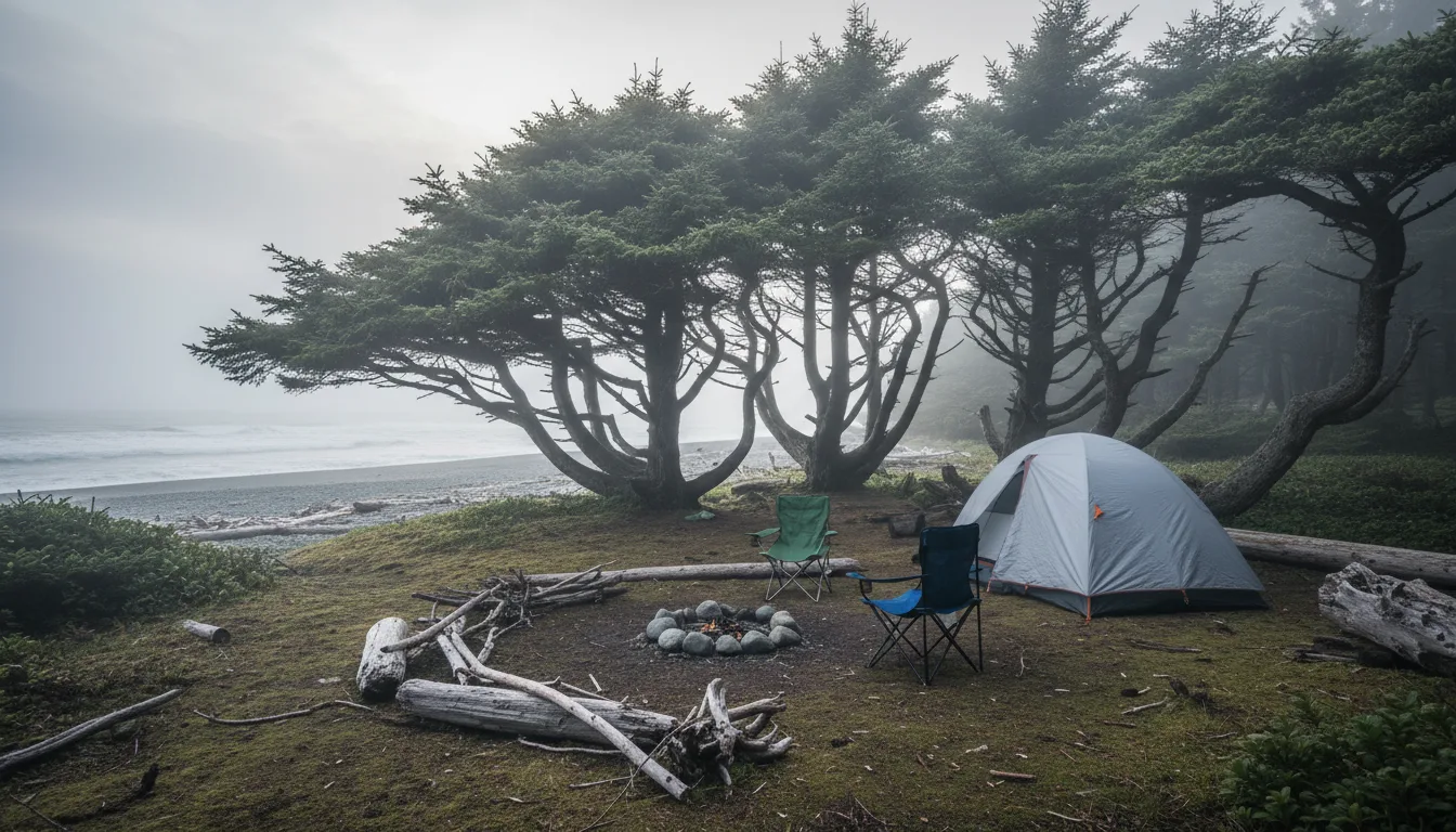
The coast's beds. One federal campground, a scattering of provincial parks inland, and Nation-operated grounds that most listings get wrong.
🔴 Green Point — one launch a year, and no overflow at allReservations for the 2026 Green Point season opened at 8 a.m. PT on 29 January 2026 via the Parks Canada Reservation Service. This is a single annual launch, not a rolling window — the exact opposite of BC Parks. By mid-July 2026 the entire summer was released months ago.
Inventory:94 drive-in sites · 20 walk-in sites · 1 group walk-in site (8–24 people) · 1 oTENTik.Season: the hours page gives "open for the season (May – October 12, 2026)" and the camping page phrases it as "Open: May 1 – mid-October." ⚠️ The two Parks Canada pages are inconsistent on the opening date: treat 12 October as the firm close and "May 1" as indicative. The campground kiosk runs 9:00 a.m.–9:30 p.m. daily.
Is it reservation-only? Parks Canada does not describe it that way — the camping page says reservations are "recommended" for both drive-in and walk-in sites. ⚠️ But we could find no Parks Canada page describing a first-come allocation, an overflow lot, or a same-day release policy for Green Point, and in practice it fills every night in high season. Assume no walk-up availability in July and August. Absence of a stated policy is not proof that no such practice exists — but it is not something to bet a night's sleep on either.
Site rules. Drive-in: 6 people max; 2 tents, or 1 RV/camper + 1 tent; 2 vehicles per site space permitting; maximum stay 7 consecutive nights. Services: 120V electrical, 15 and 30 amp, flush toilets, showers, fire pits, picnic tables, sani-dump. Walk-in: 6 people, 1 tent max, no pets, 7-night max, unserviced apart from flush toilets, cold water taps, fire pits and tables. Group walk-in: 8–24 people, unserviced, central fire pit, no pets, no alcohol, no stereos. oTENTik: sleeps 6, no pets, reservable May–October. 🔴 We publish NO maximum vehicle length for Green Point. Parks Canada says only that specifications vary by site and to contact reservations; the per-site limits live inside the reservation system. A number we cannot source is a number that strands someone at a gate.
Other Pacific Rim overnight options
Broken Group Islands — boat and kayak-access backcountry across seven islands. Open to overnight visitors 1 May – 30 September; reservations opened 29 January 2026, 8 a.m. PT. Backcountry fee $15 per person per night
Keeha Beach backcountry — 1 May – 30 September; reservations opened 29 January 2026, 8 a.m. PT
🔴 Nitinaht Triangle — "remains closed until further notice." Do not route anyone through it. This is an indefinite state that could end at any time, so re-check rather than assuming it is permanent
The mainland staging point for the Broken Group Islands is Toquaht Bay — see the Nation-operated grounds below. The islands themselves sit in Barkley Sound, and Tseshaht territory includes the Broken Group; ⚠️ we did not confirm that connection directly on tseshaht.com and flag it accordingly (§19).
🔴 Strathcona — BC Parks contradicts itself on its own page
Both of these sentences are live on bcparks.ca right now, inside the same paragraph: "Buttle Lake and Ralph River Campgrounds are 100% by reservations only for this season. There is no first come, first served camping available. If campsites are not reserved they may be used as first come, first served on a nightly basis. There is no overflow camping available."
Those two clauses directly contradict each other. The safe operational reading, and the one both fields on the page agree on: plan to reserve; there is no overflow; any first-come use is a nightly leftover, never a plan.
Buttle Lake: 85 vehicle-accessible campsites, second-growth Douglas fir, developed sandy beach, some sites on the lakeshore. Ralph River: 75 vehicle-accessible campsites among old-growth Douglas fir, 35 km south of Buttle Lake along the Buttle Lake / Westmin Road. Both $29 peak / $20 shoulder / $11 winter per party per night, plus the $20 non-resident fee.
⚠️ Note "this season" is undated on the page — it will rot. ⚠️ No firm 2026 opening or closing dates for Buttle Lake or Ralph River are published on the BC Parks page. The only dates available appear in a campground brochure BC Parks still links that is stamped 03/2002, cites a ministry that no longer exists and points readers at a defunct booking site. Everything in that brochure about fees, dates and booking is obsolete — including its statement that there are no electrical hookups, which is the only source we have for that fact either way.
Provincial park
What's there
Peak / shoulder / winter
The thing to know
Rathtrevor Beach Parksville — before you turn west
Main campground + 25 walk-in sites + 4 group sites. Hot showers, flush toilets, playground, fresh water, paved campground roads, sani-station $5/discharge. All sites within a 5-minute walk of a 2 km sandy beach
🔴 "During the peak season (last week of June to Labour Day), reservations are REQUIRED for all frontcountry sites" — including all 25 walk-ins. First-come exists outside peak only. The single most oversubscribed campground in the region. In winter, reservations are not available — first-come only
Sproat Lake Just west of Port Alberni
Two campgrounds: Lower near the lake, Upper across Highway 4, linked to the lower campground and beach by a trail through a highway underpass
$36.50 / $25 ($23.25 BC seniors) / $13
"Campsite reservations are required and first come, first served sites are available." Year-round camping with limited off-season facilities in the Lower campground only. No motorised vehicle access on the trail network or in the day-use area
Stamp River Near Port Alberni
Vehicle-accessible sites in mature forest, a number overlooking the river. Interpretive signage on the fish ladder and salmon runs
$18 flat — same peak and shoulder ($9 BC seniors, off-season only) / $11 winter
Not on the high-use list, hence no peak premium — the cheapest provincial bed in this issue. Reservations accepted and first-come available. Winter camping offered but no services off-season. No scheduled interpretive programs
Little Qualicum Falls On Hwy 4 east of the summit
Two campgrounds, Upper and Lower. Most sites vehicle-accessible; 8 sites in the Upper Campground are walk-in, with nearby parking
$33.50 / $23 ($16.75 BC seniors) / $12
Reservations accepted and first-come available; when reservations are not available all sites are first-come. "The gate is open 24 hours in the winter unless snowed in"
Englishman River Falls South of Parksville
"Spacious, vehicle-accessible campsites nestled in the mature forest"
$33.50 / $23 ($16.75 BC seniors) / $12
Reservations accepted, first-come also available. Fishing is not permitted at this park. Pets leashed, not on beaches or in park buildings
Fossli Sproat Lake area
🔴 NO CAMPGROUND
—
Verified as a negative: the BC Parks page lists no camping types at all, and Fossli appears nowhere in the recreation user fee schedule. Day-use / hike-in only. "There is no sani-station and dump facilities or boat launch available at this park" — nearest is Sproat Lake. It "operates on a 'User Maintained' basis"
Juan de Fuca — China Beach South island, for the Marine Trail
Frontcountry campground ~1 km east of the China Beach day-use area
$29 / $20 ($14.50 BC seniors)
The frontcountry option for Juan de Fuca Marine Trail hikers (§13). Advance booking advised in peak season. Backcountry on the trail is $10 adult / $5 child per person per night + $20 non-resident per person per trip
🔴 We publish no total site counts for Rathtrevor, Sproat Lake, Little Qualicum or Englishman River. BC Parks removed site counts from its park pages, and its reservation system sits behind a web application firewall that blocks programmatic access entirely. Every count circulating for these parks — including the widely repeated ~226 for Rathtrevor's main campground and 59+5 for Sproat Lake — comes from partner directories and operator marketing, not from the managing agency.Buttle Lake's 85 and Ralph River's 75 ARE from BC Parks' own page text, which is why those two appear above and the rest do not. Rathtrevor's own "peak season = last week of June" wording also differs from the fee schedule's "15 June" — the fee schedule is the authority for money; the park page is the authority for whether you can turn up.
Strathcona backcountry, group and marine sites — the detail BC Parks does publishPermit registration is required to camp on the Bedwell Lakes/Cream Lake trail, the Elk River trail, and in the Paradise Meadows (Forbidden Plateau) core area — register online before you arrive. No fee is charged for backcountry camping on the Della Falls trail, at Douglas or McKenzie Lakes, Margaret Creek, Sawblade Camp or Falls Camp. Where fees apply: $10 per adult (16+), $5 per youth (6–15), free under 6, per night, plus the $20 non-resident fee per person per trip. No fees in the winter season.
🔴 Campfires are not allowed in the backcountry of Strathcona. Carry a stove. The exception is the marine sites, where campfires are permitted only in the provided fire rings and nowhere else. Wilderness camping on undesignated ground is allowed in some areas — no fee, no facilities — but not within 1 km of main roads and not in designated fee-collection areas. No camping in any day-use area, including Crest Creek Crags and Crest Lake, at trailheads, or on Buttle Lake outside designated marine sites; eviction and charges follow under the regulation.
Three group sites, all reservation-only:Driftwood Bay on Buttle Lake — exclusive group camping, wheelchair-accessible pit toilets, covered picnic shelter. Croteau Lake — backcountry, hike-in only, no vehicle access; 12 raised wooden tent pads, day-use yurt, two bear-proof food caches, small dock, composting toilet. Karst Creek near the south end of Buttle Lake — picnic tables, fire pits, accessible pit toilets, lake shore access and an adjacent public boat launch, but 🔴 "There is no drinking water (well) on site at this time" — nearest well water is Ralph River campground, ~3 km south. Group fees: $80 base + $5 per adult (16+) for a minimum 15 adults + $1 per youth, children under 6 free.
Marine and boat-in sites on Buttle Lake (permit registration required; cash-only self-registration at boat launches and day-use areas, or register online): Titus 4 sites · Wolf River 4 · Phillips Creek 5 · Rainbow Island 5, plus one campground on Upper Campbell Lake. All have tent pads and tables. Launches at Buttle Lake and Karst Creek; kayaks and canoes may also launch at Lupin Falls and Auger Point day-use areas.
Recreation Sites — cheap, cash, first-come, and three of them are CLOSEDMost recreation sites are first-come, first-served, fees are collected by site operators, cash only, and vary with services. Additional vehicles beyond one per party cost 50% of the daily camping fee.Seniors 65+ and persons with disabilities get 50% off the regular camping fee at managed fee-collecting sites, with verification.
Site
Sites
Access
Status — as recorded 18 July 2026
Snow Creek (Sproat Lake)
30
Road
Open — "Open for the 2026 Season between May 1 and October 17, 2026.""This is a CASH ONLY site"; sites available for reservations and first-come. Small-boat launch, beach, on-site supervision
Nahmint Lake
12
Road — Nahmint FSR
Open. Old-growth hemlock, beach. Deep on an active logging road system; the record's own directions warn "Odometer reading may vary from one vehicle to another"
Blackies Beach (Nahmint Lake)
6
Boat-in, or a steep trail from the road above
Open, no comment
Arden Creek (Alberni Inlet)
6 — 2 walk-in pads + 4 vehicle pads
Road
Open, no comment
Lowry Lake
6
Road
Open — "Open for overnight camping June 1st"
Flora Lake
5
Road — ~58 km of gravel via Carmanah Main off the Port Alberni–Bamfield road
Open — "Open for the season"
Knob Point (Nitinaht Lake)
4
Boat-in
🔴 CLOSED — "SITE CLOSED." User-maintained and recorded as "in rough shape"
Father & Son Lake
—
—
🔴 CLOSED
Labour Day Lake
—
—
🔴 CLOSED — "Site CLOSED due to hazardous trees"
🔴 Father & Son Lake and Labour Day Lake are both CLOSED, and they are two of the best-known hike-in lakes near Port Alberni. They appear as open in older guidebooks and in a great deal of blog content. All the open road-access sites above have pit toilets and picnic tables.
🔴 Never trust the status badge on a BC recreation site. The public site's own records carry an "Open" badge while the comment field says the site is closed — and the comment is the field that gets updated. We used the comment text, not the badge, for every row above. A guide that repeated the badge would send its buyers to closed sites. Access disclosure: sitesandtrailsbc.ca returns a 592-byte empty JavaScript shell to any plain fetcher; everything here came from the site's own public JSON API. If that API changes, none of this section is reproducible from the public website without a real browser.
Nation-operated and private grounds — and why the attribution mattersSeveral of the best campgrounds in this region are owned and operated by Nations, in their own territories, and are routinely miscredited as "private RV parks" in travel listings. Getting this right is not a courtesy; it is accuracy.
Ground
Who operates it
What's there
Booking & season
Tsawaak RV Resort & Campground Pacific Rim Hwy at Tofino
🔴 Tla-o-qui-aht First Nation — the resort's own words: "Tsawaak is owned and operated by Tla-o-qui-aht First Nation." The name derives from His-shuk-nish-tsa-waak, "we are all one"
34 RV sites with hookups, 13 mini cabins, 5 tent sites. On Tla-o-qui-aht land with access to Tinwis Beach
Open year-round. Bookable up to 365 days in advance — a full year, against BC Parks' three months. ⚠️ 2026 nightly rates sit behind the booking flow and are not published as a table
Wya Point Resort A few km outside Ucluelet
Ucluelet First Nation (Yuułuʔiłʔatḥ) — ⚠️ attribution caution below
600 acres of old-growth forest with private beaches. Lodges, yurts, oceanside and woodland campsites, unserviced RV sites
Booking is split across platforms — lodges and yurts one way, campsites another. ⚠️ No site counts, season dates or 2026 rates published on pages we could read
Secret Beach Campground / Toquaht Marina Toquaht Bay — ~45 min from Ucluelet
Toquaht Nation traditional territory — "Owned and operated by Toquaht Marina & Campground"
67 campsites, plus tent platforms at the kayak launch. Marina, boat and kayak launches. The mainland staging point for the Broken Group Islands
2026 season: 15 May – 30 September. Kayak launch open through 7 September 2026.Gate closes 10:00 p.m.; no drop-ins accepted after 8:00 p.m.
Pachena Bay Campground Near Bamfield — the northern WCT trailhead area
🔴 Huu-ay-aht First Nations (HFN Hospitality LP)
Old growth beside a long sand beach facing the open Pacific, at the mouth of the Pachena River
2026 reservations opened 28 January 2026 at 7:00 a.m. PST. Peak 1 June – 30 Sept; off-season March–May and 1 Oct – 15 Nov
Nitinaht Lake Campground Balaats'adt / Nitinaht Village
🔴 "Operated by the Ditidaht Economic Development Corporation on behalf of Ditidaht First Nation" — since 2006, and the government's own record confirms the Nation manages the site
World-class windsurfing and kiting lake, and the gateway to the West Coast Trail mid-point entry at Nitinaht Narrows
Basic campsite $35/night + $5 online booking fee + GST. Max 5 adults per site, or up to 7 people if children 17 and under are included. Season roughly late April to end of September / early October
China Creek Campground & Marina Alberni Inlet, ~10 km from Port Alberni
⚠️ The rates page does not state who operates it. Widely described as an Alberni-Clayoquot Regional District facility; we could not confirm that from an ACRD page
Basic, partial-serviced and full-serviced sites, including beachside and oversized
2026 daily rates: basic regular $42.77 · basic beachside $58.33 · partial regular $49.58 · partial oversized $58.33 · partial beachside $64.16 · full regular $57.86 · full oversized $64.16, all plus tax. $50 non-refundable deposit at booking; $5 new-booking fee; $10 additional vehicle. Minimum stay 2 nights, 3 on long weekends. ⚠️ Sources disagree on the season close (13 Oct vs 30 Sept); the rates page gives 1 April – 13 October and is the better source
Ucluelet Campground
⚠️ 🔴 The site is silent on whether it is municipal or private — DO NOT call it "the municipal campground"
125 sites over 15 acres: waterfront harbour and mountain-view sites, full RV hookups (19–42 ft RVs, select sites 30 amp with electric, water and sewer), semi-private forested sites, and full-service, partial and unserviced tent sites
Open year round, with seasonal full-service sites October–April at monthly rates. Reservations required. ⚠️ The only rate figures visible were a stale promo — not 2026 nightly rates, and we print none
⚠️ Wya Point attribution, stated precisely because it matters. The resort's own website says it operates on "Ucluelet First Nation's traditional territory" and is welcomed by the Nation, but the pages we could read do not state Nation ownership in the first person the way Tsawaak's do. Nation ownership is widely reported, including by Indigenous Tourism BC. We describe it as operated by the Ucluelet First Nation (Yuułuʔiłʔatḥ) on that secondary attribution, and we are telling you it is secondary. ⚠️ Pachena Bay rates and site count: peak per-night figures were published on the operator's rates page (premium RV serviced $92 · standard RV serviced $84 · premium beachside $84 · unserviced beachside $68 · unserviced forest $55, before tax; off-season $73/$66/$66/$58/$46; additional unit $30 RV / $15 tent; one camping unit per site, max 4 adults; check-in 3 p.m., check-out 11 a.m.; cancellation carries a $25 admin fee, with 22+ days' notice refunded less the fee, 8–21 days forfeiting the first night plus the fee, and 0–7 days no refund). 🔴 Blackout events to plan around at Pachena Bay: the Music Festival 13–22 July and a Sand Castle event 11–15 August. The ~70-site count is from directory listings, not the rates page. ⚠️ Nitinaht's total site count, cabin inventory and hookups were not on pages we read — a secondary listing claims 120; unverified. ⚠️ Bella Pacifica (MacKenzie Beach), Surf Grove (Cox Bay) and Crystal Cove (Tofino) are privately operated and beachfront; we did not open their sites and publish no rates, counts or dates for them. ⚠️ China Creek's "250 full and partial service sites" is a directory figure, not the operator's.
🔴 One genuinely useful exception worth knowing: Nitinaht Lake has dedicated West Coast Trail hiker sites at $20/night, close to the Parks Canada orientation office — and "West Coast Trail hikers with tents do not require a reservation." Every other site there must be booked online in advance, though same-day online booking is possible if a site is free.
🔴 THE OVERFLOW REALITY — there is nowhere to "just pull over"
This is the most important practical paragraph in this section for anyone arriving without a booking, and the answer is not the one people hope for.
Green Point: no overflow, no published standby, fills every night in high season
Buttle Lake and Ralph River: BC Parks states outright, twice, "There is no overflow camping available."
Tofino: free camping is not permitted anywhere within the District. Camping in RVs, trailers, cars or tents is prohibited in public areas including parking lots, beaches and streets, with stated zero tolerance for unauthorised overnight camping on back roads, in forest, or on beaches. Some overnight parking for vehicles with trailers is tolerated in non-pay zones such as Industrial Way, subject to posted signage
Inside the national park reserve: camping without a permit carries a maximum fine of up to $25,000 under the Canada National Parks Act. ⚠️ That figure comes from news coverage rather than a Parks Canada page, and it is the statutory maximum, not a typical ticket — but the direction of the message is not in doubt
Tofino, Ucluelet and neighbouring First Nations have run joint enforcement campaigns against illegal camping. Camping on Nation lands and roadsides in Tla-o-qui-aht, Yuułuʔiłʔatḥ and Toquaht territory is not a grey area
🔴 Neither Tofino nor Ucluelet operates a municipal campground. We found none on either District's website
The realistic answer for a late arrival is inland and up-island — Snow Creek, the Sproat Lake options, China Creek, Nitinaht, Pachena Bay or Strathcona — not the Tofino–Ucluelet strip. Decide that before you are tired and in the dark on Highway 4 with nowhere to stop.
⚠️ Our reading of Tofino's specific bylaw wording is via District web pages and news coverage; we did not read the bylaw text itself.
11 / ON FOOT
Short trails, no published numbers, and one closure
The Long Beach Unit's day trails are genuinely short — most are under two kilometres — and they are almost all boardwalk over wet ground. What they are not is measured: Parks Canada publishes no elevation gain and no estimated time for a single one of them. That absence is the honest headline of this section.
The rainforest trails. Boardwalk over bog and root — short on the map, slippery in practice, and rated "Moderate" by an agency that also rates a 500 m paved path that way.
🔴 SCHOONER COVE TRAIL IS CLOSED — do not print it, do not plan it
Parks Canada's official trail conditions page, self-dated 16 July 2026, lists the Schooner Cove Trail as "Closed until further notice." A great deal of guidebook and blog content still lists it as an available hike, which is exactly why it leads this section.
⚠️ The reason circulating — major storm damage, with Parks Canada working with Tla-o-qui-aht First Nation on the area's future — comes from a social-media post rather than the main website, so we report the closure as confirmed and the reason as unverified. ⚠️ Schooner Cove the beach is reportedly still reachable on foot along Long Beach at low tide, but that is secondary sourcing only — we could not find Parks Canada endorsing the workaround, it is entirely tide-dependent, and §16 explains why "tide-dependent" is not a small caveat on this coast.
Long Beach Unit trail
Distance
Surface
Condition as of 16 July 2026
ʔapsčiik t̓ašii
25 km one way
Paved multi-use pathway
Open. 🔴 Wolf warning AND bear warning in effect
Rainforest Trail A
1 km loop
Boardwalk + gravel
Good. 🔴 Wolf warning in effect
Rainforest Trail B
1 km loop
Boardwalk + gravel
Good — "stay on trail"
Shorepine Bog
800 m loop
Boardwalk
⚠️ Limited Access — trail work in progress. Closed to dogs
South Beach
800 m one way
Asphalt / gravel / boardwalk
Open. Wolf warning. Closed to dogs
Combers Beach
500 m one way
Gravel + boardwalk
⚠️ Caution — boardwalk in disrepair. Closed to dogs
Halfmoon Bay
1.8 km one way
Boardwalk + muddy trail
Open. Wolf warning. Closed to dogs
Nuu-chah-nulth
2.5 km one way
Boardwalk / soil / gravel
Open, but construction work in progress
Willowbrae
1.4 km one way
Gravel path
Open. Wolf warning. Closed to dogs
Radar Hill
500 m one way
Paved
Good
Schooner Cove
🔴 CLOSED until further notice
🔴 Parks Canada publishes NO elevation gain and NO estimated hiking time for any of these trails, so this guide publishes none. Every "45 minutes / 30 m gain" figure you will see elsewhere is user-generated, from AllTrails and similar, not from the land manager. ⚠️ Parks Canada rates nearly everything "Moderate" — including the 500 m paved path at Radar Hill — so the official difficulty scale is not calibrated the way a hiker would expect. Ignore it and read the surface column instead. ⚠️ Nuu-chah-nulth Trail length conflicts: Parks Canada says 2.5 km one way; multiple secondary sources say 3.8 km and call it the park's longest trail. Parks Canada is the authority and we use 2.5 km; the 3.8 km figure may describe a point-to-point including a beach return, but we could not confirm which. 🔴 This whole table is fast-rotting — trail work, the fire ban and the wolf warnings will all change. Check the conditions URL the week you travel.
Tofino-area trails outside the park — all secondary
⚠️ This entire card is secondary-sourced. Tonquin, Cox Bay Lookout and Lone Cone are not Parks Canada or BC Parks trails, so no agency publishes official specs for any of them. Present them to yourself as approximate.
Tonquin Trail — roughly 3.2 km, about 85 m of gain, rated easy. The system begins with an ~800 m boardwalk at the north end of Tonquin Beach, off Tonquin Beach Road. Cox Bay Lookout — roughly 120 m of gain, with a steep section reported at 15–20 minutes; steep, rooty and rope-assisted in places per user reports.
🔴 Cox Bay is NOT inside Pacific Rim National Park Reserve — do not describe it as a park beach, and do not assume park signage or park response applies there. Parks Canada does publish a surf-hazard map for it, which is a genuinely confusing detail, and §16 explains why that matters.
Lone Cone — sources disagree, and neither is official
Two figures circulate for the climb from Meares Island's shore: roughly 2.7 km with over 700 m of gain, and roughly 3.5 km climbing 730 m with most of the gain in the last 2 km. Neither source is official.
What both agree on is the part that matters: it is steep and sustained. This is a genuinely hard short hike, not a stroll, and it is reached by the same water taxi as the Big Tree Trail. Call it roughly 3 km each way with about 700+ m of climbing, and know that sources vary.
🔴 Catface (Cat Face Mountain): we found no reliable trail data at all — no distance, no elevation, no route description, no access confirmation from any credible source. It is not an established, maintained, publicly promoted hiking trail the way Lone Cone is. We describe it as a landmark peak and publish no specs. If you see numbers for it elsewhere, ask where they came from.
12 / MEARES ISLAND & THE HOT SPRINGS
Two boat trips, and neither is a provincial park
The two best-known excursions from Tofino both require a boat, and both are commonly described wrongly. Meares Island is a Tribal Park under Tla-o-qui-aht stewardship, not a Crown park. And the hot springs park was renamed in 2025 — every older guidebook has the wrong name.
Meares Island. The old growth is standing today because of a 1984 Tribal Park declaration and a 1985 court injunction — and Tofino drinks from the creeks on it.
Frame this correctly — it is a Tribal Park, not a Crown park
Meares Island is Wanačas Hiłḥuuʔis Tribal Park, under the stewardship of the Tla-o-qui-aht Tribal Parks Guardians. It is not a provincial or national park and is not administered by BC Parks or Parks Canada. The Tribal Parks are, in the Nation's own framing, "protected by ƛaʔuukʷiʔatḥ (Tla-o-qui-aht) laws, rights, and title."
⚠️ A note on the name, because our own sources spell it two ways. Tla-o-qui-aht Tribal Parks material renders it Wanačas Hiłḥuuʔis; other material we found renders it Wanachus-Hilthuuis. We give both rather than silently picking one, and we would direct you to tribalparks.com as the Nation's own spelling. ⚠️ The widely repeated claim that it is "the first Tribal Park declared in British Columbia" is secondary-sourced — we could not load an official Tla-o-qui-aht page to verify it directly, though it is repeated consistently including by Nuu-chah-nulth-affiliated outlets. The history — 1984, MacMillan Bloedel, and the injunction that held for forty years — is in §20.
The Big Tree Trail boardwalk — the honest version
⚠️ All condition information here is secondary-sourced — there is no official trail-conditions page we could find. With that said, the reports are consistent enough to be worth passing on.
The boardwalk is built of split logs that are not flat. It is described as a "living trail" where some boards may be soft, slippery, or missing. It is consistently described as uneven and rustic, requiring careful footing, and slippery when wet — which on this coast is most of the time.
🔴 The honest framing: treat this as a rough, partially degraded boardwalk over wet ground, not a groomed interpretive walk. Good footwear matters. It is not suitable for strollers or for mobility-limited visitors, and a listing that suggests otherwise is doing someone a disservice.
Access is boat only — roughly a 10–15 minute water taxi from Tofino, then about a five-minute walk from the dock to the trailhead.
🔴 What it costs — and why we print no number
A Tribal Park levy is widely reported, supporting dock, boardwalk and trail maintenance, and water taxi fares are commonly quoted around a particular figure per person.
We are not printing either amount. Both are unverified against an official Tla-o-qui-aht source, and both are exactly the sort of small operational figure that rots within a season. Budget for a Tribal Park fee plus a water taxi cost, and confirm both when you book. A guide that quotes a stale levy amount teaches you to argue with the person collecting it, which helps nobody.
What we can tell you with confidence is where that money goes and why it exists, and that is in §19 — the Guardians programme, the 500-year stewardship plan, and the Tribal Parks Allies mechanism.
Boat access onlyExpect a Tribal Park feeNot stroller-accessible
🔴 The hot springs park has been renamed
Maquinna Marine Provincial Park was renamed Nism̓aakqin Park in 2025. The name means "our land that we care for" in the nuučaańuł language. Use "Nism̓aakqin Park (formerly Maquinna Marine Provincial Park)" on first mention — every older guidebook has the old name, and so does most search-engine content.
🔴 Accessible ONLY by boat or float plane — from Tofino, Ucluelet, Hot Springs Cove, Tahsis and Gold River. There is no road access. A 2 km boardwalk trail leads from the head of the dock to the hot springs, with stairs and a viewing platform. The springs cascade down a waterfall into a series of rocky pools, cooling progressively toward the ocean.
Facilities: boat dock, boardwalk with stairs and viewing platform, change house, picnic shelter, composting pit toilets. Rules: no alcohol or glass containers; pets prohibited in the hot springs area; no camping and no campfires at the mux̣ʷšiƛa hot springs. Private campground facilities exist north of the park.
BC Parks' own advisories: avoid visiting during high tides and winter swells, and tsunami warning protocols apply — which on a boat-access site with a shoreline boardwalk is not a formality. See §17.
⚠️ BC Parks publishes no fee for the park. Tour operators charge their own fares. The Maaqutusiis Hahoulthee Stewardship Society is the relevant Nation stewardship body for this area, and we did not verify whether a separate stewardship fee is currently charged — check before booking. 🔴 A round trip from Tofino is a full-day commitment, but we could not verify a duration from an official source and print no hour figure. ⚠️ We also did not confirm Hesquiaht settlement names or the Hot Springs Cove management arrangement from a Hesquiaht-authored page — verify anything operational before you rely on it.
🔴 This was the weakest area of our research and we are telling you rather than padding it out. What we confirmed: sea kayaking is a recognised activity in the wilderness area of Nism̓aakqin Park, and multi-day "mothership" kayak tours depart Tofino harbour.
🔴 We did NOT verify launch points, permit requirements, marine-park camping rules or route distances for Clayoquot Sound paddling. If that is the trip you are planning, this issue is not your source for it, and we would rather say so than invent a route table.
One thing we can say, and it is the thing most paddling content omits: much of Clayoquot Sound is Tla-o-qui-aht and Ahousaht territory, including Tribal Parks. Access and camping are not simply "open coast." Plan on the assumption that landing and camping have owners and rules, and find out what they are before you go.
For Barkley Sound instead, the picture is clearer: the Broken Group Islands are a Parks Canada backcountry unit with a reservation launch and a per-person nightly fee (§10), and Toquaht Bay is the mainland staging point.
13 / THE MULTI-DAY TRAILS
These are expeditions, not day hikes
The West Coast Trail, the Juan de Fuca Marine Trail and the Nootka Trail are serious multi-day backcountry trips with permits, quotas, ferries, mandatory briefings and real consequences. They are routinely listed alongside 1 km boardwalks in regional round-ups, and they do not belong there. This section exists to draw that line hard.
🔴 West Coast Trail — standby is gone, and that changed the game"Standby spaces are no longer available, all spaces are 100% reservable." Turning up at a trailhead hoping for a walk-on spot does not work any more, and a great deal of older advice assumes it does.
2026 season
1 May – 30 September, open to overnight visitors
Reservations opened
8 a.m. PT, 5 February 2026 — a single annual launch
Length
75 km, Pachena Bay to Gordon River. Recommended 6–8 days end to end
Daily entry
Capped to limit crowding and environmental damage. ⚠️ Parks Canada publishes no specific daily quota number on the page we read, so we print none
Orientation
Mandatory. Briefings at 10:00 a.m. and 2:00 p.m. daily at trailheads; the safety primer video must be watched beforehand
Group size
Max 10 (custodial and school groups up to 18)
Fees, per person unless noted
Backcountry use permit $184.75 · orientation fee $23.75 · ferry $28.00 per crossing · reservation fee $11.50 per group. The park's fee table also lists a combined "West Coast Trail, per trip, per person $208.50", which is the permit plus orientation
🔴 The ferries are extra and they are not optional — you cross by ferry twice on a full traverse. Budget $56 per person on top of the $208.50, and do not let the single headline figure fool you into under-budgeting.
The mid-point entry at Balaats'adt (Nitinaht Village) / Nitinaht Narrows allows a shorter trip; the Narrows is water-access only from Nitinaht Village. Nitinaht Lake Campground — operated by the Ditidaht Economic Development Corporation on behalf of Ditidaht First Nation — runs dedicated West Coast Trail hiker sites at $20/night near the Parks Canada orientation office, and hikers with tents do not require a reservation there. That is a real and useful exception in a region where everything else must be booked.
Juan de Fuca Marine Trail — open all year, which is not a kindness
47 km of remote coastline on southern Vancouver Island. BC Parks' own words: "A rugged trail designed for use by experienced backcountry hikers," with some easy-to-moderate day-hiking sections at the ends.
It is open all year — trail and campgrounds. There is no season closure, and there is also no summer-only safety net. That cuts both ways and people read only the first half.
Backcountry camping permit registration required. Fee from the regulated schedule: $10 per adult / $5 per child per night, plus $20 non-resident per person per trip.Four access points: Juan de Fuca East (near China Beach), Sombrio Beach, Parkinson Creek and Botanical Beach.
Bear caches are provided at Mystic Beach, Chin Beach, Bear Beach, Sombrio Beach, Little Kuitsche Creek and Payzant Creek — but BC Parks says to bring a bear canister or be ready to rig your own hang if the caches are full, and gives a method: attractants in a container, a sturdy tree 50 m from camp, rope over a branch 3 m from the trunk, hoisted at least 4 m.
Trailhead lot camping is allowed at Juan de Fuca East, Sombrio Beach and Parkinson Creek — RVs and self-contained camping vehicles only, no tents, no campfires, normal camping fee applies. Camping is not allowed at the Botanical Beach trailhead.
🔴 Live standing advisory:"Due to storm damage, there have been major trail closures in this park. At times, the Juan de Fuca Trail has been closed." ⚠️ We did not obtain a current, dated advisory — only that standing warning, so check advisories before departure rather than trusting this paragraph. ⚠️ Quota: we found no evidence of a daily entry cap, unlike the West Coast Trail — but we also could not find a page stating explicitly that there is none. Treat "no quota" as unconfirmed.
🔴 Nootka Trail — the weakest section in this issue, and we are saying so
The Nootka Trail crosses Mowachaht/Muchalaht and Nuchatlaht territory and is not a park-agency trail. There is no Parks Canada or BC Parks fee page to check it against, and the fee is charged by the Nation.
🔴 Sources disagree on the trail fee amount and we are printing no number. One set of secondary sources gives one schedule of adult, senior and youth rates; another gives a materially different one; there is also reference to an additional per-group landing fee. Go to the Mowachaht/Muchalaht First Nation's own booking portal — fees can be paid at Yuquot (Friendly Cove) or prepaid online, and you should carry a printed receipt.
Access is by float plane or boat only, staging from Gold River and Tahsis. ⚠️ Charter prices quoted in secondary sources are operator-specific and volatile, and we publish none.
⚠️ We could not verify a 2026 season, any quota, or any permit-opening date for the Nootka Trail from a primary source. Everything above is secondary. This is a genuine gap, not a stylistic caveat — if this is your trip, treat this section as a pointer to the Nation's portal and nothing more.
Why these three sit in their own section
A regional round-up that lists the West Coast Trail between the Rainforest Loop and a beach walk is not making a formatting choice; it is making a safety error. These trails involve multi-day self-sufficiency, tidal timing, ladders and cable cars, mandatory briefings, boat dependencies and — on the Nootka — a fee structure we could not even pin down. The permits exist because the consequences are real. If you have arrived at this issue planning beaches and surfing, none of these is an add-on to that trip. They are a different trip, with a different booking calendar that opened in January and February.
14 / SURFING
The region's signature activity — and you need a wetsuit in August
Surfing is what put Tofino on the map, there are licensed schools operating inside the national park reserve, and the gear is genuinely available to rent. The single most important thing to internalise before you get in: there is no time of year when you surf here without a wetsuit, and there is no time of year when anyone is watching the water.
The surf. Parks Canada's minimum is a 4 mm wetsuit in summer, a 5 mm in winter, plus booties, gloves and a hood — in a place people picture as a beach holiday.
🔴 The wetsuit rule, in Parks Canada's own numbersMinimum recommended protection: a 4 mm wetsuit in summer and a 5 mm in winter, plus booties, gloves, and a hood. The water runs 7 °C to 14 °C — and that range includes summer.
Anyone picturing a summer beach day in board shorts has the wrong mental model of this place. Independent sea-temperature data broadly agrees with the agency figure, peaking around 13–17 °C in mid-August and dropping to 7–9 °C in late January, and suggests 4/3 mm in August and 6/5/4 mm or 5/4 mm with hood, gloves and booties in January. ⚠️ Those seasonal suit recommendations are from a commercial forecasting source, not from Parks Canada — but they are consistent with the agency's own figures, which is why we pass them on with the label attached.
Rental is the sensible answer for most visitors. A full cold-water kit — suit, boots, gloves, hood — is a serious purchase for a few days' use, and the local shops carry exactly the thicknesses this coast needs, which your inland surf shop probably does not.
Lessons — and Parks Canada's actual wording
Parks Canada's beginner guidance, quoted rather than paraphrased: "If you are new to surfing, a bit rusty, or are unfamiliar with the area, take a lesson from a surf instructor from a licensed surf school."Licensed surf schools operate within the park.
Note what that sentence does not say. It does not name a beginner beach. Parks Canada recommends a lesson rather than steering you to a particular stretch of sand, which is a meaningful distinction on a coast where conditions at one beach on one day are not a guide to the next.
⚠️ Cox Bay is reportedly the largest and most consistent surf, hosts competitions and draws more experienced surfers; beginners are generally steered to Chesterman and Long Beach.That is secondary and commercial sourcing — we could not verify a beginner-beach recommendation from Parks Canada, and Cox Bay is outside the national park reserve in any case.
Per this issue's house rules we record no operator names, phone numbers or addresses. "Licensed surf school" is the qualifier that matters — it is Parks Canada's own word, and it means the operator holds a business licence to operate inside the park.
🔴 The claim we are actively debunking
A secondary source claims you should "check the Parks Canada beach condition flags" at Cox Bay. We found no Parks Canada evidence of any beach flag system anywhere in this park, and Parks Canada explicitly states that all beaches are unsupervised. Cox Bay is also outside the national park reserve entirely.
Do not repeat that claim and do not go looking for flags. It appears to be simply wrong, and the specific danger is that it gives a false sense of a monitored beach — someone who scans for a green flag, does not find one, and gets in anyway has been actively misled.
This is a good worked example of the kind of plausible-sounding detail that fails verification: it sounds like the sort of thing a national park would do, it is written confidently, and it is not true. What Parks Canada actually posts at beaches and trailheads are hazard maps showing currents and no-go zones — which are far more useful than a flag, and which you have to actually stop and read.
No lifeguards, everNo flag systemRead the hazard map at the entrance
Before you paddle out, read §16The next section is not a generic safety appendix. It is the section this issue exists for. Parks Canada states that all beaches are unsupervised, there are no lifeguards or surf guards on duty, and that maximum survival time in water this cold is two to three hours — while cold-shock and swim failure operate on a scale of minutes. If you are going in the water at all, on a board or otherwise, §16 is the part of this guide you actually paid for.
15 / STORM WATCHING, WHALES & BEARS
The things you book a boat or a window for
Three seasonal draws, all of them genuinely good, and all of them surrounded by numbers that do not survive checking. Storm counts, whale populations and tour durations are the most confidently wrong figures in west coast travel writing, and this section prints the pattern rather than the statistic.
Storm watching — and why we print no storm count
Tourism Tofino frames storm season as roughly November through February, with shoulder possibilities in late October and early March. That is the useful, sourced part.
🔴 Storm frequency claims vary wildly and irreconcilably between secondary sources — one says "15–20 mega-storms per season," another says "ten to fifteen storms every month." Those cannot both be describing the same coast, neither is agency-sourced, and we print no storm-count number at all. Say "frequent" and leave it.
And the honest expectation-setting nobody sells you: storms are weather. A booked "storm watching" week can be calm. If a dramatic sea is the entire point of the trip, build in more days rather than more hope.
🔴 Pair this with the drift-log warning in §16. Parks Canada names storm watchers specifically as an at-risk group: "high tides, large waves and rolling logs can expose hikers and storm watchers to hazardous situations." Storm watching from behind glass is a spectacle. Storm watching on the beach is the scenario that hurts people.
Whales — the nuance most guides miss
⚠️ All timing below is secondary and commercial-sourced. We could find no Parks Canada or Fisheries and Oceans page publishing migration windows. Present these to yourself as typical patterns, never as guarantees.
Grey whales — northbound migration passes roughly late February through May, peaking late March and April, with the southbound return generally from September.Humpbacks — roughly May through September, with sightings reported April through October. Overall season March through October, busiest June to September.
🔴 The nuance worth knowing: a resident group — the Pacific Coast Feeding Group — stays in Clayoquot Sound all summer rather than continuing north to the Arctic. That is why summer visitors still see greys, sometimes from shore. If you are here in July and someone tells you "you've missed the whales," they are describing the migration, not the water in front of you.
🔴 We print no population figures. The "20,000 greys" and "6,000 humpbacks" numbers in wide circulation are marketing-adjacent population claims, not verified survey data, and the local resident-group count varies by source from a couple of hundred to several hundred. A number that specific, sourced that loosely, is false confidence — and it does nothing for your trip either way.
🔴 Bear watching runs on the tide, not the clock
This is the single most useful and most commonly omitted planning fact about bear tours here: tours are scheduled around DAILY LOW TIDES, because black bears come out of the treeline to forage the exposed rocky shoreline — flipping rocks for crabs and marine life.
Departure times therefore move every day with the tide, not with the clock. If you are stacking a bear tour against a ferry, a check-out time or a Highway 4 drive, you cannot assume a morning slot exists on your day. Look at the tide table before you look at the calendar.
⚠️ Season is commonly given as April through October, with one operator stating the 2026 season began 1 April. Tours are typically 2.5–3 hours, and some operators cap group sizes. All of that is operator-sourced, single-source in places, and will vary and rot. Kayak-based bear viewing also exists — shuttle boat out, kayaks deployed on sighting — also operator-sourced.
Other wildlife commonly seen from the same boats: bald eagles, harbour seals and blue herons.
🔴 The land-side counterpart is not a footnote. Parks Canada had active bear AND wolf warnings on Long Beach Unit trails as of 16 July 2026. Watching a bear from a boat and meeting one on a trail are entirely different problems — §18.
16 / RIP CURRENTS & COLD WATER
This is what actually kills people here
Not the bears. Not the wolves. The ocean. Cold shock and swim failure operate in the opening minutes, long before hypothermia is a factor, and every beach on this coast is unsupervised at every hour of every day of the year. If you read one section of this issue properly, make it this one.
🔴 The single most important sentence Parks Canada publishes about this coast"All beaches are unsupervised. There are no lifeguards or surf guards on duty."
There is no lifeguard season here — not in July, not ever. Parks Canada states plainly that "hazards such as large surf, rip currents and cold water temperatures are present." Visitors arrive with a mental model built from supervised municipal beaches, and that model is simply wrong on this coast. Nobody is watching. If you go in and something goes wrong, the response begins when a stranger notices.
⚠️ Historically Parks Canada operated a seasonal surf guard programme at Long Beach. We could not confirm whether any such programme operates in 2026, and Parks Canada's current water-hazards page makes no mention of lifeguard services at all. This guide therefore defaults to assume no lifeguard, and we will not state that any beach here is patrolled. If you find one that is, treat that as a bonus rather than a plan.
🔴 Cold water — read the framing, not just the number
Parks Canada, verbatim: "Even in summer, Pacific Ocean water temperatures range from 7C to 14C. Maximum survival time in water this cold is two to three hours." Their standing advice is to wear a wetsuit at all times.
🔴 Now read that number correctly, because most people read it backwards. "Two to three hours" is MAXIMUM SURVIVAL. It is not "time to act."
Cold-water incapacitation — the loss of useful grip and swim ability — arrives in minutes, long before hypothermia. The gasp reflex hits on immersion; controlled breathing goes first; then the hands stop working; then the ability to swim goes. A strong swimmer who cannot close a hand or coordinate a stroke is not a strong swimmer any more. The two-to-three-hour figure describes how long a body stays alive, not how long a person stays capable — and the gap between those two things is where the drownings happen.
⚠️ Attribution split, stated precisely. The 7–14 °C range and the two-to-three-hour maximum survival time are Parks Canada's own published figures. The incapacitation-in-minutes framing is standard cold-water-immersion doctrine and was NOT stated on the Parks Canada page — do not attribute it to them. We include it because it is the difference between reading their number as reassuring and reading it as the warning it is.
Rip currents — Parks Canada's own escape guidance
Parks Canada, verbatim: "Rip currents are powerful, fast-moving currents of water that can pull even the strongest swimmer out to sea."A large swell increases rip current activity — which is to say, the days that look most impressive from the car park are the days the currents are worst.
The escape, as Parks Canada gives it:
Do not fight the current. Swimming straight back at it is how strong swimmers exhaust themselves
Swim PARALLEL to shore to get out of the current — then swim to shore
If you cannot escape it: float or tread water. The current is taking you somewhere; it is not taking you under
Combine that with the cold-water reality above and the reason for the wetsuit rule becomes obvious: every one of those three instructions assumes you can still control your breathing and move your limbs. Neoprene is what buys you that.
Parks Canada directs people to CoastSmart.ca — ocean safety information developed jointly by the Districts of Tofino and Ucluelet and Pacific Rim National Park Reserve — and to AdventureSmart.ca. Both are worth reading before you travel, not after.
🔴 Read the hazard map at the beach entrance — the highest-value 60 seconds of your trip
Parks Canada publishes hazard maps identifying "hazardous currents and 'no go' zones" for Cox Bay, Florencia Bay, Green Point, Long Beach and Wickaninnish Beach. These maps are posted at beaches and trailheads.
Actually stop and read the sign. It is beach-specific and location-specific in a way that no guide written in advance can be, it costs you a minute, and it is free. A no-go zone marked on a board at the entrance is the single most actionable safety information available anywhere on this coast, and the overwhelming majority of visitors walk straight past it toward the sand.
And note what these maps are not: they are not a monitoring system. Nobody updates them from a tower as conditions change. They mark where the water is structurally dangerous, not where it is dangerous today. Both facts matter.
🔴 Drift logs — the hazard nobody expects
Parks Canada, verbatim: "High tides and large waves can transform them into deadly hazards. Drift logs can float and roll, knock you off your feet, trap you beneath them, or roll over and crush you."
A wet drift log weighs tonnes and moves without warning in surge. It looks like furniture. It is not furniture. Long Beach in particular is lined with them, and they are the natural place to sit, shelter from the wind, and set your bag down.
🔴 Do not sit on, walk along, or shelter behind beach logs on a rising tide or in big surf. This is genuinely under-appreciated, it is specifically named by Parks Canada, and it kills people who never intended to go in the water at all.
Parks Canada names the exposed groups explicitly: "high tides, large waves and rolling logs can expose hikers and storm watchers to hazardous situations."Storm watchers. The people who came specifically to stand near a big sea.
Tides — the most common way this coast hurts walkers
Parks Canada: "Twice each day, the shores of Pacific Rim become wide as the tide goes out, and then narrow again as the tide comes in." Tidal range is described as centimetres to over three metres.
🔴 Getting cut off by a rising tide on a headland or in a cove is the most common way this coast hurts people who were only walking. Not swimming. Not surfing. Walking, at low tide, around a point that stops existing an hour later.
Carry a tide table and plan activities around it — Parks Canada's own instruction — and watch the rising water to ensure your return route stays open. The rule of thumb that follows: on this coast, the question is never "can I get there," it is "will the way back still be there when I turn around."
This applies directly to the Schooner Cove beach workaround (§11), to any headland scramble, and to anything at Nism̓aakqin Park, where BC Parks specifically advises avoiding high tides and winter swells.
⚠️ Fisheries and Oceans Canada publishes tide predictions for Canadian waters; we did not verify a specific URL this pass and print none rather than sending you to a wrong one. Any reputable tide source keyed to the correct station will do — the discipline of checking matters more than the source. One more, from Parks Canada: swimmer's itch is often present at Kennedy Lake Swim Beach during warm summer months.
Emergency numbers for the water — these are the ones that matterIn an emergency: 9-1-1.Pacific Rim National Park Reserve emergency: 250-726-3604 or 1-877-852-3100 — both published by Parks Canada on its official safety page. Put them in your phone before you leave the highway, and understand that a phone is only useful where there is signal (§21). If your trip includes the Bamfield corridor, Highway 28 or any multi-day trail, a satellite messenger is the appropriate tool, not a mobile.
17 / TSUNAMI & THE CASCADIA SUBDUCTION ZONE
The shaking is the warning
Tofino and Ucluelet have tsunami evacuation routes, marked assembly areas and sirens, and they exist because the Cascadia subduction zone lies immediately offshore. This is not a generic aside for a coastal guide. It is a specific, documented, town-by-town procedure — and the local proof of what a tsunami does here is sixty kilometres inland, at Port Alberni, in 1964.
🔴 THE LINE THAT MATTERS MOST IN THIS ENTIRE ISSUEIn a local Cascadia tsunami, the shaking IS the warning. There is no siren coming in time. Do not wait for an alert — go to high ground.
From the District of Tofino's own Tsunami Safety Guide, verbatim: "A local tsunami can reach the shoreline within minutes following an earthquake. If you feel an earthquake, DROP, COVER, and HOLD ON until the shaking stops. Then quickly evacuate to the nearest safe assembly area."
And the sentence that explains why no official system can save you: "Because a local tsunami can rapidly reach the shoreline, there may not be time for an official warning. Observing natural signs could be your only warning to evacuate:
Strong shaking from an earthquake
A receding ocean
A loud roar-like sound
⚠️ Secondary reporting puts waves on Tofino's shoreline within 15 to 30 minutes of a Cascadia earthquake. The District's own guide says only "within minutes," which is the safer framing and the one we publish. Either way, the instruction is identical, and it does not depend on which number is right.
Two kinds of tsunami — and why the distinction saves lives
From the District of Tofino guide, verbatim:
Local tsunami:"generated within 1000 km of the shoreline or travels from its source to the shoreline in less than one hour."
Distant tsunami:"originates from an earthquake or another geological event that occurs more than 1000 km from the coast and requires over three hours to travel from the source to the shoreline."
A local tsunami is the Cascadia scenario, and it is the one with no warning system attached. A distant tsunami — 1964 was one — gives hours, and the alerting infrastructure works. A local one gives you the shaking and nothing else.
🔴 This is why the elevation you evacuate to differs between the two, and it is almost never reported.
🔴 10 metres vs 20 metres — if you remember one number
Tofino's evacuation map defines three zones — Distant Tsunami Hazard Zone, Local Tsunami Hazard Zone, Outside Tsunami Hazard Zone — and two grades of assembly area:
Distant Tsunami assembly areas: 10 m elevation
Local Tsunami assembly areas: 20 m elevation
Community Hall / Reception Centre: 20 m elevation — the Tofino Community Hall, 351 Arnet Road, also functions as the community's Emergency Reception Centre
🔴 A local — Cascadia — event requires twice the elevation of a distant one. If you only remember one number: 20 metres.
And after: "Remain in safe assembly areas until authorities confirm it is safe to return to low-lying regions. Tsunami waves may continue to arrive for several hours."At Port Alberni in 1964, the second wave — an hour after the first — was the bigger one. That is not theoretical.
Alert level (distant tsunami)
Meaning
Action
WARNING
Flood wave possible
Full evacuation suggested
ADVISORY
Strong currents likely
Stay away from the shore
WATCH
Danger level not yet known
Stay alert for more information
INFO STATEMENT
Minor waves at most
No action suggested
CANCELLATION
Tidal gauges show no wave activity
Confirm safety for all local areas
Quoted from the District of Tofino Tsunami Safety Guide. Note that this table only applies to a distant tsunami — in a local event there may be no alert at all, which is the entire point of the section above. Notification channels in Tofino: sirens, which "will emit a loud, wailing tone, accompanied by a broadcasted message detailing the alert level and any necessary actions" · the Voyent Alert! Notification System by email, telephone and text · District social media · and the provincial Alert Ready intrusive alert in the event of a tsunami warning. ⚠️ We publish no siren inventory. Sirens were reportedly installed at Chesterman Beach and Cox Bay in 2017, but that is a secondary source and the District's guide does not list siren locations — an incomplete siren map is worse than none.
🔴 The District's own instruction to visitors — do this on arrival
The District of Tofino says it explicitly, and it is genuinely actionable: subscribe to the notification system for the duration of your trip, and "If you are visiting, follow the same method to unsubscribe after your trip."
That takes about two minutes on the day you arrive, it costs nothing, and it is the one preparedness step that a visitor can take that residents already have. Do it while you have signal and before you go to the beach.
The named beaches in the hazard zone — in both languages
The District of Tofino's own evacuation map labels the beaches in English and in Nuu-chah-nulth. Every one of these is a tsunami hazard zone beach. Reproducing the pairing as the District prints it is respectful and useful at once — the place names and the hazard map are the same document.
English
Nuu-chah-nulth, as printed by the District
Tonquin Beach
ƛaakašiis
Middle Beach
Hiłwinʔis
Mackenzie Beach
Tinwis
North Chesterman Beach
Nanaquuʔa
South Chesterman Beach
Yuʔatu čaḥayiis
Cox Bay
Čaaḥayiis
These are the beaches most visitors spend their whole trip on. Knowing they are all inside the hazard zone is the point of printing the list.
Ucluelet — and an honest gap we could not close
🔴 Monthly testing of the phone notification system and the tsunami warning system takes place at noon on the third Wednesday of each month. The speakers "are designed to warn residents and visitors of an impending tsunami or other significant emergency event."
🔴 The traveller rule that follows: if you hear a siren at noon on the third Wednesday in Ucluelet, it is the monthly test. At any other time, treat it as real. That single sentence is worth more to a visitor than any amount of general preparedness advice, because the alternative — freezing to work out whether it counts — is the thing that costs minutes you do not have.
Ucluelet's community assembly points are listed on the District's Household Preparedness page — not on the emergency notification page, which is where most people would look.
⚠️ 🔴 We could NOT obtain Ucluelet's evacuation route map or its assembly point list. This is a real gap and we are naming it rather than glossing it: Ucluelet gets equal billing in this issue's title and has materially less accessible public safety documentation than Tofino. If you are basing in Ucluelet — which §06 recommends on cost and logistics grounds — find the District's Household Preparedness page and locate your nearest assembly point on the day you arrive. Do not assume Tofino's 20-metre rule maps neatly onto Ucluelet's terrain; find the actual point.
1964 — the local proof, and why "inland" is not "safe"Port Alberni is 40 km inland from open ocean, and in 1964 it was the worst-hit place in Canada. The Good Friday earthquake off Alaska, 27 March 1964, magnitude 9.2–9.3 — the most powerful ever recorded in North America — sent waves up the Alberni Inlet around midnight. The narrow inlet amplified the wave. The first struck at 2.44 m; one hour later a second, larger wave of 3.05 m hit.Fifty-five homes were washed away and 375 damaged. There were no fatalities.
Two lessons transfer directly, and both are counter-intuitive. First: inlet geometry amplifies tsunami waves — being "not on the coast" is not the same as being safe. Anyone reasoning that Port Alberni is a safe base because it is inland has the physics backwards. Second: the second wave was the bigger one, an hour later — which is precisely why the modern instruction is to stay on high ground until authorities say otherwise, and why going back down to look at the damage is the mistake that kills people in a distant-tsunami event.
18 / WOLVES, BEARS & COUGARS
No grizzlies — and an active wolf problem
Vancouver Island's predator picture is genuinely different from the mainland's in a way that changes your planning, and the headline is not the one visitors expect. There are no grizzly bears here at all. There is, right now, a documented wolf habituation problem around Tofino, and Parks Canada's advice about dogs is stronger than most people are ready for.
🔴 The most consequential sentence in this section, and it is Parks Canada's ownLeave dogs at home.
Not "leash your dog." Parks Canada reports: "Recent interactions between wolves and visitors show an increasing level of habituation and bold behaviour from wolves." Wolves "have increased their boldness in attempt to prey on dogs, including large, leashed dogs." In one documented incident, two wolves charged near a visitor with a leashed dog and "pursued them at very close proximity for an extended period."
A leashed dog is documented here as insufficient protection. For an overlanding audience that travels with dogs, this is the single most consequential paragraph in the issue's wildlife content, and it is worth planning your trip around rather than discovering at a trailhead. A "wolf in area" warning has been in place, with visitors advised to hike in groups, keep children close, make noise, and remain on high alert.
And it matters for the wolves, not only for you: Parks Canada notes that "habituation and food conditioning put wolves at serious risk, often leading to their demise." Securing attractants and giving wolves space is what keeps them alive — not just what keeps you safe. A fed wolf ends up a dead wolf, and it is usually a visitor who starts that chain.
Note separately that dogs are already prohibited on Combers Beach, Halfmoon Bay, South Beach, Shorepine Bog and Willowbrae (§11) — so a significant share of the park's day trails is closed to them regardless.
The general picture — and the grizzly fact
Wolves, black bears and cougars are all present, and Parks Canada describes them as key predators shaping local ecosystems.
🔴 Black bears are the only bear species on Vancouver Island. There are no grizzlies. That is worth stating plainly because it genuinely changes the calculus for anyone arriving with mainland or Rockies habits — the surprise-a-grizzly scenario that drives so much bear doctrine simply does not exist here. Issue No. 011 covered a corridor where BC Parks confirms grizzlies in two parks; this one does not, and you should not carry that mental model across the water.
The wolves here are Coastal Gray Wolves — Parks Canada describes them as "often smaller than mainland wolves and sometimes reddish or tawny in colour." A tawny, dog-sized canid on a beach at dusk is not necessarily somebody's loose retriever, and that misidentification is exactly how close encounters begin.
🔴 What we will NOT tell you about cougars — and why
Cougars are present. That much is confirmed by Parks Canada.
🔴 We did not read specific cougar guidance on a Parks Canada page this pass, and we are therefore not writing cougar-specific behaviour advice. That may look like an odd gap in a paid guide. It is deliberate, and here is the reasoning: correct cougar response directly contradicts correct bear response on several points — eye contact, turning away, playing dead, making yourself large. Publishing half-remembered generic advice on an animal where the right answer is the opposite of the neighbouring animal's is worse than publishing nothing.
Get cougar guidance from WildSafeBC or from Parks Canada directly before you travel, read it properly, and know that it is not the same as your bear plan. Issue No. 011 carries a bear-versus-cougar comparison table sourced at the time; treat that as the framework and verify it for this park.
🔴 We also print no incident counts and no "there has never been…" claims for wolves or cougars on the Island. No historical attack data was verified this pass, and a reassuring statistic that turns out to be wrong is worse than silence. ⚠️ Bear-proof food storage requirements for specific campgrounds were not verified either — plan your food storage as though caches are not provided, and secure attractants regardless of what a site's listing says.
What to do with all of this, practicallyCheck the trail conditions page before you walk anywhere — Parks Canada posts wolf and bear warnings per trail, and as of 16 July 2026 there were warnings on five named trails plus a bear warning on ʔapsčiik t̓ašii (§00, §11). Hike in groups, keep children close, make noise, and stay alert — Parks Canada's own list. Secure all attractants.Report a problem bear or wolf: RAPP 1-877-952-7277, 24/7 — print the full number, because shortcut codes are carrier-specific. And take the dog instruction seriously enough to change a booking over it.
The wildlife you came here to see — greys, humpbacks, foraging black bears on the tide line, eagles, seals and herons — is best met from a boat (§15). The wildlife problem you did not come for is met on a trail, at dusk, with a dog. The two are entirely separable, and separating them is most of the work.
19 / THE NATIONS
Whose territory this is
The whole of this route — Tofino, Ucluelet, Long Beach, Kennedy Lake, Port Alberni — is Nuu-chah-nulth territory. This section reports only what these Nations say publicly about themselves, quotes their own websites where we could obtain them, attributes everything, retells no sacred or ceremonial narrative, and takes no side in any live disagreement. Where we could only find a third party, we say so.
The editorial rule we applied throughout, stated so you can hold us to it
Self-descriptions below are quoted from the Nations' own websites wherever we could obtain them. Where only a third party — an encyclopedia, a news outlet, a tourism board — could be sourced, it is marked and attributed.No sacred or ceremonial story is retold here. Traditional narratives belong to the families and Nations that hold them; they are not travel colour, and a paid guide that mines them for atmosphere is taking something it was not given. Where a campground or attraction is Nation-operated we say so accurately, and we do not describe a BC Parks or federal site as Nation-operated.
The framing — fourteen Nations, three regions
The fourteen Nuu-chah-nulth Nations of western Vancouver Island are represented by the Nuu-chah-nulth Tribal Council (NTC), organised into three regions:
Every Nation named in this issue is a Central or Southern region Nation, except where the Nootka Trail (§13) crosses into Mowachaht/Muchalaht and Nuchatlaht territory in the north.
A note on the orthography below: the characters are letters, not typos — ƛ, ʔ, ḥ, ʕ, č, ł, ʷ and the combining marks are all doing work, and they should survive copy-editing, search boxes and address bars. Where a Nation publishes both a plain-ASCII spelling and its own orthography, we give both on first mention and then use the Nation's.
The names, as the Nations render them
ƛaʔuukʷiʔatḥ — Tla-o-qui-aht First Nation. Territory: Ha-Hoothlee, also seen as ḥaḥuułi
ʕaaḥuusʔatḥ — Ahousaht First Nation. Main village Maaqutusiis / Maaqtusiis, on Flores Island
Hesquiaht First Nation — Hesquiat Peninsula and the Hot Springs Cove area
Yuułuʔiłʔatḥ — the Ucluelet First Nation, in the community of Hitacu
Hupačasath First Nation — Alberni Valley. The Nation renders its name with the č; "Hupacasath" is the common plain-ASCII spelling. Historically also recorded as Opetchesaht
Tseshaht First Nation — Alberni Valley; territory includes the Broken Group Islands in Barkley Sound
⚠️ Three attribution gaps we are naming rather than papering over. We could not locate an official Toquaht Nation website, so we say only what the NTC says and write no self-description for them from third-party material. We could not confirm the Tla-o-qui-aht community list (Opitsaht, Esowista, Ty-Histanis, Ittatsoo are commonly given) on the Nation's own site. And the Tseshaht–Broken Group connection, which is central to any Barkley Sound paddling content, is not confirmed on tseshaht.com directly.
🔴 What "Reserve" means in Pacific Rim National Park Reserve — and why it reframes the visit
A national park reserve is land managed as a national park but subject to one or more unresolved Indigenous land claims that Canada has accepted for negotiation. This is statute, not interpretation. From the Canada National Parks Act, s. 40:
"the application of this Act to a park reserve is subject to the carrying on of traditional renewable resource harvesting activities by aboriginal persons."
The practical meaning: the park is not settled title — it is held pending negotiation. Nuu-chah-nulth harvesting rights continue inside it, written into the statute rather than granted as a concession. If and when claims resolve, boundaries are finalised and the reserve can be brought under the Act as a full national park.
The single most useful sentence in this section for a traveller: the word "Reserve" here is not about wildlife. It is a legal marker that the land question was never settled. Most visitors do not know this, and it is verifiable statute rather than opinion.
And it connects directly to §06. Yuułuʔiłʔatḥ is a treaty nation, a signatory to the Maa-nulth Final Agreement. Tla-o-qui-aht and Ahousaht are not. That difference is the whole reason this is a park Reserve. ⚠️ The Maa-nulth agreement's effective date and the full list of signatory nations were not confirmed from a primary source this pass — commonly given as 1 April 2011, with Toquaht, Yuułuʔiłʔatḥ, Huu-ay-aht, Uchucklesaht and Ka:'yu:'k't'h'/Che:k'tles7et'h' — so we print the structural point and not the date.
ƛaʔuukʷiʔatḥ — territory, and who holds authority over it
From the Nation's own Territory page, quoted rather than summarised:
"This map represents the land mass which Tla-o-qui-aht has historically occupied and used for cultural purposes."
"Many of the areas in the Territory are protected, and through the advisory of our Ha'wiih (Hereditary Chiefs) members, and Administration honor its protection of use, or access."
That is a governance fact worth stating plainly: the Nation names Ha'wiih — Hereditary Chiefs — as the authority advising on protection and access. Elected Chief-and-Council and hereditary leadership are distinct, and hereditary authority over ḥaḥuułi is asserted, not vestigial. Visitors who assume a single "band office" answers every question about land access have the structure wrong.
The four declared Tribal Parks
Wanačas Hiłḥuuʔis — Meares Island (§12; also rendered Wanachus-Hilthuuis)
Ha'uukmin — the Kennedy Lake watershed
Esowista Tribal Park — the Esowista Peninsula
Tranquil Tribal Park — the Tranquil River watershed
The Tribal Parks website states they are "protected by ƛaʔuukʷiʔatḥ (Tla-o-qui-aht) laws, rights, and title."This is the framing to use — these are not provincial or federal parks and are not administered by BC Parks or Parks Canada.
Ha'uukmin is translated as "feast bowl" — the watershed described as once a bowl of mountains with so much food in them. The Tribal Park encompasses the whole watershed, considerably larger than the lake itself. ⚠️ The commonly cited area figure of roughly 500 km² is secondary — we could not read it on a Tla-o-qui-aht-authored page — so we name the park and not the number.
You drive through Ha'uukmin on Highway 4. It is not a detour; it is the road.
The Guardians, the 500-year plan, and the through-line worth drawing
Tribal Parks are governed under a 500-year stewardship plan, described by the Nation as "emphasizing ecological restoration, sustainable livelihoods, and community development." The contemporary Guardians Program was established in 2008. The Nation's own description of the work: "river restoration, salmon habitat revitalization, dune-grass habitat remediation, visitor and area-user education, environmental monitoring, beach and back-road cleanups." And the guiding statement quoted on the same page: "nature will provide for our needs, but not our greed."
The through-line, and it is worth drawing because most accounts leave it implicit. Industrial logging from the 1950s to the 1990s degraded habitat in the Kennedy Flats watershed feeding the lake — blocking streams with debris, removing spawning gravel for road construction, disrupting drainage with highway infrastructure. The Kennedy River was once teeming with salmon; returns are now consistently low. The Guardians' salmon habitat and river restoration work is a direct response to that damage. They are repairing the specific watershed that industrial logging broke, in a Tribal Park named "feast bowl."
⚠️ The Kennedy Flats logging-damage account is secondary-sourced, including from at least one low-authority aggregator, and should be treated as directionally reliable rather than precisely documented. The Guardians' own description of their work, the 2008 founding, the 500-year plan and both quotations above are from Tla-o-qui-aht-authored pages.
Tribal Parks Allies and the Ecosystem Service Fee
What it is: a voluntary programme under which Tofino-area businesses operating in ƛaʔuukʷiʔatḥ territory become Tribal Parks Allies by collecting a 1% Ecosystem Service Fee on behalf of the Nation — added to hotel stays, surf lessons, tours and restaurant meals.
Where the money goes: the five-year capital management plan allocates to five categories — cultural resurgence, salmon habitat stewardship, community services, education and training, and Allies-recommended projects and events.
The practical line for a traveller: if a business lists the ESF on your bill, that is the programme working as designed — not a surcharge error.
Reportable context, handled once and factually: the proposal drew a hostile public response significant enough that Tofino council formally condemned "racist" responses to the ecosystem service fee proposal. That is a documented municipal action, reported by the local paper. We state it and move on.
⚠️ We print no participation rate and no dollar totals. Secondary sources report roughly a quarter of Tofino businesses participating and a figure for 2021 contributions, against a long-term aspiration — those are third-party and dated, and they will have moved. ⏳ We also print no business list: the Allies roster changes. Point yourself at tribalparks.com.
ʔiisaak — and why "respect" is an incomplete translation
ʔiisaak — commonly written iisaak, pronounced approximately E-sock — is usually translated as "respect." But that translation is thin, and the fuller sense, from a language-revitalisation source, is worth having:
ʔiisaak "is to be observant, to appreciate, and to act accordingly."
Observe, appreciate, and then act on what you observed. That is a materially different instruction from "be respectful," and it happens to be exactly the discipline this coast asks of a visitor — read the hazard sign, read the tide, notice whose land you are on, and then behave differently because of it.
A related principle: hišuk ma c̕awak / hishuk ish tsawalk — "everything is one," all things interconnected; in resource terms, respecting the limits of what is extracted.
These are not abstractions — they were written into forest policy. E. Richard Atleo (Umeek) co-chaired the Scientific Panel for Sustainable Forest Practices in Clayoquot Sound, whose recommendations were grounded explicitly in Nuu-chah-nulth principles, and Iisaak Forest Resources Ltd. — a Nuu-chah-nulth forestry company — took the word as its name.
We introduce ʔiisaak once, translate it honestly including the note that "respect" is incomplete, attribute it, and stop. It is not a tagline and we are not going to deploy it as one.
ʕaaḥuusʔatḥ, Hesquiaht and Yuułuʔiłʔatḥ — in their own words, and what we could not getʕaaḥuusʔatḥ / Ahousaht, from the Nation's own site: "ʕaaḥuusʔatḥ is one of fourteen Nuu-chah-nulth Nations, with more than 2,400 members and a strong connection to Maaqtusiis and our traditional territories."Maaqutusiis is on Flores Island, north of Tofino — boat or air access only, no road. The Maaqutusiis Hahoulthee Stewardship Society manages Ahousaht stewardship and operates a stewardship fee — the Ahousaht analogue to Tla-o-qui-aht's ESF. Visitors to Flores Island or the Wild Side Trail should expect a fee. ⚠️ We did not read a current amount and print no figure. ⚠️ The commonly given translation of Maaqutusiis is secondary-sourced only, with no Ahousaht-authored gloss, so we do not print it.
Hesquiaht First Nation describe themselves as the most northerly and most remote of the Nuu-chah-nulth Nations in Clayoquot Sound, and as members of the Nuu-chah-nulth Tribal Council alongside the other thirteen. Territory takes in the Hesquiat Peninsula and the Hot Springs Cove area; access is by boat or float plane from Tofino. ⚠️ We did not confirm settlement names or the Hot Springs Cove management arrangement from a Hesquiaht-authored page — verify before relying on anything operational about Hot Springs Cove (§12).
Yuułuʔiłʔatḥ Government, verbatim from the Nation's own site: "The Yuułuʔiłʔatḥ Government is a modern treaty government," located in "the community of Hitacu, on the west coast of Vancouver Island, on the eastern shore of Ucluelet Inlet." Yuułuʔiłʔatḥ is a signatory to the Maa-nulth Final Agreement. Hitacu sits directly across the inlet from the District of Ucluelet and is a living community, not a viewpoint.
One more piece of accuracy that matters for §10: Tsawaak RV Resort states in the first person that it is "owned and operated by Tla-o-qui-aht First Nation." Wya Point's own pages do not carry equivalent first-person ownership language, though Nation ownership is widely reported including by Indigenous Tourism BC. Secret Beach is in Toquaht Nation territory; Pachena Bay is Huu-ay-aht; Nitinaht Lake is operated by the Ditidaht Economic Development Corporation on behalf of Ditidaht First Nation. Conversely, Green Point is federal and Buttle Lake, Ralph River, Sproat Lake, Rathtrevor and China Beach are BC Parks — they sit in Nuu-chah-nulth territory, but describing them as Nation-operated would be wrong, and this guide does not.
20 / HISTORY
A declaration, an injunction, 856 arrests, and a wave
Four things happened here that shaped everything a visitor now sees: a Tribal Park declared in 1984, a court order in 1985 that has held for forty years, a mass blockade in 1993, and a tsunami in 1964. We report all four factually with sources, correct one piece of received wisdom that is now simply out of date, and take no side.
Meares Island, 1984 — and the injunction that held21 April 1984 — Tla-o-qui-aht declared Meares Island a Tribal Park, in response to MacMillan Bloedel's plans to clearcut 90% of the timber on the island.Chief Councillor Moses Martin led the declaration.
27 March 1985 — the BC Court of Appeal injunction. In a 3–2 decision, the Court ruled that no logging could occur on Meares Island until Aboriginal land claims in the region had been settled. The reasoning reported: logging would destroy the physical evidence supporting Tla-o-qui-aht's claim to have lived on Meares Island for millennia.
Why it matters, and it is not abstract: the old growth on Meares is standing today because of a 1984 declaration and a 1985 court order. The injunction has held for four decades. And there is a second connection most accounts miss — Tofino's drinking water comes from creeks on Meares Island (§05). The town drinks from the forest the Nation saved.
⚠️ We did not read the judgment itself and we print no case citation. The case is generally cited under a name we could have reproduced from secondary sources, but we did not verify it on CanLII, and a wrong case name in a paid guide is exactly the sort of small confident fabrication this issue exists to avoid. The date, the 3–2 split and the substance are attributed to Ha-Shilth-Sa, the Nuu-chah-nulth Tribal Council's own newspaper — a strong source for this material — and corroborated by Friends of Clayoquot Sound and the Ancient Forest Alliance.
🔴 Clayoquot 1993 — and the correction that most guides now get wrongThe facts. Blockades against clearcut logging in Clayoquot Sound — "the War in the Woods" — culminated in mid-1993 with 856 people arrested. An estimated 12,000 people came to Clayoquot Sound. Participants included local residents, the Tla-o-qui-aht and Ahousaht First Nations, and environmental organisations including Greenpeace and Friends of Clayoquot Sound.
🔴 The correction: Clayoquot 1993 was the largest act of civil disobedience in Canadian history UNTIL the 2021 Fairy Creek blockades — also on Vancouver Island — surpassed it. CBC reported the change in 2021. A bare "largest in Canadian history" is now factually wrong, and it is exactly the kind of stale received wisdom that gets a guide called out. Write it, and think of it, with the qualifier attached.
Aftermath. In 1994 BC introduced the Forest Practices Code, stricter logging regulation with an independent oversight body. The Clayoquot Sound Scientific Panel, co-chaired by Umeek / E. Richard Atleo, produced recommendations grounded explicitly in Nuu-chah-nulth principles (§19). Iisaak Forest Resources — Nuu-chah-nulth forestry — emerged from this period. Clayoquot Sound was later designated a UNESCO Biosphere Reserve ⚠️ (widely reported, commonly given as 2000 — date not verified this pass, so we print none).
🔴 The distinction that this guide insists on, because it is frequently erased. The Nations were participants with their own distinct position and their own title claim — not supporting cast in an environmental campaign. Reading 1993 as an environmentalist morality play with First Nations as extras gets both the history and the present wrong, and it makes the Tribal Parks in §19 unintelligible. We report it. We do not celebrate it and we take no side.
The 1964 tsunami at Port Alberni
The source event: the Good Friday earthquake, 27 March 1964, 5:36 p.m. AKST, in Alaska — magnitude 9.2–9.3, the most powerful earthquake ever recorded in North America and the second most powerful recorded anywhere since modern seismography began in 1900.
What happened at Port Alberni. Around midnight, waves travelled up the roughly 40 km Alberni Inlet.The narrow inlet amplified the wave. The first wave struck at 2.44 m.One hour later a second, larger wave of 3.05 m hit.
Damage: 55 homes washed away, 375 damaged. Bridges destroyed, cars tossed, homes pulled off foundations. No fatalities.
🔴 The lesson transfers directly to traveller safety, and §17 is built on it. Port Alberni is 40 km inland from open ocean and it was the worst-hit place in Canada. Inlet geometry amplifies tsunami waves; being "not on the coast" is not the same as being safe. And the second wave was larger than the first, an hour later — which is precisely why modern guidance is to stay on high ground until authorities say otherwise.
Residential schools — Kakawis and Christie
Stated plainly and briefly, because it is on the route and omitting it would be a choice.
Christie Indian Residential School occupied Kakawis, on Meares Island, from 1897/1900, operated by the Roman Catholic Church and the government. It opened with thirteen children. In the early 1970s it relocated to a site near Tofino, operating 1971–1982 at what is now the Tin Wis Resort, in Tla-o-qui-aht territory. Christie closed in 1983 — the last functioning residential school in British Columbia — after more than eight decades and at least 23 recorded student deaths.
The Kakawis site was subsequently transformed into a family healing centre; the first group attended in 1974.
The Tin Wis detail is significant and verifiable, and travellers stay there without knowing it. We state it once, neutrally, and that is the whole of the point.
Sourced to the National Centre for Truth and Reconciliation, the Kackaamin Family Development Centre and BC: An Untold History. No numbers beyond what NCTR states, no dramatisation, no imagery. ⚠️ Ahousaht has conducted its own research into two former residential schools and publicly released findings — go to ahousaht.ca or MHSS for the Nation's own statement rather than to news summaries, and we do not reproduce findings here. ⚠️ Support for survivors is available through the Indian Residential School Survivors Society; we could not verify their crisis line number this pass and deliberately print none rather than publish a wrong number for a crisis line.
Whaling — what we will say, and where we stopWhaling was central to Nuu-chah-nulth life — hunting whales migrating along the west coast of Vancouver Island, in ocean-going cedar canoes, for what is described as thousands of years. Beyond its economic value, whaling was essential to Nuu-chah-nulth culture and spirituality, reflected in legends, family names, songs and place names.
🔴 And that is where this guide stops, deliberately. Whaling was a hereditary right held by specific chiefs, with ritual preparation that is not public material. We do not describe whaling ceremony, preparation, or associated narratives. We state that whaling was central; we state that it was hereditary and spiritual as well as economic; we attribute; we stop. If you want depth here, it must come from a Nuu-chah-nulth-authored source or not at all — and the fact that a paid guide could fill this space with atmosphere and chose not to is the point.
⚠️ Two related topics are deliberately absent because our sourcing was inadequate.Commercial pelagic sealing — the 19th-century schooner fleet that recruited heavily from west coast Indigenous crews — returned only a single museum artefact reference in our research, which is nowhere near enough to write from. And we verified no industrial whaling station location or closure date anywhere on this route, so we name none. The Royal BC Museum and the Alberni Valley Museum are the right places to start if this is your interest.
21 / FUEL, RESUPPLY & MEDICAL
A 24-hour ER with five stretchers
Tofino has a 24-hour emergency department, which is more than many rural BC communities get. It also has about five stretchers, serving two towns, several First Nations communities and a summer visitor population in the tens of thousands. Understanding what that hospital can and cannot do is more useful than knowing where it is.
🔴 The reality check that belongs in every trip planTofino General is a small rural hospital, not a trauma centre. Its emergency department is open 24 hours, 7 days a week with a physician on call at all times — and ⚠️ it is reported to have five ER stretchers.
Five stretchers, serving Tofino, Ucluelet, surrounding First Nations communities and a peak-season visitor population in the tens of thousands. Serious trauma goes to Port Alberni or is flown out. That is not a criticism of the hospital; it is the operating reality of rural coastal medicine, and it should shape how you think about risk on a surf day or a remote trail.
In a life-threatening emergency call 9-1-1 FIRST. Do not drive to a facility assuming it is open or assuming it is the right facility. Hours and capacity at small rural hospitals in BC change with staffing, sometimes at short notice — Tofino General's 24-hour status was confirmed as of this research pass and is worth a same-week check before you travel.
Facility
Address
ER
What to know
Tofino General Hospital
261 Neill Street, Tofino, BC V0R 2Z0
Yes — 24/7
Operated by Island Health. Physician on call at all times. ⚠️ Reported 5 ER stretchers. ⚠️ Outpatient hours reported Mon–Thu 9:00–17:00, Fri 9:00–15:30. Not a trauma centre
West Coast General Hospital Port Alberni
3949 Port Alberni Hwy, Port Alberni, BC V9Y 4S1
Yes — 24/7
Operated by Island Health, "for life-threatening or serious health concerns." 🔴 This is the referral hospital for the entire west coast
North Island Hospital, Campbell River & District
375 2nd Ave, Campbell River, BC
Yes — 24/7
24-hour emergency, diagnostics, intensive care. Island Health. 🔴 The ER entrance is accessed from Birch Street near Evergreen Road — NOT from 2nd Ave. This is the hospital for the Strathcona and Gold River leg
Ucluelet · Gold River
—
No hospital or ER
⚠️ Inferred from absence in Island Health's facility list, not positively confirmed. Plan on it being true, and verify if it governs your decision
🔴 Hospital and emergency addresses ARE printed here deliberately — this issue records no phone numbers, emails or street addresses for campgrounds or businesses, but emergency information is the exception and always will be. ⚠️ The drive time from Tofino to Port Alberni is commonly given as 2.5–3 hours; we did not verify it this pass and print no figure — but understand the shape of it regardless: the referral hospital is a long way behind you, on a road with no alternate. ⚠️ HealthLink BC on 8-1-1 is a free 24/7 nurse line and is genuinely useful for "is this bad enough to drive to Port Alberni?" — we did not verify it this pass, and it is equally useless in a dead zone.
⛽ The fuel doctrine, in three lines
Fill in Parksville or Port Alberni westbound. There is no fuel between Port Alberni and the coast — ~126 km, ~2 hours, zero services
Fill fuel, propane AND fresh water in Campbell River before Highway 28. No gas stations between Campbell River and Gold River — 99 km — and no groceries beyond Gold River
Treat Tofino and Ucluelet fuel as expensive and occasionally constrained in peak season. In the 2023 closure the coast was rationing within five days
The instruction people skip is the water half. Tofino runs a summer water deficit and is in Stage 1 conservation (§05) — it is not a place to fill a large tank. Port Alberni is. Build that into the drive rather than discovering it at a tap.
⚠️ We confirmed no 24-hour fuel anywhere on this route and did not research overnight availability — assume there is none and plan arrival times accordingly. ⚠️ Laundry, public showers and dump stations are NOT verified for any town in this issue. That is a real gap for an overlanding audience and it is listed in §26 rather than filled with guesses.
Where each town actually helps you
Town
Strongest for
NOT good for
Tofino
Surf gear, restaurants, charters to Ahousaht / Hesquiaht / Hot Springs Cove
Budget beds, walk-up availability, filling water tanks, alpine gear, parking
Restaurant breadth, nightlife; ⚠️ laundry and showers unverified
Port Alberni
Full resupply, mechanics, hospital, water & fuel
Scenery, ocean access, atmosphere
Parksville / Qualicum
Last big-box retail before Hwy 4
⚠️ Unverified generally; wilderness anything
Gold River
Strathcona west access, basic fuel & groceries
Selection, specialist gear, anything past the village
⚠️ The Parksville/Qualicum characterisation is general knowledge and unsourced — we verified no specific service there this pass, which is why it gets one line rather than a card. Everything in the Ucluelet and Port Alberni rows is sourced (§06, §07).
Communications — assume no signal, and know what we could not verifyConfirmed dead zones. The Bamfield / Lake Cowichan detour corridor: "There is no cell phone network coverage" — verbatim from the Alberni-Clayoquot Regional District, and the strongest-sourced coverage claim in this issue. Highway 28 west of Campbell River and the Strathcona corridor: BC Parks confirms mobile service is limited outside the village of Gold River; ⚠️ one touring source describes zero signal after leaving Campbell River, which is blog-sourced and not carrier-verified.
🔴 What we will NOT publish: a coverage map or a "no service between X and Y" claim for the Highway 4 corridor. We obtained no carrier coverage maps for Highway 4, Kennedy Lake or the Pacific Rim stretch. Anecdotally there are gaps through the Cameron Lake / Cathedral Grove section and along Kennedy Lake — and we are not stating that as fact. The honest instruction survives regardless: assume you will be out of cell range for meaningful stretches, and carry a satellite messenger for the Bamfield, Highway 28 and multi-day trail legs.
🔴 And a deliberate absence on marine radio. The only VHF source we obtained is the US Coast Guard, which tells us the general physics — a national distress system on Channel 16, and that VHF is line-of-sight, so antenna height is critical and range collapses in deep inlets and behind headlands. But for Canadian waters the authority is the Canadian Coast Guard / MCTS, and we did not verify Canadian coverage, station status or working channels. We therefore print no Canadian marine radio specifics. Verify with the Canadian Coast Guard before you rely on a channel. Same discipline as the resource-road channels in §07, and for the same reason.
Numbers on paper — the ones worth writing down before you lose signal
Emergencies 911 · Pacific Rim National Park Reserve emergency 250-726-3604 or 1-877-852-3100 · Tofino General Hospital, 261 Neill Street — ER 24/7 · West Coast General Hospital, 3949 Port Alberni Hwy — ER 24/7, the referral hospital · North Island Hospital Campbell River, 375 2nd Ave — ER 24/7, entrance off Birch Street near Evergreen Road · report a wildfire 1-800-663-5555 or *5555 · report a problem bear or wolf (RAPP) 1-877-952-7277 · oversize-vehicle Permit Centre for Highway 4 1-800-559-9688 · HealthLink BC 8-1-1 ⚠️ (unverified this pass).
22 / THE KIT
What this coast specifically demands
Most of this is a normal BC loadout. What's different here is driven by five facts: the water is 7–14 °C year-round, nobody is watching the beach, there is one road out, Tofino cannot fill your water tank, and the ground you walk on is wet boardwalk over bog.
The Pacific Rim loadout. A 4 mm wetsuit and a tide table do more for you here than any amount of gear — because the real hazards are the water and the clock.
The paperwork & the booking
Camping booked on the right calendar — Parks Canada is a single annual launch (29 Jan / 5 Feb 2026); BC Parks is a rolling three-month window at 7 a.m. PT daily, not four months
A booking, full stop. Green Point has no overflow, Buttle Lake and Ralph River have no overflow, and free camping is prohibited across the District of Tofino
Park entry: free 19 Jun – 7 Sep 2026 under the Canada Strong Pass. Outside that, it is a per-person day-use fee — a family pays per head unless you buy the family rate
Budget the $20 BC Parks non-resident fee if applicable — per party per campground frontcountry, per person per trip backcountry
Non-refundable BC Parks transaction fees: $6/site/night to an $18 max, $6 to change, $6 to cancel, $5 call centre
Cash for the Recreation Sites — Snow Creek states outright "This is a CASH ONLY site", and the Strathcona marine self-registration stations are cash too
West Coast Trail, Juan de Fuca or Nootka? Those booked in January and February and are a different trip (§13)
The drive
A full tank leaving Port Alberni. ~126 km, ~2 hours, zero services. And a full tank of fuel, propane and water leaving Campbell River for Highway 28
Water aboard, filled inland. Tofino is in Stage 1 conservation and is not a tank-filling town in summer
Satellite communicator for the Bamfield corridor, Highway 28 and any multi-day trail. ACRD confirms no cell coverage on the Bamfield detour, and we could obtain no carrier map for Highway 4
A measured width if you are wide: over 3.2 m means 9 p.m.–5 a.m. travel plus a Permit Centre call on the Alberni Highway section
Winter tyres or chains 1 Oct – 31 Mar per the tourism board — ⚠️ not ministry-verified, and the posted sign is the legal control
DriveBC checked the morning you leave, and again before you leave the coast. There is effectively no alternate route
Buffers of food, water and medication on the assumption you might not be able to drive out
A stove — and a park-wide fire ban was in effect inside Pacific Rim NPR at press. Campfires are never permitted in the Strathcona backcountry or at the hot springs
Water, weather & wildlife
🔴 A wetsuit — 4 mm summer, 5 mm winter, plus booties, gloves and a hood. Parks Canada's own minimum. There is no season here without one. Rent locally rather than buying the wrong thickness
🔴 A tide table, and the discipline to use it. Getting cut off by a rising tide is the most common way this coast hurts people who were only walking
Genuine waterproofs and real footwear. The rainforest trails are boardwalk over bog; Meares' Big Tree boardwalk is split logs that are soft, slippery or missing in places
Bear spray — holster, dominant hand, never buried in a pack. Black bears only on the Island; no grizzlies
🔴 Leave the dog at home. Parks Canada's own advice, given documented wolf predation on large, leashed dogs. Dogs are already banned on five park trails
Hard-sided food storage. Bear-proof storage requirements per campground were not verified — plan as though caches are not provided
Subscribe to Tofino's alert notification system on the day you arrive, and unsubscribe after — the District's own instruction to visitors (§17)
Know your nearest 20 m assembly area before you go to the beach. In Ucluelet, find it on the District's Household Preparedness page — we could not obtain that map
23 / TRIP SHAPES
Four ways to run this coast
Built around the constraints rather than around a wish list: where the beds actually are, where the fuel and water are, what closes when, and the fact that the whole thing hangs on one highway. Each shape names what you must book and what will ruin it.
Read this before you pick datesThree things shape the calendar.Park entry is free 19 June – 7 September 2026 under the Canada Strong Pass, with 25% off Parks Canada camping — that is a real reason to travel inside that window. But Green Point's 2026 inventory was released in a single launch on 29 January, so by the time most people are choosing dates it is gone, and there is no overflow. And a mid-July Strathcona alpine trip sits right at the edge of the snow-free window — BC Parks' own note is that higher trails are often snow-covered until mid-July. If your trip has both a beach half and an alpine half, late July into August is the softer landing. Storm watchers want November to February and a completely different issue of expectations (§15).
01
The long weekend — Ucluelet base
Fri: Ferry to Duke Point, Hwy 19 to Parksville, Hwy 4 west. Fill fuel and water in Port Alberni — after that there is nothing for ~126 km. Arrive Ucluelet.
Sat:Wild Pacific Trail — Lighthouse Loop and Ancient Cedars, easy and genuinely spectacular, no fee, several trailheads with parking. Afternoon on Long Beach: read the hazard map at the entrance.
Sun: A surf lesson from a licensed school (rent the 4 mm suit, booties, gloves, hood) or the Rainforest Trail A and B loops plus Radar Hill if the weather is against you.
Mon: Out early. Check DriveBC before you commit — there is no alternate route home.
Book accommodation months outPark entry free 19 Jun – 7 Sep 2026Schooner Cove Trail is CLOSED
02
The camping week — Green Point or bust
Book in January, not in May. Green Point's 2026 season released in a single launch at 8 a.m. PT on 29 January. 94 drive-in, 20 walk-in, 1 group, 1 oTENTik, 7-night maximum stay, no overflow.
Fallback, decided in advance: Nation-operated and private grounds book differently — Tsawaak takes bookings up to 365 days out, Secret Beach runs 15 May – 30 Sept with a 10 p.m. gate and no drop-ins after 8 p.m., Pachena Bay opened 28 January.
Inland fallback if the coast is full: Sproat Lake ($36.50 peak), Stamp River ($18 flat — the cheapest provincial bed here), Snow Creek (cash only, 1 May – 17 Oct 2026), or China Creek.
Do not plan to "just pull over." Free camping is prohibited District-wide in Tofino, enforcement is joint with the Nations, and camping without a permit inside the park reserve carries a statutory maximum of up to $25,000.
Parks Canada: single annual launchBC Parks: rolling 3-month windowNo overflow anywhere
03
Coast plus mountains — the two-kit trip
Buy your alpine kit before you leave. Tofino is a surf town; it does not stock backcountry mountaineering gear, and Ucluelet's Co-op hardware is not an outfitter.
Days 1–4, the coast. Long Beach, the rainforest trails, a surf lesson, Meares Island by water taxi (expect a Tribal Park fee plus water taxi cost), and one boat day to Nism̓aakqin Park's hot springs — boat or float plane only, a full-day commitment.
Day 5, reposition. Back out Hwy 4, north on Hwy 19 to Campbell River. Fill fuel, propane and water there — Hwy 28 is 99 km with no gas and no reliable signal, and the Quinsam River Bridge was single-lane through 31 July 2026.
Days 6–8, Strathcona. Buttle Lake or Ralph River (reserve; no overflow). Elk River was the best-conditioned big trail as of 5 June. Re-read the trail report — it was six weeks stale at press, and Karst Creek Trail was CLOSED.
Campfire note: the Campbell River forest district was exempt from the Category 1 ban at press while the South Island district was not — but campfires are never allowed in the Strathcona backcountry.
Two completely different kitsMid-July is the edge of snow-freeFuel discipline twice
04
The family week — no summit fever, no swimming
Base in Ucluelet or Port Alberni, not Tofino. Cheaper, available, and the Ucluelet Co-op closes groceries, hardware, pharmacy and fuel in one stop.
The short wins: Rainforest Trail A and B (1 km loops), Shorepine Bog (800 m, ⚠️ trail work in progress), Radar Hill (500 m paved), Wild Pacific Trail's Lighthouse Loop. All easy. None with published times — allow more than you think, the boardwalk is slippery.
Beach days with the right expectations. Long Beach is enormous and magnificent and the water is 7–14 °C with no lifeguards. Paddling at the edge on a falling tide, in a wetsuit, watching the drift logs — not swimming.
The boat day: a bear-watching tour, scheduled around the daily low tide rather than the clock — check the tide before you check the calendar.
On arrival, two minutes of admin: subscribe to Tofino's alert system, and find your nearest 20 m tsunami assembly area. Then explain to everyone in the party what to do if the ground shakes.
Youth 17 and under free year-roundDogs: Parks Canada says leave them homeFive park trails ban dogs anyway
The trip shape we did not writeThere is no Clayoquot Sound kayak itinerary in this issue, and that is deliberate. Multi-day paddling here is genuinely world-class, and we verified no launch points, no permit requirements, no marine-park camping rules and no route distances. An itinerary built on numbers we invented would be worse than no itinerary — and it would be worse still here, because much of Clayoquot Sound is Tla-o-qui-aht and Ahousaht territory including Tribal Parks, and access and camping are not simply "open coast." If that is your trip, §12 gives you what is real: the Broken Group Islands have a Parks Canada reservation system and a published fee, Toquaht Bay is the staging point, and the Nations are the authority for their own waters.
24 / COAST-READY
The departure check
Run it the night before. Tap each item as it's done — these are the twelve things specific to this coast that a general BC habit will skip.
Highway 4 checked this morningDriveBC or the Open511 feed. There is effectively no alternate route — the only fallback is a 4-hour gravel industrial-road detour with no cell coverage. Check again before you leave the coast.
Camping actually bookedGreen Point released its whole 2026 season on 29 January. BC Parks is a rolling three-month window, not four. No overflow at Green Point, Buttle Lake or Ralph River, and free camping is prohibited District-wide in Tofino.
Fuel AND water plan for Port Alberni~126 km with zero services to the coast. Tofino is in Stage 1 water conservation and is not a tank-filling town. Campbell River for the Hwy 28 leg — 99 km, no gas, no reliable signal.
Wetsuit sorted — 4 mm minimum in summerParks Canada's own figure, plus booties, gloves and hood. Water is 7–14 °C including summer.There is no season here without one. Rent locally if you don't own the right thickness.
Everyone knows the beaches are unsupervised"All beaches are unsupervised. There are no lifeguards or surf guards on duty." No flag system exists. Rip current escape: don't fight it, swim parallel to shore, then in; if you can't escape, float or tread.
Tsunami plan understood by every person in the partyThe shaking IS the warning. Drop, cover, hold on — then go to high ground on foot without waiting for an alert. 20 metres for a local event, not 10. Waves keep arriving for hours; in 1964 the second wave was bigger.
Alert system subscribed, assembly area locatedThe District of Tofino tells visitors to subscribe for their trip and unsubscribe after. In Ucluelet, find your assembly point on the Household Preparedness page — we could not obtain that map, so you have to.
Tide table aboardRange runs centimetres to over three metres. Getting cut off by a rising tide is the most common way this coast hurts people who were only walking. Bear tours run on the tide, not the clock — so does your headland walk.
The dog decision madeParks Canada's advice is leave dogs at home — wolves here are documented preying on large, leashed dogs. Dogs are already banned on Combers, Halfmoon Bay, South Beach, Shorepine Bog and Willowbrae.
Closures re-checked against your planSchooner Cove Trail CLOSED. Karst Creek Trail CLOSED. Nitinaht Triangle closed until further notice. Father & Son Lake and Labour Day Lake CLOSED. Never trust a rec-site "Open" badge — read the closure comment.
Fire status checked on the dayA park-wide ban was in effect inside Pacific Rim NPR. The Coastal Fire Centre Category 1 ban covered named districts — we could not confirm which district Tofino, Ucluelet and Port Alberni fall in, so assume the stricter reading and check. Never any fire in the Strathcona backcountry.
Rig width measured, if you're wideOver 3.2 m (10'6") on the Alberni Highway section means 9 p.m.–5 a.m. travel only, and a call to the Permit Centre first. Measure mirrors and anything bolted on. And measure length before you book the ferry — overlength is $8 per foot each way.
0 / 12 confirmed — one road in, and the water is 7 degrees.
25 / QUICK ANSWERS
Asked at every Highway 4 pullout
What happens if Highway 4 closes while I'm in Tofino?
You wait. Highway 4 is the only practical road link to the whole west coast and there is effectively no alternate route. In June 2023 the Cameron Bluffs wildfire closed it completely; it reopened first to single-lane alternating traffic, then to two full lanes at 5 p.m. on 31 August 2023. During that closure Port Alberni and the coast went to fuel rationing and panic buying within five days. The only fallback the Alberni-Clayoquot Regional District describes is a detour via Bamfield on "forest-service and privately owned industrial roads" with "narrow sections, sharp curves, single-lane bridges and challenging terrain," taking "about 4 hours," where "There is no cell phone network coverage" and there are "limited amenities for fuel, food, washrooms and emergency services." Note that the ACRD page carrying that description was last updated 30 August 2023 — authoritative for what the detour is like, not a current status page. Plan food, fuel, water and medication buffers on the assumption you cannot drive out. And a ferry reservation does not help — a reservation is for a sailing, not for a road.
Do I have to pay to enter Pacific Rim National Park Reserve in 2026?
Not for most of the season. Parks Canada states "Free admission and 25% off camping and overnight stays with Parks Canada from June 19 to September 7, 2026" under the Canada Strong Pass — a window covering essentially all of peak season. Outside it: $12.25 adult daily, $10.75 senior, free for youth 17 and under, $24.50 family/group; annual $60.50 adult; Discovery Pass $83.50 adult. The structural point people get wrong: this is a per-person day-use fee, not a gate. There is no toll booth — Highway 4 runs straight through the park reserve, and driving through to Tofino without stopping does not require a pass. Parking and using the park does. ⚠️ Our "no gate, enforcement by display in a parked vehicle" characterisation is a synthesis, not a verbatim Parks Canada statement; the per-person fee structure itself is confirmed. The free window expires 7 September 2026 and Parks Canada resets fees annually — confirm before travel.
How far ahead can I book a campsite?
It depends entirely on whose campground it is, and the two systems work in opposite ways. BC Parks: three months, not four — "You can make a reservation for your entire stay up to three months before your desired arrival date," released at 7 a.m. PT daily as a rolling window. The four-month figure is all over the blogs and is wrong for 2026. ⚠️ Honesty note: the three-month rule is verified on the live page, but we could not find a BC Parks page documenting the change from four months, so we publish the rule as verified and the change as undocumented. Parks Canada: a single annual launch. Green Point's whole 2026 season opened at 8 a.m. PT on 29 January 2026; the West Coast Trail on 5 February. Nation-operated and private grounds vary widely — Tsawaak takes bookings up to 365 days out, a full year. Budget BC Parks transaction fees of $6/site/night to an $18 max plus tax, all non-refundable, and the $20 non-resident fee from 15 May 2026 — per party per campground frontcountry, per person per trip backcountry.
Is it safe to swim at Long Beach?
Treat every beach here as unsupervised, because Parks Canada says exactly that: "All beaches are unsupervised. There are no lifeguards or surf guards on duty." Parks Canada states that "hazards such as large surf, rip currents and cold water temperatures are present," that "Even in summer, Pacific Ocean water temperatures range from 7C to 14C. Maximum survival time in water this cold is two to three hours," and that "Rip currents are powerful, fast-moving currents of water that can pull even the strongest swimmer out to sea."Read "two to three hours" correctly: that is maximum survival, not time to act. Cold-water incapacitation — losing grip and swim ability — arrives in minutes (that framing is standard immersion doctrine, not a Parks Canada statement). Escape from a rip, per Parks Canada: don't fight the current, swim parallel to shore to get out of it and then swim in; if you can't escape, float or tread water. Parks Canada posts hazard maps showing currents and no-go zones at Cox Bay, Florencia Bay, Green Point, Long Beach and Wickaninnish — at the beaches and trailheads. Read the sign. And do not go looking for beach condition flags: we found no evidence any flag system exists here, and a claim that one does is dangerously misleading.
Do I need a wetsuit in summer?
Yes. There is no time of year when you surf Tofino without a wetsuit. Parks Canada's minimum recommended protection is a 4 mm wetsuit in summer and a 5 mm in winter, plus booties, gloves and a hood. The water is 7–14 °C and that range includes summer. Anyone picturing a beach day in board shorts has the wrong mental model of this coast. Parks Canada's own beginner guidance: "If you are new to surfing, a bit rusty, or are unfamiliar with the area, take a lesson from a surf instructor from a licensed surf school" — and licensed schools operate within the park. Note what that does not say: it does not name a beginner beach. ⚠️ Cox Bay is widely reported to hold the biggest, most consistent surf and to draw experienced surfers, with beginners steered to Chesterman and Long Beach — that is secondary, commercial sourcing, and Cox Bay is outside the park reserve. Renting locally is the sensible answer — the shops here carry the thicknesses this coast actually needs.
What do I do if I feel an earthquake?
Drop, cover and hold on until the shaking stops, then quickly evacuate to the nearest safe assembly area — and stay there. That is the District of Tofino's own instruction. A local tsunami is "generated within 1000 km of the shoreline or travels from its source to the shoreline in less than one hour" and "can reach the shoreline within minutes." Critically: "Because a local tsunami can rapidly reach the shoreline, there may not be time for an official warning." The natural signs that may be your only warning: strong shaking, a receding ocean, a loud roar-like sound. 🔴 In a local Cascadia tsunami, the shaking IS the warning. Do not wait for a siren.The number to remember is 20 metres — Tofino's distant-tsunami assembly areas are at 10 m elevation but local-tsunami assembly areas are at 20 m, and that distinction is almost never reported. Afterwards: "Remain in safe assembly areas until authorities confirm it is safe to return to low-lying regions. Tsunami waves may continue to arrive for several hours."At Port Alberni in 1964 the second wave, an hour later, was the larger one. In Ucluelet, the systems are tested at noon on the third Wednesday of each month — a siren at any other time should be treated as real. ⚠️ We could not obtain Ucluelet's evacuation map or assembly point list; find it on the District's Household Preparedness page.
Can I hike to Della Falls?
Not from a road, and this is the most common planning error in this region. BC Parks confirms Della Falls is 440 metres over three cascades, one of Canada's highest waterfalls, and that it "requires boat access to Great Central Lake trailhead."There is no road to the trailhead. You cross Great Central Lake by boat or water taxi, or paddle it yourself, and only then start hiking. ⚠️ Secondary and operator sources give the water taxi as roughly 42 km and about 55 minutes one way, and the trail as roughly 16 km one way to the base of the falls along Drinkwater Creek on old logging grades with bridges and a cable car crossing — none of that is confirmed on a BC Parks page we could load, so treat all three as approximate. Practically: this is a multi-day trip requiring a boat booking on both ends, and missing your pickup leaves you around 42 km from a road. BC Parks' rules: no fires are permitted in campsites along the Della Falls Trail, and "This is an old growth forest with natural hazards. Campers/hikers should be exercising conservative decision making during stormy weather conditions."
Are there grizzly bears? What about wolves?
No grizzlies. Black bears are the only bear species on Vancouver Island — which genuinely changes the calculus if you are arriving with mainland or Rockies habits. Wolves and cougars are both present, and Parks Canada describes all three as key predators shaping local ecosystems. The wolves are Coastal Gray Wolves, "often smaller than mainland wolves and sometimes reddish or tawny in colour." 🔴 And there is an active habituation problem right now. Parks Canada reports "an increasing level of habituation and bold behaviour from wolves," which "have increased their boldness in attempt to prey on dogs, including large, leashed dogs" — in one documented incident two wolves charged near a visitor with a leashed dog and "pursued them at very close proximity for an extended period."Parks Canada's headline advice is not "leash your dog" but leave dogs at home, and a leashed dog is documented here as insufficient protection. Wolf warnings were posted on five named trails as of 16 July 2026. Habituation also kills the wolves — "habituation and food conditioning put wolves at serious risk, often leading to their demise." ⚠️ We deliberately publish no cougar-specific behaviour advice, because correct cougar response contradicts correct bear response on several points and we did not read Parks Canada guidance on it this pass — get it from WildSafeBC or Parks Canada directly. Report a problem bear or wolf: RAPP 1-877-952-7277.
26 / WHAT WE COULD NOT CONFIRM
The honest gaps, all in one place
Every guide has these. Most don't print them. This is the consolidated list of what we could not stand up, what we deliberately withheld, and where the numbers you'll see elsewhere come from — because on a coast with one road out and water that disables a strong swimmer in minutes, a confident wrong number costs more than an admitted gap.
Numbers we deliberately did NOT print — and whyNo elevation gain and no hiking time for ANY Pacific Rim trail. Parks Canada publishes none — every figure you'll see is user-generated. No Meares Island Tribal Park levy amount and no water taxi fare — both are unverified against an official Tla-o-qui-aht source and both rot fast. No Nootka Trail fee — two secondary sources give materially different schedules, plus a possible group landing fee; we send you to the Nation's portal instead. No storm count — the circulating figures ("15–20 mega-storms per season" vs "ten to fifteen storms every month") are irreconcilable and neither is agency-sourced. No whale population figures — the "20,000 greys / 6,000 humpbacks" numbers are marketing-adjacent, not survey data. No maximum vehicle length for Green Point — Parks Canada publishes only "varies by site." No campfire-ban status for Tofino, Ucluelet or Port Alberni — we could not confirm which forest district they fall in. No resource-road radio channel for any road in this region — the government channel-map page returned HTTP 504, and a wrong channel is actively dangerous. No Canadian marine-radio specifics — our only VHF source was the US Coast Guard. No siren inventory for Tofino — the District's own guide doesn't list locations. No Catface trail specs — no reliable data exists at all. No accommodation rates for Tofino or Ucluelet — all figures found were aggregator data that rots in months. No Kennedy Hill figures from a primary source — the ministry page 504'd and everything is secondary. No crisis line number for residential school survivor support — we could not verify it, and a wrong crisis line is unforgivable. No Mount Albert Edward specs — the BC Parks page returned HTTP 404. No incident counts or "there has never been" claims for wolves or cougars.
Route & access2026 wildfire status is unconfirmed — our BC Wildfire ArcGIS query returned zero features, which we do not trust as a true zero. Highway 4's 162 km total, the 126 km Port Alberni→Tofino figure and Highway 28's 99 km are all secondary (Wikipedia and route aggregators), none verified against a ministry source. All Kennedy Hill figures (1.5 km, 12% grade, 14 km from junction, $38M→$54M, winter 2022/23) come from secondary reporting because the MOTI project page returned HTTP 504 on repeated attempts. The winter tyre Oct 1 – Mar 31 requirement is from Tourism Tofino, not read from the ministry regulation. Pacific Marine Road's paving status is travel-blog and tourism-board sourced only. The ACRD detour page was last updated 30 August 2023 — authoritative for the detour's character, not for current status. We could not reach Western Forest Products' Bamfield road-info page (SSL handshake failure), which is the authoritative source for active hauling days and radio channels.
FerriesThe BC Ferries fares web page carries no inline prices (JavaScript calculator only) — we worked around it by parsing the official tariff PDF, which is the better source anyway. Unresolved contradiction: the PDF describes a "separate reservation fee costing $20" while the web page says "no separate reservation fee applies."The PDF is the tariff document and is more authoritative, but we could not resolve the conflict and do not assert either.Saver fare availability by route and direction could not be isolated from a clean primary statement. Our $154.35 worked example is our arithmetic on official per-unit rates, not a package price BC Ferries publishes. ⏳ The whole fare table will be wrong by roughly spring 2027.
Park fees & campingThe Parks Canada fee page does not label its rates "2026" and carries a 3 December 2025 modification date. That the fee table's "Long Beach" lines are Green Point's rates is our inference from park geography, never stated. We did not verify the full scope of what the Canada Strong Pass waives. The "no gate / display in parked vehicle" enforcement mechanism is our synthesis, not a verbatim Parks Canada statement. Green Point's exact 2026 opening date is inconsistent between two Parks Canada pages ("May 1 – mid-October" vs "May – October 12, 2026"); the October close is firm, the opening is not. Whether Green Point holds back first-come or same-day sites is unaddressed by any Parks Canada page.Site counts for Rathtrevor, Sproat Lake, Little Qualicum, Englishman River, Nitinaht, Pachena Bay, China Creek and Wya Point are all directory or marketing sourced — BC Parks removed counts from its pages and its reservation system is behind a web application firewall. Buttle Lake's 85 and Ralph River's 75 ARE from BC Parks' own text.Buttle Lake and Ralph River 2026 operating dates are not published; the only dates available are in a brochure stamped 03/2002 that BC Parks still links, whose fees, dates and booking information are all obsolete — and which is also our only source either way on whether those campgrounds have electrical hookups. Strathcona's "100% by reservations only for this season" is undated and internally contradictory on BC Parks' own page. Whether the BC Parks booking window changed from four months to three is undocumented on any current page — the three-month rule itself is verified. Whether the $20 non-resident fee reaches Recreation Sites is inference: the RSTBC fee page doesn't mention it, and it is a Park Act instrument. Caycuse Recreation Site's 2026 dates come only from the Ditidaht booking page, with no matching government record. Wya Point's ownership is secondary-attributed only — the resort's own pages say "traditional territory" but do not state Nation ownership in the first person the way Tsawaak's do. Ucluelet Campground's ownership is unstated — do not call it municipal. China Creek's operator is unstated on its rates page, and its season close date is inconsistent across sources. Bella Pacifica, Surf Grove and Crystal Cove were not researched at all. The $25,000 maximum fine for camping without a permit in the park reserve comes from news coverage citing the Act, not from a Parks Canada page, and is a statutory maximum rather than a typical ticket. Tofino's camping-prohibition bylaw text was not read directly.
Trails & figures that do not existParks Canada publishes no elevation gain and no time for any Long Beach Unit trail, and rates a 500 m paved path "Moderate" — the difficulty scale is not calibrated for hikers. Nuu-chah-nulth Trail length conflicts (Parks Canada 2.5 km one way vs secondary 3.8 km); we use Parks Canada's. Wild Pacific Trail distances conflict on every section between the trail society and the District of Ucluelet; neither publishes gain or times, and no fee is stated but absence of a stated fee is not a confirmed free trail.Tonquin, Cox Bay Lookout and Lone Cone have no agency source at all — Lone Cone's two figures disagree (~2.7 km/700+ m vs ~3.5 km/730 m). Catface has no reliable data of any kind.Mount Albert Edward's official distance, elevation and time could not be retrieved — the BC Parks page returned HTTP 404.Della Falls' ~16 km trail length and the water taxi's ~42 km / ~55 min are secondary and operator sourced; the 440 m falls height and the boat-access requirement are BC Parks. Long Beach's ~10 km length is secondary, and no official Wickaninnish Beach page with specs could be retrieved. The Schooner Cove closure is confirmed; its reason is Facebook-sourced, and the low-tide beach workaround is secondary and not officially endorsed. The Strathcona conditions report is dated 5 June 2026 — every snow and windfall detail carries that date. Marble Meadows was last assessed 14 May 2026.Juan de Fuca's quota (or absence of one) is unconfirmed, and we obtained only a standing storm-damage warning rather than a dated advisory. The West Coast Trail's daily quota number is not published on the page we read. The Nootka Trail's 2026 season, quota and booking-opening date are entirely unverified.Clayoquot Sound kayaking — launch points, permits, marine camping rules and route distances are ALL unverified. This was the weakest area of our research and warrants a dedicated pass.
Safety & medical🔴 Whether any lifeguard or surf guard programme operates at Long Beach in 2026 is completely unconfirmed — Parks Canada's water hazards page makes no mention of lifeguards. We default to "assume no lifeguard" and will never state a beach here is patrolled. The "Parks Canada beach condition flags" claim appears to be FALSE and we actively debunk it. The cold-water incapacitation-in-minutes framing is standard immersion doctrine, NOT a Parks Canada statement — the 7–14 °C range and the two-to-three-hour maximum survival time are theirs. 🔴 Ucluelet's evacuation route map and assembly point list could not be obtained — a real gap for a town with equal billing in this issue's title. Tofino's siren locations are not published by the District (a 2017 Chesterman/Cox Bay installation is secondary), so we print no inventory. The 15-to-30-minute Cascadia arrival figure is secondary; the District's own "within minutes" is what we publish. Tofino General's 5 ER stretchers and outpatient hours are reported figures.The Tofino→Port Alberni drive time was not verified.The absence of an ER in Ucluelet and Gold River is inferred from Island Health's facility list, not positively confirmed.HealthLink BC 8-1-1 was not verified this pass.No cougar-specific guidance was read on a Parks Canada page, so none is written. Bear-proof food storage requirements per campground are unverified.No carrier coverage maps were obtained for Highway 4 — only the ACRD's "no cell phone network coverage" statement for the Bamfield detour is officially sourced. No Canadian Coast Guard MCTS coverage, station status or working channels were verified.The Fisheries and Oceans tide-prediction URL was not verified, so we name no specific source.
Towns & services🔴 Laundry, public showers and dump stations are NOT verified for a single town in this issue. These are high-value overlander facts and this is a genuine hole, flagged rather than filled. All Tofino and Ucluelet accommodation price figures found were aggregator and travel-content sourced and will rot within months — we print none. tofino.ca timed out on three direct fetch attempts, so the Stage 1 water status was assembled from District-authored page titles and summaries plus local press: high confidence on the stage and dates, moderate on the restriction detail.Gold River fuel hours are crowdsourced and deliberately not printed.Parksville and Qualicum services are entirely unsourced — the characterisation is general knowledge only. The MV Frances Barkley's schedule and season were not verified.Tribal Parks Allies participation rates and dollar figures are secondary and dated.
The Nations & historyNo official Toquaht Nation website was located, so no self-description is written for them. The Maa-nulth Final Agreement's effective date and signatory list were not verified from a primary source, so we print the structural point about treaty vs non-treaty and not the date. The Tla-o-qui-aht community list was not confirmed on the Nation's own site. The Tseshaht–Broken Group Islands connection was not confirmed on tseshaht.com directly.The Meares Island case citation was not read on CanLII and we print no case name — the 27 March 1985 date and 3–2 split are attributed to Ha-Shilth-Sa, the NTC's own newspaper. The "first Tribal Park in BC" claim is secondary; so is Ha'uukmin's ~500 km² area, which we therefore omit. Our two sources spell the Meares Tribal Park Wanačas Hiłḥuuʔis and Wanachus-Hilthuuis — we give both. The Clayoquot UNESCO Biosphere Reserve designation date was not verified, so we name the designation and not the year. Maaqutusiis' name translation has no Ahousaht-authored gloss, so we don't print one. Ahousaht's stewardship fee amount was not read.Hesquiaht settlements and the Hot Springs Cove management arrangement were not confirmed from a Hesquiaht-authored page.Ahousaht's residential school research findings are CBC-sourced only — go to the Nation's own statement, and we reproduce nothing.Pacific Rim NPR's 1970 establishment date and "first national park reserve" status are secondary — Parks Canada's history pages returned HTTP 404 on two attempts.Commercial pelagic sealing is badly under-sourced (one museum artefact reference) and is not written.No industrial whaling station location or closure date on this route was verified, so none is named.The Kennedy Flats logging-damage account is secondary, including from a low-authority aggregator.
Method disclosuressitesandtrailsbc.ca returns a 592-byte empty JavaScript shell to any plain fetcher — all recreation-site data came from the site's own undocumented public JSON API. If that API changes, §10's rec-site content is not reproducible from the public website without a real browser. 🔴 Where a rec-site status badge said "Open" and the comment field said closed, we used the comment — the badge is worthless, and repeating it would send readers to closed sites. DriveBC's mobile events pages return an empty JS shell; we worked around it via the Open511 API, which is the better source. The BC Parks fee schedule, the Strathcona trail report, the BC Ferries tariff and the District of Tofino Tsunami Safety Guide all returned binary to a plain fetch and were downloaded and parsed locally — the tsunami guide in particular yielded the best primary-source material in this issue. BC Parks' camping reservation system sits behind a web application firewall that blocks all API access, which is why site counts are missing throughout.
The most perishable items in this guideHighway 4's status, first and above everything. Then: the Canada Strong Pass free-entry window, which expires 7 September 2026 and takes this issue's headline fee finding with it · all fire bans · the Schooner Cove and Karst Creek closures · every wolf and bear warning · Tofino's water conservation stage · the Strathcona snow line · the Nitinaht Triangle closure · the Quinsam bridge single-lane through 31 July 2026 · all rec-site closures, which are comment-field states that flip without the badge changing · Pachena Bay's annual festival blackout dates · and every ferry fare, which reprices roughly twice a year. A paid guide carrying a stale "entry is free" line after 7 September, or a stale closure after a reopening, teaches you to distrust everything else on the page. That is why §00 is a dated box with live links rather than a sentence in the body text.
Why this section exists
Anyone can write a guide that sounds certain. The hard part is knowing which of your numbers are real — and on this coast a surprising number are not, because Parks Canada publishes no trail times or elevations here at all, BC Parks has removed site counts from its pages, several of the best objectives sit outside any agency's jurisdiction, and half a dozen government pages simply timed out on us.The null is the product. Standing at a trailhead with no signal, "the park doesn't publish this, carry a map" is a usable instruction. "Read the channel off the sign, don't pre-programme from a list" is a usable instruction. A confident wrong number is not — and on a road with no alternate and water that disables a swimmer in minutes, it is the expensive kind of wrong.
🔒
The printable field guide
Everything above, condensed into a print-ready PDF built for the glovebox — for a coast where one highway closure strands you, nobody is watching the water, and the shaking is the only tsunami warning you will get. The Highway 4 doctrine, the ferry tariff and its hidden surcharge, the per-person park fee and the 2026 free window, the three-month booking window, the rip current and cold-water sections in full, the 20-metre rule, the wolf advice about dogs, every emergency number that matters, and the honest list of what nobody publishes — on paper that works where the signal doesn't.
$9.95 USD per guide · Instant access · Built by people who actually camp there
Trail Journal No. 013
Go farther. Camp lighter. Leave it better.
Every Trekkr Trail Journal is built like this one: custom logistics, honest trail beta, the camping and access detail, kit lists and the local knowledge that turns a good trip into the one your crew talks about for years — including, always, a plain list of what we could not confirm. New destinations drop all season long; this is our fourth over the line into British Columbia, and our first on Vancouver Island.
Get this guide — and every other Trekkr field guide, current and future — with the Adventure Passport. Read online or download for offline, plus your saved Adventure Builder trips.