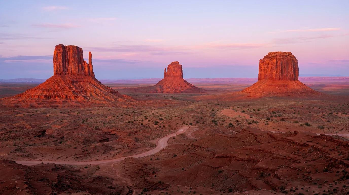
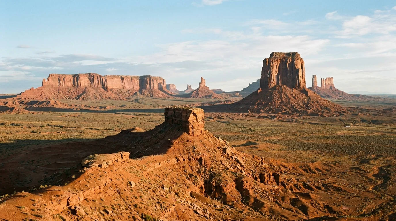
The East and West Mitten Buttes and Merrick Butte glowing deep red-orange at sunrise above an empty desert floor, isolated sandstone monoliths under a pastel dawn sky, Monument Valley on the Arizona-Utah border, ultrarealistic photograph representative of the region
Trekkr Trail Journal · No. 054 · Monument Valley & the Navajo Nation

Monument ValleyArizona & Utah — a Navajo Tribal Park, the 17-mile Valley Drive, the guided-only backcountry & the quiet Utah side

The most photographed desert on Earth is not a national park. It is sovereign Navajo land — its own entry fee (your federal pass is worthless here), its own laws, alcohol banned, drones banned, and almost everything off the rough 17-mile loop drive closed to you unless you hire a Navajo guide. Get the jurisdiction right, respect that people live here, carry more water than you think in country that turns lethally hot — and add the Utah side most visitors never find.

Arizona & Utah · Navajo Nation Valley Drive · The View · Wildcat Trail Goosenecks · Valley of the Gods · Moki Dugway Guided-only backcountry · No alcohol
17 miThe unpaved Valley Drive loop — rough dirt, high-clearance advised
TribalA Navajo Tribal Park — federal / America the Beautiful passes not accepted
GuidedAlmost everything off the loop is Navajo-guide-only or permit-only
100°F+Summer heat on a no-shade, no-water desert floor. Go at sunrise
Conditions verified 23 July 2026 · The jurisdiction and the heat decide the day before the trail does · This block goes stale — the links don't

Two gates open this place: whose land it is, and whether the desert will let you

The rest of this journal is evergreen; this box is not. In Monument Valley two things decide whether your plan works before you air down a tire — you are entering a sovereign Navajo Tribal Park with its own fee, rules and guided-only backcountry (§02), and this is high desert that turns lethally hot and floods its washes in minutes (§06). Both are set by forces outside your itinerary. Everything below is dated to the day we checked it. Trust the live sources, not our date stamp.

  • Monument Valley is a Navajo Tribal Park — fee required, federal passes NOT acceptedYou pay a Navajo Nation entry fee at the booth, and America the Beautiful, senior, military and other federal passes carry no value here. The Navajo Nation changed its fees recently and sources disagree on the 2026 amount, so [VERIFY AT THE BOOTH / navajonationparks.org — we do not assert a figure]. Hours are seasonal and the park can close for weather or tribal reasons. (§02)
  • The backcountry is guided-tour-only — you cannot wander off the loopOn your own you may drive the 17-mile Valley Drive and walk the Wildcat Trail. Everything else — arches, the deep backcountry, most formations — is closed to non-Navajos unless you go with an authorized Navajo guide or hold a visitor-center backcountry permit. Book a guide ahead in peak season. (§02, §04)
  • Alcohol is prohibited across the Navajo Nation — and drones, and climbingThe sale, possession and consumption of alcohol are illegal on Navajo land, including in the park; drones and rock climbing are banned too. Enforced with real penalties. The nearest legal drink is off-reservation in Mexican Hat or Bluff, Utah. (§02, §06)
  • Summer heat & monsoon flash floods are the real hazardThis desert regularly tops 100°F with no shade and no water on the loop or Wildcat Trail; people get heat-sick fast. Monsoon storms (roughly July–September) flood the washes and can turn the dirt roads — the Valley Drive, Valley of the Gods, the Moki Dugway — to impassable mud. [CHECK NWS + road status the morning you go] (§06)
  • The dirt roads are conditions-dependent — never assume passableThe Valley Drive is rough, washboarded dirt; Valley of the Gods (17-mi BLM loop) and the Moki Dugway are unpaved and cross washes, fine for a careful car when dry, high-clearance or 4x4 when wet. Confirm current road status locally before committing a low vehicle. (§03, §05)
  • This is living tribal land — plan it as a guest, not a touristPeople live and work throughout the valley. Ask before photographing residents (expect to pay for posed shots), stay on open routes, buy from Navajo vendors, and follow every posted rule. Respect is not optional here; it is the condition of entry. (§06)
Live sources · Navajo Parks — Monument Valley fees · Navajo Parks — rules & regulations · Authorized Monument Valley guides · Goosenecks State Park (UT) · BLM (Valley of the Gods / Moki Dugway) · NWS weather / flash-flood
In an emergency, 911 (cell service is poor to absent — know this). This box was true at press and will not stay true — the sources above are the truth on the day you travel.
01 / THE HOOK

The skyline is the easy part. The jurisdiction is the trip

Everyone knows the picture: the Mittens and Merrick Butte standing alone on a red desert floor, the most filmed landscape in the history of the Western. What almost no one tells you before they arrive is that Monument Valley is not a national park and never was. It is Tsé Biiʼ Ndzisgaii, a tribal park inside the Navajo Nation — a sovereign government the size of West Virginia — and that single fact rewrites the whole visit. Your park pass is worthless at the gate. The interior is closed to you unless a Navajo guide takes you in. There is no beer to be had for fifty miles. And straddling the Arizona–Utah line, the region hides a second act most visitors drive straight past: the Utah side, where Goosenecks, Valley of the Gods and the Moki Dugway deliver the same red-rock drama with a fraction of the crowds and none of the fee. Get the jurisdiction right and the rest falls into place.

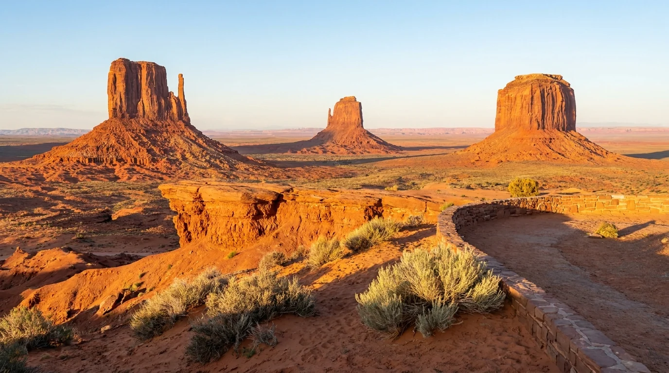
The two Mitten Buttes with their thumb spires and the pyramid of Merrick Butte seen from the rim viewpoint at the park entrance, warm afternoon light on red sandstone, sagebrush foreground, Monument Valley Navajo Tribal Park, ultrarealistic photograph representative of the region
The Mittens & Merrick Butte, from the park rim. The view from the visitor-center rim and The View Hotel is free with entry and needs no guide. Beyond it, the 17-mile Valley Drive (§03) drops onto the floor — and everything past the loop is Navajo-guide-only country (§02, §04).

The payoff

A skyline you already know by heart, seen for real — the Mittens, John Ford's Point, the Totem Pole, Artist's Point — plus a quiet Utah side of canyons, free camping and empty dirt loops the tour buses never reach (§04, §05).

The rules

This is a sovereign Navajo Tribal Park: its own fee, no federal passes, no alcohol, no drones, no climbing, and guided-only backcountry. Not bureaucracy — tribal law, enforced (§02).

The heat

High desert that runs over 100°F in summer with no shade and no water on the loop or the trail, and monsoon floods that shut the dirt roads. Sunrise starts and real water, or don't go high summer (§06).

The way to think about the region — two states, two jurisdictions, one skyline The park itself and its entrance (The View, the visitor center, the fee booth) sit on the Arizona side of the line; Goulding's Lodge and the Monument Valley KOA, a couple of miles away, are actually in Utah. The whole park and the town of Kayenta (AZ), your southern gateway, are on the Navajo Nation — tribal jurisdiction, no alcohol. Cross the state line north into Utah off the reservation and the rules change: Mexican Hat and Bluff sell a beer, and the public-land country opens up — Goosenecks State Park, the free BLM Valley of the Gods and Muley Point, the Moki Dugway. Sort which land you're standing on first (§02), then build the trip across both sides.
02 / THE NAVAJO NATION

The jurisdiction that changes everything

If you take one thing from this issue, take this. You are not visiting a national park with a slightly different logo — you are entering the territory of a sovereign nation with its own government, laws, courts and land rules. Monument Valley Navajo Tribal Park is managed by Navajo Nation Parks & Recreation, not the NPS. That means a tribal fee your federal pass will not cover, a hard rule that the backcountry is guided-only, and a set of laws — alcohol, drones, climbing — that surprise visitors every day. None of it is hard to follow. It just has to be understood before you arrive.

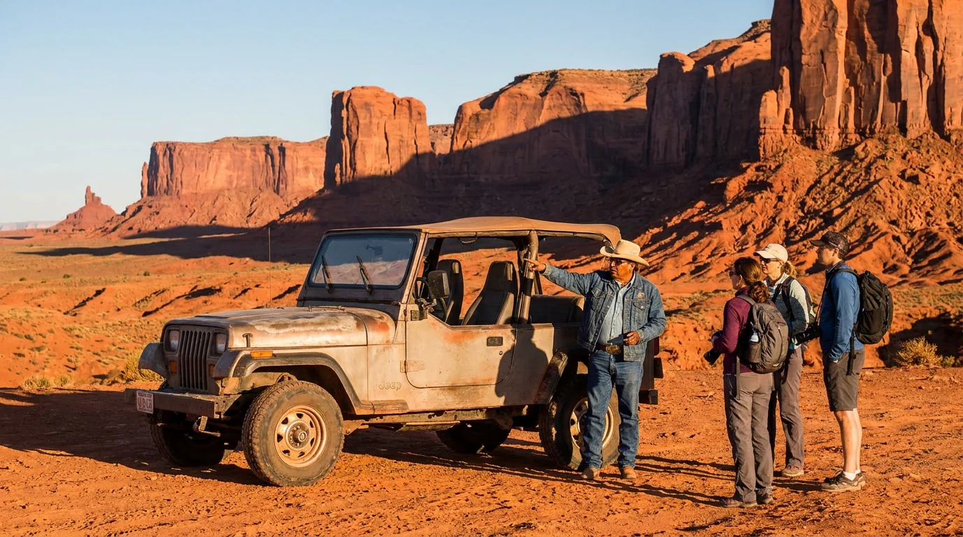
An open-top 4x4 tour vehicle parked on the red sand floor of Monument Valley among towering buttes, a Navajo guide standing and gesturing toward the landscape for a small group of visitors, warm low sunlight and long shadows, Monument Valley, ultrarealistic photograph representative of the region
A Navajo-guided tour on the valley floor. The only legal way to reach the arches, the deep backcountry and most named formations off the 17-mile loop is with an authorized Navajo guide (§04). Guides open land closed to everyone else — and the fee goes to the people who live here.

The fee — and why your pass is useless

Entry is a Navajo Nation tribal fee paid at the booth. America the Beautiful, Golden Eagle, senior, military and every other federal pass are NOT accepted — this is not federal land. The Navajo Nation adjusts its fees, and 2026 sources disagree on the exact per-person and per-vehicle amounts, so we deliberately do not print a number here.

Check the current fee on navajonationparks.org or simply pay what's posted at the gate. Bring a card and some cash; the fee is per visit and separate from any campground or tour cost.

No federal passesConfirm the current fee at the booth

The backcountry is guided-only

Unguided, you get two things: the 17-mile Valley Drive (§03) in your own vehicle, and the Wildcat Trail loop around West Mitten (§04). Everything else is closed to non-Navajos — the arches (Ear of the Wind, Big Hogan, the Sun's Eye), the dunes, Mystery Valley, Hunts Mesa — unless you go with an authorized Navajo guide or hold a backcountry permit from the visitor center.

Going off-route without a guide or permit is trespassing on tribal land, not a technicality. Book a guide ahead for the good light.

🔴 The laws that catch visitors out — alcohol, drones, climbing Alcohol is prohibited across the entire Navajo Nation — its sale, possession and consumption are against tribal law, including inside Monument Valley Tribal Park. Do not bring it onto the reservation. Drones are banned on Navajo land (no matter how good the shot would be), and so is rock climbing and scrambling off the trails. Cremation and the disturbance of any site or artifact are also prohibited. These are enforced with real penalties. If you want a beer with your steak, the nearest legal option is off-reservation in Mexican Hat or Bluff, Utah (§08) — keep it there.
The 60-second "am I allowed to do this here?" check
  1. Drive the 17-mile loop yourself? Yes — pay the fee, take a high-clearance vehicle, go at sunrise.
  2. Walk on my own? Only the Wildcat Trail (~3.2 mi loop). No other unguided hiking in the park.
  3. See the arches / backcountry / Mystery Valley? Only with an authorized Navajo guide, or a visitor-center backcountry permit.
  4. Fly a drone / climb a butte / bring beer? No, no, and no — all banned on Navajo land.
  5. Photograph a Navajo resident or vendor? Ask first, and expect to pay for a posed shot. They live and work here.
03 / THE VALLEY DRIVE

The 17-mile loop — a rough dirt road, not a park boulevard

The self-drive scenic loop is the heart of an unguided visit, and it is not what many arrive expecting. It is an unpaved, washboarded, rutted dirt road that drops steeply onto the valley floor and takes two to three hours at a crawl. Rental-car and low-clearance drivers make it in dry weather with care, but it rattles fillings loose, and rain turns it to slick red mud. Here is how the drive actually works, and how to reach the park in the first place.

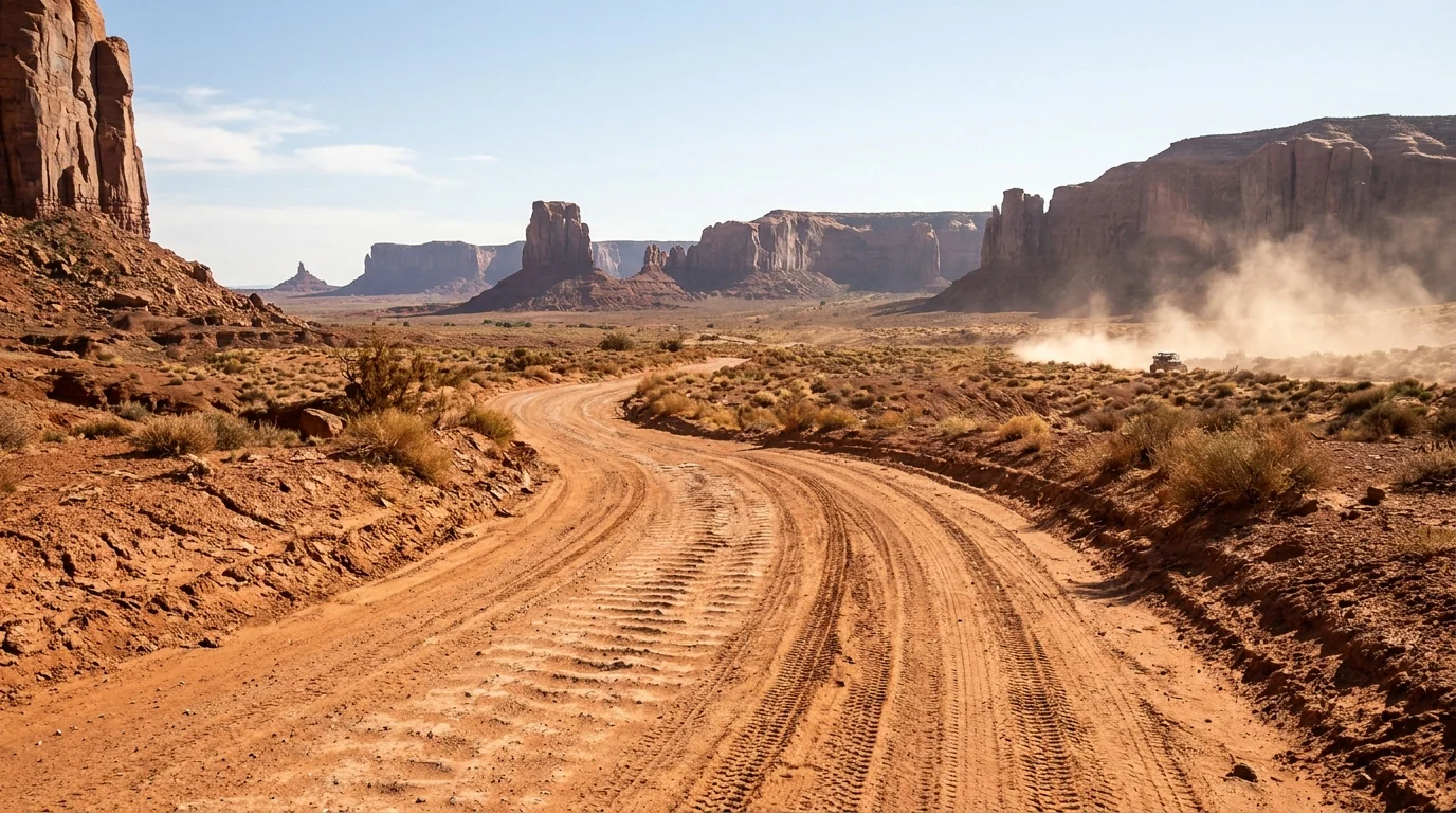
A rough washboarded red-dirt road curving down into Monument Valley between towering sandstone buttes and mesas, deep tire ruts and dust, a distant vehicle raising a plume of dust, the unpaved 17-mile scenic loop under a bright desert sky, ultrarealistic photograph representative of the region
The Valley Drive — the 17-mile self-drive loop. One-way for most of its length, dirt the whole way, with a steep, loose descent right at the start (the notorious first hill). High-clearance is strongly advised; big RVs and trailers should not attempt it. Allow 2–3 hours.

The loop, plainly

  • ~17 miles, unpaved, one-way around the floor from the visitor center, past the Mittens, Elephant Butte, Three Sisters, John Ford's Point, the Totem Pole and Artist's Point
  • 2–3 hours at photo-stop pace; the road is rough, dusty and washboarded throughout
  • High-clearance strongly advised. Careful 2WD makes it when dry; the first descent is steep and loose. No big RVs, no trailers
  • Closes / turns to mud in rain. The floor floods; don't be caught down there in a storm (§06)
  • Gates close in the evening — you can't linger for full dark unless you're on a guided tour or camping at The View. Confirm current hours
~17 mi · unpaved · one-wayNo RVs / trailersCheck hours & weather

Drive it, or ride a guided tour?

Self-drive the loop if you have a suitable vehicle and just want the classic stops — cheapest, on your own schedule. Take a Navajo-guided tour (§04) if you want the arches and backcountry the loop can't reach, if the road worries you, or if you want the cultural and geological story from someone whose family has lived here for generations.

Guided tours also run at sunrise, sunset and into the night when the self-drive gate is closed — the only way to be on the floor for the best light and the dark-sky stars.

Self-drive = the classic stopsGuided = arches, backcountry, best light

Getting to the park — and The View

The park entrance is off US-163, about 24 miles north of Kayenta, AZ and a few miles south of the Utah line. A paved spur (Monument Valley Rd / Indian Route 42) leads to the visitor center, The View Hotel and campground on the rim, and the fee booth. From the rim, the whole skyline is right there — a huge amount of the payoff needs no drive at all.

The View is Navajo-owned and the only lodging, camping and dining inside the park (§07, §08). Staying there is the one way to have the Mittens to yourself at sunrise and again after the day-trippers leave.

Off US-163, ~24 mi N of KayentaThe View = rim access, sunrise & sunset
04 / THE STOPS & THE WALK

What you see on the loop — and the one trail you can walk alone

Unlike a national park, the Navajo Tribal Park doesn't publish an official table of trail distances, and there's really only one trail you may walk without a guide. So this section is mostly about the drive-up stops on the 17-mile loop, the single self-guided hike (the Wildcat Trail), and the guided experiences that unlock everything else. Treat any distance below as a planning estimate to confirm on the ground.

The broad rock promontory of John Ford's Point overlooking the wide floor of Monument Valley, red buttes and mesas stretching to the horizon, a low rock spur jutting out over the valley, late-afternoon golden light, ultrarealistic photograph representative of the region
John Ford's Point — the loop's signature stop. Named for the director whose Westerns made these buttes world-famous. A wide promontory over the valley floor, with Navajo vendors and (for a tip) a horse-and-rider photo set-up on the rock spur. Ask before photographing people.

The self-drive stops on the loop

All reached from the 17-mile Valley Drive (§03). No guide needed for these; a tribal-park fee gets you in.

The guaranteed win · no drive requiredThe Mitten View (visitor-center rim)

Zero walking · from the rim at The View. The classic head-on view of East and West Mitten and Merrick Butte, straight off the visitor-center terrace and hotel rim. Sunrise here is the shot everyone comes for, and you don't even need the loop. Fully accessible viewing from the terrace.

Crowded mid-day when tour buses arrive. Sunrise from The View is the move — which is why staying inside the park (§07) pays off.

No walk · from the rimSunrise or golden hour
From the rim · no walk
Best at sunrise

The one trail you can walk without a guideWildcat Trail

~3.2 mi loop · modest gain on the valley floor, circling West Mitten Butte from near The View. The only self-guided hike in the park — sandy, flat-ish, and the only way to feel the scale from below without hiring a guide. Distance is widely cited around 3.2 mi; confirm at the trailhead.

No shade, no water, full sun — this is a heat-illness trail in summer. Go at first light, carry far more water than feels necessary, and turn back if it's already hot. Sign in at the trailhead.

~3.2 mi loop · moderateNo shade / no waterDistance is an estimate
~3.2 mi loop · modest gain
1.5–2.5 h (estimate)
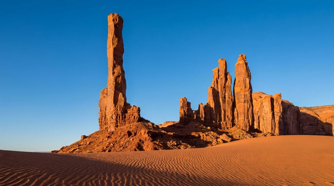
The slender Totem Pole rock spire and the Yei Bi Chei formation rising as thin sandstone needles from rippled red sand dunes in Monument Valley, side light emphasizing their thinness against a clear sky, ultrarealistic photograph representative of the region

The rest of the loop's stops

Beyond John Ford's Point, the drive passes Elephant Butte, the Three Sisters, Camel Butte, the Totem Pole and Yei Bi Chei (the impossibly thin spires pictured here), Artist's Point and North Window. Each is a signed pull-off; the light is best early and late.

The Totem Pole and the dunes around it are a classic photograph — but note the spire itself and the backcountry beyond the loop are guided-only to approach (§02).

Signed pull-offsBest light: early & late

What a guide unlocks

The arches & the backcountry

An authorized Navajo guide takes you to places the loop can't — Ear of the Wind, the Sun's Eye, Big Hogan, the Moccasin arches, the dunes, Mystery Valley's ruins and rock art, and Hunts Mesa for the iconic overhead-of-the-valley view. These areas are closed to unguided visitors (§02).

Trip menus, durations and prices vary by operator — book direct and confirm what's included. We quote no prices.

Sunrise, sunset & the night sky

Because the self-drive gate closes in the evening, a guided tour is the only way to be on the floor for sunset and the stars. Monument Valley is deep dark-sky country, and a night tour or a rim campsite at The View delivers a Milky Way most people never see. Choose an operator from the tribe's authorized list (§08).

ExperienceAccessDistance / time*Guide or permit?
Mitten View (rim)Visitor center / The ViewNo walkFee only
17-mile Valley DriveSelf-drive loop~17 mi · 2–3 hFee only (self-drive)
Wildcat TrailNear The View~3.2 mi loopFee only (self-guided)
Arches / Mystery Valley / Hunts MesaBackcountryHalf–full dayNavajo guide required
Sunset / night-sky on the floorBackcountry1–3 hNavajo guide required
Other backcountry hikingOff designated routesVariesBackcountry permit or guide

*The Navajo Tribal Park does not publish an official distance table the way a national park does; figures here are consensus estimates to confirm on the ground. The Wildcat Trail is the only self-guided hike inside the park — everything else off the loop needs a guide or a backcountry permit.

05 / THE UTAH SIDE — DON'T SKIP IT

Goosenecks, Valley of the Gods, the Moki Dugway & Mexican Hat

Cross the state line north into Utah and you leave the reservation and the fee behind for a stretch of public land that most Monument Valley visitors never see — and that is half the reason to build the trip around both sides. No tribal fee, no guide requirement, free dispersed camping, and a set of overlooks and dirt roads that rival the park itself. It's all within an hour of the buttes. Two cautions run through all of it: the dirt roads are weather-dependent, and there are no guardrails.

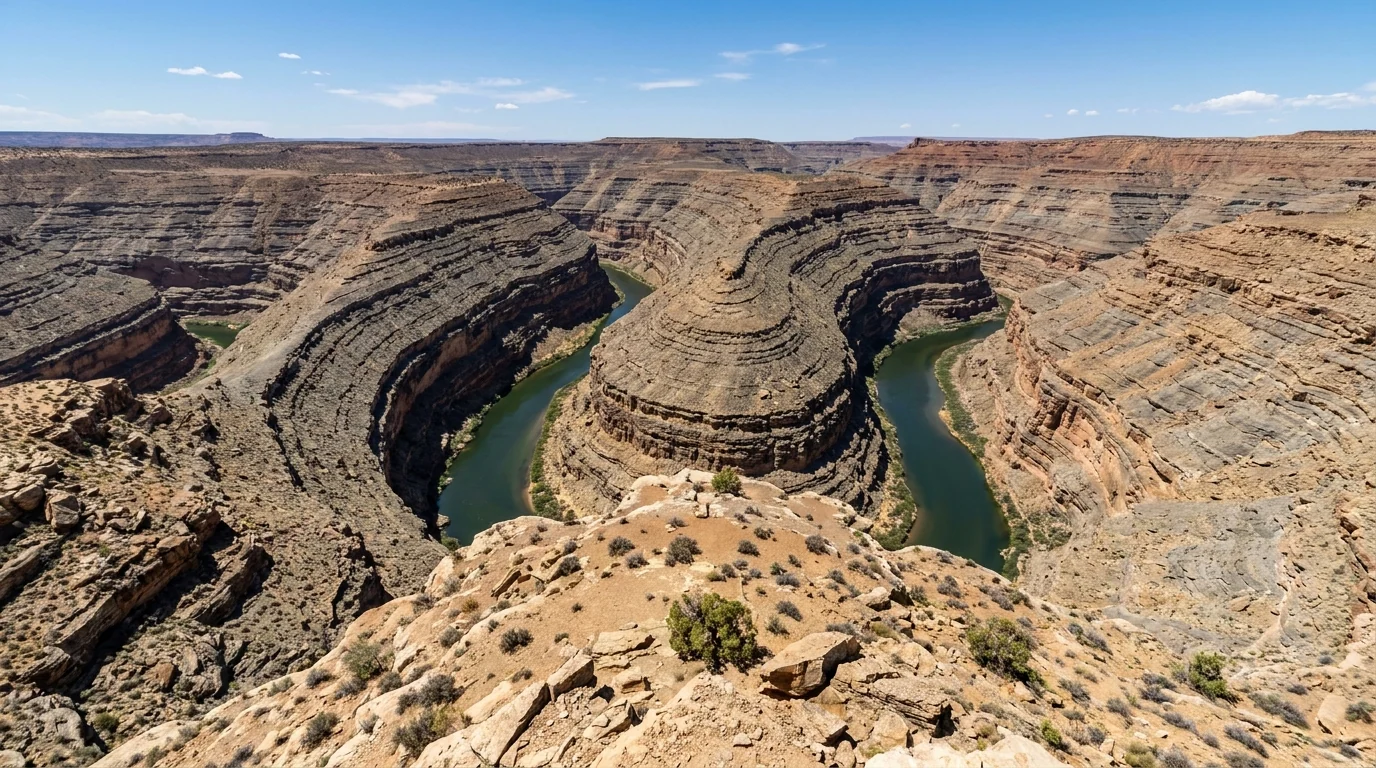
The tightly entrenched meanders of the San Juan River carved more than a thousand feet into layered gray and tan rock, seen from the mesa rim at Goosenecks State Park Utah, the river looping back on itself in deep canyon bends, ultrarealistic photograph representative of the region
Goosenecks State Park, Utah. The San Juan River doubles back on itself in tight, entrenched meanders more than 1,000 feet below the rim — 300 million years of geology in one glance. A short paved spur off UT-261, a small day-use/camp fee, primitive rim camping, and an unfenced edge.

Goosenecks State Park

A Utah state park at the end of UT-316, a short paved spur off UT-261 west of Mexican Hat. The whole park is essentially one staggering overlook plus primitive rim camping (§07). A small day-use/camp fee applies (reported around $10/night — confirm). Vault toilets, no water, no shade.

The rim is unfenced and sheer — keep well back and watch children and dogs. Fierce wind is normal up here.

One epic overlook + campingUnfenced 1,000-ft rim

Mexican Hat & Forrest Gump Point

Mexican Hat is the tiny river town just off the reservation — motels, gas, the famous swinging-grill steakhouse, and the balanced Mexican Hat Rock (a sombrero of sandstone on a skinny neck) a short dirt spur northeast of town. It's where you can legally buy a beer (§08).

Forrest Gump Point is the dead-straight run of US-163 north of the park with the buttes lined up down the road — the famous photo. It's a live highway; get the shot from off the pavement, never in the lane.

Mexican Hat = fuel, food, a beerForrest Gump Pt = live traffic
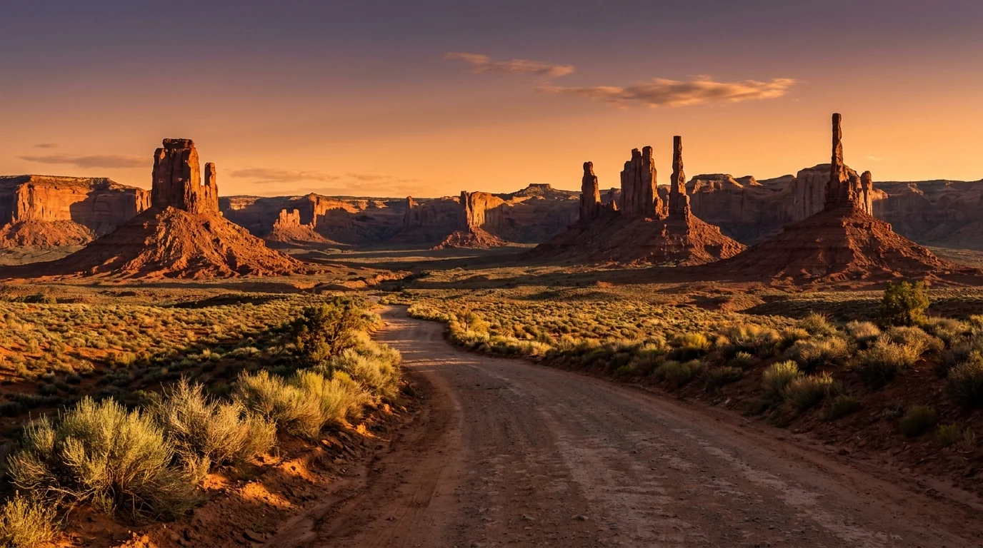
Isolated red-rock buttes and pinnacles scattered across an open desert basin with a quiet dirt road winding among them, Valley of the Gods Utah, late-day warm light, sagebrush foreground and dramatic sandstone towers, ultrarealistic photograph representative of the region

Valley of the Gods — the free, quiet twin

A 17-mile BLM dirt loop (County Road 242) between US-163 and UT-261, winding among isolated red buttes and pinnacles that feel like a miniature, crowd-free Monument Valley. No fee, no gate, free dispersed camping (§07), and often no one else in sight.

The graded road is fine for a careful car when bone-dry, but it crosses washes that flash-flood and turn to impassable mud in rain — high-clearance and a weather check strongly advised. No water, no toilets, no campfires; pack out everything.

Free · quiet · dispersed campingWashes flood — check weather
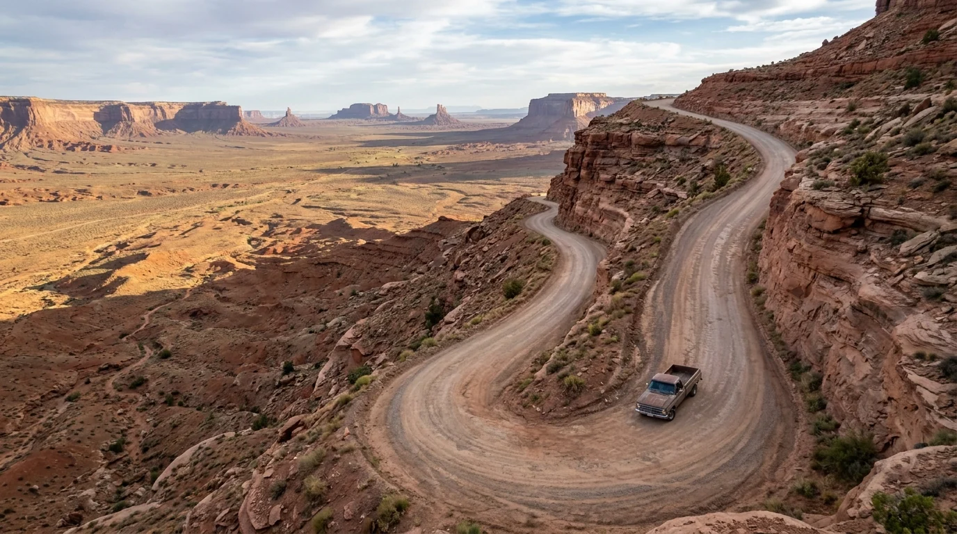
Steep unpaved switchback gravel road cut into the sheer face of Cedar Mesa with no guardrail, the Moki Dugway on UT-261 climbing hundreds of feet above the desert, red-rock cliff wall and a vast valley view below, ultrarealistic photograph representative of the region
The Moki Dugway, UT-261. A staircase of steep unpaved switchbacks climbing ~1,100 feet up the face of Cedar Mesa — graded gravel, no guardrail, huge views back over the valley. Signed for vehicles under 28 ft; not for big RVs or trailers. Slick when wet. At the top, a dirt road leads to Muley Point (§07).
🔴 The Utah-side dirt-road rules — the same three every time Valley of the Gods Road, the Moki Dugway and the Muley Point road are all unpaved and weather-dependent. One: check the forecast — clay and washes turn to grease and floodwater in a storm, and a dry-fine road becomes a trap. Two: the Moki Dugway and Muley Point are no place for a big rig, trailer or nervous low car — heed the 28-ft sign, use low gear, go slow. Three: there is no water, no fuel and poor-to-no cell service out here — fill up in Mexican Hat, Bluff or Kayenta and carry more water than you think. None of this is technical 4x4 country in the dry; all of it punishes bad timing.
06 / SAFETY & RESPECT — READ THIS FIRST

Heat, flash floods, distance, and being a guest

Four things account for most of what goes wrong here, and the fourth isn't about danger at all — it's about conduct. The first is heat: this is low-to-mid desert that kills the unprepared in summer. The second is water, moving the wrong way — flash floods in the washes and slots. The third is remoteness: thin services, poor cell coverage, long distances to help. The fourth is respect: you are a guest on living tribal land, and that carries real obligations. None of it is exotic. It just has to be planned for.

Heat — take this seriously

Summer here regularly runs over 100°F, and the Valley Drive and Wildcat Trail have no shade and no water anywhere. Heat exhaustion and heat stroke come on fast, and the desert floor is hotter than the rim.

Be on the loop or the trail at sunrise and off it by mid-morning. Carry far more water than feels necessary — several litres per person per day — plus electrolytes, a hat and real sun cover. If you feel dizzy, nauseous or stop sweating, get into shade/AC and cool down immediately.

100°F+ · no shade / no waterSunrise starts only

What actually works

  • Water, more than you plan. The dry air hides how much you're losing; carry extra in the vehicle
  • Go at first light. The light is best and the heat is survivable; midday is for shade and AC
  • Full fuel tank before you leave Kayenta, Mexican Hat or Bluff — services are far apart
  • Download offline maps — cell service is poor to absent across the region and gone on the dirt roads
  • Check the forecast for storms before any dirt road or slot — a clear morning can flash-flood by afternoon

This is general desert-safety guidance, not a substitute for current NWS forecasts and on-the-ground judgment. Conditions change fast.

🔴 Flash floods & monsoon season — the water you can't see coming From roughly July into September, monsoon thunderstorms build over the region and can dump heavy rain miles away that arrives as a wall of water in a wash minutes later — under a blue sky where you stand. Never camp in a wash or drive into a flowing crossing, and treat any slot canyon or drainage with a storm anywhere upstream as off-limits. Monsoon storms also bring lightning, dust storms (haboobs) and roads that turn to impassable mud — the Valley Drive, Valley of the Gods and the Moki Dugway all included. If a storm is building, get off the dirt and out of the low ground and wait it out.
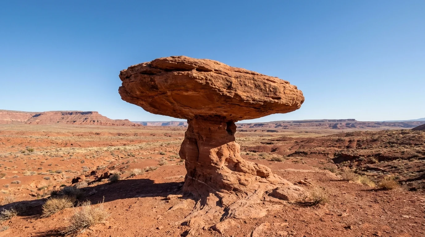
The sombrero-shaped balanced rock of Mexican Hat, a wide flat disc of sandstone perched improbably on a narrow eroded neck, red desert and low mesas behind, clear blue sky, near the town of Mexican Hat Utah, ultrarealistic photograph representative of the region
Mexican Hat Rock, Utah. Emblem of the little off-reservation town that's your nearest legal beer, gas and steak. The desert here is beautiful and unforgiving in equal measure — thin services, big distances, and weather that changes the plan. Treat remoteness as the hazard it is.

Remoteness & services

Fuel, water and cell service are all sparse and far apart. The nearest hospital is in Kayenta; full groceries mean Kayenta, Bluff/Blanding or further. Fill the tank and top up water at every town, carry a paper map and offline navigation, and tell someone your route. On the dirt roads and in the backcountry, help is not close.

Respect — you're a guest here

People live and work throughout Monument Valley. Ask before photographing residents or their animals, and pay for posed shots. Stay on open routes, don't enter hogans or private areas, don't touch or take anything from any site, buy from Navajo vendors, and follow every posted rule and your guide's instructions. No alcohol, no drones (§02). This is sacred, living land, not a film set.

In an emergency Dial 911, but know that cell coverage is poor to absent across much of the region and gone on the dirt roads and in the backcountry — a satellite messenger is worth carrying. On tribal land, park and tribal rangers and Navajo Nation police have jurisdiction; on the Utah public lands it's the county sheriff and BLM/state park staff. Carry more water and fuel than any plan requires, and build in the margin the distances demand.
07 / THE CAMPING STRATEGY

One rim inside the park, full hookups on the Utah side, free dirt out on the mesa

Camping here sorts neatly by jurisdiction. Inside the tribal park, The View is the only option — and the one that buys you sunrise on the Mittens. Just across the Utah line, Goulding's and the KOA give you full hookups and services. And out on the Utah public lands, Goosenecks, Valley of the Gods and Muley Point offer primitive-to-free camping with views that cost nothing but exposure. An hour southwest, Navajo National Monument's two NPS campgrounds are genuinely free. Match the ground to the trip.

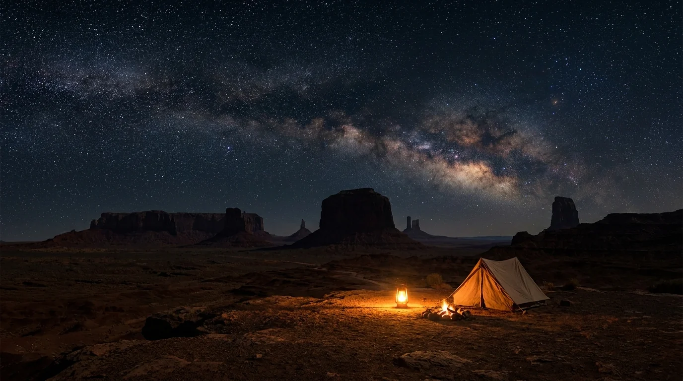
A brilliant star-filled night sky and faint Milky Way arching over the dark silhouettes of Monument Valley's buttes, a quiet rim campsite with a single warm lantern glow, no light pollution, deep desert darkness, ultrarealistic photograph representative of the region
The dark-sky payoff. Away from any city glow, the Milky Way here is staggering. A rim site at The View, or free dispersed camping at Valley of the Gods or Muley Point, puts you under it — but none of these are big-rig resorts, and the free sites have no water, no shade and no toilets. Read the row before you commit.
CampgroundSide · managerTypeHookupsReserveReported fee*
The View Campground AZ · Navajo Tribal Park RV/tent + wilderness sites, cabins None (dry) Reservation confirm; park entry fee is additional
Goulding's Campground UT · private (Goulding's) RV + tent + cabins, pool, store Full Reservation confirm on gouldings.com
Monument Valley KOA Journey UT · private (KOA) ~56 sites, RV to 60 ft + tent Full (50-amp) Reservation confirm on koa.com
Goosenecks State Park UT · Utah State Parks Primitive rim sites None First-come ~$10 (reported — confirm)
Valley of the Gods Rd UT · BLM Dispersed (pullouts) None First-come Free (14-day limit, no fires)
Muley Point UT · BLM Dispersed (rim) None First-come Free (dirt access, dry-only)
Sand Island (Bluff) UT · BLM Developed riverside None First-come camp fee — confirm
Cottonwood RV Park (Bluff) UT · private In-town RV park Full Reservation confirm operation & rates
Sunset View (Navajo Nat'l Mon.) AZ · National Park Service 31 sites, 28-ft limit None First-come Free (flush toilets, year-round)
Canyon View (Navajo Nat'l Mon.) AZ · National Park Service 14 tent sites, seasonal None First-come Free (pit toilets, no water)

*Fees and details are compiled from operator sites, Navajo/NPS/BLM pages and travel listings and vary or were not confirmed for 2026. The View's rates sit behind its reservation portal and the tribal-park entry fee is additional to any camp fee. The two Navajo National Monument campgrounds are National Park Service (not tribal) and are free. Book The View, Goulding's and the KOA ahead in peak season; the free dispersed sites are first-come and fill on holiday weekends.

Which site for which trip

  • Sunrise on the Mittens: The View Campground — the only camp inside the park, on the rim. Dry sites; book ahead; entry fee on top
  • Full hookups & services: Goulding's or the Monument Valley KOA on the Utah side, minutes from the entrance
  • Free, quiet & dark: Valley of the Gods or Muley Point BLM dispersed — no facilities, no water, dry-weather access, pack it all out
  • Genuinely free with toilets: Sunset View at Navajo National Monument (an hour SW) — free NPS camping, flush toilets, 28-ft limit

Camping realities out here

No dispersed camping on Navajo land without a tribal permit — the free dispersed options are all on the Utah public lands (BLM), not the reservation. Respect that boundary.

The free sites are exposed, windy, waterless and shadeless, with no campfires at Valley of the Gods and pack-in/pack-out everywhere. Never camp in a wash (flash floods, §06). Carry all your water in, and haul all your trash out.

No dispersed on Navajo landFree = no water, no shade, no fires
08 / TOWNS & SERVICES

Kayenta has the services. Mexican Hat has the beer. Nowhere has much

This is thin-services country, and the towns split by which side of the reservation line they sit on. Kayenta, on the Navajo Nation south of the park, is your full-service gateway — but dry. Goulding's, at the park's doorstep in Utah, is a self-contained resort. Mexican Hat and Bluff, off the reservation in Utah, are tiny but have the motels, the steakhouse and the only legal alcohol for miles. Plan resupply and fuel around that, because there's nothing on the dirt roads and long gaps between everything.

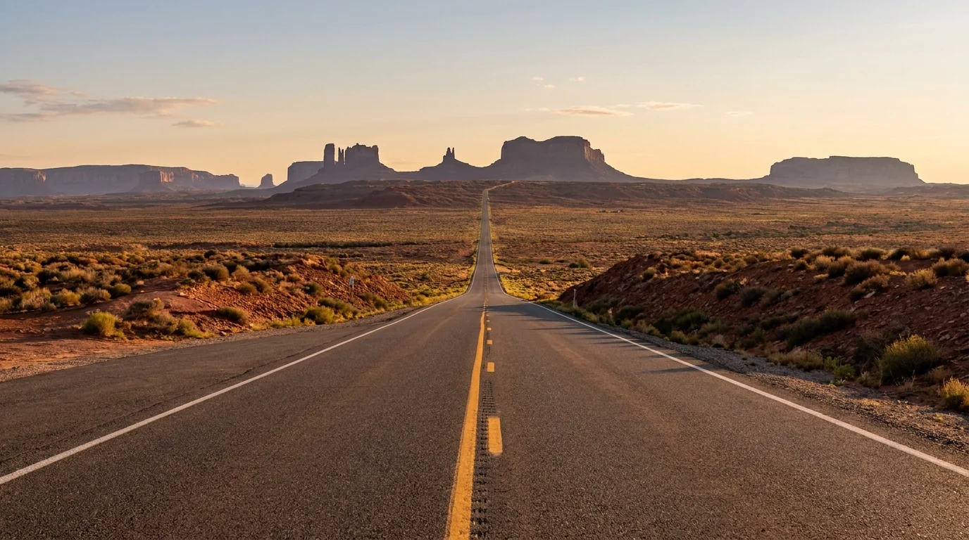
A dead-straight two-lane desert highway US-163 running toward distant Monument Valley buttes lined up on the horizon, yellow center line vanishing to a point, early morning light, wide open high-desert scrubland, the classic Forrest Gump Point view, ultrarealistic photograph representative of the region
US-163 north toward the buttes — the highway that ties the region together. Kayenta to the south (AZ, on the reservation), Mexican Hat and Bluff to the north (UT, off it), the park in the middle. Fuel and water before you turn onto any dirt. Forrest Gump Point is on this stretch — shoot it from off the pavement.

Kayenta & Goulding's — the gateways

  • Kayenta, AZ (~24 mi S of the park, on the Navajo Nation): the practical resupply town — a supermarket, gas, chain and Navajo-owned motels (Hampton Inn, Wetherill Inn), the well-known Amigo Cafe, a hospital, and the Navajo Code Talkers exhibit. No alcohol sold (reservation)
  • Goulding's Lodge, UT (~2 mi from the entrance): a self-contained resort under the cliffs — lodge, campground, store/grocery, restaurant, a trading-post museum, and its own authorized Navajo tours (§04)
  • The View, AZ (in the park): Navajo-owned hotel, cabins, campground and restaurant on the rim — the sunrise play (§07)
  • Fuel & water: top up in Kayenta or at Goulding's before the park and before any dirt road. Nothing on the loop or the Utah dirt roads

Store and restaurant hours change and some are seasonal — confirm before relying on them. Kayenta is dry; plan accordingly.

Mexican Hat, Bluff & the Utah side

  • Mexican Hat, UT (off the reservation, N of the park): tiny — a couple of motels (San Juan Inn, Mexican Hat Lodge with its swinging-grill steakhouse), gas and river outfitters. The nearest legal beer
  • Bluff, UT (~45 min NE): a slightly larger small town — lodging, RV parks, a couple of restaurants, and the base for San Juan River trips and Bears Ears. Off-reservation, alcohol available
  • Medical: the Kayenta hospital serves the AZ/park side; for the Utah side, care means Blanding/Monticello or Cortez, CO — all a long way off
  • Airports: nearest commercial service is distant — Flagstaff (FLG), Grand Junction (GJT), Durango (DRO) or the big hubs Phoenix / Salt Lake / Las Vegas, all multi-hour drives

Much of Mexican Hat and Bluff is small and seasonal — confirm current lodging, fuel and dining before you rely on it.

Authorized Navajo guides — links, not prices To go into the backcountry (§04) you must use an operator on the Navajo Nation's authorized Monument Valley tour-operator list — dozens of Navajo-owned outfits run 4x4, hiking, photography, horseback and night-sky trips. Season, trip menus and pricing change, so we link rather than quote.

A few authorized operators

  • Goulding's Tours (Goulding's Lodge, UT) — long-running Navajo-guided 4x4 tours into the backcountry, from the resort at the park's doorstep
  • Sacred Monument Tours — Navajo-owned 4x4, hiking, photography and horseback trips into areas closed to unguided visitors
  • Navajo Spirit Tours — Navajo-owned guided 4x4, hiking and photography tours of the valley's cultural and geological story
  • ...and many more on the tribe's official list — choose from it, and confirm the operator is currently authorized before you book

Booking notes

  • Book direct from the operator's own site or the tribe's authorized list — not a random reseller
  • Book ahead for sunrise, sunset and night-sky slots in spring and fall — they fill
  • Confirm what's included (park fee, duration, arches vs loop) and bring cash for tips and vendor purchases

We confirmed no operator pricing — any number should come from the operator. The tribe's authorized list is the source of truth for who may guide inside the park.

A worthwhile detour — Navajo National Monument About an hour southwest off US-160, Navajo National Monument is a free National Park Service site (not tribal) preserving the ancestral Puebloan cliff dwellings of Betatakin and Keet Seel. Short rim trails to the Betatakin overlook are self-guided; the dwellings themselves are seen only on seasonal ranger-guided hikes. It also has two free campgrounds (§07) — a genuinely free base in a region where camping otherwise costs money or exposure. Confirm ranger-hike seasons and campground status with the NPS.
09 / TIMING

When to go — spring and fall, and never underestimate summer

Monument Valley has two comfortable seasons, one brutal one, and a quiet winter. The comfort windows are spring and fall, when the light is long, the nights are cool and the flash-flood risk is lower. Summer is genuinely hazardous heat plus monsoon floods. Winter is cold, sometimes snowy, atmospheric and empty. The buttes photograph best at sunrise and sunset year-round — the question is only how much the weather will fight you.

Season by season, straight

  • Spring (April–May) — the first sweet spot. Warm days, cold nights, wildflower green, and lower flash-flood risk. Wind can be fierce and dusty. Book The View and guides ahead — this is peak season
  • Summer (June–August) — hot and hazardous. Regularly 100°F+, no shade or water on the loop/trail, and from July the monsoon brings flash floods, lightning and mud. If you come, go at sunrise and get off the dirt before afternoon storms
  • Fall (September–October) — the best all-round window. Heat easing, monsoon fading, stable light, and the crowds thinning after Labor Day. Cool nights; ideal for camping and the Utah-side dirt roads
  • Winter (November–March) — cold, quiet, striking. Snow can dust the red buttes for a rare photograph, but nights are freezing, some services are seasonal, and dirt roads can be icy or muddy. Fewest people of the year
  • Any season: shoot at sunrise and sunset, plan around the self-drive gate hours, and check the weather before any dirt road

Crowd & access strategy

  • Book The View and guided tours early for spring and fall — rim rooms, sunrise slots and night tours sell out well ahead
  • Be first onto the loop — the buses arrive mid-morning; a dawn start gives you empty pull-offs and the best light in one move
  • Use the Utah side as the crowd valve — Valley of the Gods and Muley Point are empty even when the park is busy
  • Weekdays beat weekends, and shoulder-season weekdays are the quietest of all
  • Watch the monsoon forecast in summer — plan dirt roads and any slot canyon around storm timing, not the other way round
The one-paragraph answer Go in spring (April–May) or fall (September–October) for warm days, cool nights and manageable flash-flood risk — fall edges it for stable weather and thinner crowds. Avoid high summer unless you commit to sunrise-only outings and treat the heat and monsoon as real hazards. Whenever you go: sort the tribal fee and any guided tour first, be on the loop at first light, carry far more water than you think, check the storm forecast before any dirt road, and keep the alcohol off the reservation. The buttes will be there at dawn — make sure you're the one who's ready for them.
10 / THE SHAPE OF THE TRIP

Three to four days, both states, both jurisdictions

One workable shape, not the only one. It fronts the park onto a sunrise, uses a guide for what the loop can't reach, and gives a full day to the Utah side most people skip. Adjust freely — but keep every desert outing early, sort the fee and any guide before you arrive, and check the weather before you touch a dirt road.

01

Day 1 — Arrive, resupply, sunset on the rim

  1. Fuel and stock up in Kayenta (AZ) coming from the south, or Bluff/Mexican Hat (UT) from the north — water, snacks, and a full tank.
  2. Check in inside the park at The View, or at Goulding's / the KOA on the Utah side.
  3. Pay the tribal fee, drive up to the rim for sunset on the Mittens — no loop needed for the first magic hour.
  4. Remember: no alcohol on the reservation. Save that for Mexican Hat.
Confirm the current feeSunset from the rim
02

Day 2 — The loop at dawn, a guide by day

  1. Sunrise on the rim, then be first onto the 17-mile Valley Drive before the buses — high-clearance vehicle, empty pull-offs.
  2. Walk the Wildcat Trail early if it's cool; skip it if it's already hot.
  3. Afternoon: a Navajo-guided tour to the arches / Mystery Valley / Hunts Mesa — the only way past the loop.
  4. Off the floor before afternoon monsoon storms in summer.
Dawn startGuide for the backcountry
03

Day 3 — The Utah side

  1. Cross into Utah: Forrest Gump Point (from off the pavement), Mexican Hat Rock, then Goosenecks State Park.
  2. Weather permitting, drive the free Valley of the Gods loop and up the Moki Dugway to Muley Point.
  3. Check the forecast first — these dirt roads flood and turn to mud in a storm.
  4. A legal beer and a swinging-grill steak in Mexican Hat to close the day.
Check weather before the dirtNo fee, no crowds
04

Day 4 — Deep history, or slow out

  1. Detour to Navajo National Monument (free NPS) for the Betatakin overlook trails — or a ranger-guided cliff-dwelling hike if in season.
  2. Or a slow morning: sunrise on the Mittens one more time, then roll out via US-163.
  3. Top up fuel and water before any long drive — services are far apart.
Navajo Nat'l Monument = freeFuel & water before you go
+

The photographer's variant

  1. Stay inside the park at The View for sunrise and sunset from the rim without the gate hours.
  2. Book a night-sky guided tour or camp at Valley of the Gods / Muley Point for the Milky Way (§07).
  3. A dawn Hunts Mesa guided trip for the classic overhead-of-the-valley shot — book well ahead.
  4. No drones anywhere on Navajo land — plan for ground-based shots only.
No drones on Navajo landBook night / Hunts Mesa ahead
11 / TRIP-READY

The departure check

Run it before you leave. Tap each item as it's done — these are the ten things specific to Monument Valley and the Navajo Nation that a general road-trip habit will skip. Most come back to two facts: this is sovereign tribal land with its own rules, and it's a lethal-heat desert where the dirt roads answer to the weather.

0 / 10 confirmed — the jurisdiction sets the trip.
12 / QUICK ANSWERS

Asked at every Monument Valley gate

Is Monument Valley a national park? Will my pass work?
No, and no. It's Monument Valley Navajo Tribal Park, run by the Navajo Nation — not the NPS. It charges its own fee, and America the Beautiful, senior, military and other federal passes are not accepted. The tribe adjusts its fees and 2026 sources disagree on the amount, so confirm the current per-person/per-vehicle charge at navajonationparks.org or the booth. Nearby Navajo National Monument, by contrast, is a free National Park Service site.
Can I explore on my own or do I need a Navajo guide?
On your own you get two things: the 17-mile Valley Drive in your own vehicle (rough dirt — high-clearance advised) and the ~3.2-mile Wildcat Trail. Everything else — the arches, Mystery Valley, Hunts Mesa, the backcountry — is closed to non-Navajos unless you go with an authorized Navajo guide or hold a visitor-center backcountry permit. Going off-route without one is trespassing on tribal land, not a technicality.
Can I drink alcohol or fly a drone here?
No to both. Alcohol is prohibited across the entire Navajo Nation — sale, possession and consumption, including in the park — and it's enforced. Drones are banned on Navajo land, and so is rock climbing. The nearest legal drink is off-reservation in Mexican Hat or Bluff, Utah; keep any alcohol off tribal land entirely.
Can a regular rental car drive the Valley Drive?
In dry weather, with care, often yes — but it's a rough, washboarded, unpaved 17-mile loop with a steep, loose descent at the start, and high-clearance is strongly advised. No big RVs or trailers. In rain the dirt turns to slick mud and floods. If your car or your nerve isn't up to it, take a Navajo-guided tour instead — which also reaches places the loop can't.
How bad is the summer heat, and when should I go?
Bad enough to hurt you. This desert regularly tops 100°F with no shade or water on the loop or trail, and July–September adds monsoon flash floods. The comfortable windows are spring (April–May) and fall (September–October). If you come in summer, be out at sunrise and off any dirt road before afternoon storms, and carry far more water than you think.
Where can I camp?
Inside the park: The View Campground on the rim (dry sites; tribal fee extra) — the sunrise play. On the Utah side just outside: Goulding's and the Monument Valley KOA (full hookups). Free options are on the Utah public lands only — Valley of the Gods and Muley Point (BLM dispersed, no facilities) and Goosenecks State Park (primitive, small fee). An hour southwest, Navajo National Monument has two free NPS campgrounds. There's no dispersed camping on Navajo land without a tribal permit.
What's the Utah side and is it worth the detour?
Absolutely, and most visitors miss it. Across the state line in Utah, off the reservation and free of the fee: Goosenecks State Park (the San Juan River in tight meanders 1,000 ft down), Valley of the Gods (a free, empty 17-mile dirt loop like a mini Monument Valley), and the Moki Dugway switchbacks up to Muley Point, one of the Southwest's great overlooks. Check the weather — the dirt roads flood and turn to mud in rain.
Is Forrest Gump Point dangerous?
The view is free and unforgettable; the photo is taken on a live highway. It's a pull-off on US-163 in Utah where the road runs dead straight at the buttes, and people step into the traffic lane for the shot while cars come fast over the rise. Get the picture from well off the pavement, keep kids back, and never stand in the lane.
How remote is this — fuel, cell, help?
Remote. Fuel, water and cell service are sparse and far apart, and coverage is poor to absent across much of the region and gone on the dirt roads. Fill up and top up water in Kayenta, Mexican Hat or Bluff, download offline maps, carry a paper backup and ideally a satellite messenger, and tell someone your route. The nearest hospital is in Kayenta. Build in the margin the distances demand.
13 / WHAT WE COULD NOT CONFIRM

The honest gaps, all in one place

Every guide has these; most don't print them. This region mixes a sovereign tribal park, Utah state land, BLM ground, the National Park Service and private business — with no single authoritative table, and a tribal fee that has changed recently and is reported differently by different sources. So we flag what's uncertain rather than fake certainty. Everything below was compiled in July 2026 and should be re-checked against the linked official source before you rely on it.

Why this section exists Anyone can write a guide that sounds certain. The hard part is knowing which numbers are real — and on land that mixes a sovereign nation's park, a state park, BLM ground and the Park Service, where the tribal fee changed this year and the roads answer to the weather, plenty of them need a same-day check. The null is the product. "Confirm the current fee at the booth," "you can't leave the loop without a Navajo guide," and "check the forecast before the dirt road" are usable instructions. A confident wrong answer here costs a turned-around morning at a gate — or a truck stuck in a flooding wash.
🔒

The printable field guide

Everything above, condensed into a print-ready PDF built for the glovebox — for a place where the jurisdiction decides the trip, the backcountry is guided-only, the beer is fifty miles away, and the signal dies at the trailhead. The tribal-park realities decoded, the Valley Drive and Wildcat Trail told straight, the guided-only backcountry, the Utah side (Goosenecks, Valley of the Gods, the Moki Dugway, Mexican Hat), the campgrounds by side, the heat-and-flash-flood safety, and the honest list of what nobody could confirm — on paper that works where the bars don't.

Navajo Tribal Park, decoded The 17-mile Valley Drive Guided-only backcountry The Utah side Goosenecks & Valley of the Gods Campgrounds by side Heat & flash-flood safety The departure check
Unlock the PDF — $4.95
$4.95 per guide · Instant access · Built by people who actually camp there
Trail Journal No. 054

Go farther. Camp lighter.
Leave it better.

Every Trekkr Trail Journal is built like this one: custom logistics, honest trail beta, the camping and access detail, and the local knowledge that turns a good trip into the one your crew talks about for years — including, always, a plain list of what we could not confirm. New destinations drop all season long, from the BC corridors to the Oregon Cascades to the desert Southwest.

Unlock the Trail Journal Library
↗ Read another issue — No. 036, Aspen & the Elk Mountains
$4.95 per guide · Instant access · Built by people who actually camp there