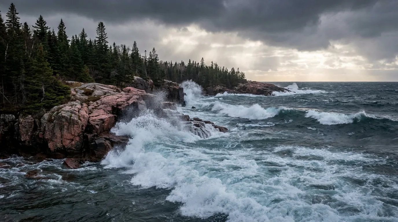
Cold blue-grey waves of Lake Superior crashing against pink Canadian Shield granite headlands under a dramatic storm sky, dark boreal spruce on the cliffs, wild remote north-shore coast, ultrarealistic photograph representative of the region
Trekkr Trail Journal · No. 059 · Lake Superior North Shore

Lake SuperiorOntario — the Highway 17 corridor, the fuel gaps, the wild parks & a cold inland sea

This is the wildest, least-developed coastline of all the Great Lakes — roughly 700 km of Trans-Canada Highway 17 threading a thin line between the boreal forest of the Canadian Shield and a cold, moody inland sea that behaves like an ocean. It is overlanding country in the truest sense: granite headlands, black spruce, and towns spaced a tank of fuel apart. The signature planning fact isn't a view — it's the ~200 km fuel gap through Lake Superior Provincial Park, the long cell dead zones, the moose you never drive into after dark, and water cold enough to kill you in minutes, year-round. Solitude, scale and storm coast — and the remoteness that is exactly why this is a guide worth buying.

Ontario · Canada Sault Ste. Marie · Wawa · Nipigon Lake Superior PP · Pukaskwa NP Self-sufficient overlanding · fuel-planned
~700 kmOf Highway 17 north-shore coast, Sault to Nipigon
~200 kmThe Sault–Wawa fuel gap — fill before you enter the park
#1Largest freshwater lake on Earth by surface area
ColdWater stays single digits to mid-teens °C even in August
Conditions verified 23 July 2026 · The fuel gap and the cold water decide the trip before the view does · This block goes stale — the links don't

Two things run this coast: your fuel range, and respect for a cold inland sea

The rest of this journal is evergreen; this box is not. On the Lake Superior north shore two things decide whether your plan works before you pick a campsite — fuel and remoteness (§02), and the cold water plus storm coast (§05, §06). There is no permit to drive Highway 17, but that does not mean you can wing it. Everything below is dated to the day we checked it. Trust the live sources, not our date stamp.

  • The Sault–Wawa "Gap" is ~200 km with no reliable fuel — fill up firstMultiple travel sources report essentially no dependable fuel for roughly 200 km through Lake Superior Provincial Park. Top off in Sault Ste. Marie (or Batchawana Bay if open) before you enter the park; the next dependable pumps are in Wawa. Small seasonal outlets near Batchawana Bay / Montreal River may exist but their hours are unreliable. [VERIFY current stations before you drive] (§02)
  • Long cell dead zones — and never drive the Gap after darkExpect no usable cell signal for long stretches through Lake Superior PP, on the Pukaskwa access, and between Wawa and Marathon. Moose on the highway are a serious collision hazard at dawn, dusk and night, and there is no lighting — travel sources warn specifically against driving the Gap after dark. Carry paper maps and consider a satellite messenger. (§02, §06)
  • Superior is cold enough to kill year-roundThe lake stays single digits to the mid-teens °C even in August, and it can cause cold-water shock and hypothermia within minutes. Wear a PFD, do not swim far from shore, and watch for sudden waves that sweep exposed rock ledges — a real hazard at the Agawa Rock pictograph site. Superior also throws sudden wind, big waves and fog any month. (§05, §06)
  • Backcountry means registration — and honest self-sufficiencyThe Pukaskwa Coastal Trail and Lake Superior PP backcountry require permits and registration; register your route and expected return. Coastal Trail sites have bear-proof food lockers — use them. Nearest hospitals and major services are only in the towns. [VERIFY current backcountry rules with the parks] (§06)
  • Winter is whiteouts and closures; black flies are a spring taxFrom roughly November into April, Hwy 17 here is notorious for whiteouts, lake-effect snow squalls, black ice and temporary closures, worst through the Gap. In spring, late May to early July is peak black-fly season in this boreal corridor. Check Ontario 511 for road conditions. [VERIFY the week you go] (§09)
  • Fees, some campgrounds and some fuel stops are UNVERIFIED hereWe print no camping fee we can't stand behind — Ontario Parks car-camping has recently run in the CAD $40s (non-electric) to ~$50 (electric) ballpark, but confirm live. Crescent Lake as a distinct operating campground, private campground names, and Johnny K's Gas current operation are all flagged — confirm before you rely on them. (§07, §13)
Live sources · Ontario Parks — Lake Superior PP · Parks Canada — Pukaskwa · Ontario 511 — road conditions & closures · Ontario — forest fires & fire bans · Ontario Parks reservations · Parks Canada reservations
In an emergency, 911 where there is signal — note there is often no cell service between towns. This box was true at press and will not stay true — the sources above are the truth on the day you travel.
01 / THE HOOK

An inland sea with no far shore, and a road spaced a tank apart

Lake Superior is the largest freshwater lake on Earth by surface area, and its Ontario north shore is the wildest coastline of all the Great Lakes. For roughly 700 km the Trans-Canada Highway threads a thin line between black spruce and jack pine on the Canadian Shield and a cold, moody inland sea — rolling swell, sudden storms, fog banks, and a horizon with no far shore in sight. The corridor's signature stop is Lake Superior Provincial Park, a 1,550-plus square-kilometre wilderness straddling the highway between the Sault and Wawa, where the road climbs the Shield and drops to cobble beaches at Old Woman Bay and Katherine Cove. Farther northwest, Pukaskwa National Park protects the largest tract of undeveloped Great Lakes shoreline anywhere. The draw is solitude, scale and storm coast — you can drive an hour and see more moose than cars. That remoteness is also the risk, and planning for it is the whole point of this guide.

An empty two-lane Trans-Canada Highway 17 curving between granite rock cuts of the Canadian Shield and the cold blue-grey water of Lake Superior, dark boreal spruce forest under a big dramatic sky, remote overlanding country, ultrarealistic photograph representative of the region
Highway 17 along the north shore. Two lanes the whole way, threading granite rock cuts and boreal forest between the towns — hills, curves and long sightless grades over the Shield. Real drive times run longer than the map says, and you plan every leg around fuel and daylight (§02).

The payoff

Granite headlands and cobble beaches, the Agawa Rock pictographs painted by Ojibwe ancestors, the roadless Pukaskwa coast and its swaying suspension bridge, corridor waterfalls, and beaches you'll often have to yourself (§03, §04).

The fuel

Towns sit a tank apart, and the Sault–Wawa Gap runs ~200 km with no reliable pumps. Top up in every town, never pass one below half a tank, and carry a jerry can. Cold and headwinds cut your range (§02).

The cold

Superior stays cold year-round and behaves like an ocean — sudden waves, fog and storms. The water can cause hypothermia in minutes, and exposed ledges are swept by rogue sets. Respect it (§05, §06).

The way to think about the region — one highway, two big parks, several towns a tank apart The whole route follows Trans-Canada Highway 17, the north-shore leg of the Lake Superior Circle Tour. Coming from the south you start at Sault Ste. Marie (the full-service city and your last big fuel before the Gap), then run Batchawana Bay → into Lake Superior Provincial Park → Wawa → White River → Marathon → Terrace Bay → Schreiber → Nipigon (and on to Thunder Bay, beyond this guide). The two anchor wildernesses are Lake Superior Provincial Park (between the Sault and Wawa) and Pukaskwa National Park (reached from Marathon). Between them are working towns, roadside waterfalls, and the "graveyard of the Great Lakes" where the Edmund Fitzgerald went down in 1975. There is no shortcut and no divided freeway — just the two-lane and the lake.
02 / GETTING THERE & ROAD ACCESS

Fuel is the plan — read this twice

Here's what first-timers underestimate: this corridor is a fuel-and-daylight problem before it's anything else. It's a two-lane highway for essentially the whole distance, with long empty stretches, no lighting, cell dead zones, and one gap where you can genuinely run dry. Get the fuel discipline right and the rest is a magnificent, easy drive. Get it wrong and you're stranded 100 km from the nearest pump with no bars on your phone. Below is how the corridor works; confirm current stations before you rely on any single one.

🔴 The single most important planning fact on this coast Sault Ste. Marie to Wawa is the critical fuel gap. There is essentially no reliable fuel for roughly 200 km through Lake Superior Provincial Park. Fill your tank in Sault Ste. Marie (or at Batchawana Bay, ~55–70 km north, if it's open) before you enter the park — the next dependable pumps are in Wawa (~230–234 km / ~2.5 hr away). Small seasonal outlets near Batchawana Bay and the Montreal River may exist but their hours are unreliable, so do not build a plan on them. Confirm current stations before you go.
Leg (Hwy 17)DistanceDrive timeFuel note
Sault Ste. Marie → Wawa~230–234 km~2.5 hrTHE GAP — fill before you enter the park
Wawa → White River~90–100 km (confirm)~1 hrFuel at both ends (White River has an Esso)
Wawa → Marathon~185 km (confirm)~2 hrJohnny K's reportedly opened between the two in 2025 (confirm)
Marathon → Terrace Bay~82 km~1 hrDependable fuel at both
Marathon → Nipigon~180–190 km~2 hrTerrace Bay, Schreiber, Nipigon dependable
Nipigon → Wawa (reverse run)~360 km~3 hr 50 minMultiple must-fill towns — never below half

Distances are compiled from travel and mapping sources; some exact figures are flagged (confirm) where sources disagreed. Times are for a normal vehicle in good conditions — a loaded rig on a two-lane over the Shield runs slower. Don't push distance into darkness.

The dependable fuel towns

Treat each of these as a must-fill, and never pass one below half a tank: Sault Ste. Marie, Wawa, White River, Marathon, Terrace Bay, Nipigon (and Thunder Bay beyond).

A newer stop, Johnny K's Gas & Convenience, reportedly opened in August 2025 on Hwy 17 between Marathon and White River, slightly easing that stretch. Its current operation is unconfirmed — don't rely on it.

Top up in every townCarry a jerry can

The overlander's fuel rule

  • Plan a real-world range under 350 km between fills — then treat that as a ceiling, not a target
  • Cold, headwinds and roof loads cut range — a Superior gale off the lake will drink your tank
  • Carry a jerry can and know your true tank range before the Gap, not on it
  • Fill in daylight — some small-town pumps keep short hours, and you don't want to be hunting fuel at night

Cell coverage — expect dead zones

Coverage is generally usable only in or near the towns. Expect long dead zones through Lake Superior PP, along the Pukaskwa access, and between Wawa and Marathon.

Do not rely on a phone for navigation or emergencies in the gaps. Carry paper maps, download offline maps in town, and seriously consider a satellite messenger — especially for the coastal backcountry. Exact carrier maps vary; check your provider.

No bars between townsSatellite messenger advised

Winter & night driving

Hwy 17 here is notorious for whiteouts, lake-effect snow squalls, black ice and temporary closures in winter; the Sault–Wawa Gap is especially exposed.

Do not drive the Gap after dark year-round — there's no lighting and a real moose-collision hazard. Winter travelers should carry full recovery and survival gear and check Ontario 511 for closures before every leg.

Moose at dawn/dusk/nightCheck Ontario 511
The 60-second fuel decision, at every town
  1. Below half a tank? Fill now — even if you "probably" have enough for the next town.
  2. About to enter Lake Superior PP from the Sault side? This is the Gap. Fill to the top in Sault Ste. Marie, no exceptions.
  3. Late afternoon and a long leg ahead? Stop early. Don't run the Gap or the Wawa–Marathon stretch into darkness.
  4. Jerry can empty? Top it up in town, not on the shoulder.
  5. Storm or squall building? Check Ontario 511 and be ready to overnight where you are.
03 / THE PARKS & THE COAST

Two anchor wildernesses, and a string of parks between

The corridor is organised around two big protected coasts — Lake Superior Provincial Park in the south, Pukaskwa National Park in the northwest — with a chain of provincial parks strung between them along the highway. Lake Superior PP is the roadside heart, where the highway itself delivers you to cobble beaches and clifftop bays. Pukaskwa is the opposite: the largest undeveloped Great Lakes shoreline anywhere, roadless, reached only on foot or by kayak from one frontcountry base. Know which one you're set up for before you point the rig.

A wide curving cobble and sand beach at Old Woman Bay beneath towering dark granite cliffs several hundred feet high, cold blue-grey Lake Superior water and boreal spruce forest under moody overcast weather, Lake Superior Provincial Park Ontario, ultrarealistic photograph representative of the region
Old Woman Bay, Lake Superior Provincial Park. Dramatic cliffs said to top ~200 m rise straight from a cobble-and-sand beach at the park's north end — prime storm-watching and photography, right off Highway 17. A day-use bay, and a reminder of the scale you're driving through.

Lake Superior Provincial Park — the roadside heart

  • 1,550+ km² straddling Hwy 17 between the Sault and Wawa — the corridor's signature stop
  • Roadside icons: the Agawa Rock pictographs, Old Woman Bay, Katherine Cove (§04) — all reachable off the highway
  • Two car-camping grounds: Agawa Bay (on a 3 km Superior beach) and Rabbit Blanket Lake (§07)
  • Serious backcountry: 163 designated sites across 76 zones, plus the Coastal Hiking Trail — permit and registration required
Roadside accessOntario Parks

Pukaskwa National Park — the roadless coast

  • The largest tract of undeveloped Great Lakes shoreline anywhere — a wild, roadless coast reached from Marathon
  • Hattie Cove is the one frontcountry base: campground, oTENTik roofed accommodation, visitor centre, interpretive trails and beaches (§07)
  • The ~60 km Coastal Hiking Trail is the draw — one of Ontario's premier backpacking routes, with the famed White River Suspension Bridge (§04)
  • Sea kayaking the coast is a signature activity — guided and gear-dependent (§08). Cold water demands skill
Foot / kayak accessParks Canada
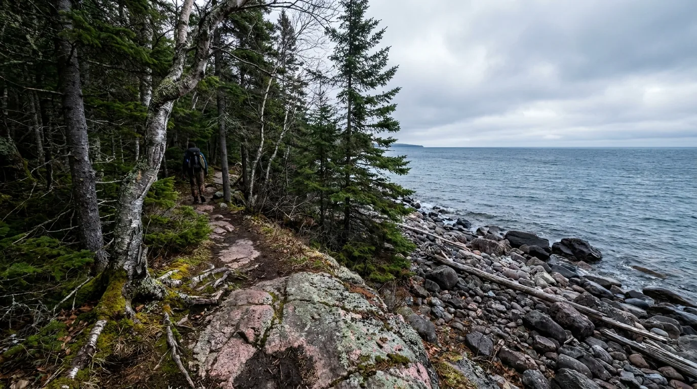
A rugged wilderness footpath winding over pink granite bedrock and through dense boreal spruce forest along a wild remote cobble shoreline of Lake Superior at Pukaskwa, cold blue-grey water with no far shore visible, ultrarealistic photograph representative of the region

The provincial parks strung between

Along the corridor, several Ontario Parks give you reservable bases and beaches:

  • Pancake Bay — the famous 3.2 km sand beach ~75 km north of the Sault
  • Obatanga — rustic lakes camping between Wawa and White River
  • White Lake — three campgrounds near White River
  • Neys — a Superior coast with WWII history near Marathon
  • Rainbow Falls — Whitesand Lake and Rossport, near Terrace Bay

Full campground detail, with honest UNVERIFIED flags, is in §07.

Which base for which trip Want roadside cobble beaches and the pictographs without a backpack? Base in Lake Superior PP at Agawa Bay or Rabbit Blanket Lake. Want the wild roadless coast and the suspension bridge? That's Pukaskwa from Hattie Cove — a frontcountry base for day hikes, or a permitted multi-day on the Coastal Trail. Just moving down the corridor? The provincial parks (Pancake Bay, White Lake, Neys, Rainbow Falls) are your reservable one-night stops between the two anchors. Whichever you choose, remember the coast and the forest are two different worlds — and Superior sets the weather.
04 / THINGS TO DO

Pictographs, beaches, a swaying bridge, and the corridor's waterfalls

The stops here are a mix of pull-off-the-highway easy and earn-it wild. Below are the ones worth planning a day around, roughly south to north, with the honest cautions attached. Several are sacred, exposed or weather-dependent — and the single most photographed piece of folk art on the corridor is a giant steel goose. Distances and difficulty are best-consensus figures; confirm on-site signage and current rules, especially at the pictographs.

A low smooth grey granite rock ledge at the calm cold water's edge of Lake Superior with a sheer rock face rising from the water and faint weathered red-ochre indigenous rock paintings on the stone, boreal forest and blue-grey great lake, Agawa Rock Lake Superior Provincial Park, ultrarealistic photograph representative of the region
The Agawa Rock pictographs. On a lakeside rock ledge, Ojibwe ancestors painted red-ochre images — canoes, the horned water lynx Mishipeshu, caribou — estimated 150–400 years old. A short (~0.5 km) but rugged, rocky trail leads down. A sacred site: respect the signage, and never go out on the ledge in high water or waves.

Lake Superior Provincial Park & the south

Sacred site · weather-dependentAgawa Rock Pictographs

Off Hwy 17 south of Agawa Bay. A short but rugged, rocky ~0.5 km trail drops to a lakeside ledge with red-ochre Ojibwe paintings. One of the corridor's most profound stops.

Do not visit in high water or waves — the ledge is genuinely dangerous and swept by sudden sets. Some sources report photography is discouraged or restricted out of respect — verify current rules on the park's signage and follow them.

~0.5 km rugged trailDangerous in wavesConfirm photo rules
Half a day with the drive
Calm water only

Warmest swimming, relativelyKatherine Cove & the beaches

Katherine Cove is a sheltered sandy beach behind the Lizard Islands with reputedly warmer, shallower water — an easy roadside stop for picnicking and swimming. Old Woman Bay is the dramatic clifftop bay for storm-watching. Batchawana Bay (day-use) has some of the warmest water on Superior.

"Warm" is relative on Superior — even sheltered bays stay cold. Watch children near the water and never swim far from shore (§05).

Roadside & easyDay-use
Roadside stops
Pack a wind layer
A sheltered crescent sandy beach at Katherine Cove with clear shallow cold water over pale sand and small rocky islands offshore, boreal forest fringe of spruce and jack pine on a calm summer day, Lake Superior Provincial Park Ontario, ultrarealistic photograph representative of the region
Katherine Cove. A sheltered, shallow, sandy bay right off Highway 17 — the corridor's easiest swim and one of the "warmest" spots on the lake, which on Superior still means bracing. An effortless stop between the bigger destinations.

3.2 km of sand · a shipwreck viewPancake Bay Beach & the Edmund Fitzgerald Lookout

One of the longest natural beaches on Superior — 3.2 km of sand ~75 km north of the Sault. The Lookout Trail (a longer loop up to ~14 km, or ~7 km return to the lookout) climbs to platforms over the water near where the SS Edmund Fitzgerald sank in a November 1975 storm.

The lookout trail has real elevation and exposure — carry water and a wind layer. Beach water is cold even in August.

3.2 km sand beachLookout ~7–14 km
Beach + optional hike
Half to full day

Pukaskwa & the north

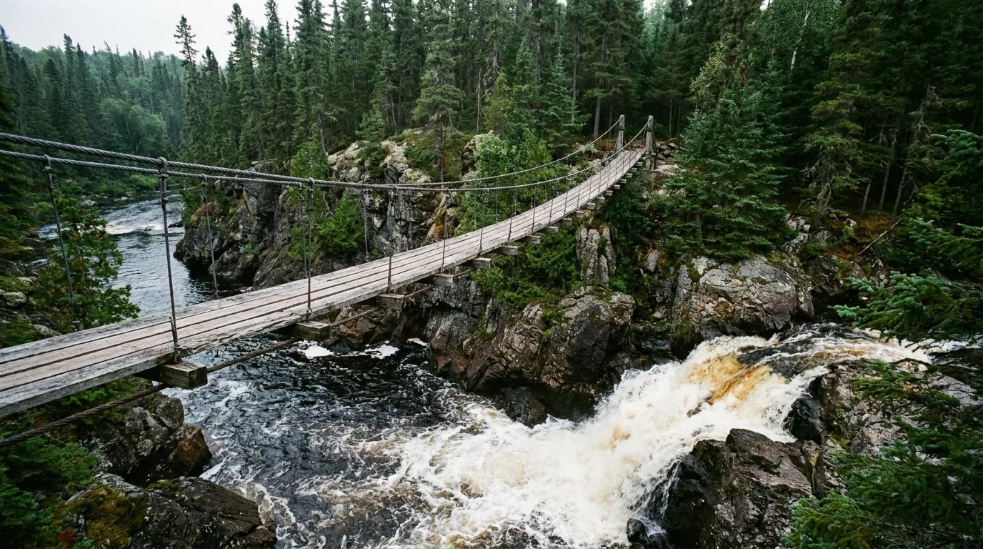
A long wooden pedestrian suspension bridge hanging high above a rocky river gorge and waterfall in the boreal Canadian Shield wilderness of Pukaskwa, dark tannin-stained white water rushing below through dense spruce forest, ultrarealistic photograph representative of the region
The White River Suspension Bridge, Pukaskwa. A pedestrian suspension bridge sways ~23 m (75 ft) above Chigamiwinigum Falls on the White River, reached by a full-day out-and-back hike (~15–18 km round trip) along the Coastal Trail from Hattie Cove. The corridor's iconic backcountry photo — and a real day's effort to earn.

A full-day out-and-backWhite River Suspension Bridge & the Coastal Trail

The Pukaskwa Coastal Hiking Trail runs ~60 km point-to-point toward the North Swallow River — a premier backpacking route. Day-hikers do the Hattie Cove interpretive loops and the out-and-back to the suspension bridge (~15–18 km round trip).

The bridge is a serious day hike, not a stroll — boreal terrain, roots and rock. The full Coastal Trail needs a backcountry permit and registration (§06). Sites have bear-proof lockers — use them.

Bridge ~15–18 km RTRegister the backcountry~60 km full trail
Bridge = a full day
Full trail = multi-day

The Wawa Goose & the town falls

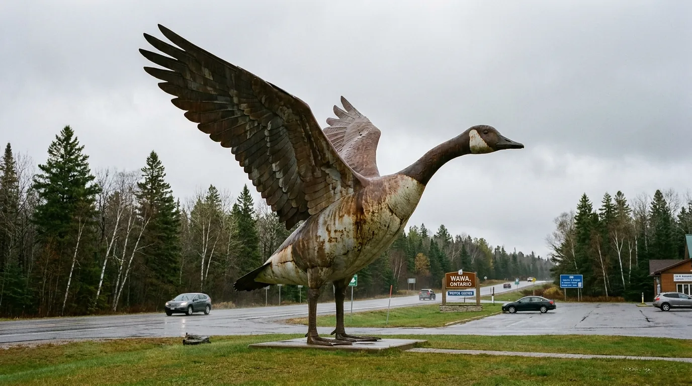
The Wawa Goose — an 8.5 m (28 ft) steel Canada Goose monument built in 1960 at the Wawa visitor centre off Hwy 17 — is the corridor's classic photo stop. Nearby, Magpie / Scenic High Falls (~23 m high, ~38 m wide on the Magpie River, ~5 km southwest of Wawa) is free, with washrooms and a pavilion, and spectacular at high flow. Quieter Silver Falls connects to it by a ~3 km Voyageur Hiking Trail segment.

Free & roadsideBest at high flow

Aguasabon Falls & the far corridor

Aguasabon Falls & Gorge at Terrace Bay drops ~30 m into a deep gorge of ~2.6-billion-year-old bedrock, with a boardwalk to an observation platform right off Hwy 17 — very accessible. Chippewa Falls near Batchawana Bay marks the approximate halfway point of the Trans-Canada Highway. Continuing west past Nipigon, Ouimet Canyon (a ~100 m deep gorge) is a natural add-on toward Thunder Bay, just past this guide's edge.

Boardwalk accessOuimet is past our edge
A wide powerful waterfall on the Magpie River near Wawa, a broad curtain of white water dropping over dark rock ledges into a churning pool surrounded by boreal spruce and birch forest of the Canadian Shield at high water flow, ultrarealistic photograph representative of the region
Scenic High Falls on the Magpie River, near Wawa. A broad ~23 m curtain a short drive off the highway, free to visit and thunderous at high flow. Paired with the Wawa Goose and a fuel stop, it's the classic reason to actually pull into Wawa rather than just refuel and roll on.
A river plunging about thirty metres into a deep narrow rock gorge of ancient dark billion-year-old bedrock at Aguasabon Falls near Terrace Bay, boreal forest on the rim and mist rising with a viewing platform, cool overcast light, ultrarealistic photograph representative of the region
Aguasabon Falls & Gorge, Terrace Bay. The Aguasabon River drops ~30 m into a deep gorge cut in ~2.6-billion-year-old bedrock, with a boardwalk to an observation platform right off Highway 17 — one of the most accessible big waterfalls on the whole corridor, and a natural leg-stretch on the run toward Neys and Nipigon.
StopWhereEffortThe honest note
Agawa Rock PictographsLake Superior PP~0.5 km ruggedSacred; calm water only; confirm photo rules
Old Woman BayLake Superior PPRoadside / day-useCliffs & storm-watching; keep back from edges
Katherine CoveLake Superior PPRoadside"Warmest" swim — still cold
Pancake Bay BeachPancake Bay PPRoadside + hike3.2 km sand; Fitzgerald lookout ~7–14 km
White River Suspension BridgePukaskwa NP~15–18 km RTFull-day hike; register backcountry beyond
Wawa GooseWawaRoadsideThe classic photo stop; free
Scenic High Falls (Magpie)near WawaRoadside / short walkFree; best at high flow
Aguasabon Falls & GorgeTerrace BayBoardwalk~30 m into ancient bedrock; very accessible

Heights, lengths and distances are compiled from Ontario Parks, Parks Canada and regional tourism sources and should be confirmed on-site. The Agawa Rock ledge is a real hazard in waves — treat calm water as a requirement, not a preference.

05 / THE WATER — READ BEFORE YOU GET IN

A cold inland sea that behaves like an ocean

Superior is the reason this coast is beautiful and the reason it can turn dangerous fast. It is cold enough to cause hypothermia year-round, big enough to build ocean-scale swell and fog from a storm you can't see, and edged with smooth rock ledges that rogue waves sweep clean. We're not going to pretend the water's swimmable just because the sun's out. Here's the honest version — the cold, the waves, and how to be around the lake without becoming a statistic.

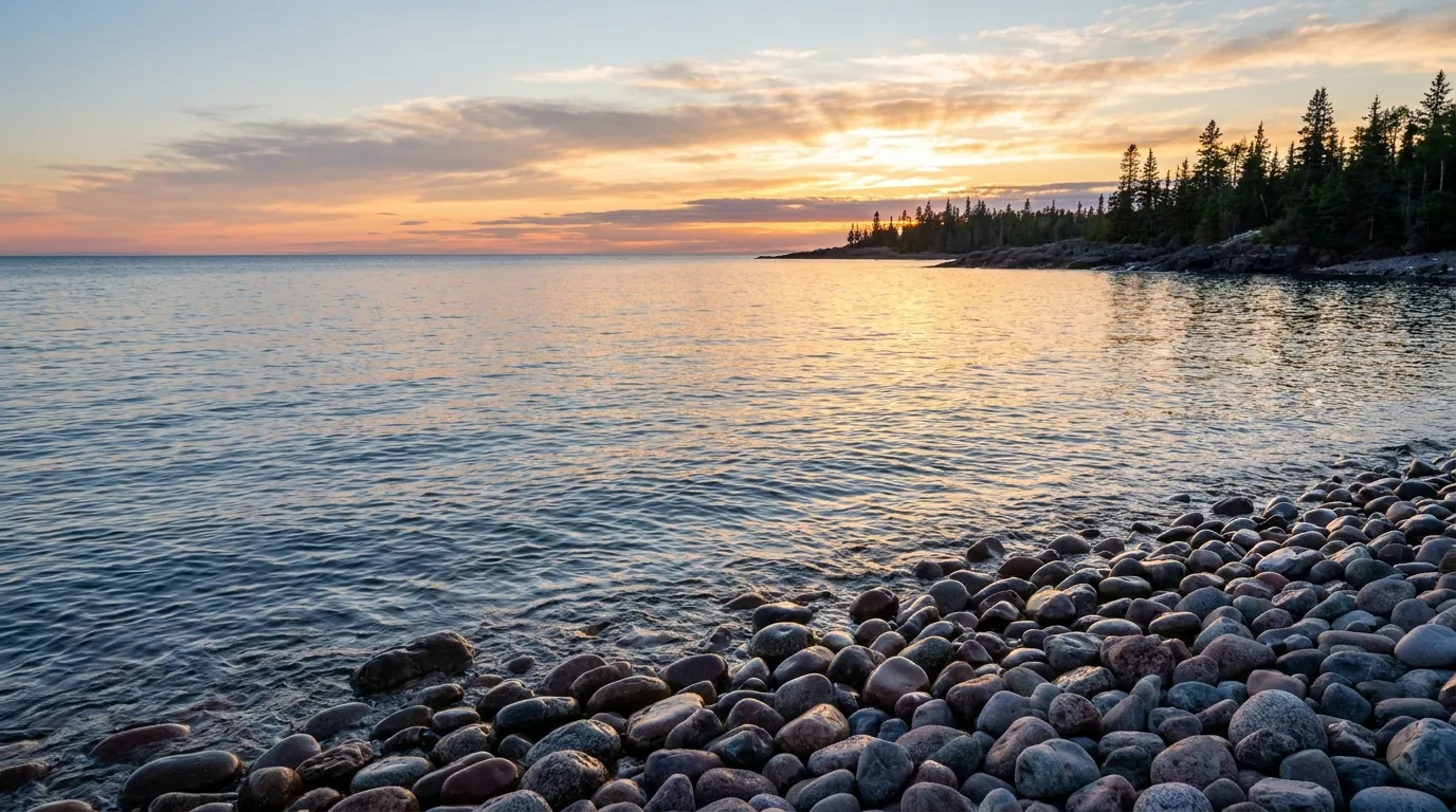
Sunset over Lake Superior from a smooth wave-rounded cobble beach, warm gold and pink light on cold calm blue-grey great lake water with rounded granite cobbles in the foreground and dark boreal spruce silhouettes, wild remote coast, ultrarealistic photograph representative of the region
Sunset over a cobble beach. On a calm evening Superior is serene — but the same water that mirrors this sky is cold enough to disable a swimmer in minutes, and the wave-rounded cobbles underfoot are proof of how hard it hits when the wind turns. Beauty and hazard are the same lake.

The cold, plainly

Superior's water stays cold year-round — often single digits to the mid-teens °C even in summer. That's cold enough to trigger cold-water shock (an involuntary gasp and loss of breath control) and hypothermia within minutes.

Sheltered bays — Batchawana, Katherine Cove, Pancake Bay — are the "warmest," but that's relative. Wear a PFD, don't swim far from shore, and get out before you're cold.

Hypothermia in minutesPFD, always

The waves, fog & exposed ledges

  • Superior generates sudden wind, big waves and fog banks any month — conditions turn in minutes
  • Rogue sets sweep exposed rock ledges — a genuine, documented hazard at the Agawa Rock site. Never turn your back on the lake there
  • Sea kayaking is a skilled, gear-dependent activity here — wetsuit or drysuit, not a rental sit-on-top on a whim
  • Storm-watching is a highlight in fall — do it from safe, set-back ground, not out on wet rock
🔴 If you're getting on or near the water — the non-negotiables Treat Superior as an ocean, not a lake. Wear a PFD any time you're paddling or on exposed rock. Dress for the water temperature, not the air — a warm sunny day means nothing once you're in. Check the marine forecast and wind before any paddle, and turn back early if it builds. Keep well back from wet ledges and never go out on the Agawa Rock ledge in waves. If someone goes in cold water, get them out fast and treat for hypothermia — and remember help can be a long way off with no cell signal (§06).
06 / SAFETY — READ THIS FIRST

Remoteness, cold water, and the animals on the road and in camp

Most of what goes wrong here comes down to four things, and the first isn't a bear — it's remoteness. Long fuel gaps, sparse services and cell dead zones mean self-sufficiency is mandatory, not optional. The second is the cold water (§05). The third is wildlife: black bears in camp and moose on the highway, the latter a genuine collision risk. The fourth is weather and fire — sudden Superior storms, winter closures, and northern fire bans. None of it is exotic; it just has to be planned for.

Self-sufficiency is mandatory

Long fuel gaps (§02), sparse services and cell dead zones mean overlanders must carry spare fuel, extra food and water, a spare tire (or two) and basic recovery gear, warm layers, and ideally a satellite communicator.

Nearest hospitals and major services are concentrated in the towns — Sault Ste. Marie, Wawa, Marathon, Terrace Bay, Nipigon. Plan as if help is hours away, because it can be.

Help can be hours offCarry sat comms

Wildlife — bears in camp, moose on the road

  • Black bears are common. Use bear-proof food storage (Coastal Trail sites have lockers), keep a clean camp, never feed wildlife
  • Moose on the highway are a serious collision hazard, worst at dawn, dusk and night — do not drive the Sault–Wawa Gap after dark
  • Store all food and scented items securely in vehicles and lockers — a raided camp is a dangerous camp
  • Give every animal room and never approach for a photo
🔴 Cold-water hypothermia — the quiet killer Superior is cold enough to cause cold-water shock and hypothermia within minutes year-round (§05). Wear a PFD (and a wetsuit or drysuit for kayaking), do not swim far from shore, and watch for sudden waves sweeping exposed rock ledges — a real hazard at Agawa Rock. Air temperature is irrelevant once you're in. If someone goes in, get them out immediately, remove wet clothing, insulate and warm them, and call for help — knowing help may be far away with no signal.

Backcountry registration & permits

The Pukaskwa Coastal Trail and Lake Superior PP backcountry require permits and registration — Parks Canada and Ontario Parks both run backcountry reservation and permit systems. Register your route and expected return, carry the gear for self-rescue, and know that a delayed check-in is what triggers a search. Coastal Trail sites have bear-proof food lockers.

Register your routeConfirm the permit system

Fire bans, weather & Leave No Trace

Northern Ontario fire restrictions (Restricted Fire Zones) are common in dry spells — check current fire bans before any campfire and use provided fire pits only. Winter brings whiteouts and Hwy 17 closures; sudden storms strike year-round — check Ontario 511. Pack out all trash, respect the Agawa Rock sacred site, stay on trails on fragile Shield terrain, and keep back from cliff edges (Old Woman Bay, Aguasabon Gorge, the suspension bridge).

Check fire bans liveOntario 511 for roads
Wildlife distance & a clean camp, briefly Keep a clean, food-secure camp everywhere on this coast: store food and scented items in vehicles or the provided bear-proof lockers, cook away from your sleeping area, and pack out every scrap. Never feed or approach any animal, from a chipmunk to a moose. If an animal changes its behaviour because of you, you're too close. Confirm current bear and backcountry guidance with the parks, and treat every wild animal as wild.
07 / THE CAMPING STRATEGY

Two parks' campgrounds, the corridor's provincial parks, and the coastal backcountry

Camping here sorts into four buckets: the two car-camping grounds in Lake Superior Provincial Park, Pukaskwa's Hattie Cove frontcountry (and oTENTiks), the string of corridor provincial parks (Pancake Bay, Obatanga, White Lake, Neys, Rainbow Falls), and the permit-only coastal backcountry. Reservable grounds fill for peak summer weekends — book early. And a straight-shooting note: every fee below is an UNVERIFIED ballpark, and a couple of "campgrounds" you may have seen listed we could not confirm. We print what we could stand behind and flag the rest.

A very long sweeping natural sand beach curving along Lake Superior at Pancake Bay Provincial Park, pale golden sand meeting cold clear blue-green great lake water with a boreal forest backdrop and gentle waves on a bright summer day, ultrarealistic photograph representative of the region
Pancake Bay Provincial Park. A large reservable campground behind one of the longest natural sand beaches on Superior (3.2 km), ~75 km north of the Sault — the classic first or last night of a corridor trip. Book early for peak-summer weekends; the water is cold even in August.
CampgroundPark · managerSitesServices*BookingFee*
Agawa Bay Lake Superior PP · Ontario Parks 147 (38 electric) 3 km beach; flush toilets, showers, laundry; dump/fill; visitor centre Reservable $$ (confirm)
Rabbit Blanket Lake Lake Superior PP · Ontario Parks 60 (20 electric) Inland lake (Wawa end); flush toilets, showers, laundry; dump/fill Reservable $$ (confirm)
Lake Superior PP backcountry Lake Superior PP · Ontario Parks 163 sites / 76 zones Box privies, some fire pits; Coastal Trail sites have bear lockers Permit + registration permit (confirm)
Hattie Cove Pukaskwa NP · Parks Canada 67 Hot showers, washrooms; some electrical; WiFi at visitor centre Reservable (confirm vs FCFS) $$ (confirm)
oTENTik (Hattie Cove) Pukaskwa NP · Parks Canada Pre-set canvas-and-wood cabins; "camping without the fuss" Reservable $$ (confirm)
Pukaskwa Coastal backcountry Pukaskwa NP · Parks Canada Wilderness sites along the ~60 km Coastal Trail; paddle-in coastal sites Permit + registration permit (confirm)
Pancake Bay Pancake Bay PP · Ontario Parks large (confirm) 3.2 km sand beach; some electrical, roofed accom., comfort stations, barrier-free Reservable $$ (confirm)
Obatanga Obatanga PP · Ontario Parks 2 serviced + ~10 canoe (confirm) Rustic; on Bumfield Lake; check for reduced services Reservable $$ (confirm)
White Lake White Lake PP · Ontario Parks 187 (~1/3 electric) 3 grounds (Woodlily, Moccasin Flower, Sundew); flush toilets, showers, laundry Reservable $$ (confirm)
Neys Neys PP · Ontario Parks ~150 (~half electric) Superior coast; showers, flush toilets, laundry; barrier-free; big-rig-friendly Area 1 Reservable $$ (confirm)
Rainbow Falls — Whitesand Lake Rainbow Falls PP · Ontario Parks ~100 (~half electric) Comfort stations, showers/laundry; canoe/kayak/SUP rentals on Whitesand Lake Reservable $$ (confirm)
Rainbow Falls — Rossport Rainbow Falls PP · Ontario Parks 36 (23 electric) ~5 km west, on Lake Superior; open birch-grove sites with Superior views Reservable $$ (confirm)
Crescent Lake Lake Superior PP (listed) · Ontario Parks UNVERIFIED Status as a distinct operating campground unconfirmed — the park emphasises Agawa Bay & Rabbit Blanket Lake Confirm before relying

*Site counts and services are compiled from Ontario Parks and Parks Canada listings and vary by source and season. Every fee is UNVERIFIED — recent Ontario Parks car-camping has run in the CAD $40s (non-electric) to ~$50 (electric) ballpark, and Pukaskwa frontcountry similarly, but confirm all fees live at reservations.ontarioparks.ca / reservation.pc.gc.ca. Note: Agawa Bay's sites 101–149 were flagged as a reduced-amenity early-season block (vault privies only) for 2026 — confirm. Crescent Lake as a distinct operating campground is unconfirmed.

Which base for which trip

  • Lake Superior PP, lakeside with showers: Agawa Bay (on a 3 km beach) — the basecamp for the pictographs, Katherine Cove and Old Woman Bay
  • Lake Superior PP, Wawa end / inland: Rabbit Blanket Lake — handy for the north of the park and the run to Wawa
  • Pukaskwa & the suspension bridge: Hattie Cove (or an oTENTik) from Marathon — frontcountry base for the coast
  • Corridor one-nighters: Pancake Bay (south), White Lake / Obatanga (middle), Neys / Rainbow Falls (north)
  • The wild coast: Lake Superior PP or Pukaskwa backcountry — permit and registration only (§06)

Private, municipal & the honest gap

Rock Island Lodge (Naturally Superior Adventures) at Wawa is a waterfront lodge base at the Michipicoten River mouth — not a campground, but a camping-adjacent base with services (§08). Additional private and municipal RV parks and motels exist in Wawa, Marathon and Terrace Bay.

We won't invent specific private campground names. Confirm current private options via the Algoma Country and Superior Country directories before you count on a booking.

No invented listingsCheck regional directories
Booking — the two systems Ontario Parks car-camping and backcountry book through reservations.ontarioparks.ca or 1-888-ONT-PARK (1-888-668-7275). Pukaskwa (Parks Canada) books through reservation.pc.gc.ca / 1-877-737-3783. Backcountry zones (Lake Superior PP) can be reserved up to ~5 months ahead; the Coastal Trail requires a backcountry permit and registration. Confirm current fees, seasons, site details and any early-season reduced-amenity blocks on the live systems before you rely on them — every figure here is a ballpark.
08 / TOWNS & SERVICES

Fuel, food and beds — spaced a tank apart

The towns are your fuel, food, resupply and bail-out points, and they're spread thin. Sault Ste. Marie is a full-service city and your last big everything before the Gap; Wawa is the first dependable stop north of it; Marathon, Terrace Bay and Nipigon carry you the rest of the way. Between them are the outfitters and family restaurants that make the corridor liveable. Below are real, currently-trading businesses whose details we could resolve — but seasons, hours and menus change, so we link and describe rather than quote, and we flag what we couldn't confirm.

A large roadside steel Canada goose monument statue with wings raised standing on a grassy roadside plaza beside the Trans-Canada Highway in a small northern Ontario town, boreal forest and grey sky behind, weathered metal sculpture, ultrarealistic photograph representative of the region
The Wawa Goose. The 8.5 m steel goose at the Wawa visitor information centre off Hwy 17 — the corridor's most photographed landmark and the sign you've reached the first dependable fuel, food and lodging north of the Gap. Fuel up, grab the photo, and check the falls before you roll on.

Outfitters & paddling

  • Naturally Superior Adventures & Rock Island Lodge (Wawa, at the Michipicoten River mouth) — guided sea-kayak, canoe, Voyageur-canoe and SUP trips (day to multi-day), rentals, outfitting and shuttles, plus a 4-room waterfront lodge. Founded 1994; billed as the only waterfront accommodation for 400+ km on the Circle Tour. naturallysuperior.com / rockislandlodge.ca

Superior sea kayaking is skill- and gear-dependent (§05) — a guided intro is the sane way in for most travelers. Confirm current trips and pricing with the operator.

Motels & restaurants (gateway towns)

  • Kinniwabi Pines Restaurant (Wawa) — eclectic international menu with Lake Superior trout, whitefish and pickerel, overlooking the Michipicoten River
  • Best Northern Motel & Restaurant (Wawa) — highway motel with attached restaurant (website unverified)
  • North of 17 Restaurant (Wawa) — classic diner-style spot, pizza (website unverified)
  • OAR House Family Restaurant (Marathon) — family dining (website unverified)
  • Drifter's Motel & Restaurant (Terrace Bay) — highway motel + family restaurant (website unverified)

The dependable fuel & service towns

  • Sault Ste. Marie — full-service city; last major fuel and resupply before the Gap
  • Wawa — multiple stations; first dependable fuel north of the Gap, plus food and lodging
  • White River — includes an Esso ("A1 Stop") and others
  • Johnny K's Gas & Convenience — Hwy 17 between Marathon and White River, reportedly opened Aug 2025 (current operation unconfirmed)
  • Marathon, Terrace Bay, Nipigon — dependable fuel and convenience

Tourism & info resources

Useful for confirming the moving details — private campgrounds, current business hours, road and event info — before you go:

  • Algoma Country (algomacountry.com) — the Sault-to-Wawa side
  • Superior Country (superiorcountry.ca) — the Marathon-to-Nipigon side
  • Tourism Sault Ste. Marie, Municipality of Wawa, Visit Terrace Bay, Northern Ontario Travel

We confirmed no operator pricing — any number you see elsewhere should come from the business.

Getting there From the south, the corridor is usually entered at Sault Ste. Marie (reached via Hwy 17 from Sudbury, or across the International Bridge from Michigan, USA). From the west it's entered from Thunder Bay via Nipigon. There is one road — Trans-Canada Highway 17 — and no divided freeway or shortcut. Confirm current drive times and any highway closures with Ontario 511 and live mapping; this two-lane closes for weather, wildfire and collisions.
09 / TIMING

A short summer, a great fall, and honest bugs

This corridor has a short prime season and a couple of honest trade-offs most guides gloss over. Summer is the obvious window — warm days, long light, everything open — but it starts behind a wall of black flies. Fall is arguably the better overlanding season. Winter is genuinely harsh. And Superior's cold water and sudden weather are constants in every season. Here's the straight version so you pick your window with your eyes open.

Season by season, straight

  • Summer (late Jun–Aug) — the prime window. Warm days, long daylight, all parks and services open. Peak weekends fill reservable campgrounds — book early. Water stays cold
  • Black flies (late May–early Jul) — be honest. Peak black-fly season in this boreal corridor; brutal inland and on the Coastal Trail. Bring head nets and DEET/permethrin
  • Fall (Sep–early Oct) — arguably the best. Crisp air, fewer bugs, excellent boreal and hardwood colour, dramatic storm-watching. Cold nights; some services wind down mid-October
  • Winter (Nov–Apr) — harsh. Lake-effect snow, whiteouts, squalls and Hwy 17 closures, worst through the Gap. Most campgrounds closed. Well-equipped travelers only — check Ontario 511

Conditions that don't care what month it is

  • Cold water year-round. Superior stays single digits to mid-teens °C even in summer — plan for it (§05)
  • Wind & fog any month. Superior builds sudden wind, big waves and fog banks; paddling and shoreline scrambling turn dangerous fast
  • Shoulder seasons (May, mid-Oct) are variable — reduced services (e.g. early-season vault-privy-only blocks at Agawa Bay), cold nights, but quiet
  • Fire bans can appear in any dry spell — check before you plan a campfire (§06)
The one-paragraph answer Go in late July or August for the warmest, driest, everything-open trip — and book reservable campgrounds early. If you can, go in September: fewer bugs, better colour, best storm-watching, and quieter roads, at the cost of colder nights and some services winding down. Avoid late May to early July unless you're at peace with black flies, and avoid winter unless you're fully equipped for whiteouts and closures. Whatever you pick: cold water and sudden weather are constants — pack for Superior, not for the calendar.
10 / THE SHAPE OF THE TRIP

Five ways to run the coast, all fuel-planned

Workable shapes, not the only ones — from a single day drive to a full corridor overland. Every one is built around the fuel rule (top up in every town, never below half, jerry can along) and daylight (don't run the Gap or the Wawa–Marathon stretch after dark). Adjust freely, but keep the fuel and daylight discipline non-negotiable.

A

Sault-to-Wawa Coastal Day Drive (~230 km one-way)

  1. Fill up in Sault Ste. Marie — last fuel for ~200 km.
  2. Chippewa Falls (TCH halfway plaque) → Batchawana Bay beach.
  3. Pancake Bay beach + optional Edmund Fitzgerald Lookout Trail.
  4. Into Lake Superior PP: Agawa Rock (calm water only), Katherine Cove, Old Woman Bay.
  5. Wawa: fuel, the Goose, Scenic High Falls. Do not run this after dark.
Fill before the GapDaylight only
B

Lake Superior PP Basecamp (2–3 days)

  1. Base at Agawa Bay (lakeside, showers).
  2. Day 1: Agawa Rock + Katherine Cove + beach time.
  3. Day 2: hike a Coastal / Orphan Lake / Nokomis trail segment; sunset at Old Woman Bay.
  4. Day 3: paddle a sheltered bay or drive Gargantua Road to the coast.
  5. Fuel round-trips from Wawa or the Sault.
Roadside iconsShowers on site
C

Pukaskwa Hattie Cove + Coastal Day (2 days)

  1. From Marathon (fuel, supplies), drive to Hattie Cove (or an oTENTik).
  2. Day 1: Hattie Cove interpretive trails, beaches, visitor centre.
  3. Day 2: full-day out-and-back to the White River Suspension Bridge (~15–18 km RT).
  4. Add a guided sea-kayak intro if conditions and skill allow.
Register any backcountryFull-day bridge hike
D

Full Hwy 17 North-Shore Overland (4–6 days)

  1. Sault Ste. Marie (fuel) → Lake Superior PP (2 nights, Agawa Bay).
  2. Wawa (fuel, Goose, Magpie/Silver Falls; optional kayak day) → White Lake or Obatanga (1 night).
  3. Marathon (fuel) → Pukaskwa / Hattie Cove (1–2 nights, suspension bridge).
  4. Terrace Bay (fuel, Aguasabon Falls) → Neys or Rainbow Falls (1 night) → Nipigon (fuel).
  5. Rule: fuel in every named town; never below half; jerry can along.
Fuel every townBook the parks early
E

Waterfalls & Beaches Sampler (2–3 days, family-friendly)

  1. Chippewa Falls → Pancake Bay beach → Katherine Cove.
  2. Wawa: Scenic High Falls + the Goose.
  3. Aguasabon Falls & Gorge (Terrace Bay).
  4. Rainbow Falls PP (Whitesand Lake swimming, rentals).
  5. Low-difficulty, high-payoff, mostly roadside stops.
Roadside & easyGreat with kids
+

Continue west (past our edge)

  1. Beyond Nipigon, the Circle Tour runs on toward Thunder Bay.
  2. Ouimet Canyon (a ~100 m deep gorge near Dorion) is a spectacular day-use add-on.
  3. Fuel at Nipigon before you go; this leg is beyond this guide's scope.
Beyond this guideToward Thunder Bay
11 / TRIP-READY

The departure check

Run it before you leave. Tap each item as it's done — these are the ten things specific to the Lake Superior north shore that a general road-trip habit will skip. Most come back to two facts: the towns are a tank apart with dead zones between them, and Superior is a cold inland sea that turns dangerous fast.

0 / 10 confirmed — fuel and daylight set the schedule.
12 / QUICK ANSWERS

Asked at every north-shore fuel stop

Where's the fuel gap, and how far is it?
The critical gap is Sault Ste. Marie to Wawa, ~230 km, of which about 200 km runs through Lake Superior Provincial Park with no reliable fuel. Fill your tank in Sault Ste. Marie before you enter the park; the next dependable pumps are in Wawa. Small seasonal outlets near Batchawana Bay / Montreal River may exist but are unreliable. The corridor rule: top up in every town, never pass one below half a tank, carry a jerry can, and plan a real-world range under 350 km. Confirm current stations before you go.
Is it safe to drive Highway 17 at night?
Avoid it, especially the Sault–Wawa Gap. It's a two-lane highway with no lighting, long stretches with no services or cell signal, and a serious moose-collision hazard worst at dawn, dusk and after dark. Travel sources specifically warn against driving the Gap at night year-round. In winter the same stretch brings whiteouts, squalls, black ice and closures. Plan driving for daylight and check Ontario 511 for conditions.
Can you swim in Lake Superior? How cold is it?
You can, but Superior stays cold year-round — often single digits to the mid-teens °C even in August — and it's cold enough to cause cold-water shock and hypothermia within minutes. Sheltered bays (Batchawana, Katherine Cove, Pancake Bay) are the "warmest," but that's relative. Wear a PFD, don't swim far from shore, and watch for sudden waves that sweep exposed rock ledges — a real hazard at Agawa Rock.
What campgrounds are on the north shore?
The main car-camping grounds run down Hwy 17: in Lake Superior PP, Agawa Bay and Rabbit Blanket Lake; Pukaskwa's Hattie Cove (with oTENTiks); and the corridor provincial parks — Pancake Bay, Obatanga, White Lake, Neys, Rainbow Falls (Whitesand Lake + Rossport). Plus permit-only backcountry on the Lake Superior PP Coastal Trail zones and Pukaskwa's ~60 km Coastal Trail. Book at reservations.ontarioparks.ca / reservation.pc.gc.ca. Every fee here is a ballpark — confirm live.
Is there cell service out there?
Expect long dead zones between towns — especially through Lake Superior PP, on the Pukaskwa access, and between Wawa and Marathon. Coverage is generally usable only in or near the towns. Do not rely on a phone for navigation or emergencies in the gaps: carry paper maps, download offline maps in town, and seriously consider a satellite messenger, particularly for the coastal backcountry (where you must also register your route).
When's the best time to go, in one sentence?
Late July–August for the warmest, everything-open trip (book campgrounds early), or September for fewer bugs, better colour and the best storm-watching at the cost of colder nights. Avoid late May–early July unless you're at peace with black flies, and avoid winter unless you're fully equipped for whiteouts and closures. Cold water and sudden weather are constants year-round.
How long should the drive take?
The whole leg follows Hwy 17: Sault Ste. Marie to Wawa is ~230 km (~2.5 hr); Marathon to Nipigon ~180–190 km (~2 hr); Nipigon to Wawa ~360 km (~3 hr 50 min). It's a two-lane with hills, curves and long grades over the Shield, so real times run longer than the map — and you shouldn't push distance into darkness. Most people give the corridor 4 to 6 days to actually stop at the parks, beaches and falls.
Can I see the Agawa Rock pictographs, and can I photograph them?
Yes — a short but rugged, rocky ~0.5 km trail drops to the lakeside ledge with the red-ochre Ojibwe paintings. But it's a sacred site: respect the signage, and never go out on the ledge in high water or waves — rogue sets make it genuinely dangerous. Some sources report photography is discouraged or restricted out of respect, so check and follow the current on-site rules.
What about the Edmund Fitzgerald?
The SS Edmund Fitzgerald sank in a November 1975 storm on Lake Superior — the "graveyard of the Great Lakes." You can hike the Edmund Fitzgerald Lookout Trail at Pancake Bay Provincial Park (up to ~14 km loop, or ~7 km return to the lookout) to viewing platforms over the water near where she went down. It's a real climb with exposure — carry water and a wind layer.
Do I need to worry about bears and moose?
Yes, in different ways. Black bears are common in camp — store food and scented items securely (Coastal Trail sites have bear-proof lockers), keep a clean camp, never feed wildlife. Moose on the highway are a serious collision hazard, worst at dawn, dusk and night — which is a big reason not to drive the Gap after dark. Give every animal room and never approach for a photo.
13 / WHAT WE COULD NOT CONFIRM

The honest gaps, all in one place

Every guide has these; most don't print them. This corridor's fees, some site counts, a couple of "campgrounds," and one or two fuel stops are moving targets — so some numbers here are estimates, and we've flagged them in place. Everything below was compiled 23 July 2026 and should be re-checked against the linked official source before you rely on it.

Why this section exists Anyone can write a guide that sounds certain. The hard part is knowing which numbers are real — and on a coast where the pumps can be shut the day you pass, a "campground" on someone's list may not exist, the water can kill a swimmer in minutes, and a moose can end a night drive, plenty of these details need a same-week check. The null is the product. "Fill before the Gap," "register your backcountry route," and "never swim far from shore in cold water" are usable instructions. A confident wrong answer here costs a stranding 100 km from a pump with no bars — or worse.
🔒

The printable field guide

Everything above, condensed into a print-ready PDF built for the glovebox — for a coast where the towns are a tank apart, the cell signal disappears for hours, and the lake is cold enough to kill. The fuel-gap plan mapped town by town, the two anchor parks and the corridor's provincial parks, the pictographs, beaches and waterfalls, the cold-water and backcountry rules, the campgrounds by area with honest UNVERIFIED flags, the outfitters and fuel towns, and the honest list of what nobody could confirm — on paper that works where the bars don't.

The fuel gap, mapped Lake Superior PP & Pukaskwa Pictographs, beaches & falls Cold-water & backcountry rules Campgrounds by area Fuel towns & outfitters Fuel-planned routes The departure check
Unlock the PDF — $4.95
$4.95 per guide · Instant access · Built by people who actually camp there
Trail Journal No. 059

Go farther. Camp lighter.
Leave it better.

Every Trekkr Trail Journal is built like this one: custom logistics, honest trail beta, the camping and access detail, and the local knowledge that turns a good trip into the one your crew talks about for years — including, always, a plain list of what we could not confirm. New destinations drop all season long, from the Colorado Rockies to the Utah canyons to the wild Great Lakes shield.

Unlock the Trail Journal Library
↗ Read another issue — No. 051, Grand Canyon National Park
$4.95 per guide · Instant access · Built by people who actually camp there