Brightly painted false-front gold-rush storefronts and wooden boardwalks lining an unpaved dirt street under low golden evening sun, forested hills behind, Dawson City Yukon, ultrarealistic photograph representative of the region
Trekkr Trail Journal · No. 044 · The Klondike & Dawson City

The Klondike & DawsonYukon — the North Klondike Highway, the Gold Rush town, the goldfields & the Top of the World

This is the drive to the end of the road — 530 km up the North Klondike Highway to a Gold Rush town of false-front saloons on dirt streets, a preserved dredge in the tailings, and a lookout over two great rivers meeting. Getting there means real fuel gaps. Getting past it means a free river ferry with no bridge behind it and a gravel road along the top of the world to a border that keeps banker's hours. Plan the fuel, catch the ferry, and it's one of the great northern trips.

Yukon · Canada Whitehorse → Carmacks → Dawson City George Black ferry · Top of the World Hwy Season roughly June–mid-Sept
~530 kmWhitehorse to Dawson — plan fuel; the last full service is Carmacks
0 bridgesThe free George Black ferry is the only crossing at Dawson
Poker Cr.The Top of the World border keeps limited daytime hours, seasonal only
GrizzlyBear + gravel-road country — spare tire, bear spray, no signal
Conditions verified 22 July 2026 · The ferry and the border decide the day before the town does · This block goes stale — the links don't

Two gates open this trip: the ferry, and the border

The rest of this journal is evergreen; this box is not. On the Klondike run two things decide whether your plan works — the free George Black ferry across the Yukon River at Dawson (§05, §07), and whether the Top of the World Highway and its Poker Creek border are open and within hours (§05). Both are seasonal and both can stop without notice. Everything below is dated to the day we checked it. Trust the live sources, not our date stamp.

  • The George Black ferry — the only crossing, and it's seasonalThere is no bridge at Dawson. The free Yukon government vehicle ferry runs day and night through summer — reported roughly mid-May to mid-October — and is the only way to reach the Yukon River Campground, West Dawson and the Top of the World Highway. It stops for high water, break-up, freeze-up and mechanical outages. [VERIFY current status — 511 Yukon / Yukon Highways & Public Works] (§05, §07)
  • Top of the World Highway & the Poker Creek border — seasonal, limited hours, gravelThe ridge road to Alaska is open roughly late May to mid-September and closed all winter. The Poker Creek / Little Gold Creek border keeps limited daytime hours (reported ~8 a.m.–8 p.m. Alaska / 9 a.m.–9 p.m. Pacific) with no after-hours processing — arrive late and you wait until morning. Mostly gravel; no fuel on the ridge. [VERIFY season & hours — CBP/CBSA] (§05)
  • Fuel is a plan, not an afterthought — Braeburn Lodge is closedThe last dependable full-service fuel/food is Carmacks (about halfway). Beyond it, fuel at Pelly Crossing and Stewart Crossing is limited and seasonal. The old cinnamon-bun roadhouse at Braeburn (Km 55) is reported closed indefinitely as of 2026 — do not plan a stop there. Fill up in Carmacks and top up whenever you can. (§02, §08)
  • Gravel & wildlife on the Dempster/Tombstone gateway and the Top of the WorldBoth gravel roads demand a good full-size spare (ideally two), slower speeds and dust/washboard patience. This is grizzly and black-bear country with caribou near Tombstone — animals on the road are a real hazard, and cell service is largely absent. (§05, §06)
  • Site hours are seasonal — confirm before you count on themParks Canada's Dawson sites (Dredge No. 4, S.S. Keno, the walking tours) and the Klondike Visitors Association venues run on seasonal schedules; many services in Dawson, Carmacks and the smaller communities are summer-only. [VERIFY the week you go — parks.canada.ca/klondike + operator sites] (§03, §04, §08)
Live sources · 511 Yukon — roads & ferry · US CBP border wait/hours · Yukon Parks camping · Parks Canada — Klondike NHS · Travel Yukon
In an emergency, 911 where there is signal; otherwise there may be none for long stretches. This box was true at press and will not stay true — the sources above are the truth on the day you travel.
01 / THE HOOK

The road to the end of the road, and the town the Gold Rush left behind

In the summer of 1896 a discovery on a creek called Bonanza set off the greatest gold stampede in North American history, and by 1898 a city of tents and false-front saloons had risen on a mudflat where the Klondike River pours into the Yukon. The stampede moved on; Dawson City stayed, half museum and half living town, its wooden buildings leaning on the permafrost and its streets still unpaved. Getting there is the North Klondike Highway — 530 km of boreal forest and river valley with a handful of small communities and long stretches of nothing. Getting past it is a free ferry and a gravel road along the tops of the hills to Alaska. This guide runs the whole corridor honestly: where the fuel actually is, what's worth the stop, and which gates — the ferry, the border, the season — decide your trip before you ever get out of the truck.

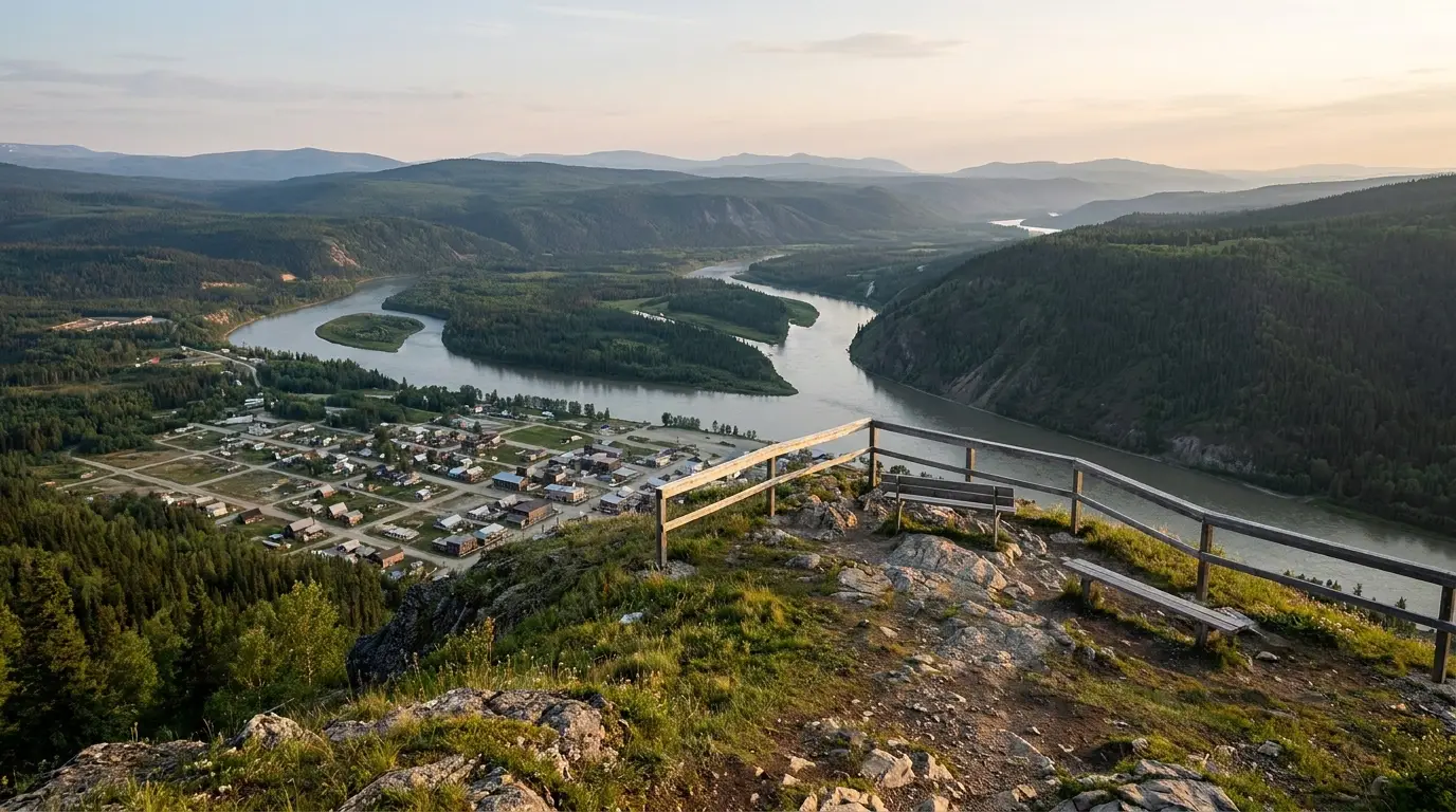
Elevated panoramic view from a bald hilltop over two rivers meeting below, a small grid-pattern town on the river flat, boreal forest and distant blue ranges in soft late-evening light, the Midnight Dome above Dawson City Yukon, ultrarealistic photograph representative of the region
The Midnight Dome, ~887 m, above Dawson City. The lookout over the confluence of the Klondike and Yukon rivers, the goldfields and the Ogilvie Mountains beyond — reached by a short winding drive (§03). Near the solstice this is where the town climbs to watch the midnight sun.

The payoff

A living Gold Rush town — Dawson City — plus the Dredge No. 4 and the Bonanza Creek goldfields, the Midnight Dome view, and a genuine frontier drive over the Top of the World Highway (§03, §04, §05).

The distance

About 530 km Whitehorse to Dawson. The last full-service fuel and food is Carmacks, near halfway; after that, plan your range and don't count on Pelly or Stewart Crossing being open (§02, §08).

The gates

The George Black ferry is the only way across the river, and the Top of the World border is seasonal with limited hours. Both can stop without notice — confirm before you plan around them (§05).

The way to think about the region — one highway, one town, and the road beyond it This guide runs north up the North Klondike Highway from Whitehorse (the Yukon's only city, full services) through Carmacks (~halfway, the last dependable fuel/food) to Dawson City at the end. Along the way are a few small communities — Pelly Crossing and Stewart Crossing — with limited seasonal services, and roadside stops like Five Finger Rapids. Dawson is the hub for the goldfields (§04) and the Midnight Dome; from there the George Black ferry (§05) crosses the river to West Dawson, the largest campground in the territory, and the start of the Top of the World Highway to Alaska. And about 40 km east of Dawson the Dempster Highway peels off toward Tombstone — a gateway noted here (§06) and covered in full by guide 045.
02 / THE NORTH KLONDIKE HIGHWAY

530 km of boreal forest, river valley, and a fuel plan

The North Klondike Highway is a good, mostly-paved road — the driving is easy. What catches people out is the distance between services. This is not a corridor where you fill up when the gauge hits a quarter; it's one where you fill up whenever you pass an open station, because the next one may be 150 km away and closed. Below is the run north with the stops that matter, told in the order you'll meet them.

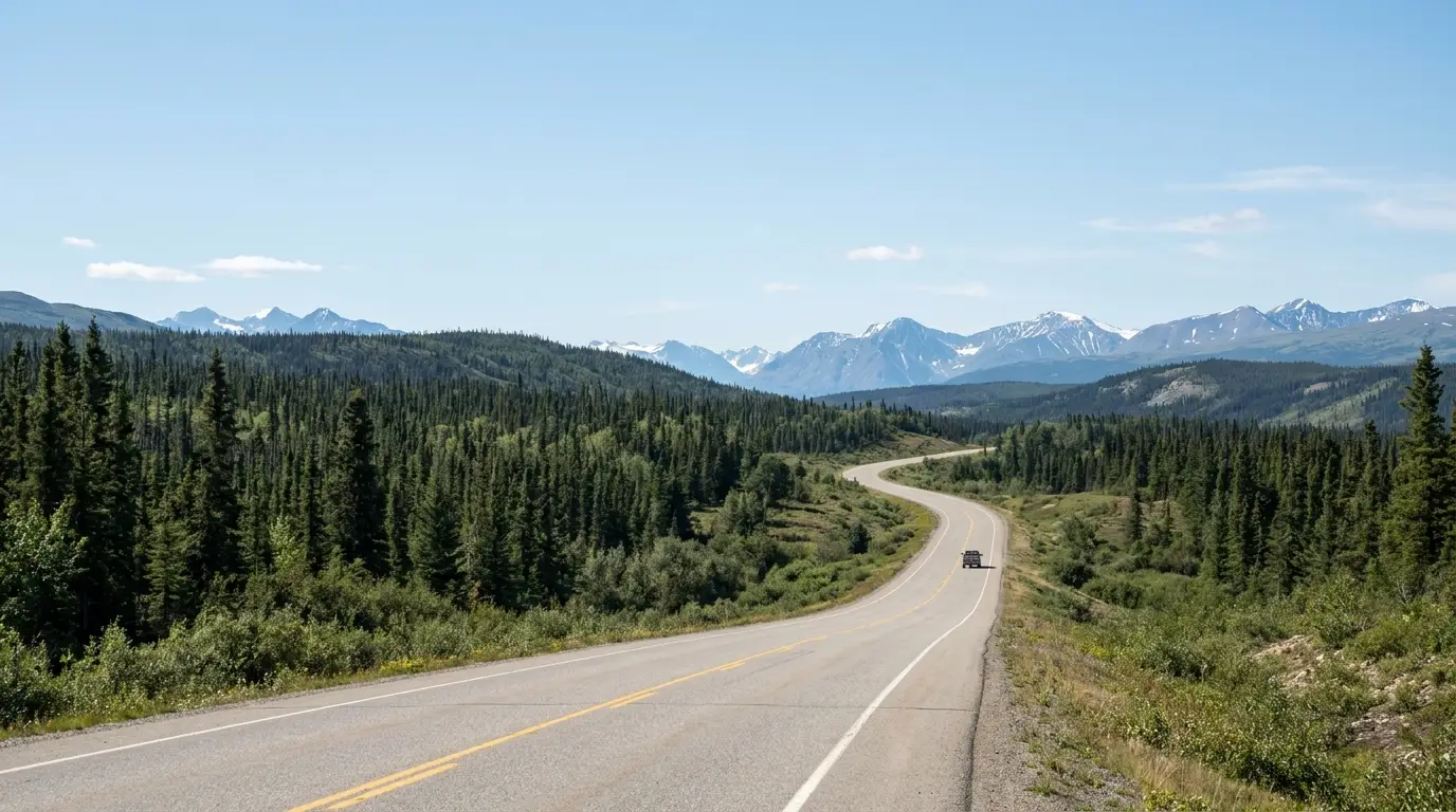
An empty two-lane highway curving through rolling boreal spruce forest and low hills under a vast pale northern sky with distant mountains, a single vehicle far ahead on a clear summer day, North Klondike Highway Yukon, ultrarealistic photograph representative of the region
The North Klondike Highway. Good pavement, big country, long gaps. The driving is easy; the discipline is fuel and daylight. Fill up in Carmacks and treat every open station after it as the one you should use.
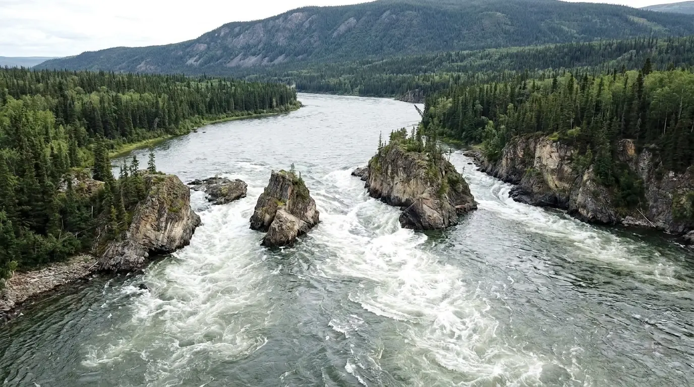
A wide northern river split into channels by four steep rock islands creating turbulent whitewater, forested banks and a distant ridge under bright overcast light, Five Finger Rapids on the Yukon River, ultrarealistic photograph representative of the region

Five Finger Rapids — the stop worth the stairs

About 24 km north of Carmacks (near Km 380), four rock islands split the Yukon River into five channels — the rapids that once forced sternwheelers to be winched through. A viewing platform sits right by the highway; a 1.4 km return trail with a long staircase and interpretive panels drops toward the water.

The Northern Tutchone name, Tthi-cho Nädezhé, means "rocks standing up in the water." A good leg-stretch and one of the classic photo stops of the drive. Carry bear spray on the trail.

Roadside viewpoint + short trailBear country — carry spray
Stop (south → north)RoughlyWhat's thereFuel / services
Braeburn
Km ~55
~1 hr N of Whitehorse The old roadhouse famous for giant cinnamon buns Reported CLOSED indefinitely (2026) — do not rely on it
Carmacks
~halfway
~180 km N of Whitehorse Village on the Yukon River; Little Salmon Carmacks First Nation; riverside boardwalk The last dependable full service — fuel, food, the Coal Mine Campground (§07, §08)
Five Finger Rapids
near Km 380
24 km N of Carmacks Viewpoint + 1.4 km stair trail to the rapids Day-use only; no services
Pelly Crossing ~2 hr N of Carmacks Selkirk First Nation community on the Pelly River; Big Jonathan House display Store + fuel, limited/seasonal — confirm hours
Stewart Crossing ~2/3 of the way Junction with the Silver Trail (Hwy 11) to Mayo & Keno; Stewart River bridge Seasonal, sparse — do not count on late fuel
Dawson City ~530 km / end The Gold Rush town, the goldfields, the ferry, the Dome (§03–§05) Full services (seasonal peaks); fuel, groceries, medical (§08)

Kilometre posts follow the highway's own markers and distances are approximate. Fuel hours at Pelly Crossing and Stewart Crossing are limited and change seasonally — treat Carmacks as your fill point and everything after it as a bonus. Confirm current openings with Travel Yukon / 511 Yukon.

🔴 The single most common Klondike-drive mistake Assuming there's a gas station "up ahead." There often isn't — or it's there and closed for the evening, or for the season. People run low between Carmacks and Dawson every summer. Fill up in Carmacks even if you don't think you need to, carry a realistic range for your rig, and if you're continuing out the Top of the World Highway or up the Dempster, remember those add long stretches with no fuel at all (§05). Range anxiety here is just good planning.
03 / DAWSON CITY

A Gold Rush town that never got tidied up

Dawson is the reward at the end of the highway, and it wears its history plainly: wooden boardwalks, false-front saloons, streets left as gravel and dirt because pavement heaves on the permafrost. The whole town is a National Historic Site, part living community and part open-air museum, and it's small enough to walk in an afternoon. Here's what's worth your time — and the honest note that most of it runs on a summer schedule.

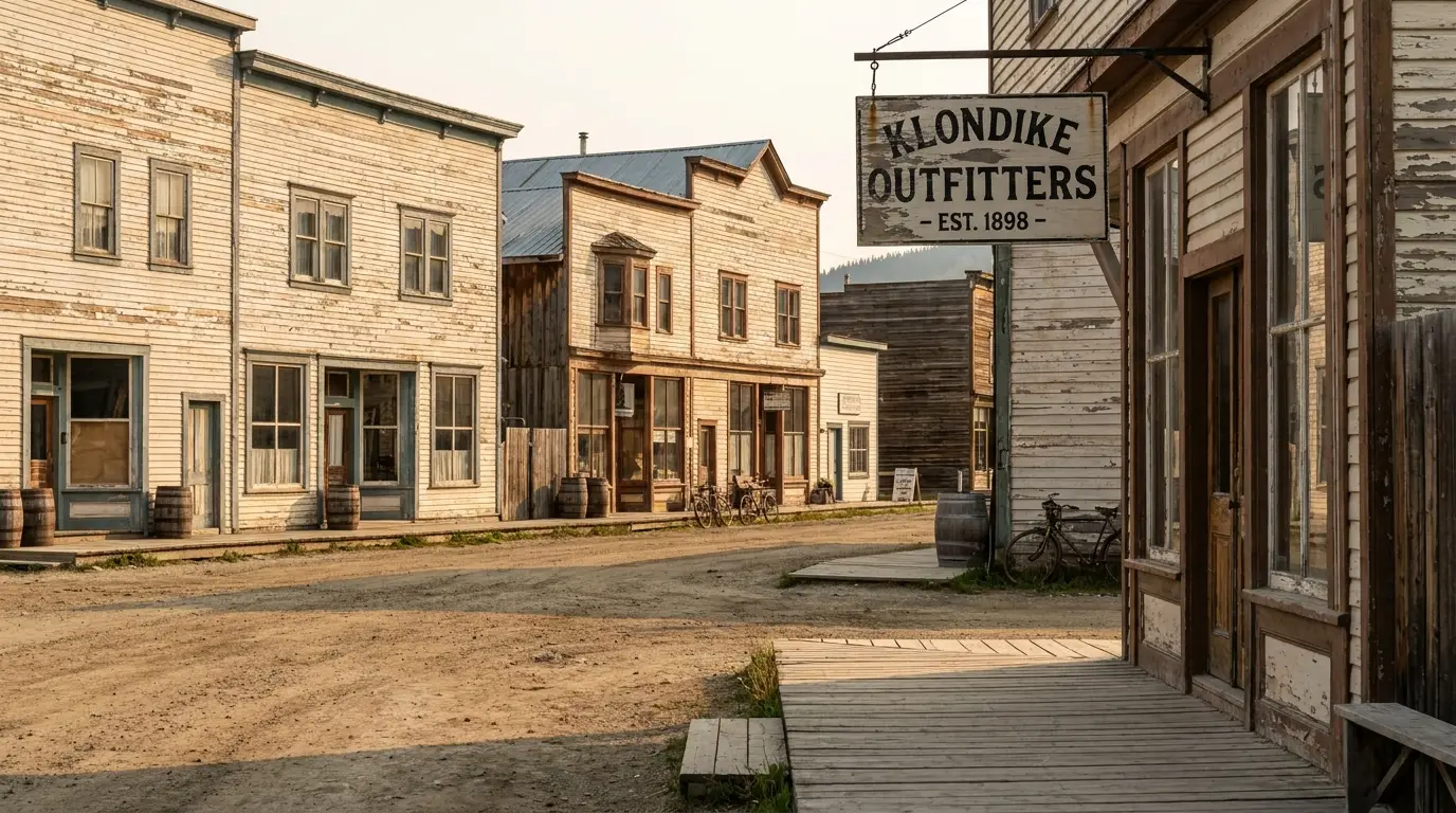
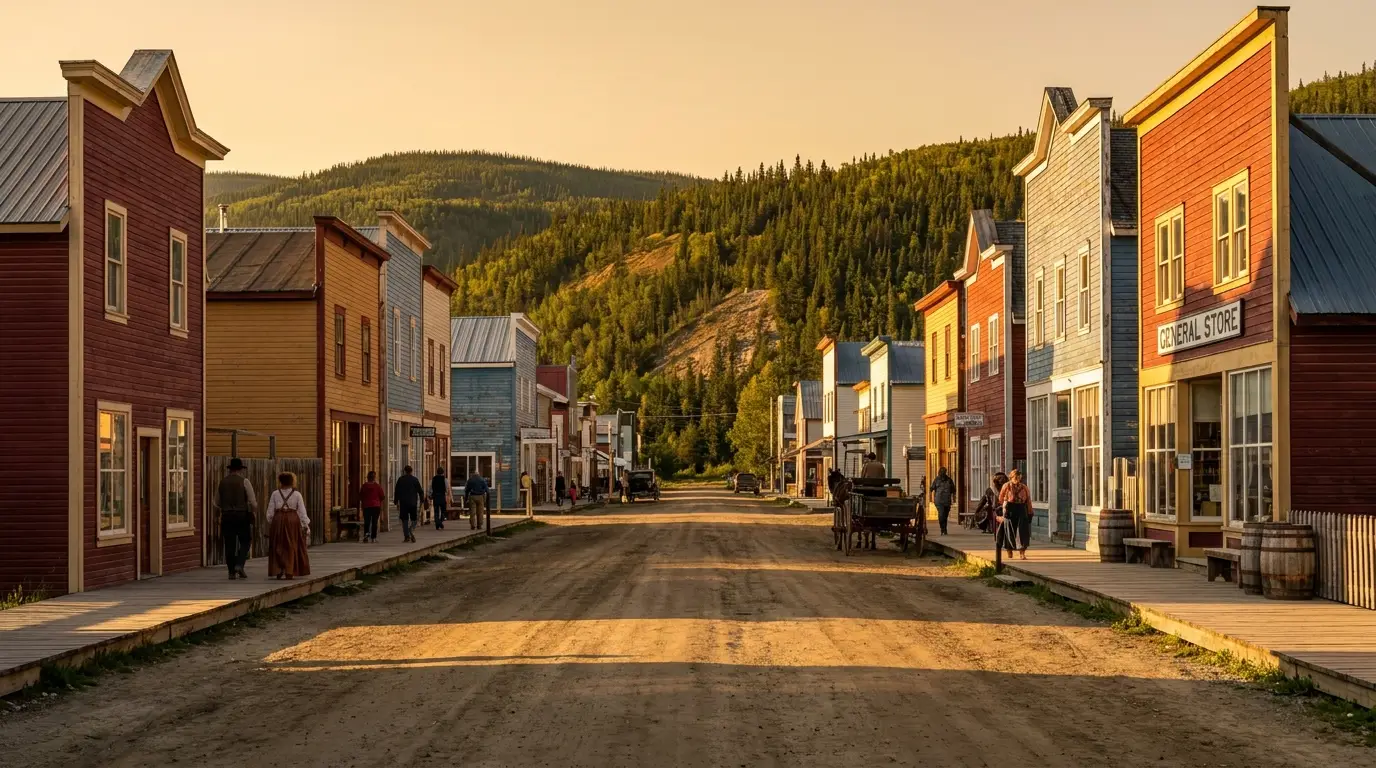
Weathered painted Victorian false-front wooden buildings with wooden sidewalks along a dusty unpaved street, a vintage storefront and hanging sign in warm daylight, historic Dawson City Yukon, ultrarealistic photograph representative of the region
Front Street, Dawson City. False-front buildings and boardwalks over unpaved streets, preserved as the Dawson Historical Complex National Historic Site. Parks Canada and the Klondike Visitors Association keep the town's Gold Rush character alive — most of it seasonally.

The historic town — Parks Canada & the KVA

  • Dawson Historical Complex — Parks Canada walking tours and restored buildings tell the 1898 story; start at the visitor centre for current tour times
  • S.S. Keno National Historic Site — a restored wood-hulled sternwheeler on the waterfront, from the era when riverboats were the highway
  • Robert Service & Jack London cabins — the writers who made the Klondike a legend; small seasonal interpretive stops uphill from downtown
  • Diamond Tooth Gerties — Canada's oldest gambling hall, run by the Klondike Visitors Association, with nightly cancan shows (§08)

Site hours and tour schedules are seasonal and set each year — confirm on parks.canada.ca/klondike and the KVA site before you plan a day around them.

The Midnight Dome & the Sourtoe

Drive the winding Dome Road (about 10–15 minutes) to the Midnight Dome lookout, ~887 m, for the panorama over the Klondike–Yukon confluence and the goldfields. Near the solstice it's the classic midnight-sun viewpoint. There's a hiking route up too, but it's steep.

And the town's most notorious tradition: at the Downtown Hotel's Sourdough Saloon, the Sourtoe Cocktail drops a preserved human toe into your drink — "you can drink it fast or drink it slow, but your lips have gotta touch the toe." Seasonal, real, and exactly as strange as it sounds (§08).

Dome Rd view over the confluenceSourtoe: seasonal, at the Downtown Hotel
A note of respect — this is First Nation home ground Dawson sits on the traditional territory of the Tr'ondëk Hwëch'in, whose people lived and fished at the mouth of the Klondike long before 1896 and were displaced by the stampede. The Dänojà Zho Cultural Centre in town tells that side of the story, and it's the one the Gold Rush myth usually skips. Treat the goldfields, the fish camps and the land with that in mind.
04 / THE GOLDFIELDS

Bonanza Creek, the dredge, and where it all began

Just south of town, Bonanza Creek Road runs up the valley where the whole thing started — past a century of dredge tailings and working placer claims to the spot where three men staked the discovery claim in 1896. It's the most concentrated dose of Gold Rush history on the trip, and you can still pan for colour yourself. It's also an active mining district, so the etiquette matters: stay on the public and interpretive ground, off the working claims.

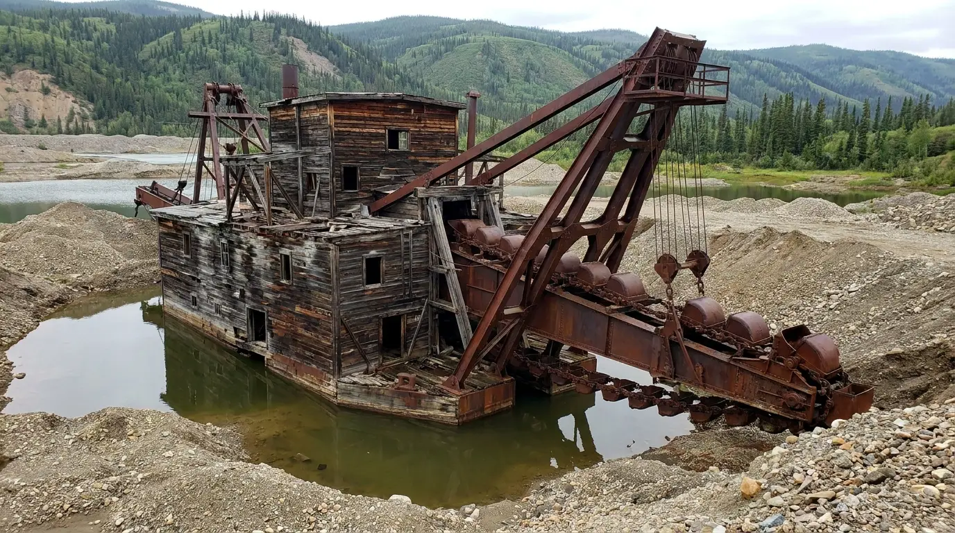
A massive weathered wooden bucketline gold dredge sitting in a pond of its own tailings in a wide river valley, rusted steel buckets and gantry with spruce-covered hills behind under soft daylight, historic Klondike goldfields Yukon, ultrarealistic photograph representative of the region
Dredge No. 4, on Bonanza Creek. A 1912 bucketline dredge — the largest wooden-hulled bucket dredge in North America — that chewed up the creek valleys for gold until around 1959. Now a Parks Canada National Historic Site with seasonal guided tours.
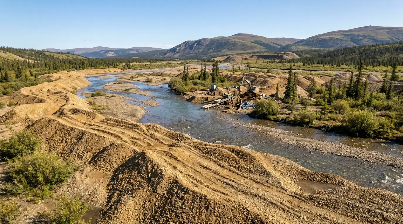
Long winding rows of gravel dredge tailing piles snaking through a broad creek valley in the goldfields with sparse spruce and willow, a small creek and a working placer claim in bright northern daylight, Bonanza Creek Yukon, ultrarealistic photograph representative of the region

Up Bonanza Creek Road

  • Dredge No. 4 NHS — the star of the valley; Parks Canada tours in season. Confirm current open dates, tour times and admission before you drive out
  • Discovery Claim NHS — a short self-guided interpretive walk at the spot where George Carmack, Skookum Jim (Keish) and Dawson Charlie (Kaa Goox) staked the 1896 claim near the old Grand Forks townsite
  • Free public gold panning at Claim No. 6 — the Klondike Visitors Association keeps a claim open for anyone to try their luck; bring a pan or rent one in town
  • The tailings themselves — the endless gravel ridges are dredge spoil, a landscape rewritten by mining you can read from the road

Much of this valley is active private placer mining. Stay on public/interpretive areas and off working claims — and confirm Dredge No. 4 hours and any panning details for the season.

What the goldfields really are It's tempting to read the tailings as scenery. They're the physical record of an industry that turned an entire river valley inside out — first by hand, then by hydraulic monitors, then by the giant dredges like No. 4 that floated in their own ponds and ate the ground beneath them. Placer mining continues here today. The interpretive sites are the safe, legal, fascinating way in; the working claims are private property and often genuinely hazardous. Look, learn, pan at Claim No. 6 — and leave the rest to the miners.
05 / THE FERRY & THE TOP OF THE WORLD — READ BEFORE YOU DRIVE

A free ferry, a ridge road, and a border that keeps banker's hours

West of Dawson the map runs out of pavement and, for part of the year, out of road entirely. To go on you first take the free George Black ferry across the Yukon River — the only crossing — and then climb onto the Top of the World Highway, a gravel road that follows the very tops of the ridges to the northernmost land border between Canada and the United States. It's one of the great drives in the North. It's also seasonal, serviceless and gated by a border with strict hours, so here's the honest version before you commit.

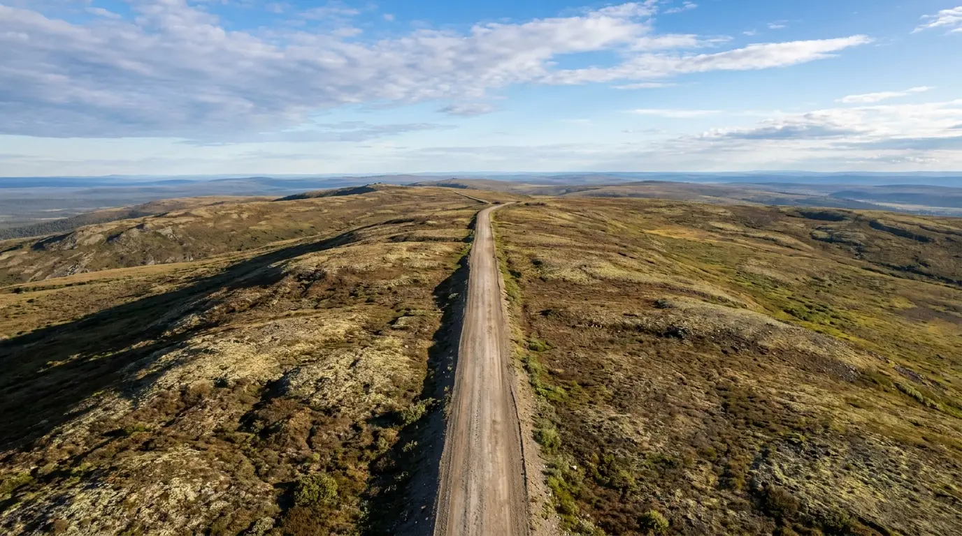
A gravel highway running straight along the crest of a treeless rolling ridge with tundra hills stretching to the horizon in every direction under a huge sky, no other vehicles in clear summer light, Top of the World Highway Yukon, ultrarealistic photograph representative of the region
The Top of the World Highway. Yukon Highway 9, running the ridgelines west from Dawson toward Alaska — mostly gravel, open only in summer, and named for exactly the feeling of driving along the roofs of the hills. There is no fuel and no service on the ridge; you carry everything.

The George Black ferry — the gate you can't skip

There is no bridge. The free Yukon government vehicle ferry crosses the river day and night through summer — reported roughly mid-May to mid-October — carrying you to West Dawson, the Yukon River Campground and the foot of the Top of the World Highway.

It stops for high water, break-up, freeze-up and mechanical outages, and lines can be long at peak times. When it's down, everything on the west bank — including that campground and the road to Alaska — is cut off. Confirm it's running before you plan around it.

Free · day & night in seasonNo bridge — ferry or nothing

The border — Poker Creek / Little Gold Creek

The road tops out at the northernmost land border between Canada and the US. It is seasonal — open roughly late May to mid-September — and keeps limited daytime hours (reported ~8 a.m.–8 p.m. Alaska / 9 a.m.–9 p.m. Pacific) with no after-hours processing and no exceptions.

Note the time-zone change at the line. Arrive after closing and you wait until morning. Nearest services are back in Dawson on the Canadian side and Chicken on the Alaska side — both a long way off. Confirm the season and hours with CBP/CBSA before you go.

Limited hours · no after-hoursSeason & hours: verify
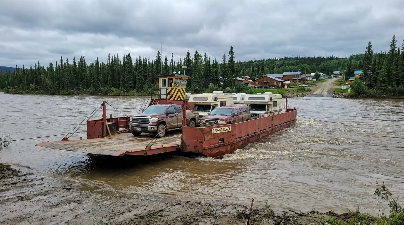
A small open vehicle ferry loaded with a couple of trucks and campervans crossing a wide fast brown river toward a forested far bank and a small town under overcast northern light, the George Black ferry on the Yukon River at Dawson City, ultrarealistic photograph representative of the region
The George Black ferry crossing the Yukon River. Free, frequent in season, and the only way to the west bank. It also feeds the Yukon River Campground — reported the largest in the territory — so a night there depends entirely on the ferry running (§07).
🔴 If you're driving the Top of the World — the non-negotiables Fuel up in Dawson — there is none on the ridge and none until Chicken, Alaska, well beyond the border. Carry at least one good full-size spare (two is smart) and know how to change it; the gravel throws stones and the shoulders can be soft. Cross the border well before closing and account for the time-zone change; there is no after-hours processing. Check the weather — the ridge is exposed and fog, rain or early snow can turn the gravel greasy fast. And confirm both the ferry and the border season are current before you leave town. If any of that doesn't line up, this is a road to save for another day, not to improvise.
06 / SAFETY — READ THIS FIRST

Bears, gravel, fuel, and no signal

Nothing here is exotic, but the margins are thinner than most travellers are used to. Four things account for most of what goes wrong on the Klondike run and the roads beyond it: this is grizzly and black-bear country; the gravel roads punish the unprepared; the fuel and service gaps are real; and for long stretches there is simply no cell signal and no quick help. Plan for all four and the trip is safe and superb.

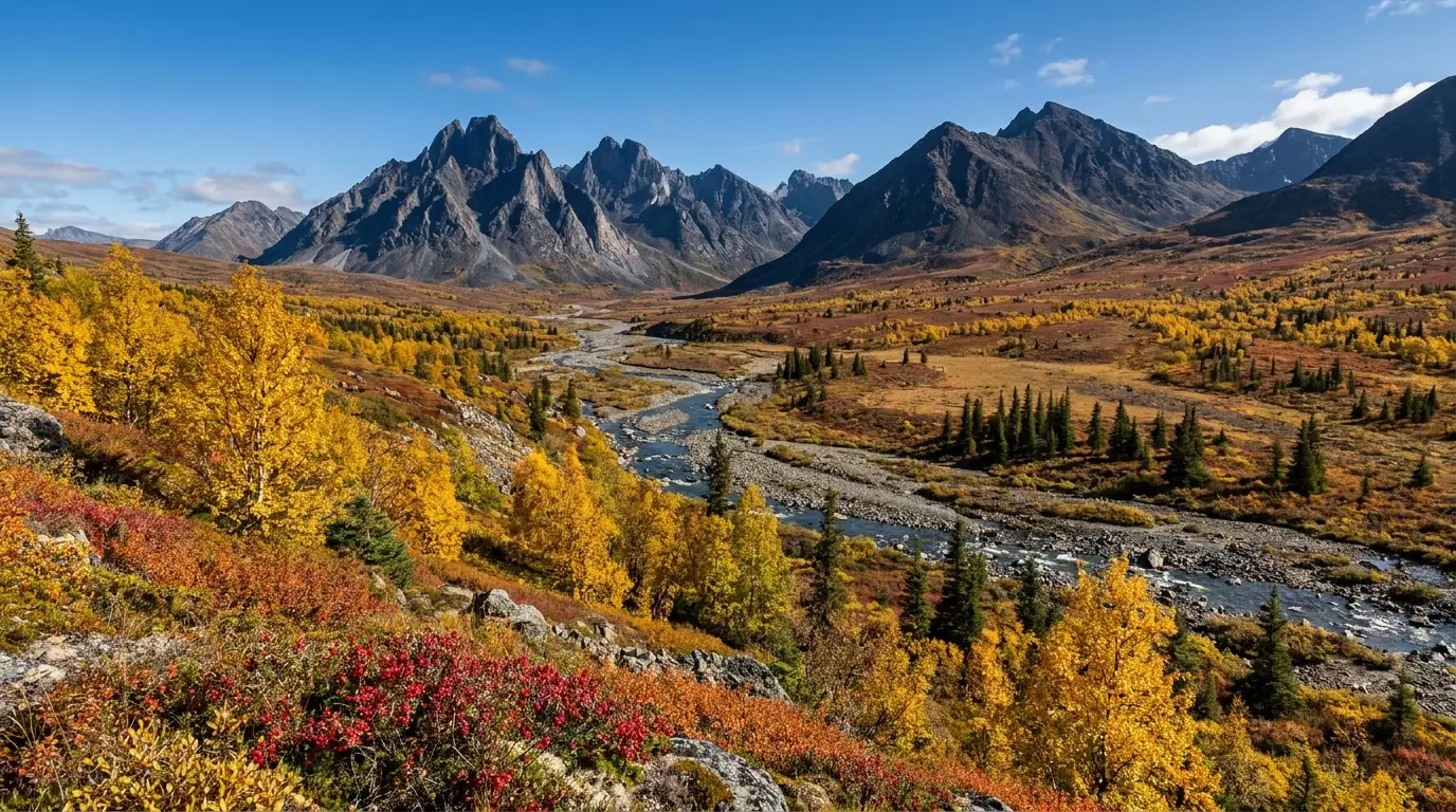
Sweeping open sub-arctic tundra glowing gold and red with autumn colour beneath jagged dark granite peaks, scattered spruce and a winding valley in crisp clear September light, Tombstone country Yukon, ultrarealistic photograph representative of the region
The Tombstone gateway, ~40 km east of Dawson up the Dempster. Jagged black peaks and open tundra — grizzly and caribou country, gravel-road country. Guide 045 covers the Dempster and Tombstone in full; here it's the reminder that the wild starts right at the edge of the goldfields.

Bears — grizzly and black

This is grizzly and black-bear country, unlike the black-bear-only ranges further south. Carry bear spray and know how to use it, make noise on trails like the Five Finger Rapids staircase, and keep a clean camp — store food and scented items in a hard vehicle or locker, never in a tent.

If you meet a bear: don't run. Speak calmly, back away, give it room. Grizzly and black-bear responses differ — read up on the distinction, and confirm current guidance with Yukon Conservation Officers or the ranger/park staff before a backcountry night.

Grizzlies present — spray + clean camp

Gravel roads — tires and speed

  • Carry a good full-size spare (two for the Top of the World or the Dempster) and the tools and know-how to change it
  • Slow down on washboard, soft shoulders and blind crests; most gravel-road trouble is speed
  • Expect stone chips and dust — hang back from other vehicles, and a headlight/windshield can take a hit
  • Rain changes everything — gravel and clay turn greasy fast; ease off and wait out the worst
🔴 The fuel-and-signal rule — plan as if there's no help coming Between Carmacks and Dawson, and on the Top of the World and Dempster, you can go a long way with no open fuel and no cell signal. Treat every leg as self-sufficient: full tank, real spare, water, warm layers, a basic recovery and first-aid kit, and someone who knows your route and expected arrival. A satellite messenger (inReach/SPOT) is genuinely worth it up here — it's the difference between an inconvenience and an emergency when something breaks where the bars don't reach.

Weather, cold & the midnight sun

Summer days are long and can be warm, but this is the sub-Arctic — nights get cold, and weather turns fast, especially up high on the Top of the World or toward Tombstone. Pack real layers even in July. Near the solstice the midnight sun means near-24-hour daylight; a sleep mask helps, and don't let endless light trick you into driving exhausted.

Wildlife on the road

Bears, moose and — near Tombstone — caribou use the highway and its verges. A collision with a moose can be fatal. Slow down at dawn, dusk and in the long twilight, scan the shoulders, and never assume an animal will get out of the way. Give any wildlife a wide berth and never approach for a photo.

07 / THE CAMPING STRATEGY

Government campgrounds up the highway, and the ferry-only one at Dawson

Camping this corridor is simple and good. Yukon Government campgrounds are strung along the North Klondike Highway at comfortable intervals — small, quiet, inexpensive, mostly first-come, with outhouses and firewood and no hookups. Nearest Dawson is the Klondike River Campground; across the river by ferry is the Yukon River Campground, reported the largest in the territory. For full hookups and showers, the private RV parks at Dawson and the Coal Mine at Carmacks fill the gap. Here's the run.

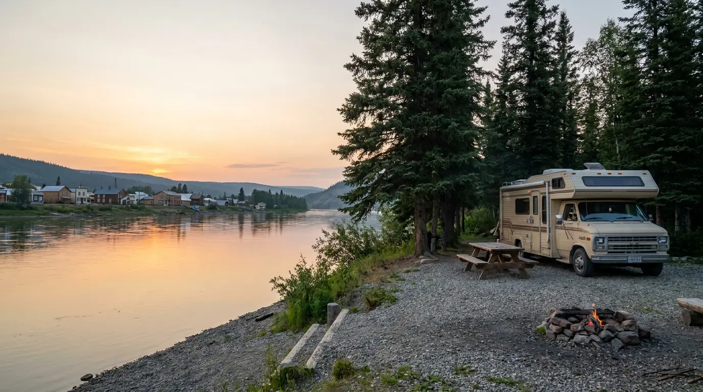
A quiet forested riverside campsite with a campervan and picnic table among spruce trees on the bank of a broad northern river, calm water and a distant town across the river in soft golden evening light, Yukon River Campground Dawson City, ultrarealistic photograph representative of the region
The Yukon River Campground, across from Dawson. Reached only by the free George Black ferry, and reported the largest campground in the Yukon. A river beach, the sternwheeler graveyard nearby, and the town lights across the water — but your night there depends entirely on the ferry running (§05).
CampgroundWhere · managerSites*TypeBookingNotes
Twin Lakes N Klondike Hwy ~Km 55 · Yukon Parks confirm Government First-come Lakeside, boat launch; a first stop out of Whitehorse
Fox Lake N Klondike Hwy ~Km 248 · Yukon Parks confirm Government First-come On Fox Lake, boat launch
Tatchun Creek N Klondike Hwy ~Km 382 · Yukon Parks 12 Government First-come (no reservable sites) Creekside, ~24 km N of Carmacks
Tatchun Lake Frenchman Rd (off N Klondike) · Yukon Parks confirm Government First-come ~9 km in on gravel; boat launch, good fishing
Moose Creek N Klondike Hwy ~Km 559 · Yukon Parks 36 Government First-come Interpretive trails to the Stewart River; ~4 pull-throughs
Ethel Lake Ethel Lake Rd (long gravel spur) · Yukon Parks confirm Government First-come Remote, quiet; rough access road — verify before towing in
Klondike River Rock Creek Rd ~Km 697 · Yukon Parks 35 Government Mixed (confirm) ~20 km SE of Dawson; boardwalk trail through un-dredged old growth
Yukon River West Dawson · via George Black ferry · Yukon Parks ~98–102 Government Mixed (confirm) Ferry-access only; reported largest in the Yukon; river beach
Tombstone Mountain Dempster Hwy ~Km 71.5 · Yukon Parks confirm Government Mixed (confirm) On the Dempster (gravel), not the Klondike; base for Tombstone TP (guide 045)
Dawson City RV Park Km 712 Klondike Hwy · private confirm Private Reservable Full hookups, laundry, wash, on-site fuel/store (§08)
Bonanza Gold ~1.5 km S of Dawson · private confirm Private Reservable Motel + full-service RV park, WiFi (§08)

*Site counts, seasons, fees, water and reservation status are compiled from Yukon Parks, explorenorth.com and travel listings and vary by source and season. Yukon Government campgrounds are simple — outhouses, firewood, usually untreated well water, no hookups — and charge a flat nightly camping-permit fee we did not confirm for 2026 (left as "confirm"). Check current fees, seasons and any reservable sites on yukon.ca before you rely on them.

How the Yukon government system works

Most are first-come, self-register — you find a site, fill out the envelope, and pay the flat nightly camping-permit fee. Firewood is usually provided, water is typically an untreated hand-pump well (treat or boil it), and toilets are clean outhouses. No power, no showers, no dump stations at most. It's basic, cheap and often beautiful.

Yukon has added a reservation system for some popular campgrounds — confirm which sites are reservable and the current fee on yukon.ca before counting on a spot.

When to use the private parks

If you need hookups, laundry, showers, a dump station or WiFi, use the private options: the Dawson City RV Park and Bonanza Gold at Dawson, or the Coal Mine Campground & Canteen at Carmacks (whose canteen burgers are locally famous). These also solve resupply — the Dawson RV park has fuel, propane and a store on site (§08).

And remember the Yukon River Campground is a government site but ferry-access only — plan it around the ferry, not the other way round.

08 / TOWNS & SERVICES

Carmacks is your fill point. Dawson has it all — seasonally.

Services on this corridor cluster at two ends and thin dramatically in between. Whitehorse behind you is the only real city; Carmacks is the dependable mid-point; Dawson at the end has everything a traveller needs, though much of it runs on a summer schedule. Pelly Crossing and Stewart Crossing are small and seasonal. Plan resupply around that shape — and remember there is no fuel on the ferry crossing, the Top of the World or the Dempster.

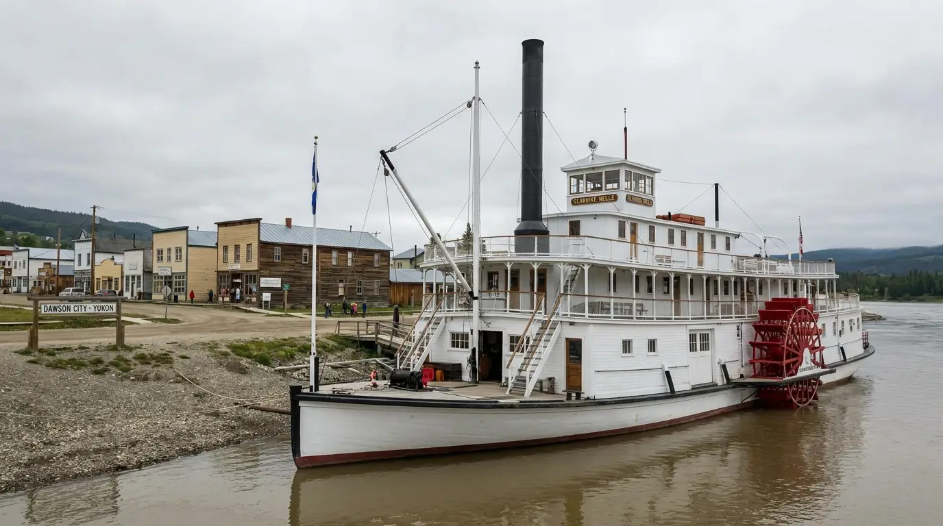
A restored white wooden paddlewheel sternwheeler riverboat with a tall smokestack moored on a broad river bank beside a small northern town, calm brown river water under an overcast summer sky, Dawson City waterfront Yukon, ultrarealistic photograph representative of the region
The Dawson City waterfront and the S.S. Keno. Dawson is the full-service end of the trip — fuel, groceries, a health centre, outfitters and the historic sites — but many businesses are summer-only, so confirm hours before you rely on them out of season.

Carmacks & the mid-highway

  • Carmacks — the last dependable full-service stop: fuel, food, a store, and the riverside Coal Mine Campground & Canteen (famous burgers). Fill up here, always
  • Pelly Crossing — a Selkirk First Nation community with a store, fuel and the Big Jonathan House heritage display; limited/seasonal hours
  • Stewart Crossing — a junction with the Silver Trail to Mayo and Keno; seasonal, sparse fuel — don't count on it late in the day
  • Braeburn — the famous cinnamon-bun roadhouse is reported closed indefinitely (2026); treat it as a rest area, not a service

Dawson City — the full-service end

  • Fuel, propane & groceries — stations and a grocery in town; the Dawson City RV Park (Km 712) also has fuel, diesel, propane, a store and a car/RV wash
  • Medical — Dawson has a community health centre; the nearest hospital is in Whitehorse, a long way back. Plan accordingly
  • Lodging — historic hotels and cabins: the Downtown Hotel (Sourtoe), Bombay Peggy's inn & pub, Klondike Kate's cabins, plus the RV parks
  • Fuel before the ferry — there is no fuel across the river, on the Top of the World or up the Dempster. Top up in town first

Store, fuel and site hours are seasonal and change — confirm current openings, especially outside July–August, before you rely on them.

Operators worth knowing — links, not prices All of the following are real, currently-trading businesses whose own websites we resolved. Seasons, pricing and menus change annually, so we link rather than quote.

Dawson City

  • Diamond Tooth Gerties (4th & Queen) — Canada's oldest gambling hall, run by the Klondike Visitors Association; cancan shows, gaming, seasonal
  • The Downtown Hotel (2nd Ave) — rooms and the Sourdough Saloon, home of the Sourtoe Cocktail
  • Bombay Peggy's (2nd & Princess) — a restored Gold Rush inn and pub, nine Victorian-styled rooms
  • Klondike Kate's Cabins (331 King St) — locally owned cabins in the heart of town, May–Sept
  • The Klondike Experience (Husky Bus) — scheduled summer bus Whitehorse↔Dawson, plus Tombstone and city tours

On the highway

  • Coal Mine Campground & Canteen (Km 359, Carmacks) — riverside sites, cabins and a canteen locally famous for burgers; seasonal
  • Dawson City RV Park & Campground (Km 712) — family-run full-service park with fuel, propane, store and wash
  • Bonanza Gold Motel & RV Park (~1.5 km S of Dawson) — motel rooms year-round and a full-service RV park

We confirmed no operator pricing — any number you see elsewhere should come from the operator. Phone numbers and hours change; check the current website before you rely on them.

Getting there Most travellers reach the Klondike overland from Whitehorse (the Yukon's capital, with the main airport, ERIK Nielsen International, YXY), driving the North Klondike Highway. Dawson has a small airport (YDA) with limited service, and the Klondike Experience / Husky Bus runs a scheduled summer coach between Whitehorse and Dawson for those without a vehicle. If you're continuing to Alaska, it's the ferry and the Top of the World Highway (§05) in season, or back down and around via the Alaska Highway. Confirm current drive times, bus schedules and any road/ferry closures with 511 Yukon and the operators before you commit.
09 / TIMING

When to go — the season is short and the gates decide it

The Klondike has one broad good season and a couple of special weeks inside it. The constraint is the same one that runs the whole trip: the ferry and the Top of the World Highway are summer-only, and the smaller services along the corridor open and close with them. Come between June and mid-September and everything works; come at the edges and you're gambling on the ferry, the border and the fuel stops. Here's the honest calendar.

Season by season, straight

  • Winter–spring (Oct–May) — a different, serious trip. The ferry stops, the Top of the World closes, and cold and short daylight run everything. Beautiful and doable with real winter preparation — but not this guide's road trip
  • Break-up (roughly April–May) — the awkward gap. The ice goes out and the ferry can't yet run reliably; West Dawson and the Top of the World may be unreachable. Confirm before you count on crossing
  • Solstice / late June — the midnight sun. Near-24-hour daylight; the Midnight Dome is the place to watch it. Ferry and (usually) the border are open; services are ramping up
  • Peak summer (July–mid-August) — everything open. All services running, the border and ferry reliable, warm long days. Busiest, and the safest window for the full loop including the Top of the World. Mid-August brings Discovery Days in Dawson
  • Late August–early September — the tundra gold. The fall colour, especially toward Tombstone, is spectacular and the crowds thin — but the border and ferry season is closing and freeze-up is coming. Watch the dates

Access & crowd strategy

  • Confirm the ferry and border dates first — they define whether the west-bank half of the trip is even possible. Everything else bends around them
  • July–August is the sure thing; June and September are lovelier and quieter but riskier at the edges of the season
  • Weekdays and shoulder weeks ease the ferry lines and the campground pressure; Discovery Days weekend fills Dawson
  • Fall colour shifts a week or two year to year — watch Yukon fall-colour reports rather than trusting a fixed date, and don't leave the Top of the World or Dempster too late
The one-paragraph answer Go in July or the first half of August for the sure thing — every service open, the ferry and border reliable, and the full loop over the Top of the World on the table. Late June if you want the midnight sun; late August into early September if you want the tundra gold and can watch the closing dates. Whatever you pick: confirm the ferry and the border season before you leave, fill up in Carmacks, carry a real spare and a satellite messenger, and don't let the endless daylight talk you into driving tired.
10 / THE SHAPE OF THE TRIP

Five days, built around the fuel gaps and the ferry

One workable shape, not the only one. It runs north at a human pace, banks the fuel and the miles honestly, and saves the ferry-and-border day for when you've confirmed both are running. Adjust freely — but keep the fill-up in Carmacks non-negotiable, and don't commit to the Top of the World until the ferry and the border are confirmed open.

01

Day 1 — Whitehorse to Carmacks

  1. Stock up and fuel in Whitehorse — the last city. Groceries, propane, a spare check.
  2. Drive ~180 km to Carmacks; Braeburn is closed, so it's a straight run.
  3. Camp at the Coal Mine Campground (burgers) or a nearby government site; walk the riverfront.
  4. Fill the tank in Carmacks before you sleep — tomorrow the gaps begin.
Fuel + resupplySleep at Carmacks
02

Day 2 — Carmacks to Dawson

  1. Stop at Five Finger Rapids (the stair trail) north of Carmacks.
  2. Top up at Pelly or Stewart Crossing if they're open — don't rely on it.
  3. Watch Gravel Lake for swans in migration; roll into Dawson by evening.
  4. Camp at the Klondike River Campground or a Dawson RV park; walk Front Street.
Long fuel gap — plan itArrive Dawson
03

Day 3 — Dawson & the Midnight Dome

  1. Do the historic town: Parks Canada walking tour, S.S. Keno, the Robert Service / Jack London cabins.
  2. Drive the Dome Road for the confluence view; near solstice, come back for the midnight sun.
  3. Evening at Diamond Tooth Gerties (cancan) or the Sourtoe at the Downtown Hotel — if you dare.
Town dayConfirm site hours
04

Day 4 — The goldfields

  1. Up Bonanza Creek Road: tour Dredge No. 4 (confirm times), walk the Discovery Claim.
  2. Try your luck panning at the KVA's Claim No. 6 — free, bring or rent a pan.
  3. Read the tailings for what mining did to the valley; stay off the working claims.
  4. Back to town; if you're crossing tomorrow, fuel up in Dawson tonight.
Gold Rush historyFuel before the ferry
05

Day 5 — The Top of the World (or the Dome + home)

  1. Only if the ferry and border are confirmed open: take the George Black ferry and drive the Top of the World Highway to Alaska — cross the border well before closing.
  2. No spare, no fuel margin, or the gates are down? Skip it — it's not a road to improvise.
  3. Otherwise, camp at the ferry-access Yukon River Campground, or turn for home down the highway.
Confirm ferry + border firstGravel, no fuel, hard hours
+

The Tombstone variant

  1. Instead of (or before) the Top of the World, turn up the Dempster Highway to Tombstone Territorial Park (~1.5 hr to the interpretive centre).
  2. Base at the Tombstone Mountain Campground; day-hike the tundra. Grizzly country — travel smart.
  3. It's gravel with no fuel for a long way — see guide 045 for the full Dempster.
  4. Carry two spares and a satellite messenger; the Dempster is a bigger commitment than it looks.
See guide 045 for the DempsterGravel, grizzly, no fuel
11 / TRIP-READY

The departure check

Run it before you leave. Tap each item as it's done — these are the ten things specific to the Klondike run that a general road-trip habit will skip. Most come back to two facts: the fuel and service gaps are real, and the ferry and the border can stop your plan cold if you haven't checked them.

0 / 10 confirmed — the fuel plan sets the schedule.
12 / QUICK ANSWERS

Asked at every Dawson visitor centre

How far is Whitehorse to Dawson, and where's the fuel?
About 530 km, roughly 6 hours of steady driving up the North Klondike Highway. The last dependable full-service fuel and food is Carmacks, near halfway; beyond it, fuel at Pelly Crossing and Stewart Crossing is limited and seasonal. Braeburn Lodge (Km 55) is reported closed indefinitely as of 2026 — don't plan on it. Fill up in Carmacks and top up whenever you pass an open station; carry more range than you think you need.
Do I really need the ferry to cross the river at Dawson?
Yes — there's no bridge. The free George Black ferry is the only vehicle crossing, and the only way to the Yukon River Campground, West Dawson and the Top of the World Highway. It runs day and night through summer (reported roughly mid-May to mid-October) but stops for high water, break-up, freeze-up and mechanical outages. When it's down, the west bank is cut off — so confirm it's running before you plan a night across the river or a drive to Alaska.
Is the Top of the World Highway paved, and what are the border hours?
Mostly gravel, with a short paved section out of Dawson, and it's a seasonal road (roughly late May–mid September, closed in winter). It runs the ridgelines to the Poker Creek / Little Gold Creek border, which keeps limited daytime hours (reported ~8 a.m.–8 p.m. Alaska / 9 a.m.–9 p.m. Pacific) with no after-hours processing, and there's a time-zone change at the line. No fuel on the ridge; you cross the ferry first. Confirm the season and hours with CBP/CBSA before you commit.
What's actually worth seeing in Dawson?
The whole town — false-front saloons and boardwalks on dirt streets, all a National Historic Site. See the S.S. Keno sternwheeler, take a Parks Canada walking tour, visit the Robert Service and Jack London cabins, drive the Midnight Dome for the confluence view, catch a cancan show at Diamond Tooth Gerties, and — if you dare — do the Sourtoe Cocktail at the Downtown Hotel. The Dänojà Zho Cultural Centre tells the Tr'ondëk Hwëch'in side. Most sites are seasonal; confirm hours.
Can I see the goldfields and pan for gold?
Yes. Bonanza Creek Road runs up the valley where the 1896 strike began, past Dredge No. 4 (a Parks Canada National Historic Site with seasonal tours) to the Discovery Claim. The Klondike Visitors Association keeps free public gold panning at Claim No. 6 — bring or rent a pan. Much of the valley is active private placer mining, so stay on the public and interpretive areas and off working claims. Confirm Dredge No. 4 tour times and panning details for the season.
Where should I camp?
Yukon Government campgrounds line the highway — Twin Lakes, Fox Lake, Tatchun Creek, Moose Creek and, nearest Dawson, the Klondike River Campground. Across the river by ferry is the Yukon River Campground, reported the largest in the territory. These are simple: outhouses, firewood, usually untreated well water, no hookups, mostly first-come. For full hookups and showers use the private RV parks at Dawson or the Coal Mine at Carmacks. Confirm fees, seasons and any reservable sites on yukon.ca.
How do I handle the gravel roads?
Slow down and carry a real full-size spare (two for the Top of the World or the Dempster). Gravel throws stones — hang back from other vehicles, expect chips and dust, and know that rain turns gravel and clay greasy fast. Watch for soft shoulders and washboard on blind crests. And remember there's no fuel on the ferry crossing, the Top of the World or the Dempster — top up in Dawson first, and treat these as self-sufficient legs.
Is this bear country, and how careful do I need to be?
Yes — grizzly and black bear, unlike ranges further south that only have black bears. Carry bear spray and know how to use it, make noise on trails, and keep a clean camp: food in a hard vehicle or locker, never a tent. If you meet one, don't run — speak calmly, back away, give it room. Grizzly and black-bear responses differ, so read up on the distinction and confirm current guidance with Yukon Conservation Officers or park staff before a backcountry night.
When's the best time to go, in one sentence?
July or the first half of August for the sure thing — every service open and the ferry and border reliable — with late June for the midnight sun and late August–early September for the tundra gold if you watch the closing dates. All of it needs the ferry and the Top of the World season to be open (roughly June–mid September). Winter is a different, serious trip: the ferry stops and the border road closes.
What about Tombstone and the Dempster?
The Dempster Highway leaves the Klondike Highway about 40 km east of Dawson and climbs into Tombstone Territorial Park — jagged peaks, open tundra, and the base Tombstone Mountain Campground at ~Km 71.5 (note: it's on the Dempster gravel, not the Klondike). It's a gateway noted here; the full Dempster — a serious gravel commitment with a huge fuel gap and grizzly country — is covered by guide 045. If you go, carry two spares, extra fuel range and a satellite messenger.
13 / WHAT WE COULD NOT CONFIRM

The honest gaps, all in one place

Every guide has these; most don't print them. Northern services and government campgrounds run on seasonal, weather-dependent schedules that reset every year, and the two gates that decide this trip — the ferry and the border — change without notice. So more here is "confirm before you go" than we'd like, and we've flagged it in place. Everything below was compiled 22 July 2026 and should be re-checked against the linked official source before you rely on it.

Why this section exists Anyone can write a guide that sounds certain. The hard part is knowing which numbers are real — and on a road where the fuel stops keep banker's hours, the campground fees reset each season, the ferry is the only way across a river with no bridge, and the border to Alaska closes at night and for winter, plenty of them need a same-week check. The null is the product. "Fill up in Carmacks" and "confirm the ferry is running before you plan the west bank" are usable instructions. A confident wrong answer here costs a night stranded at a closed gate — or a long walk for fuel where there's no signal to call for it.
🔒

The printable field guide

Everything above, condensed into a print-ready PDF built for the glovebox — for a drive where the fuel stops keep banker's hours, the only river crossing is a ferry, and the road to Alaska closes at night. The fuel-gap plan with the stops in order, Five Finger Rapids and the goldfields, Dredge No. 4 and Bonanza Creek, the Midnight Dome, the George Black ferry and the Top of the World border decoded, the corridor campgrounds, the Tombstone gateway, the grizzly and gravel-road cautions, and the honest list of what nobody could confirm — on paper that works where the bars don't.

The fuel-gap plan, stop by stop Ferry + Top of the World, decoded Dredge No. 4 & the goldfields Corridor campgrounds Dawson historic sites Grizzly & gravel-road safety Tombstone gateway The departure check
Unlock the PDF — $4.95
$4.95 per guide · Instant access · Built by people who actually camp there
Trail Journal No. 044

Go farther. Camp lighter.
Leave it better.

Every Trekkr Trail Journal is built like this one: custom logistics, honest trail beta, the camping and access detail, and the local knowledge that turns a good trip into the one your crew talks about for years — including, always, a plain list of what we could not confirm. New destinations drop all season long, from the BC corridors to the Yukon and the Dempster to the Colorado Rockies.

Unlock the Trail Journal Library
↗ Read another issue — No. 036, Aspen & the Elk Mountains
$4.95 per guide · Instant access · Built by people who actually camp there