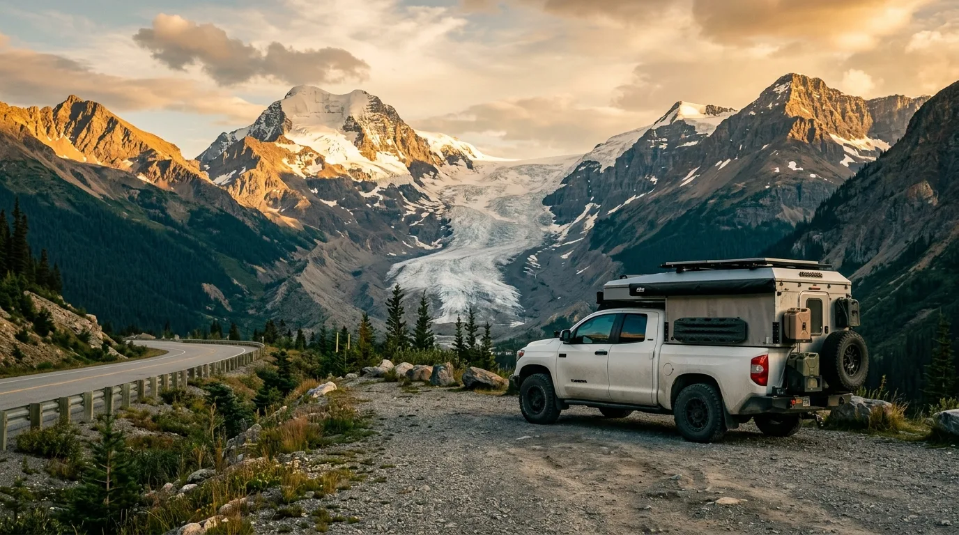
Overland truck camper at a gravel pullout on the Icefields Parkway with the Athabasca Glacier and Mount Athabasca behind, golden hour
Trekkr Trail Journal · No. 003 · Icefields Parkway

Icefields ParkwayCamping + Trails — The Complete Field Guide

The most famous drive in the Rockies, and the least understood as a place to actually stay. One seasonal fuel stop, campgrounds you mostly can't reserve, a glacier that kills the unguided, and the darkest legal skies you can park under. Highway 93N, Saskatchewan Crossing to Jasper — taken apart.

Alberta · Canada Highway 93N · Banff + Jasper NP Summer / Shoulder Season Winter Bonus Inside
7Basecamps profiled
7Hike profiles
~153 kmThe fuel gap
0Cell bars en route
Conditions at press time · Verified 15 July 2026 · This block goes stale — the links don't

The fire's long shadow, and a berry summer

Two years after the 2024 Jasper Wildfire the corridor is open and spectacular — but the recovery still decides what you can reach, and July 2026 is peak buffaloberry season with bear advisories active in both parks. The rest of this journal is evergreen — this box is not. Check the live sources before you commit to anything below.

  • Cavell Road: closed for all of 2026Parks Canada's own words: Cavell Road and Maligne Canyon "will remain closed for the 2026 season" while rehabilitation of the fire-damaged slopes is planned. That takes Path of the Glacier, Cavell Meadows and the Tonquin trailheads off this year's menu entirely. No reopening date exists.
  • Wabasso campground: closed until further noticeThe Highway 93A campground is out for 2026. Wapiti runs at reduced capacity (~150 reservable sites). Whistlers is open, as is 77% of Jasper's frontcountry inventory. Plan as if townsite camping books out — because it does.
  • Rampart Creek: bear warning + hard-sided restrictionA black bear making close approaches triggered a warning on 10 June 2026 and a hard-sided-camping restriction posted 21 June. If you planned to tent at the corridor's only reservable mid-Parkway campground, check the Banff bulletins page before you drive out.
  • It's berry season — encounters are likelyJasper's advisory (13 July) and Banff's (15 July) both flag that bears are on the buffaloberry right now, often beside roads and trails. Spray on the hip, noise on, dogs leashed.
  • Valley of the Five Lakes: Valley Loop partially closedThe full 7.7 km loop has repair work in progress (checked 15 July). Wetland Way and the Emerald Loop are in good shape — the lakes themselves are all reachable. The trail network reopened this spring after post-fire rehabilitation.
  • Jasper is running on two gas stationsThe 2024 fire destroyed two of the town's four stations. Both survivors get congested in peak season. Arrive with fuel to spare, not fumes and faith.
Live sources · Jasper — what's open · Jasper bulletins · Banff bulletins · Jasper trail conditions · 511 Alberta roads
One trap worth knowing: several Parks Canada pages carry old "date modified" stamps while the content churns — and third-party trip blogs recycle pre-fire information constantly. When a blog and a Parks Canada bulletin disagree, the bulletin wins.
01 / START HERE

The road that is the destination

The Icefields Parkway runs 230 km from Lake Louise to Jasper along the spine of the continent, past more than a hundred visible glaciers. This issue covers its wilder northern half: Saskatchewan River Crossing to Jasper townsite — the stretch where the tour buses thin out, the campgrounds go first-come, and the services drop to approximately zero. If Kananaskis is Alberta's playground and Abraham Lake is its free-camping secret, the Parkway is the country's postcard — and the postcard doesn't mention where you'll sleep.

Here's the honest shape of it: this is a national park corridor, which means the scenery is unmatched and the rules are absolute. There is no dispersed camping, no sleeping in the van at a pullout, no cutting firewood, and no walking on the glacier that everyone comes to see. What you get in exchange is a road where bighorn sheep hold up traffic, waterfalls arrive every twenty minutes, and the night sky is legally protected. Play it by the rules and it's the best road trip on the continent.

How to use this journal Read the conditions box and the camping rules first — on the Parkway, where you'll sleep is the puzzle, not what you'll see. Then pick a basecamp strategy from §05, build your days from the trail selector, and run the departure check the night before you roll. Every distance and rule in here is a planning estimate. The Verify Before Departure links at the bottom are your final word.
02 / THE GATE FEE

One pass, and 2026 is the year it's free

Unlike Kananaskis, the Parkway's pass is per vehicle-load, not per plate-scanner — and for summer 2026 the federal government made it free. Read that twice, then read the fine print once.

What it costs (2026)

Adult · day$12.25
Family/group · day (up to 7, one vehicle)$24.50
Senior · day / Youth 17 & under$10.75 / free
Discovery Pass · adult / family (12 months, every Parks Canada place)$83.50 / $167.50

The 2026 headline: the Canada Strong Pass. Park admission is free for everyone from 19 June to 7 September 2026, and camping is 25% off in the same window. No sign-up, no card — it simply applies. Outside that window, the table applies. If you'll spend 7+ days in parks over the year, the Discovery Pass wins.

How it actually works

  • A pass is required to travel the Parkway at all — transiting without stopping still counts
  • There is no staffed gate at Saskatchewan Crossing — entering from Hwy 11 you must already have one. Buy online at pc.gc.ca or at a visitor centre; roadside checks happen
  • Staffed gates sit at the park entrances: Banff East, Jasper East and West on Hwy 16, Kootenay West
  • The pass is admission only — it never covers camping, fires or fishing
  • Hang it from the mirror or keep the digital receipt reachable — you'll have no signal to re-download it
The comparison worth making Kananaskis charges $15/day per vehicle and fines by plate-scanner. The Parkway's family day pass is $24.50 for seven people, was free all summer 2026, and the Discovery Pass makes every national park in the country a return trip. The park fee is the cheapest part of this corridor — it's the fuel, food and glacier bus that get you.
03 / ORIENTATION

The Highway 93N corridor

One road, 153 km, no side roads that go anywhere except 93A — and everything on it happens in a strip five minutes wide. Learn the order of things and the Parkway stops being a blur of pullouts. A schematic planning map: navigate with an offline topo, not this page.

COLUMBIA ICEFIELD HWY 11 · DAVID THOMPSON → ABRAHAM LAKE · FREE CAMPING (ISSUE 001) HWY 93N HWY 93A WABASSO CG CLOSED CAVELL RD CLOSED ALL 2026 SUNWAPTA PASS BANFF / JASPER BOUNDARY JASPER · FUEL (2 STATIONS) ~153 KM · NO FUEL CROSSING → JASPER. NO GAS AT THE ICEFIELD CENTRE. WINTER GAP: 230 KM RAMPART CK · BEAR WARNING WILCOX CK · ICEFIELD CG ICEFIELD CTR RV · NO GAS JONAS CK HONEYMOON LK MT KERKESLIN · GOAT LICK WHISTLERS · WAPITI PARKER RIDGE · NIGEL PASS WILCOX PASS TOE OF THE GLACIER BEAUTY CK · STANLEY FALLS VALLEY OF THE FIVE LAKES WEEPING WALL · BIG BEND TANGLE FALLS SUNWAPTA FALLS ATHABASCA FALLS JASPER SASKATCHEWAN CROSSING THE CROSSING · SEASONAL FUEL ~APR–OCT · CALL AHEAD ← LAKE LOUISE 87 KM (24/7 FUEL) N ≈ 20 KM (SCHEMATIC) HWY 93N · SASKATCHEWAN CROSSING → SUNWAPTA PASS → JASPER · PLANNING SCHEMATIC ONLY — NOT FOR NAVIGATION
Campground Trailhead Falls / viewpoint Fuel Closure (2026) Highway 93N Hwy 11 / 93A
The corridor's one rule Everything here is national park, and national park rules don't bend. Camping happens in designated campgrounds only. Firewood is provided, not gathered. Drones are banned outright. Wildlife gets 100 metres (bears) or 30 metres (everything with hooves). And from 1 November to 1 April the whole road legally requires winter tires or chains. The freedom this corridor offers is scenery, not improvisation — improvisation is what Highway 11 east of the Crossing is for.
04 / BEFORE YOU ROLL

Where you'll sleep is the whole puzzle

Here's what surprises everyone coming from Kananaskis: you mostly can't reserve here. And here's what surprises everyone else: you absolutely cannot freelance it either. The Parkway's camping game has exactly three legal moves.

First-come campgrounds

Five of the seven corridor campgrounds — Wilcox, Columbia Icefield (tents and RV), Jonas Creek, Honeymoon Lake, Mount Kerkeslin — take no reservations at all. Show up, claim a site, self-register. In July and August that means arriving before noon.

Arrive early~$33.25/nightFirewood included

Reservable anchors

Rampart Creek (Banff side, $22) and the Jasper townsite pair — Whistlers (781 sites, showers, power) and Wapiti — book on reservation.pc.gc.ca. The 2026 windows opened 27 January (Jasper) and 12 February (Banff); $11.50 booking fee. Book the first and last night, run first-come in between.

Book at launchShowers at Whistlers

The Hwy 11 escape valve

Exit east at Saskatchewan Crossing and the David Thompson corridor is Alberta public land — random camping legal in the Kiska/Willson PLUZ on a Public Lands Camping Pass ($30/year or $20/3-day, per person 18+). It's the subject of our free issue No. 001, and it's the Parkway camper's insurance policy.

Random camping legalPL pass required
The rule — read this twice Parks Canada's wording, verbatim: "Camping — including sleeping in a vehicle — in roadside pullouts, trailheads, and day-use areas is not allowed." There is no grey zone, and Canada National Parks Act offences come with automatic court appearances, not warning notes under the wiper. The one legal vehicle-sleep outside a campground proper is the Icefields Centre RV area — a 100-site self-register lot across from the Glacier Discovery Centre (mid-May to mid-October, trailers and RVs only, no water, no fires). It is a parking lot with a view worth millions. Take it over a ticket.

Booking reality

Jasper's fee schedule runs by service level: $33.25 primitive with fire pit (the Parkway norm, firewood included), $19.50 for the no-fire Icefields RV lot, $47.75–$61.00 at serviced Whistlers loops, oTENTiks $147.50. Rampart Creek is $22 plus Banff's $17/day fire permit (wood included). The 25% Canada Strong camping discount applies all summer 2026. Parks Canada publishes fees by category, not per campground — confirm the exact rate when you register.

Connectivity reality

Parks Canada's own line: cell service exists "only at highway endpoints, not along the route itself." No signal at any corridor campground, none at the Icefield Centre (and no public wifi there either). Practical dead zone: roughly Athabasca Falls to Lake Louise. Download offline maps, screenshot reservations, carry a satellite communicator, and leave your route with someone at home. Jasper dispatch, 24/7: 780-852-6155.

05 / BASECAMPS

Seven places to plant the flag

South to north: one reservable Banff classic, five first-come Jasper campgrounds spaced a waterfall apart, and the hardened lot at the Icefield for the rigs. Seasons and services below were checked against Parks Canada in July 2026 — confirm at booking or on the board when you pull in.

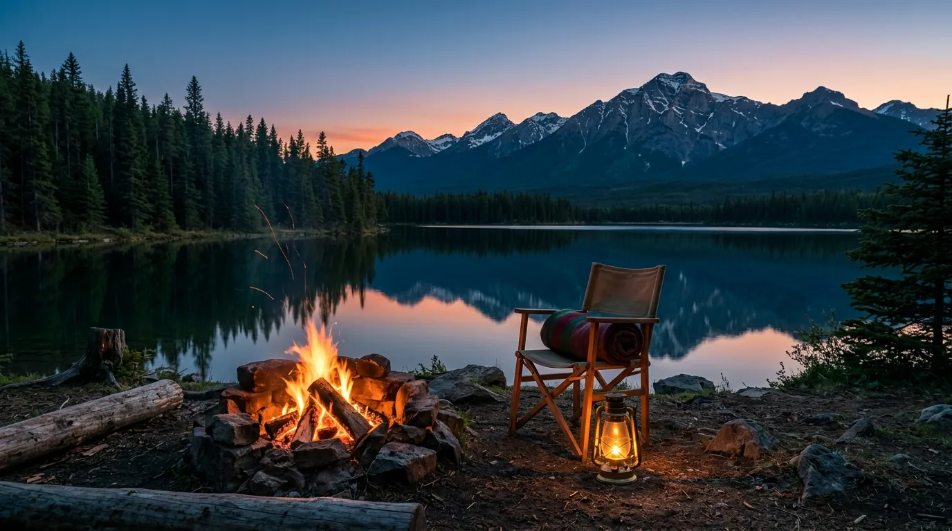
Campfire at a treed lakeside campground on the Icefields Parkway at blue hour
Honeymoon Lake. First-come, 34 sites, and evenings like this are why you arrived at eleven in the morning.
BasecampWhereStylePick it forWatch for
Rampart Creek Banff NP · ~34 km S of the Icefield 51 sites · $22 · reservation-only The only mid-corridor site you can lock in advance. Cooking shelter, food lockers, solar-treated water. Season ~late May–late Sep (sources conflict on exact dates). Rigs to 10 m. Active bear warning + hard-sided restriction — check Banff bulletins first
Wilcox Creek Jasper NP · 3 km S of the Icefield Centre 46 sites · first-come Sleeping at 2,000 m beside the corridor's best hike. Wilcox Pass trail leaves from the entrance road. Season Jun 10–Sep 28. Rigs under 27 ft preferred. Cold nights even in August
Columbia Icefield Jasper NP · at the Icefield 31 sites · tents only · first-come The glacier at your tent door and the darkest sky on the corridor. Walk-in pads for the quiet crowd. Season Jun 10–Oct 12. No RVs. High, exposed, and genuinely cold
Icefields Centre RV Jasper NP · at the Centre 100 sites · RVs/trailers only · first-come The legal answer to "can I just sleep at the Icefield?" Self-register lot, glacier view included. Season May 13–Oct 12. No water, no fires. It's a parking lot — price your expectations accordingly
Jonas Creek Jasper NP · mid-corridor 25 sites · first-come The smallest and quietest. Walk-in sites, a dedicated cyclist site, and creek noise instead of neighbours. Season Jun 3–Sep 7 — the shortest on the Parkway. Rigs under 25 ft, the tightest limit here
Honeymoon Lake Jasper NP · mid-north corridor 34 sites · first-come Lakefront sites, calm-morning reflections, and a swimming hole if you're brave. The one everyone tries for. Season May 27–Sep 14. Fills first of the first-come set — arrive earliest for this one
Mount Kerkeslin Jasper NP · 5 min S of Athabasca Falls 42 sites · first-come The waterfall basecamp — Athabasca Falls before the buses, goats at the lick up the road. Season May 13–Sep 14. Active fox warning (Jun 2026) — keep food and small pets managed
Verify before you trust a rate or a date Parks Canada publishes camping fees by service category, not per campground — the ~$33.25 Parkway rate above is inferred from each campground's listed services and could shift with any fee revision. Rampart Creek's season dates conflict between the official page and the booking system. And no official Parks Canada page we could find states where Jasper's sani-dump stations are. Confirm all three at reservation.pc.gc.ca or the Jasper Visitor Centre — and treat any third-party blog's "2026 fees" with suspicion.

Worth knowing about

  • Whistlers — Jasper townsite, 781 sites, showers, 15/30/50-amp power, 17 oTENTiks. Reservable, and the civilized bookend to a first-come week. Season May 6–Oct 12
  • Wapiti — 150 reservable sites for 2026 (reduced after the fire), plus a 40-site winter operation — the corridor's only winter camping
  • Wabasso — closed until further notice. Cross it off
  • The Bare Campsite program — everything scented lives in the vehicle or a bear locker whenever you're not using it. Violation = permit revoked, no refund
  • Generators — 8–10 am and 5–7 pm only, everywhere. Quiet hours 11 pm–7 am, and alcohol only at your own site
  • Backcountry — $15/person/night by permit; Jasper's remote random-camping zones are a different, stricter system booked by phone
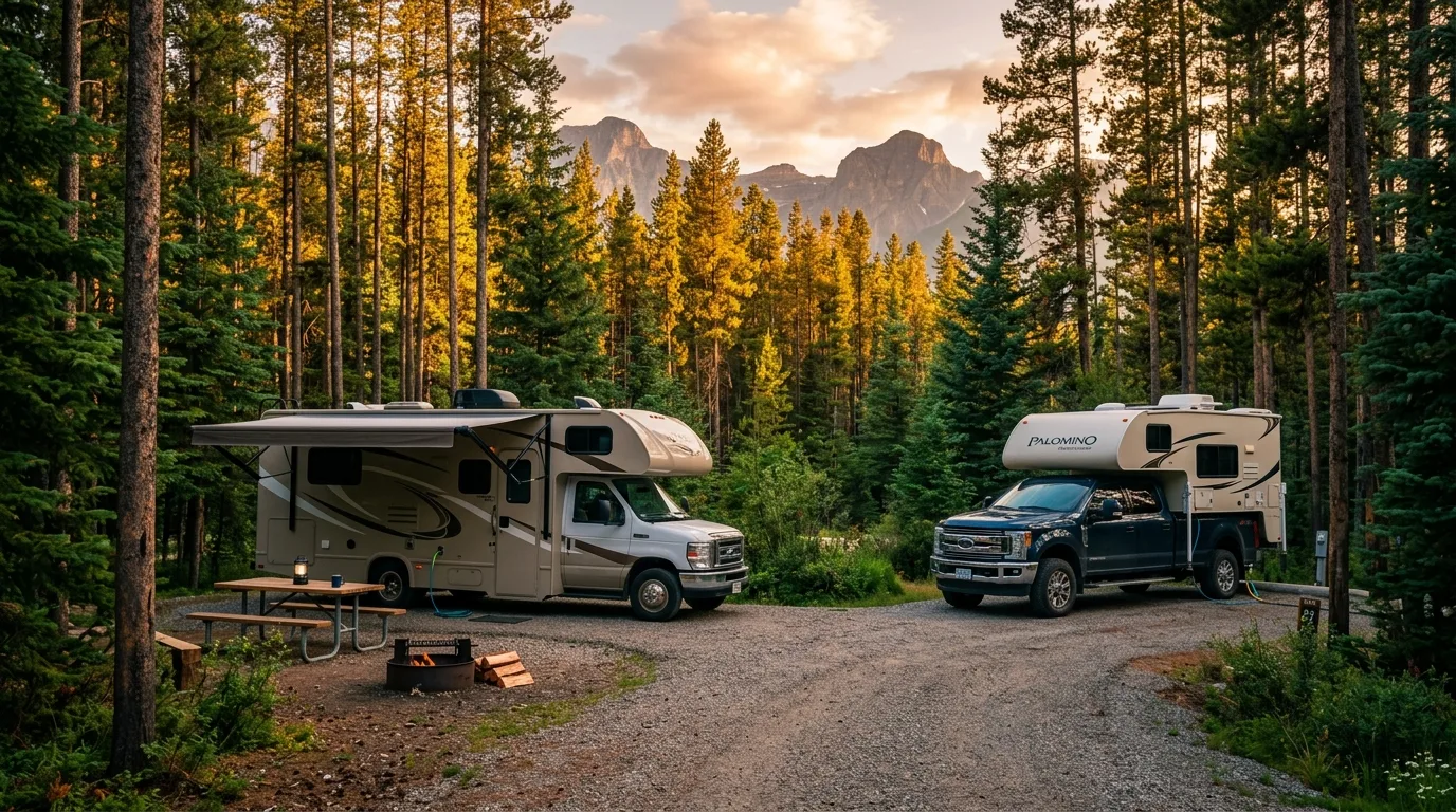
RV and truck camper at a forested serviced campground loop near Jasper on a summer evening
06 / TRAIL SELECTOR

Choose the day that fits the group

Seven profiled routes from paved-stroll to a full day on the Continental Divide's doorstep. A quirk worth knowing: Parker Ridge and Nigel Pass straddle the parks boundary and Banff's and Jasper's official pages print different figures for the same trails — where they disagree, we print both.

TrailLevelDistanceGainTimeStatus · 15 Jul 2026
Toe of the Athabasca Glacier1.8 km return60 m1 hrGood
Sunwapta Lower Falls2.6 km return87 m1 hrGood
Valley of the Five Lakes1.8–7.7 km loopsNo official figure1–3 hrValley Loop partial
Beauty Creek · Stanley Falls~3.8 km return*~163 m*1–1.5 hrNo official status
Parker Ridge5.4 km return250–305 m†2.5–3 hrFair · snow patches
Wilcox Pass2.4 km viewpoint · 8 km pass390 m1–3 hrFair · wet, snow patches
Nigel Pass14.4–14.6 km return†365–395 m†4–5 hrFair · stream crossings

* No official Parks Canada figure exists — best established third-party numbers, treat as estimates. † Banff's and Jasper's official pages disagree; both figures shown.

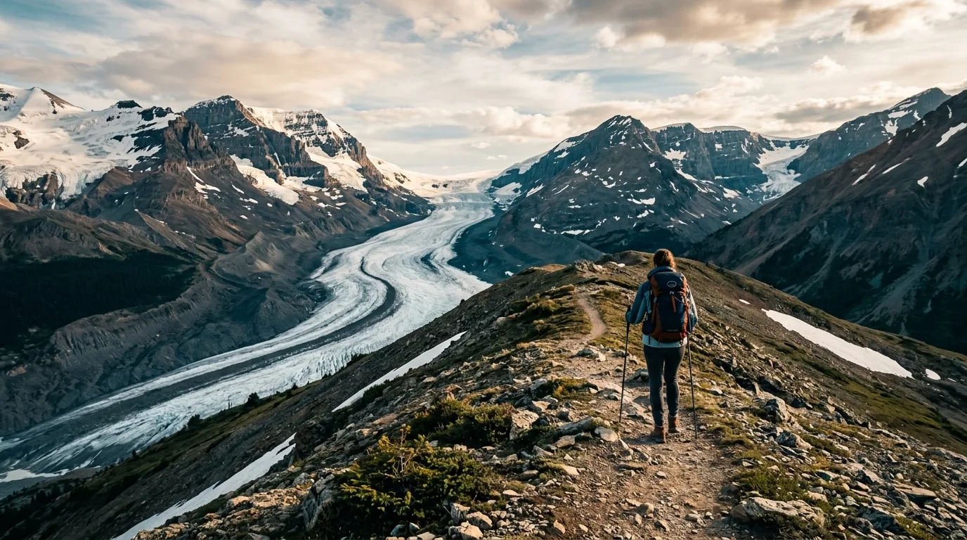
Hiker on the Parker Ridge trail high above the Saskatchewan Glacier
Parker Ridge. Three hundred metres of climbing buys you a private audience with the Saskatchewan Glacier.

Best all-round hikeWilcox Pass

Moderate2.4 km return to viewpoint · 8 km to the pass390 m gain1–3 hr

Twenty minutes of forest, then you pop above treeline and the entire Columbia Icefield unrolls across the valley — the view of the Athabasca Glacier that the people in the parking lot below never see. The red chairs at the first viewpoint are the corridor's best photo-per-effort ratio; the full pass adds open tundra, wildflowers through July, and bighorn rams that treat the trail as theirs.

MAIN CAUTION: Parks Canada's own warning — the pass area can be snowy until late July, and this July's condition report still flags snow patches and mud. Fully exposed above the viewpoint; weather moves fast at 2,300 m. Trailhead is on the Wilcox Creek campground entrance road, 3.1 km south of the Icefield Centre.

Steep start, then open tundra · out-and-back

Best short outing — read the cautionToe of the Athabasca Glacier

Easy–moderate1.8 km return60 m gain1 hr

A short walk over rock the ice released within living memory, to a rope line an arm's length from a 10,000-year-old glacier. Date markers along the way show where the toe stood each decade — the most honest climate exhibit in the country. Pair it with the Forefield Trail (3.6 km return) if you want the full deglaciated moonscape.

MAIN CAUTION: do not cross the barriers onto the ice. Parks Canada, verbatim: "the ice at the toe of the glacier is hollow and is collapsing… People have been killed falling into deep, hidden cracks." A 10-year-old died of hypothermia in a crevasse here in 1990; a skier died in a 25 m crevasse fall on this glacier in May 2026. On the ice, guided means alive.

Short climb over glacial rock · out-and-back

Best view-per-kilometreParker Ridge

Moderate5.4 km return250–305 m gain2.5–3 hr

Switchbacks through the last of the trees, then a ridgeline where the ground drops away and the Saskatchewan Glacier — bigger than the Athabasca, and nearly private — fills the valley below. This is the corridor's great bang-for-effort climb and the classic first-evening leg-stretch from Rampart Creek or Wilcox camp.

MAIN CAUTION: snow holds on the switchbacks well into July (flagged in this July's live report), and the alpine plants here take decades to recover — stay on the trail, it's the one thing Parks asks. Banff's page says 2.7 km one-way and 305 m; Jasper's says 5.4 km return and 250 m. Same trail. Take poles either way.

Switchbacks, then the reveal · out-and-back

Best full-day hikeNigel Pass

Moderate–hard14.4–14.6 km return365–395 m gain4–5 hr

The corridor's honest big day: an old road, then meadows, then a rocky pass on the Banff–Jasper boundary with the Brazeau country spilling away on the far side — the doorway to country most Parkway visitors never learn exists. The distance does the work; the gradient stays civilized the whole way.

MAIN CAUTION: stream crossings — this July's report flags them alongside mud and deadfall, so bring footwear you can soak. The trailhead is a gated side road on the east side of the highway 13 km south of the Icefield Centre, easy to blow past at 90 km/h. Official figures disagree (Banff: 7.3 km one-way/395 m; Jasper: 14.4 km return/365 m) — plan on the bigger day.

Long approach, honest finish · out-and-back

Best family dayValley of the Five Lakes

Easy–moderate1.8 / 5.4 / 7.7 km loopsNo official gain figure1–3 hr

Five small lakes in five impossible shades of turquoise, 9 km south of Jasper townsite, on a trail network that reopened this spring after two years of post-fire rehabilitation. Three official loops — Wetland Way (1.8 km), Emerald (5.4 km), Valley (7.7 km) — let you size the day to the crew. Go early: this is deservedly the most popular walk on the Jasper end.

MAIN CAUTION: the full Valley Loop is partially closed for repair work as this issue ships — the shorter loops are in good shape. Berry-season bear advisory active park-wide, and the main trail is shared with fast-moving cyclists. Trailhead P15 on 93N.

Rolling forest and lakeshore · loops

Best hidden stopBeauty Creek · Stanley Falls

Easy~3.8 km return — unofficial~163 m — unofficial1–1.5 hr

An unsigned-feeling turnout, a stretch of old road, and then a limestone canyon stacked with eight cascades ending at Stanley Falls. It's the stop the buses skip because there's nowhere for a bus to park, which is exactly the recommendation. Pack it as the recovery day between Wilcox and Nigel.

MAIN CAUTION: unfenced canyon edges the whole way up — this is not the one for off-leash dogs or sprinting kids. Parks Canada publishes no distance, no gain and no status for this trail; the figures above are established third-party estimates and the turnout (~15–17 km north of the Icefield Centre, east side) is easy to miss. If you reach Jonas Creek campground you've overshot.

Gentle canyon climb · out-and-back

Best waterfall walkSunwapta Lower Falls

Moderate2.6 km return87 m gain1 hr

Everyone photographs the upper falls from the viewpoint beside the lot. Almost nobody takes the 1.3 km path down the river to the three lower falls — same glacial water, triple the waterfall, a tenth of the people. This is the cheapest solitude on the Parkway and the best picnic real estate on the Jasper half.

MAIN CAUTION: canyon-rim drop-offs — the railings exist where they exist, and the rock past them is wet and rounded. Watch kids near the brink viewpoints. Peak flow (and peak spray) is late May through early July snowmelt; the upper falls viewpoint is steps from the lot if the group is done walking.

Downhill to the falls — save legs for the return
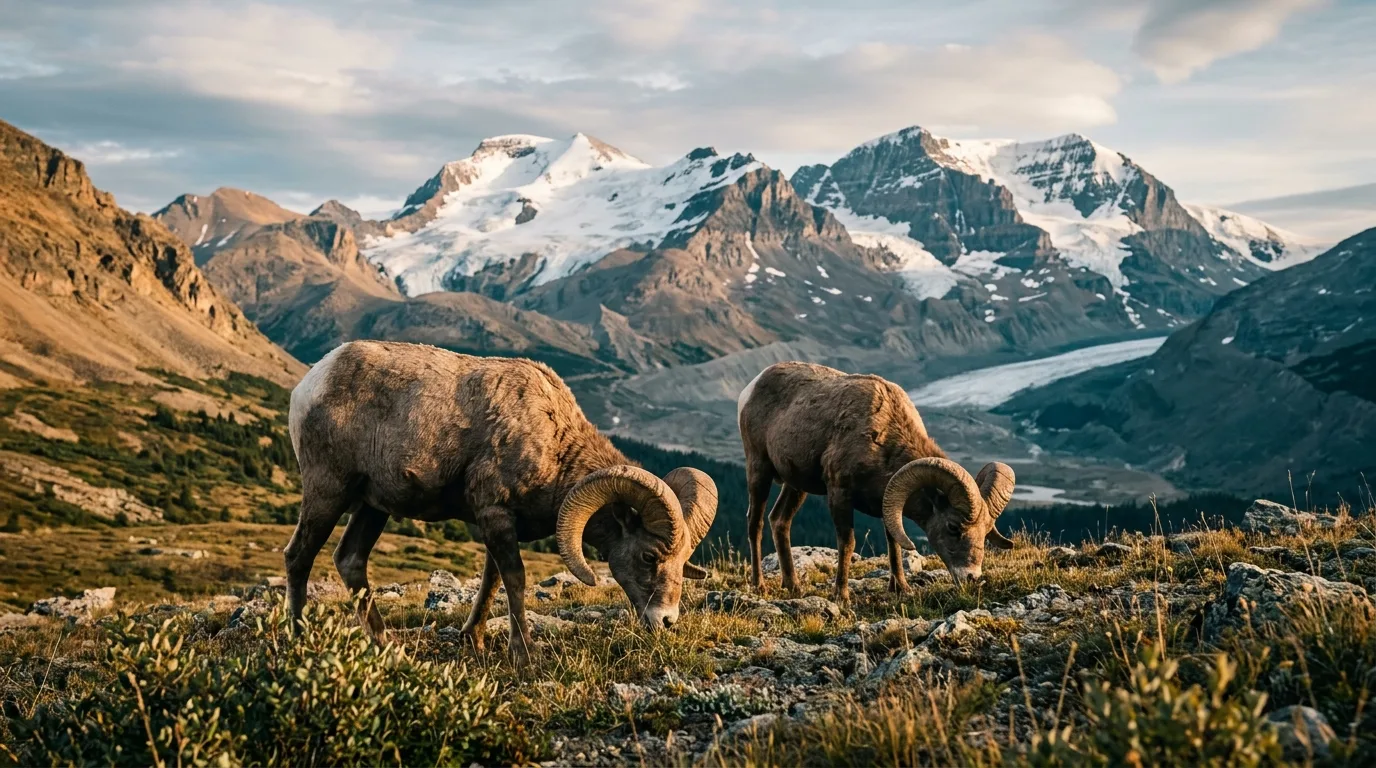
Two bighorn sheep rams on alpine tundra at Wilcox Pass with the Columbia Icefield behind
Wilcox Pass locals. The rams were here first and know it. Thirty metres is the law — your lens does the approaching.
Trails not on this list — deliberately Path of the Glacier and Cavell Meadows (1.6 km and 6–7 km of the best glacier scenery in Jasper) are unreachable: Cavell Road is closed for all of 2026 for post-fire slope work, with no reopening date. Tonquin Valley trailheads sit behind the same closure. Bow Glacier Falls, south of Saskatchewan Crossing, is closed until further notice per Banff's trail list. And Horseshoe Lake, the famous cliff-jumping stop near Athabasca Falls, has no official Parks Canada trail figures or status page at all — it's absent from this list because we couldn't verify it, which is the standard everything here has to meet.
The universal trail plan Same operating system as every issue: check the live trail report the morning you go — both parks run one, and the boundary trails appear on both. Start early; lots at Athabasca Falls and Five Lakes jam by 10 am in summer. Offline maps before you leave Jasper or Lake Louise — there is no signal to check anything en route. Bear spray on the hip. Hard turnaround time. The glacier doesn't care how far you drove.
Check both parks' trail reportsStart earlyOffline mapsBear spray on hipTurnaround time
07 / THE ICEFIELD

Ice by bus, boots or barrier

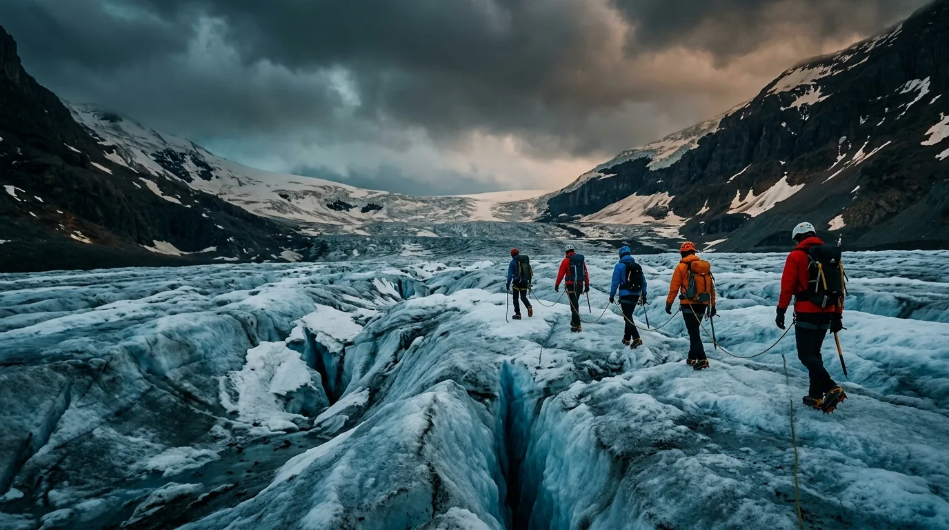
The Columbia Icefield is the corridor's headline act and its most commercial hundred acres. There are exactly three relationships you can have with the Athabasca Glacier: paid, guided, or behind the rope. There is no fourth.

Roped guided group walking on the lower Athabasca Glacier in dramatic storm light
On the ice, guided means alive. The toe is hollow and collapsing — Parks Canada's words, not ours.

The paid version

The Columbia Icefield Adventure (operator: Pursuit, banffjaspercollection.com) runs the Ice Explorer buses onto the glacier and bundles the Skywalk — the glass floor 280 m above the Sunwapta Valley. 2026 season: 1 May – 12 October, weather dependent.

Pricing is dynamic and lives in the booking engine — recent checks put the combo around $126 adult / $82 child, but treat that as indicative, not gospel. The reliable discounts: ~20% off departures after 3:30 pm, ~20% off for Alberta residents with ID, and one free child (6–15) per adult on pre-11 am departures. July sells out — book two weeks ahead or take the late slot and keep the discount.

May 1 – Oct 12Book 2+ weeks out in JulyPrices move — verify

The free version

You don't need a ticket to have the glacier day. The Toe trail (1.8 km return) puts you a rope's width from the ice. The Forefield trail (3.6 km) walks the ground the glacier abandoned since the 1840s. And the Wilcox red-chair viewpoint (2.4 km return) gives you the panorama of the whole icefield that the bus passengers physically cannot see — because they're standing on it.

Want to actually stand on ice without the bus? Licensed guided icewalks operate on the Athabasca — roped, cramponed and legal. That's the line: guided on the ice, or free beside it.

Toe · Forefield · WilcoxGuided icewalks exist
Why the barrier is not a suggestion Parks Canada, verbatim: "The glacier is dangerous! For your safety do not cross the barriers. People have been killed falling into deep, hidden cracks called crevasses." In 1990 a 10-year-old walking the ice with his family slipped into a crevasse and died of hypothermia before he could be freed. In May 2026 a skier descending from Mount Andromeda died in a 25-metre crevasse fall on this same glacier — his experienced party couldn't reach him. The meltwater under the ice is barely above freezing and moving fast. Every year people step over the rope for a photo. The rope is where the survivable photos end.
08 / WATER & SKY

Waterfalls by day, preserve-grade dark by night

The Parkway's water does its work in gorges — two headline falls and a supporting cast of roadside cascades. Then the sun goes down over a Dark Sky Preserve the size of a small country, and the second show starts.

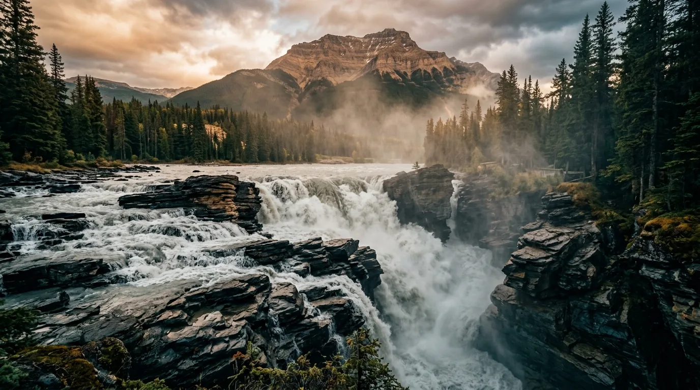
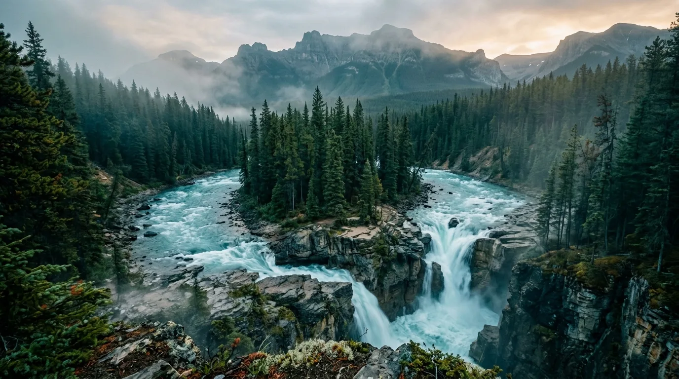
Athabasca Falls thundering through its narrow quartzite gorge

The falls, ranked honestly

  • Athabasca Falls — the most powerful in Jasper, 31 km south of town at the 93A junction. Paved paths, brutal crowds 10 am–7 pm in summer. Parks' warning is earned: "the rock beyond [the railings] is slippery and dangerous"
  • Sunwapta Falls — upper falls steps from the lot, and the lower-falls walk (§06) is the connoisseur's move. Peak thunder late May–early July
  • Tangle Falls — multi-tier roadside cascade just north of the Icefield; shoot it from the pullout, and watch for foot traffic on the highway
  • Weeping Wall — a 300 m cliff of seasonal waterfalls south of Big Bend; best in spring, a world-class ice-climbing wall in winter (§14)
  • Panther + Bridal Veil Falls — from the Big Bend hairpin pullout; the short steep path to Panther is unofficial (~1.3 km return) and spray-slick behind the falls

Timing rule for all of them: before 9 am or after 5 pm. The lots turn over fast either side of the bus window.

Fishing the corridor

National park water needs a national park fishing permityour Alberta licence is not valid here, which catches Albertans constantly. $15.00/day or $51.25/annual, one permit good across Banff, Jasper, Yoho and Kootenay. Under-16s fish free with a permit holder, sharing their limit.

  • Artificial lures only — no natural bait within 100 m of park waters, no lead tackle under 50 g
  • Sunwapta River: open year-round — the corridor's odd one out
  • Most other rivers and streams: 1 Jul – 7 Sep 2026. Most lakes: 16 May – 7 Sep 2026

The Dark Sky Preserve

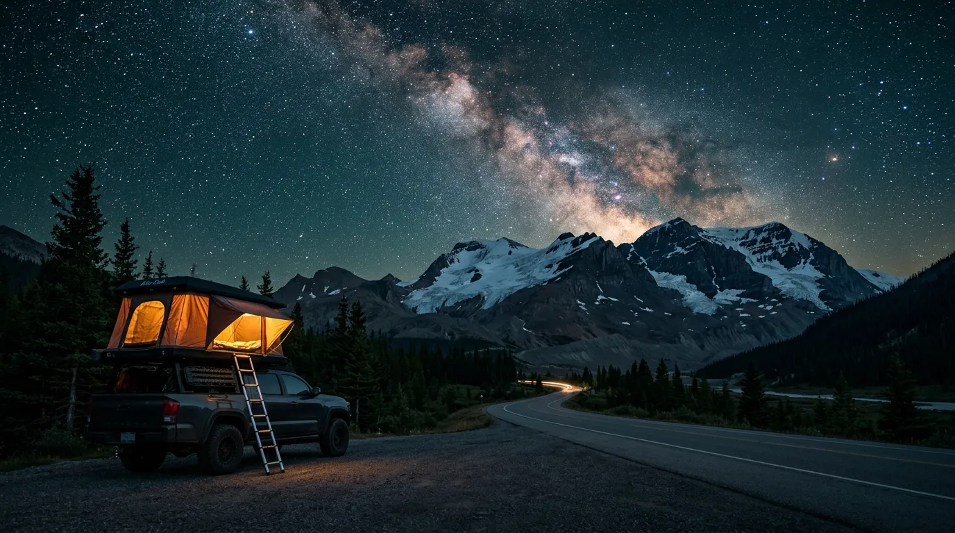
Jasper National Park has been an RASC Dark Sky Preserve since 2011 — the second-largest in the world, and the largest anywhere with a town inside it. On the Parkway that's not a slogan: there is functionally zero artificial light for 150 km, and the Icefield-area campgrounds sit above 2,000 m with thin, dry air.

The practical version: stargaze from your campground — overnighting at pullouts is illegal (§04) and the law doesn't make a Milky Way exception. New moon weeks beat full weeks. The Jasper Dark Sky Festival runs mid-October — published 2026 dates conflict (16–25 vs 17–26 Oct), so verify at jasperdarksky.travel before you book around it.

Preserve since 2011Festival mid-OctDates conflict — verify
Milky Way over the Icefields Parkway with a rooftop tent glowing at a dark pullout in the Jasper Dark Sky Preserve
Preserve-grade dark. This sky is legally protected. Shoot it from camp — the pullout overnight is a court date.
09 / WILDLIFE

The road the animals use too

Bears in the valley bottoms spring and early summer, bighorn holding court at Tangle and Wilcox, goats at the Kerkeslin lick — and a caribou story every visitor should know before they complain about a winter closure.

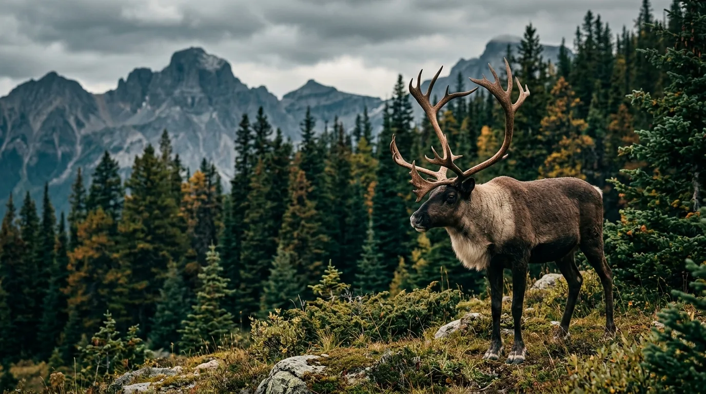
Woodland caribou bull at the edge of subalpine forest in Jasper National Park, long-lens distance
Jasper's quietest resident. The Brazeau herd is already gone. The winter closures exist so the Tonquin herd isn't next.

Bears

Both parks posted berry-season advisories in mid-July 2026 — bears feed on buffaloberry right beside roads and trails through late summer. Spray on the hip everywhere, noise in brush, and if a roadside bear draws a crowd, Parks' instruction is to leave immediately, not join. Rampart Creek campground carries its own active bear warning.

The legal distances

100 metres from bears, wolves and cougars. 30 metres from elk, moose, caribou, sheep and goats — except inside a legally parked vehicle. Feeding or baiting any wildlife, or leaving attractants out, runs to a $25,000 maximum fine. The Wilcox rams and Tangle Falls bighorn are habituated, not tame.

Camp discipline

Jasper runs the Bare Campsite program: food, coolers, dishes, toiletries, garbage and pet food live in the vehicle or a bear locker whenever not in use. Coolers are not bear-proof. Violation = permit revoked, no refund, possible charges. Kerkeslin adds a fox warning this summer — same discipline, smaller thief.

The caribou story — why winter here has rules Jasper's woodland caribou are one of the most endangered mammals in the Rockies. From 1 November to 15 May, about 2,000 km² of winter habitat closes — including Cavell Road and the Tonquin trails reached from this corridor — because packed ski tracks give wolves a highway into caribou country. If that feels strict, sit with this: the Brazeau herd's closure ended 4 March 2026 because there are no Brazeau caribou left — the last three were moved to a conservation breeding centre in 2025. The closures aren't caution. They're triage.
10 / LOGISTICS

Fuel, firewood & resupply

The corridor's golden rule, sharpened: arrive full, of everything, from either end. There is one fuel stop in 153 km, it's seasonal, its hours aren't published — and the visitor centre everyone assumes sells gas, doesn't.

StopPositionCount onField notes
The Crossing Resort Sask. Crossing · Hwy 11 jct Gas, diesel, store, food · seasonal The only fuel on the corridor. Open ~mid-April to ~mid-October; pump hours unpublished — call 403-761-7000. Real site: thecrossingresort.com — booking-aggregator lookalikes exist
Columbia Icefield Centre Mid-corridor Food, washrooms, tours No fuel. No wifi. No cell. People plan around all three every summer and lose. It's a tour terminal, not a truck stop
Jasper townsite North end Fuel (2 stations), groceries, laundry, signal Post-fire reality: two of four stations burned in 2024; the survivors queue in peak season. Groceries at Nesters/Nutters/TGP. Coin showers + laundry at SnowDome, 607 Patricia St, $7/10 min
Lake Louise 87 km south of the Crossing Gas, diesel, propane · 24/7 The southbound anchor and the only round-the-clock fuel near the corridor. Top up here even if the gauge says you're fine

Fuel math

Crossing to Jasper is ~153 km with nothing between — but that's the minimum. Add every viewpoint pull-in, the Toe road, a campground hunt that visits three first-come loops, and an idle hour in a wildlife jam, and a "153 km day" burns like 250. In winter The Crossing closes and the gap becomes Parks Canada's own stated number: 230 km, Lake Louise to Jasper, no services. Jerry can if you're running a thirsty rig; no EV charging anywhere on the corridor.

Firewood doctrine

Simplest in the series: firewood is provided at Jasper's Parkway campgrounds — included with your site — and Banff's Rampart Creek includes wood with its $17/day fire permit. Gathering deadfall is illegal everywhere in a national park. Fires in designated pits only, dead out by 11 pm, and check both parks' fire pages the morning you leave — no ban was active at press time, but July was running hot and dry.

Signal reality

Coverage: endpoints only — roughly Athabasca Falls to Lake Louise is dead air, and the Icefield Centre is not a reliable pocket. Buy passes, download maps and send your trip plan before the last bar dies. Carry a satellite communicator; recent iPhones' satellite SOS works in Canada. Emergencies: 911 where there's signal; Jasper dispatch 780-852-6155 (24/7); Banff dispatch 403-762-1470 — program both into the sat device.

11 / BEYOND THE TENT

Stops worth building the day around

Columbia Icefield Skywalk

The glass-floored arc 280 m above the Sunwapta Valley, ticketed with the Ice Explorer or standalone. Access is by shuttle from the Icefield Centre — you can't park at it. Vertigo is the product; buy accordingly.

Goats & Glaciers viewpoint

A bluff over the Athabasca River, 37 km south of Jasper, above a mineral lick that pulls mountain goats down the cliffs. Reopened September 2024 after the fire. Bring binoculars; the goats don't do close-ups on demand.

Big Bend & the Weeping Wall

The Parkway's great hairpin, with Bridal Veil Falls (370 m of cascade) off the top and the Weeping Wall's 300 m curtain just south. Use the designated pullouts — the shoulder past the bend drops away for real.

Stutfield Glacier pullout

A ninety-second stop for a hanging wall of ice pouring off the Columbia Icefield's north edge. The habit worth building: on this road, stop for the unsigned pullouts too — the named ones have buses.

Jasper townsite, honestly

Two years post-fire: open, friendly, rebuilding, and busier than its shrunken services want. 77% of frontcountry camping is back; hotels and gas are the pinch points. Resupply, shower at SnowDome, tip well, and don't ask staff for fire stories — they lived them.

The dark-horse hike

Sunset Lookout (4.5 km, 615 m, Banff official) climbs to an old fire-lookout aerie above the Alexandra River confluence near the Crossing. Difficult rating, zero crowds, and the best views-per-stranger ratio on the south end.

Sunwapta Falls with its forested island splitting the river above the drop, morning mist
Sunwapta, before the buses. The island split is the postcard. The lower falls are the secret. Go at 8 am and have both alone.
Don't plan around: Cavell Road Every pre-2024 itinerary on the internet sends you up Cavell Road for Path of the Glacier and Cavell Meadows. The road is closed for all of 2026 — fire-damaged slopes, rehabilitation still being planned, no reopening date. Maligne Canyon (off-corridor but on every Jasper list) is closed too. The blogs have not caught up. Check the Jasper recovery page before believing any itinerary, including this one.
12 / THE KIT

What rides in the rig

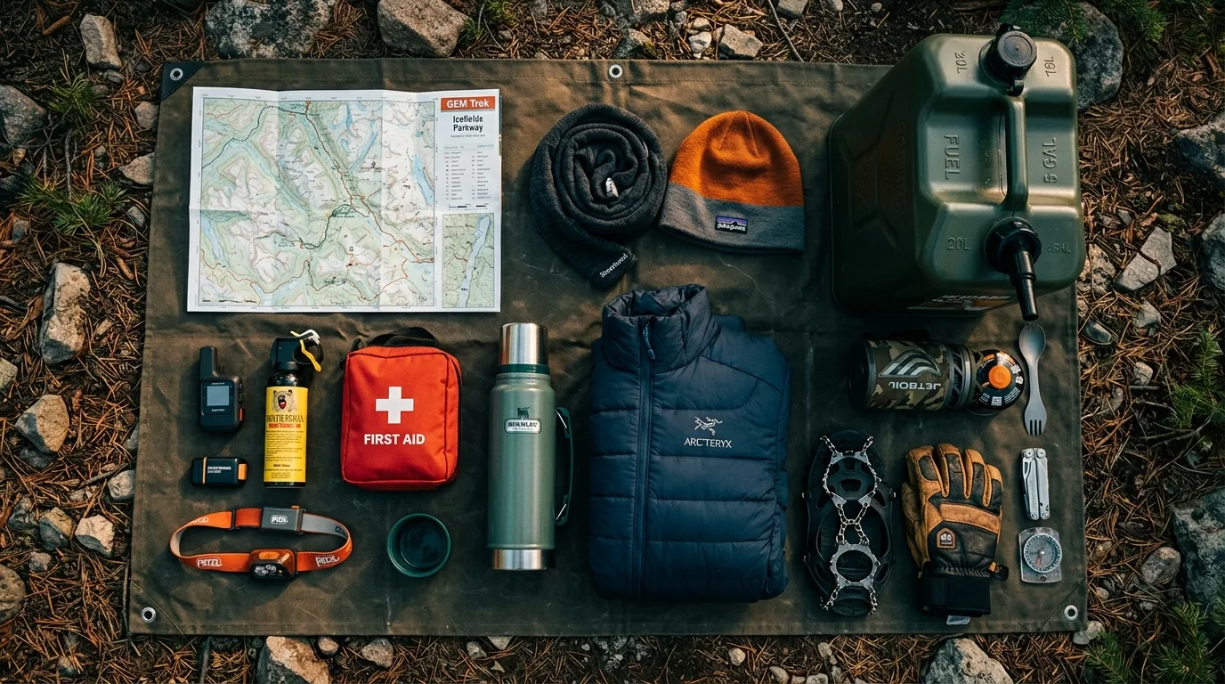
A corridor with one seasonal fuel stop, zero cell coverage, campgrounds you can't reserve, and camps above 2,000 m where August frosts. Orange items are the non-negotiables.

Overhead flat lay of a complete Icefields Parkway overlanding kit: topo map, satellite communicator, bear spray, jerry can, warm layers, stove
The Parkway loadout. The jerry can and the down jacket earn their seats. It snows here in August and nobody is surprised.

Passes & paperwork

  • Parks Canada pass — bought before the Crossing (no gate there, checks happen)
  • Reservation screenshots — Whistlers/Rampart confirmations won't re-download without signal
  • National park fishing permit if casting — the Alberta licence doesn't count here
  • Cash/card for first-come self-registration envelopes
  • Both parks' trail reports + fire status checked the morning of
  • Camping fallback plan written down: next campground north, or Hwy 11 east

Navigate & communicate

  • Offline maps downloaded + paper backup
  • Satellite communicator / PLB — this corridor has no bars, by design
  • Trip plan left with someone at home
  • Numbers written down: Jasper dispatch 780-852-6155 · Banff 403-762-1470 · The Crossing 403-761-7000
  • Power bank + 12V charging sorted
  • Headlamps + spares — darkness is the local specialty

Safety & supply

  • Bear spray — on the hip, one per adult
  • Jerry can of fuel — the 153 km gap doesn't negotiate
  • Real insulation + toque — camps sit at 1,400–2,000 m and frost in any month
  • Hard-sided food storage — Bare Campsite is enforced
  • Full-size spare, checked, with a real jack
  • Water capacity for a no-fill day (Icefields RV lot has none)
  • First aid kit sized for the group
13 / MAKE A WEEKEND OF IT

Three ready-made trip shapes

01

Waterfall Family Run

  1. Night 1: Whistlers (reserved) — showers, power, zero stress.
  2. Day 2: Valley of the Five Lakes early, Athabasca Falls before 10, Sunwapta lower-falls walk, camp at Kerkeslin or Honeymoon if a site's open.
  3. Day 3: Goats & Glaciers, Toe of the Glacier, home via the Crossing with a full tank.
Low mileageKid-proofOne reserved anchor
02

Icefield Immersion

  1. Day 1: Claim a Wilcox Creek site before noon. Parker Ridge as the evening leg-stretch.
  2. Day 2: Wilcox Pass at dawn, Toe + Forefield midday, discounted 3:30 pm Ice Explorer. Stargaze from camp — you're sleeping in the Dark Sky Preserve at 2,000 m.
  3. Day 3: Nigel Pass full day, then north to Honeymoon Lake or out.
Arrive by noonWarm bagLegs required
03

The Full Traverse

  1. Day 1: Fuel at Lake Louise, Rampart Creek (reserved). Sunset Lookout if the legs say yes.
  2. Day 2: Weeping Wall, Big Bend, Parker Ridge, Icefield afternoon, Beauty Creek, camp Jonas or Honeymoon.
  3. Day 3: Sunwapta + Athabasca Falls early, Five Lakes, resupply and shower in Jasper — or keep rolling east and free-camp the Hwy 11 corridor (Issue 001).
Fuel at both endsFirst-come middleThe whole postcard
14 / WINTER BONUS

The Parkway with the volume off

From November the buses vanish, The Crossing locks its pumps, and the road becomes something else entirely: 230 km of white silence that demands real preparation and pays in kind.

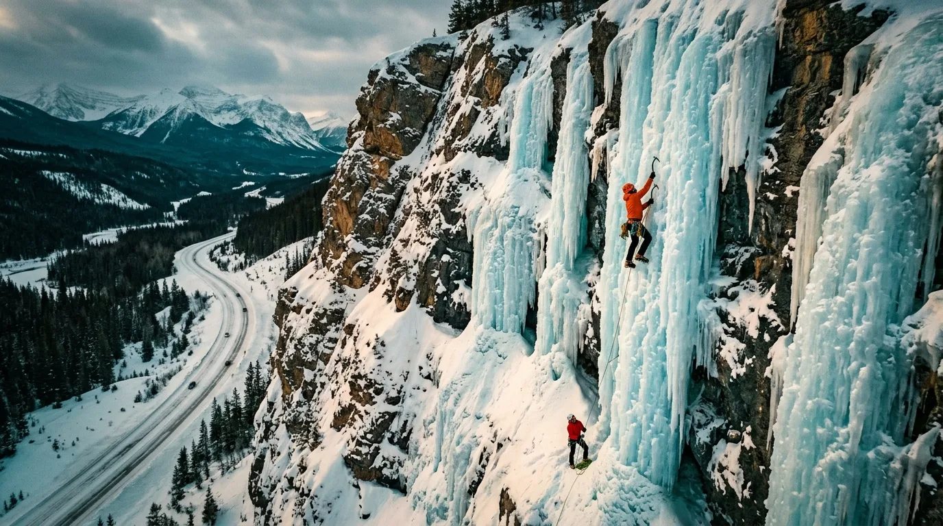
Ice climbers on the huge frozen blue icefalls of the Weeping Wall beside the snow-covered Icefields Parkway
The Weeping Wall, frozen. In summer it weeps. In winter it's one of the most famous ice-climbing walls on Earth.

The rules of the winter road

  • Winter tires or chains are law, 1 Nov – 1 Apr — 3-peak-snowflake or M+S minimum
  • No services for 230 km. Parks Canada's words: "Fill fuel tanks beforehand." The Crossing is closed ~mid-Oct to mid-Apr
  • Plows run 7:00–15:30 with low-salt sand only — compact snow is the normal surface. Travel in daylight
  • 38 avalanche paths cross the road; control closures can run multi-day. Check 511 Alberta the morning of, every time
  • Caribou closures shut ~2,000 km² of backcountry 1 Nov – 15 May, including Cavell Road and Tonquin approaches
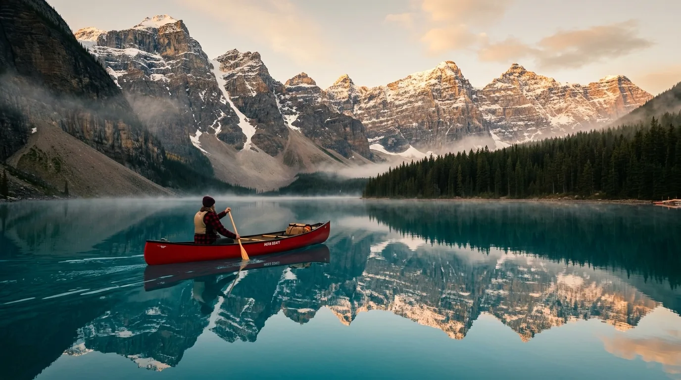
Red canoe on a calm turquoise glacial lake at dawn near the Icefields Parkway

What winter is actually for

Ice climbing — the Weeping Wall is a global pilgrimage route, and watching parties on it from the road costs nothing. Photography — frozen Tangle and Athabasca Falls, and the emptiest version of the most photographed road in Canada. Astronomy — the Dark Sky Preserve with 16-hour nights. Base at Wapiti's winter loop (40 sites, power, the corridor's only winter camping) and day-trip the road.

What winter is not for

Improvising. Every Parkway campground except Wapiti's winter loop is closed. The Crossing is closed. Cell coverage is still zero and now it's −25°. This is the one season where "wing it" stops being a style and becomes a rescue callout — carry the sat communicator, tell someone your plan, and treat a 511 closure notice as the final word, because the plows already went home at 3:30.

15 / MOUNTAIN-READY

The departure check

Run it the night before you roll. Tap each item as it's done — no excuses survive contact with this list.

0 / 10 confirmed — the mountains are watching.
16 / QUICK ANSWERS

Asked around every campfire

Do you need a park pass just to drive the Parkway?
Yes — a Parks Canada pass is required to travel Highway 93N even if you never stop. 2026 rates: $12.25/day adult, $24.50/day for a full vehicle of up to 7 people, or the Discovery Pass at $83.50 adult / $167.50 family for 12 months of every Parks Canada place. The catch-free bonus of 2026: the Canada Strong Pass makes admission free from 19 June to 7 September, with 25% off camping. There's no staffed gate where Highway 11 meets the Parkway at Saskatchewan Crossing — buy online or at a visitor centre, because roadside checks happen.
Can I sleep in my van at a pullout?
No. Parks Canada's rule is explicit: camping — including sleeping in a vehicle — at roadside pullouts, trailheads and day-use areas is not allowed, and Canada National Parks Act offences carry automatic court appearances. The legal version of the same idea is the Icefields Centre RV area: 100 first-come sites in a hardened lot across from the Glacier Discovery Centre, mid-May to mid-October, no water or fires. Otherwise it's the designated campgrounds, or exit east on Highway 11 to Alberta public land.
Do I need camping reservations?
Mostly you can't make one — and that's the strategy. Only Rampart Creek (Banff side) and the Jasper townsite anchors (Whistlers, Wapiti) are reservable. Wilcox, Columbia Icefield, Jonas Creek, Honeymoon Lake and Mount Kerkeslin are all first-come, first-served, which means arriving before noon in July and August with a fallback plan. The 2026 reservation launches were 27 January (Jasper) and 12 February (Banff) at reservation.pc.gc.ca, $11.50 booking fee.
Where's the fuel?
One place, seasonally: The Crossing Resort at Saskatchewan River Crossing. North of it there's nothing for about 153 km until Jasper — and the Columbia Icefield Centre does not sell fuel, which surprises people every summer. The Crossing is seasonal (roughly mid-April to mid-October; hours unpublished — call 403-761-7000). In winter, with The Crossing closed, the gap is the full 230 km from Lake Louise to Jasper with no services at all, per Parks Canada. Jasper itself runs on two gas stations since the 2024 fire — expect queues.
Can you walk on the Athabasca Glacier?
Not on your own. Parks Canada's wording is blunt: walking on the glacier is not safe — the ice at the toe is hollow and collapsing, and people have been killed in hidden crevasses. A 10-year-old died of hypothermia after a crevasse fall in 1990, and a skier died in a 25-metre crevasse fall on this glacier in May 2026. Stay behind the barriers on the Toe trail; if you want to stand on ice, take the Ice Explorer or a licensed guided icewalk.
How did the 2024 fire change a trip?
Jasper is open and welcoming visitors, but plan around three things: Cavell Road — with Path of the Glacier and Cavell Meadows — is closed for all of 2026, along with Maligne Canyon. Wabasso campground is closed until further notice and Wapiti runs reduced, though 77% of frontcountry camping is open including Whistlers. And the town lost two of its four gas stations, so fuel queues are real. Valley of the Five Lakes reopened for 2026 after rehabilitation.
When do the high trails clear of snow?
Later than you'd hope. Wilcox Pass and Parker Ridge sit above 2,000 m and typically hold snow into late July — Parks Canada's own page warns the Wilcox pass area can be snowy until late July, and live reports this July still flagged snow patches on both. The dependable window is mid-July to mid-August, which is also peak wildflower season up there. Check the live trail conditions pages the morning you go.
Is it really a dark-sky destination?
One of the world's best. Jasper National Park has been a Dark Sky Preserve since 2011 — the second-largest on Earth and the largest with a town inside it. Practically: near-zero artificial light for 150 km, so any clear night at a campground is a genuine astronomy session. Stargaze from camp (pullout overnights are illegal, aurora or not). The Jasper Dark Sky Festival runs mid-October — published 2026 dates conflict (16–25 vs 17–26), so verify at jasperdarksky.travel before booking around it.
17 / VERIFY BEFORE DEPARTURE

The final word lives here

Some figures in this journal come from official pages that disagree with each other, and some trails have no official figures at all — we've flagged every case. Conditions, access, fees and rules change. These sources are the truth on the day you travel.

🔒

The printable field guide

Everything above, condensed into a print-ready PDF built for the glovebox — where it still works in the 153 km of dead air past the Crossing. The corridor map, trail cards, basecamp table, the fuel math, the phone numbers and the departure check, on paper that doesn't need a signal.

Corridor map 7 trail cards Basecamp table Fuel & passes Departure check Emergency numbers
Unlock the PDF — $9.95
One-time unlock · Yours to keep · Built by people who actually camp there
Trail Journal No. 003

Go farther. Camp lighter.
Leave it better.

Every Trekkr Trail Journal is built like this one: custom maps, honest trail beta, full logistics, kit lists and the local knowledge that turns a good trip into the one your crew talks about for years. New destinations drop all season long.

Unlock the Trail Journal Library
↗ Read the free sample issue — Abraham Lake
$9.95 per guide · Instant access · Built by people who actually camp there