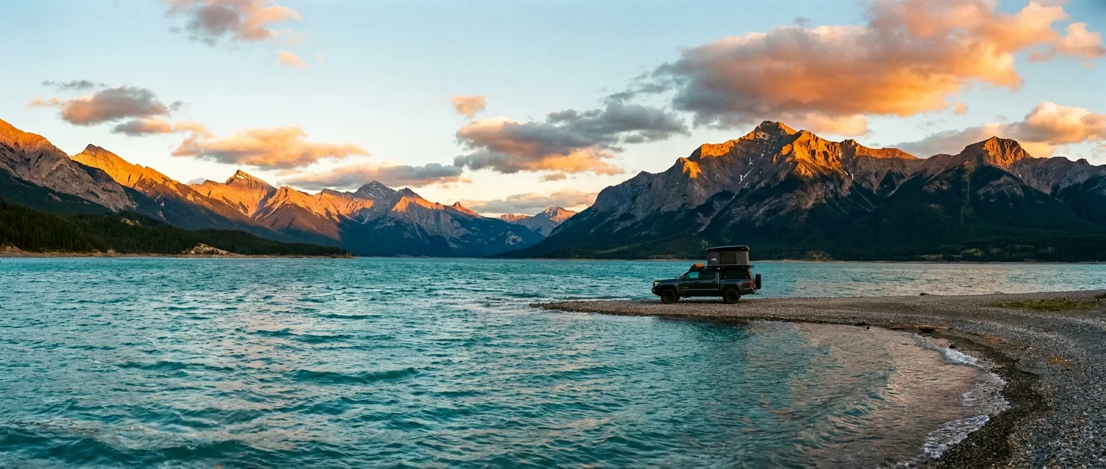
Abraham Lake at golden hour with an overlanding rig on the shoreline, Alberta Rockies
Trekkr Trail Journal · No. 001 · Free Sample Issue

Abraham LakeCamping + Trails — The Complete Field Guide

Wild water. Big sky. A wind-shaped reservoir on the edge of the Rockies where the pavement is easy and everything else isn't. This journal is the difference between a good trip and a great one.

Alberta · Canada David Thompson Corridor Summer / Shoulder Season Winter Bonus Inside
6Basecamps profiled
7Hike profiles
~50 kmAdventure corridor
0Reliable cell bars
01 / START HERE

A better basecamp than the postcard parks

Abraham Lake is not a conventional park destination — and that's the whole point. It's a long, wind-shaped reservoir edged by Highway 11, public land, provincial recreation areas and a handful of established campgrounds. No gates, no entry queues, no reservation lottery for the shoreline. That mix is exactly what makes it special, and exactly why preparation matters more here than almost anywhere else in Alberta.

Get it right and you'll have turquoise water, empty ridgelines and a fire under a sky full of stars while the Icefields Parkway crowd fights for parking an hour west. Get it wrong and you'll be the rig with a flattened tent, an empty tank and a cooler a bear already audited. This journal exists so you're the first one.

How to use this journal Read the map and the Know-Before-You-Go rules first. Pick a basecamp, pick your days from the trail selector and activity sections, then run the departure check the night before you roll. Every distance and rule in here is a planning estimate — the Verify Before Departure links at the bottom are your final word.
02 / ORIENTATION

The Highway 11 adventure corridor

"Within 50 km" means the Abraham Lake / Kootenay Plains travel corridor, measured from the lake and its principal access points — not a perfect radius from one pin. A schematic planning map: navigate with an offline topo, not this page.

PREVAILING SW WIND ABRAHAM LAKE KOOTENAY PLAINS BIGHORN COUNTRY NORDEGG FUEL · FOOD · INFO DAVID THOMPSON RESORT SEASONAL FUEL · STORE SASK. CROSSING FUEL · ICEFIELDS PKWY FISH LAKE CG GOLDEYE CG CRESCENT FALLS CG TWO O'CLOCK CK CG THOMPSON CK CG COLISEUM MTN ALLSTONES LK TH VISION QUEST TH SIFFLEUR FALLS TH BIGHORN DAM VIEWPOINT WINDY POINT PREACHER'S POINT N ≈ 10 KM (SCHEMATIC) HWY 11 · NORDEGG → SASKATCHEWAN CROSSING · PLANNING SCHEMATIC ONLY — NOT FOR NAVIGATION
Campground Trailhead Fuel / services Viewpoint / lake access Highway 11
The corridor's one rule The wind owns this valley. Chinook and outflow winds funnel down the North Saskatchewan and can go from calm to gear-scattering in under an hour — it's why the trees lean, why the ice bubbles form, and why every camp, paddle and summit plan in this journal starts with "secure it or lose it."
03 / BEFORE YOU ROLL

Three camping styles, three rulebooks

The corridor mixes provincial recreation areas, one private resort and a huge sweep of public land. Know which rulebook you're camping under before you commit to a spot.

Established Campground

Marked sites, toilets, managed access. Some sites reservable, others first-come. Best for predictable arrivals, families and lower-impact camping.

Reservable optionsToiletsFire rings

Private Campground

Amenities and booking set by the operator. Confirm check-in, power, water, firewood and cancellation directly. Your fallback when weather or crowds break plan A.

Services varyBook direct

Public-Land Camping

No guaranteed site, no services. A Public Lands Camping Pass is generally required, and the current PLUZ map, posted signs, closures and stay limits are law — not suggestions.

Pass requiredPLUZ rulesZero services

Connectivity reality

Treat the whole corridor as a dead zone. Pockets of signal exist near Nordegg and on some high points, but nothing you'd bet a rescue on. Download offline maps before Rocky Mountain House, carry a satellite communicator, and leave your route and return time with someone at home.

Water reality

Campground taps can be off or non-potable, and public-land sites have nothing at all. Carry your full drinking supply — 4 L per person per day is a sane planning number in this dry, windy valley — plus a filter or purifier as backup for creek water.

04 / BASECAMPS

Six places to plant the flag

Three established bases at the Nordegg end, three at the west end of the corridor. Confirm current services, site lengths and opening dates when booking — everything out here is seasonal.

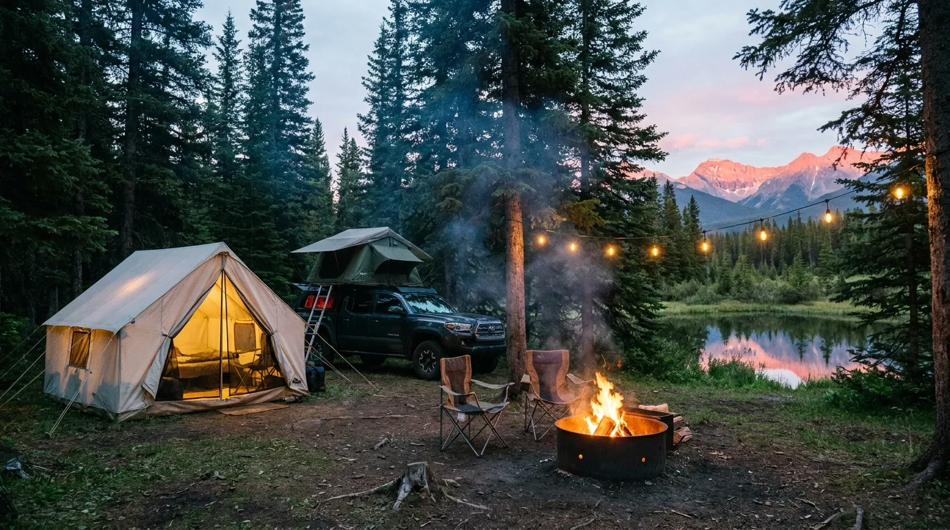
Campfire at a wooded lakeside campground at blue hour in the Alberta foothills
Established east. Fish and Goldeye Lakes trade lake drama for shelter, trees and calm evenings.
BasecampWhereStylePick it forWatch for
Fish Lake~8.5 km W of Nordegg, N of Hwy 11Serviced + unserviced · reservable optionsThe most full-featured base: paddling, fishing, easy trails, family comfortBooks up on summer weekends
Goldeye Lake8 km W of Nordegg + ~3 km NRustic · 40+ unserviced sitesQuieter spruce-and-aspen base with a loop walk and paddling at the doorstepReservable/first-come mix changes — check Alberta Parks
Crescent FallsBighorn River, NW of NordeggRV + walk-in tent sitesCamping beside a two-tier waterfall and its viewpointsFinal access road can be rough; cliffs demand respect
Two O'Clock CreekKootenay Plains, west corridorUnserviced RV + walk-in tentingDry open-Rockies setting; the base for Siffleur Falls and Plains walksWind can be intense — stake everything, bring water
Thompson CreekNear Banff boundary, E of Sask. CrossingRustic established campgroundMountain-river base for Icefields Parkway connectionsOuter edge of the 50 km corridor
David Thompson ResortHwy 11, west-central corridorPrivate · sites, cabins, servicesAmenities, a reliable base, and the corridor's mid-point service hubConfirm site types, rates and fuel hours with the operator
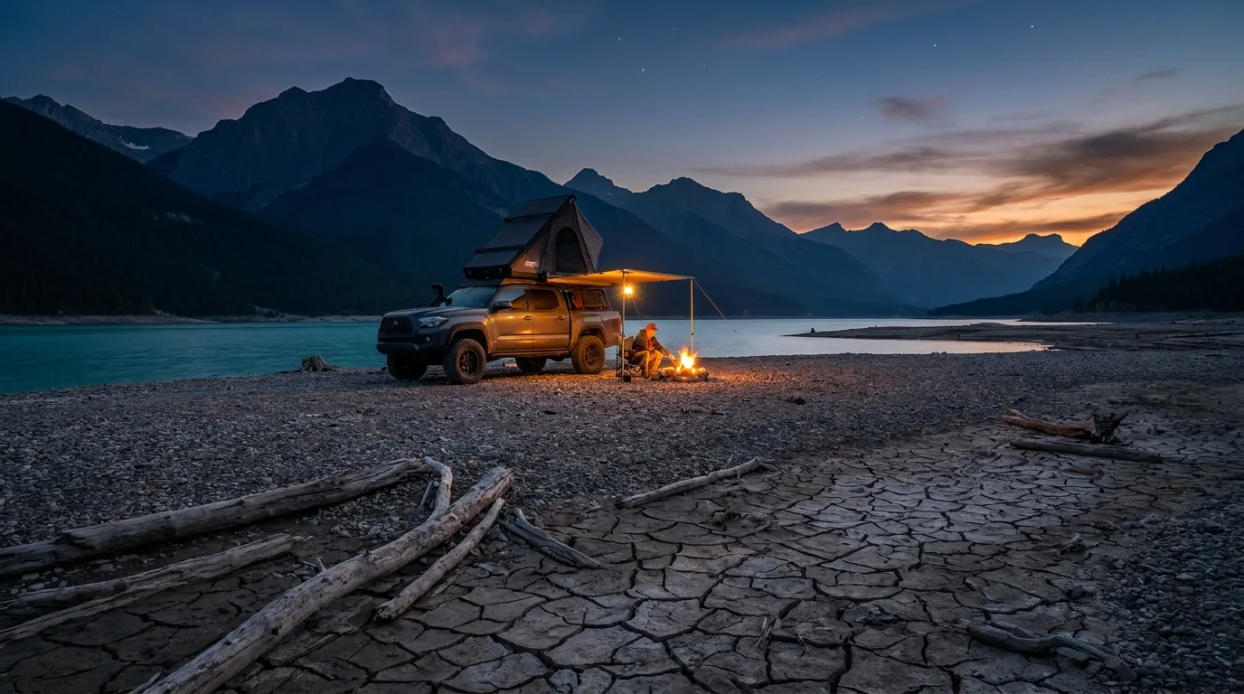
Overlanding truck with rooftop tent camped on gravel flats beside Abraham Lake at dusk

Public land: shoreline freedom, earned

The informal spots you've seen on Instagram — Preacher's Point, Belly of Abraham, Abraham Slabs, Allstones Cove — are local names, not designations. Treat them as orientation only. A track that was open last August may be closed, eroded or underwater this one; reservoir levels move, and so do the rules.

  1. Get the pass. Confirm the current Public Lands Camping Pass requirement before departure.
  2. Read the current map. The official Bighorn Backcountry PLUZ map and on-site signs are final.
  3. Camp durably. Use an existing legal disturbed site; avoid vegetation, wetlands and unstable shoreline.
  4. Pack everything out. No garbage, food scraps, greywater or abandoned fire rings.
  5. Plan for zero services. Water, toilet supplies, weather shelter and a backup campsite ride with you.
05 / TRAIL SELECTOR

Choose the day that fits the group

Seven profiled routes from stroller-friendly to scree-and-swearing. Distances and gains are planning estimates from official destination material and established route descriptions — GPS recordings vary.

TrailLevelDistanceGainTime
Crescent Falls viewpoints~1–2 km loopsLow30–75 min
Goldeye Lake loopShort loop — verify signageMinimal45–90 min
Kootenay Plains walksSigned out-and-backsVariable1–3 hr
Siffleur Falls~8 km return~150 m2.5–3.5 hr
Allstones Lake~8.8 km return~650 m4–6 hr
Coliseum Mountain~14 km return~900 m5–7 hr
Vision Quest ridge~4.7–5.5 km return~700–900 m4–6 hr
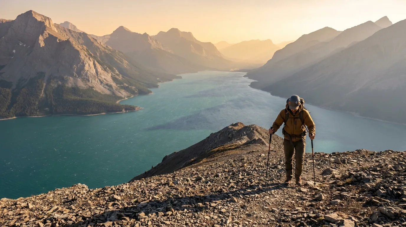
Hiker on a scree ridge high above turquoise Abraham Lake
Vision Quest ridge. Short, brutal, unforgettable. The viewpoint below the true summit is the sane turnaround.

Best all-round hikeSiffleur Falls

Easy–moderate~8 km return~150 m gain2.5–3.5 hr

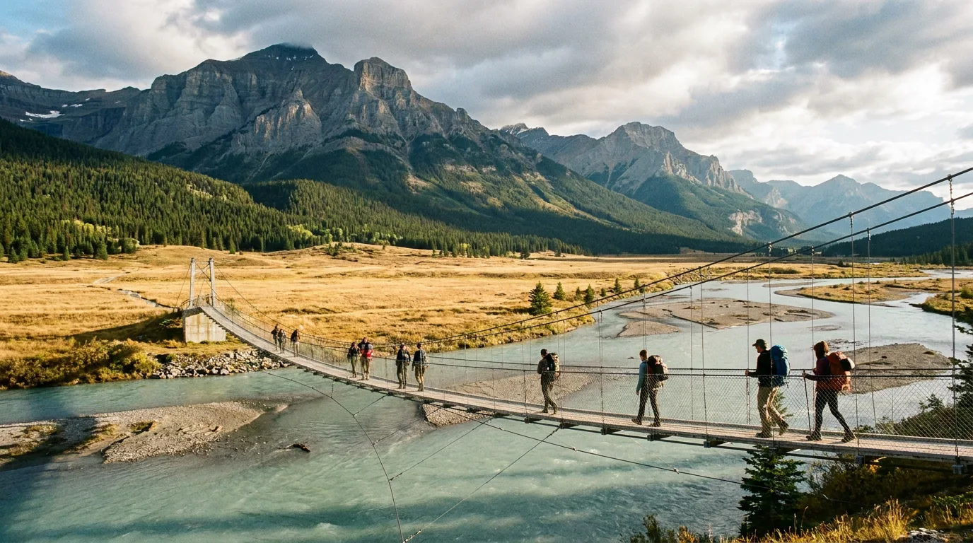
A broad, family-oriented route crossing the open Kootenay Plains and a suspension bridge before following the canyon to the first falls. The protected viewpoint is the destination; beyond it the trail turns rougher and less obvious, and the canyon edges have taken lives. This is the corridor's signature walk — go early, before the tour buses find it.

MAIN CAUTION: wind, exposed canyon edges, wildlife. Stay on the official route.

Gentle plains + canyon rise · out-and-back

Best short outingCrescent Falls viewpoints

Easy~1–2 km loopsLow gain30–75 min

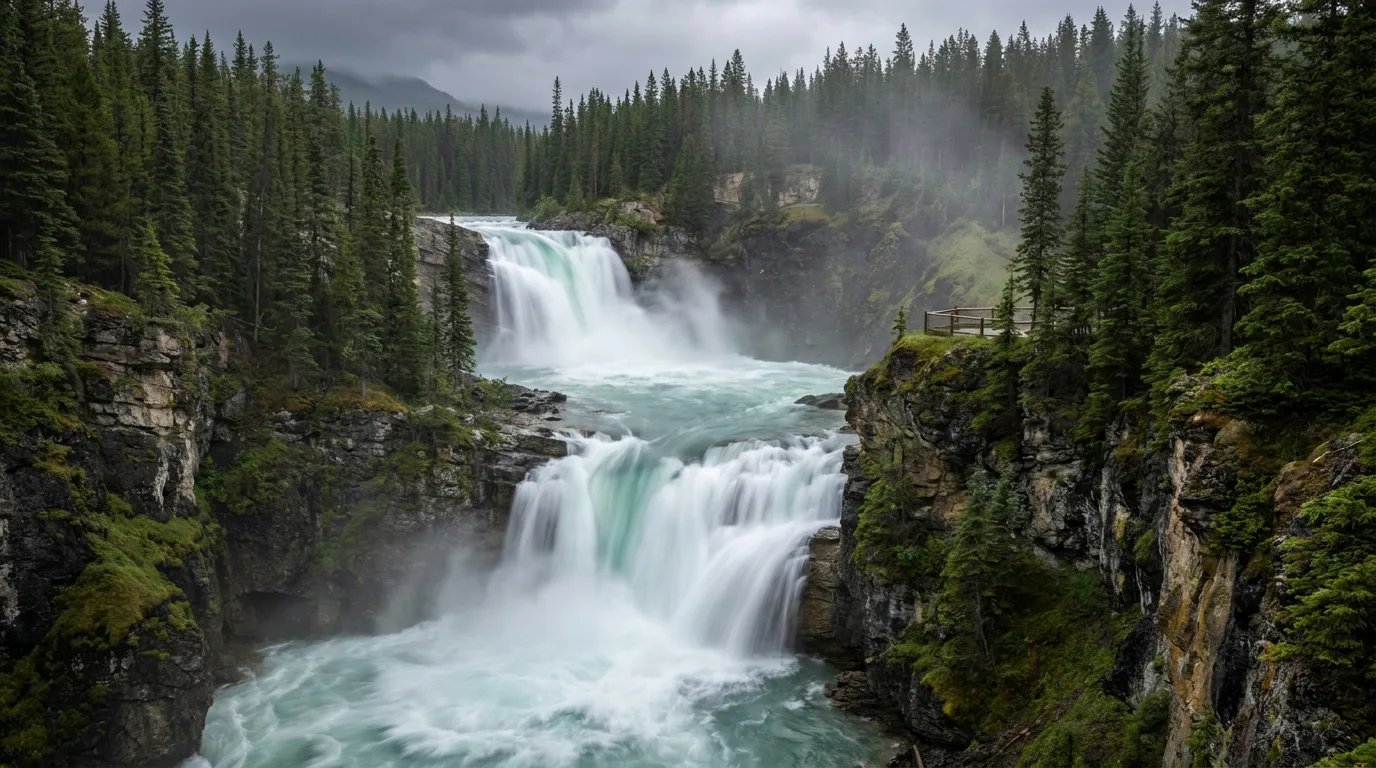
A short developed walk linking viewpoints above the two-tiered Bighorn River falls. Huge scenic payoff for almost no distance — perfect for arrival day, kids or pairing with a campground night.

MAIN CAUTION: do not cross barriers or approach cliff edges and wet rock. Current and cliffs here are lethal, not theoretical.

Nearly flat viewpoint loops

Best alpine lakeAllstones Lake

Hard~8.8 km return~650 m gain4–6 hr

A sustained, no-mercy climb from Highway 11 through forest to a small alpine lake. The grade never really relents, but the lake is a proper destination on its own without adding the exposed ridge extension. Bring more water than you think — the climb faces the sun.

MAIN CAUTION: steep, muddy or snowy conditions; route can be faint. Carry offline navigation.

Relentless steady grade · out-and-back

Best lake panoramaVision Quest ridge

Very hard~4.7–5.5 km return~700–900 m gain4–6 hr

A short but relentless ascent straight up from the lake. Loose rock, steep dirt and real exposure make this a serious mountain outing wearing a day-hike costume. The viewpoint below the true summit is the appropriate turnaround for most parties — and the view of the whole turquoise corridor from there is the best in this journal.

MAIN CAUTION: loose scree, exposure, wind and route-finding. Not a beginner hike. Helmets aren't a silly idea.

Straight-up scree · turn around at the viewpoint

Best full-day hikeColiseum Mountain

Hard~14 km return~900 m gain5–7 hr

A long climb from the Nordegg area through forest to broad upper slopes and enormous foothills views — the amphitheatre summit shape earns the name. Length and elevation demand an early start, a stable forecast and honest fitness. Pairs perfectly with a Fish Lake or Goldeye basecamp.

MAIN CAUTION: long day, changing weather, wildlife and seasonal snow.

Long forest approach to open slopes

Best campground walkGoldeye Lake loop

EasyShort lake loopMinimal gain45–90 min

A mellow forest-and-lakeshore walk directly from the campground. Ideal for arrival day, young hikers, or an evening stroll to shake out the legs after a bigger mountain objective. Verify the signed distance at the trailhead.

MAIN CAUTION: roots, mud and insects; stay on signed trails.

Flat loop from the campground

Best flexible dayKootenay Plains walks

Easy–moderateSigned out-and-backsVariable gain1–3 hr

Open grasslands, river views and big mountain scenery in every direction. Pick a signed trail, set a turnaround time, and go as far as the group's legs and the wind allow. The Plains hold deep cultural significance — move respectfully and never create shortcuts across sensitive ground.

MAIN CAUTION: wind, fast weather shifts and limited shade or water.

Rolling grassland · turn around anytime
Hikers crossing the suspension bridge on the Siffleur Falls trail across the Kootenay Plains

The universal trail plan

Every route above shares the same operating system. Start early — wind and storms build through the afternoon here. Download an offline map before you leave signal. Set a hard turnaround time and honour it even when the summit looks close. Keep the group together, and reassess at every major weather or route change. The mountains don't care that you drove three hours; they'll still be here next weekend.

Start earlyOffline mapsTurnaround timeStay together
06 / ON THE WATER

Paddling, boating & swimming

Two very different waters share this corridor: a big, cold, wind-raked reservoir — and a pair of small, sheltered lakes that do everything families actually want.

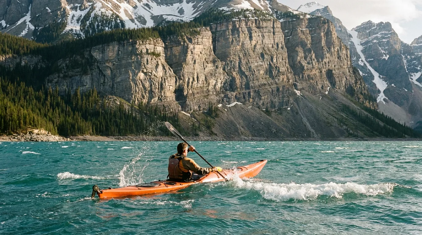
Kayaker paddling on windswept turquoise Abraham Lake below limestone peaks
Abraham is expert water. When it's calm it's the best paddle of your year. It is rarely calm.

Abraham Lake — the big water

There's no marina, no rentals, no rescue service and no formal beach — launching is from informal gravel access, and what's launchable changes with reservoir levels. Powerboats, canoes, kayaks and paddleboards all show up here, but this lake punishes casual plans: the prevailing southwest wind can turn glass into whitecaps in minutes, the water is cold enough to incapacitate a swimmer fast, and the far shore is a long, exposed crossing.

  • ▸ Paddle mornings only; be off the water by early afternoon
  • ▸ Hug the shoreline — never commit to open crossings in wind
  • ▸ PFDs worn, not stowed; dress for immersion, not air temperature
  • ▸ Clean, drain and dry your boat — Alberta takes invasive species inspections seriously

Fish & Goldeye — the family water

This is where swimming and easy paddling actually live. Both small lakes near Nordegg are sheltered, warm up far more than Abraham in summer, and put canoes, paddleboards and shore fishing steps from your site. No lifeguards anywhere in the corridor — supervise swimmers, expect cool water even in August, and check current electric-motor-only or boating rules on site.

Swimming Abraham itself? People do, off shallow bays on hot, still days. Cold shock, sudden drop-offs on a fluctuating reservoir bed, and wind chop mean it's a quick, supervised dip — not an afternoon float. If the trees are moving, stay out.

Fishing the corridor An Alberta sportfishing licence is required everywhere here. Fish Lake and Goldeye Lake are the reliable, family-friendly trout waters; Abraham and the North Saskatchewan hold whitefish and trout for those willing to work wind and water levels. Bull trout are catch-and-release province-wide — know how to identify Alberta's provincial fish before you wet a line, and check current regulations for the exact waters you're fishing.
07 / SADDLE & THROTTLE

Horseback & OHV country

The Bighorn is one of Alberta's great traditional horse landscapes and a serious OHV destination — but both run on the same rulebook: the current PLUZ map decides where you ride.

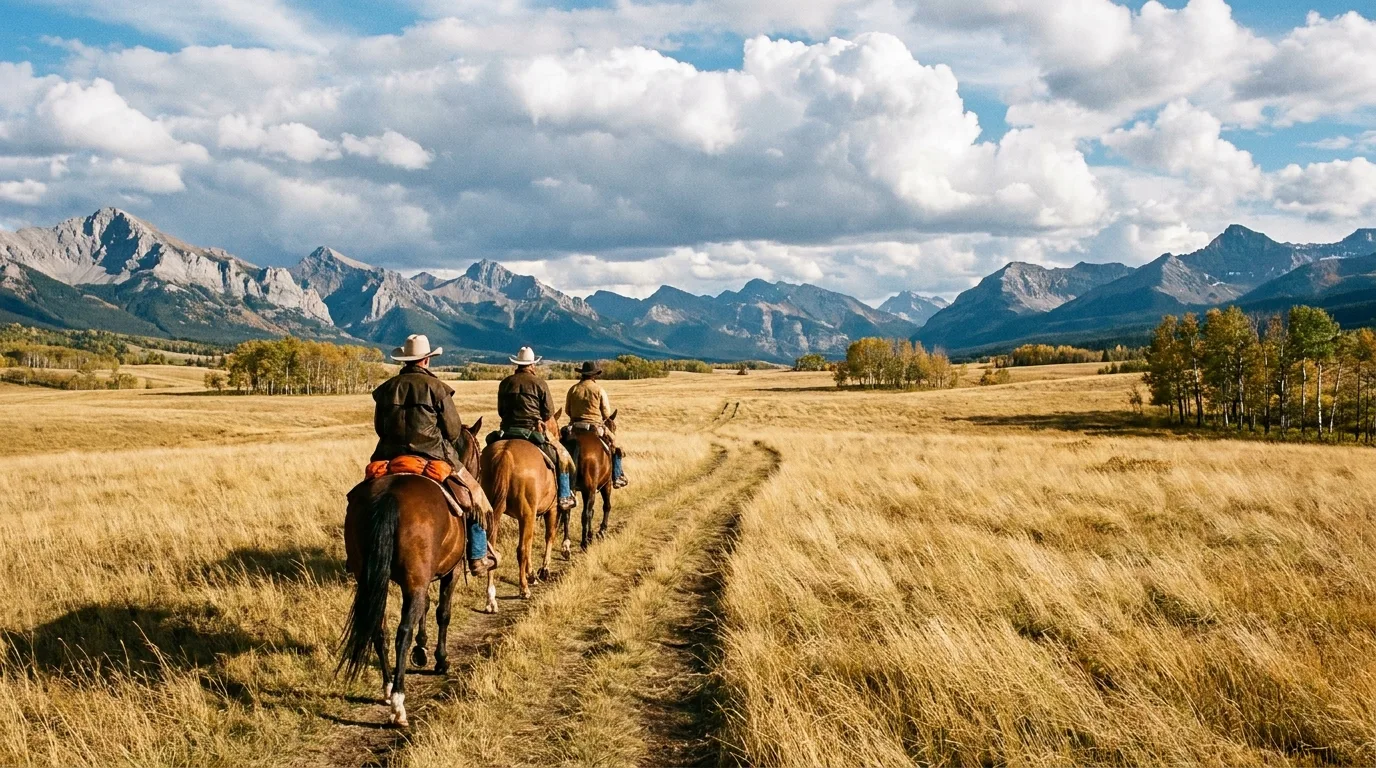
Trail riders on horseback crossing the open Kootenay Plains grasslands

In the saddle

The open Kootenay Plains and the trail network fanning off Highway 11 are classic Rockies horse country — Stoney Nakoda and outfitter horses have crossed these grasslands for generations. If you don't haul your own, guided trail rides and pack trips operate seasonally in the corridor; the David Thompson Resort area and Nordegg are the places to ask, and booking ahead is essential in July–August.

Hauling your own stock? Confirm equestrian staging, feed rules (weed-free where required) and camping allowances on the current PLUZ map before you load the trailer — and give hikers and wildlife generous space on shared trails.

Guided rides · book aheadShared trailsCheck staging rules

On the throttle

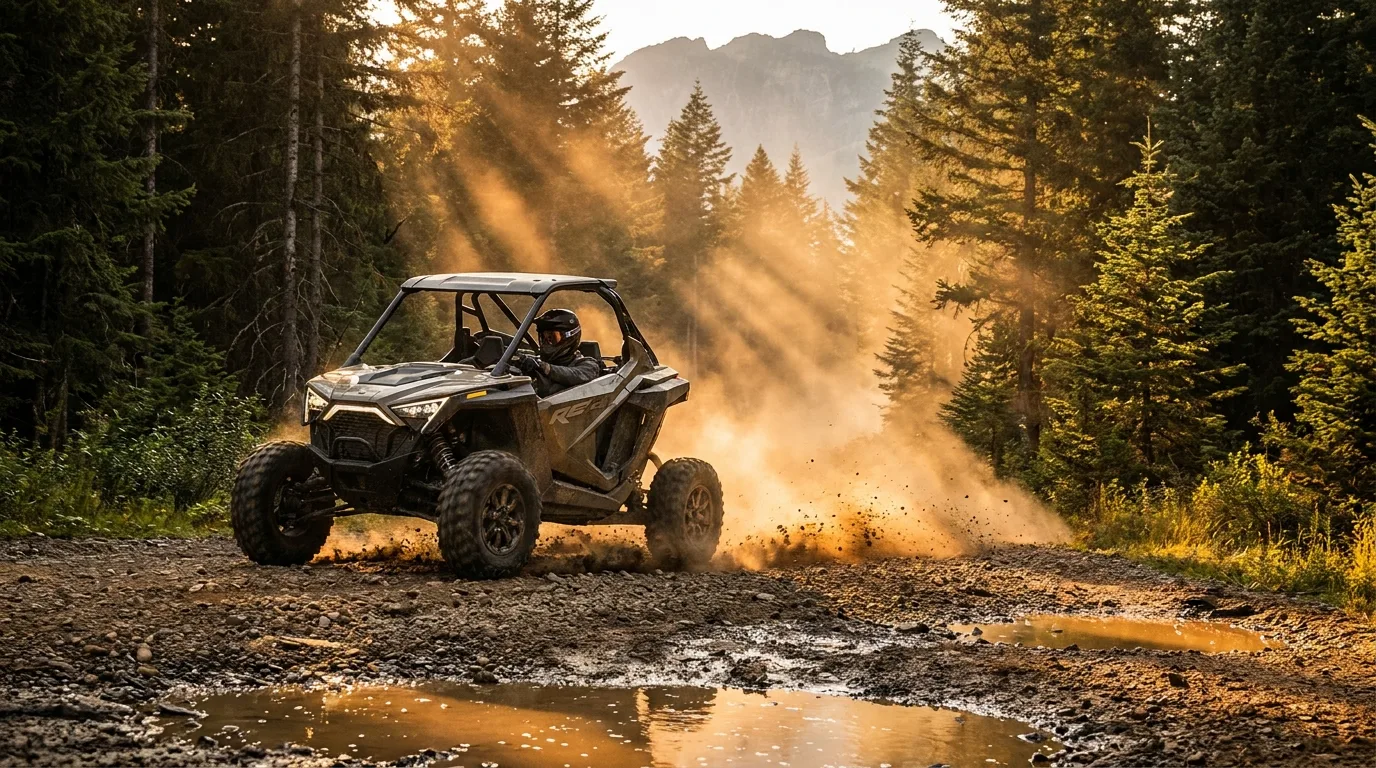
OHV riding in the Bighorn Backcountry is real and it's good — but it lives on designated trails only, mapped zone by zone on the current PLUZ map, with seasonal closures to protect wet ground and wildlife. The Abraham lakeshore, the flats and the beaches are not an OHV playground, and enforcement out here is active.

  • ▸ Machine registered, insured and plated for Alberta public land
  • ▸ Current-year PLUZ map downloaded — trails open and close
  • ▸ Spark arrestor, spare belt, tools, first aid and a buddy machine
  • ▸ Creek crossings at designated points only — stay out of the water elsewhere
Designated trails onlySeasonal closures
Side-by-side UTV on a gravel backcountry trail through Alberta pine forest
08 / WILDLIFE

You're a guest in serious animal country

Grizzly and black bears, cougars, moose, elk, deer and the corridor's celebrity bighorn sheep all live here. Most encounters are a privilege. Your job is keeping them that way.

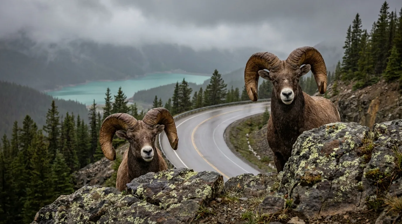
Bighorn sheep rams on rocky cliffs above Highway 11 near Abraham Lake
Windy Point regulars. Bighorns own the roadside rocks — slow down, stay in the vehicle, never feed.

Bears

Both species range the whole corridor. Bear spray rides on your hip — not in the pack — on every trail and every walk to the outhouse at dusk. Make noise in brush and on blind corners, travel in groups, and give any carcass or berry patch a wide berth. A camp that smells like nothing is a camp bears skip.

Camp discipline

All food, coolers, garbage, dishes, toiletries and dog food live sealed in a hard-sided vehicle or bear-proof storage — never in your tent, never on the table overnight. Cook and eat away from where you sleep at informal sites. Pack out every scrap; buried scraps are just slow-release bait.

Roadside & trail manners

Bighorns loiter on the highway rocks near Windy Point and moose stand in dawn shadows — drive Highway 11 like something is around the next bend, because it is. Photograph from the vehicle, keep dogs leashed everywhere, and give moose and elk more room than feels necessary, especially with young in spring and during fall rut.

Non-negotiable Feeding or baiting any wildlife — including "just one" bighorn by the road — is illegal, dangerous, and usually ends with the animal destroyed. Report aggressive wildlife encounters and problem bears to Alberta Fish & Wildlife.
09 / LOGISTICS

Fuel, firewood & resupply

The corridor's golden rule: arrive full, of everything. Every service out here is small, seasonal and closes earlier than you hope.

StopPositionCount onField notes
Rocky Mountain House~85 km east of NordeggFull services — fuel, groceries, hardware, propane, cell signalYour last real town. Top the tank, fill the cooler, download the maps here.
NordeggEast gatewayFuel, food, general store, visitor info at the Heritage CentreSmall and seasonal-hours. Don't roll in at 9 pm expecting miracles.
David Thompson ResortMid-corridor, Hwy 11Seasonal fuel, camp store, firewood, hot food in seasonThe mid-corridor lifeline — confirm hours and fuel availability with the operator before relying on it.
Saskatchewan CrossingWest end, Icefields Pkwy junctionFuel, food, lodging (seasonal, resort pricing)Handy if you're continuing to Banff/Jasper. Expect to pay for the location.

Fuel math

Nordegg to Saskatchewan Crossing is roughly 90 km of highway — then add every campground detour, trailhead shuttle and sightseeing lap. Plan the weekend on a half-tank of driving, arrive with a full one, and jerry-can it if you're running OHVs, a generator or a thirsty rig.

Firewood doctrine

Buy it where you burn it — Nordegg, the resort, or campground hosts — and never haul wood across the province (pests travel in firewood). Scrounging deadfall is unreliable and restricted in places; a windy valley strips easy wood fast. Check the fire ban status the morning you leave, and again at the trailhead signs.

Cooler strategy

Ice is a resupply item too, and it's scarce mid-corridor. Freeze water jugs at home (they become drinking water as they melt), pre-chill the cooler overnight, and split perishables from drinks so the food cooler opens ten times a day instead of a hundred.

10 / BEYOND THE TENT

Attractions worth building the trip around

Abraham Lake shoreline

Turquoise summer water, dramatic exposed flats at lower levels and broad mountain views. Use durable access points and stay well back from unstable banks.

Crescent Falls

A two-tier waterfall with developed viewpoints. Combine with a campground night or a half-day outing.

Kootenay Plains

Dry grasslands, deep cultural significance and unusually open views. Move respectfully and remain on signed routes.

Nordegg Heritage Centre

Coal-town history, visitor information and the best place to ask about changing conditions on your way in.

Bighorn Dam viewpoint

A compelling engineering-meets-landscape stop at the east end of the reservoir — and the reason this lake exists at all.

Icefields Parkway connection

Highway 11 meets the Parkway at Saskatchewan Crossing, making Abraham a brilliant base or side-trip before Banff/Jasper travel.

Two-tiered Crescent Falls dropping through a limestone canyon on the Bighorn River
Crescent Falls. Massive payoff, minimal walk — and cliffs that demand you stay behind the barriers.
11 / THE KIT

What rides in the rig

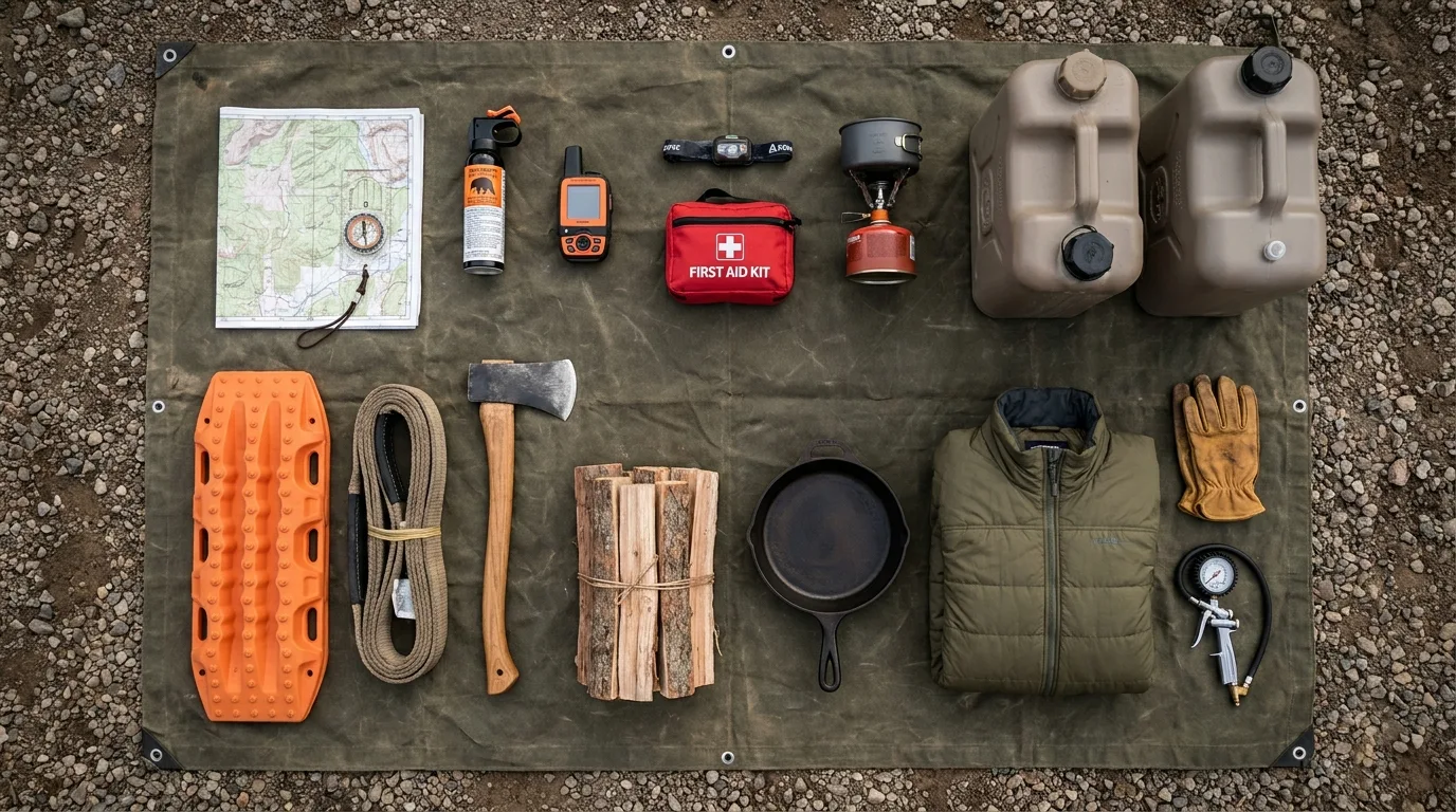
A corridor with no cell service, no water taps you can count on, and wind with a grudge. Orange items are the non-negotiables.

Overhead flat lay of complete overlanding kit: maps, bear spray, satellite communicator, recovery gear, stove and firewood
The Abraham loadout. If it can blow away, tie it down. If it smells like food, lock it up.

Navigate & communicate

  • Offline maps downloaded + paper backup
  • Satellite communicator / PLB
  • Trip plan left with someone at home
  • Compass you actually know how to use
  • Power bank + 12V charging sorted
  • Current PLUZ map (printed or offline)

Camp & fire

  • 4 L water / person / day + filter backup
  • Purchased local firewood + fire permit awareness
  • Wind-rated tent, extra stakes & guy lines
  • Stove + fuel (fires may be banned)
  • Tarp/awning with storm tie-downs
  • Toilet kit: trowel, bags, TP — pack it out
  • Insulation + rain shell, even in July

Safety & recovery

  • Bear spray — on the hip, one per adult
  • First aid kit sized for the group
  • Full-size spare, checked, with a real jack
  • Traction boards + tow strap + shackles
  • Tire repair kit + compressor
  • Headlamps + spare batteries
  • Jerry can if running toys or long detours
12 / MAKE A WEEKEND OF IT

Three ready-made trip shapes

01

Easy Scenic Weekend

  1. Night 1: Fish or Goldeye Lake — camp set, fire lit, paddle at sunset.
  2. Day 2: Crescent Falls viewpoints + Nordegg Heritage Centre + ice cream.
  3. Day 3: Goldeye loop walk, pack slow, drive home happy.
Low mileageWeather-flexibleFamily-first
02

Lake + Summit Weekend

  1. Day 1: Base near Abraham; shoreline sunset shoot at Preacher's Point area (legal spot confirmed).
  2. Day 2: Allstones Lake or Coliseum Mountain, matched honestly to the group.
  3. Day 3: Recovery walk on the Plains, then home.
Early startsOffline navLegs required
03

West Corridor Weekend

  1. Day 1: Base at Two O'Clock Creek or Thompson Creek; Kootenay Plains wander.
  2. Day 2: Siffleur Falls — the corridor's classic.
  3. Day 3: Continue west to Saskatchewan Crossing and the Icefields Parkway.
Wind-ready shelterFuel planningParkway launchpad
13 / WINTER BONUS

Come back when it freezes

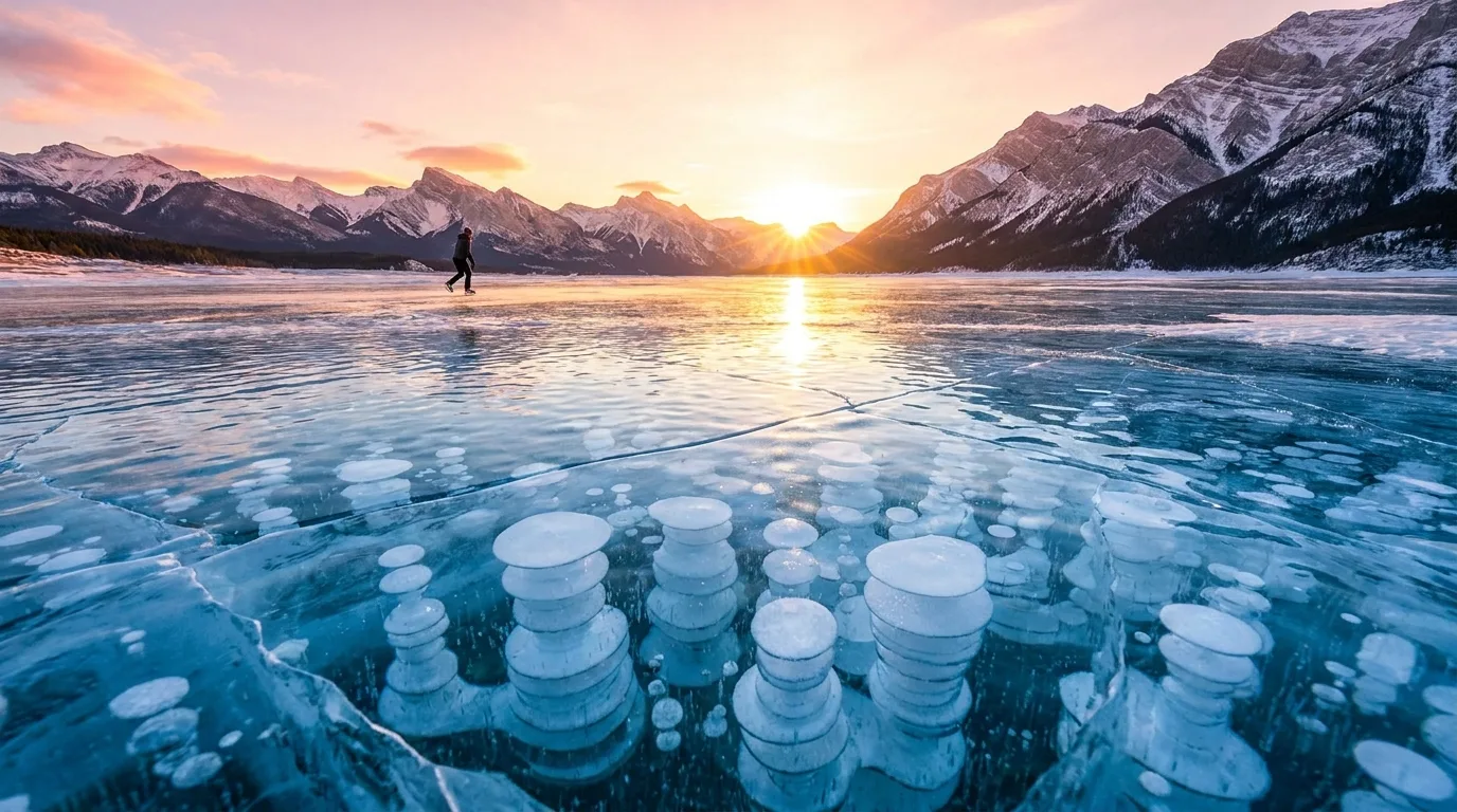
The same methane that seeps from the lakebed all summer becomes, in deep winter, one of the most photographed natural phenomena in Canada: stacked towers of frozen bubbles under glass-clear ice.

Frozen methane ice bubbles stacked under clear blue ice on Abraham Lake at sunrise
The famous ice bubbles. Typically best roughly mid-January into February, before heavy snow buries the show.

Where & when

The Preacher's Point end and wind-scoured mid-lake flats are the classic zones — the same wind that ruins your summer awning polishes the winter ice to glass. Sunrise light through the bubbles is the shot everyone drives for.

The hard rules

This is a reservoir with fluctuating levels — ice thickness is never uniform and never guaranteed. Assess conditions yourself, wear ice cleats (the wind-polished surface is treacherous), never drive on the ice, and treat pressure cracks and open leads as hard boundaries. Beauty out here is load-bearing only sometimes.

14 / MOUNTAIN-READY

The departure check

Run it the night before you roll. Tap each item as it's done — no excuses survive contact with this list.

0 / 10 confirmed — the mountains are watching.

15 / QUICK ANSWERS

Asked around every campfire

Can you camp for free at Abraham Lake?
Informal camping on the surrounding public land generally requires a Public Lands Camping Pass, and the current PLUZ map, signs, closures and stay limits apply. The famous named spots are orientation, not permission — and there are zero services, so you carry everything in and out.
Is there fuel at Abraham Lake?
Not on the lake itself. Nordegg (east), David Thompson Resort (mid-corridor, seasonal) and Saskatchewan Crossing (west) are your options; Rocky Mountain House is the last full-service town. Arrive full and treat every stop as seasonal until you've confirmed it.
Can you swim in Abraham Lake?
A quick supervised dip off a shallow bay on a hot, calm day — yes. An afternoon of swimming — that's what Fish Lake and Goldeye Lake are for. Abraham is cold, drop-off-prone, unpatrolled and windy.
Are ATVs allowed?
On designated trails per the current Bighorn Backcountry PLUZ map, with seasonal closures, registration and insurance. The shoreline and flats are not open riding areas.
When do the ice bubbles appear?
Typically best from roughly mid-January into February, once ice is thick and clear and before heavy snow. Conditions vary every year — assess ice yourself, and never drive on it.
Do I need reservations?
For summer weekends at the established campgrounds, book anything reservable as early as Alberta Parks allows. First-come sites and public land are the fallback — which is exactly why a backup campsite is on the departure check.
16 / VERIFY BEFORE DEPARTURE

The final word lives here

Trail distances and elevation figures in this journal are planning estimates. Conditions, access, fees and rules change — these sources are the truth on the day you travel.

This was a free sample issue

Go farther. Camp lighter.
Leave it better.

Every Trekkr Trail Journal is built like this one: custom maps, honest trail beta, full logistics, kit lists and the local knowledge that turns a good trip into the one your crew talks about for years. New destinations drop for members all season long.

Unlock the Trail Journal Library
⤓ Download the printable field guide (free PDF)
$9.95 per guide · Instant access · Built by people who actually camp there