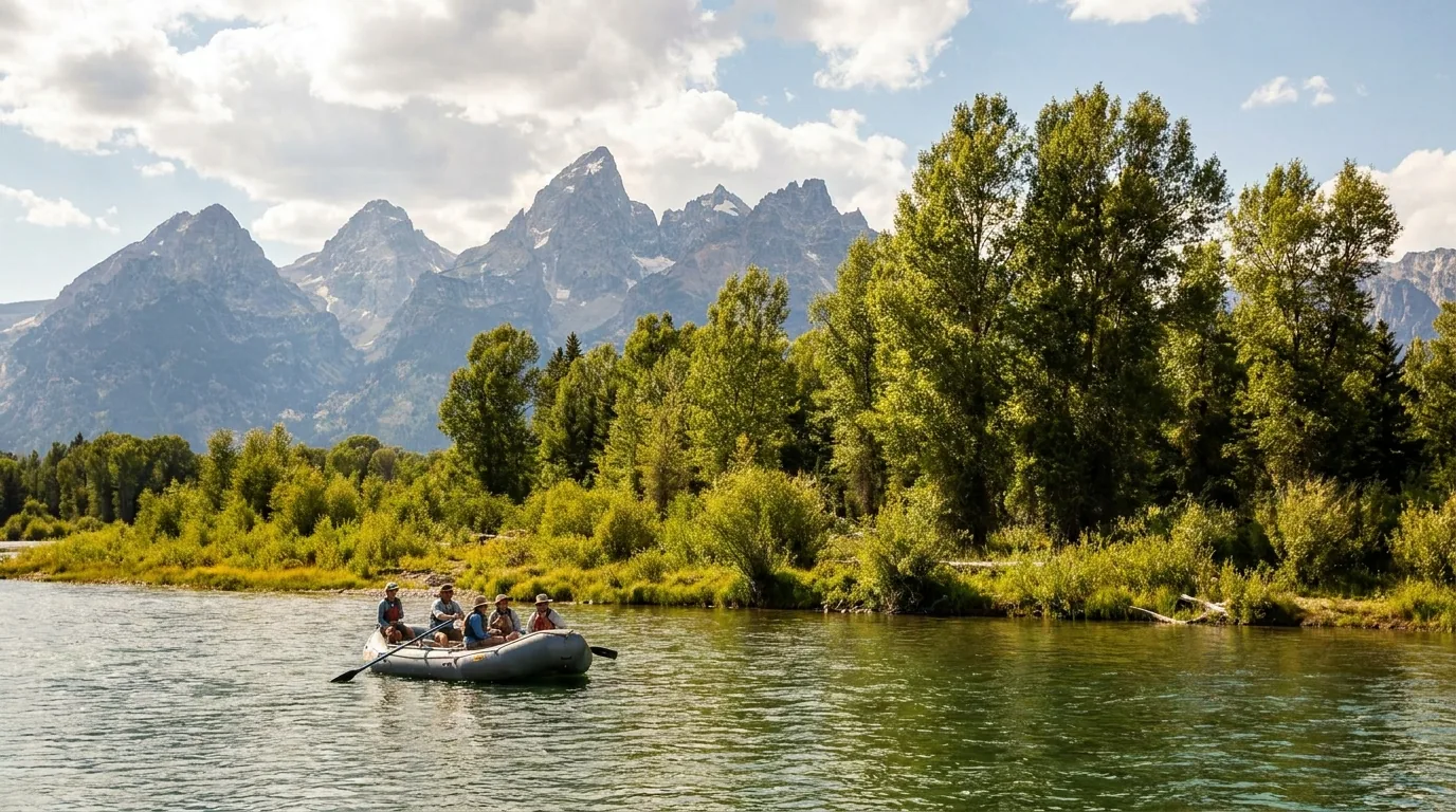
Most ranges give you warning — foothills, then benches, then peaks. The Tetons don't bother. You come north out of Jackson on a flat sagebrush plain and the wall is simply there, standing straight up out of the valley floor with nothing in between. That geometry decides everything in this guide: why sunrise is the whole event, why every canyon climbs hard from the first step — and why the thing most likely to end your trip isn't weather or grizzlies. It's that every campground in this park is now reservation-only, six months out, with no first-come option anywhere inside the boundary.
The rest of this journal is evergreen; this box is not. The thing that ends most Grand Teton trips isn't a storm or a bear — it's arriving with a rig and nowhere legal to put it, or driving to a trailhead that's been fenced off since May. 2026 is a heavy construction year and the camping system has changed for good. Everything below is dated to the day we checked it. Trust the live sources, not our date stamp.
Most mountain ranges give you warning. Foothills, then benches, then peaks — a gradual argument that builds to a conclusion. The Tetons don't bother. You come north out of Jackson on a flat sagebrush plain and the range is simply there, seven thousand feet of it, standing straight up out of the valley floor with nothing in between. It's the youngest range in the Rockies and it looks it: unworn, unbuttressed, still arguing with the sky. Every practical decision in this guide falls out of that one piece of geometry.
The fault runs north–south, so the peaks face east. Every clear morning they catch the first light in the state while the valley you're standing in is still blue and cold. The sun sets behind the range — evening gives you silhouettes, not lit peaks. (§07)
There's no easing into these canyons. Lupine Meadows gains 3,070 ft in under five miles because there's nowhere else for the trail to go, and Paintbrush Divide sits at 10,700 ft and holds snow into mid-July. The range grants access on its own terms. (§06)
The park is running infrastructure projects ahead of its 2029 centennial, and they've landed on the most-visited corridor. Roads are torn up, Death Canyon is shut, and getting through Moose costs you twenty minutes you didn't budget. (§02)
⚠️ That 1:15 is a no-traffic figure and it does not survive a 2026 summer. Budget two hours. The North Park Road between Leeks Marina and Lizard Creek is running one-lane alternating traffic with up to 15-minute daytime delays and up to one-hour night delays between 9 p.m. and 6 a.m. — directly on the Teton→Yellowstone route. Add wildlife jams on top.
This is the single most important planning fact for a 2026 trip, and most guidebooks and blogs are still describing the park as it was. The park is upgrading infrastructure ahead of its 2029 centennial and the work has landed squarely on the busiest corridor. The hiking above the trailheads is unaffected. The driving is the tax — and two closures remove named destinations from the map entirely.
| Project | 2026 dates | Impact |
|---|---|---|
| Moose-Wilson Road LSR Preserve ↔ Moose |
May 1 – Jun 19: CLOSED Jun 20 – Sep 7: open Sep 8 – Nov 15: CLOSED |
Fully closed for the first seven weeks of the season. In the window it is open, expect 45-minute delays or longer on a dirt/gravel surface. Closed again from the second week of September |
| Death Canyon Road & Trailhead | May 2026 – June 2027 | CLOSED completely — to vehicles, bicycles AND pedestrians. It's an active work zone. Trailhead being relocated ~1 mile with paved access, ~90 parking spots and restrooms; reopening anticipated 2027 |
| Teton Park Road — Moose roundabout | May – Nov 2026 2-year project into 2027 |
20-minute delays at the Menor's Ferry Road junction just north of the Moose Entrance Station — not including the entrance-station queue. See the source conflict below |
| Taggart Lake Trail north segment |
Entire 2026 season, through Nov 15 | Northern segment between trailhead and lake CLOSED. Trailhead and parking stay open; access is the longer southern route, reported at 4.24 miles with 711 ft of gain |
| North Park Road Leeks Marina → Lizard Creek |
Summer 2026 | One-lane alternating traffic. Up to 15-minute daytime delays; up to 1-hour night delays, 9 p.m.–6 a.m. This is the road past Lizard Creek Campground and the Yellowstone route |
| Mormon Row Historic District | Jun – Nov 2026 | OPEN, but under a site-improvement project — pedestrian/cycling zone, expanded parking at the southeast corner of Antelope Flats & Mormon Row, new restrooms, vegetation restoration. Expect equipment in the viewshed |
| Menor's Ferry Road | Summer 2026 | Sporadic delays; Chapel of the Transfiguration reported open Sundays (tourism-board note — confirm) |
| Signal Mountain Summit Road | Closed Nov 1 – May 1 by regulation | Trailers and RVs prohibited — of any size. Not a length limit, a flat ban. Because of elevation it typically isn't plowed open until late June or early July (2026 actual opening date unconfirmed — check park alerts) |
Highway 26/89/191 (the Outer Park Road) and Colter Bay remain open throughout. The park itself is open 24 hours a day, year-round; winter (Nov–Apr) closes all campgrounds and most facilities and takes several roads out of service (§11).
These may be two descriptions of overlapping projects, or a secondary source may have conflated them. We are not picking a side. If your plan depends on the Teton Park Road being open in May or early June — and if you're camping at Signal Mountain or hiking Lupine Meadows, it does — confirm at nps.gov/grte road construction before you commit. Getting this wrong strands you on the wrong side of the valley.
Two things, and both matter. First, a marquee 7.7-mile, 2,400-ft day hike is gone for the year. Second — and this is the one that wrecks itineraries — Death Canyon is a standard Teton Crest Trail access and exit. If you had a Crest Trail plan built around it, it needs rebuilding from the trailhead up.
Local reporting says access is possible from farther trailheads, with a Whitegrass alternate adding roughly a mile each way, and that the Laurance S. Rockefeller Preserve / Phelps Lake Trailhead stays open. The exact legal status of that walk-in is not something we could confirm — call the Craig Thomas Discovery & Visitor Center at 307-739-3399 before you count on it.
2026 buys you a better park in 2027 and a more annoying one right now. This is the least convenient summer Grand Teton has had in years. It is also, still, the mountain range that ruins other mountain ranges for you. Get up before the light does, park before nine, and it delivers exactly what it promises.
This is the section that saves the trip. Two facts govern where you sleep in Grand Teton, and both of them have to be settled months before you pack: there is no first-come, first-served camping inside the park at all, and the length of your rig eliminates most of the campgrounds before you even look at availability. Everything else — showers, hookups, views, quiet — is a distant third.
The move: set a calendar alarm for six months minus one day from your intended arrival date, and be on Recreation.gov at opening. If you miss it, your walk-up options are Bridger-Teton National Forest dispersed sites outside the park (§04) — and those fill by midday.
Stay limits: 14 nights maximum at any one campground · 7 nights at Jenny Lake · 30 nights cumulative across all park campgrounds per year.
| Campground | 2026 season | Sites | 2026 fee/night | RV limit | Hookups | Generators | Showers / laundry |
|---|---|---|---|---|---|---|---|
| Gros Ventre Kelly / Mormon Row side |
Apr 27 – Oct 9/10 closing date conflicts — check the booking calendar |
279 std + 39 electric (10 ADA) + 4 group | $59 std $78 electric $17/person group |
45 ft incl. tow | 39 electric-only | Loops A, B, C, East Corridor only · 8am–8pm | NO SHOWERS |
| Jenny Lake base of the range |
May 2 – Sep 27 | 51 tent sites (3 ADA) + 10 hiker/biker | Not confirmed — price displays live in the booking flow | TENT ONLY — no trailers, campers, pop-ups or towables. One vehicle, ≤8 ft high × 14 ft long | None | Policy not confirmed | Token-operated showers on site |
| Signal Mountain on Jackson Lake |
May 8 – Oct 11 | 80 sites, 3 loops (3rd loop generator-free) | $59 std $83 electric (pre-tax) |
30 ft | 24 sites @ 30/50-amp | 8am–8pm · banned in 3rd loop | Coin laundry + showers · dump station on site |
| Colter Bay the full village |
May 21 – Sep 26 | 324–338 std + 13 electric ADA + 10 hiker/biker + 10–12 group | $59 std $78 electric $17/person group |
Varies by site — check the listing | 13 electric (ADA) | Loops H, J, K, M, O + group sites · 6am–10pm | Showers & laundry (fee) · free dump station + water fill |
| Colter Bay RV Park RVs only, no tents |
early-May – early-Oct services from May 21 |
112 full-hookup (102 pull-through + ~10–12 back-in), 6 ADA | Not confirmed — check the live booking flow | 45 ft pull-through 30 ft back-in |
Full: sewer, water, 20/30/50-amp | Prohibited at all times | Showers & laundry (fee) |
| Lizard Creek north shore, Jackson Lake |
Jun 12 – Sep 7 shortest season |
60 (tent, RV, walk-in tent) | $53 (pre-tax) | 25 ft | None | Policy not confirmed | Not confirmed |
| Headwaters at Flagg Ranch JDR Parkway, 2 mi from Yellowstone |
Jun 7 – Oct 2026 | 34 tent + 97 full-hookup pull-through RV + 40 camper cabins | Not printed — our two sources gave conflicting figures. Check the live booking flow | 45 ft incl. tow | Full: sewer, water, 20/30/50-amp | Policy not confirmed | Showers · coin laundry · store, gift shop, restaurant |
| Colter Bay Tent Village tent cabins, not campsites |
Not confirmed | 66 tent cabins | Not confirmed | n/a | n/a | n/a | Shared Colter Bay facilities |
Book everything at recreation.gov/gateways/13525. Fees confirmed against the NPS camping page and the two park concessioners (Grand Teton Lodge Company, Signal Mountain Lodge). Where a 2026 rate could not be pinned to an official page we print nothing rather than guess — prices display live during the booking flow.
51 tent sites at the base of the range, walking distance to the boat dock, Hidden Falls, Inspiration Point and Cascade Canyon — the single best trailhead access in the park.
The price of that: strictly tent-only — no trailers, campers, pop-ups or any towable — one vehicle per site no bigger than 8 ft high × 14 ft long, six people, two small-to-medium tents, and a 7-night cap instead of 14. Recreation.gov notes these limits are "strictly enforced." It is the hardest reservation in the park. If you're in a van taller than 8 feet, you are not camping here.
The 45-foot limit is the most generous in the park, it has 39 electric sites, and at 279+ sites it's the largest — which also makes it the one most likely to still have something when everywhere else is gone. It's open the longest season by a wide margin: late April to early October, so it's the shoulder-season answer.
Cottonwoods, the Gros Ventre River, and genuinely good wildlife viewing — this is the Kelly and Mormon Row side of the valley, which puts you close to the best sunrise sites. The catch: no showers at all. The biggest campground in the park, and you drive to Colter Bay or into Jackson to wash. Plan around it.
The full village: grocery store, restaurants, marina, visitor centre, laundry, showers, gift shop, ranger programs, WiFi at several buildings, and a free dump station and water fill. Also the most generous generator window in the park at 6am–10pm in the designated loops.
If your trip involves kids, resupply, or a rig that needs to dump, this is the base. The tradeoff: it's 40 minutes north of the Teton trailheads, and the sites are lodgepole forest, not view sites.
Right on Jackson Lake with a marina, a dump station, coin laundry and showers, and a generator-free third loop if you want quiet. Best all-around compromise for a mid-size rig that wants water access without the Colter Bay crowds.
The catch: a 30-foot RV limit and only 24 electric sites. And note the Summit Road above it — trailers and RVs are prohibited on it entirely. Unhitch at the campground or skip the drive.
60 sites on the north shore of Jackson Lake, no hookups, 25-ft limit, and the shortest season in the park (Jun 12 – Sep 7). It's the closest park campground to Yellowstone's South Entrance and the least developed of the drive-in options.
2026 caveat: the North Park Road construction zone runs right past it. If you're arriving after dark, add the one-hour night delay to your plan.
Headwaters at Flagg Ranch is the Yellowstone-first answer: 97 full-hookup pull-throughs at 45 ft, two miles from Yellowstone's South Entrance, with a lodge, restaurant, store and coin laundry. If Yellowstone is the main event and Teton the side trip, sleep here.
Colter Bay RV Park holds the only full hookups in the southern half of the park. RVs only, no tents. Wood fires prohibited (gas and charcoal grills fine). Generators prohibited at all times — which is fine, because you have shore power.
And the flat ban worth repeating: no trailers or RVs of any size on the Signal Mountain Summit Road. That one isn't a length limit you can argue with — it's prohibited outright.
Here's the part that matters if you missed it: only about one-third of permits go to advance reservation. The other two-thirds are held for walk-ups, issued one day before your start date, first come first served, in person at a park permit office. Grand Teton holds back far more walk-up inventory than most marquee parks. A flexible traveller is genuinely not out of luck.
Fees: $20 flat non-refundable permit fee + $7 per person per night (nightly portion refundable up to 5 days before start). Card only, no senior or Access discount. Group size: individual permits cover up to 6; groups of 7–12 must use designated group sites. Stay limits: 2 nights per location (3 at Jackson Lake), no more than 10 nights between June 1 and Labor Day, 30 nights annually.
The hard deadline: permits must be picked up in person by the holder or a listed alternate by 10:00 a.m. on the start date — at Craig Thomas Discovery & Visitor Center, Colter Bay Visitor Center, or Jenny Lake Ranger Station. Miss the window and it's cancelled as a no-show (call 307-739-3309 if you're delayed). Climbing/mountaineering permits and Garnet Canyon camping must be collected at Craig Thomas or Jenny Lake only, not Colter Bay.
And the free thing nobody knows: much of Grand Teton's backcountry camping is above tree line where hanging food is impossible, so a hard-sided IGBC-approved bear canister is required — and the park loans them free of charge at every permit-issuing station when you collect your permit. Don't buy one. Don't try to fly one in.
Outside the park boundary, the Bridger-Teton National Forest offers free dispersed camping with Teton views, and it's the reason a lot of people plan a Jackson trip at all. It's also the weakest-sourced section in this guide, and we'd rather tell you that than dress it up. Read the warning box before you use a single figure below.
The stay-limit rules in particular have changed in recent seasons, and that's exactly the kind of thing a guide must not get wrong. Call the Jackson Ranger District at 307-739-5400 to confirm stay limits, site status and closures before you rely on any of it. We print it because knowing these areas exist is worth a lot; we flag it because the details are not ours to guarantee.
East of Kelly, off the Antelope Flats Road area. Free, no permit required for dispersed camping — but you must camp in a numbered designated site, and this is enforced. Roughly 45 designated sites, many clustered near the bottom of the hill. Pulling off wherever you like is not permitted here.
Facilities: essentially none. No toilets, no water, no tables, no fire rings at most sites, no trash service. A porta-potty is reported at sites 1–15 only. Full self-sufficiency — bring all water, pack out everything including human waste where there's no toilet.
Fills by late morning in season. Bear-resistant storage of all food, garbage and scented items is mandatory (§08).
About 10 miles east of Jackson in the Jackson Ranger District. Free, with a reported 16–18 numbered dispersed sites along the switchbacks above the National Elk Refuge, each with a fire ring; many take tents or small RVs. First come, first served.
Camping is prohibited in the lower section — sites begin after the switchbacks start, and it's signed.
The road: reports conflict. One 2026 account calls it "in good shape if you go slow"; others describe the first miles as rough and potholed and recommend high-clearance 4×4 for the upper sites. Assume rough gravel, high-clearance preferred, and avoid it when wet. Fills by early afternoon.
Note there is also a separate developed, fee Curtis Canyon Campground distinct from the dispersed sites — don't conflate the two.
⚠️ This is the single most important Forest Service fact on this page and it comes from a secondary source, because the official forest order page returned a 403. Confirm with the Jackson Ranger District at 307-739-5400 before you build a trip on it.
Up the Gros Ventre Road east of Kelly, along Lower Slide Lake and the Gros Ventre River. Same sourcing warning applies to every cell in this table.
| Campground | 2026 status | Sites | Fee | Reservations |
|---|---|---|---|---|
| Atherton Creek | Open; closes Sep 22, 2026 | 21 total (16 reservable), 1 electric site (A21) | ~$20/night (1 car + tent); +$10/night extra vehicle | Mix — reservable via Recreation.gov, some first-come |
| Crystal Creek | Open, partially damaged — sites 1–3 usable, sites 4–6 unusable from river erosion; overflow across the road open | — | Not confirmed | First come, first served only — no reservations |
| Red Hills | Reported DECOMMISSIONED — confirm by phone before you drive up | — | — | — |
Atherton Creek detail: paved road access, vault toilets, bear boxes at every site, picnic table and fire ring, no hookups except A21, one RV with tow vehicle or two vehicles per site, and no public lake access through the campground.
The Virginian RV Park, Jackson — 103 full-hookup sites, pull-through and back-in; laundry, pool, hot tub; open roughly May 1 – Oct 15, weather dependent. About a 15-minute walk to Town Square and ~11 miles to the park. Nightly rates are review-reported, not a published 2026 rate — call for current pricing.
Jackson Hole Campground — the longest-running campground in the area, established 1963; electric (30/50 amp), water, sewer. Winter-only sites have electric and WiFi but no water or sewer. 2026 rates and dates not confirmed — call.
Teton Village sits about 12 miles northwest of Jackson at the base of Jackson Hole Mountain Resort, adjacent to the park's southern end. It is a resort base, not an RV-park hub — full amenities and resort prices, but we could not confirm a specific RV park there.
For the current roster of area RV parks, use the Jackson Hole Chamber RV park list rather than a guide's snapshot — this category turns over.
Two pieces of good news first: Grand Teton has no timed entry and no vehicle reservation system. This is not Rocky Mountain or Arches — you can simply show up. And there's no cheaper "two-park" combo for Yellowstone; the America the Beautiful pass is the combo product. The bad news is entirely for our Canadian and other non-US readers, and it's expensive enough to plan around.
| Pass | 2026 price | Valid |
|---|---|---|
| Private vehicle | $35 | 7 days |
| Motorcycle | $30 | 7 days — admits up to 2 motorcycles / 4 people |
| Per person (foot, bike, ski) | $20 | 7 days, age 16+ |
| Grand Teton Annual Pass | $70 | 1 year from month of purchase · US citizens/residents only |
| America the Beautiful — Resident Annual | $80 | 1 year, all federal fee areas |
| America the Beautiful — Non-Resident Annual | $250 | 1 year |
| America the Beautiful — Senior Annual | $20 | 1 year |
| Military / Access / 4th Grade | Free | — |
Figures as published on the park's 2026 fee page. The park does not accept cash — credit or debit only at entrance stations. 2026 fee-free days: Feb 16 · May 25 · Jun 14 · Jul 3–5 · Aug 25 (NPS 110th birthday) · Sep 17 · Oct 27 · Nov 11.
The arithmetic, as reported: if the $250 non-resident pass replaces a $100-per-person surcharge, then a party of three or more is almost certainly better off buying the pass — and it covers Yellowstone too, which most Teton trips include. A solo traveller or a couple should run their own numbers.
⚠️ Confirm this before you travel. The exact mechanics of how the $100 surcharge interacts with the US-residents-only $70 Grand Teton annual pass and the $250 non-resident America the Beautiful pass are not spelled out in a single clean paragraph on the fee page, and we could not verify the interaction to our own standard. The numbers above are what is reported. Read nps.gov/grte/planyourvisit/fees.htm yourself before you drive to the gate — arriving at a booth with the wrong assumption about a $400 charge is not a small mistake.
Grand Teton has no timed-entry system and no vehicle reservation. It's a common worry for readers who've dealt with other parks. You pay at the gate or show a pass and drive in.
Entrance stations take credit and debit only. Don't arrive with a fistful of US bills expecting to pay with them.
Jackson Hole Airport sits inside the park boundary — the only commercial airport in the US that does. You still pay the entrance fee. Landing inside the boundary doesn't admit you; driving the park roads does. (§10)
Distances, elevation gains, difficulty ratings and durations below are the National Park Service's own published figures unless marked otherwise — and NPS durations are generous ranges covering a wide fitness spread, so a fit hiker often comes in at the bottom or below. Two things apply to every line in this section: this is grizzly and black bear country and bear spray is not optional (§08), and the universal gate here is snow.
Read that plainly: in early-to-mid July the Paintbrush–Cascade Loop and the Teton Crest Trail are not hikes, they are snow routes. Their reputation as moderate multi-day walking is a late-August reputation. The snow on the north side of Paintbrush Divide is a steep, hard traverse above a long runout and people have been badly hurt there. NPS says outright to stop at the Jenny Lake Ranger Station and ask about the Divide before you commit. Do that. Conditions reports are dated — pull the current one.
2026 season & hours: May 15 – Jun 5, 9 a.m.–5 p.m. · Jun 6 – Sep 7, 7 a.m.–7 p.m. · Sep 8 – Sep 30, 9 a.m.–5 p.m. September 30 is the last day of the 2026 season.
2026 rates: Adult (13–61) $20 round-trip / $15 one-way · Child (2–12) $15 / $12 · Senior (62+) $18 / $15 · free under 2 and over 80.
Frequency: boats depart every 10–15 minutes, continuously. Booking: reservations are not taken — buy at the East Boat Dock before boarding.
The honest caution: the boat doesn't solve the parking problem, it concentrates it — everyone with the same idea is trying to park at South Jenny Lake, and NPS says plainly "arrive before 9 a.m. to guarantee a parking spot" in mid-summer. And the last boat back is a hard deadline. Miss it and you're walking about 2.4 miles around the south shore, in the dark, in bear country.
1 mi (1.6 km) round trip, 300 ft (90 m), easy — from the west-shore boat dock. Walking the lakeshore trail instead makes it 4.9 mi (7.9 km) RT, 620 ft (190 m), moderate. The feature is a roughly 100-ft cascade fed by snowmelt. Under an hour from the dock; 2–3 hours walking in.
This is the most crowded half-mile of trail in Wyoming between 10 a.m. and 4 p.m. in July. The falls are worth seeing; the queue is not. Take the first boat of the day or a late-afternoon one. Season is dictated by the boat (May 15 – Sep 30, 2026); walkable outside that.
5.7 mi (9.2 km) RT, 870 ft (270 m), moderate, average slope 10% — via the lakeshore trail. From the boat dock it's roughly 1 mile each way past Hidden Falls. 1–2 hours from the dock; 3–4 hours on foot from South Jenny. The payoff is the classic look straight down onto Jenny Lake with the valley beyond.
The final pitch is rock steps on an exposed ledge above a drop — genuinely unnerving for anyone with a fear of heights, and slick when wet. Lower Inspiration Point is the fallback and a legitimate destination in its own right; there's no shame in stopping there.
Via shuttle boat: 9.4 mi (15.1 km) RT, 1,480 ft (450 m), moderately strenuous, 5–9 hours. Via the South Jenny Lake Loop Trail with no boat: 13.3 mi (21.4 km) RT, 1,720 ft (520 m), strenuous. A glacially carved canyon under the north face of the Grand, Mount Owen and Teewinot — moose, black bear and pika.
The canyon is flat enough that people over-commit. It's 4.7 miles in from the dock and every one of them has to be walked back — on the boat's schedule. Turn around at a time, not at a landmark. Cascade Canyon often holds snow until early-to-mid summer; as of the 12 July 2026 report the lower canyon was snow-free but Cascade Canyon North held snow for the last 200 yards before Lake Solitude.
7.1 mi (11.4 km), 1,040 ft (320 m), moderate, average slope 6%, 3–5 hours. The full circuit of the lake with the Cathedral Group — Teewinot, Mount Owen, the Grand — standing above, plus the Moose Ponds spur, reliable moose and beaver habitat. Spring, summer and fall.
Dirt, narrow, rooty and rocky — this is a moderate hike that looks flat on a map. It's also the best bad-weather option in the park, because the payoff doesn't depend on a summit view. Trailhead reality: South Jenny Lake, and NPS says parking fills in mid-summer — arrive before 9 a.m.
Normally 3 mi (4.8 km) RT, 360 ft (110 m), easy, average slope 6%, 1–2 hours. In 2026 the north side of the Taggart Trail between the trailhead and the lake is closed for trail improvements, the entire season. The southern route remains open and is longer — reported at 4.24 miles with 711 ft of gain. Budget accordingly if this was your easy first-day hike.
Trailhead "is a popular spot and often fills in summer," and in 2026 the reroute concentrates everyone on one approach. The burn-regrowth section is open and hot in mid-afternoon with no shade for much of the climb. Year-round trail — in winter it's reached on snowshoes or skis, and it's one of the best short ski tours in the valley (§11).
5.6 mi (9 km) RT loop, 860 ft (262 m), moderate, about 3 hours. Two glacial lakes with the range standing directly behind them — the best big-mountains-for-the-effort ratio in the park after Jenny Lake. Summer and fall; skiable in winter.
Same trailhead-parking crunch as Taggart, plus the 2026 north-side closure re-routes the loop. Get the current configuration from the visitor centre rather than an old map or a printed guide — including this one.

The valley's swimming-and-paddling hikes and the mellowest family day in the park. Access is the String & Leigh Lakes Trailhead off Teton Park Road at North Jenny Lake Junction, where NPS says flatly that "parking is limited."
Options: a loop around String Lake; a relatively level trail along String Lake's east shore extending north to Leigh, Bearpaw and Trapper lakes; or the long climbs into Cascade and Paintbrush canyons from the same lot.
On distances, we'd rather be honest: NPS does not publish exact figures on this page. Community consensus puts the String Lake loop around 3.5–4 mi and Leigh Lake's east shore at roughly 2 mi each way to the beaches — confirm at the Jenny Lake Ranger Station rather than trusting those numbers.
The standout is paddling: put in on String Lake and portage to Leigh — "no roads go to Leigh Lake and it is only accessible by foot or boat." Boating is permitted on Jenny, String and Leigh. String Lake is shallow and genuinely warm-ish by August; Leigh is not.
Honest caution: black bears and moose are resident here and NPS says so explicitly — 100 yards from bears, 25 yards from other wildlife, and use the bear boxes when picnicking. The String Lake lot is the most contested parking in the north half of the park after Jenny; full by 9 a.m. on a July weekend.
6.4 mi (10.3 km) RT loop, 1,060 ft (323 m), moderate, 3–5 hours, from the Laurance S. Rockefeller Preserve off the Moose-Wilson Road. Views into Death Canyon and the southern Tetons, extendable via the Aspen Ridge and Boulder Ridge trails. There's a jumping rock on the lake's east side that's a local institution.
The crux is parking: the Preserve is capped at 50 cars. Fifty. That's the whole allocation, and when it's full you are turned away — this isn't "fills early," it's a hard cap. And in 2026 you may only be able to reach it from the Granite Canyon (south) end of the Moose-Wilson Road depending on the closure window (§02). The Preserve is a quiet-use area with a different culture from the rest of the park — no pets, no bikes, and limited visitor-centre hours. The NPS page for the Preserve was a placeholder at our check — confirm hours by phone at 307-739-3399.
In a normal year: 7.7 mi (12.4 km) RT, 2,400 ft (730 m), strenuous, average slope 15%, 4–6 hours — climbing to the Phelps Lake Overlook, dropping to the lake, then climbing into the canyon past a patrol cabin. The trailhead normally sits a mile down a rutted dirt road not recommended for low-clearance vehicles.
In 2026 the road and trailhead are closed May 2026 – June 2027 — to vehicles, bicycles AND pedestrians. It's an active work zone. Don't plan around this one. Substitute the Phelps Lake Loop from the Rockefeller Preserve, which reaches the same lake from the open side. For reference on conditions when it does return: as of 12 July 2026 the canyon was snow-free except below Fox Creek Pass, while Static Peak Divide and the Sheep Steps were 100% snow with ice axe and crampons strongly advised.
9.8 mi (15.8 km) RT, 3,070 ft (940 m), strenuous, average slope 13%; NPS lists 5–7 hours on the Lupine Meadows page. Switchbacks for five miles to Surprise Lake, then a quarter-mile more to Amphitheater Lake beneath Disappointment Peak.
From Teton Park Road, turn at Lupine Meadows and follow about a mile of dirt road. The lot is small and fills very early — this is a pre-dawn-arrival trailhead in July, not a 9 a.m. one. Trails from Lupine Meadows can hold snow until mid-July. 3,070 ft in under 5 miles at 7,000–9,700 ft of altitude: if you flew in from sea level yesterday, this hike will humble you. The switchbacks are east-facing and brutally hot from 11 a.m. — start early.
From Granite Canyon Trailhead: 13.4 mi (21.6 km) RT, 2,190 ft gain, strenuous, 7–11 hours. From Rendezvous Mountain at the top of the tram, one-way: 12.9 mi, 1,480 ft gain and 5,520 ft of LOSS, moderately strenuous, 7–11 hours — the classic "ride up, walk down" day. Via the Valley Trail: 15.0 mi RT, 3,250 ft gain, strenuous.
NPS: "trails are not recommended for hiking until snow has melted, usually by late July." Lower Granite Canyon was snow-free as of 12 July 2026. The tram descent is the most-recommended and most-underestimated hike in Jackson Hole — 5,520 feet of descent over 13 miles destroys knees. Bring poles and don't do it on day one. And the last tram down is irrelevant to you, but the last bus out of Teton Village to your car may not be.
Lake Solitude via shuttle boat: 14.4 mi (23.2 km) RT, 2,670 ft (810 m), strenuous, 9–13 hours. Via the South Jenny Lake Loop Trail: 18.3 mi (29.5 km) RT, 2,910 ft (890 m), very strenuous. From the Forks of Cascade Canyon it's a 2.5-mile climb to the lake.
The full loop: 19.9 miles, 4,480 ft of gain, very strenuous, 11–14 hours, average slope 9%, from the String & Leigh Lakes Trailhead. The crux is Paintbrush Divide at 10,700 ft, which NPS says "often holds snow until July."
On 12 July 2026 Paintbrush Divide was 100% snow-covered with ice axe and crampons strongly advised. That makes this loop a mountaineering objective, not a long hike, in early-to-mid July. Stop at the Jenny Lake Ranger Station and ask about the Divide before you commit — NPS says this outright. The snow on the north side is a steep, hard traverse above a long runout. Counter-clockwise (up Paintbrush, down Cascade) hits the snow earlier when it's firmest; clockwise hits it soft in the afternoon. Neither is safe without an axe when it's fully covered. Realistic season: mid-July through September.
From Grand View Point Trailhead: 2.6 mi (4.2 km) RT, 740 ft (230 m), easy, 1–4 hours. From Jackson Lake Lodge: 5.8 mi (9.3 km) RT, 950 ft (290 m), moderate. Summer and fall.
NPS describes "steep switchbacks, narrow sections passing through dense underbrush." Dense brush plus a quiet trail is the classic surprise-bear setup — make noise the whole way. The access road is rough dirt; check your clearance before committing.
Distance and gain — community figures, not NPS: commonly reported as ~8.75 mi (14 km) round trip with ~2,400 ft (730 m) of gain, 3.5–5.5 hours. Other sources give ~8.0 mi and higher gain figures. There is no official number because there is no official trail. Treat every figure you see for this route, including ours, as consensus rather than fact.
The route itself: a narrow dirt path with deadfall, then boulder fields requiring scrambling. On the second field, stay right and aim for the trees on the opposite side — a visible line of hikers climbing straight up the boulders are not on the route and will end up high above the lake. It is unmarked and, despite heavy traffic, very easy to lose.
The blunt version: this is a route, not a trail. It requires real route-finding and a steep scramble on loose rock, and it is emphatically not for casual hikers. The lake is spectacular — turquoise glacial melt directly beneath the Grand. It is also the hike most likely, in this entire park, to leave you with a broken ankle two hours from the road with no cell signal. Go early, go with someone, carry a headlamp, and turn around if the boulders feel wrong. If you're not a confident scrambler, hike to Amphitheater Lake instead — same trailhead, comparable views, an actual maintained trail. Note also that the local tourism board has flagged possible reroutes or delays on this trail in later summer 2026; that's a tourism-board note rather than an NPS notice, so confirm at the Jenny Lake Ranger Station.
Vertical rise 4,139 ft. Summit: Rendezvous Mountain, 10,450 ft. Capacity 100 passengers; the current tram was commissioned 19 December 2008, replacing a 63-passenger tram that ran 40 years. Ride time is given as 9 minutes on the tram's own page and 12 in some resort copy — sources conflict.
Summer 2026: May 16 – October 4, daily 9 a.m.–5 p.m. Rates: Adult $54 · Senior 65+ $43 · Youth 5–17 $35 · 4 and under free, with a discount for booking online. Family summer sightseeing ticket $120 (2 adults + up to 4 juniors, full-day unlimited on the Tram, Bridger and Sweetwater Gondolas and Teewinot lift). Winter sightseeing tram ticket $55.
Why it matters in 2026: the tram puts you at 10,450 ft, from which you can drop into Granite Canyon and connect to the Teton Crest Trail, saving roughly 5 miles and ~2,500 ft of climbing versus a valley start. With Death Canyon Road closed all season, the tram plus Granite Canyon is the primary substitute access to the southern high country. At the top: Corbet's Cabin and the lip of Corbet's Couloir, worth walking to just to understand why it's famous.
Honest caution: that's a 4,139-ft elevation change in nine minutes. People step out at 10,450 ft, feel fine, start walking, and discover altitude an hour later. And the summit is weather, not scenery, when a front moves in — there's no shelter beyond the cabin.
The classic multi-day traverse of the range's west side, linking Death Canyon Shelf, Alaska Basin, Sunset Lake, Hurricane Pass, the South Fork of Cascade Canyon, Lake Solitude and Paintbrush Divide. Generally hiked south to north, typically 3–5 days, most commonly 4–6 with side trips.
On total mileage, we won't give you a clean number. It's commonly quoted as roughly 35–40 miles, but the total varies with which trailheads you link. Build your own number from the segments rather than trusting a blog total — including ours.
Access: north terminus at the Leigh/String Lake Trailhead; south terminus at the Phillips Bench Trailhead on Hwy 22 over Teton Pass; the most popular start is the tram. Also Granite Canyon Trailhead and the Jenny Lake boat into Cascade Canyon. Death Canyon Trailhead — a standard access and exit — is closed for 2026.
Highest passes: Paintbrush Divide 10,700 ft (the crux and the last to melt), Hurricane Pass above 10,000 ft with the Grand/Middle/South Teton view, plus Fox Creek Pass, Mount Meek Pass and Static Peak Divide depending on route.
Zones: camping is by zone and designated site — inside a Mountain Camping Zone you may camp anywhere within the boundary. Classic zones: Marion Lake, Death Canyon Shelf, Alaska Basin, South Fork Cascade, North Fork Cascade, Holly Lake. Note that Alaska Basin is in the Jedediah Smith Wilderness, Caribou-Targhee National Forest — no NPS permit needed there. Permit mechanics are in §03.
The gate: its reputation as a moderate thru-hike is a late-August reputation. In early July it is a snow route. See the conditions box at the top of this section.
One fact organises every photograph taken in this park: the range runs north–south and rises abruptly from the valley floor with no foothills. That means the peaks face east, and they catch the very first light of the day while the valley you're standing in is still dark. Sunrise here is not "a nice option." Sunrise is the entire event. The corollary matters just as much — the sun sets behind the range, so evening gives you silhouettes and afterglow, not lit peaks.
| Location | Best light | Why | Arrive |
|---|---|---|---|
| Schwabacher Landing | Sunrise (strong) | Beaver-pond channels of the Snake give a mirror reflection of the range — NPS: "on a calm morning, will reflect the Teton Range" | 45 min before sunrise. Reflection is wind-dependent — dead calm or nothing |
| Oxbow Bend | Sunrise (best) / sunset | Mount Moran reflected in a slack bend of the Snake. NPS: "a popular area to view sunrise or sunset" | 45 min before sunrise, before the wind picks up |
| Snake River Overlook | Sunrise | The Ansel Adams location — sweep of river below sagebrush flats with the high peaks behind. Read the honest note below before you go | 30–45 min before sunrise |
| Mormon Row / T.A. Moulton Barn | Sunrise (the most reliable) | The barns are side-lit from the east while the peaks above catch first light. No reflection required, so wind doesn't kill the shot | 45 min before sunrise |
| Signal Mountain Summit | Sunset | Panorama across the valley — you're not shooting the lit face, so evening works. No trailers or RVs on the road | 45 min before sunset |
| Jenny Lake (west shore) | Sunset | Evening light on the water from the boat-dock side | — |
| Jackson Lake Lodge deck | Sunrise & sunset | Willow Flats foreground with Mount Moran behind; also a reliable moose viewpoint | — |
Location and light guidance combines NPS place pages with timing advice from a local operator — treat the arrival times as experienced consensus rather than official gospel. The wind dependency, though, is physics.

Two sections, north and south of Antelope Flats Road, off Highway 89/191. The T.A. Moulton barn took its builder over 30 years; the John & Bartha Moulton barn is the pink-stucco-house one with the two-story gambrel roof, north of the road. The district was listed on the National Register of Historic Places in 1997, significant for the period 1908–1950. Antelope Flats Road is closed in winter.
Why it's the strategic pick: the barns are side-lit from the east and the peaks above catch first light. No reflection is involved, so wind doesn't ruin it. When you wake to a breeze and know the ponds will be rippled, this is where you drive instead.
2026 note: Mormon Row is open but under a site-improvement project June–November 2026 — pedestrian and cycling zone, expanded parking at the southeast corner of Antelope Flats & Mormon Row, new restrooms, vegetation restoration. Expect equipment in the viewshed. Compose tight.
Grand Teton is grizzly and black bear country, and the food-storage rules are enforced with a seriousness that surprises visitors from parks where they're advisory. This isn't a section about being nervous in the woods. It's a section about a specific, boring, repeatable discipline that keeps bears alive and keeps you from getting a citation.
Bear-proof food storage boxes are provided at park campsites and using them is required, not optional. Every park campground in §03 includes food storage lockers; so does Atherton Creek.
Everything scented goes in the box or a hard-sided locked vehicle when not in immediate use — food, coolers, dishes, garbage, toiletries, sunscreen, pet food, cooking gear. Not "most things." Everything.
The stakes, in the park's own words: NPS has publicly stated that food-storage violations can force the euthanization of bears. Rangers ticket for this. A cooler left on a picnic table overnight is a citation, not a warning.
Requirements vary by exact location — Teton County publishes an interactive food-storage map at bearwisejh.org.
Much of Grand Teton's backcountry camping is above tree line where hanging food is impossible, so backcountry campers must carry a hard-sided IGBC-approved bear canister unless a bear box is installed at the site.
The park loans canisters free of charge, checked out at every permit-issuing station when you collect your permit. This is a real cost saving and a lot of people don't know about it. Don't buy one. Don't try to fly one in.
NPS also advises hiking in groups of three or more, making noise, and staying alert — particularly on quiet trails through dense brush like Grand View Point.
Rent: Bear Aware operates a staffed kiosk in the baggage claim building at Jackson Hole Airport, summer season roughly June–October — rent on arrival, return before departure. It is purpose-built for exactly this problem. Also rentable from Teton Backcountry Rentals.
Buy: mountaineering and sporting-goods stores in Jackson, including JD High Country Outfitters on the Town Square. If you buy, give it away before you fly out.
And carry it on your hip, accessible — not in the pack. Spray in the pack is a souvenir.
That is regulation, not etiquette. The practical test is simpler than the yardage: if your actions cause an animal to move or change behaviour, you are too close. Never get between a mother and young. Never feed anything. Use binoculars or a long lens — that's what they're for.
The defining summer weather pattern. Convective storms build over the range through the afternoon and arrive with lightning, hail and hard temperature drops. Start alpine hikes early and be off exposed ridges and passes by early afternoon — on the Crest Trail that's the standard, not conservative advice. (No NPS-published hour threshold exists; this is best practice.)
Valley overnight lows can drop into the 30s°F in midsummer. This is not a summer-quilt trip — bring a real sleeping bag. And the pre-dawn photography starts are genuinely cold. (Specific temperature normals weren't pulled from an official source — see the NPS weather page.)
Patchy and carrier-dependent. Assume usable service in Jackson and the southern valley and unreliable to nonexistent at the north end, at Lizard Creek, on the Gros Ventre Road, and everywhere in the backcountry. Download offline maps. On a Crest Trail trip, carry a satellite messenger.
Get this distinction right or a family ends up in Class III. The word "float" and the word "whitewater" describe two entirely separate trips on two separate stretches of the Snake, run by overlapping operators who advertise side by side. Book the one you actually want.

Flatwater to moderate, oar rig or raft, wildlife and Teton views. This is the family and photography trip, and it's the one most people picture when they book.
South of Jackson, outside the park on Bridger-Teton National Forest. Eight miles of Class III, West Table Boat Ramp to Sheep Gulch, with named rapids including Lunch Counter, Big Kahuna, Rope Rapid and California Curler. A genuinely different day out.
In the canyon, Forest Service boat permits are required for groups of 15 or more; commercial outfitters handle their own. Note that whitewater operators in the canyon are Forest Service-permitted, not NPS concessioners — different list, don't conflate them.
| In-park section | Miles | Level |
|---|---|---|
| Jackson Lake Dam → Pacific Creek | 5 | Beginner — calm, few obstructions |
| Pacific Creek → Deadmans Bar | 10 | Intermediate — swift, braided |
| Flagg Ranch → Lizard Creek Campground | 10 | Intermediate, strenuous |
| Deadmans Bar → Moose | 10 | Advanced — "the most challenging stretch of river in the park" |
| Moose → Wilson Bridge | 14 | Advanced |
| Southgate → Flagg Ranch | 3 | Advanced — Class III at high flows |
A Grand Teton boat permit is required for every vessel — motorized, non-motorized, and stand-up paddleboards and windsurf boards. The sticker goes on the left rear (port stern). Buy on Recreation.gov or in person at Moose or Colter Bay visitor centers in summer; digital proof is valid until the sticker arrives.
We're not printing a permit fee. The figures circulating for non-motorized, motorized and paddleboard permits conflict and predate the move online. Pull 2026 pricing from Recreation.gov.
AIS inspection is mandatory: every watercraft stops at a park aquatic invasive species station — just before the entrance at Moose, just after the entrance at Moran, daily 7:30 a.m.–4:30 p.m. You also need a Wyoming Game & Fish AIS decal.
Required gear per NPS: USCG-approved PFD (must be worn by under-13s), proper footwear, layers, knife, whistle, throw bag, first aid kit, water. Spring flows are very cold, fast and muddy; afternoons bring wind. Check the USGS gauges at Moose, Moran and Flagg Ranch. Info: 307-739-3399.
Barker-Ewing Scenic Tours · Grand Teton Lodge Company · Heart 6 Ranch · Signal Mountain Lodge · Snake River Angler and Float Trips · Solitude Float Trips · Triangle X Ranch / National Park Float Trips · Lost Creek Ranch (guests only).
Verify anyone against the NPS Authorized Concessioners database before booking — that list is the check that matters.
Whitewater and mixed operators (Forest Service-permitted, canyon side): Dave Hansen Whitewater (55+ years, both trip types daily) · Teton Whitewater (30+ years) · Lewis & Clark River Expeditions · Sands Whitewater & Scenic River Trips · Snake River Park Rafting · Snake River Float Tours (scenic, locally owned) · Jackson Hole WhiteWater, whose private scenic floats launch from Snake River Ranch and avoid the crowded public ramps.
Season roughly May–September, flow-dependent. Prices not verified — check each operator's own site.
| NPS-named viewing area | Species |
|---|---|
| Oxbow Bend 1 mi E of Jackson Lake Jct | Moose, beaver, muskrat, waterbirds; dawn Mount Moran reflection |
| Timbered Island SE of Jenny Lake | Pronghorn, elk |
| Mormon Row E of Hwy 26/89/191 | Bison, pronghorn, coyote, raptors |
| Snake River Jackson Lake Dam → Moose | Elk, bison, bald eagle, beaver, moose |
| Cascade Canyon W of Jenny Lake | Mule deer, moose, ground squirrels, songbirds |
| Blacktail Ponds 0.5 mi N of Moose | Elk, moose, ducks, waterfowl |
Timing: dawn and dusk for essentially every mammal. Midday is for scenery.
Wolves. They're present in the valley — Pilgrim Creek, Willow Flats, the Elk Refuge periphery — but sightings are opportunistic and far less reliable than Yellowstone's Lamar Valley. Anyone selling you a Teton wolf sighting is selling you a maybe. Presence is reported rather than confirmed to our standard.
Jackson Hole EcoTour Adventures — founded 2008, an authorized NPS Concessioner & Permittee, with guides including former NPS interpretive rangers, wildlife biologists and trackers. The substantive, education-forward choice.
Also operating: Backcountry Safaris, JHMR scenic & wildlife tours, and the Chamber directory. BrushBuck Wildlife Tours runs Grand Teton and Yellowstone trips from 4–8 hours up to multi-day, but reviews are mixed and we could not confirm an official site — worth knowing before you book.
Jackson is a full-service town and it is the only place in the region where you can reliably get anything you forgot. The north end of the park is thin on services and Yellowstone beyond it is thinner and more expensive. Fill fuel, fill propane and do the big grocery run in Jackson before heading north — that single habit removes most of the friction from a Teton trip.
Maverik — "Adventure's First Stop", 1005 S US-89. The one-stop: open 24 hours with diesel, propane, potable water and an RV dump. If you only note one address in Jackson, note this one.
Also: Sinclair, 400 S Hwy 89. Jackson Hole Campground northwest of town has a dump station — free to guests, non-guest fee unconfirmed, call first.
In-park dumps: Colter Bay (free, with water fill) and Signal Mountain. Whether Gros Ventre and Headwaters have dump stations could not be confirmed — sources were ambiguous. Confirm with the park.
Albertsons, 105 Buffalo Way — full supermarket with pharmacy and deli, listed 6 a.m.–11 p.m. daily. The after-hours resupply.
Smith's Food & Drug, 1425 S Hwy 89 · (307) 733-8908 — Kroger banner, pharmacy and a bank branch in store. Store hours differ from pharmacy hours — confirm.
On the natural-foods store at 1155 S Hwy 89: our sources disagree about whether Jackson Whole Grocer still operates under that name or has been rebranded. One research pass reported a rebrand; another could not confirm it. We're not printing either version as fact — check what's actually at that address before you plan a shop around it.
St. John's Health, 625 E Broadway · (307) 733-3636 · open 24 hours. The valley's hospital and its only emergency room. Put it in your phone before you arrive.
St. John's Urgent Care — Smith's Plaza, 1415 S Hwy 89 · (307) 739-8999 · Mon–Fri 9 a.m.–7 p.m., Sat 10 a.m.–4 p.m.
Closed Sunday — that's the gap to plan around. A Sunday injury that isn't an emergency has nowhere to go but the ER.
JAC is the only commercial airport in the United States located inside a national park, sitting within Grand Teton's boundary. You land, and you're already in the park.
Rental car counters in the terminal: Avis, Budget, Enterprise, Hertz, National — south of ticketing, east of baggage claim. Dollar/Thrifty and Hertz also operate 9 miles south in town.
Parking is limited because the airport can't expand freely inside the boundary — book ahead if you're leaving a vehicle. The Bear Aware bear-spray kiosk is in baggage claim, June–October (§08). And you still pay the park entrance fee.
Rental cars are not RVs — RV rental is a separate arrangement out of Jackson or Salt Lake City, and we could not confirm a specific 2026 Jackson RV rental operator.
Moran — be blunt: it's a ZIP code and a highway junction, with lodge-attached seasonal services largely shuttered outside roughly May–October. Signal Mountain Lodge, 1 Inner Park Rd, is the most complete stop in the park's north: general store, gas station, coffee bar, restaurants, bar, marina, campground, and public showers plus a laundromat. Jackson Lake Lodge service station is self-serve gasoline only, no other services. Colter Bay Village has gas with a convenience store, pay-at-pump, air pump, general store and public showers, staffed roughly May 1 – Oct 10, 2026, with complimentary WiFi at the restaurants, activities desk, launderette and stores.
Kelly — beautiful, and almost nothing. Year-round population around 140, an inholding surrounded by park and national forest, with some of the valley's best Teton views and heavy bison, elk and moose traffic. Do not send yourself to Kelly expecting to buy anything. Directory pages and business listings contradict each other on whether its one landmark café is currently operating. Treat Kelly as a no-services zone.
Teton Village — base of Jackson Hole Mountain Resort, with a post office, bank, small grocery (Mangy Moose Market & Cellars and Bodega), childcare, gear rental, lockers and a dense restaurant and après cluster. Full amenities, resort prices.
Propane and in-park gas: secondary sources describe propane and fuel at Colter Bay, but we could not confirm it on an official page. Assume you fuel and fill propane in Jackson and treat any in-park availability as a bonus.
Print this on your forehead: Jackson runs on two shoulder seasons — roughly April to mid-May ("mud season") and late October through November — when a large share of restaurants close outright or cut hours. All in-park dining is summer-only. For a July trip everything below should be open; in any other month, call ahead.
Jackson icons: Million Dollar Cowboy Bar, 25 N Cache St · (307) 733-2207 · daily 11 a.m.–1 a.m. — open since 1937, saddle barstools, live music, western dancing; bar food. The adjacent Cowboy Steakhouse is a separate, pricier operation. Snake River Grill on Town Square — Jackson's benchmark fine-dining room, roughly 28 years old, ~300-bottle wine list; reservations essential in July. Persephone Bakery, 145 E Broadway — French-inspired café sourcing from 20+ local farms; Mon–Sat 7 a.m.–6 p.m., Sun 7 a.m.–5 p.m., kitchen closes 3 p.m. Expect a line.
Mid-range: Hatch Taquería & Tequilas, 35 Glenwood St · Pinky G's Pizzeria, 50 W Broadway · Liberty Burger, repeatedly cited as one of the less price-inflated sit-down options in town.
Teton Village: The Mangy Moose (the legendary après institution) · Corsa (modern Italian) · Café 6311 · Casper Restaurant. Mid-mountain venues close when the lifts do.
Free work-and-upload stop: Teton County Library, 125 Virginian Ln · (307) 733-2164 · Mon–Thu 9–7, Fri–Sat 9–5, closed Sunday.
Unlike a badlands trip, this calendar has a hard snow gate on one end and a facilities-closing stagger on the other. The high country's genuinely usable window is roughly July through mid-September — but the best overall weeks in this valley are later than most people book, and the emptiest ones are earlier than anyone expects.
| Window | Verdict |
|---|---|
| Late Sept – early Oct | Best overall. Aspen peak, the clearest air of the year, the elk rut, thinning crowds, and a real chance of snow-dusted peaks. Accept that the Jenny Lake boat stops Sept 30 and lodges close through early-to-mid October |
| Mid-Aug – early Sept | Best for hiking. All the passes melted out, crowds easing after mid-August, mosquitoes gone. If the high country is your objective, this is the window |
| Late June – mid July | Wildflowers and long days, but high passes still snowbound, mosquitoes at their worst, and peak crowds. Fine for valley hiking, gated for the divides |
| July 3–5, 2026 | Worst. Fee-free days on a holiday weekend in peak season with a construction delay at Moose. Avoid outright if you can |
| April – mid May | Mud season. Half the town is closed — but the car-free Teton Park Road is a genuine, uncrowded reason to come |
The plowing window. Teton Park Road is plowed through April but stays closed to cars until May 1. In that gap, roughly 14 miles of clean pavement between the Taggart Lake Trailhead and Signal Mountain Lodge are car-free and open to walking, running, biking and skating. The park entrance fee still applies, and dogs are allowed on-leash (6 ft max) — unusual for this park. The exact plow-completion date is announced by press release each year, usually late March or early April.
Bear emergence: adult male grizzlies emerge in March; females with cubs April into early May. Emerging bears scavenge winter-kill carcasses, and carcass-related trail closures are routine in spring.
Also: Grassy Lake Road closed March 15 – May 31 or later. Valley trails are mud and postholing. Visitor centres reopen on a stagger — Craig Thomas April 10, Colter Bay May 8, Jenny Lake May 15. Willow Flats closed to public entry May 15 – July 15 for elk calving.
Canyon snow clearing. NPS: valley trails snow-free by mid-June; mountain trails and passes may not be snow-free until late July. Paintbrush Divide often holds snow until mid-July and is genuinely dangerous without an ice axe and traction — see §06.
Wildflowers: valley floor early-to-mid June; canyons and montane meadows peak late July; alpine species bloom right at the melting snowfield edge, late July into early August.
Mosquitoes: widely reported as worst mid-June through late July in willow flats, lakeshores and canyon bottoms after snowmelt, tapering by mid-August. Field wisdom, not an official statistic.
Afternoon thunderstorms build late morning and strike early-to-mid afternoon. Be off Paintbrush Divide, Hurricane Pass, Static Peak Divide and the Rendezvous summit by early afternoon. Start at dawn.
Colour: aspens begin mid-September and peak roughly the last week of September into early October; cottonwoods along the Snake and Gros Ventre run slightly later.
Elk rut: late August/early September through mid-October, peaking late September into early October. Bugling is best at dawn and dusk — Willow Flats, the meadows near Jackson Lake Lodge, the Gros Ventre, and the National Elk Refuge boundary.
Also autumn: pronghorn migrate about 150 miles to winter range near Pinedale — the second-longest land migration in the Western Hemisphere. Bison drop to lower elevations. Bears go hyperphagic and get bolder.
Facilities close on a stagger: Jackson Lake Lodge Oct 4 · Gros Ventre CG Oct 10 · Signal Mountain Lodge Oct 11 · Jenny Lake VC Oct 12 · Craig Thomas Oct 31 · Jenny Lake boat shuttle Sept 30. Roads generally hold until November 1.
Closed: Teton Park Road (Nov 1 – Apr 30, Taggart Lake TH to Signal Mountain Lodge, ~14 miles), Moose-Wilson (Nov 1 – mid-May), Signal Mountain Summit Road (Nov 1 – May 1), Antelope Flats (seasonal by conditions), all campgrounds, most facilities. US 26/89/191 between Jackson and Moran is plowed and open year-round — that's the winter spine.
Wildlife closures: Snake River / Buffalo Fork / Kelly Hill closed to all public entry Dec 15 – Mar 31. Summits of Mount Hunt, Prospectors Mountain and Static Peak closed Dec 1 – Apr 30 for bighorn sheep winter range.
The payoff: elk and bison drop to the National Elk Refuge, bighorn sheep to Miller Butte, moose into the valley willows. This is the highest wildlife density of the year.

The marquee ski: the Teton Park Road from the Taggart Lake Trailhead to Signal Mountain Lodge — Nov 1 – Apr 30, non-motorized only, intermittently groomed mid-December through mid-March. Flat, scenic, beginner-friendly, with the range directly above you. Other options: Colter Bay, Antelope Flats Road, Taggart Lake, Flagg Ranch.
Ranger-led snowshoe hikes: Tuesdays and Thursdays, January 6 – March 12, 2026, 1–2 miles with little to no elevation gain, minimum age 8, snowshoes provided. Reserve by phone at 307-739-3399, Mon–Fri; reservations open December 1. Fee not stated on the NPS page — ask when you call. Confirm 2027 dates.
Winter backcountry overnight permits are FREE — call 307-739-3301 or 307-739-3309. And check the Bridger-Teton Avalanche Center forecast daily. In Teton terrain that is not optional.
Commercial nordic: Turpin Meadow Ranch Nordic Center (Moran) · 307-543-2000 — 20+ km groomed daily, 7 connected loops, trail system originally designed by Olympians Hans and Nancy Johnstone. 2026 rates: trail pass $25 adult / $15 youth · rentals $35–40/day · lessons $125 per person for two hours. Also Trail Creek Nordic Center (9+ miles groomed daily) and the Jackson Hole Nordic Center at Teton Village. The best daily grooming report for the whole valley is the Jackson Hole Nordic Alliance at jhnordic.com. Rentals: Skinny Skis in town.
National Elk Refuge sleigh rides: 24,700+ acres on the northern edge of Jackson. Season runs roughly mid-December through the first week of April, beginning the day after the elk hunt ends — most recently published as December 20, 2025 – April 4, 2026, closed Christmas Day. Daily 10 a.m.–4 p.m., departures every 20–30 minutes, ride 45–60 minutes (about 1.5 hours total with the shuttle). 2025–26 rates: adults $42 · children 5–12 $27 · 4 and under free · private sleigh up to 16 people $750 plus tax and fees. Ticketing is a white trailer in the parking lot of the Jackson Hole & Greater Yellowstone Visitor Center, 532 N. Cache St. Public rides are generally first-come, first-served, but arrive early over Christmas–New Year. Confirm 2026–27 dates and rates — online reservations for that season open in fall 2026.
The honest sidebar: the Jackson elk herd is the nation's largest, with a winter 2025–26 peak count of 6,970 elk, and sleigh rides have averaged just over 23,000 riders per season over the past decade. But chronic wasting disease has been detected on the refuge, there's live policy debate about reducing herd size and phasing out supplemental feeding, and winter 2026 was one of only 11 winters since 1912 with no supplemental feeding at all. The tightly concentrated fed herd that made this experience famous may not be a permanent feature.
Built around three constraints that don't negotiate: your campground was booked six months ago, the good light is at dawn, and the parking lots fill before nine. Notice how little driving there is — this valley rewards staying put and getting up early far more than it rewards covering ground.
Camping and self-catering, two people per day: campsite $59 (anchor) + groceries $35–50 + fuel $20–35 + showers/laundry amortized $10–20 + a coffee or cheap meal $15–30 = roughly $140–195/day. Excludes park entry and guided activities.
Lodging and restaurants, two people per day: roughly $445–735/day — but the lodging component ($280–480/night mid-range, third-party aggregate, unverified) is doing most of that work and we can't stand behind it. Treat it as an order of magnitude, not a quote.
The variable that dominates everything: one guided activity resets the day. A single 4-hour horseback ride for two is $860 at the published rate — more than a full day of mid-range lodging and restaurant meals combined. Guided Grand Teton climbs and private float trips sit in the same tier or higher. Budget guided activities as discrete line items, never as part of a daily rate.
The cheap wins, ranked: the free bear canister with your backcountry permit · the free winter backcountry permit · the $20 Jenny Lake boat that saves four miles · the Rec Center shower · midweek everything. Friday and Saturday nights reportedly carry a lodging premium over midweek, which makes midweek travel the single largest controllable saving — in money and in solitude.
Run it before you leave. Tap each item as it's done — these are the ten things specific to Grand Teton in 2026 that a general road-trip habit will skip. Most of them come back to three facts: you cannot camp here without a reservation, the roads are torn up this year, and this is grizzly country where food storage is a citable offence.
Every guide has these. Most don't print them. This issue has more than usual, for a specific reason: the Forest Service website blocked our verification outright, several campground rates live only inside a booking flow, and 2026's construction schedule is a moving target. Everything flagged below should be re-checked against the linked official source before you rely on it.
Everything above, condensed into a print-ready PDF built for the glovebox — for a park where the campground booking closes six months before you arrive, the roads are torn up all season, and the good light is over before most people are awake. The full campground table with RV limits and fees, the 2026 closure dates, the non-resident fee arithmetic, the trail roster with real snow gates, the sunrise strategy with a wind plan, the bear-country discipline, the Jackson service addresses, and the honest list of what nobody could confirm — on paper that works where the signal doesn't.
Every Trekkr Trail Journal is built like this one: custom logistics, honest trail beta, the camping and access detail, and the local knowledge that turns a good trip into the one your crew talks about for years — including, always, a plain list of what we could not confirm. New destinations drop all season long, from the BC corridors to the Oregon Cascades to the Alberta badlands to the Wyoming Rockies.
Unlock the Trail Journal Library