The GhostCamping + Trails — The Complete Field Guide
Ninety minutes from a million people: a braided-river wilderness where free camping is legal and published, one loose hill decides who gets in, an abandoned lookout watches from a summit, and a gap in the mountains opens Banff's back door. Calgary's backyard — and the rules everyone gets wrong — taken apart.
Alberta · CanadaGhost PLUZ + Waiparous + the Banff BoundaryCalgary's Backyard WildernessWinter Bonus Inside
~90Minutes from Calgary
1Hill that decides everything
0Bars of signal inside
$30A year to camp free
Conditions at press time · Verified 16 July 2026 · This block goes stale — the links don't
A fire-advisory summer, and a shooting ban that's still standing
The forest area that covers the Ghost went under a fire advisory two days before press, the target-shooting restriction on the main access corridor is still in force two years on, and the highway bridge at Waiparous is a temporary structure until a planned rebuild. The rest of this journal is evergreen — this box is not. Check the live sources before you commit to anything below.
Fire advisory: Calgary Forest Area, issued 14 July 2026Wildfire danger VERY HIGH — 38 wildfires in the area since January. Campfires remain legal under an advisory but new fire permits are case-by-case, and fireworks and exploding targets are banned in the Forest Protection Area. Check albertafirebans.ca in a real browser (it loads blank in some tools) or call 310-FIRE the morning you leave.
Target shooting: still banned on the TransAlta corridorThe "temporary" restriction along the TransAlta Road / Ghost River corridor (in force since August 2024 after repeated unsafe-use reports) is still listed on Alberta's closures page at press time. Licensed hunting remains legal; recreational target shooting there does not.
The Waiparous bridge is temporaryHighway 40's crossing at Waiparous Creek is currently a temporary bridge with posted weight limits; permanent construction is planned to begin in 2027. Big rigs and trailers: check current limits at waiparous.ca.
The official trail map is from 2016The published Ghost PLUZ designated-trails map dates to April 2016 and a 2024 closure order for the Stud Creek corridor is still hosted online without a clear rescission. Practical rule: on-the-ground signage governs — and 310-LAND answers the open questions.
No area closures in the PLUZ itselfAs of press, Alberta's public-land closures page lists no Ghost area closures beyond the firearms restriction. Nearby Kananaskis items (Powderface parking, one collapsed-bridge trail) don't affect this corridor.
The Ghost takes its name from a Stoney Nakoda tradition — spirits gathering the skulls of warriors killed in a battle near where the Ghost meets the Bow. The Palliser Expedition first mapped it as Dead Man's River, and the details of the legend vary between tellings; this guide gives it to you as oral tradition, not documented history. What's documented is stranger anyway: a full braided-river wilderness — grizzlies, bighorn, an abandoned fire lookout, a boundary with Banff — surviving ninety minutes from a million people, because one loose gravel hill filters out almost everyone.
The Ghost nearly didn't survive it. Through the 1990s and 2000s this was Alberta's cautionary tale of unmanaged motorized use — one government study measured a ten-fold increase in sediment washing into Waiparous Creek. The response built the place you visit today: a designated-trail network (2006), millions in enforcement and campground rebuilds (2018), and a watershed society that's still active. The result is a rare thing — free camping that is legal, published and sustainable — sitting next to the Ghost River Wilderness Area, one of only three tracts in Alberta under the province's strictest protection. Two rulebooks, nearly opposite, side by side. Most people out here can't tell you which one they're standing in. After this guide, you can.
How to use this journal
Sort yourself by vehicle, honestly. Any vehicle: the campgrounds, Ghost Reservoir, Lesueur Ridge and Mockingbird Lookout make a real weekend without ever leaving decent gravel. 4x4 with clearance and recovery gear: the Big Hill, the flats, legal random camps on the gravel bars, Black Rock and Devil's Gap. The hill is the sorting mechanism and it doesn't negotiate. Either way: no cell signal, no potable water at the Red Rock camps, and every figure here is a planning estimate — the Verify links at the bottom are the final word.
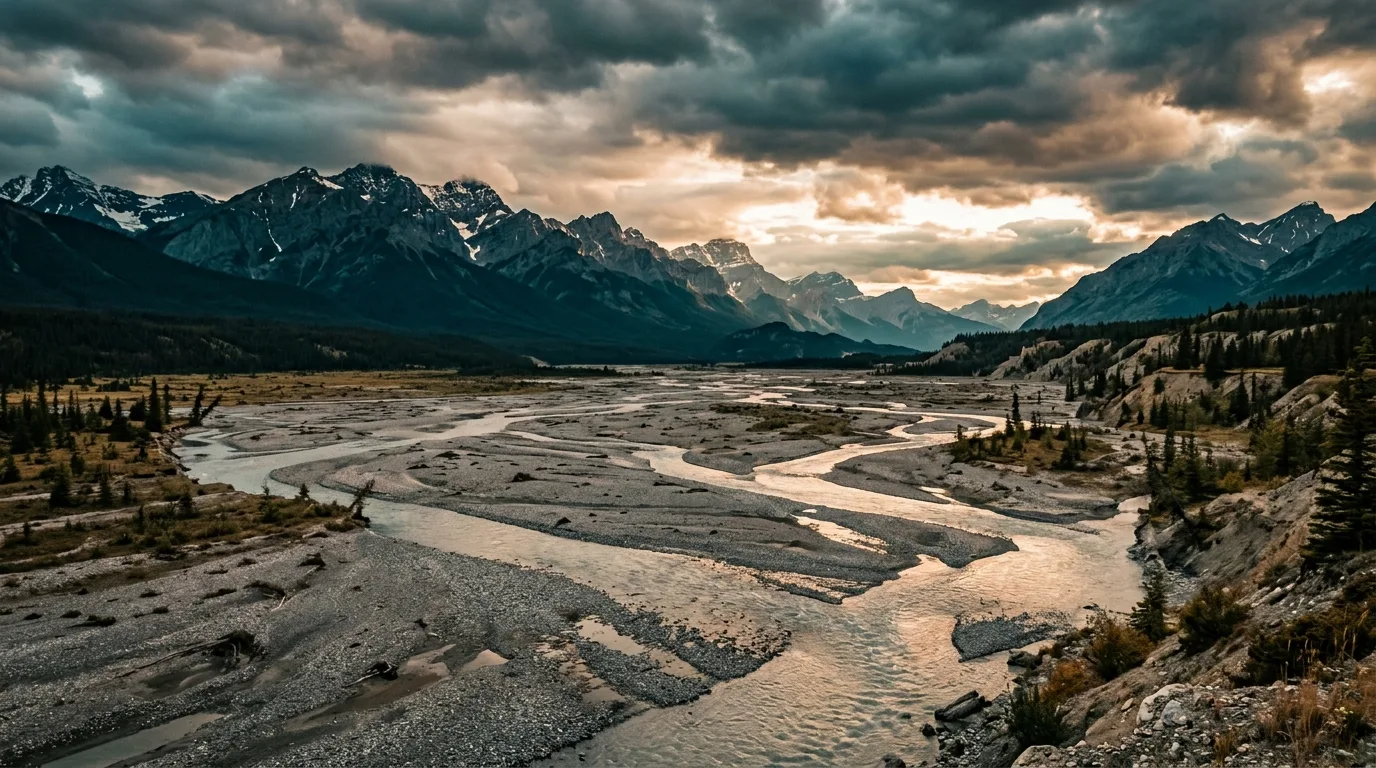
The Ghost flats. A braided moonscape an hour and a half from downtown Calgary. The river decides the road; the road decides who visits.
02 / THE GATE FEE
No gate — and no Kananaskis pass either
The Ghost sits outside the Kananaskis Conservation Pass boundary: no gate fee, no windshield scanner, nothing daily. Money changes hands in exactly three places — the camping pass, the campground envelope, and Banff's boundary if you cross it.
What the Ghost costs
Public Lands Camping Pass — adults 18+ random-camping: $30/year or $20/3-day per person, + $3.25 processing and a one-time $8 WiN, via albertarelm.com or licence vendors
Campgrounds: $31–$40/night — no pass needed there; the fee is the fee
Kananaskis Conservation Pass: NOT required in the Ghost PLUZ — the boundary excludes this country. Stopping in K-Country proper is a different story, and Ghost Reservoir sits under Kananaskis administration — check the boundary map before assuming
Fire permits: free; needed for any burning except campfires (Mar 1 – Oct 31, Forest Protection Area)
Fishing licence (16–64) if casting — and read §08 first: most of this water is zero-keep
The Banff boundary, priced
Walk through Devil's Gap and the moment you pass the boundary sign you're in Banff National Park: a Parks Canada pass applies, camping happens only at designated backcountry sites with a backcountry permit, and from July 10 to September 15 the Minnewanka-corridor trails carry a legal grizzly-season restriction — groups of four or more, no dogs, no bikes — with fines that reach five figures.
The practical read: the Ghost side is the free, flexible side. Day-walk into the Gap and back and the paperwork stays simple; plan to camp at the Ghost Lakes or push toward Minnewanka and it becomes a Banff trip — permits first.
$0 gates in the GhostBanff rules past the sign
The comparison worth making
A Kananaskis weekend costs a Conservation Pass plus a booked campsite you fought for in January. A Ghost weekend costs $30 a year and the willingness to bring your own water and drive gravel. Same mountain front, one valley north — the difference isn't the scenery, it's the paperwork. What the Ghost charges instead is competence: the hill, the fords and the self-sufficiency are the real admission.
03 / ORIENTATION
One highway in, one hill down
Highway 1A west from Cochrane, Highway 40 gravel north past Waiparous, then the TransAlta road west toward the mountains: sixteen kilometres of decent dirt, the Big Hill, and the braided flats beyond — with Devil's Gap and the Banff boundary at the very end. A schematic planning map: navigate with an offline topo, not this page.
Campground Day objective Devil's Gap The Big Hill Fuel / Hwy 40 Hwy 1A TransAlta road
The corridor's one ruleEverything is negotiable except the hill and the river. The gravel to the Big Hill is ordinary; the descent is not, and the braided fords beyond it change week to week — June melt or a hard rain can close the flats to everyone. There's no ranger station, no conditions page and no cell signal to check from: the state of the road IS the trip report, and you find it out in person. Fill up at Ghost Station, close the TransAlta gate behind you, and never point a 2WD down the hill "just to look."
04 / BEFORE YOU ROLL
The rules everyone gets wrong
This section is the reason this issue exists. The Ghost's camping rules are widely misquoted — including the famous one that doesn't actually apply here. Here's the rulebook, verbatim from the province, sorted into the three legal moves.
Pay for the campground
Six established campgrounds, $31–$40 (§05) — no pass needed. Five are run by Red Rock Sawmills (587-830-2198), mostly first-come; North Ghost and Fallen Timber South also reserve through the operator, and the reservoir camp is pure first-come self-registration.
$31–$40Mostly first-come
Random-camp the PLUZ
Legal with the Public Lands Camping Pass (adults 18+). The real rules: 14 days max, then move ≥1 km for 72 hours; ≥1 km from any campground or recreation area; ≥30 m from water; ≥100 m from oil-and-gas sites; durable surfaces; bear-proof storage. One corridor exception: Stud Creek Road's first 16 km — signed nodes only.
Legal + publishedPLCP required
Walk into the Wilderness Area
The strictly protected block against the Banff boundary: foot travel only — no vehicles, bikes or horses — no campfires, no hunting, no fishing, no collecting anything. Camping on foot is free with no permit. It is one of only three Wilderness Areas in Alberta, and it is not the PLUZ: the rulebook flips at the boundary.
Foot only · no firesFree camping on foot
The myth, killed with the province's own words"You can't camp within 1 km of a road" is NOT a Ghost rule. Alberta's random-camping page names exactly where that rule applies: the Kananaskis, McLean Creek, Sibbald and Cataract Creek PLUZs — the Ghost is not on the list. Here, the 1-km buffer is from campgrounds and recreation areas, not roads. Two honest caveats: the same page adds "or where posted elsewhere," so a sign on the ground always wins — and vehicles must stay on designated routes, so you camp adjacent to legal roads and trails, not off cross-country. Quote this box at whoever tells you otherwise around the fire.
The other rules that bite
OHVs and vehicles: designated trails only, on the trail tread, with seasonal windows — and the official map is from April 2016, so signage governs where they disagree. Target shooting is banned on the TransAlta corridor (since 2024, still in force at press) and within 400 m of provincial trails everywhere; licensed hunting is unaffected. Fireworks and exploding targets: banned in the Forest Protection Area. Close the TransAlta gate — it's a working grazing lease.
Connectivity reality
The province's own words: most of the Ghost PLUZ has no cell coverage — official advice is a satellite communicator and a trip plan, with the RCMP called if you miss your check-in. Numbers on paper: 911 (backcountry calls route to Kananaskis dispatch) · satellite-phone emergency line 403-591-7767 · Cochrane RCMP 403-932-2211 · 310-LAND.
05 / BASECAMPS
Six campgrounds and the legal wild
From the reservoir on the pavement to the flats at the end of the world. Fees and seasons are as posted on the Alberta Parks and operator pages in July 2026 — and the water warning applies to all but one: the pumps are for putting out fires, not drinking.
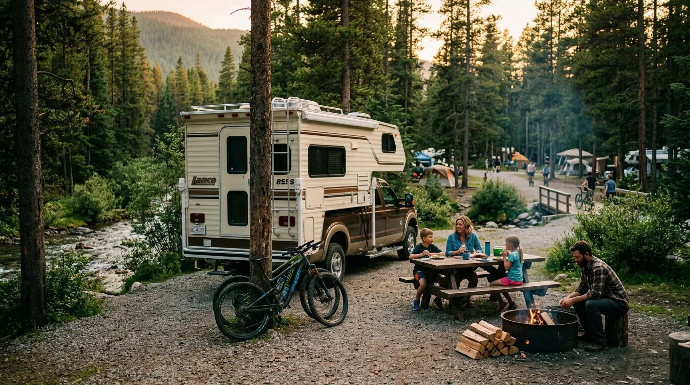
The Waiparous camps. Big, treed, first-come and forty dollars — the staging grounds Calgary's OHV crowd built their weekends around.
Basecamp
Where
Style
Pick it for
Watch for
Ghost Reservoir
Hwy 1A · 18 km W of Cochrane
80 sites · $31 · first-come, self-register
The pavement-side anchor: boat launches, windsurfing wind, and the corridor's only potable water.
Season May 1 – Oct 15. Operator: Ghost Lake Recreations, 403-851-0766. The reservoir runs low until July 7 (flood-operations drawdown) — launch accordingly
Waiparous Creek
Hwy 40 · at the village
53 unserviced · $40 · first-come
Creekside sites and the closest established camp to the TransAlta turnoff.
Season May 1 – Oct 14. No potable water. Weekend OHV energy — this is staging country
North Ghost
Ghost Airstrip PRA
169 unserviced · $40 · FCFS + reservable
The giant: the area's main basecamp, rebuilt 2018–19 with bear bins and real washrooms. Reserve at redrocksawmill.com.
Season May 1 – Oct 14. No potable water. OHVs stay on trailers until the off-site trailhead
Ghost Airstrip group camp
On the airstrip itself
Up to 60 units · $360/night for 10 units
The club-weekend venue — book the actual airstrip through the Alberta Parks group system.
Season May 1 – Oct 13. shop.albertaparks.ca. Riding is off-site here too
Burnt Timber
North end · Stud Creek country
28 unserviced · $40 · first-come
The quiet north pocket, and the base for the Stud Creek node corridor.
Short season: May 1 – Sep 8. No potable water
Fallen Timber South
Northeast corner
62 unserviced · $40 · FCFS + reservable
The one where registered campers can ride OHVs directly from their sites — and the longest season in the PLUZ.
Season May 1 – Oct 31. No potable water. It's popular for exactly that reason
The water rule — same as the rest of this series, with one exception
Every Red Rock campground carries the identical official line: hand-pump water "is not safe for consumption" — it's fire water. The single exception is Ghost Reservoir, whose operator provides potable water. Fill everything in Cochrane, budget 4+ litres per person per day, and don't plan on filtering the Ghost in June — the glacial silt that braids the river also clogs filters.
The legal wild — where the pass earns its $30
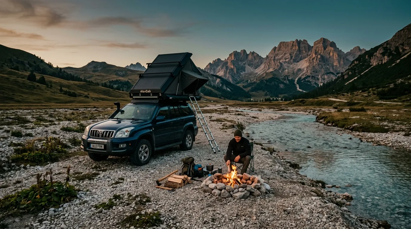
The flats past the Big Hill — the classic: gravel-bar camps beside braided channels, mountains on three sides, nobody checking a reservation. Legal with the pass, ≥30 m from water, on durable gravel
Stud Creek Road corridor — signed designated nodes only for the first 16 km; the node map lives on the PLUZ brochure
The 1-km buffer — no random camping within 1 km of any campground above; the fee camps bought their quiet honestly
Wilderness Area on foot — free, permit-less backpacking in the strictest protection in Alberta: no fires, carry a stove
Leave-it rule — pack out everything, bury waste 60+ m from water, and don't build new fire rings on the flats; the river erases nothing but the rocks
06 / TRAIL SELECTOR
Choose the day that fits the group
Six real objectives, sorted by what you drove in on. Sourcing honesty: there is no official trail system out here — no signs, no report page — so figures come from GPS trip reports and club records, rated in place. Nothing below cites crowd-sourced trail apps.
Objective
Level
Distance
Gain
Time
Vehicle needed
Big Hill viewpoint
Drive-to
—
Stop
Any (park on top)
Mockingbird Lookout
~6 km return
~355 m
2–3 hr
Careful 2WD
Lesueur Ridge
~8–9 km loop
~300–380 m
3–5 hr
Any
Devil's Gap & Ghost Lakes
~14 km return
Minimal
3–4 hr
4x4 to the boundary
Black Rock Mountain
~10.8 km return
~920 m
4–6 hr
4x4 approach
The TransAlta road itself
~16 km + the flats
The Big Hill
Half day
4x4 + recovery gear
All figures are GPS-report consensus (Bob Spirko's tracks and club outing records are the local standard) — no official measurements exist. Pre-2013-flood trip reports carry stale road beta; the 2013 flood permanently rearranged the approaches.
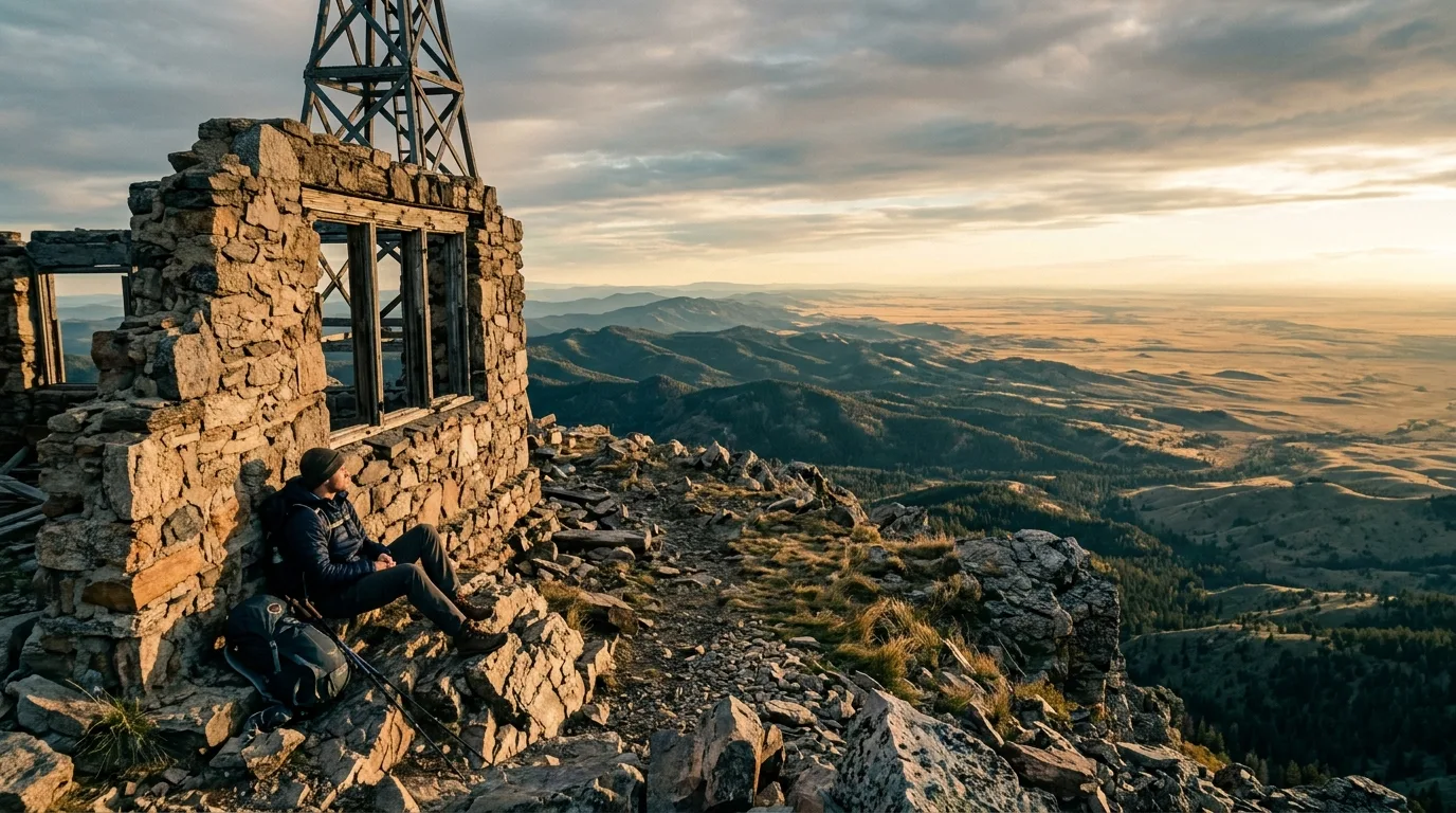
Black Rock Mountain, 2,462 m. The lookout went up in the late 1920s and was abandoned by the early 1950s — the cloud that kept blinding its observers is the same weather you should respect on the ridge.
The marquee dayBlack Rock Mountain
Difficult~10.8 km return~920 m gain4–6 hr2,462 m summit
The old packhorse trail to the abandoned lookout: carved steps low down, a natural weakness through the cliff band that looks impossible from below and walks easily in person, then steep scree to a summit ridge with the wooden lookout hut still standing — built in the late 1920s, abandoned by the early 1950s when cloud kept beating the view, and covered in a century of visitors' inscriptions.
MAIN CAUTION: the summit ridge drops sheer on both sides, the block is fissured, and the Ghost funnels wind that can stagger you on a calm valley day. The approach is the other half: 4x4 down the Big Hill and across braided channels just to reach the trailhead. Full day, full kit, full tank.
Packhorse steps to a ruin · out-and-back
Banff's back doorDevil's Gap & the Ghost Lakes
Moderate~14 km returnNearly flat3–4 hr
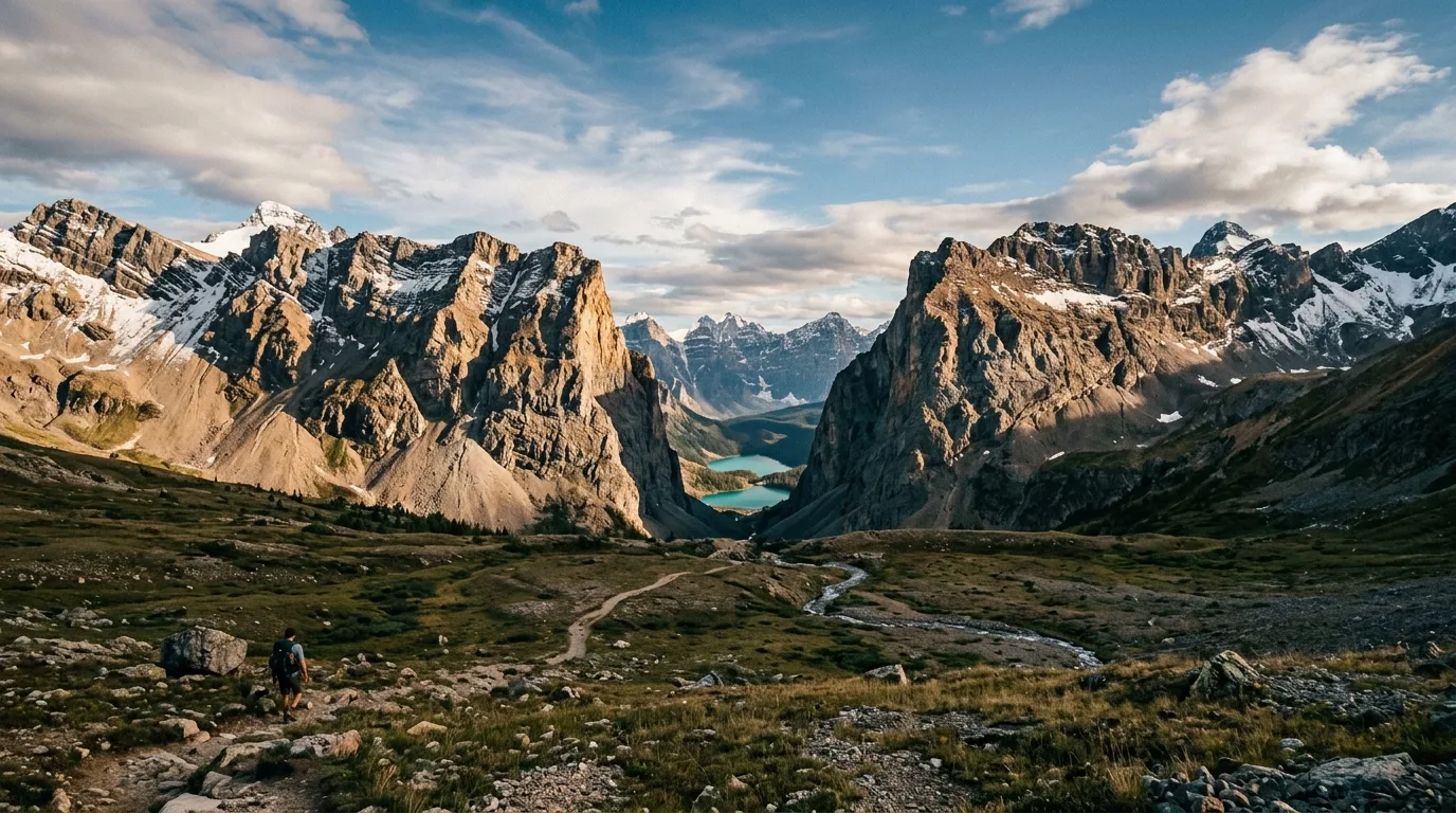
From the end of the designated route at orange marker 27, walk (or pedal, on the Alberta side) through the great notch in the ranges to the chain of Ghost Lakes strung toward Lake Minnewanka. The valley floor is old road and gravel — flat, huge and windy — and the moment you pass the boundary sign, you're in Banff by the quietest entrance it has.
MAIN CAUTION: Banff's rules start at the sign — park pass, permits for any camping, and the July 10 – September 15 grizzly-season restriction on the Minnewanka corridor: groups of four, no dogs, no bikes, real fines. This is prime berry habitat in exactly that window. And the channel between the first lakes is a ford — sandals in the pack.
Flat, vast, windy · out-and-back
Best family summitMockingbird Lookout
Easy~6 km return~355 m gain2–3 hrCareful 2WD OK
A gated fire road climbs gently to the area's working lookout — staffed May to Thanksgiving, 360° views from the foothills to the front ranges, and a name borrowed from a 1950s hit song. Access is off Waiparous Valley Road near marker 121, and a carefully driven car makes the trailhead.
MAIN CAUTION: it's someone's workplace and home. The picnic table is the visitor zone — stay off the helipad, away from the building, and don't expect the observer to play host. The surrounding valley is OHV country: weekends hum, weekdays don't.
Fire road, steady grade · out-and-back
No 4x4 requiredLesueur Ridge
Moderate~8–9 km loop~300–380 m gain3–5 hr
The consolation prize that isn't one: a grassy foothill ridge with near-continuous views to Devils Head, Phantom Crag and Black Rock — and its trailhead sits on the TransAlta road before any of the 4x4 ground, so every vehicle in the driveway qualifies. Unofficial, unsigned, and quietly one of the best view-per-effort walks this close to Calgary.
MAIN CAUTION: the soil is steep, loose and sandy in places — run the loop counter-clockwise so you ascend the worst of it. No signage means offline map and attention; "unofficial" cuts both ways.
Grass, views, loose descent · loop (go CCW)
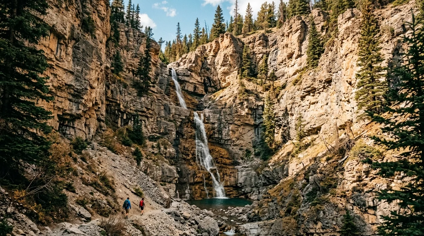
South Ghost canyon country. An honesty note: the Ghost's famous waterfalls earn their fame frozen — in summer most run to a trickle, and no established trail serves them. See them in §14, in their season.
Objectives not on this list — deliberatelyThe "Ghost waterfalls" are winter ice-climbing objectives with 4x4-plus-bushwhack approaches and no verifiable summer trail — any summer figures you find online are guesswork. Aylmer Lookout from this side is a 40-plus-kilometre permit-managed Banff backpack, not a day hike — admire it from the Ghost Lakes and do the lookout from Minnewanka outside the restriction window. Margaret Lake is real but lives in the Waiparous OHV network (not near Devil's Gap, whatever the internet says), and its shoreline is under active restoration with motorized access being fenced to foot-only — check with the trail groups before building a trip on it.
The universal trail plan
Tuned for a zone with no infrastructure: there are no trailhead boards, no report page and no rangers — recent GPS trip reports are the conditions system, and 310-LAND answers the legal questions. Start early (the wind builds). Offline maps mandatory. Bear spray on the hip, one per adult — this is grizzly corridor country an hour from the city. And tell someone which drainage, because your phone won't.
No report page existsStart earlyOffline mapsBear spray on hipName your drainage
07 / THE ROAD
Sixteen kilometres, one hill, and Banff at the end
The TransAlta road is the Ghost's whole plot: an unsigned gated turnoff, a decent gravel run, a descent that sorts every vehicle in the province, and a braided riverbed that is the road. Here's the honest version of driving it.
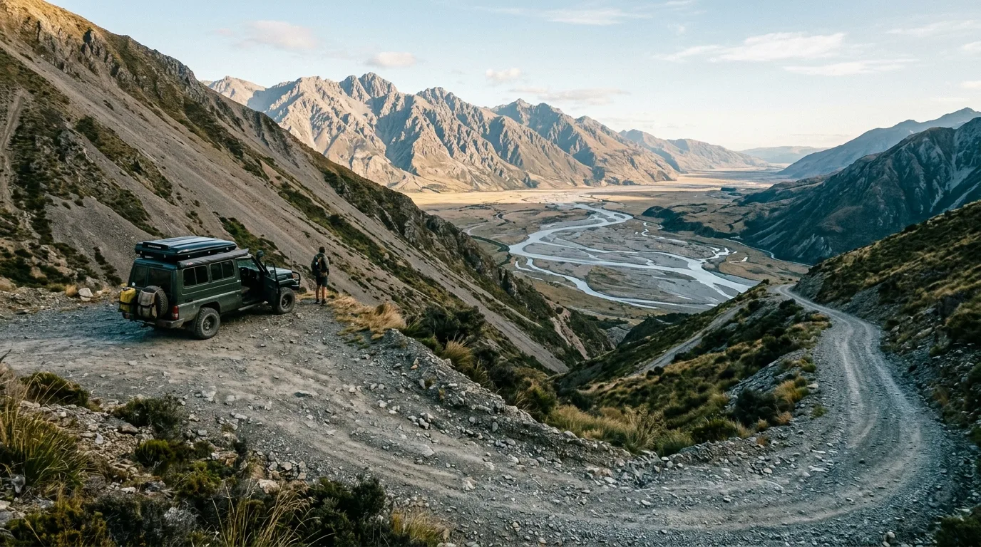
The Big Hill. The top is a viewpoint; the descent is a decision. Everything about your weekend is determined in the next four hundred metres.
Running it — the practical version
The turnoff: a gated gravel road off Hwy 40 roughly 23 km north of the 1A — kiosk board, no obvious sign. Close the gate behind you; it's a working grazing lease
Km 0–16: rough but ordinary gravel to the top of the Big Hill — most vehicles make this, slowly. The rim is the free viewpoint and the honest turnaround
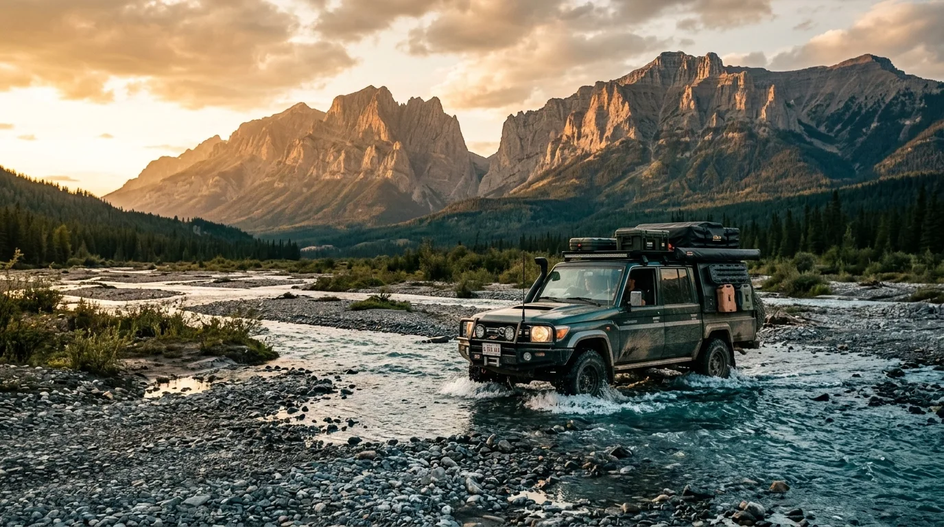
The Big Hill: loose, steep, rutted river rock. 4x4 with clearance going down; the real question is coming back up, especially wet. The local norm is recovery gear and a second vehicle
The flats: braided channel fords that swing from ankle-deep to impassable with rain and June melt; left = South Ghost/Devil's Gap, right = North Ghost
The end: the designated route finishes at the Banff boundary in Devil's Gap — orange marker 27. Past the sign, you walk
The fine print that keeps it legal
Vehicles are permitted only on designated routes, on the tread — the flats are not an open playground, however open they look. The published trail map dates to April 2016, so treat markers and signage as the law and the PDF as background. No maintenance, no plowing, no rescue infrastructure: the road is graded when industry needs it, not when you do.
And the trip-planning math nobody skips twice: the last 30 km routinely take longer than the entire highway drive from Calgary. Budget 2.5–3 hours door-to-flats, more with water up. The climbers' line about this valley has survived decades because it's true — driving in the Ghost is part of the adventure, and some days it's the whole adventure.
No maintenanceMarker 27 = the end2016 map — signs govern
Devil's Gap. Banff's quietest entrance: no gate, no lineup, no pavement — just a boundary sign in a gap the wind owns.
The ford doctrine — this corridor's trip-killer
The Ghost's channels are glacial, braided and moody: June melt and any serious rain can close the flats to everyone, and what was axle-deep on Friday can be hood-deep by Sunday. Walk every ford before driving it, cross square and steady, and treat "the guy ahead made it" as data about his truck, not yours. There is no cell signal to call for help and no tow service that wants to meet you down there — the second vehicle isn't paranoia, it's how the locals have always done it.
08 / FISH & SKY
Threatened trout, borrowed darkness
The Ghost's waters carry some of Alberta's most protective fishing rules because its native westslope cutthroat are a threatened species — and its night sky is genuinely dark in three directions, with Calgary glowing in the fourth.
Fishing the Ghost (ES1, 2026)
Ghost River mainstem: open Jun 16 – Aug 31, bait ban, trout 0 (whitefish 5 over 30 cm); Sept–Oct zero-keep; closed Nov 1 – Jun 15
Wilderness Area waters: closed to fishing all year — the strict zone means it
Waiparous Creek: brook trout 2, all other trout 0, bait ban — the brookies are the invasive you're encouraged to keep
Ghost Reservoir: the keep option — open all year, bait allowed, trout 5 (cutthroat 0)
Bull trout: zero, province-wide. And clean-drain-dry everything — whirling disease is in Alberta and these are cutthroat recovery waters
The night sky, honestly
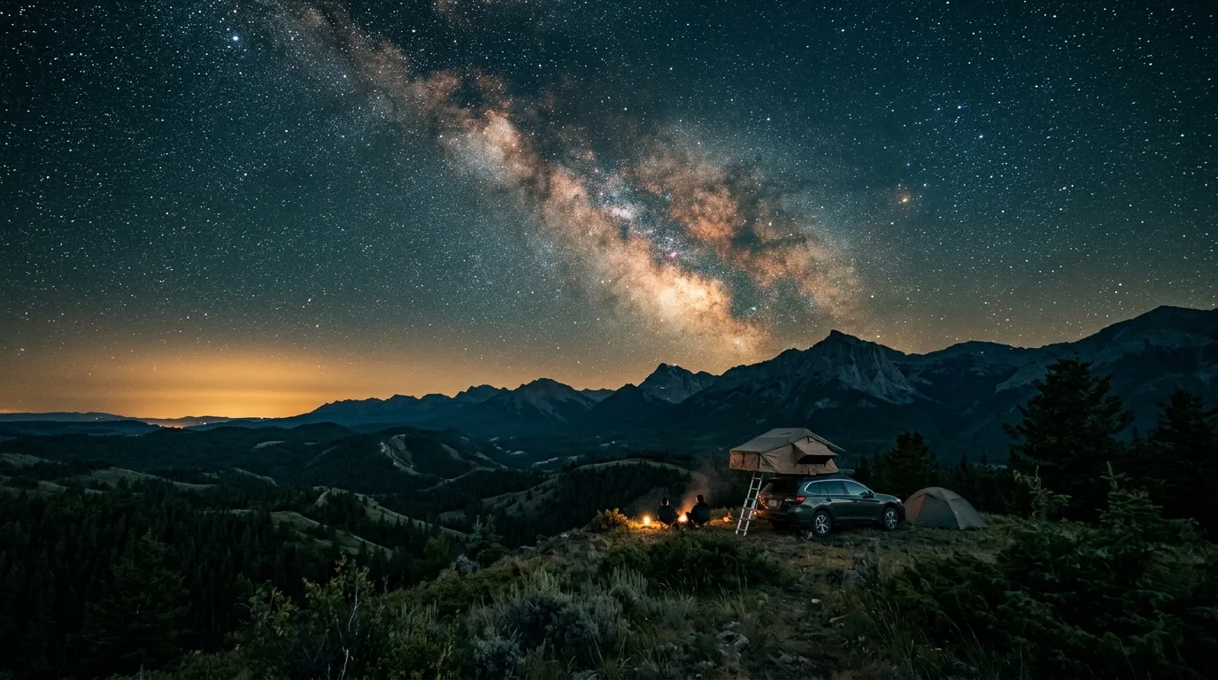
Face west from a flats camp and the sky is properly dark — mountains, stars, silence. Face east and Calgary's light dome sits low on the horizon, a permanent orange dawn. It's not a dark-sky preserve and this guide won't pretend otherwise; it IS the best Milky Way most Calgarians can reach in ninety minutes. Aurora at 51°N needs a genuinely strong storm and shows low on the northern horizon — pick a camp with an open north view, check a space-weather app, and count anything you see as a bonus.
09 / WILDLIFE
The corridor the city forgot it had
Grizzlies, wolves, bighorn and cougars use the Ghost as the connective tissue between Banff and the foothills — which means Calgary's closest wilderness runs on big-wilderness rules, whatever the drive time says.
Bears, properly
Grizzlies — provincially Threatened since 2010 — work this whole corridor, and the Devil's Gap country is prime berry habitat in exactly the mid-July-to-mid-September window (that's why Banff's legal restriction exists next door). Practice is non-negotiable: spray on the hip from the vehicle, hard-sided or hung food at camp, and the bear bins at the rebuilt campgrounds used every time.
The comeback story
The Ghost nearly loved itself to death: a government study once measured a ten-fold increase in sediment pouring into Waiparous Creek from unmanaged motorized use. The designated-trail network, the enforcement money, the rebuilt campgrounds and the still-active Ghost Watershed Alliance Society are the repair job — and the reason the flats still hold threatened cutthroat and clean fords. Staying on the tread isn't bureaucracy; it's the treaty.
Sheep & the fall overlap
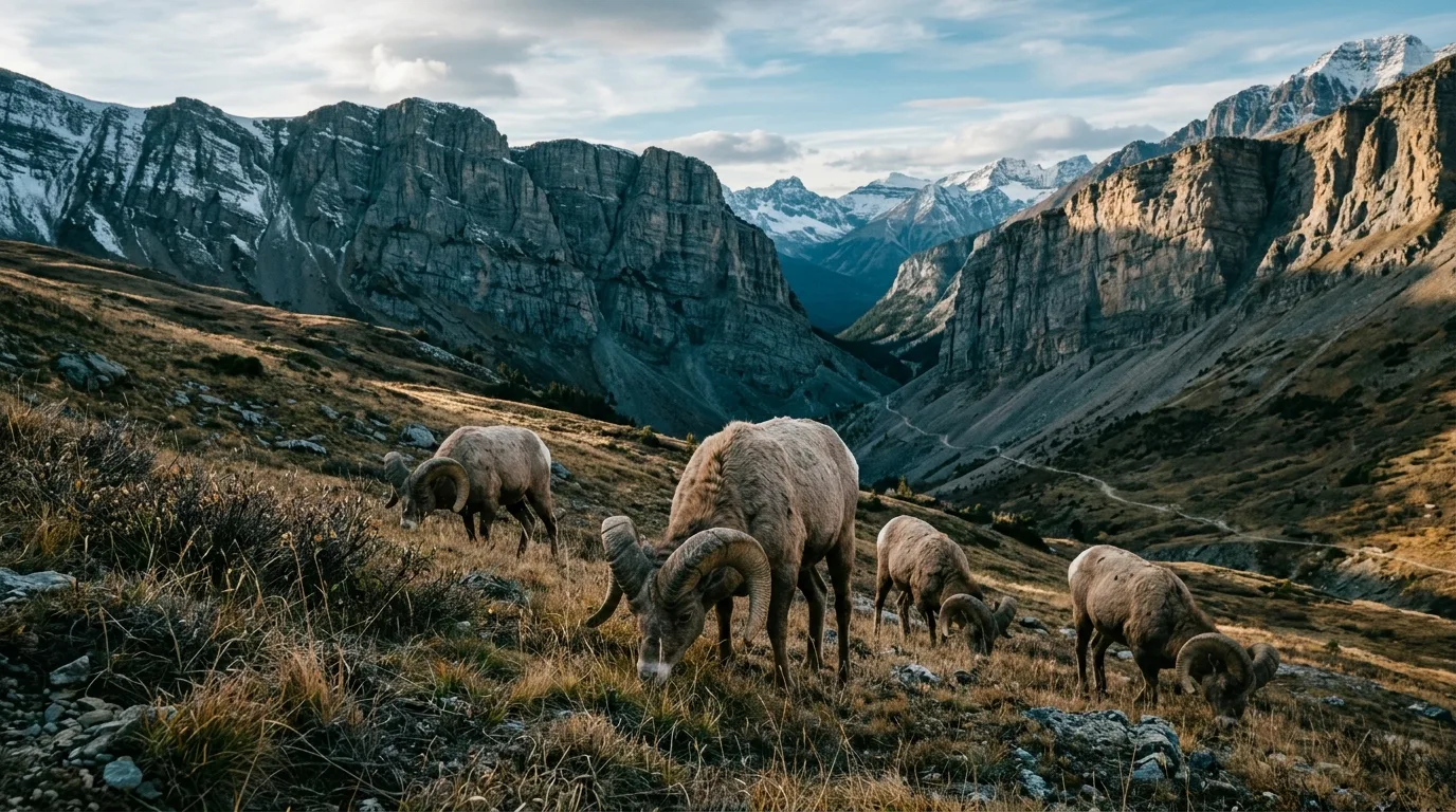
Bighorn work the gap country and the high grass; goats hold the ridgelines. From late August through November this is WMU 412 hunting country (plus a spring bear season), and Alberta has no blaze-orange law — wear it anyway, on you, the pack and the dog. Traplines and grazing leases operate throughout: gates as found, sets alone. Report poaching: 1-800-642-3800.
The name on the map
Devils Head — the plug of rock that anchors every view out here — and the Ghost itself carry Stoney Nakoda stories older than the province: spirits gathering the skulls of the fallen after a battle where the Ghost meets the Bow. The Palliser Expedition wrote it down as Dead Man's River before "Ghost" won. The tellings differ on the details, as oral tradition does, and this guide leaves them their mystery — but camp on the flats on a windy night and you'll understand why no one ever renamed it something cheerful.
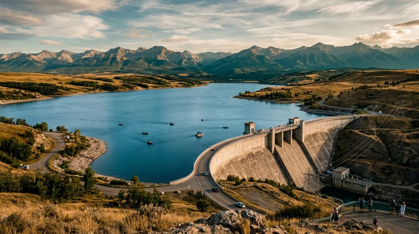
The modern layer: the dam at the river's mouth has generated power since 1929, and since the 2013 flood its reservoir runs deliberately low each spring as Calgary's first line of flood defence — the wild valley upstream and the city downstream, tied together by the same water.
10 / LOGISTICS
One last pump, one urgent-care clock
The supply chain is short and absolute: Cochrane has everything, Ghost Station has the last fuel, and beyond the Highway 40 junction there is nothing for sale in any direction. Close to the city is not the same as close to help.
Stop
Position
Count on
Field notes
Cochrane
Hwy 1A · the gateway town
Everything: groceries, fuel + diesel, EV charging, urgent care
Urgent care is 8 a.m.–10 p.m., not 24/7 (403-851-6000). DC fast charging + a Tesla site in town — the last plugs anywhere on this trip
Ghost Station
Hwy 1A at the Hwy 40 junction · 13 km W of Cochrane
Gas, diesel, propane, convenience store
Literally billed as the last stop for gas — and it is. 403-851-5209. Top up here even if you filled in town
Waiparous Village
Hwy 40 north
Nothing commercial
A summer village of ~57 people, not a supply stop. Note the temporary bridge and its weight limits
Beyond the junction
Hwy 40 north + the TransAlta road
Nothing at all
No fuel, no store, no potable water (one campground excepted), no signal. Roughly 50–65 km of slow gravel from the last pump to the far flats — and the same back
Emergency math
Cochrane's urgent care closes at 10 p.m.; the nearest 24/7 emergency departments are Canmore (403-678-5536) and Calgary's Foothills. Backcountry 911 calls route to Kananaskis dispatch; from a satellite phone use 403-591-7767 directly. With no signal on the flats, the real plan is the one you left with someone in town — including when to call the RCMP (Cochrane: 403-932-2211) if you're overdue.
Chinook doctrine
This is chinook country: 20-degree temperature swings in hours, foothills wind warnings that reach 100 km/h, and the arch on the western sky as your barometer. Summer practice: stake like you mean it, stow the awning unattended. Winter practice: chinooks open the access one week and drift it shut the next — the window is real, and so is its slamming.
Services & signal
Water fills, showers, laundry: Cochrane. Potable water on-trip: Ghost Reservoir campground only. Signal: towns yes, PLUZ no — official advice is satellite comms. Numbers on paper: 911 · sat line 403-591-7767 · Cochrane RCMP 403-932-2211 · 310-LAND · Red Rock camps 587-830-2198 · Report A Poacher 1-800-642-3800 · 310-FIRE.
Ghost Reservoir. Powering Calgary since 1929 — and since 2013, held low every spring as the city's flood buffer. It refills after July 7; plan the boat launch accordingly.
11 / BEYOND THE TENT
Stops worth building the day around
Ghost Reservoir PRA
The pavement-side playground: two boat launches, a marina, and wind that made this lake a windsurfing and ice-sailing name. Power boats welcome — clean, drained and dry, always. Low water until early July (the flood-operations drawdown), full and blue after.
The Big Hill rim
The best free viewpoint in the corridor, reachable by any vehicle that takes the first 16 km slowly: the whole braided Ghost laid out below, Devils Head and the Banff front ranges walling the horizon. For half the visitors this should be the destination — and there's no shame in that half.
Cochrane
The gateway town plays its role well: last groceries, last fuel before Ghost Station, last plugs for the EV, urgent care until 10 p.m. — and the size of town where the hardware store still solves trip problems. Everything the Ghost refuses to sell you, 40 minutes east.
The watershed people
The Ghost Watershed Alliance Society is the valley's quiet institution — water monitoring, streambank restoration, guided wildflower walks in season. Their events calendar is the closest thing the Ghost has to a visitor program, and their work is why the creeks still run clear. ghostwatershed.ca.
The dam story
Built 1929 by Calgary Power, still spinning 51 MW under TransAlta, and since the 2013 flood the reservoir doubles as Calgary's flood shield each May–July. Watch this space: a study is underway on relocating the dam downstream for bigger flood-and-drought storage — the valley's next chapter is being drafted now.
Waiparous Village
A summer village of a few dozen souls at the creek crossing — no services, private roads, and residents who've watched every wave of weekend traffic for decades. Roll through slow, wave, and note the temporary bridge's weight limits if you're hauling heavy. Good neighbours keep backcountry access friendly.
12 / THE KIT
What rides in the rig
A zone with one sorting hill, moody fords, no signal, no rangers and almost no potable water — ninety minutes from the city that lulls you into packing light. Orange items are the non-negotiables.
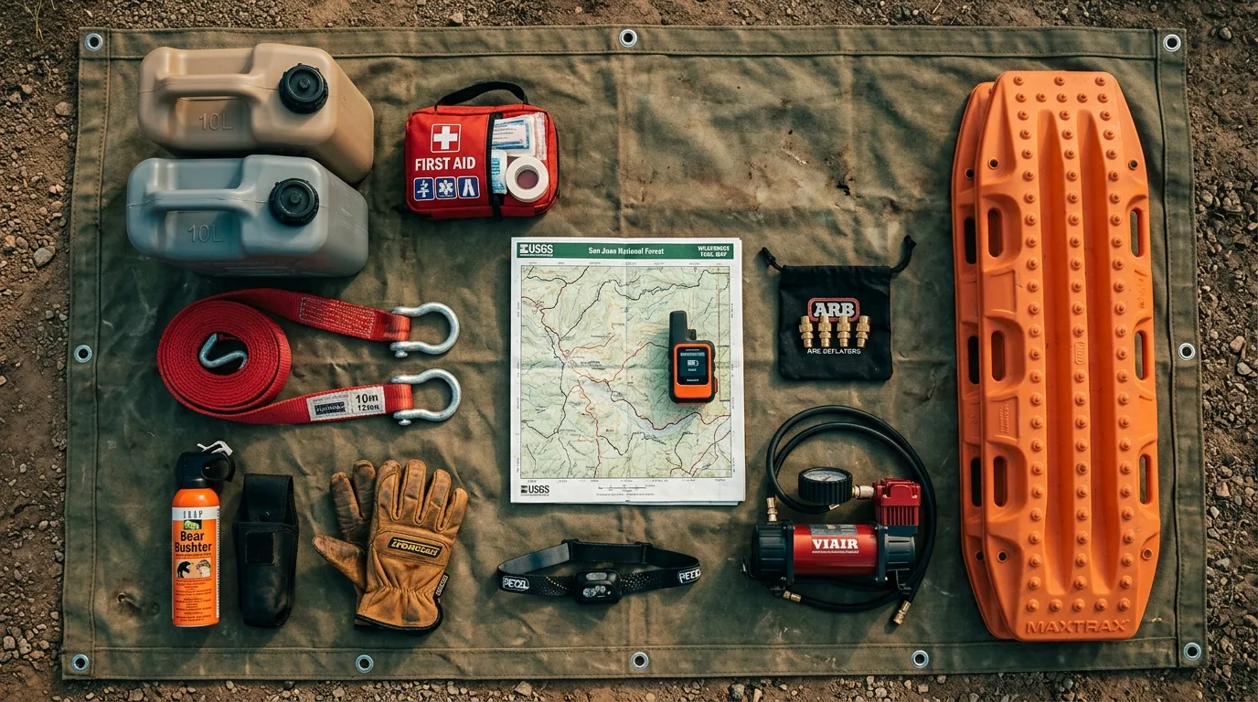
The Ghost loadout. Recovery gear headlines here like nowhere else in the series — the Big Hill and the fords are the trip, and the kit is the ticket.
Passes & paperwork
Public Lands Camping Pass per adult if random-camping (albertarelm.com — buy in town, with signal)
Trip plan left with someone — drainage named, RCMP-call time agreed
Fire status checked day-of (advisory active at press) — albertafirebans.ca in a real browser, or 310-FIRE
Fishing licence + current ES1 tables if casting
Current PLUZ map downloaded — and the humility to obey signs over the 2016 PDF
Banff pass + backcountry permit if the Ghost Lakes plan grows legs
The road & recovery
Recovery strap, shackles, traction boards — the Big Hill's toll booth
Full-size spare + plug kit + compressor; deflate for the hill, reinflate for the highway
A second vehicle for the flats, or the discipline to stop at the rim
Shovel + work gloves
Sandals for walking fords before driving them
Fuel topped at Ghost Station — the last pump, both directions
Camp & safety
ALL drinking water — one potable tap in the whole corridor; 4 L/person/day
Satellite communicator — the official advice, not ours
Bear spray on the hip, one per adult; food hard-sided or hung
Chinook-rated stakes and guylines; stove windscreen
Blaze orange (person + dog) from late August
Real first-aid kit — urgent care closes at 10 p.m. and it's two hours away
13 / MAKE A WEEKEND OF IT
Three ready-made trip shapes
01
The No-4x4 Sampler
Day 1: Cochrane provisioning, Ghost Station top-up, claim a site at Waiparous Creek or the reservoir, evening on the water.
Day 2: Lesueur Ridge in the morning (counter-clockwise), Mockingbird Lookout after lunch — two summits, zero fords.
Day 3: Drive the TransAlta road to the Big Hill rim for the full-valley finale, out via brunch in Cochrane.
Any vehicleFirst-come sitesWater for 3 days
02
The Flats Weekend
Day 1: Pass bought, jugs full, down the Big Hill with a partner rig, legal random camp on the gravel bars — the $30-a-year kind of night.
Day 2: Black Rock Mountain — the lookout, the inscriptions, the wind — back to camp for the western dark.
Day 3: Fords walked and re-crossed early, up the hill while it's dry, air up at the top.
4x4 + recovery gearFords rule the schedulePLCP required
03
The Banff Back Door
Day 1: Flats camp as above; scout the road to marker 27 in the evening light.
Day 2: Walk Devil's Gap to the Ghost Lakes and back — Banff by its quietest entrance. Mind the July 10 – Sep 15 rules past the sign: group of four, no dogs, no bikes.
Day 3: Slow morning on the bars, out ahead of the weather. Total gate fees paid: zero, unless you crossed the sign.
Flat 14 km walkBanff rules past the signSandals for the ford
14 / WINTER BONUS
World-famous, frozen
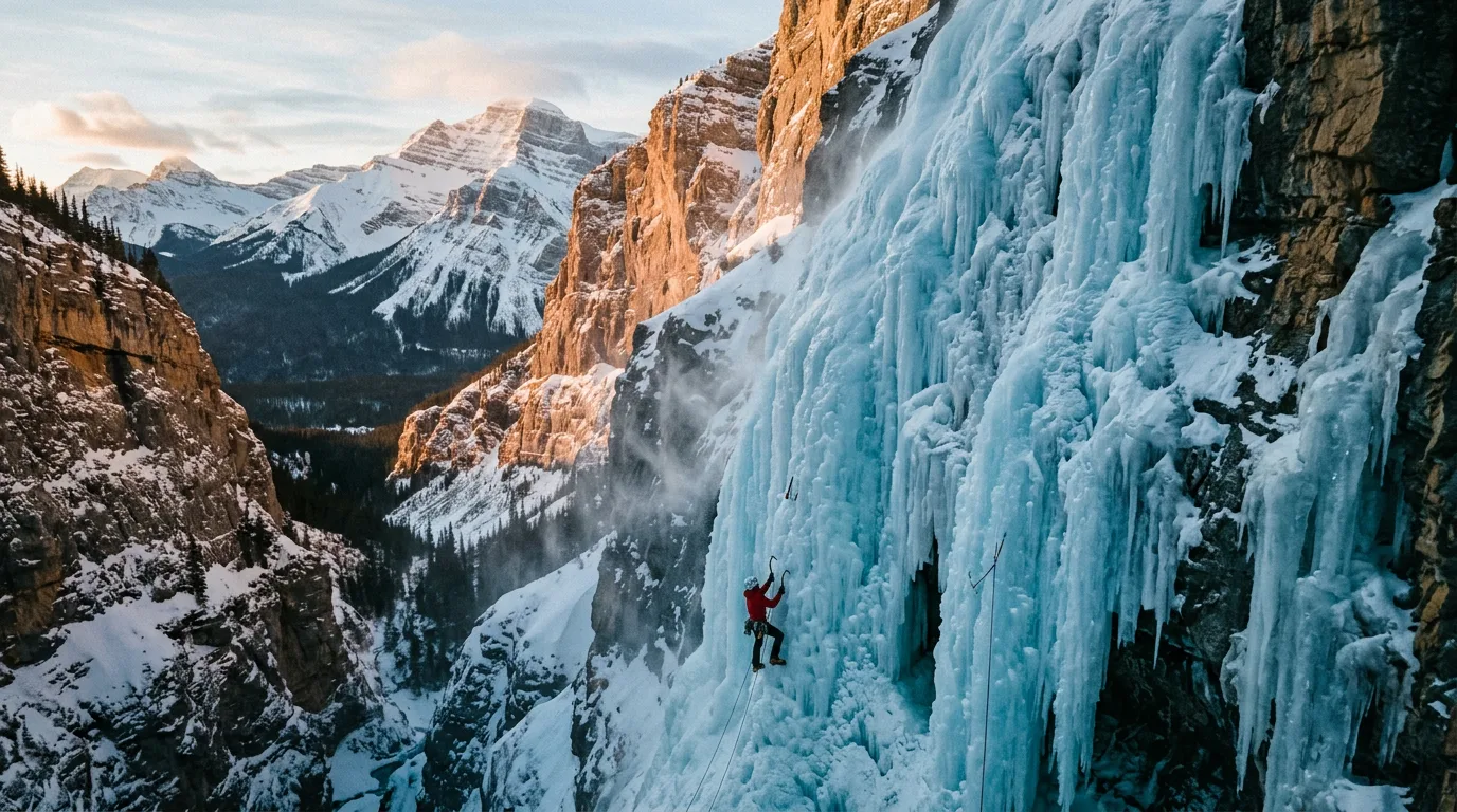
Here's the twist ending: the Ghost's biggest claim to fame isn't summer at all. In winter this valley holds one of the finest concentrations of waterfall ice climbing on Earth — and the same unmaintained road that filters summer traffic becomes the sport's legendary approach crux.
The Ghost in its famous season. Climbers fly from Europe for this ice. The driving stories they take home are usually better than the climbing ones.
What winter is actually for
The ice, if you're qualified — the Ghost is credibly called one of the world's great waterfall-ice areas: wilderness routes at every grade, typically thin snowpack, and solitude the Rockies' roadside crags lost decades ago. Guided days from Canmore outfits are the sane entry
Chinook-window drives — bare-ground weeks open the road to winter camps and Big Hill viewpoints that feel like another planet; the next front closes them
Sledding, by the map — snowmobiles run designated winter trails only; pull the current winter map and check dates, because the designations are seasonal and the published map is old
Reservoir ice — ice fishing and the ice-sailing crowd when the wind and the freeze cooperate
What winter is not for
Assuming anything. The TransAlta road is not plowed for the public — it's graded when industry needs it — and drifts, ice and the fords stop trucks that laughed at July. The PLUZ is not avalanche-controlled, urgent care still closes at 10 p.m., and the chinook that opened your window can glaze the Big Hill behind you by dinner. Winter here rewards the party with a bail plan, a second vehicle and zero ego about turning around — the same virtues as summer, at stakes that don't forgive.
15 / MOUNTAIN-READY
The departure check
Run it the night before you roll. Tap each item as it's done — no excuses survive contact with this list.
Passes & papersPLCP per adult if random-camping; fishing licence if casting; Banff pass/permit if crossing the Gap; cash for fee envelopes.
The rules, straight1-km buffer is from campgrounds (not roads); Stud Creek = nodes only; signs beat the 2016 map. Quote the province, not the campfire.
WaterOne potable tap in the corridor (the reservoir) — every litre carried, 4 L/person/day, filled in Cochrane.
The hill decisionMade in the driveway, not at the rim: 4x4 + recovery gear + ideally a second rig for the flats — or a proud stop at the viewpoint.
FuelTopped at Ghost Station — the last pump both directions; 100+ km of slow gravel round trip beyond it.
CommunicationSat-comm charged (official advice); trip plan + drainage + overdue-call time left with someone; numbers on paper.
Fire statusAdvisory active at press — albertafirebans.ca (real browser) or 310-FIRE, morning-of and before every match.
WildlifeBear spray per adult, on the hip from the vehicle; food hard-sided or in the bins; dog leashed — and home entirely if Banff's restriction window is the plan.
FordsWater levels considered; sandals packed; every crossing walked first; the turn-around agreed out loud before the first tire gets wet.
Season checkLate Aug+: blaze orange, person and dog. Winter: chinook window watched, no-plow reality accepted, avalanche terrain respected.
0 / 10 confirmed — the mountains are watching.
16 / QUICK ANSWERS
Asked around every campfire
Is the 1-km-from-a-road camping rule true here?
No — that's the most-repeated myth about the Ghost. The road rule applies in the Kananaskis, McLean Creek, Sibbald and Cataract Creek PLUZs, not here. In the Ghost the 1-km buffer is from campgrounds and recreation areas. The real limits: 14 days max (then move 1 km for 72 hours), 30 m from water, 100 m from oil-and-gas sites — and Stud Creek Road's first 16 km are signed-nodes-only. Posted signage always wins.
Do I need a pass to camp?
Random camping, yes: the Public Lands Camping Pass, adults 18+ — $30/year or $20/3-day per person via albertarelm.com. Not needed in the fee campgrounds. The Kananaskis Conservation Pass doesn't apply in the Ghost PLUZ.
Can my car make it in?
To the top of the Big Hill, usually — about 16 km down the TransAlta road. The descent and the braided fords beyond are 4x4 territory with recovery gear and ideally a second vehicle. No 4x4 still gets you Lesueur Ridge, Mockingbird Lookout, the campgrounds and the reservoir — a real weekend, no hill required.
What's at Devil's Gap?
Banff's back door: the route ends at the boundary (marker 27), then it's ~14 km return of flat walking to the Ghost Lakes. Past the sign, Banff's rules apply — park pass, permits for camping, and the July 10 – Sept 15 grizzly-season restriction: groups of four+, no dogs, no bikes.
Is there drinking water out there?
One tap: Ghost Reservoir campground. Every Red Rock campground's pump is officially fire water, not drinking water. Fill everything in Cochrane, 4+ litres per person per day.
Can I keep a fish?
Mostly no: the Ghost mainstem is trout-zero with a bait ban (open Jun 16 – Aug 31), the Wilderness Area is closed to fishing entirely, Waiparous Creek allows 2 brook trout only, and bull trout are zero everywhere. The keep option is Ghost Reservoir: open all year, 5 trout, bait allowed. Clean-drain-dry — these are threatened-cutthroat recovery waters.
Is there really no cell signal an hour from Calgary?
Really — the province's own PLUZ page says most of the Ghost has no coverage. The front ranges shadow the valley floor. Official advice: satellite communicator, trip plan, RCMP if you miss check-in. Treat it as no-signal country.
What's the difference between the PLUZ and the Wilderness Area?
Nearly opposite rulebooks, side by side. The PLUZ: OHVs on designated trails, random camping with the pass, hunting and fishing legal, campfires allowed outside bans. The Wilderness Area: foot only — no vehicles, bikes or horses — no hunting, no fishing, no campfires; free permit-less camping on foot. Everything flips at the boundary, and knowing which side you're on is the whole game.
17 / VERIFY BEFORE DEPARTURE
The final word lives here
No rangers, no report page, a 2016 official map — the Ghost runs on alberta.ca's rule pages, the operators' phones and recent trip reports. Where this issue leans on GPS-report figures, it says so in place. These sources are the truth on the day you travel.
Waiparous Village — bridge status & local noticeswaiparous.ca
Emergency911 (routes to Kananaskis dispatch) · satellite line 403-591-7767 · Cochrane urgent care (8–10 daily) 403-851-6000 · 24/7 ER: Canmore 403-678-5536 / Calgary Foothills · Cochrane RCMP 403-932-2211
🔒
The printable field guide
Everything above, condensed into a print-ready PDF built for the glovebox — for the zone where the province itself tells you to carry satellite comms. The corridor map, the real camping rulebook, the trail cards, the ford doctrine, the Banff-boundary fine print, every phone number that matters and the departure check, on paper that works below the Big Hill.
Corridor mapThe real rulebook6 trail cardsFord doctrineDeparture checkEmergency numbers
One-time unlock · Yours to keep · Built by people who actually camp there
Trail Journal No. 007
Go farther. Camp lighter. Leave it better.
Every Trekkr Trail Journal is built like this one: custom maps, honest trail beta, full logistics, kit lists and the local knowledge that turns a good trip into the one your crew talks about for years. New destinations drop all season long.
Get this guide — and every other Trekkr field guide, current and future — with the Adventure Passport. Read online or download for offline, plus your saved Adventure Builder trips.