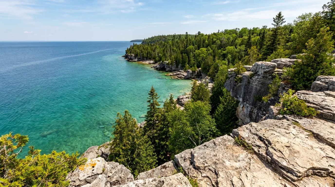
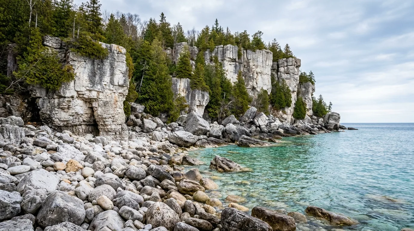
Sheer white and grey dolomite limestone cliffs dropping straight into glowing turquoise Georgian Bay water on a calm sunny day with cedars on the cliff edge, Bruce Peninsula Ontario, ultrarealistic photograph representative of the region
Trekkr Trail Journal · No. 057 · Georgian Bay & the Bruce Peninsula

Georgian BayOntario — turquoise water, white dolomite cliffs, the Grotto's timed parking & the Chi-Cheemaun ferry

In the middle of Ontario, over pale limestone shelves, the water of Georgian Bay glows an almost Caribbean turquoise below sheer white cliffs. The Bruce Peninsula is the spine of the Niagara Escarpment — a UNESCO biosphere of dolomite headlands, sea caves and shipwrecks, anchored by two national parks and the little harbour town of Tobermory. It is also, now, a place you plan around a parking reservation: the Grotto and Cyprus Lake run on timed-entry slots, the ferry runs on a schedule, and the cliffs and cold water are genuinely dangerous. Sort those three, and it's one of the most beautiful shorelines in the country.

Ontario · Canada Bruce Peninsula NP · Fathom Five NMP Timed parking at the Grotto Chi-Cheemaun ferry · ~1 May–18 Oct
~100 kmLength of the peninsula, Wiarton north to Tobermory
4-hourTimed parking slots now required at the Grotto & Cyprus Lake
~22Protected shipwrecks in Fathom Five, Canada's first marine park
1 venomousThe Massasauga rattlesnake — Ontario's only, and it lives here
Conditions verified 23 July 2026 · The parking slot and the ferry decide the day before the trail does · This block goes stale — the links don't

Two things open this shore: a timed parking slot, and the water itself

The rest of this journal is evergreen; this box is not. On the Bruce two things decide whether your plan works before you lace a boot — whether you have a pre-booked parking reservation for the Grotto / Cyprus Lake (§02), and how you'll handle the cold, deep, cliff-lined water and the ferry schedule (§05, §06). Everything below is dated to the day we checked it. Trust the live sources, not our date stamp.

  • The Grotto runs on a timed PARKING reservation — no slot, no entry in peak seasonFor most of the season the Cyprus Lake / Grotto lot and Halfway Log Dump require a pre-booked four-hour parking slot via the Parks Canada system — reported at about $15 per vehicle plus an $11.50 reservation fee, with per-adult admission on top. Lots fill; arriving without a reservation in peak season means being turned away. [VERIFY current fees, slot times & season at reservation.pc.gc.ca] (§02)
  • The Chi-Cheemaun ferry is seasonal — and books out in summerThe MS Chi-Cheemaun (Tobermory ↔ South Baymouth) ran roughly 1 May – 18 October 2026, three daily sailings each way in peak summer, fares held at 2025 rates. New for 2026: a daily terminal parking fee (reported $10/day, $70/week), and no fall repositioning cruise (five-year dry-dock). Vehicle reservations strongly advised in peak season. [VERIFY schedule & fares at ontarioferries.com] (§02)
  • The cliffs and cold water at the Grotto are genuinely dangerousThe dolomite cliffs are high, wet and slippery; cliff diving is prohibited; Georgian Bay can throw sudden waves and cold-water shock. There have been real injuries and rescues at the Grotto and Indian Head Cove. Wear proper footwear, stay back from wet edges, and supervise children closely. (§06)
  • Camping books far ahead — and national-park sites had a spring closureCyprus Lake and the provincial parks fill months out; 2026 warm-season national-park bookings opened 2 February, and Cyprus Lake sites and yurts were closed 1–14 May 2026 for maintenance. Book at reservation.pc.gc.ca (national) and reservations.ontarioparks.ca (provincial). [VERIFY dates & fees at booking] (§07)
  • There is a rattlesnake here — and it's protectedThe eastern Massasauga is Ontario's only venomous snake and it lives on the Bruce. It's shy and retreats, rattles as a warning, and strikes only as a last resort. See or hear one? Stop, stay calm, locate it, slowly back away. Wear ankle boots and long loose pants in rocky/brushy/wetland areas. Do not handle it — it's a protected species at risk. (§06)
  • Cell coverage thins fast off the main townsCoverage is good in and around Owen Sound, Wiarton, Lion's Head and Tobermory, but is patchy-to-nonexistent on backcountry Bruce Trail sections and at remote points like Cabot Head. Carry offline maps and tell someone your plan; don't rely on a phone for trail navigation or an emergency. [Coverage is carrier-dependent — VERIFY] (§02, §06)
Live sources · Parks Canada — Bruce Peninsula NP · reservation.pc.gc.ca — parking & camping · ontarioferries.com — Chi-Cheemaun · ontarioparks.ca — provincial camping · Parks Canada — Fathom Five NMP
In an emergency, 911. This box was true at press and will not stay true — the sources above are the truth on the day you travel.
01 / THE HOOK

Caribbean water in the middle of Ontario

The Bruce Peninsula is the long, narrow limestone finger that separates the open water of Lake Huron from Georgian Bay, reaching roughly 100 km north from Wiarton to its tip at Tobermory. It is the geological spine of the Niagara Escarpment, a dolomitic limestone ridge named a UNESCO World Biosphere Reserve in 1990, and that escarpment gives the whole region its signature look: sheer white-and-grey cliffs dropping straight into water that glows turquoise on calm, sunny days — a colour produced by clean, cold, mineral-clear Georgian Bay water over pale limestone. It is a hiking and paddling magnet, a world-class freshwater diving destination, and, on the Lake Huron side, a string of warm shallow beaches. It is also intensely popular in summer, which is why the signature sights now run on reservations. Understand the two shores, sort the parking and the ferry, respect the cliffs and the cold water, and it's one of the great Great-Lakes shorelines. Underestimate the crowds or the water, and it's a wasted morning at a full gate — or a rescue.

A pebble cove framed by tall white dolomite limestone cliffs with brilliant clear turquoise Georgian Bay water, Indian Head Cove Bruce Peninsula National Park Ontario, ultrarealistic photograph representative of the region
Indian Head Cove, beside the Grotto. The classic turquoise-water photo of the Bruce — and a cove hemmed by high dolomite cliffs, reached on the same trail and the same timed parking as the Grotto (§02). The water is beautiful, cold and deep; the edges are wet and unforgiving (§06).

The payoff

Two national parks in one place: Bruce Peninsula NP (the Grotto, cliff-edge Bruce Trail, rare orchids) and Fathom Five NMP — Canada's first marine park, with ~22 shipwrecks and Flowerpot Island's sea stacks (§05).

The catch

Intense summer popularity. The Grotto, Cyprus Lake and Halfway Log Dump are reservation-controlled, the ferry books out, and the campgrounds fill months ahead. This is a place you plan, not wing (§02, §07).

Two shores, one peninsula

The Georgian Bay side is cliffs, caves and cold turquoise coves. The Lake Huron side is warm, shallow, sandy beaches — Sauble, Singing Sands. Same trip, two completely different swims (§03).

The way to think about the region — one road up, two national parks, a ferry off the end, and two very different shores Everything funnels onto Highway 6, the only through-road, which runs the length of the peninsula and dead-ends at the Tobermory ferry dock. The service towns step down the highway south to north: Owen Sound (the big regional hub, hospital, full services), Wiarton ("gateway to the Bruce"), Lion's Head (mid-peninsula, on the Georgian Bay side), and Tobermory at the tip — the tourism epicentre and the base for Fathom Five boat tours and diving. The Georgian Bay (east) side holds the dolomite cliffs, the Grotto and the Bruce Trail's most dramatic clifftop walking; the Lake Huron (west) side holds the warm sand beaches. East of the peninsula, Georgian Bay opens into the legendary 30,000 Islands — the world's largest freshwater archipelago — though that windswept granite country is reached more from the Parry Sound side than from the Bruce tip.
02 / GETTING THERE & THE PARKING RESERVATION

One highway up, a ferry off the end — and a slot you book in advance

Access to the Bruce is simple in shape and strict in detail. There's one road up (Highway 6), one ferry off the tip (the Chi-Cheemaun), and one thing first-timers get badly wrong: the Grotto is not something you just drive to and park at anymore. For most of the season you need a pre-booked, timed four-hour parking slot to reach the Grotto and Cyprus Lake — and if you show up without one in July, you get turned around. Here's how it worked for 2026; confirm the current fees and rules before you rely on them.

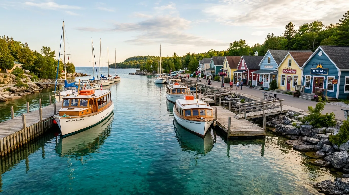
A small sheltered village harbour with tour boats and sailboats moored on clear blue water, waterfront shops and docks, Little Tub Harbour Tobermory Bruce Peninsula Ontario, warm afternoon light, ultrarealistic photograph representative of the region
Little Tub Harbour, Tobermory — the end of Highway 6. The northern tip and tourism hub: two harbours (Little Tub for tour boats and shops, Big Tub near the ferry area and the shipwrecks), the base for Fathom Five cruises and diving, and the dock for the Chi-Cheemaun to Manitoulin Island.
🔴 The single most important thing to book — the Grotto / Cyprus Lake parking slot For most of the season, the Cyprus Lake / Grotto parking lot and Halfway Log Dump require a pre-booked four-hour timed parking reservation through the Parks Canada system. Reported 2026 cost: about $15 per vehicle plus an $11.50 reservation fee, with per-adult park admission on top (admission was waived under the Canada Strong Pass from 19 June to 7 September 2026, but the parking fee and reservation still applied). Typical slots run 9am–1pm, 12–4pm, 1–5pm, 4–8pm and 5–9pm. The lots fill, and no reservation means being turned away in peak periods. Book at reservation.pc.gc.ca and confirm the current fees, slot times and which dates require a reservation before you count on a visit.
Getting thereWhat it is2026 notesThe catch
Highway 6
the only through-road
Runs the length of the peninsula from Owen Sound through Wiarton and Ferndale to the Tobermory ferry dock Year-round Rural between towns — fuel up in the towns; groceries thin out north of Wiarton
MS Chi-Cheemaun ferry
the "Big Canoe"
Tobermory ↔ South Baymouth (Manitoulin Island); car + passenger ferry, Owen Sound Transportation Co. ~1 May–18 Oct 2026 3 daily sailings each way in peak summer; reserve ahead (1-800-265-3163); new $10/day terminal parking
Grotto / Cyprus Lake parking
timed reservation
Pre-booked 4-hour slot for the Cyprus Lake / Grotto lot (and Halfway Log Dump) Reservation required most of season No slot = turned away. ~$15/vehicle + $11.50 reservation fee + admission. Book at reservation.pc.gc.ca
Fuel
plan the gaps
Reliable stations in Owen Sound, Wiarton, Ferndale and Tobermory (Hoppy's Gas Bar, 7392 Hwy 6) Rural between towns Fill up before long clifftop-trail days; don't count on fuel north of the towns

Fares, schedules and parking rules change annually. Confirm the ferry schedule and fares at ontarioferries.com, and the parking reservation rules at reservation.pc.gc.ca, before you build a day around either.

The Chi-Cheemaun, in detail

The ferry crosses Tobermory to South Baymouth on Manitoulin Island in three service periods for 2026: spring (May 1–Jun 18), peak summer (Jun 19–Sep 7, three daily departures each way) and fall (Sep 8–Oct 18). Fares were held at 2025 rates; vehicle-plus-passenger reservations are strongly advised in peak season (1-800-265-3163).

New for 2026: a daily terminal parking fee (reported $10/day, $70/week), and no fall repositioning cruise owing to a five-year dry-dock inspection.

Reserve in peak seasonNew terminal parking fee

What the parking slot is not

It is a parking permit, not a Grotto ticket or a camping booking. It gets your vehicle into the Cyprus Lake lot for a four-hour window; it does not reserve a campsite (that's a separate Parks Canada camping reservation, §07), and it doesn't apply to every trailhead.

Singing Sands, on the Lake Huron side, uses separate parking, and towns like Lion's Head and beaches like Sauble are outside the national-park reservation system entirely — useful pressure valves when the Grotto slots are gone (§03).

The 60-second access decision
  1. Set on the Grotto? Book a timed Cyprus Lake / Grotto parking slot at reservation.pc.gc.ca as far ahead as you can — peak dates go fast.
  2. Crossing to Manitoulin? Reserve the Chi-Cheemaun (1-800-265-3163) and budget the new terminal parking fee if you're leaving a car.
  3. Grotto slots gone? Pivot to Singing Sands (separate parking), Lion's Head, or the Lake Huron beaches — no reservation needed.
  4. Long trail day planned? Fuel up in Owen Sound, Wiarton or Tobermory first, and carry offline maps — coverage drops on the backcountry Bruce Trail.
03 / THE TWO SHORES

The cliff side and the beach side — and the reasons to choose

The peninsula has two coasts that feel like two different places. The Georgian Bay (east) side is the postcard: white dolomite cliffs, sea caves, cold turquoise coves and the escarpment-edge Bruce Trail. The Lake Huron (west) side is the opposite — long, warm, shallow sand beaches with west-facing sunsets, the gentler, family-friendly half of the trip. Most people come for the cliffs and never realise the warm swimming is a short drive away. Know both, and you can build a trip that isn't all crowds and cold water.

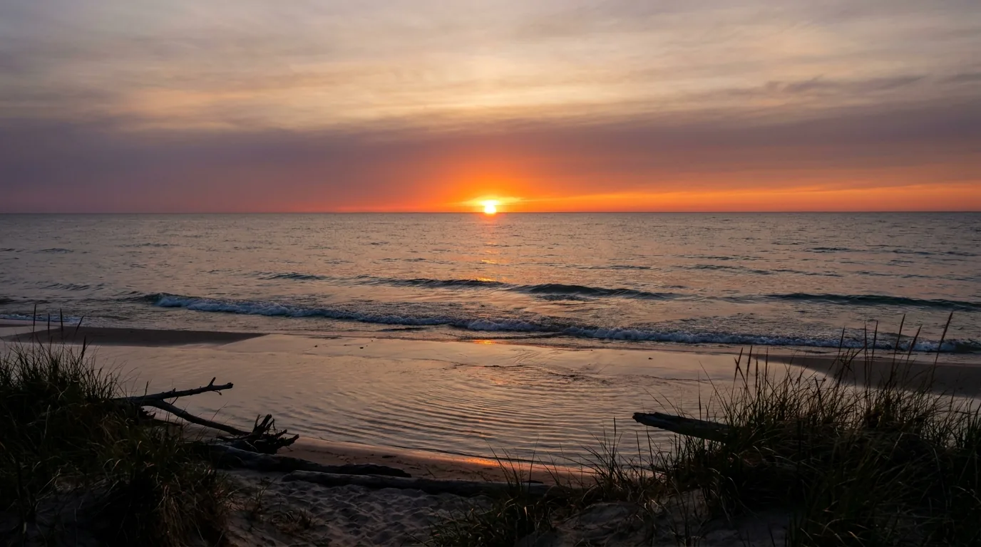
A wide sandy freshwater beach at sunset with the sun sinking into Lake Huron, warm orange and violet sky reflected on shallow water and wet sand, gentle waves, Sauble Beach Ontario, ultrarealistic photograph representative of the region
Sunset over Lake Huron at Sauble Beach. Roughly 11 km of sand, west-facing sunsets and warm, shallow water — the warm, family-friendly counterweight to the cold turquoise coves on the Georgian Bay side. (Sauble's "second-longest freshwater beach" billing is commonly cited but promotional — treat it as such.)

The Georgian Bay side — cliffs & cold turquoise

  • The signature look: white dolomite cliffs, sea caves and clear, cold, turquoise water — the Grotto, Indian Head Cove, Halfway Log Dump
  • The Bruce Trail's best clifftop sections run this shore (§04), with the Lion's Head lookout mid-peninsula
  • Cold, deep, sometimes rough water below high wet cliffs — beautiful and genuinely hazardous (§06); great for diving, bracing for swimming
  • Where the crowds and the reservations are — the Grotto/Cyprus Lake timed-parking zone (§02)
Turquoise covesCold, cliff-lined water

The Lake Huron side — warm sand & sunsets

  • Warm, shallow, sandy beaches that heat up much more in July–August — Sauble Beach (~11 km) and Singing Sands
  • Singing Sands (Dorcas Bay, in the national park) pairs a shallow beach and boardwalk with a rare-orchid fen — a calmer contrast to the Grotto, with separate parking
  • West-facing sunsets and family-friendly swimming — the gentle half of the peninsula
  • Mostly outside the national-park reservation system — a pressure valve when the Grotto slots are gone
Warm shallow waterNo timed parking
A warm shallow sand beach with a low boardwalk crossing a fen, calm Lake Huron water, dune grass and rare wildflowers, Singing Sands Bruce Peninsula National Park Ontario, ultrarealistic photograph representative of the region

Singing Sands — the calmer half of the national park

On the Lake Huron side at Dorcas Bay, Singing Sands is a warm, shallow sand-and-boardwalk beach fronting a rare fen with orchids and carnivorous plants, laced by a ~3 km moderate trail. It's the family-friendly counterpoint to the crowded, cold Grotto scene.

It has its own separate parking — not the Cyprus Lake timed lot — which makes it a genuinely useful fallback on a busy day. Stay on the boardwalks: the fen habitat and its rare plants are fragile (§06).

Warm & shallowSeparate parkingFragile fen — stay on boardwalks
Which shore for which day Chasing the turquoise-water photo and the cliffs? The Georgian Bay side — but book the parking (§02) and mind the cold, wet edges (§06). Travelling with kids, or just want a warm swim and a sunset? The Lake Huron side — Sauble Beach or Singing Sands, no reservation, warm shallow water. Best of both? Base near the middle or on the Huron side, do a dawn Grotto slot, and spend the warm afternoon on a Lake Huron beach. The two shores are close — use them against each other to dodge the crowds.
04 / THE HIKES

The Bruce Trail's best cliffs, and where they get serious

The Bruce Trail is Canada's oldest and longest marked footpath, and it delivers its most dramatic clifftop walking right here, along the Georgian Bay escarpment. This is exposed, rocky, root-and-rubble terrain along wet dolomite edges — slower and more demanding than the flat mileage suggests, and genuinely dangerous near the drops. The distances below come from Parks Canada and standard trail sources and are the best figures we could find; confirm at the trailhead board, wear real footwear, and treat every cliff edge as a one-way drop.

A narrow footpath along the white dolomite limestone escarpment edge high above turquoise Georgian Bay with wind-bent cedars and a lone hiker for scale, Bruce Trail Bruce Peninsula Ontario, ultrarealistic photograph representative of the region
The Bruce Trail along the Georgian Bay escarpment. The clifftop sections through the national park — the Cyprus Lake, Marr Lake and Georgian Bay Trail loops linking the Grotto and Indian Head Cove — offer Ontario's most dramatic clifftop walking, and continue to the backcountry camps at Stormhaven and High Dump.

The signature loop · timed parkingGrotto & Indian Head Cove (Georgian Bay Trail)

The escarpment-edge loop through Bruce Peninsula NP linking the Grotto and Indian Head Cove, on the Cyprus Lake / Marr Lake / Georgian Bay Trail system. The Grotto sea cave is roughly a 30–45 minute walk from the Cyprus Lake trailhead. Ontario's most dramatic short clifftop walk — and the busiest.

Timed parking reservation required for Cyprus Lake most of the season (§02). Cliff diving is prohibited; the wet dolomite edges are slippery and the water is cold and deep — real injuries and rescues have happened here (§06).

~30–45 min to the GrottoTimed parking · cliff hazard
From the Cyprus Lake trailhead
Half day (estimate)
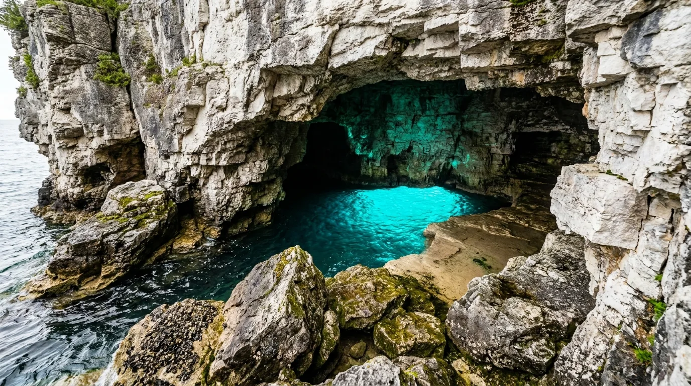
A turquoise-lit limestone sea cave opening on the Georgian Bay shore with electric turquoise water glowing inside the cave mouth and white dolomite rock, the Grotto Bruce Peninsula National Park Ontario, ultrarealistic photograph representative of the region
The Grotto — the Bruce Peninsula's signature sea cave. A turquoise-lit limestone cavern on the Georgian Bay shore. Reached on foot from Cyprus Lake with a timed parking slot. Magnificent — and hemmed by high, wet cliffs over cold, deep water, with cliff diving banned and rescues on record (§06).
A dramatic white dolomite limestone clifftop viewpoint over 60 metres above brilliant turquoise Georgian Bay water with a forested shoreline curving away on a clear day, Lion's Head lookout Bruce Peninsula Ontario, ultrarealistic photograph representative of the region
The Lion's Head lookout, mid-peninsula. A clifftop viewpoint 200-plus feet above turquoise Georgian Bay water, in the town of Lion's Head — some of the best cliff views on the Bruce, reachable as a short out-and-back or a challenging full loop, and without the Grotto's timed-parking reservation.

The big clifftop view · in a townLion's Head Lookout

A clifftop viewpoint roughly 200+ ft above turquoise Georgian Bay water, in the town of Lion's Head mid-peninsula. Reachable as a shorter out-and-back (~4 km) from the Lion's Head trailhead, or as a challenging full loop (reported ~18.7 km). Some of the best cliff views on the Bruce — without the Grotto's reservation.

Exposed, unfenced clifftop edges over a long drop — keep well back, mind footing on rock, and don't approach wet edges. The long loop is a serious full-day hike; know which version you're doing.

~4 km out-and-back~18.7 km full loopUnfenced clifftop
Out-and-back to the lookout
2–3 h (estimate)

The wild boulder cove · timed parkingHalfway Log Dump

A wild boulder-beach cove with cliffs and swimming, south of the Grotto in the national park. Reached via a ~1 km trail and then coastal boulder-hopping. Quieter and rougher underfoot than the Grotto, with the same clear cold water.

Timed parking reservation required (reported roughly mid-June to late September) — same system as the Grotto (§02). Boulder-hopping is ankle-turning terrain; the water is cold and deep. Wear real footwear.

Timed parkingBoulder-beach coveRough footing
~1 km trail + boulder-hop
Half day (estimate)

The gentle one · Lake Huron sideSinging Sands (Dorcas Bay)

A ~3 km moderate trail around a warm, shallow Lake Huron beach and a rare orchid fen, on boardwalk and sand. The family-friendly, low-exposure alternative to the cliffs — and it uses separate parking from Cyprus Lake (§02, §03).

Stay on the boardwalks — the fen and its rare, protected plants (orchids, carnivorous plants) are fragile alvar/wetland habitat. No timed reservation, but the lot can fill on hot days.

~3 km, easy–moderateSeparate parkingStay on boardwalks
Beach + fen loop
1–2 h (estimate)
🔴 The one rule that matters most here The dolomite cliff edges are wet, slippery and unforgiving, and cliff diving is prohibited. The trails run right along the drops, the rock is often greasy with spray, and the water below is cold, deep and sometimes rough. There have been genuine injuries and rescues at the Grotto and Indian Head Cove. Wear proper footwear, keep well back from wet edges, judge your swimming against cold deep water, and supervise children constantly. A photo from the lip is not worth it (§06).
Trail / featureWhereDistance*CharacterParking
Grotto / Indian Head CoveCyprus Lake, Bruce Peninsula NP~30–45 min to the caveClifftop + sea caveTimed reservation
Halfway Log DumpBruce Peninsula NP (south of Grotto)~1 km + boulder-hopWild boulder coveTimed reservation
Lion's Head Lookout (short)Town of Lion's Head~4 km out-and-backClifftop viewpointTown trailhead
Lion's Head loop (full)Town of Lion's Head~18.7 km loopSerious full-day cliff hikeTown trailhead
Singing SandsDorcas Bay, Bruce Peninsula NP~3 kmBeach + orchid fen (easy)Separate lot
Cabot Head Lighthouse trailsCabot Head Provincial Nature Reserve~6.3–18.2 kmRemote shoreline / lightstationGravel road access

*Distances are compiled from Parks Canada and standard trail sources and vary by source — confirm at the trailhead board. The Bruce Trail is rocky and slow; times mean little. Cell coverage drops on backcountry sections and at Cabot Head — carry offline maps.

05 / ON THE WATER — FATHOM FIVE

Sea stacks, shipwrecks, and Canada's first marine park

Offshore from Tobermory, Fathom Five National Marine Park — Canada's first national marine conservation area — protects roughly 22 shipwrecks and about 20 islands, including Flowerpot Island with its wave-sculpted sea stacks and a historic lightstation. The cold, exceptionally clear freshwater makes this a world-renowned diving destination and a superb place for glass-bottom boat touring. Almost all of it is boat-access only, out of Tobermory's Little Tub Harbour, so this part of the trip runs on tour operators and dive charters (§08).

Two wave-sculpted rock pillar sea stacks rising from turquoise Georgian Bay water at the shoreline with a forested island backdrop, Flowerpot Island Fathom Five National Marine Park Tobermory Ontario, ultrarealistic photograph representative of the region
Flowerpot Island's sea stacks. About 6.5 km offshore from Tobermory and boat-access only, the island is named for its two "flowerpot" rock pillars, and also holds a historic lightstation, hiking trails and caves. You can take a continuous cruise, or be dropped for a self-guided hike with a set pickup time.

Flowerpot Island

The marine park's signature stop, ~6.5 km offshore from Tobermory. The two "flowerpot" sea stacks, a historic lightstation, hiking trails and caves. Take a continuous cruise, or get dropped for a self-guided hike and catch a set pickup.

Boat-access only, from Little Tub Harbour. If you hike, watch the clock — the pickup time is the plan.

Sea stacks + lightstationBoat-access only

The shipwrecks

Within about five minutes of leaving Little Tub, glass-bottom boats pass two 19th-century wrecks — the Sweepstakes and the City of Grand Rapids — in Big Tub Harbour, visible from the surface in the clear water. Fathom Five protects roughly 22 wrecks in total.

For divers, Tobermory is world-class: cold, exceptionally clear water and well-preserved wrecks (Sweepstakes, Arabia, Forest City, W.L. Wetmore and more), served by local dive charters (§08).

Sweepstakes & City of Grand Rapids~22 protected wrecks
Looking down through exceptionally clear cold turquoise water at a 19th century wooden shipwreck resting on the pale limestone lake bottom with timbers and ribs visible, Big Tub Harbour Tobermory Fathom Five Ontario, ultrarealistic photograph representative of the region
A wreck in the clear water of Big Tub Harbour. The cold, mineral-clear freshwater that turns the coves turquoise also preserves the shipwrecks and makes them visible from the surface. It's why Tobermory is both a glass-bottom-boat town and a world-renowned freshwater dive destination — and why the water is bracingly cold to swim in (§06).
How to actually do the water — it runs on operators Flowerpot Island, the shipwreck tours and the dive charters all depart from Tobermory's Little Tub Harbour, and they book up in peak summer. For a glass-bottom / Flowerpot cruise, the long-established operators are Blue Heron Cruises and Bruce Anchor Cruises (§08). For diving and snorkelling, Tobermory has local charter and gear operators — but the dive scene has changed (a historic operator, Divers Den, has reportedly wound down), so confirm the operating status and 2026 season of any dive charter before you count on it. Season, pricing and schedules change annually — we link to operators rather than quote prices (§08).
06 / SAFETY — READ THIS FIRST

The cliffs, the cold water, and the rattlesnake

Most of what goes wrong on the Bruce comes down to a few specific things, and they're not exotic. The first is the combination that defines the Grotto: high, wet, slippery cliffs above cold, deep, sometimes rough water, where real injuries and rescues happen. The second is that this is home to the eastern Massasauga — Ontario's only venomous snake, shy and protected but genuinely here. Add black bears in the backcountry, fragile rare-plant habitat, and cell coverage that vanishes off the main towns, and the whole trip rewards a little caution.

A wild boulder and cobble beach cove backed by white dolomite limestone cliffs meeting clear turquoise Georgian Bay water with smooth rounded rocks, Halfway Log Dump Bruce Peninsula National Park Ontario, ultrarealistic photograph representative of the region
Cold, clear, cliff-lined water at Halfway Log Dump. The same turquoise water that draws the crowds is genuinely cold and deep, and the coves sit below dolomite edges. Cold-water shock and sudden waves are real; boulder-hopping is ankle-turning terrain. Beautiful — and to be respected.

Cliffs & cold water at the Grotto — take it seriously

The dolomite cliffs are high, wet and slippery, the trails run along the drops, and cliff diving is prohibited. Georgian Bay can produce sudden waves and cold-water shock, and there have been real injuries and rescues at the Grotto and Indian Head Cove.

Wear proper footwear, stay back from wet edges, assess your swimming against cold, deep, sometimes rough water, and supervise children closely.

Cliff diving prohibitedCold-water shock is real

The Massasauga rattlesnake — what to actually do

The eastern Massasauga is Ontario's only venomous snake and it lives on the Bruce Peninsula — a shy, protected species at risk, active early spring to late fall. It retreats when it can, rattles as a warning, and strikes only as a last resort.

If you see or hear one: stop, stay calm, locate it, and slowly back away. Wear ankle-covering boots and long loose pants in rocky, brushy, wetland and tall-grass areas. Bites are rare and rarely serious but need prompt medical attention. Do not handle or harass it — that's illegal.

Back away slowlyAnkle boots + long pants
🔴 Black bears & food storage in the backcountry Black bears are present on the peninsula and active spring to late fall; they normally avoid people. Make noise, never leave food out, and store food securely. At the Stormhaven and High Dump backcountry campgrounds, use the provided food-storage poles; at Cyprus Lake, store food securely in your vehicle. Carrying bear spray and knowing how to use it is reasonable in the backcountry. A fed bear becomes a dangerous bear — keep a clean camp.

Leave No Trace & the fragile escarpment

This is a UNESCO biosphere with rare cliff-edge and alvar habitat and rare orchids. Pack out all trash, stay on marked trails and boardwalks, don't remove rocks or plants, and don't trample cliff edges or the Singing Sands fen. The habitat that makes this place special is exactly what heavy visitation threatens.

Stay on trails & boardwalksRare-plant habitat

Dogs, coverage & the basics

National park: dogs must be leashed at all times and are barred from some sensitive areas — verify current Grotto/beach restrictions. Ontario Parks: dogs welcome, leashed to max 2 m (6 ft); some campgrounds/beaches are pet-free (e.g. Awenda's Snake Campground); roofed-accommodation dog fee ~$40/reservation. Cell coverage drops on backcountry trails and at Cabot Head — carry a map and water and tell someone your plan.

Dogs leashedConfirm per-site pet rules
07 / THE CAMPING STRATEGY

One national-park base, and a belt of provincial parks

Camping here sorts into a few buckets: the national-park campground at Cyprus Lake (the closest base to the Grotto, but unserviced and reservation-heavy), its hike-in backcountry sites, and a belt of provincial parks that spread the load — Sauble Falls and MacGregor Point on the Lake Huron side, Awenda and Craigleith on the southern Georgian Bay side, several with electrical sites, yurts or cabins. Everything books far ahead for summer weekends. Book Cyprus Lake early if you want the Grotto on your doorstep, and use the provincial parks as the roomier fallback.

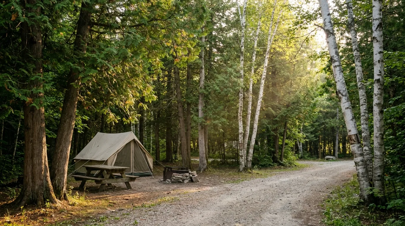
A quiet forested drive-in campground among mixed cedar and birch trees with a tent, picnic table and fire pit at an unserviced site in dappled evening light, Cyprus Lake Bruce Peninsula Ontario, ultrarealistic photograph representative of the region
Cyprus Lake Campground — the closest base to the Grotto. 232 unserviced drive-in sites in three areas (Tamarack, Poplars, Birches), each with a picnic table and fire pit. No electrical hookups anywhere — and, like everything here, it books out for peak summer. A central shower building ("The Campground Hub") opened in 2020.
CampgroundArea · managerSitesPowerBookingNotes
Cyprus Lake Bruce Peninsula NP · Parks Canada 232 unserviced None reservation.pc.gc.ca 3 areas; showers, dump station; closest to the Grotto; closed 1–14 May 2026
Cyprus Lake Yurts Bruce Peninsula NP · Parks Canada count unconfirmed Reservation Roofed; BBQ + fire pit; showers/flush nearby; shoulder/winter too
Stormhaven Bruce Peninsula NP (backcountry) · PC 9 tent platforms Reservation, hike-in Bruce Trail, Georgian Bay shore; composting toilet, food poles
High Dump Bruce Peninsula NP (backcountry) · PC 9 tent platforms Reservation, hike-in North of Halfway Log Dump; composting toilet, food poles
Sauble Falls Lake Huron side · Ontario Parks 154 (79 electrical) 15/30-amp ontarioparks.ca 8 RV pull-through, ~99 radio-free, EV charging; rigs to ~32 ft (West)
MacGregor Point Lake Huron, S of Port Elgin · ON Parks ~360 Some electrical ontarioparks.ca 3 campgrounds; 6 yurts, 10 rustic cabins; dump station; winter camping
Awenda S Georgian Bay, Penetanguishene · ON Parks ~330 Wolf (all) + some Hawk ontarioparks.ca 6 campgrounds; Snake is radio/pet/generator-free; sand beaches
Craigleith S Georgian Bay, Blue Mountains · ON Parks 172 (~40 electrical) ~40 electrical ontarioparks.ca Areas A–D; flat-rock fossil shoreline; near Collingwood
Cabot Head NE tip · Provincial Nature Reserve day-use only No developed campground — lighthouse & trails; corrects a common assumption

Ontario Parks 2026 posted ranges were roughly $38.70–$52.55/night non-electrical and $43.79–$59.33/night electrical, plus a ~$9.73 reservation fee (varies by park/site). Bruce Peninsula NP per-night camping rates are NOT quoted here — we could not confirm them; verify on the Parks Canada fees page. The Canada Strong Pass gave 25% off national-park camping 19 Jun–7 Sep 2026. Site counts and areas vary by source — book by site and read the actual price and type.

Which base for which trip

  • Grotto on your doorstep, tents / small rigs: Cyprus Lake — unserviced, no hookups, books early; still need the separate timed parking slot for the Grotto lot (§02)
  • Backpacking the cliffs: Stormhaven or High Dump — 9 hike-in tent platforms each, food poles, reservation required
  • Electrical / bigger rig, warm beaches: Sauble Falls (79 electrical, EV charging) or MacGregor Point (yurts & cabins) on the Lake Huron side
  • Southern Georgian Bay loop: Craigleith (fossil shoreline, near Collingwood) and Awenda (six campgrounds, sand beaches)

The rules & realities that catch people out

Cyprus Lake has no electrical hookups at all — it's unserviced drive-in camping, with a dump station near the office. A campsite reservation is separate from the Grotto parking slot; booking one does not get you the other.

Cabot Head has no developed campground — it's a day-use nature reserve, listed here to correct a common assumption. And private RV parks and campgrounds near Tobermory, Miller Lake and Sauble do exist, but we did not independently verify their names, site counts or fees this pass, so we don't publish specific ones — confirm each operator's own current website (§13).

Campsite ≠ Grotto parkingPrivate parks unverified
08 / TOWNS & SERVICES

Owen Sound resupplies, Tobermory runs the boats

Services step down the peninsula. Owen Sound is the big regional hub — full services, a hospital, big-box stores — and the last major full-service city before you head up. Wiarton and Lion's Head are smaller waypoints, and Tobermory at the tip is the tourism epicentre: the harbour town where the boat tours, dive charters and the ferry all depart. Plan your resupply around that gradient, top off fuel before the rural stretches, and know that groceries thin out north of Wiarton.

The service towns, south to north

  • Owen Sound: the largest regional hub — full services, big-box stores, hospital, fuel. The last major full-service city before the peninsula
  • Wiarton ("gateway to the Bruce," home of Wiarton Willie): fuel, groceries, banks, LCBO. Stations at 490 Berford St and on Hwy 6 South
  • Lion's Head: mid-peninsula, Georgian Bay side — harbour, beach, the Lion's Head lookout trailhead, small grocery, bakery/cafes, fuel
  • Tobermory: the tip and tourism epicentre — two harbours, Fathom Five boat tours and diving, shops, restaurants, the ferry. Fuel at Hoppy's Gas Bar (7392 Hwy 6)

Groceries thin out north of Wiarton; Tobermory has a small grocery. Fuel up before long trail days. Confirm hours before relying on them.

Where to start — the Visitor Centre

The Bruce Peninsula NP Visitor Centre in Tobermory is the practical starting point for both national parks — orientation, exhibits, a lookout tower, and the trailhead for the Burnt Point Loop.

Quieter national-park-adjacent coves near Tobermory — Little Cove and Dunks Bay — are worth knowing for swimming and shoreline walking away from the Grotto crowds (Little Cove uses its own Parks Canada parking area).

Start at the Visitor CentreLittle Cove · Dunks Bay
Operators & services worth knowing — links, not prices These are real Tobermory (Ontario) businesses; season, pricing and menus change annually, so we link rather than quote. Note the two "Tobermory" trap: there is also a Tobermory on the Isle of Mull in Scotland — make sure any listing you find is the Ontario one.

Boat tours & diving

  • Blue Heron Cruises (Tobermory) — the town's longest-running tour company: glass-bottom & jet-boat shipwreck/Flowerpot Island cruises, plus scuba & snorkel adventures. blueheronco.com
  • Bruce Anchor Cruises (Tobermory) — established 1989; a fleet of glass-bottom vessels; Flowerpot Island + shipwreck tours; also motel/cottages. cruises.bruceanchor.com
  • Adventure Tobermory (Tobermory Scuba & Snorkelling) (3 Bay St) — dive/snorkel charters, rentals, tank fills, PADI courses; seasonal. adventuretobermory.com. Reported successor to the former "Divers Den" — confirm 2026 operating status.

Food, ferry & tourism info

  • Tobermory Brewing Co. & Grill (28 Bay St S; 519-596-8181) — craft brewery + restaurant, pub fare with local meats/produce/seafood. tobermorybrewingco.com
  • The Fish & Chip Place (Tobermory) — fresh local whitefish & chips, harbour-side. thefishandchipplace.com (confirm address/hours)
  • Owen Sound Transportation Co. — MS Chi-Cheemaun (Tobermory terminal) — the car/passenger ferry to Manitoulin. ontarioferries.com
  • Tourism info: Tobermory & Northern Bruce Peninsula Chamber (tobermory.com), Explore The Bruce / Bruce County (explorethebruce.com), Municipality of Northern Bruce Peninsula (northbrucepeninsula.ca)

We confirmed no operator pricing — any number you see elsewhere should come from the business. A couple of Tobermory food spots (a coffee shop and a sweet shop) turned up in searches with unverified details, so we don't list them by name here. Check current websites before you drive over.

09 / TIMING

When to go — summer for the water, fall for the balance

The Bruce has one clear trade-off: the warmest water and weather come with the heaviest crowds and the strictest parking reservations. Peak summer is glorious and busy; fall is the connoisseur's window — strong escarpment colour, thinning crowds, the ferry still running — but the water cools. Spring is quiet and cool with some facilities still closed, and winter is a genuinely different, harder trip. If you want one answer: go in September for the balance, or peak summer if warm swimming is the point — and book everything early.

Season by season, straight

  • Peak summer (late Jun–early Sep) — warmest, busiest. Warm water and weather, the ferry at three sailings a day, but heaviest crowds and the strictest Grotto/Cyprus Lake timed parking. Book weeks-to-months ahead
  • Fall (mid-Sep–mid-Oct) — the sweet spot. Strong escarpment fall colour, thinning crowds, ferry through ~18 Oct. Cooler swimming; timed parking may still apply into late September
  • Spring (May–early Jun) — quiet, cool, limited. Some facilities closed; national-park sites & yurts were closed 1–14 May 2026 for maintenance; ferry season starts ~1 May
  • Winter — a different trip. The ferry stops, much of Tobermory closes, and the cliff-edge trails become icy and dangerous. Limited fall/winter camping in Cyprus Lake's Tamarack area and yurts

Water, and a note on temperature

Georgian Bay (Grotto-side) water is cold and clear year-round — that's what makes the turquoise colour and the diving so good, and the swimming so bracing. It stays refreshing-to-frigid even in high summer.

The Lake Huron sandbar beaches (Sauble, Singing Sands) warm up much more in July–August — noticeably warmer and shallower. If warm swimming matters, plan those for the afternoons.

Exact water temperatures vary and there's no single official figure — treat any specific number as unverified.

Georgian Bay: cold year-roundLake Huron: warmer
The one-paragraph answer Go in peak summer if warm swimming and the full ferry schedule are the point — but book the Grotto parking, the ferry and your campsite weeks-to-months ahead, and expect crowds. Go in mid-to-late September for the best balance — escarpment colour, fewer people, the ferry still running — accepting cooler water. Spring is quiet but limited; winter is a separate, harder trip with the ferry stopped and icy cliffs. Whichever you pick: reserve the parking and the ferry early, use the Lake Huron beaches for warm swims, and respect the cold water and the cliffs.
10 / THE SHAPE OF THE TRIP

Five ways to shape a Bruce trip

A few workable shapes, not the only ones. They range from a tight Grotto-and-Flowerpot day to a multi-day southern Georgian Bay loop. Whichever you build, the constants are the same: book the timed Grotto parking (and the ferry, if you're crossing) as early as you can, keep the popular sights early in the day, and use the warm Lake Huron beaches as your pressure valve when the cliffs are mobbed.

01

Tobermory Weekend (2 nights)

  1. Base at Cyprus Lake (or a Tobermory motel/cottage if sites are full).
  2. Day 1: pre-booked Grotto + Indian Head Cove timed slot, then the Cyprus Lake / Georgian Bay Trail loop; evening in Tobermory harbour.
  3. Day 2: glass-bottom boat + Flowerpot Island (Blue Heron or Bruce Anchor), plus the Sweepstakes / City of Grand Rapids wrecks in Big Tub.
  4. Book the parking slot and the boat well ahead.
Timed parkingBook the boat ahead
02

Grotto + Flowerpot Day Trip (1 day)

  1. Early Grotto timed slot (9am–1pm), then lunch in Tobermory.
  2. Afternoon Flowerpot Island cruise/hike with a set pickup time.
  3. Tight but doable — book both the parking slot and the boat in advance.
  4. No camping required; good if you're passing through.
Both must be pre-bookedNo overnight
03

Diver's Long Weekend (2–3 nights)

  1. Base in Tobermory; charter for wreck dives (Sweepstakes, Arabia, Forest City) — confirm the operator's 2026 status first.
  2. Non-diving companions do glass-bottom tours + the Grotto.
  3. Warm-up swims at Little Cove / Dunks Bay.
  4. Remember the water is cold — plan exposure protection.
Verify dive operator statusCold water
04

Lake Huron Beach & Falls Loop (2 nights)

  1. Camp at Sauble Falls PP or MacGregor Point PP (family-friendly).
  2. Days at Sauble Beach and Singing Sands — warm, shallow water.
  3. One day trip north to the Grotto / Tobermory (with a booked slot).
  4. The gentler alternative to the crowded cliff scene.
Warm swimmingFamily-friendly
05

Southern Georgian Bay Loop (3–4 nights)

  1. For the Collingwood/Midland side: Craigleith PP (Blue Mountains, fossil shoreline).
  2. Then Awenda PP (Penetanguishene, six campgrounds, sand beaches).
  3. Optional Georgian Bay Islands / 30,000 Islands access from the eastern shore.
  4. Can be combined with a Bruce Peninsula leg via Owen Sound.
Southern bay30,000 Islands context
+

The Manitoulin add-on (in season)

  1. From Tobermory, take the Chi-Cheemaun ferry to South Baymouth (~1 May–18 Oct).
  2. Reserve the vehicle crossing in peak summer (1-800-265-3163).
  3. Budget the new terminal parking fee if leaving a car.
  4. Extends the trip onto Manitoulin Island — a whole separate world.
Reserve the ferrySeasonal
11 / TRIP-READY

The departure check

Run it before you leave. Tap each item as it's done — these are the things specific to the Bruce that a general road-trip habit will skip. Most come back to two facts: the popular sights run on pre-booked parking and a seasonal ferry, and the water and cliffs that make this place beautiful are genuinely cold and dangerous.

0 / 10 confirmed — the parking slot sets the schedule.
12 / QUICK ANSWERS

Asked at every Bruce Peninsula trailhead

Do I need a reservation to see the Grotto?
You don't reserve the Grotto itself, but you must pre-book a timed parking slot to reach it. For most of the season the Cyprus Lake / Grotto lot (and Halfway Log Dump) require an advance four-hour parking reservation — reported at about $15 per vehicle plus an $11.50 reservation fee, with per-adult admission on top (waived under the Canada Strong Pass 19 Jun–7 Sep 2026, but the parking fee and reservation still applied). Lots fill; no reservation means being turned away in peak season. Book at reservation.pc.gc.ca and confirm current fees and slot times.
How does the Chi-Cheemaun ferry work, and do I need to book?
The MS Chi-Cheemaun crosses between Tobermory and South Baymouth on Manitoulin Island. The 2026 season ran roughly 1 May to 18 October, with three daily departures each way in peak summer (~19 Jun–7 Sep). Fares were held at 2025 rates, and vehicle-plus-passenger reservations are strongly advised in peak season (1-800-265-3163). New for 2026: a daily terminal parking fee (reported $10/day, $70/week) and no fall repositioning cruise. Confirm the schedule and fares at ontarioferries.com.
Is the water really that turquoise, and is it safe to swim?
Yes — on calm, sunny days it genuinely glows turquoise over the pale limestone. But it's cold, clear, deep and sometimes rough, and the Grotto and Indian Head Cove sit below high, wet, slippery cliffs. Cliff diving is prohibited, cold-water shock and sudden waves are real, and there have been genuine injuries and rescues. Wear proper footwear, stay back from wet edges, judge your swimming honestly, and watch children. For warm, shallow, family swimming, use the Lake Huron beaches (Sauble, Singing Sands).
Are there really rattlesnakes here?
Yes. The eastern Massasauga is Ontario's only venomous snake and it lives on the Bruce Peninsula — a shy, protected species at risk that retreats, rattles as a warning, and strikes only as a last resort. If you see or hear one: stop, stay calm, locate it and slowly back away. Wear ankle-covering boots and long loose pants in rocky, brushy, wetland and tall-grass areas. Bites are rare and rarely serious but require prompt medical attention. Do not handle or harass it — that's illegal.
Where should I camp, and how far ahead should I book?
Cyprus Lake in Bruce Peninsula NP is the closest base to the Grotto — 232 unserviced (no-hookup) drive-in sites, plus yurts and two hike-in backcountry areas (Stormhaven, High Dump). It books far ahead; 2026 warm-season bookings opened 2 February 2026, and Cyprus Lake sites/yurts were closed 1–14 May 2026. The provincial parks spread the load: Sauble Falls and MacGregor Point (Lake Huron), Awenda and Craigleith (southern Georgian Bay). Book national-park sites at reservation.pc.gc.ca and provincial at reservations.ontarioparks.ca — months ahead for summer weekends.
Is the campsite reservation the same as the Grotto parking?
No — they're two separate bookings. A Cyprus Lake campsite reservation gets you a place to sleep; it does not get you into the timed Grotto parking lot, which is a separate reservation with its own fee. Even campers need to book the parking slot for the Grotto lot in peak season. Book both, and don't assume one covers the other.
How do I get to Flowerpot Island and the shipwrecks?
By boat from Tobermory's Little Tub Harbour. Flowerpot Island (~6.5 km offshore) is boat-access only — take a continuous cruise, or get dropped for a self-guided hike with a set pickup. Glass-bottom boats pass the Sweepstakes and City of Grand Rapids wrecks in Big Tub within minutes of departure. The long-running operators are Blue Heron Cruises and Bruce Anchor Cruises. For diving, confirm a charter's 2026 status first — the dive scene has changed.
When's the best time to go, in one sentence?
Peak summer (late June–early September) for the warmest water and the full ferry schedule, accepting the crowds and the strict Grotto parking; or mid-to-late September for the best balance — escarpment fall colour, fewer people, ferry still running — accepting cooler water. Spring is quiet but limited (national-park sites were closed 1–14 May 2026), and winter is a separate, harder trip with the ferry stopped and icy cliffs. Either way, book the parking and the ferry early.
Can I bring my dog?
Yes, leashed — but rules differ by jurisdiction. In the national park, dogs must be leashed at all times and are barred from some sensitive areas (verify current Grotto/beach restrictions). In Ontario Parks, dogs are welcome, leashed to max 2 m (6 ft); some campgrounds and beaches are pet-free (e.g. Awenda's Snake Campground), and roofed accommodation carries a dog fee (~$40/reservation). Confirm current per-site pet rules at booking, and mind the heat, the cliffs and the wildlife.
Is Sauble Beach really the second-longest freshwater beach in the world?
It's commonly billed that way, but treat that as promotional — we couldn't confirm the ranking to an official source. What's solid: Sauble is roughly 11 km of west-facing sand on Lake Huron with warm, shallow water and excellent sunsets, and it's the family-friendly counterweight to the cold turquoise coves on the Georgian Bay side. Whether or not the "second-longest" claim holds, it's a genuinely long, warm, sandy beach.
13 / WHAT WE COULD NOT CONFIRM

The honest gaps, all in one place

Every guide has these; most don't print them. Fees, ferry schedules and parking rules on the Bruce change yearly, and a few details simply couldn't be pinned to an official source this pass — so some numbers here are flagged in place. Everything below was compiled 23 July 2026 and should be re-checked against the linked official source before you rely on it.

Why this section exists Anyone can write a guide that sounds certain. The hard part is knowing which numbers are real — and on a peninsula where the Grotto now runs on a parking reservation, the ferry schedule shifts yearly, the national-park camping rates weren't confirmable, and the water and cliffs genuinely hurt people, plenty of them need a same-week check. The null is the product. "Book the timed parking slot before you count on the Grotto" and "the water is cold and the cliffs are wet — stay back from the edge" are usable instructions. A confident wrong answer here costs a wasted morning at a full gate — or worse.
🔒

The printable field guide

Everything above, condensed into a print-ready PDF built for the glovebox — for a shoreline where the signature sight now runs on a pre-booked parking slot, the ferry runs on a season, and the turquoise water that draws the crowds is genuinely cold below wet cliffs. The Highway 6 and Chi-Cheemaun logistics decoded, the Grotto / Cyprus Lake / Halfway Log Dump timed-parking reality, the Bruce Trail cliffs and Lion's Head at honest numbers, Flowerpot Island and the Tobermory shipwrecks, the campgrounds by park, the cliff, cold-water and rattlesnake safety, the Tobermory operators, and the honest list of what nobody could confirm — on paper that works where the bars don't.

Grotto timed-parking, decoded Chi-Cheemaun ferry logistics Bruce Trail cliffs & Lion's Head Flowerpot Island & the wrecks Campgrounds by park Cliff, cold-water & rattlesnake safety Tobermory operators The departure check
Unlock the PDF — $4.95
$4.95 per guide · Instant access · Built by people who actually camp there
Trail Journal No. 057

Go farther. Camp lighter.
Leave it better.

Every Trekkr Trail Journal is built like this one: custom logistics, honest trail beta, the camping and access detail, and the local knowledge that turns a good trip into the one your crew talks about for years — including, always, a plain list of what we could not confirm. New destinations drop all season long, from the Great Lakes & Shield to the Colorado Rockies to the Desert Southwest.

Unlock the Trail Journal Library
↗ Read another issue — No. 051, Grand Canyon National Park
$4.95 per guide · Instant access · Built by people who actually camp there