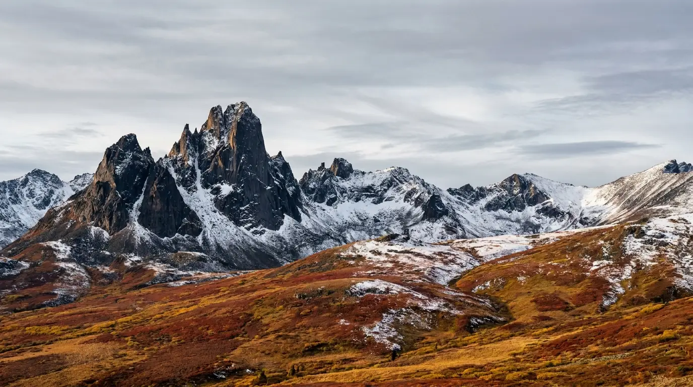
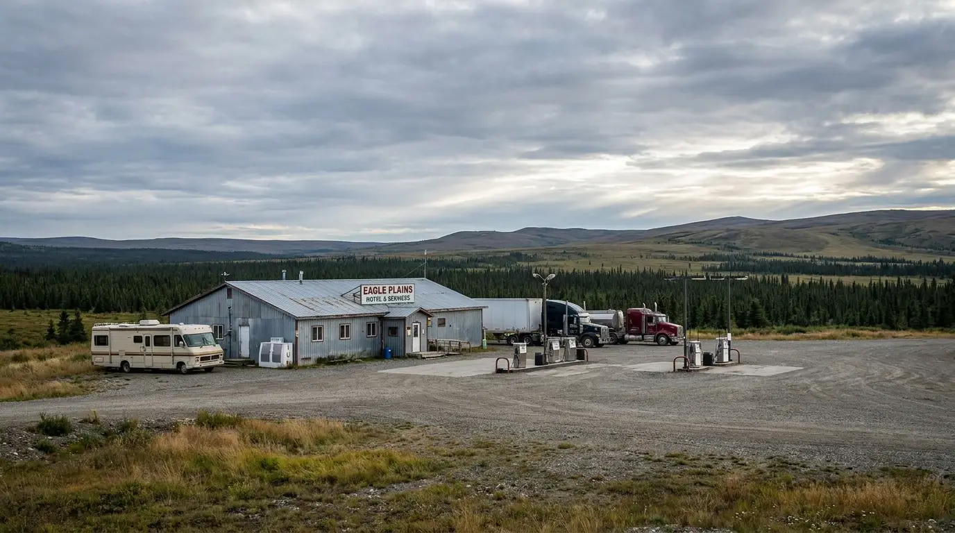
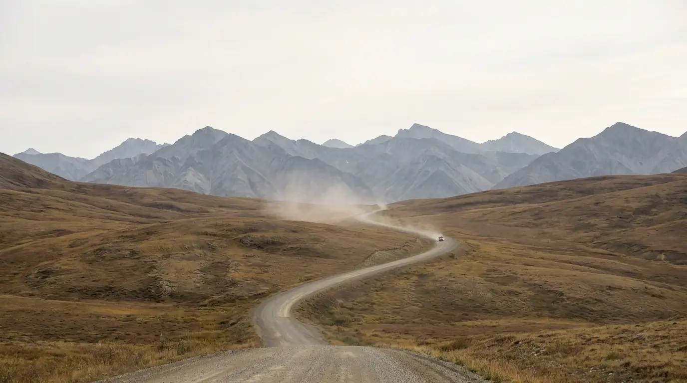
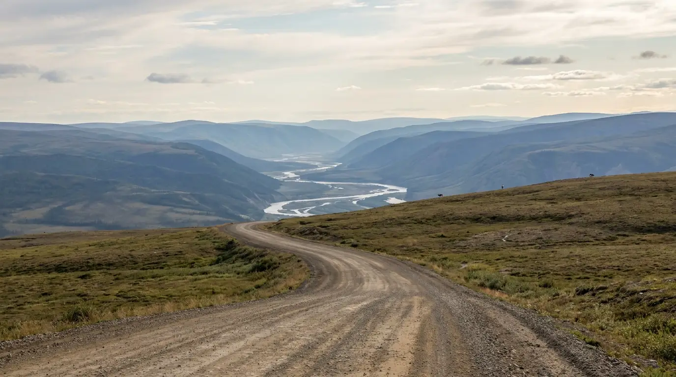
The only public road in Canada to cross the Arctic Circle runs about 740 km of raw gravel from the Klondike Highway near Dawson to Inuvik — then keeps going, on the Inuvik–Tuktoyaktuk Highway, to salt water on the Arctic Ocean. This is a trip measured in fuel gaps, spare tires and ferry schedules as much as in mountains: Tombstone's black granite peaks up front, one lonely fuel stop at Eagle Plains in the middle, two seasonal river crossings, and the far north beyond. Get the logistics right and it is the greatest drive on the continent.
The rest of this journal is evergreen; this box is not. On the Dempster, three things decide whether your plan works before you photograph a single peak — whether you have the fuel range to reach the next pump (§02), whether your tires and spares can survive the shale (§02), and whether the Peel and Mackenzie ferries are running or the road is cut by break-up/freeze-up (§03). Everything below is dated to the day we checked it. Trust the live sources, not our date stamp.
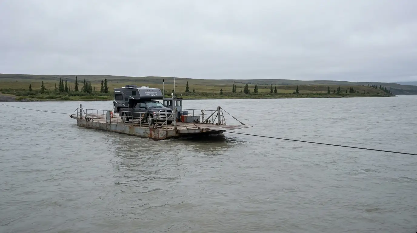
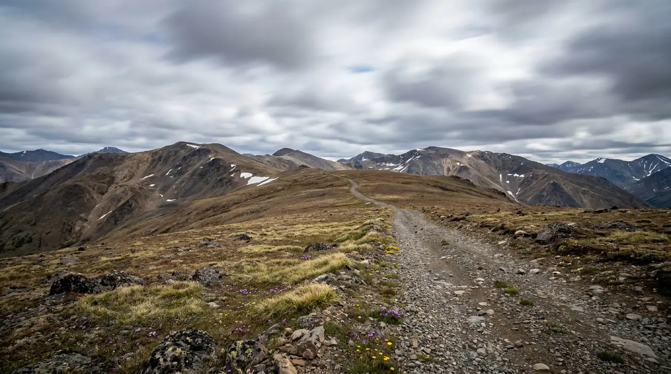
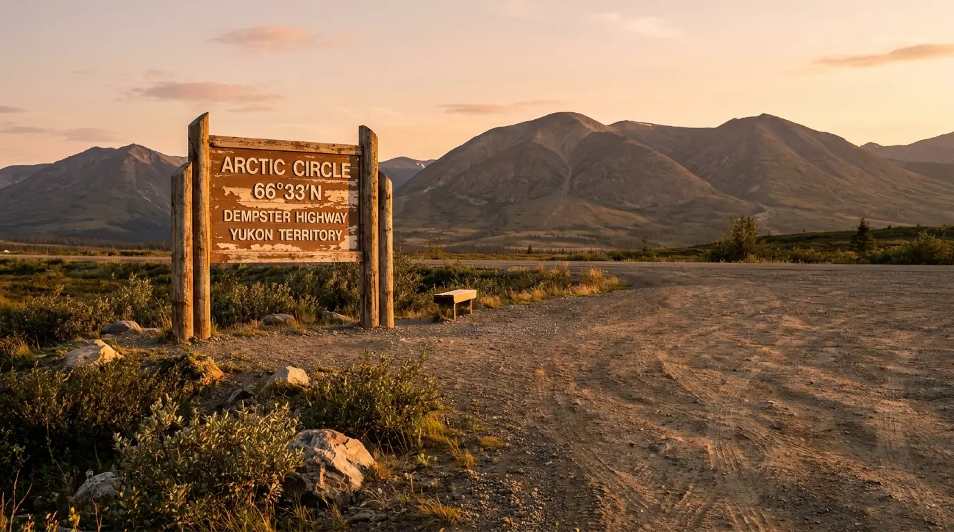
The Dempster is not really a drive; it is an expedition you happen to do in a vehicle. In ~740 km it climbs out of the Klondike boreal forest into the alpine tundra of Tombstone Territorial Park, crosses the bald Ogilvie and Richardson Mountains, steps over the Arctic Circle, drops off the Peel Plateau to the Gwich'in communities of the Mackenzie Delta, and ends at Inuvik — from where a newer gravel road runs another 138 km to the Arctic Ocean at Tuktoyaktuk. Between those landscapes there is exactly one fuel stop, two seasonal river ferries, no cell service for hours at a time, and a road surface that shreds tires. Respect the logistics, and it delivers scenery and solitude almost nowhere else on the continent can match.
Tombstone's peaks, the midnight sun above the Arctic Circle, two great rivers by ferry, and the genuine Arctic Ocean at the end of the road — a landscape that changes completely four times in one drive (§04, §05).
One fuel stop (Eagle Plains, km 371), two ferries, two spare tires, and no cell service — this trip rewards planning far more than horsepower (§02, §03).
Realistically June to mid-September for a road trip — when the ferries run and the campgrounds are open. The shoulders belong to break-up and freeze-up, when the road is cut (§03, §09).
If you take one thing from this issue, take this. On the Dempster the make-or-break decisions are not which hike or viewpoint — they are whether you can reach the next fuel pump, whether your tires survive the shale, and whether you can look after yourself for hours with no signal and no traffic. Sort these three, and the rest of the trip is scenery. Get them wrong, and a beautiful drive becomes a genuine emergency in a place with no quick rescue.
| The gap | Roughly | What's there | The rule |
|---|---|---|---|
| Dawson → Eagle Plains the long climb north |
~370 km, no fuel | Tombstone, Engineer Creek — campgrounds, not services | Top up at the Klondike junction / Dawson; you must reach Eagle Plains on one tank plus margin |
| Eagle Plains → Fort McPherson across the Circle & the border |
~180 km, no fuel | Arctic Circle sign, Rock River camp, the Peel ferry | Fill at Eagle Plains even if you "have enough" — the next pump is a ferry crossing away |
| Fort McPherson → Inuvik the delta run |
~185 km, fuel at both ends | Tsiigehtchic (Mackenzie ferry), Gwich'in park | Two ferries in this stretch — a missed sailing can cost you hours; don't run it low |
| Inuvik → Tuktoyaktuk (ITH) the run to the ocean |
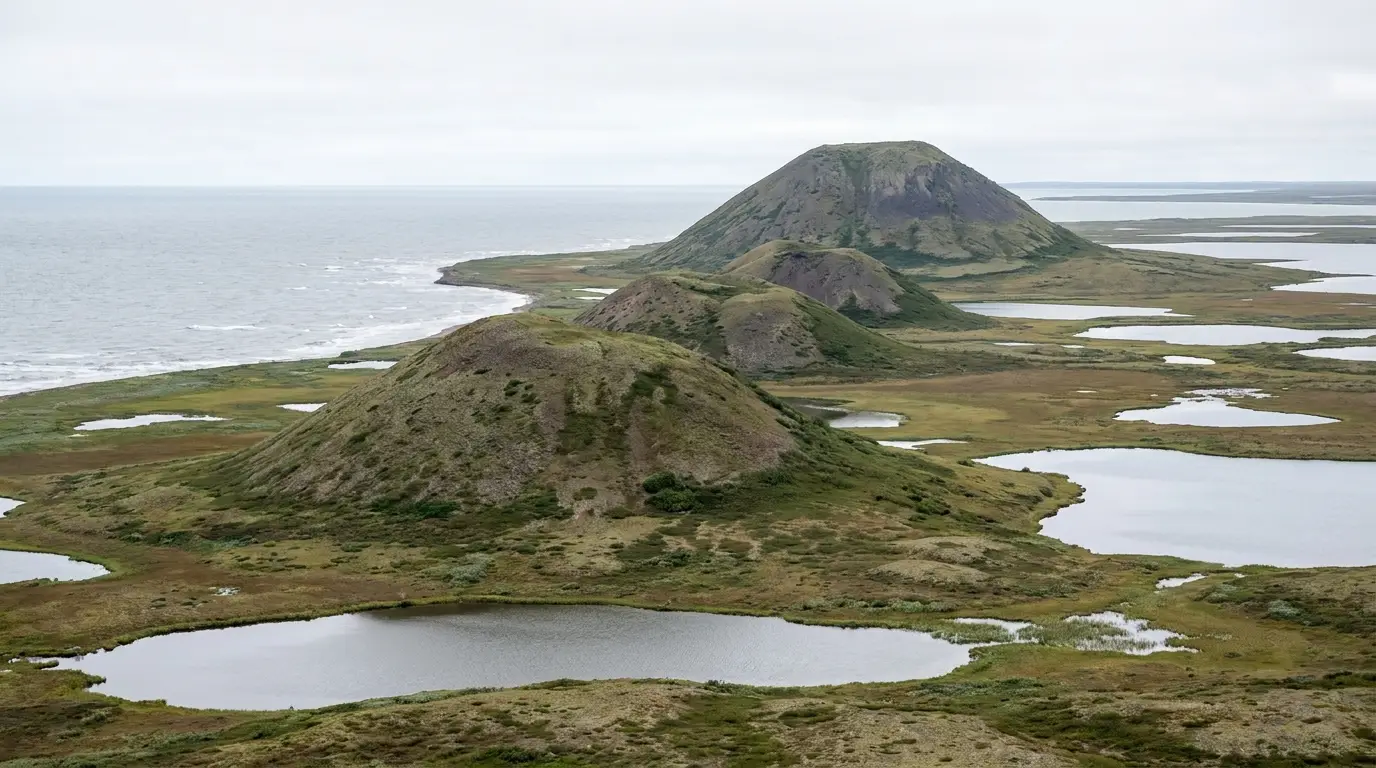
~138 km, no fuel | Open tundra, pingos — no services between towns | Fuel in Inuvik both ways; it is a round trip with nothing in the middle |
Distances are approximate and rounded from the standard mileposts. Confirm current station hours and that Eagle Plains and community pumps are actually open before you count on them — northern fuel supply can be interrupted.
The Dempster is a well-built all-weather gravel highway — but "all-weather" does not mean "always open." Its two great rivers are crossed by ferries in summer and ice roads in winter, with a hard gap in between when neither works. Its surface goes from fast and smooth to greasy clay with a few hours of rain. And its far end, the Inuvik–Tuktoyaktuk Highway, is a newer road with the same rules. Understand how the road behaves through the year before you fix a single date.
Mostly a graded gravel-and-shale surface, good in the dry. A few hours of rain can turn stretches into slick clay; drive to the conditions and don't be shy about stopping.
Snow and freezing temperatures are possible in any month at altitude and latitude, and heavy weather can close the road outright. There is no fuel and no services on the passes — the mileposts in §01 are the whole supply chain.
Watch for wildlife, trucks and dust. Slow and pull right for oncoming rigs to save your windshield and theirs.

Canada's first all-season public road to the Arctic Ocean, opened November 2017. About 138 km of gravel across open, treeless tundra from Inuvik to Tuktoyaktuk on the Beaufort Sea.
No services between the two towns, fully exposed, and hard on tires just like the Dempster. Fuel in Inuvik both ways and treat it as a committing round trip, not a casual add-on.
It is what lets you say you drove to the Arctic Ocean — and it is worth every washboard kilometre (§05).
Tombstone is where most of the Dempster's postcards are made — black granite peaks over tundra that turns molten in late August, glacial lakes, and wildlife on the roadside. It sits in the first ~120 km of the highway, close enough to Dawson for a day trip and rich enough to hold you for days. But Tombstone's famous backcountry is a genuine alpine wilderness with a strict, reservation-and-registration access system — this is not a place you wander into. Here is the park, from the roadside stops to the serious hikes, told straight.
No permit, no big effort — the park's easy wins, all within a short drive of the Interpretive Centre and Tombstone Mountain Campground.
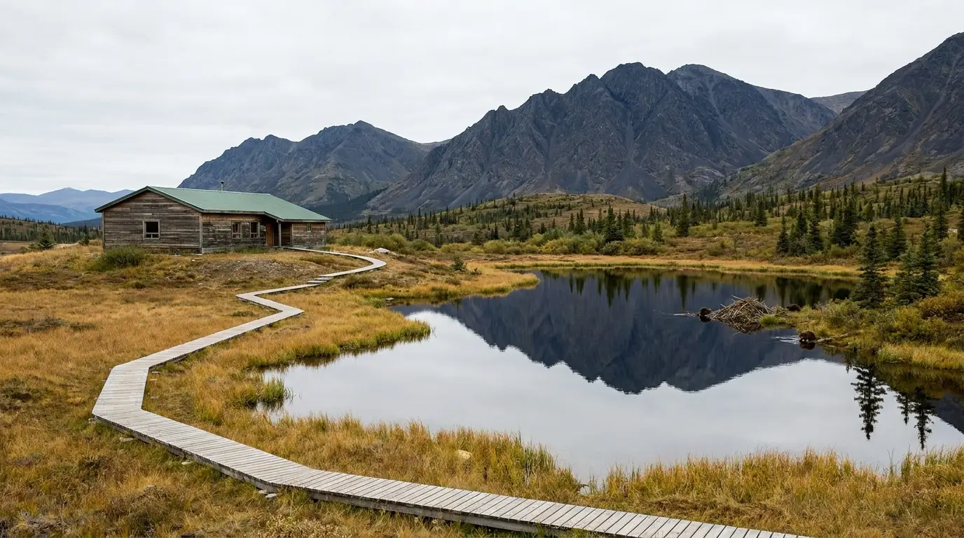
Short, easy interpretive walking · minimal gain. Free programs, exhibits on the park's ecology and Tr'ondëk Hwëch'in and Gwich'in connections, and a wheelchair-accessible interpretive trail through tundra and beaver ponds with the peaks behind. The essential first stop for weather, wildlife and trail conditions.
This is also the mandatory registration point for all backcountry camping — plan your day around its hours if you're heading into the lakes.
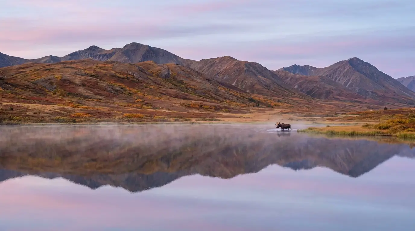
Roadside pull-off · no hiking. A tundra lake north of the campground with an interpretive board, named for the moose regularly seen feeding in the shallows at first and last light. On a still morning the peaks mirror in the water. Bring a long lens and patience.
Wildlife is never guaranteed and never to be approached — stay with your vehicle, keep well back, and never come between a moose and its calf.
Tombstone's signature hiking is a genuine alpine backpacking system: reserve tent pads in advance on the Yukon Parks portal, then register in person at the Interpretive Centre. Distances and times below are planning estimates from trail and land-manager sources, not an official table — confirm at the Centre.
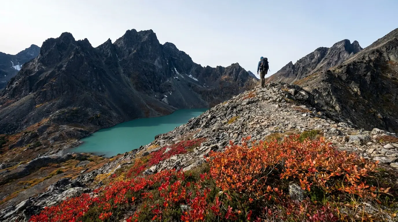
Steep, sustained, high-consequence · trailhead at km 58.5. The only maintained trail into the backcountry climbs over Grizzly Ridge to a glacial lake ringed by black granite. A hard full-day out-and-back, or the first leg of the multi-day lakes circuit. Distance and gain are planning estimates — confirm at the Interpretive Centre.
Reserved tent pads and in-person registration are required to camp. This is grizzly country — carry deterrent. Fully exposed alpine terrain; weather turns fast.
Beyond Grizzly, the classic Grizzly–Divide–Talus circuit pushes deeper into the granite. Divide Lake camp has designated tent pads, an outhouse, a cooking shelter, bear lockers and grey-water disposal; Talus Lake is the deepest camp and the base for day wandering. Your first night must be booked at Grizzly Lake.
Season roughly mid-June to mid-September. Tenting is restricted to your reserved pads only. Book early on the Yukon Parks portal.
North of Eagle Plains the Dempster gets wilder and lonelier, and the milestones start coming: the Arctic Circle, the border, the drop off the Peel Plateau, two great rivers by ferry, and the Gwich'in and Inuvialuit communities of the Mackenzie Delta. Then, from Inuvik, the newest road in Canada runs the last stretch to the Arctic Ocean at Tuktoyaktuk. These are living communities and fragile lands, not a theme park — travel them with respect and they give you the trip of a lifetime.
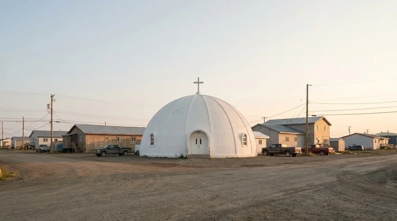
Past the border the road drops off the Peel Plateau in long curves to the Peel River ferry and Fort McPherson (Teetł'it Zheh) — a Gwich'in community, the first town on the NWT side, and home to the well-known Fort McPherson Tent and Canvas workshop (§08).
Then the Mackenzie River ferry at Tsiigehtchic, where the Arctic Red River meets the mighty Mackenzie, before the delta run into Inuvik — the largest community in the Western Arctic and the hub for the final leg.
From Inuvik the ITH runs ~138 km of gravel across open tundra to Tuktoyaktuk on the Beaufort Sea — where you can stand on the shore and touch the Arctic Ocean.
Near Tuk, the Pingo Canadian Landmark protects ice-cored hills including Ibyuk Pingo, the tallest in Canada — best seen from the road or by guided boat tour. Local Inuvialuit operators run community, cultural and shoreline tours (§08).
The Dempster's dangers are not exotic — they are remoteness, wildlife, and weather, amplified by the fact that help is hours away with no cell service. Nothing here requires nerve; it requires preparation and the humility to turn around. The mistakes that hurt people are the small ones stacked up: no spare, no sat comms, no warm layer, pushing on tired into bad weather. Plan for self-sufficiency and the rest is scenery.
There is no cell service across long stretches, little traffic, and one fuel/repair stop in ~740 km. A breakdown or injury here is a serious situation, not an inconvenience.
Carry a satellite communicator, days of food and water, warm layers, a first-aid kit and recovery gear, and tell someone your route and dates. If you break down, stay with the vehicle.
Camping is how most people do the Dempster, and the campgrounds are refreshingly simple: government-run territorial grounds strung along the highway, mostly first-come, mostly basic, and priced modestly. The Yukon Parks grounds run to the border; the NWT Parks grounds carry on to Inuvik. The one wrinkle is Tombstone's backcountry, which is the opposite — reservation-and-registration only. Book nothing you don't need to, arrive early where it's first-come, and keep a bear-clean camp everywhere.
| Campground | Where · manager | Sites | Booking | Toilets / water | Reported fee* |
|---|---|---|---|---|---|
| Klondike River | Klondike Hwy ~km 697 · Yukon Parks | 35 | First-come | Vault · hand-pump | confirm YG permit |
| Tombstone Mountain | Dempster ~km 71 · Yukon Parks | confirm | First-come | Vault · yes | ~$18 reported |
| Grizzly / Divide / Talus | Tombstone backcountry · Yukon Parks | Tent pads (Divide ~10) | Reserve + register | Outhouse · none/creek | confirm |
| Engineer Creek | Dempster ~km 194 · Yukon Parks | ~11–15 | First-come | Vault · confirm | confirm YG permit |
| Eagle Plains (RV) | Dempster km 371 · private (hotel) | confirm | Mixed | Flush · water hookups | confirm at hotel |
| Rock River | Dempster ~km 447 · Yukon Parks | confirm | First-come | Vault · confirm | confirm YG permit |
| Nitainlaii | Near Fort McPherson · NWT Parks | 22 | Register on arrival | Flush · yes (showers) | confirm NWT fee |
| Vadzaih Van Tshik | Gwich'in TP, near Tsiigehtchic · NWT Parks | 9 | Self-register kiosk | Washrooms · yes | confirm NWT fee |
| Jàk | Just before Inuvik · NWT Parks | ~36 (10 powered) | Register on arrival | Flush · yes (showers) | confirm NWT fee |
*Site counts, seasons and fees are compiled from Yukon Parks, NWT Parks and travel listings and vary by source and season. Fees are shown as "confirm" because the current Yukon Parks camping-permit rate and NWT Parks nightly fees change and we could not confirm 2026 figures. Yukon grounds are first-come; Tombstone backcountry is reservation-and-registration. Book nothing you don't need to, and arrive early at the first-come grounds.
Tombstone backcountry is not first-come. You must reserve tent pads on the Yukon Parks portal and register in person at the Interpretive Centre within posted windows — turning up to backpack in without both will get you turned back.
NWT grounds don't take online bookings — you register on arrival or at a self-serve kiosk. And Engineer Creek's mineralized water is not a good drinking source — the iron springs stain the creek orange; carry your own.
The services on the Dempster are almost comically simple: full-service towns at each end, one outpost in the middle, and small Gwich'in and Inuvialuit communities with limited, sometimes seasonal, services near the north end. Dawson City (just off the south end) and Inuvik are where you truly resupply; Eagle Plains is the lifeline in between; Fort McPherson, Tsiigehtchic and Tuktoyaktuk are communities to pass through respectfully and support locally. Plan your resupply around that shape — and never assume a small-community pump is open.
Community services (Fort McPherson, Tsiigehtchic, Tuktoyaktuk) are limited and sometimes seasonal — confirm hours before relying on them, and carry margin.
Alcohol is restricted or prohibited in some communities — know the local rules before you arrive.
We confirmed no operator pricing — any number you see elsewhere should come from the operator. Phone numbers, hours and seasons change; check the current website before you drive north.
The Dempster has one broad road-trip season and two hard closures. The season is summer, roughly mid-June to mid-September, when the ferries run and the campgrounds are open. The closures are break-up and freeze-up, when the rivers strand you. Inside the season, the choice is midsummer's midnight sun and long days versus late August's spectacular tundra colour and first cold snaps. Pick by what you're chasing — and always confirm the ferries before you fix a date.
One workable shape, not the only one. It runs one-way from Dawson to Tuktoyaktuk over about five driving days, front-loads Tombstone while you're fresh, treats Eagle Plains as the mandatory mid-point, and leaves margin for weather and ferries. Reverse it, stretch it, or fly out of Inuvik — but keep the fuel and tire discipline non-negotiable, and confirm the ferries before you commit.
Run it before you leave the pavement. Tap each item as it's done — these are the ten things specific to the Dempster that a general road-trip habit will skip. Most come back to two facts: there is one fuel stop and no cell service across ~740 km of gravel, and the ferries and the weather decide whether the road is even open on your dates.
Every guide has these; most don't print them. The Dempster spans two territories and a mix of Yukon Parks, NWT Parks, private and community services, with numbers that change every season — so more here is "confirm before you go" than we'd like, and we've flagged it in place. Everything below was compiled 22 July 2026 and should be re-checked against the linked official source before you rely on it.
Everything above, condensed into a print-ready PDF built for the glovebox — for a road where there's one fuel stop in 740 km, the signal dies past town, and the ferries decide whether you get across at all. The fuel-and-tire logistics laid out milepost by milepost, the ferry seasons and closures, Tombstone's roadside stops and its reservation-only backcountry, the Yukon and NWT campgrounds, the run to the Arctic Ocean, and the honest list of what nobody could confirm — on paper that works where the bars don't.
Every Trekkr Trail Journal is built like this one: custom logistics, honest trail beta, the camping and access detail, and the local knowledge that turns a good trip into the one your crew talks about for years — including, always, a plain list of what we could not confirm. New destinations drop all season long, from the BC corridors to the Yukon and the Western Arctic.
Unlock the Trail Journal Library