Crowsnest & the Trunk RoadCamping + Trails — The Complete Field Guide
Coal country to the Divide: five towns stitched under a mountain that fell on one of them, a trout river you legally can't keep a fish from, wind that built Canada's first wind farm — and, running north, 106 km of gravel through the one corridor in this series where camping beside your truck is free, legal and normal. Taken apart.
Conditions at press time · Verified 16 July 2026 · This block goes stale — the links don't
A fire-advisory summer, and a bridge down at Racehorse
The Calgary Forest Area — which covers this whole corridor from its headquarters in Blairmore — went under a fire advisory two days before press, one Trunk Road campground lost its foot bridge to high water, and the coal question is moving through regulators again. The rest of this journal is evergreen — this box is not. Check the live sources before you commit to anything below.
Fire advisory: Calgary Forest Area, issued 14 July 2026Wildfire danger VERY HIGH — hot, dry and windy, with 38 wildfires in the area since January. Campfires remain legal under an advisory but are discouraged, and new fire permits are case-by-case. This can escalate to a restriction or full ban in a day; check albertafirebans.ca in a real browser (it loads blank in some tools) or call 310-FIRE the morning you leave.
Racehorse campground: foot bridge washed outHigh water took out the bridge to the trails across from the campground on 30 June 2026; Alberta Parks says a replacement is underway. The campground itself is open.
York Creek Staging Area: closed 4 Jun – 1 Oct 2026Hazardous ground conditions. York Creek Road itself stays open — this affects staging, not the road.
The coal question, dated honestlyAs of mid-July 2026: coal exploration is approved and underway at Grassy Mountain above the Lille valley; no mine is approved; a new, smaller mine application is anticipated and fiercely contested, with water-licence and consultation processes live. Access to the Lille area could change — this file moves monthly, so verify before building a trip around that valley.
The 2026 event that's real — and the one that isn'tThe Crowsnest Pass Heritage Festival runs 30 July – 3 August 2026. Thunder in the Valley, the famous fireworks show old blogs still promote, has been dead since 2012. Rum Runner Days: unconfirmed for 2026 — check locally.
At 4:10 on the morning of 29 April 1903, the east face of Turtle Mountain let go. In about a hundred seconds, somewhere between 82 and 110 million tonnes of limestone — both figures come from official bodies, so this guide prints both — buried the edge of the coal town of Frank under rock up to 45 metres deep. More than 90 of the roughly 100 people in its path were killed; around 80 of them are still under the boulders you drive through on Highway 3 today. Eleven years later and three kilometres away, the Hillcrest mine exploded and killed 189 men — still Canada's worst mine disaster. In between, this valley ran whisky through Prohibition, and the trial that followed a bootlegger's shootout hanged the only woman ever executed in Alberta.
That's one corridor. Five coal towns — Bellevue, Hillcrest, Frank, Blairmore, Coleman — amalgamated into one municipality of about 5,700 in 1979, after the last mine closed in 1983 the story became the product: an interpretive centre on the slide, an underground mine you can tour at 0°C in July, stone ruins, a national historic site, and a dead 700-year-old tree so loved that locals bolted it back together when the wind knocked it over. And north of it all runs the other half of this issue: the Forestry Trunk Road — 106 km of gravel through the Livingstone Public Land Use Zone, the one place in this series where free camping beside the truck is not a loophole but the actual, published system.
How to use this journal
This is two trips sharing one fuel stop. Trip one is the Highway 3 heritage corridor: paved, any vehicle, museums and short walks, campgrounds with numbers on the posts. Trip two turns north at Coleman onto gravel: the Trunk Road, the PLUZ, random camps and no services of any kind — self-sufficient rigs only. The wind and the water rule apply to both: stow the awning, and bring every litre you'll drink, because not one provincial campground on this corridor has a potable tap. Every figure is a planning estimate; the Verify links at the bottom are the final word.
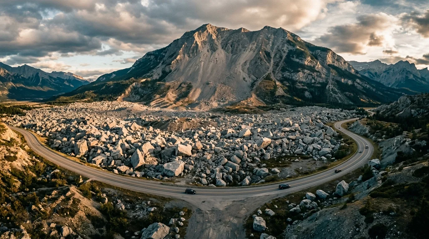
The Frank Slide. A hundred seconds in 1903, up to 45 metres deep, and the highway drives straight through it. Roughly 80 people are still beneath the rock.
02 / THE GATE FEE
No gate. Two documents. Some tickets worth buying.
There is no park pass on this corridor at all — no national park, no Kananaskis pass, nothing scanned. Your money goes to two documents (one for camping free, one for fishing) and to the heritage sites, which are the best-value admissions in this series.
The two documents
Public Lands Camping Pass — required for adults 18+ random-camping on the public land: $30/year or $20/3-day per person, + $3.25 processing and a one-time $8 WiN, via albertarelm.com or any licence vendor in Coleman/Blairmore
Alberta sportfishing licence (ages 16–64) if you're touching the famous water — and read §08 before you pack a creel: the mainstem is zero-keep
Established campgrounds: $23–$36/night — no pass needed, the fee is the fee
Fire permits: free, required for any burning except campfires (Mar 1 – Oct 31, Forest Protection Area)
Heritage admissions (2026)
Frank Slide Centre · adult
$18
Frank Slide Centre · family (up to 8)
$45
Senior $14 · Youth 7–17 $11 · under 7 free
Bellevue Underground Mine · adult
~$25 — confirm: 403-564-4700
Leitch Collieries · self-guided
By donation
Old blog posts still quote the Frank Slide Centre at $15 — the official 2026 adult rate is $18. Hours: mid-May to mid-October daily 10–5; closed Mondays in winter.
The comparison worth making
A week out here for two adults costs $60 in camping passes if you run the PLUZ free camps, or roughly $160–$250 in campground fees if you want an outhouse and a fire ring — and either way, $0 in gate fees. Add the $45 family ticket to the Frank Slide Centre and you've bought the best rainy-day museum in the southern Rockies. The line item that actually matters here is water: with no potable taps anywhere, your jugs are infrastructure.
03 / ORIENTATION
One highway east–west, one gravel road north
Highway 3 runs the five towns east to west between Pincher Creek and the BC border. At Coleman, the Allison Creek/Atlas roads climb north into the Livingstone PLUZ, and the Forestry Trunk Road (Hwy 40) carries on — gravel, campground to campground — 106 km to Highway 541 at Highwood Junction. A schematic planning map: navigate with an offline topo, not this page.
Campground Town Fuel Summit The Slide Hwy 3 Trunk Road (gravel)
The corridor's one ruleEverything north of Highway 3 is committing; everything on it is easy. The pavement gives you five towns, fuel, a hospital and the museums. The moment you turn north — Allison Creek Road, Atlas Road, the Trunk Road — you're on gravel with no fuel, no potable water, no cell coverage and a seasonal gate at the far end (closed Dec 1 – Apr 30). Fill everything in Coleman or Blairmore, download the maps, and tell someone which drainage you'll be in.
04 / BEFORE YOU ROLL
Three legal moves, one land-use zone
This is the series' free-camping capital — the Livingstone PLUZ publishes actual rules for camping beside your truck instead of pretending nobody does it. Know the three moves and their fine print.
Pay for the campground
Seven provincial campgrounds, $23–$36 (§05). Only Lundbreck Falls and Chinook Lake reserve (Alberta Parks system, 90-day window); the other five are first-come. Commercial parks in Blairmore, Coleman and Bellevue add showers, laundry and — crucially — water fills.
$23–$36Mostly first-come
Random-camp the PLUZ
With the Public Lands Camping Pass ($30/yr or $20/3-day per adult): 14 days max in a spot, then move ≥1 km for 72 hours; camp ≥1 km from any campground or PRA, ≥30 m from water, ≥100 m from oil-and-gas sites. The Atlas Road country is the classic ground. Exception: the Willow Creek area restricts camping and fires to designated nodes only.
Truly legal free campingPLCP required
Know where it ends
Free-range camping has a northern border: cross into the Cataract Creek PLUZ (Kananaskis country) and random camping within 1 km of a road is prohibited — which, on a road trip, means it's over. Practical rule: vehicle-based free camping runs from the Pass to roughly the Livingstone/Cataract boundary, then it's campgrounds only. Check the PLUZ maps for the line.
Ends at Cataract CkCarry the map
The rules that bite — read before the trip, not duringOHVs run on designated trails only in the Livingstone PLUZ — the province publishes summer (May 1–Nov 30) and winter (Dec 1–Apr 30) trail maps, reissued annually, and the current map is legal notice; the Willow Creek area adds a 363 kg weight cap. Fire is the live issue: the whole corridor is Forest Protection Area — campfires need no permit but everything else does (free, Mar 1–Oct 31), and advisories, restrictions and bans layer on top; a restriction can end wood fires on public land while campgrounds still allow them. Drones are banned recreationally in Alberta's parks and protected areas — and at the Frank Slide, remember what the site is: assume no, and ask staff. Dogs leashed in campgrounds. And from September, hunting season shares every trail here — blaze orange isn't law in Alberta, but wear it anyway.
Booking reality
Two campgrounds book online (Lundbreck Falls, Chinook Lake — reserve.albertaparks.ca, $12 fee); the rest are drive-up-and-claim, and outside long weekends they deliver. The random-camping flats fill Friday nights in July near the staging areas — arrive before dinner or push one drainage deeper. Alberta Parks info line for every campground on this corridor: 403-627-1165.
Connectivity reality
Signal is decent along Highway 3 through the towns; assume none once you turn north — route guides for the Trunk Road are blunt that most of it is dead air. Download offline maps in town, carry the satellite communicator, and write down the numbers: 911 · Crowsnest Pass Health Centre 24/7 ER 403-562-5011 (Blairmore) · Blairmore Ranger Station 403-562-3210.
05 / BASECAMPS
Seven places to plant the flag
East gateway first, then west along Highway 3, then north up the Trunk Road. All fees and seasons are 2026 figures from the Alberta Parks pages — and every single one of these campgrounds carries the same official line about its hand pump: the water is for putting out fires, not for drinking.
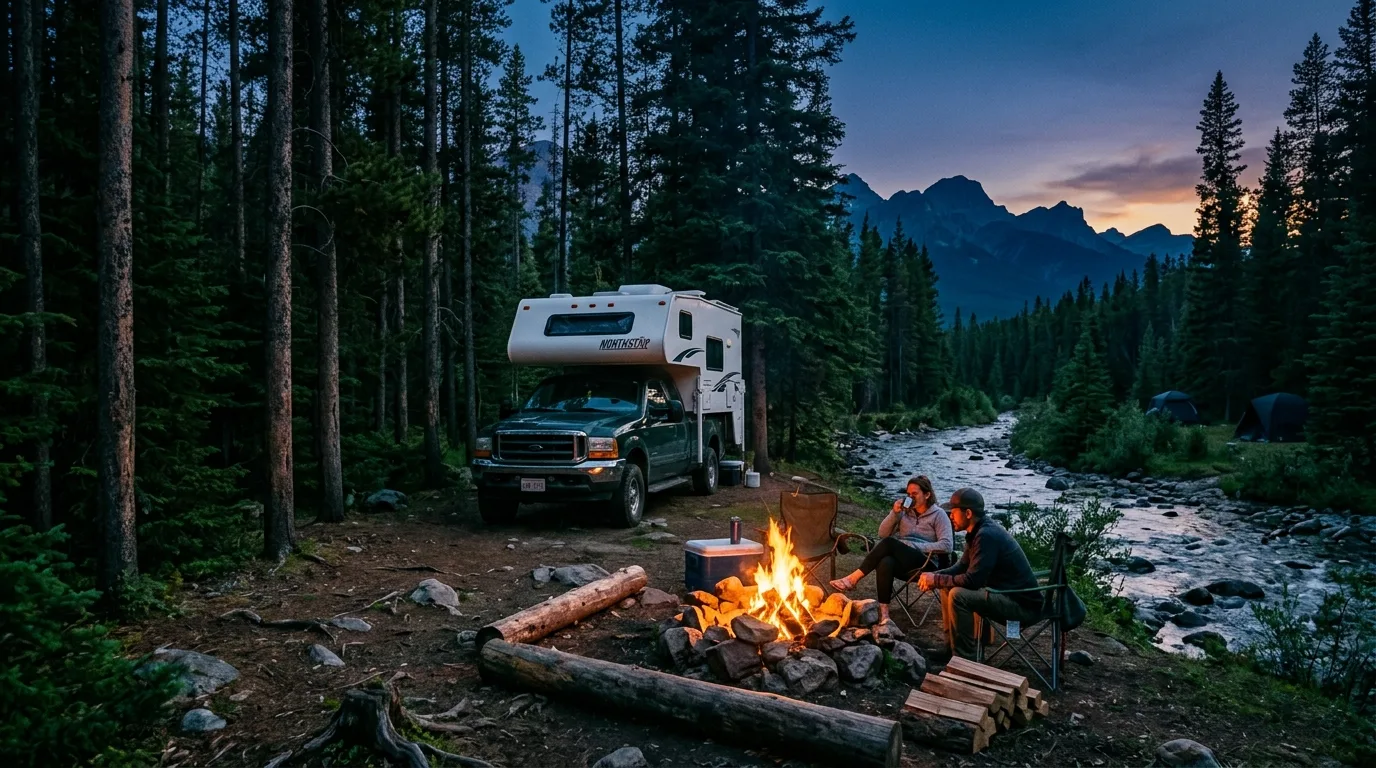
Trunk Road camping. Creek noise, lodgepole shade, and a fee envelope instead of a reservation app. Five of the seven never take bookings at all.
Basecamp
Where
Style
Pick it for
Watch for
Lundbreck Falls PRA
Hwy 3A · east gateway
53 sites (26 powered) · $28–$36 · reservable
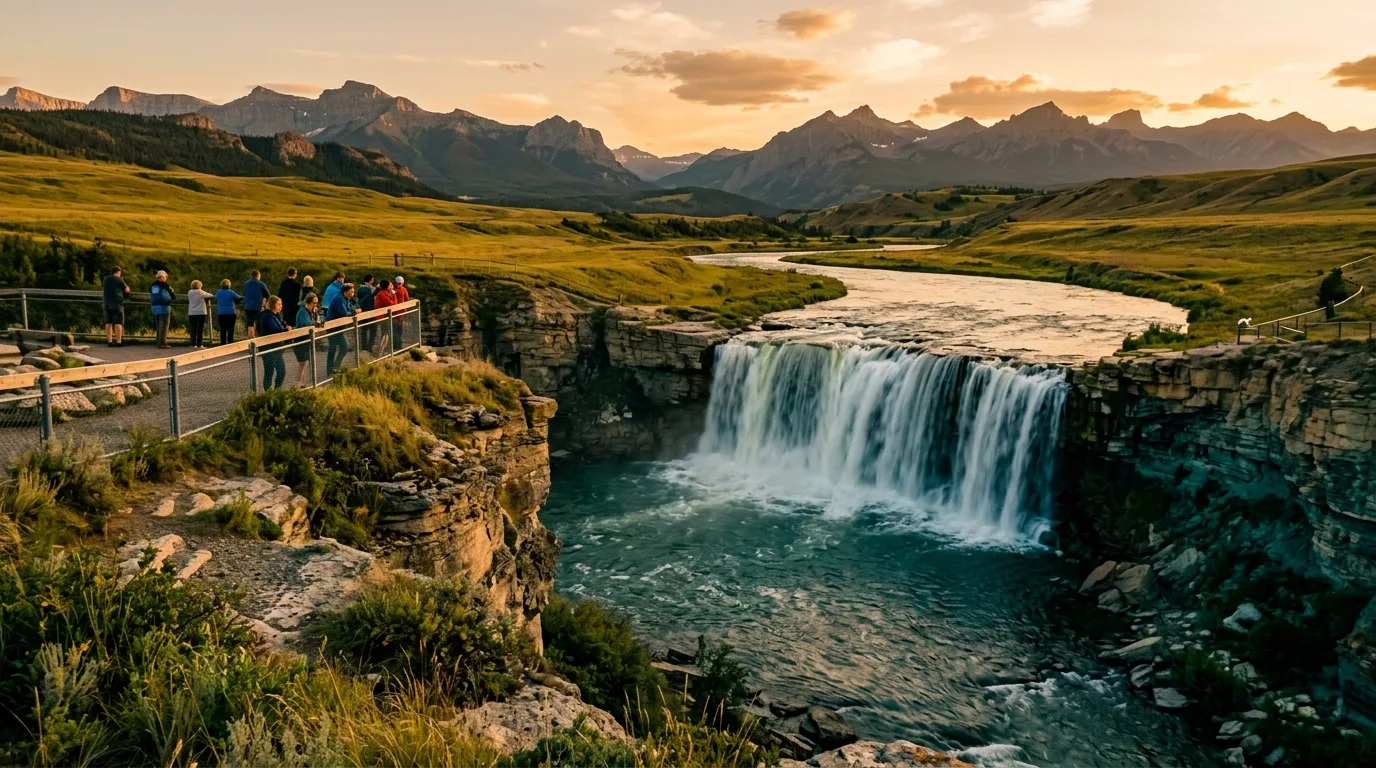
Camping beside a 12 m waterfall on the Crowsnest River — power, the falls platforms, and the fly water at your door.
Season May 8 – Sep 29. No potable water. No firewood sales. Unfenced canyon edges near the brink
Island Lake PRA
Hwy 3 · ~14 km W of Coleman
36 unserviced · $23 · first-come
The Crowsnest Lakes shoreline with the longest season on the corridor — and the cheapest lakefront in this series.
Season May 8 – Oct 14. Hand-launch boats only. Exposed to the famous wind — rig accordingly
Chinook Lake
Allison Creek Rd · 6 km gravel
93 unserviced · $28 · fully reservable
The family flagship: a swimmable lake with Crowsnest Mountain across the water, a 2.3 km shoreline loop, cook shelter.
Season May 15 – Sep 30. No motorized watercraft. Books out summer weekends — it's the one everyone knows
Racehorse PRA
Trunk Road · 25 km N of the Pass
38 unserviced · $26 · first-come
The Trunk Road workhorse: creekside sites, picnic shelter, and the PLUZ trail country out the back.
Season May 15 – Oct 1. 2026: the foot bridge to the trails washed out June 30 — replacement underway. OHV traffic on weekends
Dutch Creek PRA
Trunk Road · mid-corridor
30 unserviced · $26 · first-come
The quiet middle: spruce sites on Dutch Creek, and a $19/night seasonal rate if you're staying 90+ nights.
Season May 8 – Oct 1. Zero services, zero signal — the real Trunk Road experience begins here
Oldman River North PRA
Trunk Road · the Oldman crossing
10 unserviced · $23 · first-come
Ten sites where the Trunk Road meets the upper Oldman — small, riverine, and usually yours.
Season May 15 – Oct 1. Tiny — no plan B if full; the random-camping flats nearby are the fallback (1 km buffer applies)
Livingstone Falls PRA
Trunk Road · 60 km N of the Pass
22 unserviced · $26 · first-come
The far anchor: falls on the Livingstone River, cook shelter, and the last camp before the Cataract boundary ends the free-range country.
Season May 15 – Oct 1. An hour of gravel from the nearest fuel — arrive complete
The water rule — this corridor's defining trap
Seven campgrounds, zero potable taps. Every Alberta Parks page on this corridor carries the identical warning: the hand-pump water "is not safe for consumption" and is for putting out fires. Fill tanks and jugs in Blairmore or Coleman (the commercial RV parks have water service), budget 4+ litres per person per day in summer, carry a filter as backup — and treat the wind as the second half of the same problem, because a toppled jug here is a real loss.
Worth knowing about
Atlas Staging Area — the PLUZ hub west of Coleman: loading ramps, outhouses, a big meadow, and random camping with the pass. The gateway to Window Mountain Lake and the Racehorse/Deadman pass country
In-town commercial parks — Lost Lemon (Blairmore, pool + laundry), Crowsnest River RV Park (Coleman), Crowsnest Pass Campground (Bellevue, 403-564-4814), ADANAC (Hillcrest). This is where the water and showers live
Honeymoon Creek PRA — group camp only: one rustic equestrian clearing with a shelter, booked through the Alberta Parks group system
Castle River Bridge and the Castle — twenty minutes southeast and a different rulebook; that's issue 004's territory, and its powered sites are the fallback when this corridor blows a gale
York Creek staging — closed 4 Jun – 1 Oct 2026 (ground conditions); the road itself stays open
06 / TRAIL SELECTOR
Choose the day that fits the group
Seven road-accessible objectives, from a stroller-grade heritage path to a chained-gully scramble. Sourcing honesty up front: the local standard for distances is a municipal brochure last printed in 2012 — still the best figures that exist, cross-checked here against GPS trip reports. Nothing below cites crowd-sourced trail apps.
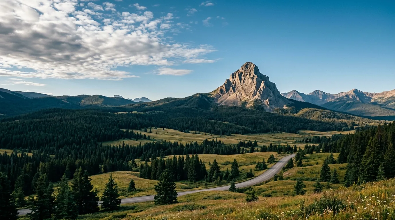
Crowsnest Mountain, 2,785 m. It stands alone, which is why every viewpoint in this issue keeps finding it — and why its summit day is a real scramble, not a walk.
The anchor stopFrank Slide Interpretive Trail
Easy1.5 km loopMinimal gain30–60 min
A gravel loop through the rock that fell in 1903 — boulders the size of garages, the scar on Turtle Mountain above, and the interpretive centre's exhibits ($18 adult / $45 family, 2026) to put numbers to what you're standing on. The trail starts from the centre's parking lot; a marker guidebook is sold in the gift shop.
MAIN CAUTION: fully exposed to sun and to this valley's violent weather swings — the centre's own advice. And remember what the ground is: roughly 80 people were never recovered from beneath it. Walk it accordingly; fly nothing over it.
Flat loop through fallen mountain
Best family hourMiners' Path & Star Creek Falls
Easy–Moderate~1 km + ~2.5 km loop30 min – 1.5 hr each
Two Coleman classics that pair into a half day. Miners' Path follows Nez Perce Creek to Rainbow Falls the way miners walked to work from 1909 to 1957 — maintained by the Coleman Lions Club, trailhead at Flumerfelt Park downtown. Star Creek Falls loops a narrow canyon at the town's west edge to a 15 m waterfall with a 2017 footbridge in the gorge.
MAIN CAUTION: Star Creek's viewpoint sits on an unfenced canyon rim above a sheer drop — hold the kids, and skip the creekbed scramble unless the water is low. Winter visitors have needed rescue here when ice at the falls gave way.
Creekside heritage · two short outings
Best alpine payoff per effortWindow Mountain Lake
Moderate~7.6 km return~335 m gain2.5–3 hr
An emerald lake in a limestone cirque with a window-notch ridge above it, reached from the Atlas Road country north of Coleman. Park at the km 16.5 spur junction and walk the rough spur, or crawl it in a high-clearance 4x4 and shrink the day to a couple of kilometres — where you park is the whole variance in the published figures.
MAIN CAUTION: the access spur eats low-clearance vehicles, and the final ~600 m over the headwall is steep, rocky and a little technical. This is the PLUZ: expect OHV dust on the drive and remember the fire status before any shoreline lunch stove.
Rough spur, steep finish, big reward
The mountain with a historyTurtle Mountain
Difficult~6–7 km return — unsanctioned~820–900 m gain3–5 hr
The summit of the mountain that fell, from a marked-by-yellow-rocks start at the southeast edge of Blairmore. Nobody officially maintains this trail, and that's part of the honesty: it's a steep, popular, informal route to a ridge where the Alberta Geological Survey has run 80+ sensors since 2005. Their published read: the monitored South Peak creeps millimetres a year, a large slide is unlikely — and about five million cubic metres are still expected to eventually go.
MAIN CAUTION: real exposure — the route passes near sheer precipices, the summit ridge crosses the fissured zone, and the wind up there is the Pass's wind with nothing in its way. No official body warns against hiking it; none endorses it either. Strong party, calm forecast, and stay out of the cracks.
Steep, exposed, monitored · out-and-back
The serious one — flagged honestlyCrowsnest Mountain
Scramble — not a hike~8.2–8.6 km return~1,100 m gain2,785 m summit
The lone pyramid that owns every view in this issue. From a trailhead 9.7 km up the Allison/Atlas road: forest to treeline, scree to the cliff bands, then "the Chimney" — a ~50 m gully with fixed chains — and loose scree to a summit that sees the whole southern Rockies. The local brochure's own words: extremely dangerous for the unprepared.
MAIN CAUTION: rockfall in the Chimney (helmets — parties above you dislodge constantly), treacherous with any rain or snow, and route-finding matters. This is for experienced scramblers on a dry day with an early start. Everyone else gets the better deal anyway: the view of it, from Chinook Lake, with coffee.
Chains, scree, consequence · scramblers only
The ghost-town half-dayLille townsite
Moderate~12.6 km return3 creek crossings4–5 hr
A walk up shared backroads to a coal town that died in 1912 and became a Provincial Historic Site: the 50-bay row of Bernard coke ovens, the hotel foundation, the cemetery. Access starts near the hairpin on the Frank Slide Centre road; high-clearance rigs can shorten the approach substantially.
MAIN CAUTION: braided OHV tracks make the route-finding messier than the distance suggests, and everything on the site is protected — removing so much as a brick is illegal. Time-sensitive note: coal exploration is active on Grassy Mountain above this valley (no mine approved as of July 2026) — access could change; check locally.
Backroads to a dead town · out-and-back
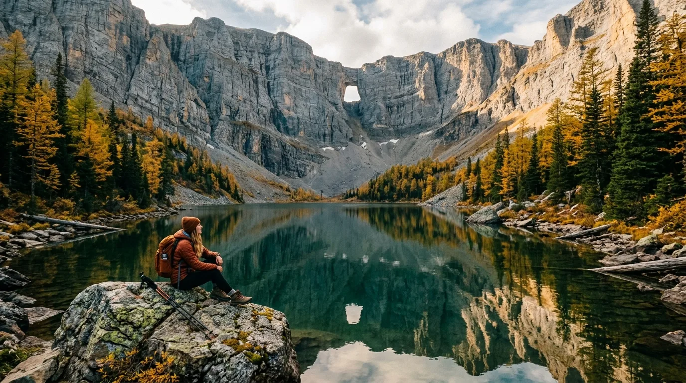
Window Mountain Lake. The best payoff-per-effort in the Pass — as long as your suspension survives the spur road, or you just walk it.
Objectives not on this list — deliberatelyPhillipps Pass crosses private land and local sources conflict on whether the Alberta-side trail is open at all — until that's resolvable, it doesn't clear this guide's bar. Saskatoon and Wedge mountains are real local summits with no trail — fence-line and volcanic-rock slogs for people who like that sort of thing (Wedge's sharp rock eats runners; wear boots). North York Creek's plane-crash hike (6.2 km one-way to a 1946 RCAF DC-3 wreck) shares its road with OHVs and asks you to leave the wreckage untouched. And Deadman Pass is a fine forest walk that is also, officially, a motorized multi-use trail — go on a weekday.
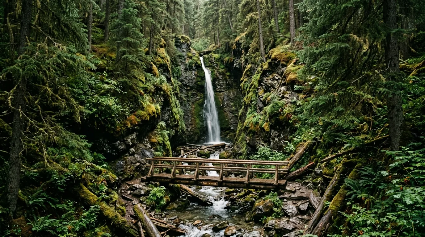
Star Creek Falls. Fifteen metres of water in a slot canyon at the edge of Coleman — and an unfenced rim above it. The 2017 footbridge is the safe seat.
The universal trail plan
Tuned for coal country: the trailheads have no boards and no live report page — the Blairmore Ranger Station (403-562-3210) and the Frank Slide Centre staff (403-562-7388) are the conditions system. Start early. Offline maps before leaving Highway 3. Bear spray on the hip, one per adult — this is grizzly corridor country (§09). Check the fire status and the gust forecast the same morning; on this corridor they're usually the same problem.
Phone beats refreshStart earlyOffline mapsBear spray on hipGusts + fire, same check
07 / THE TRUNK ROAD
106 kilometres, five campgrounds, zero services
The drive is the destination: the Forestry Trunk Road runs gravel from Coleman to Highwood Junction along the spine of the Livingstone Range, through the most generous free-camping country in Alberta. Here's the honest version of running it.
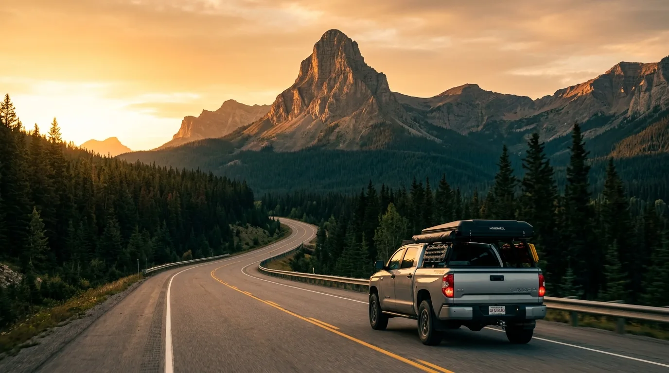
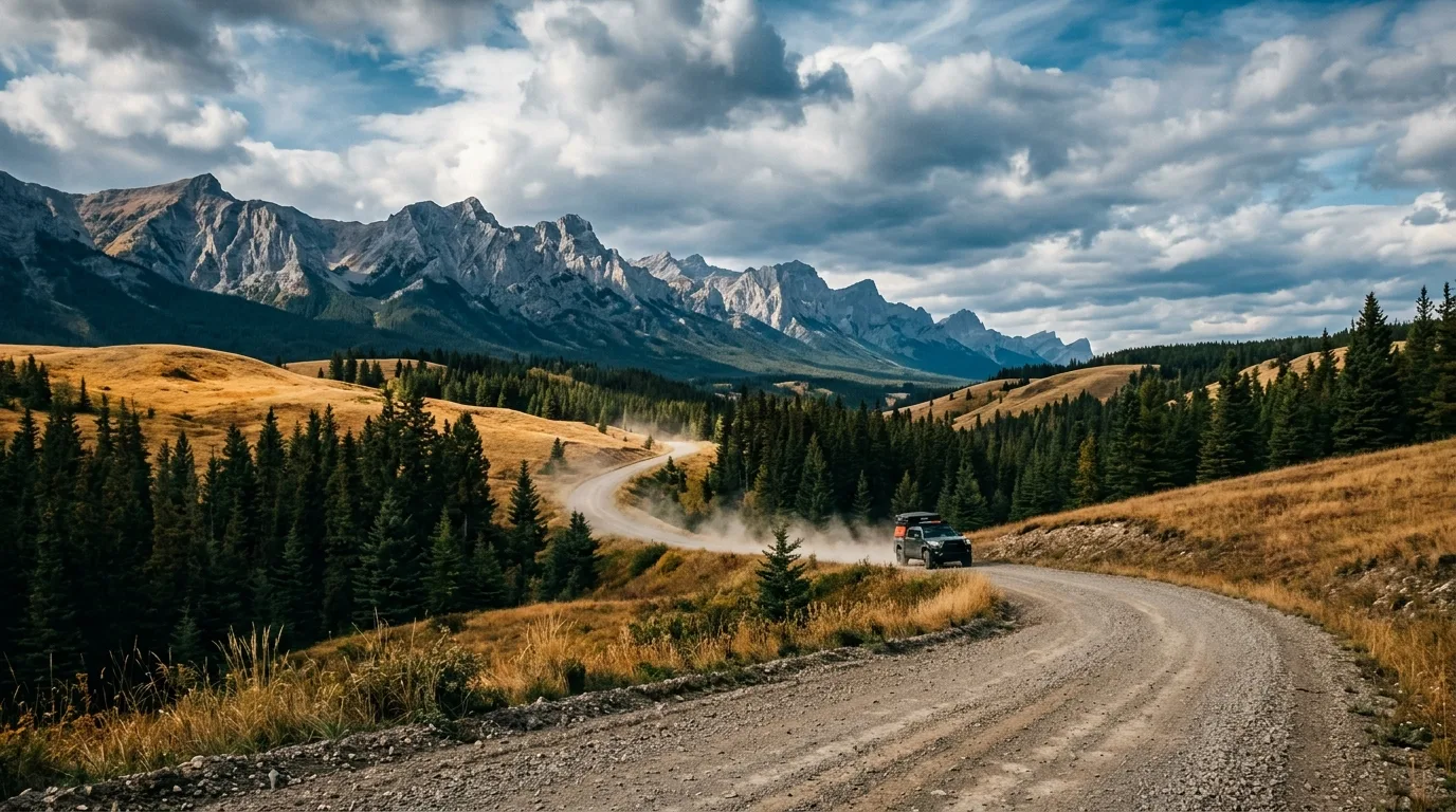
The Forestry Trunk Road. Gravel, minimal maintenance, no fuel, no signal — and a legal campsite in almost every drainage. That's the trade, and it's a good one.
Running it — the practical version
Season: the north section (south of Cataract Creek) is gated closed Dec 1 – Apr 30; the paved Highwood Pass continuation beyond Highwood Junction stays closed to June 14. The full through-run is a June–November trip
Surface: gravel end to end, minimally maintained — washboard, potholes, dust; expect industrial traffic and drive with headlights on
Supplies: nothing between Coleman and Highwood Junction — no fuel, no store, no potable water, no cell. Arrive complete, leave a margin
The five PRA campgrounds (§05) space the road roughly a half-hour apart — Racehorse, Dutch Creek, Oldman North, Livingstone Falls, plus Honeymoon Creek's group camp
Random camping with the PLCP fills the gaps — 1 km from the campgrounds, 30 m from water, and it ends at the Cataract Creek boundary
Sharing it — the OHV reality
The Livingstone PLUZ is one of Alberta's premier OHV landscapes, and pretending otherwise would make this guide useless. Quads and side-by-sides run the designated trail network (summer map effective May 1 – Nov 30, reissued annually — the current map is the legal document), stage at Atlas and along the road, and share several hiking approaches. Weekends hum; weekdays are quiet.
Etiquette that keeps the peace: slow way down passing camps (dust is the currency of resentment out here), keep your own rig on the designated routes, and remember the Willow Creek exception — designated camping nodes only, fires only in the nodes, OHVs under 363 kg. If you want silence, camp a drainage away from the staging areas and the road.
The wind doctrine — this corridor's trip-killer
This is the windiest inhabited corridor in Alberta — Canada's first commercial wind farm went up at Cowley Ridge, just east of here, in 1993, and Environment Canada logged 130 km/h gusts on Highway 3 through the Pass in a December 2025 storm that had the RCMP telling people to stay home. Summer practice: awning stowed whenever camp is unattended, heavy stakes and doubled guylines, stove windscreen always, and park the rig nose-to-wind. Winter practice: check 511 Alberta before committing to the Pass at all. A calm evening here is a loan, not a gift — same as Waterton, one valley system north.
08 / FISH & SKY
The river you can't keep
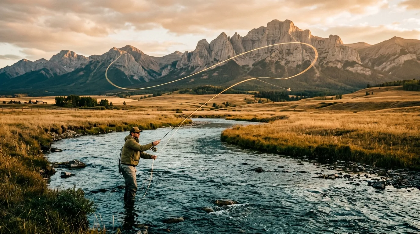
The Crowsnest River is one of Canada's great trout streams, and the 2026 rulebook keeps it that way with the simplest regulation in this series: on the famous water, you keep nothing. Ever. That's not a restriction on the fishing — it's why the fishing is worth driving for.
Fishing the corridor (ES1, 2026)
Crowsnest River mainstem (Crowsnest Lake outlet → Cowley Bridge): open all year, bait ban, limit zero — all species. Full catch-and-release, and a world-class dry-fly fishery because of it
Tributaries (except Gold Creek): Jun 16 – Aug 31, bait ban, 2-trout limits with species rules; zero-keep Sept–Oct; closed Nov 1 – Jun 15
The harvest options: Crowsnest Lake (5 trout), Emerald/Hart Lake (5 trout), and the stocked water on the Allison road — cutthroat go in by the thousands
Bull trout: zero, province-wide — learn the ID before you cast
Licence: ages 16–64, via albertarelm.com or the town vendors. Read the current ES1 tables — they change yearly
The night sky, honestly
The towns string light along Highway 3, but the side valleys and the Trunk Road go properly dark — and Waterton-Glacier, the world's first cross-border Dark Sky Park, is one valley system south. What this latitude doesn't reliably deliver is aurora: at ~49.6° north you need a genuinely strong geomagnetic storm, so treat northern lights as an occasional bonus and the Milky Way over the Livingstone Range as the dependable show. Check a space-weather app the way you check the fire ban: day-of, low expectations, occasional jackpots.
09 / WILDLIFE
A corridor with a bottleneck
The Pass sits on the Yellowstone-to-Yukon linkage — the pinch point where grizzlies, elk and everything else must cross a highway, a rail line and five towns. The infrastructure is finally catching up to the animals.
Bears & the BearSmart town
Grizzlies and black bears both work this valley, and the Pass is a provincially recognized BearSmart community — the chronic attractants are fruit trees and unsecured garbage in town, not backcountry surprises. Camper practice is the usual religion: hard-sided food storage, clean camp, spray on the hip from the trailhead. Report sightings to Fish & Wildlife at 310-0000.
The crossing project
The Reconnecting the Rockies program is stitching the corridor back together: Alberta finished the $11-million Rock Creek wildlife underpass and fencing in late 2025, and camera monitoring shows safe crossings more than doubled at fenced sites. A detail worth the drive-slow: females with cubs favour overpasses for the sightlines; the big males take the underpasses. Dusk and dawn on Highway 3, assume something is about to cross.
The tree that wouldn't fall
The Burmis Tree — a limber pine at the east gate of the Pass, often called the most photographed tree in Alberta — died around 1978 at an estimated 600–750 years old, blew over in 1998, and was re-erected by locals with steel rods. It still stands, dead and beloved. The living limber pines on the ridges around it are an Endangered species in Alberta — the dead one is the monument; the live ones are the point.
The fall overlap
Big-game seasons run through the Livingstone country from roughly September (archery from late August) — and Alberta has no blaze-orange law, which makes wearing it your own responsibility. Orange on you, the pack and the dog from September on, especially in the PLUZ where sightlines are short and quads move fast. Traplines and grazing leases operate through here too: leave gates as you found them, and leave sets alone. Report poaching, not hunting: 1-800-642-3800.
10 / LOGISTICS
Fuel, wind & the five-town main street
The Pass is its own supply chain: five communities strung on 20 minutes of highway, population about 5,700 total, with everything a trip needs — and hard edges on three sides: no fuel west to Sparwood, none north on the Trunk Road, and a hospital that matters precisely because of both.
Stop
Position
Count on
Field notes
Pincher Creek
Hwy 3/6 · 50 km east
Full services, fuel + diesel · year-round
The eastern supply anchor — and the fallback shopping run if something's closed in the Pass
Blairmore
Mid-Pass
Groceries (IGA), hardware, fuel, restaurants, 24/7 ER
The service centre. Crowsnest Pass Health Centre: 403-562-5011. EV fast charger at Crowsnest Crossing (Peaks to Prairies network)
Coleman & Frank
West + east of Blairmore
Fuel (Esso, Petro-Can, Co-op in Coleman; Fas Gas in Frank — diesel listed)
Coleman is the last stop before the Trunk Road turn. 24-hour pumps: unverified — phone before counting on a midnight fill
West of Coleman
Hwy 3 → BC
Nothing until Sparwood (~34 km)
The lakes stretch and the summit have no services. Short gap, but a real one at -25 with the wind up
The Trunk Road
North · 106 km
Nothing at all
No fuel, no store, no potable water, no signal until Highwood Junction country. Arrive complete
Fuel & range math
Distances are friendly — it's the gravel that eats fuel: the Trunk Road round trip plus spur exploring can burn half a tank of low-gear kilometres. Rule: leave Coleman full for anything north, and jerry up for a through-run to Highwood. Diesel is in the towns (Frank's station lists it); EV drivers get one DC fast charger in Blairmore and should treat everything beyond Highway 3 as out of range.
The wind, again
It bears repeating in the logistics section because it drives them: 130 km/h verified gusts on this highway, a wind-farm province born just east of here, high-profile vehicles warned off the road in storms. Summer: awning discipline and real stakes. Winter: 511 Alberta before every crossing, full winter kit in the cab, and the humility to wait a day — the locals do.
Services & signal
Town water fills at the commercial RV parks (the provincial campgrounds have none), laundry and showers in Blairmore, groceries at the IGA. Signal: good along Highway 3, assume zero north of it. Numbers on paper: 911 · ER 403-562-5011 · Blairmore Ranger Station 403-562-3210 · municipality 403-562-8833 · Report A Poacher 1-800-642-3800 · 310-FIRE.
Lundbreck Falls. The east gateway: a 12-metre curtain on the Crowsnest River with a campground beside it — power, falls, fly water, and no drinking water. Bring the jugs.
11 / BEYOND THE TENT
The best rainy-day corridor in the Rockies
Nowhere else in this series does weather matter less to a good day. The Pass's history sites are genuinely excellent — and half of them are underground or indoors.
Frank Slide Interpretive Centre
The essential stop: the 1903 slide told properly — the geology, the mining, the hundred seconds, the survivors. $18 adult / $45 family (2026); mid-May–mid-Oct daily 10–5, closed Mondays in winter; 403-562-7388. The 1.5 km trail through the debris starts at the parking lot.
Bellevue Underground Mine
Walk into a real coal mine with a lamp on your head — 0°C underground in July, which is either a warning or a selling point. Tours daily May–September (hourly in summer), October "Dark" tours for the brave; book ahead at bellevuemine.com or 403-564-4700. Dress warm; they mean it.
Leitch Collieries
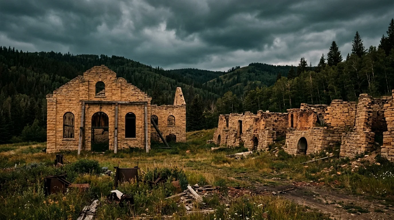
The stone skeleton of a 1907 coal empire — powerhouse walls, manager's residence, coke ovens — as a self-guided Provincial Historic Site at the east end of the Pass. Open May 15 to Labour Day, admission by donation, accessible gravel paths. The golden-hour photography stop.
Hillcrest Cemetery
The quietest site in the Pass: 180 of the 189 men killed in the 1914 Hillcrest explosion lie here, most in two mass-grave trenches, ringed by the Millennium Memorial's stones from every province. A short, mobility-friendly interpretive walk. Go respectfully; it earns the silence.
Coleman & the museum
Downtown Coleman is a National Historic Site — walk it with the Crowsnest Museum's rum-running exhibit fresh in mind: Prohibition, Emperor Pic, the 1922 shooting of Constable Lawson, and Florence Lassandro — the only woman ever hanged in Alberta. Then Miners' Path from Flumerfelt Park to walk the miners' actual commute.
The Burmis Tree & the festival
Photograph the famous dead limber pine at the east gate (sunrise puts the Livingstone Range behind it), and if you're here 30 July – 3 August 2026, the Crowsnest Pass Heritage Festival is the real annual event — five days across the five towns. The fireworks show old blogs promise? Gone since 2012.
Leitch Collieries. A coal empire that lasted eight years, preserved as stone. Self-guided, by donation, and at its best in evening light.
12 / THE KIT
What rides in the rig
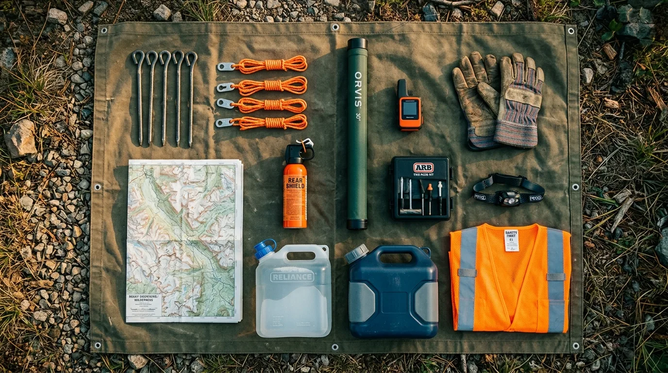
A corridor with no potable taps, a famous wind, gravel that eats sidewalls, and a north half with no signal. Orange items are the non-negotiables.
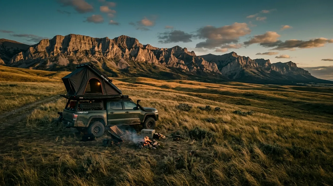
The Crowsnest loadout. Water jugs and wind stakes do the heavy lifting here. The fly rod is optional; wanting one isn't.
Passes & paperwork
Public Lands Camping Pass per adult if random-camping (albertarelm.com or town vendors)
Fire status checked day-of — advisory active at press; albertafirebans.ca in a real browser, or 310-FIRE
Fishing licence + the current ES1 tables if casting
Current Livingstone PLUZ map downloaded (it's the legal document for trails and camping)
Cash for first-come fee envelopes
Hunting licences/draws if that's the trip
Navigate & communicate
Satellite communicator for anything north of Hwy 3 — the Trunk Road is dead air
Numbers on paper: ER 403-562-5011 · Ranger Station 403-562-3210 · 310-FIRE
Trip plan left with someone, drainage named
Power bank + 12V charging sorted
Headlamps + spares
Wind, water & the rig
ALL drinking water — zero potable taps at seven campgrounds; 4 L/person/day
Heavy stakes + doubled guylines — the 130 km/h corridor means it
Full-size spare + plug kit + compressor for the gravel
Bear spray on the hip, one per adult
Stove windscreen + awning discipline agreed in advance
Blaze orange (person + dog) from September
Warm layer for the mine tour — 0°C underground in July
13 / MAKE A WEEKEND OF IT
Three ready-made trip shapes
01
The Heritage Weekend
Day 1: Burmis Tree at the gate, Leitch Collieries, claim or check into Lundbreck Falls, evening on the falls platforms.
Day 2: Frank Slide Centre + the debris trail in the morning, Bellevue Mine tour after lunch, Hillcrest Cemetery before dinner, Coleman's historic downtown for the evening.
Day 3: Miners' Path and Star Creek Falls, brunch in Blairmore, home with the whole story.
Any vehicleWeather-proofBook the mine tour
02
The PLUZ Free-Camp
Day 1: Fill everything in Coleman — fuel, water, pass bought — up Allison/Atlas Road, claim a legal random camp off the staging country.
Day 2: Window Mountain Lake in the morning, Chinook Lake swim in the afternoon, second night at camp with the Livingstone Range going gold.
Day 3: Deadman Pass leg-stretch (weekday = quiet), out via a proper meal in Blairmore.
PLCP requiredHigh clearance helpsWater for 3 days
03
The Trunk Road Through-Run
Day 1: Coleman full to the brim, north on the gravel — Racehorse or Dutch Creek for night one, creek noise included.
Day 2: The slow middle: Oldman crossing, Livingstone Falls camp, the range on your left all day. Last legal random camps before the Cataract boundary.
Day 3: Out at Highwood Junction — and you've connected this issue to Kananaskis country (issue 002) on one tank of gravel. June–November only.
Winter here is a different proposition than the rest of this series: the towns stay fully alive and the museums stay warm — but the highway itself becomes the hazard, and the Trunk Road simply closes.
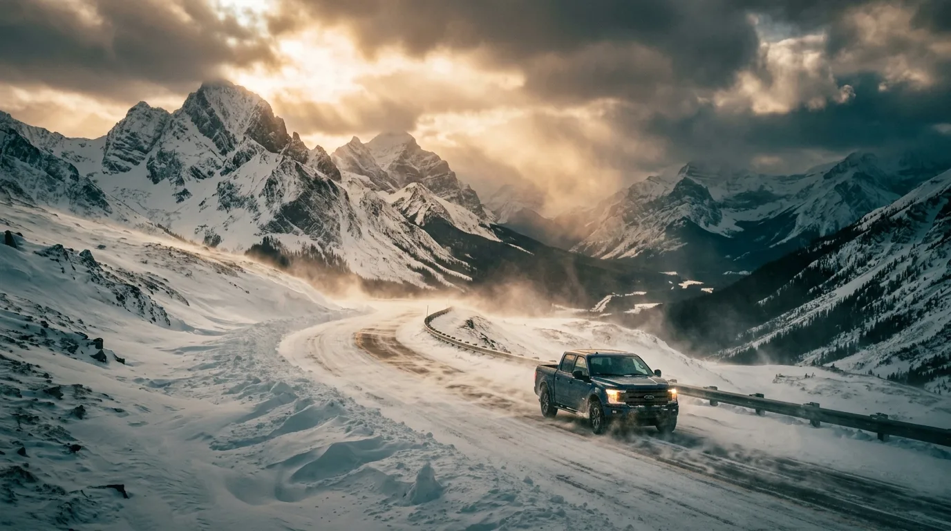
Highway 3 in a December blow. 130 km/h gusts, verified. When the RCMP says stay home, the locals already have.
What winter is actually for
The indoor Pass — Frank Slide Centre runs all winter (closed Mondays), the museum too; the story corridor works at -20
Pass Powderkeg — the town's own little ski hill in Blairmore; community skiing, not a resort weekend
Sledding the PLUZ — snowmobiles run the designated winter trail network (Dec 1 – Apr 30 map); the annual winter map is the law, and local clubs know the conditions
Quiet snowshoe days — Miners' Path and the lower creek trails work on snowshoes; Star Creek's falls ice is exactly the hazard the rescues keep proving it is — view, don't approach
What winter is not for
Schedules. The Trunk Road's north end is gated Dec 1 – Apr 30 and the rest is unplowed gravel; every provincial campground on the corridor is closed by mid-October; and Highway 3 itself — the thing you must drive to be here at all — produces the kind of wind-and-whiteout storms that close it outright. Check 511 Alberta before committing, carry the cab survival kit, keep the tank above half, and build a plan that survives waiting out a day in a warm café in Blairmore. Honestly? That's not a bad day.
15 / MOUNTAIN-READY
The departure check
Run it the night before you roll. Tap each item as it's done — no excuses survive contact with this list.
Passes & papersPLCP per adult if random-camping; fishing licence + ES1 tables if casting; cash for fee envelopes; PLUZ map downloaded.
Fire statusAdvisory active at press — check albertafirebans.ca (real browser) or 310-FIRE the morning of, and again before every match.
WaterZero potable taps at all seven campgrounds — every litre carried, 4 L/person/day, filled in Blairmore or Coleman.
Wind riggingHeavy stakes, doubled guylines, awning-stow discipline agreed before the first gust. This is the 130 km/h corridor.
Fuel planFull in Coleman before anything north; nothing west until Sparwood; nothing at all on the Trunk Road. 24-h pumps unverified — don't bet on them.
CommunicationSat-comm charged for the gravel; trip plan + drainage left with someone; key numbers on paper.
NavigationOffline topo + the current PLUZ trail map; braided OHV tracks make paper worth carrying.
WildlifeBear spray per adult, on the hip; food hard-sided; dog leashed; dusk speeds on Hwy 3 — the crossings project exists for a reason.
Season checkSeptember+: blaze orange, person and dog. Winter: 511 checked, cab kit packed, Trunk Road gate dates respected (Dec 1 – Apr 30).
The rigFull-size spare + plug kit + compressor for the gravel; headlights on; slow past camps — dust is the local currency of resentment.
0 / 10 confirmed — the mountains are watching.
16 / QUICK ANSWERS
Asked around every campfire
Do I need camping reservations here?
Mostly no. Of the seven provincial campgrounds on this corridor, only two take reservations — Lundbreck Falls and Chinook Lake (90-day window on the Alberta Parks system). Island Lake, Racehorse, Dutch Creek, Oldman River North and Livingstone Falls are all first-come, first-served. The commercial RV parks in town book directly.
Is free camping really legal here?
Yes — this is the series' free-camping capital. The Livingstone PLUZ allows vehicle-based random camping with the Public Lands Camping Pass ($30/year or $20/3-day per adult): 14 days max in a spot, then move 1 km for 72 hours; at least 1 km from any campground; 30 m from water. Willow Creek restricts camping to designated nodes, and once you cross into the Cataract Creek PLUZ, roadside random camping is prohibited — that boundary is where the free-range country ends.
Why can't I keep a fish from the Crowsnest River?
Because the famous water is fully catch-and-release: the 2026 ES1 rules set the mainstem from the Crowsnest Lake outlet to Cowley Bridge at open all year, bait ban, limit zero — all species. That's what keeps it world-class. Harvest options: Crowsnest Lake (5 trout) and the stocked lakes off the Allison road. Bull trout are zero everywhere in Alberta.
Is it safe to hike Turtle Mountain?
People do it constantly — with facts in hand. The trail is unsanctioned and unmaintained, the route passes near sheer drops, and the summit crosses the fissured zone the Alberta Geological Survey has monitored with 80+ sensors since 2005. AGS says the South Peak moves millimetres a year and a large slide is unlikely — but ~5 million cubic metres are expected to eventually fail. No official body warns against the hike or endorses it. Strong party, calm day, stay out of the cracks.
Where's the fuel — and is there diesel?
Coleman, Blairmore and Frank all have stations, with diesel available (Frank's Fas Gas lists it). The gaps: nothing west of Coleman until Sparwood, BC (~34 km), and nothing at all on the Trunk Road's 106 km. Confirm 24-hour availability by phone — it isn't verified.
How bad is the wind, actually?
Canada's first commercial wind farm was built just east of here in 1993 — at Cowley Ridge — because of this wind. Environment Canada verified gusts to 130 km/h on Highway 3 through the Pass in December 2025, with RCMP telling travellers to stay home. Awning stowed when unattended, real stakes, doubled guylines, and 511 Alberta before winter crossings.
When is the Trunk Road open?
The north section (south of Cataract Creek) is gated closed December 1 to April 30 each year, and the paved Highwood Pass beyond Highwood Junction stays closed until June 14. The full through-run is a June-to-November trip — gravel, minimal maintenance, no fuel, no signal, even in season.
Is Thunder in the Valley still a thing?
No — the famous fireworks show was cancelled in 2012 and never came back, whatever old blog posts say. The verified 2026 anchor event is the Crowsnest Pass Heritage Festival, July 30 – August 3. Rum Runner Days: unconfirmed for 2026 — check locally before planning around it.
17 / VERIFY BEFORE DEPARTURE
The final word lives here
This corridor's rules live on alberta.ca, its campgrounds on albertaparks.ca, and its conditions on the phone at the Blairmore Ranger Station. Where this issue leans on the 2012 local brochure for trail figures, it says so in place. These sources are the truth on the day you travel.
Emergency911 · Crowsnest Pass Health Centre (24/7 ER, Blairmore): 403-562-5011 · RCMP Crowsnest Pass 403-562-2866
🔒
The printable field guide
Everything above, condensed into a print-ready PDF built for the glovebox — for a corridor where the good half has no signal at all. The corridor map, the free-camping rulebook, seven trail cards with their honesty ratings, the campground tables, the wind doctrine, every phone number that matters and the departure check, on paper the gusts can't crash.
One-time unlock · Yours to keep · Built by people who actually camp there
Trail Journal No. 006
Go farther. Camp lighter. Leave it better.
Every Trekkr Trail Journal is built like this one: custom maps, honest trail beta, full logistics, kit lists and the local knowledge that turns a good trip into the one your crew talks about for years. New destinations drop all season long.
Get this guide — and every other Trekkr field guide, current and future — with the Adventure Passport. Read online or download for offline, plus your saved Adventure Builder trips.