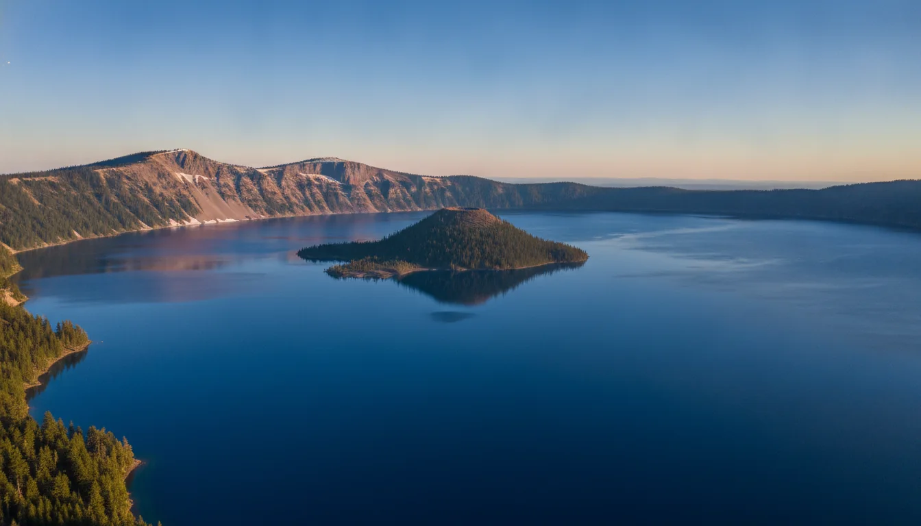
A vast, impossibly blue caldera lake ringed by dark cliffs with a small cinder-cone island, Crater Lake at golden hour, illustrative render in the series style
Trekkr Trail Journal · No. 019 · Crater Lake

Crater Lake& the Southern Oregon Cascades — The Complete Field Guide

The bluest lake in America is having its strangest few years. In 2026 the water itself is untouchable — the only trail to the shore is closed for three straight seasons, so there are no boat tours, no Wizard Island, no swimming. The famous 33-mile Rim Drive isn't a full loop this year either. This issue is about planning the trip the way it actually is in 2026, not the way the old guidebooks describe it — and it is still absolutely worth going.

Oregon · USA Crater Lake National Park · Rogue-Umpqua Byway Diamond Lake · Prospect · Klamath Falls Southern Cascades
2026–28Seasons the lake shore, boats & Wizard Island are closed
$30Per vehicle in summer — and NO timed entry
5Campgrounds in and around the park
~41 ftAverage annual snow — the season is short
Conditions verified 18 July 2026 · A snow park with a three-year lake closure · This block goes stale — the links don't

The lake is off-limits, the rim loop is broken, and the road status resets every winter

The rest of this journal is evergreen; this box is not. Everything below is dated to the day we checked it, and the most perishable items here — the construction closures, the road openings, the wildfire smoke, the fee figures — change faster than any printed guide. Each item gives you the 60-second check as well as the snapshot. Trust the procedure, not our date stamp.

  • The lake shore, boat tours and Wizard Island are CLOSED for 2026, 2027 AND 2028Cleetwood Cove Trail is the only legal public access down to the water, and NPS has closed it for a major trail-and-marina rehabilitation across three consecutive summers. NPS: "There will be no public boat tours on the lake during the summers of 2026, 2027, and 2028." No boats means no Wizard Island; no shore access means no swimming and no lakeshore recreation. News reporting says a 2029 reopening — NPS itself only says "three summers" and prints no exact date. Full account in §01. Any third-party site still selling a 2026–2028 boat tour is wrong.
  • Rim Drive is NOT a full loop in 2026 — and Ride the Rim is cancelledPer the NPS Current Conditions page (last updated 27 June 2026): West Rim Drive and the North Entrance Road are OPEN; East Rim Drive is partially open, with the section "from Park Headquarters to Phantom Ship Overlook" closed for construction. You cannot drive the classic ~33-mile loop — plan an out-and-back on West Rim. Sun Notch is inaccessible and Crater Peak is hike/bike only. The vehicle-free Ride the Rim event is cancelled for 2026, no replacement date set. Details in §02.
  • 2026 opened EARLY — do not assume that repeatsA low-snow winter let NPS open the North Entrance and West Rim Drive by early June, months ahead of the "typical" mid-July target. That's the opposite of a normal Crater Lake year. This park averages ~41 ft of snow, roads close on 1 November or the first big storm, and NPS states there are "no set dates for reopening." If you're planning for 2027, plan for a mid-July opening and be pleasantly surprised, not the reverse (§09).
  • Wildfire smoke is a real July–September riskNPS: "during the fire season (July, August, September) smoke may move over the park," from fires "hundreds of miles away in Oregon or California." A locally clear sky is no guarantee of a clear lake view — smoke can erase it entirely. Keep a flexible date window and check the park's air-quality readings and the Current Fire Activity page before you commit to a long drive (§10).
  • No timed entry — but entry is cashless, and the ATB price changedGood news first: no timed-entry reservation is required in 2026 (the 2025 pilot was dropped). Standard fee entry: $30 per vehicle in summer, and cashless only — no cash since 1 January 2023, so bring a card or digital wallet. New for 2026, America the Beautiful is $80 resident / $250 non-resident — a figure that matters for Canadian readers (§07). The NPS fees page is stale (2024); reconfirm before you go.
  • Lost Creek Campground's 2026 status is genuinely unconfirmedLost Creek (16 tent-only sites) was closed for all of 2025, and the NPS page says nothing about 2026. One secondary source claims it's closed all year; we could not confirm that on any NPS page. Do not build a trip around Lost Creek without a fresh check. Mazama (in-park) and the four surrounding-forest campgrounds are the reliable backbone (§08).
Live sources · NPS — Current Conditions (roads & trails) · Cleetwood Cove rehabilitation · Current Fire Activity & smoke · fees & passes
Road & weather info line 541-594-3000 · Recreation.gov reservations 866-292-6720 · in an emergency, 911. This box was true at press and will not stay true — the sources above are the truth on the day you travel.
01 / THE HEADLINE

The lake is untouchable — 2026, 2027 and 2028

Every older Crater Lake guide opens with "take the boat tour to Wizard Island." For three straight years that advice is flat wrong. There is exactly one legal way down to the water, it is closed for a full rebuild, and understanding that reshapes the entire trip. So we lead with it, and we do not bury it.

A steep switchbacking trail cut into a pumice slope descending toward a deep blue lake, the Cleetwood Cove Trail, illustrative render in the series style
Cleetwood Cove — CLOSED 2026–2028. The only legal access to the shore, shut for a major trail-and-marina rebuild. The parking lot is a construction-staging area, and there are no boats. This is not a photograph of a route you can walk this year.
🔴 The single most important fact in this issue Cleetwood Cove Trail is "the only legal access to the shore of Crater Lake" (NPS), and it is closed for the 2026, 2027 and 2028 seasons.

The consequences are total, and NPS lists them: the 1.1-mile switchback trail itself is closed; there are no public boat tours on the lake any of the three summers; Wizard Island is unreachable because the tour boats are the only way there and they launch from the Cleetwood marina; swimming and lakeshore access are gone; and the Cleetwood parking lot is closed and used for construction staging. NPS's own words: "There will be no public boat tours on the lake during the summers of 2026, 2027, and 2028."

There is no other way to touch the water. Plan the rim, the peaks and the surrounding Cascades — not the lake surface.

What the project actually is

Per the NPS rehabilitation page, the work covers rockfall mitigation and slope scaling above the trail, trail-tread and retaining-wall rehabilitation, replacement of the failed marina bulkhead (it failed in 2016) with a floating dock system, new restrooms replacing outdated composting toilets, and a new lakeshore ticket booth. NPS calls these "critical safety issues" — eroding tread, undermined walls, active rockfall.

The scale is the point: this is not a seasonal trail closure that might reopen mid-summer. It is a three-summer construction program, with NPS stating the work "is estimated to take three summers to complete" (through fall 2028).

The reopening date — and who actually said it

You will see "reopens 2029" everywhere. Here's the honest sourcing: the NPS project page does not print an exact reopening date — it says only that the work will take three summers. The 2029 figure comes from news reporting (KOIN, KDRV), not from NPS.

So write it the way we do: closed 2026–2028, expected to reopen in 2029 per news reporting. A three-summer schedule can slip, so re-check each spring if 2029 is on your horizon.

No boats · no island · no swim2029 is news-sourced, not NPS
The booking-site trap — this will cost people a trip Third-party sites and trip aggregators still surface boat-tour and Cleetwood pages as though they're bookable. Anyone who plans or "books" a boat tour for 2026, 2027 or 2028 will be turned away at the trailhead. If a page is offering you a Crater Lake boat tour or a Wizard Island landing for these years, it is out of date — the tours do not run, full stop. The good news, and the whole rest of this guide: the rim views, the West Rim overlooks, Garfield and Watchman peaks, and the waterfall-and-hot-spring circuit on the Rogue-Umpqua Byway are all open and unaffected.
02 / RIM DRIVE 2026

A partial loop, not the full 33 miles

Rim Drive is the reason most people come — a road that encircles the caldera with two dozen pullouts and the bluest water in the country underneath. In 2026 you can drive most of it, but not all of it, and the piece that's closed takes several of the classic viewpoints with it. Here's exactly what's open, on the park's own live source.

A ribbon of two-lane road curving along the rim of a deep blue caldera with cliffs dropping to the water, Rim Drive, illustrative render in the series style
Rim Drive. Normally a ~33-mile loop climbing to nearly 7,900 ft near Cloudcap — but the 33-mile figure is Wikipedia-sourced, not on any NPS page, and in 2026 the loop is broken.
🔴 You cannot drive the complete loop in 2026 Source: the NPS Current Conditions page, last updated 27 June 2026. West Rim Drive is OPEN (Rim Village to North Junction) and the North Entrance Road is OPEN (it closes 1 November or earlier with snow). But East Rim Drive is only "Partially OPEN" — the section "from Park Headquarters to Phantom Ship Overlook" is closed for road construction. Highway 62 stays open year-round along the west and south boundary. Practical read: plan an out-and-back on West Rim Drive, not a loop. The west and northern arc are drivable; the southeast segment past Park HQ is a construction zone.

What the closure knocks out

  • Sun Notch Trail — CLOSED. NPS: "Inaccessible due to road construction on East Rim Drive."
  • Crater Peak Trail — hike/bike only. NPS: "Only reachable by hiking/biking along Grayback Road."
  • Cleetwood Cove — closed for the multi-year rebuild (§01)
  • Pinnacles Road — open but hike/bike only, "due to road construction project" — no vehicle access
  • All other park trails: "OPEN," per the same NPS conditions page

The viewpoints on the closed segment — Sun Notch, Vidae Falls, Phantom Ship Overlook, Pumice Castle — sit behind the construction. Cloudcap is on the northeast arc; verify at time of travel whether it's reachable from the open North Junction side.

Ride the Rim — cancelled for 2026

The vehicle-free cycling days on East Rim Drive are cancelled for 2026. NPS cites "repairs and paving along East Rim Drive, major repairs on the Cleetwood Cove Trail and marina, improvements at North Junction Overlook, and rehabilitation of the Rim Village employee dormitory." Its wording on the future: "The next Ride the Rim event has not yet been scheduled."

If a car-free ride is why you were coming, it isn't happening this year, and there's no announced replacement date. Watch for reinstatement in a future season.

Ride the Rim cancelled 2026No future date set
Seasonal opening — why the rim season is short in any year Per the NPS Operating Hours & Seasons page, Rim Drive closes "with the first big snowstorm, or on November 1, whichever comes first." Plowing begins on West Rim Drive in mid-April, and "all roads are ready to open by mid-July" in a normal year — East Rim is the last to open. NPS is explicit: "There are no set dates for reopening the closed roads." So even in a normal year the full-rim season runs roughly mid-July to 1 November — and 2026 has no full loop at all. Remember the §00 caveat: 2026 opened early after a low-snow winter, which is the exception, not the rule.

Source honesty: the 33-mile loop length, ~6,500 ft low point, nearly 7,900 ft near Cloudcap, ~23 pullouts and the 1926–1941 build date all come from Wikipedia and secondary sources — we could not confirm the mileage on any NPS page. We print it as "about 33 miles" and tell you where it's from.

03 / THE VIEWPOINTS

The best rim stops — and which are gated this year

With the boat gone, the overlooks are the trip. Most of the great ones are on the open West Rim; a cluster of favourites is behind the East Rim closure. This table tells you which is which, so you don't drive to a gated pullout.

A jagged rock islet resembling a ghostly sailing ship rising from deep blue water below caldera cliffs, Phantom Ship, illustrative render in the series style
Phantom Ship. The rock formation is 170 ft high and 500 ft long — but the Phantom Ship Overlook sits on the East Rim segment that's likely gated in 2026. Verify against the NPS conditions page before you drive to it.
ViewpointWhere2026 accessWhy go
Discovery PointWest Rim OPEN Where prospector John Wesley Hillman first sighted the lake in 1853. Easy 2-mi round-trip rim walk from Rim Village (NPS: 100 ft gain)
Watchman OverlookWest Rim OPEN The best straight-down view of Wizard Island, and the trailhead for Watchman Peak (§04)
Cloudcap OverlookNortheast arc ⚠️ Verify "The highest viewpoint accessible by car" and the highest paved road in Oregon (~7,900 ft); Mt Shasta visible on clear days. Confirm 2026 access from the open side
Phantom Ship OverlookEast Rim 🔴 Likely gated Best view of the Phantom Ship formation, 170 ft high, 500 ft long. On the closed Park HQ → Phantom Ship segment
Pumice Castle OverlookEast Rim 🔴 Likely gated Orange-and-pink eroded pumice resembling a castle, ~1.1 mi west of Cloudcap
Sun NotchEast Rim 🔴 CLOSED (NPS confirmed) 0.8-mi round-trip to a Phantom Ship viewpoint — inaccessible due to construction
Vidae FallsEast Rim 🔴 Likely gated Roadside waterfall on the southeast segment

Access honesty: Sun Notch and Crater Peak are the only two the NPS conditions page names as cut off. Cloudcap, Pumice Castle, Phantom Ship and Vidae Falls sit on or near the East Rim construction segment and need live verification against the NPS conditions page at time of travel — we mark them "likely gated" rather than guessing. Viewpoint descriptions are from regional tourism sources (Travel Medford, Discover Klamath) for orientation.

04 / ON FOOT

The hikes, and which ones survive 2026

With the lake off-limits, the rim hikes carry the trip — and the good news is that the two best payoff hikes are both on the open West Rim. Distances and gains below are NPS figures; the 2026 status is cross-checked against the live conditions page, because the NPS hiking page does not flag closures.

Hikers on a short switchback trail to a stone fire lookout on a rim peak above an intensely blue lake, Watchman Peak, illustrative render in the series style
Watchman Peak. 1.6 miles, 420 ft, a historic fire lookout and the easiest big payoff on the rim — the view drops straight onto Wizard Island. NPS warns it gets "extremely crowded... especially at sunset."
TrailRound tripGainEffort2026 status & note
Watchman Peak1.6 mi420 ft Moderate ✅ Open. Historic fire lookout, view onto Wizard Island. NPS: "extremely crowded... especially at sunset"
Discovery Point2.0 mi100 ft Easy ✅ Open. Flat rim walk on the West Rim from Rim Village
Garfield Peak3.6 mi1,010 ft Strenuous ✅ Open. Starts at Crater Lake Lodge / Rim Village — the classic "best view" hike. Summit ~8,054 ft ⚠️ (secondary)
Godfrey Glen1.1 mi50 ft Easy ⚠️ Likely open. Pet-friendly loop near Munson Valley (near HQ) — verify
Mount Scott4.4 mi1,250 ft Trophy summit ⚠️ Verify. Park's highest point, 8,929 ft (NPS). Trailhead is on East Rim Drive — check the closure before you go
Plaikni Falls2.0 mi100 ft Easy ⚠️ Verify. Off Pinnacles Road / East Rim area; wheelchair-accessible except the final ¼ mi. Check access
Sun Notch0.8 mi150 ft Easy 🔴 CLOSED 2026 — road construction (NPS conditions)
Cleetwood Cove2.2 mi700 ft Steep 🔴 CLOSED 2026–2028 — the lake-access trail (§01)
Recommended for 2026: the three West Rim hikes you can count on All three are confirmed open on the West Rim: Garfield Peak (3.6 mi / 1,010 ft — the best views in the park), Watchman Peak (1.6 mi / 420 ft — the easiest big payoff), and Discovery Point (2.0 mi, flat). Mount Scott is the trophy summit at 8,929 ft, but its trailhead is on East Rim Drive and may be behind the construction closure — verify on the NPS conditions page before you send yourself there, because it's a long drive to a gate. Same caution for Plaikni Falls and anything on the Pinnacles Road side.

The NPS hiking page lists distances and gains but does not flag 2026 closures — that's why every trail here is cross-checked against the separate conditions page. Garfield's 8,054 ft summit figure is secondary-source; the NPS distances and gains are primary.

05 / THE ROGUE-UMPQUA BYWAY

The Highway of Waterfalls — and a source problem we have to disclose

If the lake is the reason you came and it's closed, this is the answer: a scenic byway nicknamed the "Highway of Waterfalls," running from the Roseburg lowlands up into the southern Cascades past more than fifteen cascades, a travertine hot spring, and a big alpine lake. It's the strongest reason to keep the trip. But we could not read a single Forest Service page, and you deserve to know that up front.

A double-tiered waterfall plunging over a wall of columnar basalt into a turquoise pool in deep forest, Toketee Falls, illustrative render in the series style
Toketee Falls. A double-tiered plunge over columnar basalt, roughly 113 ft, reached by a short 0.8-mile round trip — one of the signature stops on the byway. Every figure here is secondary-source; see the disclosure below.
🔴 Source-access problem — read this before you trust a number in this section Every fs.usda.gov page — the Forest Service, the authoritative source for the Umpqua and Rogue River-Siskiyou National Forests — returned HTTP 403 Forbidden to our fetcher, the same block that defeated our Olympic research. We could not read a single Forest Service page. All figures in this section are secondary-source only — heights, trail distances, fees, road conditions. Re-verify with someone who can load the site, and check the Forest Service for current-season road and fire closures before you drive any of these forest roads.

We also could not confirm the byway's total length. It's commonly given as 172 miles; no primary source confirms that, so we print no mileage. One secondary source notes that combining the byway with Crater Lake makes "about 130 miles" as a driving day. The route is roughly OR-138 → OR-230 → OR-62.

Toketee Falls

A double-tiered plunge over columnar basalt, commonly cited at ~113 ft (a ~28-ft upper tier plus an ~85-ft lower plunge); some sources round to ~120 ft. Trail: 0.8 mi round trip, ~170 ft gain, 25 min to an hour.

⚠️ Heights vary by source; not verified against the Forest Service.

Watson Falls

272 ft (the Travel Oregon figure) — "one of the highest in Southern Oregon." Trail: 0.8 mi loop, ~433 ft gain.

⚠️ Height disputed — another source says "nearly 300 ft, third highest in Oregon." We print 272 ft and note it's among Oregon's tallest; we don't commit to "third highest" without a primary source.

Diamond Lake

A ~3,000-acre lake ringed by the Cascades (Mt Bailey, Mt Thielsen), with an 11-mile paved bike path, stocked-trout fishing, boating and campgrounds. The best staging base for Crater Lake's North Entrance (§08).

⚠️ Forest Service specifics unverified.

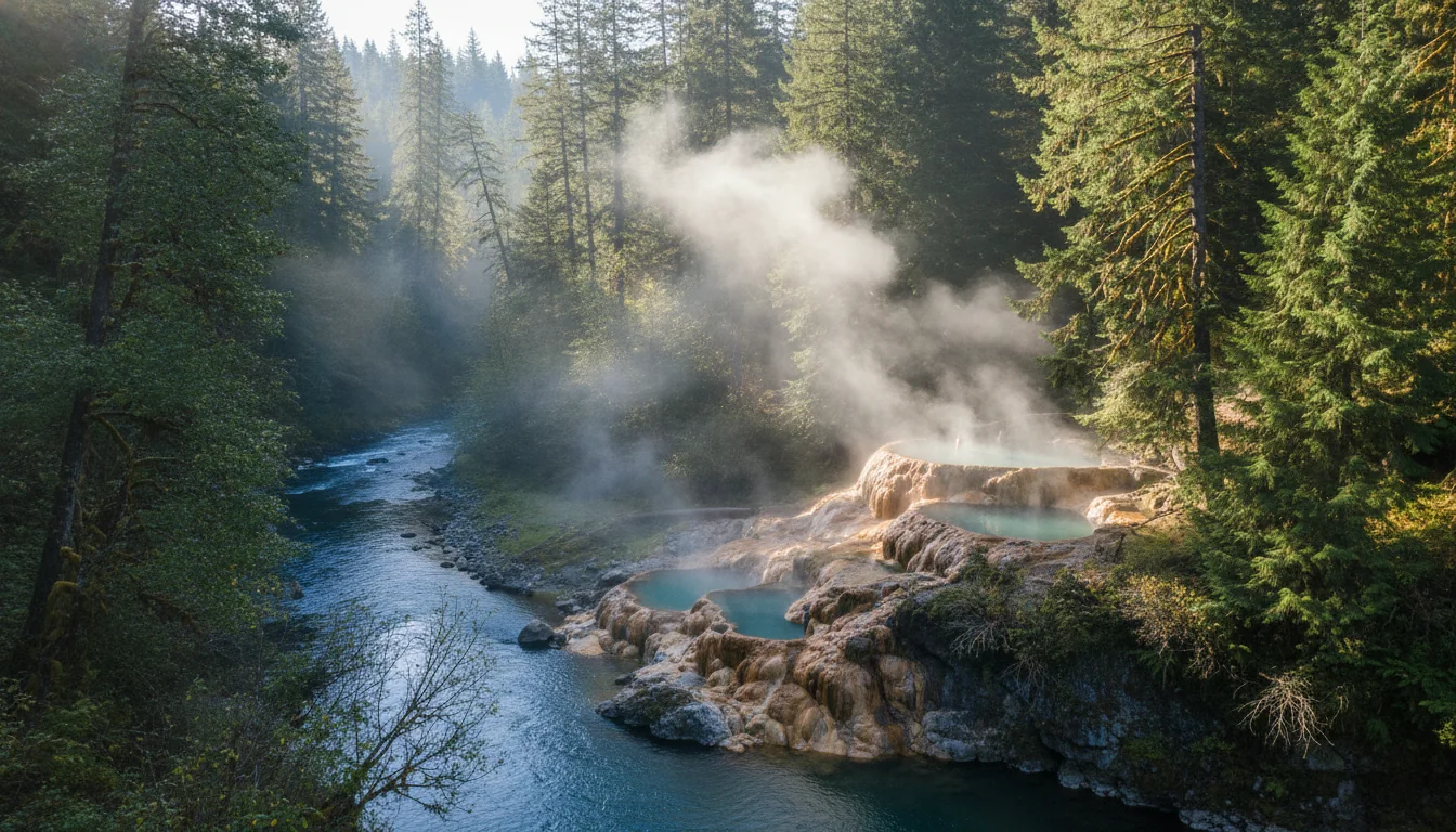
Terraced travertine pools of steaming water perched on a cliff above a green forested river, Umpqua Hot Springs, illustrative render in the series style

Umpqua Hot Springs — read this before you go

Travertine-terrace pools on a cliff above the North Umpqua River, several pools at varying temperatures. $5 per vehicle day-use fee, USFS day-use only, sunrise to sunset. Access is a ~0.5-mile steep hike from the trailhead, reached via Forest Road 34 off OR-138 near Toketee, then Forest Road 3401 — high-clearance vehicle recommended for the rough, potholed gravel on FR 3401.

🔴 Clothing-optional — nudity is common and expected. If you're travelling with children, that's a reason to decide in advance whether it's the right stop.

⚠️ Seasonal and road closures unverified — FR 34/3401 and the trailhead can close for snow, fire or crowding, and the Forest Service page was blocked. Check before you send a low-clearance vehicle up a rough forest road.

Fall colour — the other reason to come, and the larch is the star The High Cascades (5,000–7,000 ft), including Crater Lake and Diamond Lake, peak late September to early October, and park services generally run through mid-October. The signature display is the western larch (tamarack) — a deciduous conifer that turns pure gold across the mountain slopes for about two weeks in October before dropping its needles, with the byway and Diamond Lake area prime viewing. Mid-elevation slopes add vine maple and aspen in early-to-mid October. Fall is genuinely the sweet spot for Crater Lake — fewer crowds, crisp air — but remember the full Rim Drive loop and all lake access are gone in 2026, and Rim Drive can close with the first big snowstorm any time after early October.
06 / WIZARD ISLAND

The island you'll only see from above

Wizard Island is the postcard — a cinder cone rising from the bluest water in America. In a normal year you'd take a boat from Cleetwood and land on it. For 2026 through 2028 there are no boats, so the honest advice is the opposite of every old guide: this is a view, not a destination.

A symmetrical volcanic cinder-cone island with a forested crater rising from vivid blue caldera water, Wizard Island, illustrative render in the series style
Wizard Island — no landings 2026–2028. The tour boats are the only public way onto it, and they don't run during the Cleetwood closure. This is what you'll get, and it's still worth the drive: the view from above.

Where to see it best this year

Both of the best straight-down views of Wizard Island are on the open West Rim, which is the whole reason this trip still works: Watchman Overlook gives the classic angle, and the short climb to Watchman Peak (1.6 mi / 420 ft, §04) lifts you above it. Discovery Point and the West Rim pullouts give you the island against the full sweep of the caldera.

Set your expectations honestly and you won't be disappointed: the rim view of Wizard Island is one of the great sights in the American West, boat or no boat.

What you're missing, stated plainly

In a normal year, the boat tour drops you at the island for a few hours — a summit hike up the cinder cone, a look into its own small crater. None of that is available in 2026, 2027 or 2028. The boats launch from the Cleetwood marina, and there is no marina during the rebuild.

If landing on Wizard Island is non-negotiable for your trip, the honest answer is to wait until the trail and marina reopen — news reporting points to 2029, though NPS prints no date (§01). Otherwise, come for the rim.

No landings until ~2029Best viewed from the West Rim
07 / FEES & ENTRY

No timed entry — but cashless, and the pass price changed

Unlike many of the big parks, Crater Lake has no timed-entry system and no vehicle reservation in 2026. That's the easy part. The parts that catch people are that entry is cashless, that the fee has two seasons, and that the America the Beautiful pass now has a two-tier price that matters if you're driving down from Canada.

The good news, first — no reservation required No timed entry and no entrance reservation in 2026. The 2025 timed-entry pilot was discontinued as of 1 October 2025. NPS verbatim: "Although an entrance fee or NPS pass is required to enter Crater Lake National Park, vehicle reservations are not needed." You just show up and pay — which, given the boat and rim-loop closures, is a rare piece of Crater Lake logistics that got simpler this year, not harder.
PassSummer (May 22 – Oct 31)Winter (Nov 1 – May 21)Validity
Private vehicle$30.00$20.007 days
Motorcycle$25.00$15.007 days
Per person (foot/bike, 16+)$15.00$15.007 days
Children under 16FreeFree
Crater Lake Annual Pass$55.001 year
America the Beautiful — Resident$80.001 year
America the Beautiful — Non-Resident$250.00 (new 1 Jan 2026)1 year

🔴 Cashless only — bring a card

NPS verbatim from the fees page: "Beginning January 1, 2023, cash will not be accepted. You can pay by debit or credit cards, and Apple or Samsung pay/digital wallet." There is no cash option at the entrance, so a carful of cash and no card does not get you in. Senior, Military, Access and 4th-Grade federal passes are all still honoured.

The $250 tier — for Canadian readers specifically

The America the Beautiful pass went two-tier on 1 January 2026: $80 resident, $250 non-resident. That's a per-pass price, not a park surcharge, and it's the same change we flagged on the Olympic issue. If you're a Canadian planning several US parks on one trip, the maths on ATB just changed — run the numbers before you assume the annual pass is the cheap option. For a single Crater Lake visit, the $30 vehicle fee is far cheaper.

Cashless since 2023ATB non-resident $250
The Northwest Forest Pass does NOT get you free forest camping For the surrounding national forests, the general rule (from prior verification, not read off a live Forest Service page this issue — fs.usda.gov was blocked) is that the Northwest Forest Pass ($30/yr, $5/day) covers USFS day-use fee sites in Oregon and Washington, and America the Beautiful substitutes for it. But be clear about the limit: the campgrounds in §08 — Diamond Lake, Union Creek, Farewell Bend — charge nightly camping fees that a Northwest Forest Pass does NOT cover. Do not tell yourself a forest pass gets you free camping; it doesn't. Confirm the specific day-use trailhead fees on a Forest Service page before relying on any of this.

The NPS fees page itself was last updated April 2024 and is stale — the fee change was announced separately. Reconfirm the $30/$20 figures live before you travel.

08 / THE FIVE CAMPGROUNDS

Two in the park, three in the forests around it

Five campgrounds are the backbone of a Crater Lake trip: Mazama and Lost Creek inside the park, and Diamond Lake, Union Creek and Farewell Bend in the surrounding national forests. Only one of the five has hookups. One of them may not be open at all this year. And several of the fee and date figures could not be nailed to a primary page — where that's true, we say so.

A camp set among tall Cascade firs with a rig and awning, evening light through the trees near a Cascade lake, illustrative render in the series style
The area's beds. Five campgrounds across a national park and two national forests — and exactly one of them, Mazama, offers an electric or full hookup anywhere in the cluster.

Mazama Campground — the big one, RVs welcome

214 sites across loops A–G at 6,000 ft, a mix of tent-only, RV no-hookup and RV electric, with about 5 ADA-accessible sites. Operated by the park hospitality concessioner (ExplorUS ⚠️ secondary), booked via Recreation.gov, 866-292-6720.

2026 season: late May – 30 June is first-come, first-served (weather dependent); 1 July – 1 October is reservation-required (last night bookable 30 September).

Amenities, concessioner verbatim: "restrooms, a gas station, food storage lockers, potable water, a dump station, and showers" (showers Loop F only). The Mazama Camper Store sells groceries, propane, firewood and gasoline. Dump station free for guests, $10 for non-guests.

2026 Mazama fees — and an unreconciled gap

Site typeFee/night
Tent / walk-in$35.00
RV — no hookups$35.00
RV — electricity$48.00
RV — full hookups$57.00
Walk-in hiker/biker (per person)$5.00

⚠️ Fee discrepancy: some listings (Recreation.gov summaries, Hipcamp) quote $38 / $38 / $50 / $59. The $35/$35/$48/$57 figures above are from the official concessioner site and should be authoritative — but the gap is worth a re-check at booking. Senior/military reportedly get 50% off (⚠️ secondary). And the RV length limit is not published on any page we read — we print no max-length number.

🔴 Lost Creek Campground — 2026 status genuinely unconfirmed Lost Creek is a small tent-only campground, 16 sites, first-come first-served, ~6,000 ft, that historically opens in early July and fills by mid-afternoon. It is tent-only — no RVs or trailers (steep access). But here's the problem: the only thing the NPS page states is "Lost Creek Campground will not be open in 2025." It says nothing about 2026. One secondary source claims it's "closed all year 2026," which we could not confirm on any NPS page. Do not state — or assume — that Lost Creek is open OR closed for 2026 without a fresh check. If you're counting on those 16 tent sites, call the park first.
A wide Cascade lake ringed by conifer forest with a snow-capped peak beyond and a paved shoreline path, Diamond Lake, illustrative render in the series style

Diamond Lake — Umpqua NF, the north approach

On OR-138, the best staging base for Crater Lake's North Entrance. 238 sites (51 lakeshore, 187 inshore), reservation-only — no first-come, via Recreation.gov (541-498-2531). No hookups"No electric, water, or sewer site hook-ups available." RV length max 35 ft. Drinking water, flush toilets, boat ramps, fish-cleaning stations, staffed gatehouse; elevation ~5,183 ft.

⚠️ Base site fee not captured on a primary page (extra vehicle $5/night is confirmed) — confirm on Recreation.gov before printing a number. 2026 open/close dates not confirmed; fills fast. Thielsen View Campground across the lake is a smaller alternative if Diamond Lake is full.

Union Creek — Rogue River-Siskiyou NF, west on OR-62

~18 mi west of the park, old-growth on the Rogue River, ~11 mi past Prospect. 73 sites"Not recommended for trailers over 28 feet long." 2026 fees: single $22/night, single with electric $35/night, extra vehicle $5. 🔴 Cashless as of July 2026"Visitors need to pay using the Scan and Pay feature of recreation.gov." Union Creek Resort (store, restaurant) is within walking distance. High Cascades Ranger District: 541-560-3400.

Farewell Bend — Rogue River-Siskiyou NF, west on OR-62

~18 mi west of the park, ~12 mi past Prospect. 60 sites, paved pads, and it accommodates most RVs and trailers — the more rig-friendly of the two OR-62 sites. Drinking water, flush toilets, picnic tables, fire rings; Union Creek Resort within about a mile.

⚠️ 2026 fees and season dates not captured on a primary page — confirm on Recreation.gov, likely similar to Union Creek's cashless/fee structure.

Practical read for a rig Mazama (in-park) and Farewell Bend (west) are the two most RV/trailer-friendly. Diamond Lake takes RVs to 35 ft but has no hookups. Union Creek caps trailers at 28 ft. Lost Creek is tent-only (and maybe closed). Only Mazama offers electric or full hookups anywhere in this cluster — so if you need to plug in, Mazama is the answer, and you book it on Recreation.gov for 1 July onward. One last honesty note: the ExplorUS operator name, the ~121-tent/~75-RV Mazama site split, and the Diamond Lake / Farewell Bend base fees and dates are all secondary or unconfirmed — reservations definitively go through Recreation.gov regardless of who runs the ground.
09 / WEATHER & THE SHORT SEASON

A snow park with a July-to-September window

Crater Lake is not a place you visit on a whim in June. It averages about 41 feet of snow a year, its roads are the seasonal variable, and the "when does it open" question genuinely cannot be answered until NPS plows and posts. 2026 opened early — and that is precisely the trap.

The numbers that define the place

  • Average annual snowfall: 41 ft (12.5 m) at park headquarters
  • Record single season: 879 in (73 ft), winter 1932–33; max depth on the ground 258 in (21½ ft), 1983
  • Summers are "short but sunny" — NPS: "July, August, and September are your best bets for warm, dry weather"
  • Standing hazard, NPS: "Winter conditions may extend into June or July"
  • Roads close 1 November or the first big storm. Plowing starts on West Rim mid-April; all roads usually open by mid-July

⚠️ NPS does not publish a clean summer temperature range or a "months snow-covered" figure. We don't invent numbers. The usable takeaway: the realistic driving-and-camping window is roughly July to September.

Why 2026 is misleading — don't let it set your expectations

A low-snow winter let NPS open the North Entrance Road and West Rim Drive by early June 2026 — months ahead of the typical mid-July target. As of the 27 June 2026 conditions update, both were open. This is the opposite of a normal Crater Lake year.

If you're planning 2027 or beyond, plan around mid-July, not early June. NPS's own caveat is worth carrying: "With late or even early snowfalls, unpredictable snow melt, and the timing of snow removal, it is difficult to determine from year to year when certain facilities or services may be available."

Fall is the sweet spot — the High Cascades peak late September to early October and the larch turns gold for about two weeks in October (§05) — but Rim Drive can close with the first big storm any time after early October.

Window: roughly Jul–Sep~41 ft of snow a year
10 / WILDFIRE SMOKE

The thing that can erase the view you drove for

You can do everything right — clear forecast, roads open, campsite booked — and still arrive at "the bluest lake in America" to find it hidden behind smoke from a fire hundreds of miles away. In southern Oregon that isn't a freak event; it's a recurring feature of July, August and September. Plan for it.

A mule deer standing among lodgepole pines with a hazy smoke-tinted ridge behind, southern Oregon Cascades wildlife, illustrative render in the series style
The southern Cascades in fire season. Smoke haze is a genuine risk to the lake view from July through September — a locally clear sky is no guarantee of a clear caldera.

What NPS actually says

Verbatim window: "during the fire season (July, August, September) smoke may move over the park." The smoke can come from "fires hundreds of miles away in Oregon or California" — so clear local weather is no guarantee of a clear lake view. NPS runs air-quality (AQI) sensors at multiple park locations for real-time readings, and lists "Summer/fall air quality impacts from wildfires" as a standing hazard.

For live conditions, use the NPS Current Fire Activity page and the park's AQI readings rather than any static claim — smoke moves fast and nothing printed here will be current.

The planning move: a flexible window

A smoked-out August is a real risk for anyone driving hours for the view. The single best defence is a flexible date window and an AQI check before you commit to the long final drive. If you can move a trip by a few days when a smoke event is forecast, do — the lake will still be there, and the difference between a hazy grey caldera and the deep blue is entirely down to the air.

And treat smoke as a health hazard, not just a view-spoiler — see §11. If the AQI is high, that's a reason to shorten exertion, not just to shrug about the photos.

Peak risk Jul–SepCheck AQI before the final drive
11 / SAFETY

A caldera rim, cold water, and thin air

The hazards here are specific to the place: a near-vertical drop to the water all along the rim, water cold enough to be dangerous even in summer, altitude that surprises people, and a remoteness that makes rescue slow. None of it should stop you — all of it should shape how you move.

The rim — a 1,000-foot drop

🔴 The rim is a ~1,000+ ft near-vertical drop to the water. In winter and spring, snow cornices — overhanging ledges of snow beyond the solid ground — can collapse and cause fatal falls. Even in summer, loose pumice and rock at the edge make the margin thinner than it looks. Stay on official paths and behind railings.

⚠️ The cornice detail is from a secondary summary of the NPS safety page; the hazard is real and well-documented, but we flag the sourcing rather than quote wording we couldn't verify verbatim.

Cold water — ~50°F, no lifeguards

🔴 The lake stays near ~50°F even in summer. Hypothermia is a genuine risk for a tired swimmer, and onset can be rapid. There are no lifeguards. This is largely moot for 2026–2028 anyway — with Cleetwood closed there's no legal lakeshore access (§01) — but it applies to the byway's rivers and to Diamond Lake, and it's why the general cold-water discipline matters: flotation, and don't overestimate a strong swimmer's odds in cold water.

Altitude & sun

The rim sits at ~7,000–7,900 ft; HQ and Mazama are at ~6,000 ft. Expect thinner air, stronger sun and cooler nights than the drive up suggests. Pace the climbs — Garfield and Mount Scott both top 8,000 ft — hydrate, and don't underestimate a "short" rim hike done at altitude on your first day up from the valley.

Remote rescue & the cell problem

Many trails are unmarked in snow and rescues can be delayed. Combined with poor cell service (§12), that argues for a satellite messenger and told-someone-your-plan discipline — the same kit that makes sense anywhere remote. Treat wildfire smoke (§10) as an air-quality health hazard, not just a view-spoiler, and dial back exertion when the AQI climbs.

Rim drop-offs · cold waterCarry a satellite messenger
12 / FUEL, SERVICES & CELL

There is no reliable gas in the park — plan around it

Crater Lake is remote, the in-park fuel is a summer-only pump that may or may not have gasoline, and cell coverage is "spotty" on every source we could find. This is the logistics you sort before you drive up, not after.

An overland rig on a forested Cascade highway climbing toward a distant snow-streaked peak, the approach to Crater Lake, illustrative render in the series style
The approach. Fill the tank in a gateway town before you climb — the in-park pump is summer-only and unreliable, and the nearest stations are 29–30 miles from the fee booth.
🔴 No regular gas station in the park NPS verbatim: "Self-serve, unleaded gasoline is available in the park at the Mazama Village Store only during summer when the camper store is open" — and the pump "may or may not have available gasoline, depending upon when the tanker truck arrives." Do not rely on it. NPS's own warning: "Anytime of the year, running out of gas results in frustration and is very expensive to rectify if a tow company has to deliver gas." There is one EV charging station at the Annie Creek Gift Shop in Mazama Village (standard + Tesla connectors), which may be snowed out.
Direction from the south fee boothNearest stationDistance
West (OR-62)Prospect Service Station29 mi
South (US-97)Crater Lake Junction Travel Center30 mi
North (OR-138)Diamond Lake Resort gas stationNearest north

⚠️ Chemult (US-97, northeast) is cited as "your last stop for year-round gas before the park" — secondary tourism source. Distances are from NPS and tourism pages. Per our dataset rules we did not record business phone numbers or addresses beyond the park info lines.

Gateway towns — where the services actually are

  • Klamath Falls — the largest full-service town, ~56 mi south; groceries, fuel, medical, lodging
  • Roseburg — full services on the northwest OR-138 approach via the Umpqua NF
  • Prospect — small; Prospect Service Station is the key west-approach fuel/food stop (OR-62)
  • Chemult — small US-97 stop; a few restaurants, markets, motels; year-round gas ⚠️
  • Diamond Lake — resort services (gas, store, food) on the north approach, not a town
  • Mazama Village (in-park) — store, gas, food, showers — summer only

Road & weather info line: 541-594-3000. Recreation.gov reservations: 866-292-6720.

Cell coverage — assume little to none

⚠️ Every source we found says only "spotty." NPS references cell and internet but provides no specifics; secondary tourism pages just say "Phone coverage is spotty within and around the park." There is no carrier map and no NPS coverage statement, so we publish no carrier-by-carrier table — the sourcing doesn't support one.

How to plan it: assume little-to-no service in and around the park, download offline maps before you arrive, and don't count on navigation or calls once you're off US-97, OR-62 or OR-138. This is exactly the terrain where a satellite messenger (§11) earns its keep.

No reliable in-park fuelAssume no cell service
13 / THE KIT

What this park specifically demands

Most of this is a normal Cascades loadout. What's different at Crater Lake in 2026 is driven by four facts: the lake is off-limits so this is a rim-and-forest trip, there's no reliable fuel or cell in the park, it's a high-altitude snow park with a short season, and wildfire smoke can turn the air against you with no warning.

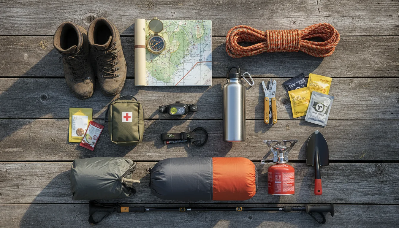
Overhead flat lay of park kit: a satellite communicator, a full jerrycan, layered clothing, an N95 mask, a paper park map and a card wallet, illustrative render in the series style
The Crater Lake loadout. A full tank, a card (it's cashless), offline maps and a smoke plan do more for you here than any amount of specialist gear — because the park's real hazards are distance from fuel, distance from help, and the air.

The paperwork & the booking

  • A debit/credit card or digital wallet — entry is cashless, and cash won't get you in
  • No timed-entry reservation needed — but do check the NPS conditions page for what's open before you drive
  • Mazama booked on Recreation.gov for 1 July onward (first-come before that); Diamond Lake is reservation-only, Lost Creek FCFS if it opens at all
  • Cash or Scan-and-Pay for the forest campgrounds — Union Creek is cashless as of July 2026
  • Don't book — or believe — any 2026 boat tour or Wizard Island landing; they don't run until ~2029
  • The NPS conditions page and Current Fire Activity page checked within a day or two of travel

The drive & the altitude

  • A full tank before you climb. No reliable fuel in the park; nearest stations are 29–30 mi from the fee booth
  • Offline maps downloaded — cell is "spotty" at best in and around the park
  • Satellite communicator for the remote forest roads and trails — rescue can be slow up here
  • Layers and a warm night kit — the rim is 7,000–7,900 ft and nights are cold even in July
  • Sun protection for altitude — stronger sun at 6,000–8,000 ft than the valley
  • High-clearance thinking for FR 34 / FR 3401 to Umpqua Hot Springs — rough, potholed gravel
  • If it's shoulder season, chains/snow readiness — this park can hold winter into June or July

Smoke, camp & the rim

  • An N95 mask or two and a smoke plan — fire-season air can spike with no local fire in sight (§10)
  • A flexible date window — the single best defence against a smoked-out lake view
  • Your own water where campgrounds don't provide it, and a filter for the forest sites
  • Food storage discipline — Mazama has food lockers; assume standard Cascades bear practice
  • Rim discipline: stay behind railings — it's a ~1,000 ft near-vertical drop, and the edge is loose pumice
  • Warm/water layers if you go near the byway rivers or Diamond Lake — the water is cold (§11)
  • A camp chair and patience for the West Rim at sunset — with the boat gone, the overlooks are the trip
14 / TRIP SHAPES

Three ways to run it in 2026

Built around what's actually open this year: the West Rim, the peaks you can still climb, the waterfall byway, and the five campgrounds. Each shape names what you must book and what will ruin it — and none of them promise you a boat.

Read this before you pick dates Two things dominate 2026 date-planning. First, the lake shore, boats and Wizard Island are closed all season — no combination of dates changes that, so build the trip around the rim. Second, wildfire smoke peaks July–September and can erase the view; keep the window flexible and check AQI before the final drive. And remember the road reality: the full Rim Drive loop is not drivable, so every itinerary here is a West Rim out-and-back, not a circuit.
01

The rim weekend — Mazama base

  1. Fri: Fuel up in a gateway town, enter (cashless, $30), set up at Mazama (6,000 ft, the only hookups around). Book it on Recreation.gov for July onward.
  2. Sat: Garfield Peak at first light (3.6 mi / 1,010 ft, the best views), then the West Rim overlooks — Discovery Point and Watchman Overlook for the Wizard Island angle.
  3. Sun: Watchman Peak (1.6 mi / 420 ft) before the sunset crowds, and a slow drive of the open West Rim. Skip anything on East Rim — it's gated.
  4. Reality check: no boat, no Wizard Island landing, no swimming. This is a rim trip, and on a clear day it's a great one.
Book: Mazama, Recreation.gov No timed entry needed Cashless — bring a card
02

The waterfall byway — Diamond Lake base

  1. Base at Diamond Lake (238 sites, Umpqua NF, north approach, no hookups, RV max 35 ft) — the staging point for both the byway and the North Entrance.
  2. Day 1 — the Highway of Waterfalls: Toketee Falls (0.8 mi RT) and Watson Falls (0.8 mi loop, 272 ft), then Umpqua Hot Springs — $5/vehicle, sunrise–sunset, clothing-optional, high-clearance for FR 3401.
  3. Day 2 — the rim: enter via the North Entrance, drive the open West Rim, climb Watchman or Garfield.
  4. Ruins it: a snowed-in or fire-closed FR 34/3401, or a smoke day on the rim. Check the Forest Service and AQI first.
Diamond Lake — reservation only Forest roads: verify before you drive All byway figures secondary-source
03

The family week — no summit fever, west approach

  1. Base at Farewell Bend (60 sites, paved pads, the most rig-friendly forest site) or Union Creek on OR-62, ~18 mi west.
  2. Easy rim wins: Discovery Point (2.0 mi, flat) and Watchman Peak (1.6 mi) — the two lowest-effort payoffs, both on the open West Rim.
  3. A waterfall day on the byway — short trails to Toketee and Watson, minimal walking, big scenery.
  4. A rest day at Diamond Lake — the 11-mile paved bike path, stocked-trout fishing, and a lake you can actually get to the shore of.
  5. Set expectations early: tell the kids the boat isn't running this year, so nobody's disappointed at the trailhead.
Farewell Bend takes most rigs Rim edge — hold small hands Union Creek cashless Jul 2026
04

The fall-colour run — flexible dates

  1. Time it late September to early October for the High Cascades peak, and the larch turning gold across the slopes for ~two weeks in October.
  2. Base wherever's open — park services run through mid-October; Mazama's reservation window ends 1 October, so late trips lean on the forest campgrounds.
  3. Drive the byway for the larch and the Diamond Lake area, then the West Rim for the caldera against autumn light.
  4. The catch: Rim Drive can close with the first big snowstorm any time after early October — so keep the dates flexible and watch the forecast.
Larch peaks ~2 weeks in October First storm can close the rim Services through mid-October
A note on the trip we didn't write There is no "boat tour and Wizard Island" itinerary in this issue, and that's not an oversight — it's impossible in 2026, 2027 and 2028. Every older Crater Lake guide is built around that day on the water, and for three straight years it's simply gone. If landing on Wizard Island is the whole point of your trip, the honest advice is to wait for the reopening (news-reported 2029, no NPS date). Otherwise, the rim and the Cascades around it are more than enough — and a lot less crowded than the boat dock used to be.
15 / TRIP-READY

The departure check

Run it before you leave. Tap each item as it's done — these are the twelve things specific to Crater Lake in 2026 that a general national-park habit will skip.

0 / 12 confirmed — the lake is off-limits this year.
16 / QUICK ANSWERS

Asked at every Rim Village pullout

Can I take a boat tour or visit Wizard Island in 2026?
No — and not in 2027 or 2028 either. Cleetwood Cove Trail is "the only legal access to the shore of Crater Lake" (NPS), and it's closed for a major trail-and-marina rehabilitation across all three summers. NPS verbatim: "There will be no public boat tours on the lake during the summers of 2026, 2027, and 2028." The tour boats launch from the Cleetwood marina, so with no marina there is no way to reach Wizard Island, and no other legal route to the shore — which also means no swimming and no lakeshore access. News reporting says a 2029 reopening; NPS itself only says the work will take three summers and prints no exact date. Any third-party site still selling a 2026–2028 boat tour is out of date. Plan the trip around the rim.
Can I drive the full Rim Drive loop?
Not in 2026. Per the NPS Current Conditions page (last updated 27 June 2026), West Rim Drive and the North Entrance Road are open, but East Rim Drive is only partially open — the section "from Park Headquarters to Phantom Ship Overlook" is closed for construction. So the classic ~33-mile loop isn't drivable; plan an out-and-back on West Rim Drive. The closure also cuts off Sun Notch (NPS: inaccessible) and leaves Crater Peak reachable only by hiking or biking Grayback Road, and it's why Ride the Rim is cancelled for 2026 with no replacement date. The ~33-mile figure, by the way, comes from Wikipedia and secondary sources, not an NPS page.
Do I need a timed-entry reservation, and how much is entry?
No timed entry and no vehicle reservation are required in 2026 — the 2025 pilot was discontinued. Entry is a standard fee: $30 per private vehicle in summer (May 22 – Oct 31), $20 in winter, valid 7 days; motorcycle $25/$15; per person on foot or bike (16+) $15; Crater Lake Annual Pass $55. America the Beautiful is accepted, but note the new two-tier ATB pricing from 1 Jan 2026: $80 resident, $250 non-resident — relevant to Canadian visitors. Entry is cashless — no cash since 1 January 2023, so pay by card or digital wallet. The NPS fees page is stale (2024); reconfirm before you travel.
Which campgrounds are open?
Five anchor the area. In the park: Mazama (214 sites, 6,000 ft, the only hookups, first-come late May – 30 June then reservation-required 1 July – 1 October via Recreation.gov) and Lost Creek (16 tent-only sites). Nearby: Diamond Lake (238 sites, Umpqua NF, north on OR-138, no hookups, RV max 35 ft), Union Creek (73 sites, west on OR-62, not for trailers over 28 ft, cashless as of July 2026) and Farewell Bend (60 sites, west on OR-62, paved pads, more rig-friendly). One caution: Lost Creek was closed all of 2025 and its 2026 status is unconfirmed — the NPS page says nothing about 2026, so don't count on it without a fresh check. Mazama and Farewell Bend are the most RV-friendly, and only Mazama has electric or full hookups.
When is the best time to go — will snow or smoke be a problem?
Crater Lake averages about 41 ft of snow a year at headquarters, with a record 879 in (73 ft). Roads close 1 November or with the first big storm, and NPS says there are no set reopening dates — plowing begins on West Rim mid-April and all roads are usually open by mid-July. The realistic driving-and-camping window is roughly July through September. 2026 opened early after a low-snow winter, but that's the exception, not the rule. Two caveats: the full Rim Drive loop and all lake access are gone in 2026, and wildfire smoke in July–September can erase the view even on a locally clear day. Fall (late Sept – early Oct) is the sweet spot for crowds and the golden larch — keep a flexible date window and check the park's AQI.
Is there gas in the park?
Not reliably. NPS states unleaded is available only at the Mazama Village Store, only in summer when the camper store is open, and even then the pump "may or may not have available gasoline, depending upon when the tanker truck arrives" — so don't rely on it. Fill up before you arrive. From the south fee booth the nearest stations are Prospect Service Station (~29 mi west, OR-62), the Crater Lake Junction Travel Center (~30 mi south, US-97), and Diamond Lake Resort (north, OR-138); Chemult on US-97 is cited as the last year-round gas ⚠️ (secondary). There's one EV charger at the Annie Creek Gift Shop in Mazama Village, which may be snowed out. NPS warns plainly that running out of gas is expensive to fix if a tow truck has to bring fuel.
17 / WHAT WE COULD NOT CONFIRM

The honest gaps, all in one place

Every guide has these. Most don't print them. This is the consolidated list of what we could not stand up, what we deliberately withheld, and where the numbers you'll see elsewhere come from — because on a trip this remote, a confident wrong number costs more than an admitted gap.

Numbers we deliberately did NOT print — and why No Rogue-Umpqua Byway mileage. It's commonly given as 172 miles, but no primary source confirms it and the Travel Oregon page was blocked, so we print no length. No confident Watson Falls ranking. We print 272 ft (Travel Oregon) and note it's among Oregon's tallest, but we don't commit to "third highest" — a second source disputes it. No fixed Cleetwood reopening date. NPS says only "three summers"; the 2029 figure is news reporting, so we attribute it as such. No Mazama RV max length — not published on any page we read. No Lost Creek 2026 open/closed statement — genuinely unresolved; we won't guess either way. No Diamond Lake or Farewell Bend base nightly fee or 2026 dates — not on a primary page we could load. No summer temperature range or "months snow-covered" figure — NPS publishes neither. No cell carrier table — every source says only "spotty."
Why this section exists Anyone can write a guide that sounds certain. The hard part is knowing which of your numbers are real — and for this issue a surprising number aren't, because the Forest Service blocked every fetch, NPS doesn't print Rim Drive's mileage, the fees page is two years stale, and Lost Creek's status is genuinely unknown. The null is the product. If you're standing at a trailhead with no signal, "the Forest Service is the authority and it was blocked — verify on the ground" is a usable instruction. A confident wrong number is not.
🔒

The printable field guide

Everything above, condensed into a print-ready PDF built for the glovebox — for a park where the cell dies, the fuel is unreliable, and the lake itself is closed for three years. The Cleetwood closure and what it really means, the partial Rim Drive and which viewpoints are gated, the West Rim hikes you can count on, the five campgrounds and the one that may not open, the cashless-entry and ATB catch, the wildfire-smoke plan, and the honest list of what nobody could confirm — on paper that works where the signal doesn't.

The 2026 closures, decoded West Rim hikes & viewpoints The five campgrounds Fees, cashless & the ATB tier The waterfall byway Smoke, altitude & cold water Fuel & the departure check
Unlock the PDF — $4.95
$4.95 per guide · Instant access · Built by people who actually camp there
Trail Journal No. 019

Go farther. Camp lighter.
Leave it better.

Every Trekkr Trail Journal is built like this one: custom logistics, honest trail beta, the camping and access detail, kit lists and the local knowledge that turns a good trip into the one your crew talks about for years — including, always, a plain list of what we could not confirm. New destinations drop all season long, from the BC corridors to the Oregon Cascades.

Unlock the Trail Journal Library
↗ Read another issue — No. 011, The Sea-to-Sky Corridor, BC
$4.95 per guide · Instant access · Built by people who actually camp there