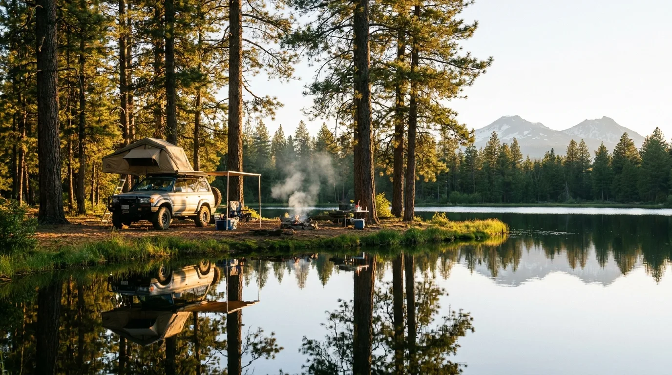
Bend is where the high desert hits a wall of young volcanoes. In forty-five minutes you go from sagebrush at 3,600 ft to a chain of alpine lakes strung under the Three Sisters. The catch is the calendar: the road that links them, the Cascade Lakes Scenic Byway, is gated by snow for roughly half the year, so the high country is really a late-June-to-October place. This issue is about getting the timing right — and about the volcano you can paddle in the morning and stand on top of by afternoon.
The rest of this journal is evergreen; this box is not. Central Oregon's signature roads — the Cascade Lakes Byway, the Newberry caldera road, Paulina Peak, McKenzie Pass, the Tumalo Falls road — all close for snow for six or seven months, and the exact open/close dates move year to year. Everything below is dated to the day we checked it. Trust the live sources, not our date stamp.
Most mountain regions give you rock and ice. Central Oregon gives you fire — geology so young and so raw you can touch it. Lava-dammed lakes, a drivable cinder cone, the youngest lava flow in the state, a caldera holding twin lakes, and 65 square miles of lava so lunar that NASA trained Apollo astronauts on it. That's the through-line: this whole trip is a living volcano.
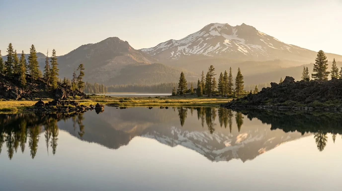
Sparks and several of its neighbours sit behind lava flows, not glacial dams — shallow, marshy and slowly filling in. That's why they're so mirror-flat at dawn and so good for reflections.
A huge shield volcano south of Bend with a ~5-mile caldera holding Paulina and East lakes — still geothermally active, with hot-spring seeps, obsidian and the youngest lava in Oregon.
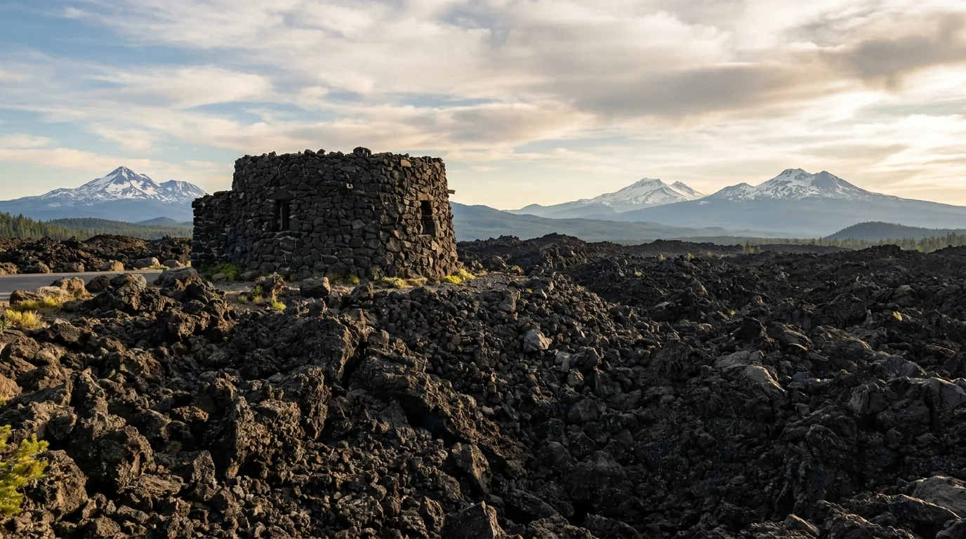
The basaltic lava fields at McKenzie Pass are so stark that NASA ran astronaut drills here in the 1960s. The Dee Wright Observatory is built out of that same black rock (§05).
This is the spine of the trip: a 66-mile National Scenic Byway (Forest Route 46) that climbs from Bend past Mt Bachelor and then strings together more than a dozen alpine lakes with the Three Sisters and Broken Top as a constant backdrop. Each lake has a personality — one you paddle in silence, one you waterski, one you fly-fish only. Here's how to read them.
| Lake | Elev. | The character | Boats / rules |
|---|---|---|---|
| Sparks | ~5,400 ft | The signature reflection paddle; shallow, lava-dammed, glass at dawn. ~26 mi W of Bend | Non-motorized |
| Devils | ~5,450 ft | A tiny, glowing turquoise pool (glacial silt); circle it in an hour. Also the South Sister trailhead, so it fills early | Paddle · rec pass to park |
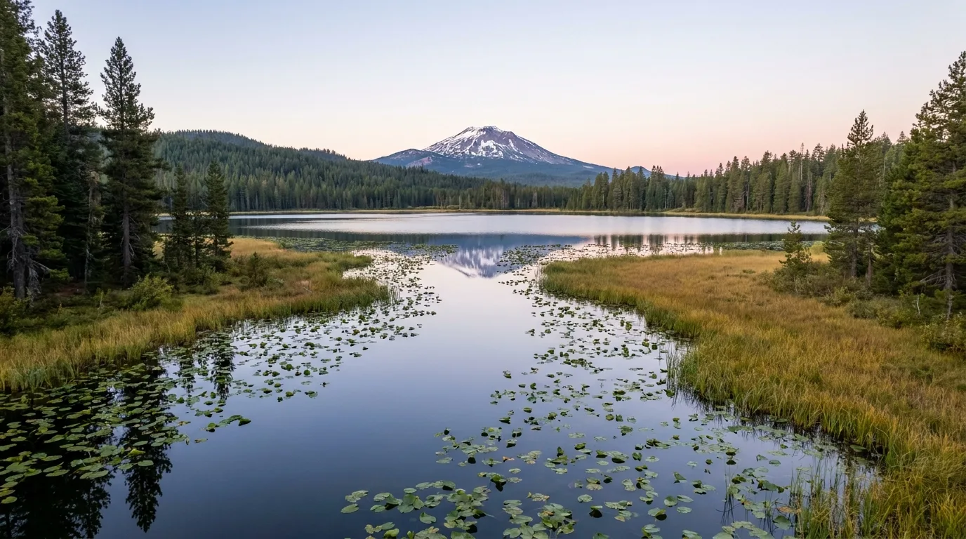
| Hosmer | ~5,000 ft | A two-lobe lake joined by a lily channel you paddle through; loons, herons, otters. A canoe paradise | Electric-motor only · fly-only, barbless |
| Elk | ~4,900 ft | The developed hub: resort, marina, swimming, sailing/windsurfing. Paddle early — afternoon wind chops it up | Motors ~10 mph limit |
| Cultus | ~4,668 ft | Clear, deep, sandy; the byway exception. 2 mi off the byway on FR 4635; resort + boat-in sites | Waterski / high-speed OK |
| Todd | ~6,150 ft | The highest Cascade lake here, under Broken Top. A 0.4-mi walk-in; snowmelt-cold. See §04 for the loop | Walk-in · quiet water |
⚠️ Elevations are from Wikipedia/TopoZone (anchor coordinates, not GPS-surveyed shorelines). Several day-use fees (Sparks, Elk, Hosmer, Cultus) are marked "verify" in our dataset — most are free day-use with a rec pass ($5/day or NW Forest Pass) needed at some trailhead lots; confirm at the lot. Crane Prairie reservoir (trophy "cranebows") and Lava Lake sit further down the byway.

Hosmer is the quiet one: electric motors only, fly-fishing only with barbless hooks (Atlantic salmon and brook trout, salmon released), and a lily-lined channel you paddle between its two lobes. It's Central Oregon's premier canoe and wildlife lake — bring binoculars for the loons. Two small campgrounds (Mallard Marsh, South) sit at the southwest end.
Cultus is the loud one: glacially clear, sandy-bottomed, and the rare byway lake that allows waterskiing and high-speed watercraft. Great for swimming, but paddlers should stick to the quieter west and north coves. A small resort, a 55-site campground and several boat-in sites ring the shore.
If the byway is fire-and-ice, Newberry National Volcanic Monument is fire up close. A shield volcano with a five-mile caldera holding two lakes, a mile of jet-black obsidian only 1,300 years old, a drivable cinder cone, and a 7,984-ft rim you can reach on four wheels for the best sunset in the region. One $5 pass covers the whole monument.
A 500-foot cinder cone with a steep paved road to a fire lookout and a 360° Cascades view; a rim loop circles the crater and trails at the base cross the 7,000-year-old lava flow. 🔴 Access is controlled: private cars need a timed permit mid-April to mid-June and after Labor Day; in peak summer it's shuttle-only from the Lava Lands Visitor Center (cars not allowed up, ~10am–4pm). VC open ~early April to mid-October. $5 monument pass (or NW Forest / America the Beautiful).
The high point of the caldera rim, looking straight down onto Paulina and East lakes, the obsidian flow, and out to the whole Cascade volcano line. A steep, dusty, narrow 4-mile gravel road (vehicles under 23 ft) climbs to the top; a trail also reaches it. Often snow-blocked until early July and closing by late October. The best sunset panorama in the region — go in the evening.
A ~1-mile interpretive loop (distanceKm 1.6, ~60 m gain ⚠️ unverified) across Oregon's youngest lava. Stairs and boardwalk, interpretive signs, no shade. Obsidian is literally volcanic glass — stay on trail, wear sturdy shoes.
An ~80-ft twin waterfall spilling over the caldera rim just below Paulina Lake. A short paved path reaches the top-of-falls overlook; a steeper 0.3-mile trail switchbacks to a lower viewpoint. Height per NW Waterfall Survey.
Twin lakes in the caldera — fishing (browns, kokanee), boating and hot-spring seeps. Three campgrounds ring them (§06). The whole caldera shares the late-opening season; Paulina Lake Road closes to cars ~Nov 15.
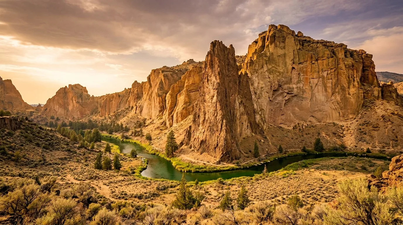
Twenty-odd miles north of Bend the forest drops away and the Crooked River carves a canyon of welded tuff and basalt into the high desert. This is Smith Rock State Park — world-class sport climbing, a brutally good ridge hike, and a 350-foot spire called Monkey Face. It's the year-round card in the deck: open when the byway is buried, but dangerous in the midday summer heat.
The classic Smith Rock circuit: steeply up Misery Ridge on switchbacks and stairs, past the 350-ft Monkey Face spire, then down to the Crooked River and back flat on the River Trail. The full loop is roughly 6.2 mi / ~1,768 ft gain; the ridge climb alone is about a mile and brutally steep. World-class sport climbing lines the tuff and basalt walls the whole way.
Heat is the hazard: no shade on the ridge, high-desert sun. Start early, carry water. $10/vehicle day-use. Leashed dogs allowed, but the stairs are hard on them; not one for small kids.
The Deschutes River is Bend's spine — it runs right through town, over a lava dam at Benham Falls, and up a snowmelt creek to a 97-foot plunge just west of the city. Add a seasonal lava-field observatory on McKenzie Pass, and you've got the shoulder-season and family-friendly half of the trip: short walks, big scenery, minimal alpine commitment.
One of Bend's most accessible big waterfalls: the overlook is a two-minute walk from the lot, and trails continue up Tumalo Creek past a string of smaller falls into prime mountain-bike country. ~14 mi west of downtown Bend. 🔴 The catch is access: the last ~3 miles of Skyliners/FR 4603 are gated by snow roughly November–May, adding a long walk or ride in the off-season. $5 day-use (or NW Forest Pass).
Not a vertical drop but a long, thundering rapid where the Deschutes squeezes past a lava dam near Sunriver. An easy ~1.5–2 mi round-trip on the Deschutes River Trail from the Benham Falls East/West day-use areas reaches the best viewpoints; the wider trail links Bend to Sunriver for cyclists. Flat and family-friendly — but keep well back from the powerful current. $5 day-use.

A lava-rock observatory (~5,187 ft) with windows framing named Cascade peaks and a bronze "peak finder" on the roof, ringed by 65 square miles of black lava so lunar NASA trained astronauts here. The half-mile Lava River interpretive loop threads the flows. 15 miles west of Sisters.
🔴 Highway 242 is seasonal — a narrow road closed by snow most of the year. Earliest legal opening is the third Monday in June, closing by early November. Verify the gate on ODOT's McKenzie Highway page before you route through it.
The camping here splits cleanly by season. A handful of year-round developed parks close to Bend give you the reliable backbone; the byway and Newberry sites are the alpine dream but only run ~late May to October and fill the day they open. The strategy is simple: book the high-country sites the moment they release, and keep a year-round base as your fallback.
Tumalo State Park — the closest developed base, ~4 mi N of Bend on the Deschutes. 23 full-hookup, 54 tent, 7 yurts; showers, dump station. $20 tent / $30–35 full hookup / $62+ yurt. Reserve early.
LaPine State Park — south, on the upper Deschutes. Full/electric hookups, cabins, and Oregon's largest ponderosa (the "Big Tree"). $19–40. Year-round.
RV full-service in Bend: Crown Villa RV Resort (S Bend, big-rig friendly, full hookups) and Scandia RV (full hookups + dump station).
Mostly no hookups, a mix of reservation and first-come:
Reservation, flush toilets, snow-closed in winter, ~$27–29/night:
Climbers: Smith Rock Bivouac — walk-in, tent-only, ~$12–15/person, no RVs (max 20-ft vehicle), showers.
⚠️ Source honesty: several site counts, base fees and season dates (Soda Creek, Devils Lake, Elk, Mallard Marsh, Cultus, Todd Lake) are Recreation.gov/USFS-sourced where we could confirm them and flagged where we couldn't. The 2026 dates shown are the ones our data captured this year and will change — confirm on Recreation.gov before you rely on a date.
Central Oregon is easy to reach and easy to run out of gas in. Bend has everything — fuel, groceries, medical, gear, a bike shop on every corner — but the moment you turn onto the byway or drop into the Newberry caldera, the services stop. This is the logistics you sort in town, not on the road.
Central Oregon has no single park gate; you'll juggle three fee systems:
Nothing here is exotic, but the hazards are specific: snowmelt water cold enough to be dangerous in July, altitude that surprises people, high-desert heat with no shade, volcanic glass underfoot, and the seasonal-road reality that dominates every plan. None of it should stop you — all of it should shape your dates.
| Zone | Realistic window |
|---|---|
| Cascade Lakes Byway (high) | mid-June – mid-Oct |
| Newberry caldera | late June – mid-Oct |
| Paulina Peak summit road | early July – late Oct |
| Smith Rock | year-round; best Apr–May & Sept–Oct |
| Tumalo Falls (drive-up) | late May – Oct |
| McKenzie Pass / Dee Wright | ~3rd Mon June – early Nov |
| Bend / Deschutes in town | year-round |
The pattern: the higher and the further from Bend, the shorter and later the season. Smith Rock and the in-town river carry the shoulder seasons; the alpine lakes and summits are a July-to-September show.
Run it before you leave. Tap each item as it's done — these are the ten things specific to Central Oregon that a general road-trip habit will skip. Most of them come back to two facts: the roads are seasonal, and the services stop at the edge of Bend.
Every guide has these. Most don't print them. On a trip this seasonal — where the difference between a great day and a locked gate is a snow-removal schedule — a confident wrong number costs more than an admitted gap. Here's what we hedged and why.
Everything above, condensed into a print-ready PDF built for the glovebox — for a region where the fuel stops at the edge of Bend, the cell dies past Mt Bachelor, and the best roads open on a snow-removal schedule. The lake-by-lake byway breakdown, the Newberry permit-and-shuttle reality, the Smith Rock and river beta, the fourteen campgrounds and the release-day booking move, the three-agency pass puzzle, the cold-water and smoke plan, and the honest list of what nobody could confirm — on paper that works where the signal doesn't.
Every Trekkr Trail Journal is built like this one: custom logistics, honest trail beta, the camping and access detail, and the local knowledge that turns a good trip into the one your crew talks about for years — including, always, a plain list of what we could not confirm. New destinations drop all season long, from the BC corridors to the Oregon Cascades.
Unlock the Trail Journal Library