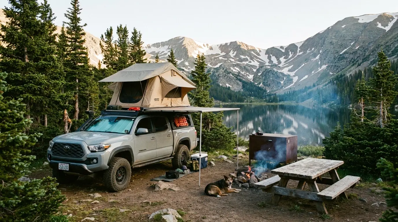
BeartoothMontana & Wyoming — Beartooth Highway & the Absaroka-Beartooth
Charles Kuralt called it the most beautiful drive in America, and then most people plan it like a scenic detour and discover it is a weather-gated, 11,000-foot mountain crossing with no fuel, no cell signal, and a habit of closing for snow in July. The Beartooth Highway climbs from Red Lodge over an alpine plateau of tundra and glacial lakes to Yellowstone's quiet Northeast gate. This issue is about the one date that governs the whole trip, the campgrounds along the corridor, the altitude and the grizzlies — and an honest account of what nobody could confirm.
Montana · WyomingUS-212 · 68 miles · 10,947 ftPlateau lakes & the high passesAbsaroka-Beartooth Wilderness
10,947 ftWest Summit — the high point of the highway
~68 miRed Lodge to Cooke City — no fuel between
Late May–mid-OctThe only window US-212 is open — snow-gated
0 barsCell coverage across most of the plateau
Conditions checked 21 July 2026 · The highway's open/closed status is the headline risk · This block goes stale — the links don't
The road you are planning around is closed most of the year, and can close again tomorrow
The rest of this journal is evergreen; this box is not. The Beartooth Highway is not a road you drive whenever you like — it is a seasonal alpine crossing, and the difference between a trip and a locked gate is entirely a matter of dates and weather. Everything below is dated to the day we checked it. Trust the live sources, not our date stamp — and read the Safety section (§07) before you go.
US-212 opened 23 May 2026, and closes for the season in mid-OctoberThe 2026 opening was scheduled for May 22 and slipped one day to May 23 because of a winter storm. It typically closes in mid-October — the last day of the 2025 season was October 14 — but the 2026 closing date had not been announced at press.[VERIFY AT PUBLISH — do not print a specific 2026 close date until MDT/NPS announce it]
It can close for snow inside the open season — including in JulyThis is not a formality. Winter weather crosses the plateau in every month, and MDT closes the pass temporarily for snow and ice at short notice. Never plan a day that depends on the Beartooth being open at a specific hour without checking Montana 511 and Wyoming's WYDOT that morning.
Altitude is the hazard people underestimateThe West Summit is 10,947 feet; the Wyoming-side campgrounds sit near 9,000–9,500. Altitude sickness is common above a mile — headache, nausea, shortness of breath. Give yourself an easy first day, hydrate, and descend if symptoms build. (§07)
This is grizzly country — the food rules are legally enforcedThe Absaroka-Beartooth and the plateau sit in the greater Yellowstone grizzly ecosystem. The Custer Gallatin food-storage order runs March 1 – December 1, and several campgrounds near Cooke City are hard-sided-only after a fatal 2010 grizzly attack. Carry bear spray on your hip. (§07, §08)
No fuel and almost no cell signal on the plateauThere is no gas station in the 68 miles between Red Lodge and Cooke City, and cell coverage across the plateau is effectively nil. Fuel up and download offline maps before you climb. (§09)
Fire danger changes constantly — check before any campfireWe print no restriction status because it resets on its own schedule across two national forests. Check the Custer Gallatin and Shoshone current conditions the day you arrive. [VERIFY AT PUBLISH — changes without notice]
The Chief Joseph Byway (WY-296) is the shoulder-season back doorWhen US-212 over the plateau shuts, WY-296 over Dead Indian Pass usually stays open and is the way east to Cody — but it too can close in storms. (§02)
You are not driving a scenic route. You are crossing an alpine plateau.
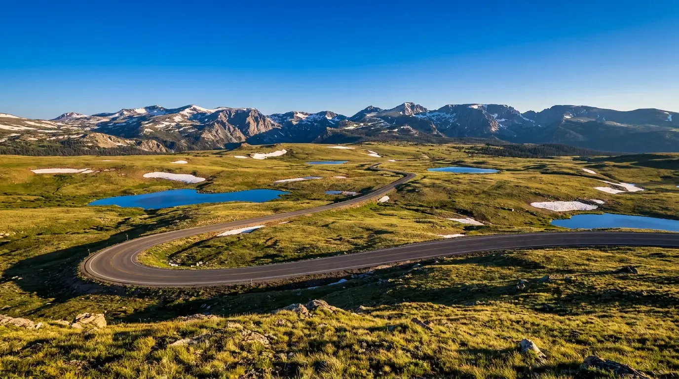
The Beartooth Highway (US-212) runs roughly 68 miles from Red Lodge, Montana, over the Beartooth Plateau to Cooke City and Yellowstone's Northeast Entrance, topping out at the West Summit of Beartooth Pass at 10,947 feet. It is regularly called the most beautiful drive in America, and it earns it — switchbacks, hairpins, tundra, snowfields all summer, and a hundred alpine lakes. But it is a genuine high-mountain crossing, and it punishes the assumptions people bring from ordinary road trips: that the road is always open, that there will be fuel, that the weather at the bottom is the weather at the top. None of those hold here.
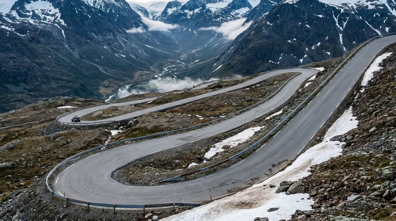
The Red Lodge switchbacks. The Montana side climbs the Rock Creek headwall in a stack of hairpins to the plateau. It is the reason the road opens so late and closes so early: this is where the snow drifts deepest, and where the plows work longest each spring.
The date is the trip
Not which overlook, not which lake. Whether the road is open at all. US-212 is open only from late May to mid-October, snow-dependent, and closes temporarily inside that window. Confirm before you commit a drive.
Two forests, two states
The corridor crosses the Custer Gallatin National Forest (Montana, near Red Lodge) and the Shoshone National Forest (Wyoming, on the plateau). Rules, ranger districts and reservation systems differ by side (§08).
Real altitude, real weather
You will sleep near 9,000 feet and drive over 10,900. Afternoon thunderstorms and lightning above treeline are routine, the water is snowmelt-cold, and this is grizzly country. The answer is preparation, not fear (§07).
The way to think about this region — a corridor with three worlds
Picture the trip as three zones strung on one road. The Montana foot at Red Lodge (~5,600 ft) — real town, groceries, fuel, the Rock Creek campgrounds, the switchbacks. The plateau top in Wyoming (9,000–11,000 ft) — Rock Creek Vista, the West Summit, Clay Butte, and the Beartooth and Island lake country, all of it above treeline and snow-gated. And the Cooke City end (~7,600 ft) — a tiny outpost four miles from Yellowstone's Northeast gate, with limited services and hard-sided-only camping nearby. Plan which zone you sleep in against what you came for, and never assume you can nip back for something you forgot: it's a long, slow, high road between them.
02 / THE ROAD
One highway, one short season, and the byway that outlasts it
The Beartooth Highway is the star, but it is only open for roughly five months, and even then it can shut for snow. Understanding its window — and the Chief Joseph Scenic Byway that stays open longer — is the difference between a route that exists and one that doesn't. Get these dates wrong and your plan is a locked gate at 8,000 feet.
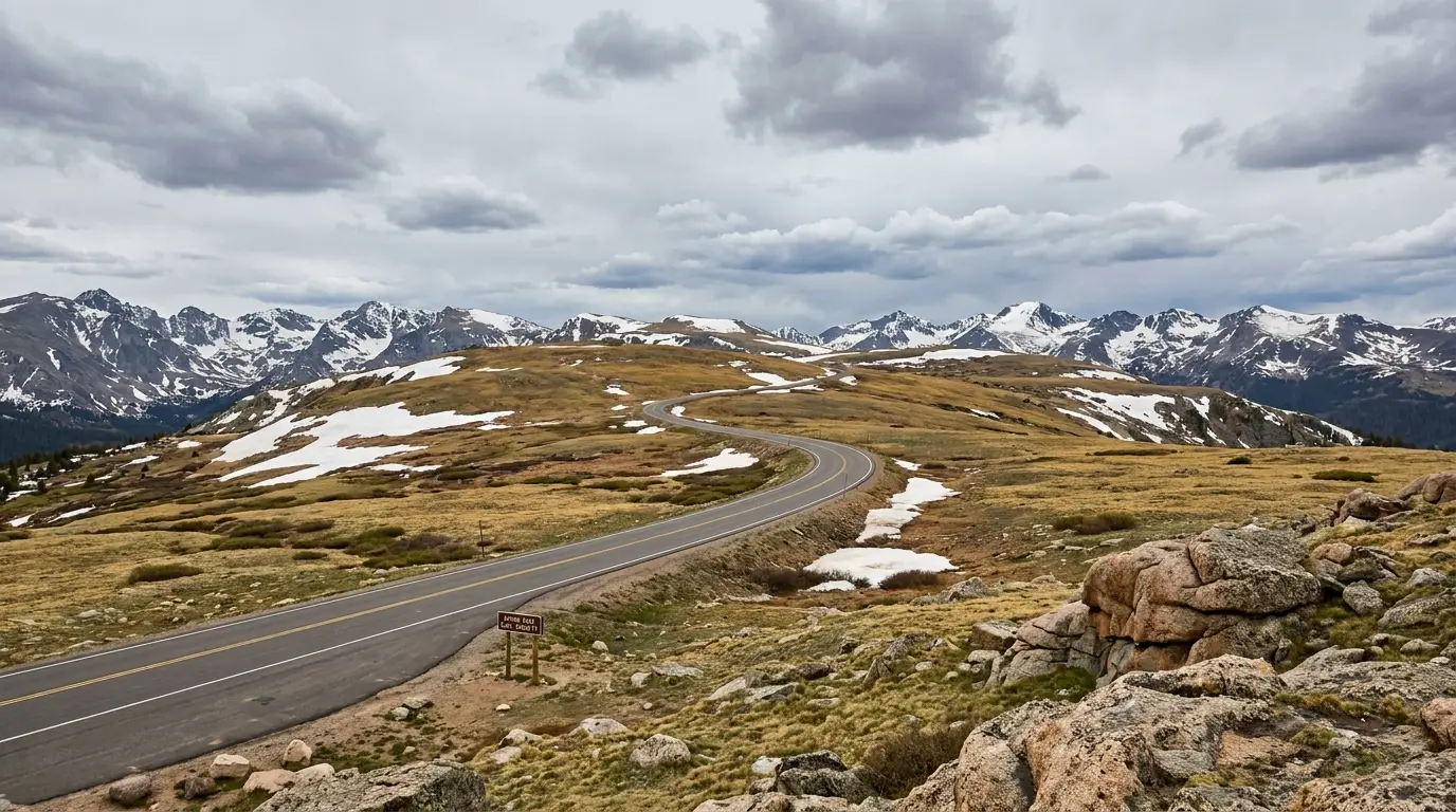
The West Summit, 10,947 feet. The high point of the highway sits in genuine alpine tundra, above the last trees, with snowfields that never fully melt. Snow can fall here in July, and afternoon lightning on this open ground is a real hazard — do not linger high in a building sky.
Segment / road
2026 opens
Closes
Why it matters
Beartooth Highway (US-212), Red Lodge – Cooke City
May 23 (scheduled 22)
Mid-October (2026 date not announced)
The itinerary-maker. The whole plateau — Rock Creek Vista, West Summit, the lakes — hinges on this. Can close for snow any time inside the window
US-212, Cooke City – Northeast Entrance (Yellowstone)
Year-round
—
Open all year, but in winter reachable by car only through Yellowstone from Gardiner once the plateau closes
Chief Joseph Scenic Byway (WY-296), Dead Indian Pass
Year-round (weather permitting)
—
Stays open far longer than the Beartooth — the shoulder-season exit east to Cody. Can still close in storms
West Fork Road (Basin Lakes trailhead, Red Lodge)
Mid-April
Early December
Gated roughly Dec 2 – Apr 14; no drive-in trailhead access in winter
All dates are weather-dependent. The 2026 Beartooth opening slipped a day for a storm, and the road closes temporarily for snow through the summer. Reconfirm within 72 hours at Montana 511 (mdt.mt.gov/travinfo), WYDOT (wyoroad.info) and the NPS Beartooth Highway page.
🔴 The two things that catch people outOne: the "62/68-mile" drive is a half-day, not an hour. With the switchbacks, the altitude, the photo stops and the wildlife, plan on 3–4 hours minimum to drive it properly one way — and it is a destination, not a shortcut to Yellowstone. Two: once the Beartooth closes, Cooke City becomes a near dead-end. The Cooke City–Northeast Entrance stretch stays open, but in winter you can only reach it by driving through Yellowstone from Gardiner — in at the North Entrance, past Mammoth, and 50-odd miles east through Lamar Valley. Budget fuel, groceries and medical contingency for that reality if you are travelling the shoulder seasons.
The Chief Joseph Scenic Byway (WY-296)
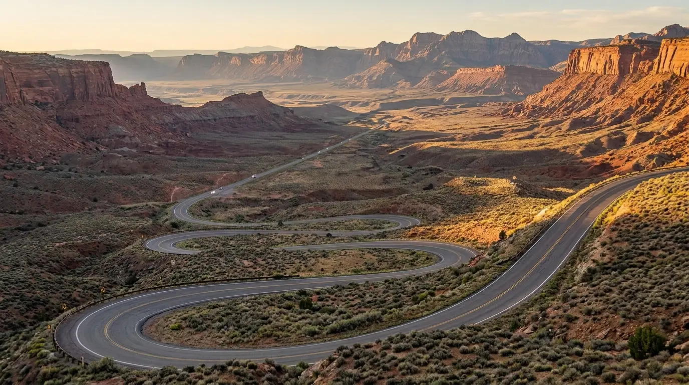
A 47-mile road that leaves the Beartooth Highway near Cooke City, climbs over Dead Indian Pass at 8,071 feet, and drops through seven switchbacks into Sunlight Basin and the Clarks Fork Canyon before reaching WY-120 north of Cody. The summit has a turnout with interpretive signs and restrooms and a huge view.
Two reasons to build it into your plan: it is a spectacular drive in its own right — the high Sunlight Creek Bridge over Sunlight Gorge is the highest bridge in Wyoming — and it is the shoulder-season and stormy-day alternative when the Beartooth Plateau is snowed shut. Pairing US-212 in and WY-296 out (or the reverse) makes a superb loop from Cody.
Open far longer than US-212Dead Indian Pass 8,071 ftConfirm winter status in storms
There is no entrance fee for the highway — but the plateau has real teeth
The Beartooth Highway itself is free to drive; there is no gate and no timed-entry reservation. If your route continues into Yellowstone at the Northeast Entrance, standard park fees apply ($35 per private vehicle, 7 days; the $80 America the Beautiful annual pass covers it and every other federal fee area). What the plateau charges instead is in weather and altitude: no services, sudden storms, and a road that closes on its own schedule. Respect that and the drive is the trip of the summer.
03 / THE PLATEAU
Above the trees — the overlooks, the lakes and the fire tower
This is the half of the trip people picture: the tundra top of the Beartooth Plateau, strung with pull-offs, glacial lakes and hundred-mile views. These are drive-up or short-walk stops, but every one of them sits high and exposed, and the weather can turn in minutes. Do the high stops in the morning before afternoon storms build over the plateau.
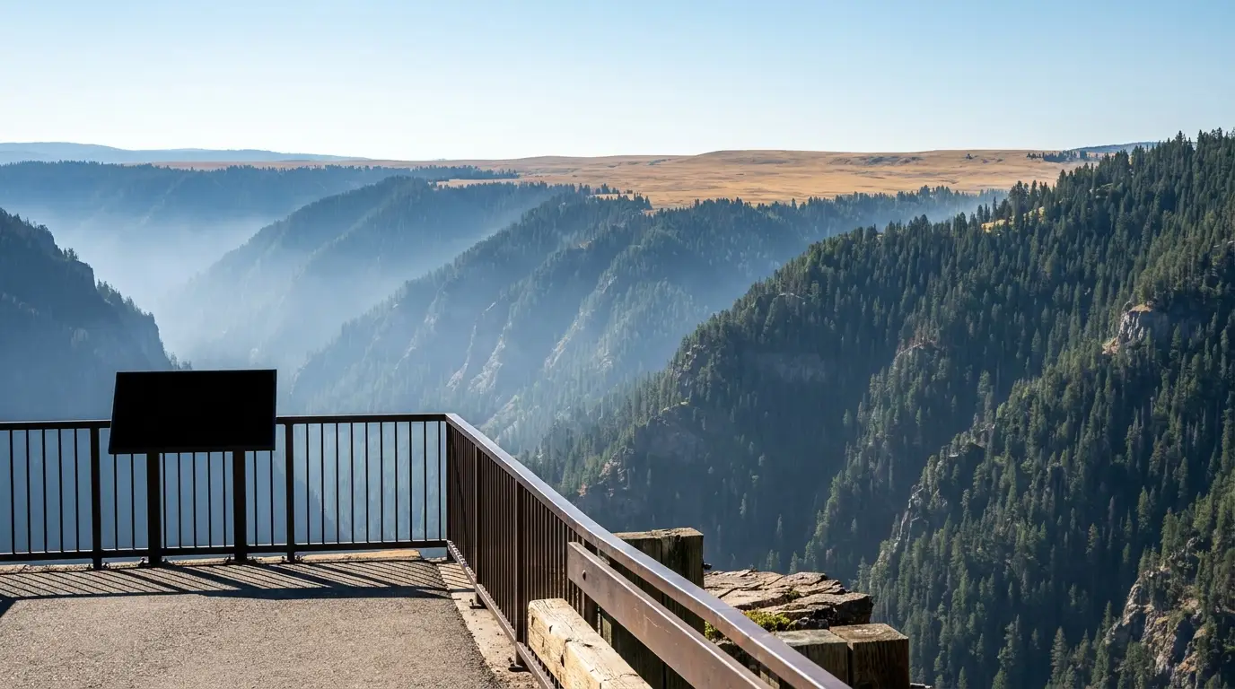
Rock Creek Vista Point, 9,190 feet. The first big pull-off above the switchbacks, and the one genuinely wheelchair-accessible viewpoint on the corridor — a short paved path to a railed platform above the Rock Creek Canyon and the Hellroaring Plateau.
The easiest big view on the Montana side · paved & accessibleRock Creek Vista Point
A rest area and interpretive overlook at about 9,190 feet, roughly 21 miles from Red Lodge, with a short (about 0.2-mile) paved, wheelchair-accessible path to a railed platform looking straight down the glacial Rock Creek Canyon toward the Hellroaring Plateau. Restrooms on site. It's the natural first pull-off above the switchbacks and the best accessible viewpoint on the corridor. Allow 20–40 minutes.
Even here you are near 9,200 feet and fully exposed — afternoon lightning is a real risk, so do this early if the sky is building. The paved path is genuinely wheelchair-navigable, a rarity out here.
Paved 0.2-mi accessible path9,190 ft · restroomsExposed — watch the sky
~0.2 mi paved loop · 9,190 ft 21 mi from Red Lodge
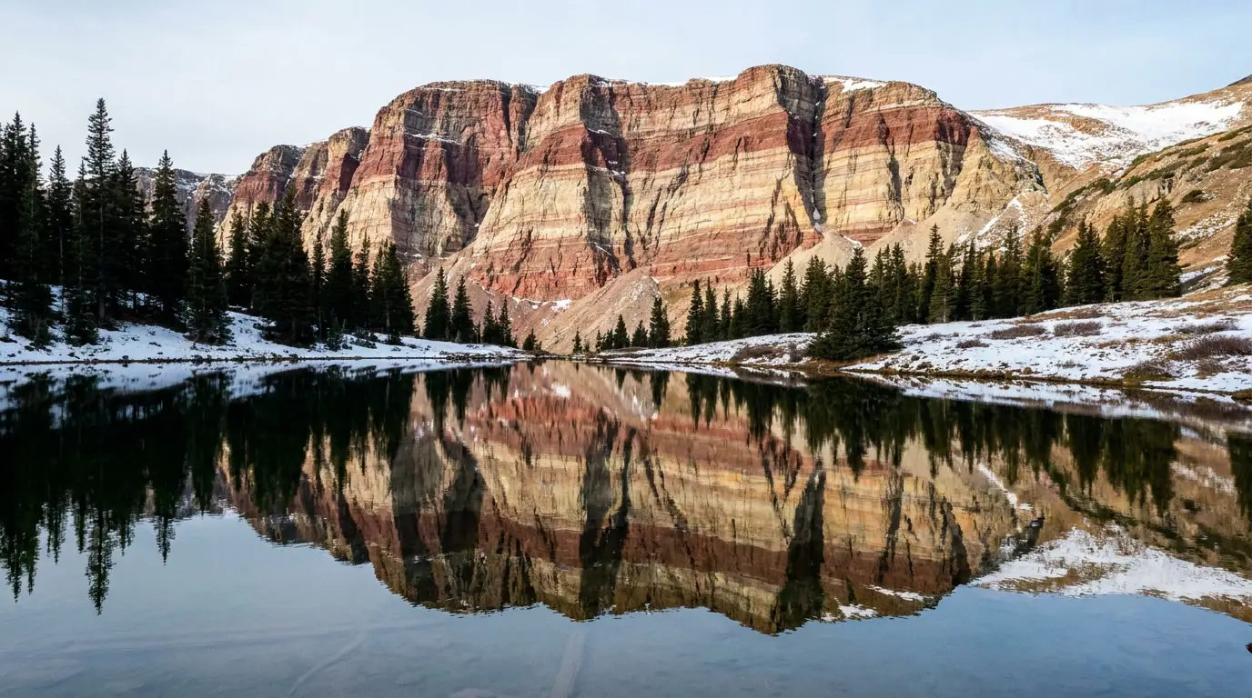
Beartooth Lake, beneath Beartooth Butte. The layered cliff of the Butte is one of the oldest exposed rock stories on the plateau. The lake is cold, clear, stocked with trout, and steps from a first-come campground — but the water is dangerously cold year-round and afternoon wind builds fast.
Beartooth Lake & Beartooth Butte
A classic plateau lake at about 9,000 feet under the banded cliff of Beartooth Butte. Trout fishing, canoeing and kayaking, shoreline picnicking, and a short walk to Beartooth Falls where the outlet drops off the plateau. A first-come campground sits on the shore (§08).
Cold-water reality: plateau lakes stay frigid all summer, and a capsize far from help is serious. There are no services and no lifeguards. Store food securely — this is grizzly country.
~9,000 ft · trout & paddlingWater dangerously cold
Island Lake & the High Lakes
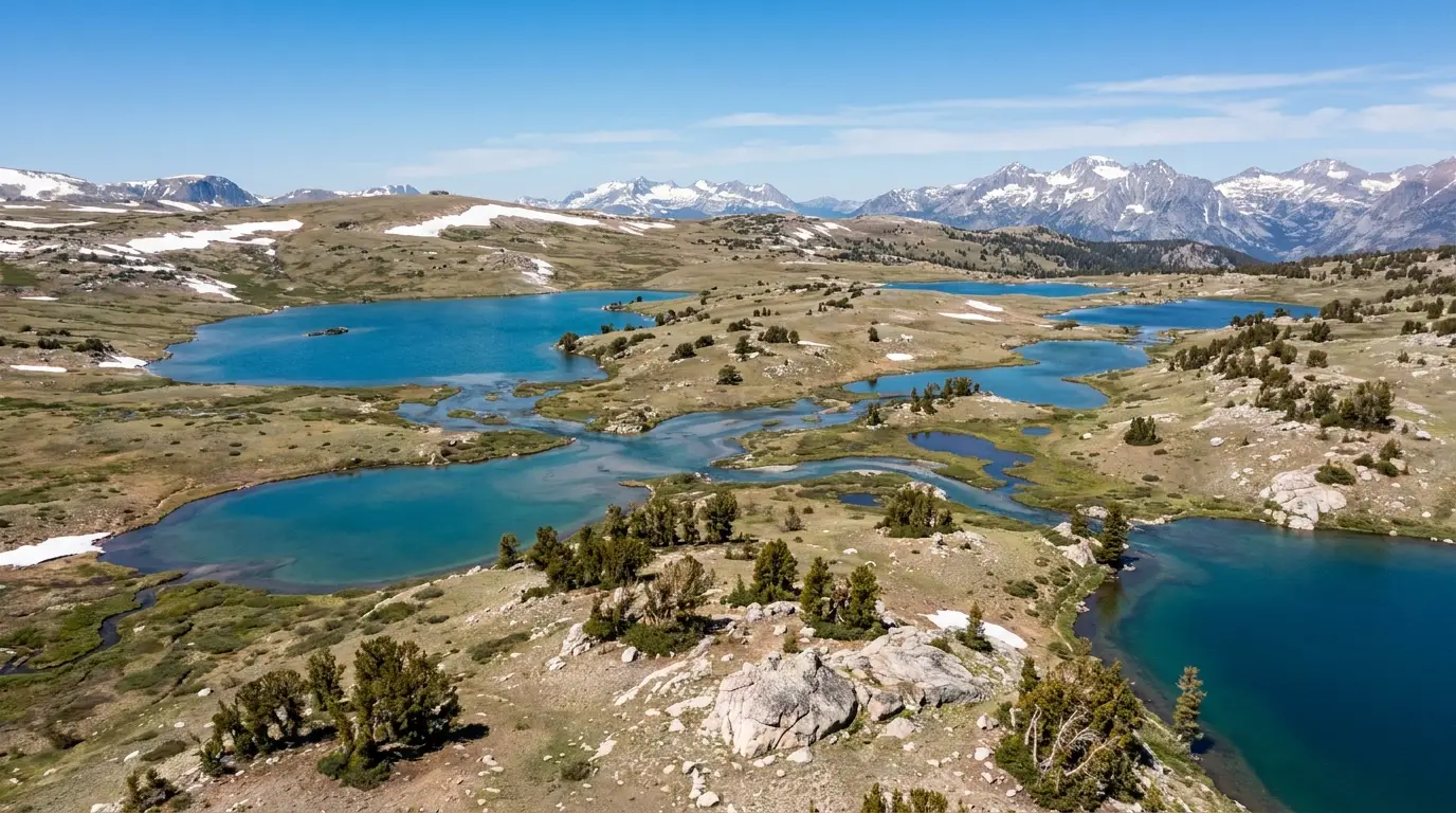
At roughly 9,500 feet, Island Lake is the main trailhead into the Beartooth High Lakes — a tundra plateau dotted with dozens of alpine lakes on relatively gentle grades. Day hiking, fly fishing and light backpacking all launch from here, and a first-come campground sits at the lake.
Fully exposed alpine terrain: no shade, afternoon lightning, sudden snow any month, and grizzlies. Trails hold snow into July. Carry a map — the network of spur trails is easy to lose track of.
~9,500 ft · High Lakes trailheadSnow lingers into July
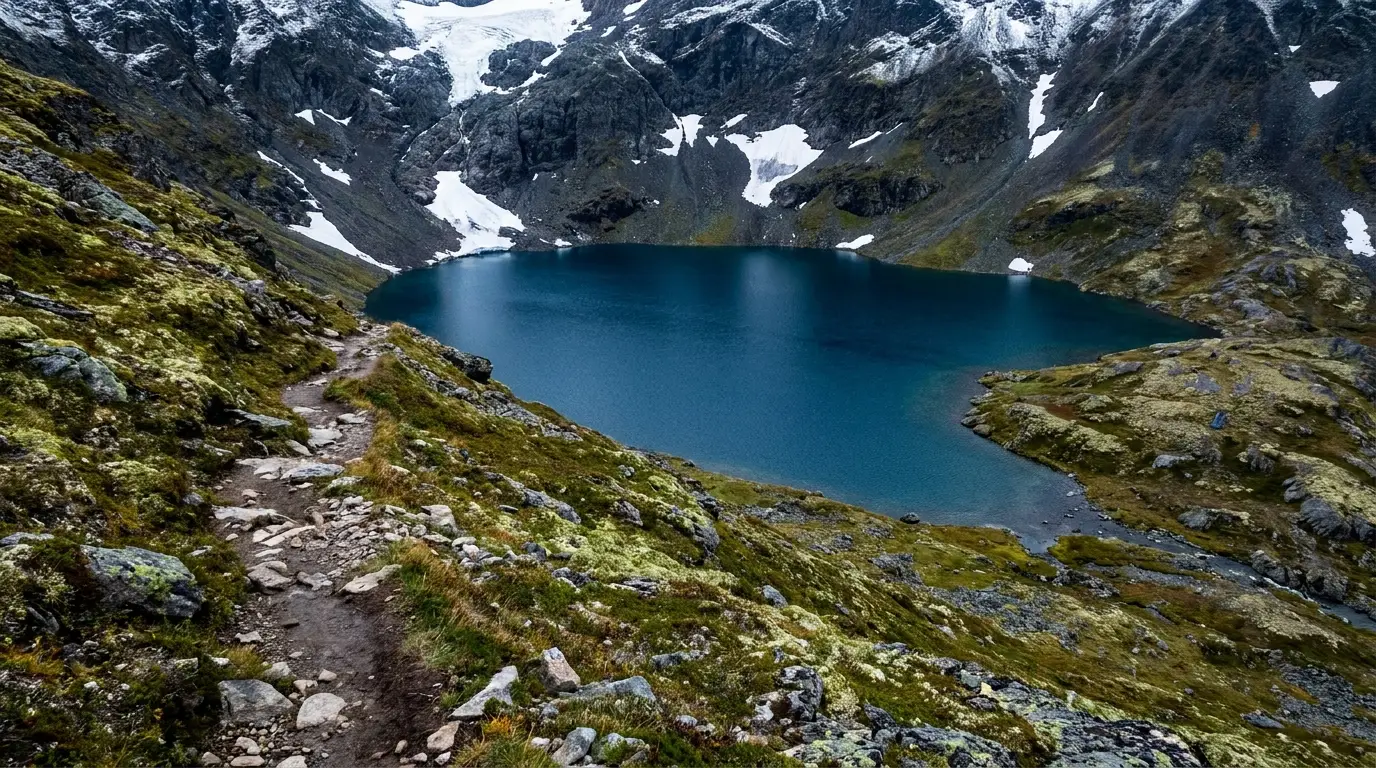
The Beartooth High Lakes, from Island Lake. Above the trees the plateau flattens into a maze of interconnected alpine lakes on surprisingly gentle grades — day-hiking, fly-fishing and light backpacking country, snow-covered into July and fully exposed to the weather.
A 1942 fire tower off a gravel spurClay Butte Fire Lookout
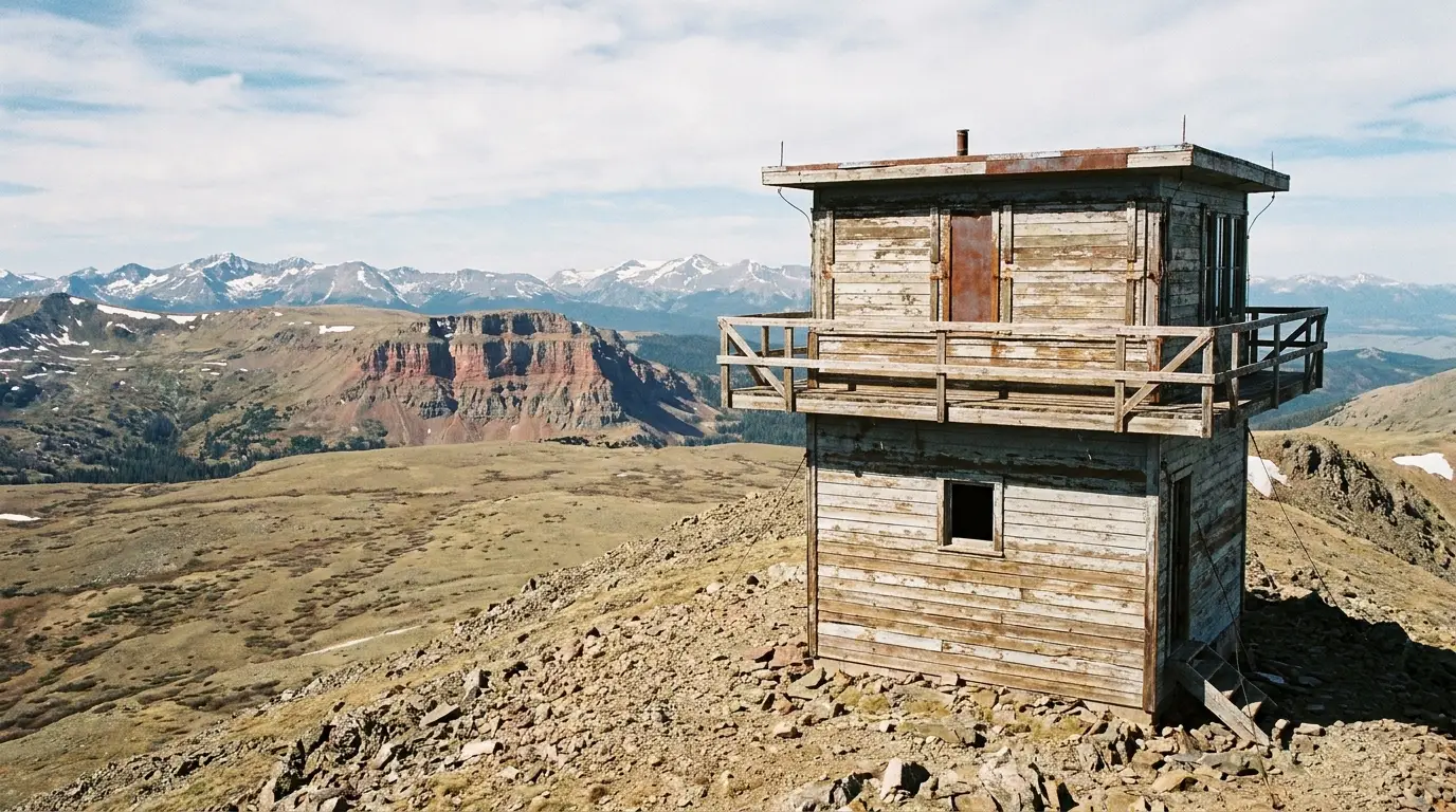
A Civilian Conservation Corps fire lookout built in 1942, reached by a gravel Forest Service road (FR 142) that climbs about half a mile off US-212 to roughly 9,800 feet. Indoor and outdoor observation decks give sweeping views over the plateau, Beartooth Butte and the Absaroka Range, and a staffed interpretive display is sometimes open in summer.
The spur road is unpaved, high and clears later than the main highway — it can be rough, snow-blocked early season, or gated. Not ideal for low cars or big trailers. Confirm it's open before committing.
Gravel FR 142 · ~9,800 ftSpur clears late — confirm open
~0.5 mi gravel spur off US-212 1942 CCC fire lookout
Clay Butte Fire Lookout. A 1942 Civilian Conservation Corps tower up a rough gravel spur, with indoor and outdoor decks and one of the best panoramas on the plateau — out to Beartooth Butte and the Absaroka Range. The spur clears late; confirm it's open before you turn off.
The West Summit, Twin Lakes headwall & the summer ski hill
The highway's West Summit at 10,947 feet is the roof of the drive — a broad tundra pass with pull-offs and snowfields that last all summer. Just below it, the Twin Lakes headwall is home to the small Beartooth Basin summer ski area, one of the only lift-served summer ski operations in North America, which runs a short season on the snowfield when conditions allow (its 2026 season was set to close June 28). You don't need to ski it to enjoy the spectacle of people carving turns in July beside the road. As everywhere up here: watch the weather, don't linger high in a storm, and take the altitude seriously.
04 / THE HIKES
From roadside strolls to wilderness passes
The Beartooths hold some of the finest alpine hiking in the Lower 48 — but the terrain is unforgiving: high, exposed, snow-late, and grizzly-inhabited. Distances and elevation figures below are planning estimates gathered from trail guides, not GPS-verified surveys, and where sources disagree we say so. Start early, watch the sky, and hike in groups of three or more with bear spray on your hip.
Gardner Lake, below the pass. Three-quarters of a mile down from a highway pull-off near the West Summit — and close to a thousand feet of climbing to get back out, at nearly 11,000 feet. A lot of alpine scenery for very little distance, and a good lesson in what altitude does to an "easy" hike.
A lot of tundra for very little distanceGardner Lake Trail
A short trail dropping from a pull-off near the top of the pass (between the Beartooth Basin ski area and the West Summit) down to Gardner Lake — roughly three-quarters of a mile one way, but descending close to 1,000 feet, so the return is a genuine steep climb. Big alpine-tundra scenery, fishing at the lake, for minimal mileage.
Because you start near 10,800 feet, this is harder than the distance implies — the climb back out at altitude gets people. Snow lingers here into midsummer. Watch the weather; you are fully exposed.
~0.75 mi each way · steep~1,000 ft climb back at 10,800 ft
~1.5 mi round trip ~1,000 ft down, then up · high altitude
The signature plateau day hikeBeauty Lake & Beartooth High Lakes Loop
A loop from the Beartooth Lake trailhead that strings together several alpine lakes — commonly Beauty, Crane and Claw — on the tundra plateau. Numerous spur trails let you shorten or extend it, and a point-to-point between Island Lake and Beartooth Lake is possible with a shuttle. Superb fishing and lake scenery throughout.
Published distances vary widely by route — roughly 5 to 8+ miles depending on the loop, so treat any single figure as an estimate and carry a map and compass or GPS. Fully exposed above 9,000 feet: afternoon storms, no shade, cold water, and grizzlies. Snow into July.
~5–8+ mi (route-dependent)Exposed · grizzly country
Loop from Beartooth Lake TH Beauty · Crane · Claw lakes
The best half-day hike from Red LodgeBasin Lakes National Recreation Trail (#61)
A steady forest climb off the West Fork Road southwest of Red Lodge — about 4 miles one way, roughly 2,000+ feet of gain, past Basin Creek Falls to the Lower and Upper Basin Lakes. Ample trailhead parking and a vault toilet; rated moderate, with a high payoff-to-effort ratio. Allow 3–5 hours.
The access West Fork Road is gated roughly December 2 – April 14, so there is no drive-in trailhead access in winter. Grizzly country: hike in groups, make noise, carry spray. Steep, sustained climb — carry water.
~4 mi each way · 2,000+ ftWest Fork Rd gated Dec–Apr
~8 mi round trip · 2,000+ ft Lower & Upper Basin Lakes
A full wilderness commitmentLake Fork of Rock Creek (toward Sundance Pass)
One of the great Absaroka-Beartooth Wilderness routes from near Red Lodge: the Lake Fork trail climbs the Lake Fork of Rock Creek past waterfalls and alpine lakes (Lost Lake, Keyser Brown Lake) and continues over Sundance Pass into the West Fork — a long, strenuous day or a multi-day backpack with several thousand feet of gain (a through-route is cited around 3,800 feet of climb). Walk the lower valley for an easy family outing, or commit to the full alpine crossing.
Serious grizzly country and serious altitude. Groups of three or more, spray on the hip, noise on blind corners. The upper basin holds snow much of the year. Distances and gain are planning figures, not GPS-verified.
Day hike or multi-day backpackGrizzly country · big elevation
Lake Fork → Sundance Pass ~3,800 ft to the pass (est.)
Crazy Creek Falls — the short one near Cooke City
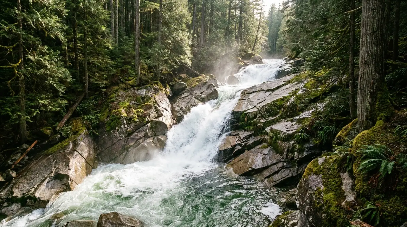
A short trail from the Crazy Creek Campground / trailhead on US-212, about 11 miles east of Cooke City, leads to Crazy Creek Falls — less a single plunge than a long, loud whitewater cascade over granite slabs, at its most thunderous in early-summer snowmelt. An easy family walk to the lower viewpoints.
The terrain above the lower views is steep and the wet rock is lethally slick — keep well back from the edge and keep children close. Grizzly country; make noise. A good leg-stretch on the Cooke City end when the high plateau is fogged in.
Short walk · family-friendly belowSlick wet rock · steep above
🔴 Granite Peak is not a hike — know the difference
The Beartooths hold Granite Peak, the highest point in Montana at roughly 12,800 feet. It is a genuine technical mountaineering objective — exposed scrambling and climbing, glacier travel, and a long committing approach — not a trail you walk up. It kills people who treat it as a hike. If it's on your list, go with a qualified guide or the right skills, gear and experience. For everyone else, the plateau's lakes and passes are the reward, and they are more than enough.
05 / THE GATEWAYS
Red Lodge, Cooke City, Cody — and the wild Northeast gate
Three very different towns anchor this corridor, and choosing your base is a real decision. Red Lodge is a full-service Montana town at the foot of the switchbacks. Cooke City is a tiny, service-thin outpost at Yellowstone's back door. Cody, off to the southeast, is the best resupply on the Wyoming side. Provision deliberately — the gap between them is a slow, high, fuel-free road.
Red Lodge, MT — the base camp
At about 5,600 feet at the northern foot of the highway: real groceries, fuel, fly shops and gear stores, restaurants and breweries, a historic Broadway main street, and Red Lodge Mountain just west (skiing in winter, lift rides and disc golf in summer). This is the last full resupply before the plateau — fuel and provision here. The Rock Creek campgrounds sit 12 miles south.
Cooke City / Silver Gate, MT — the outpost
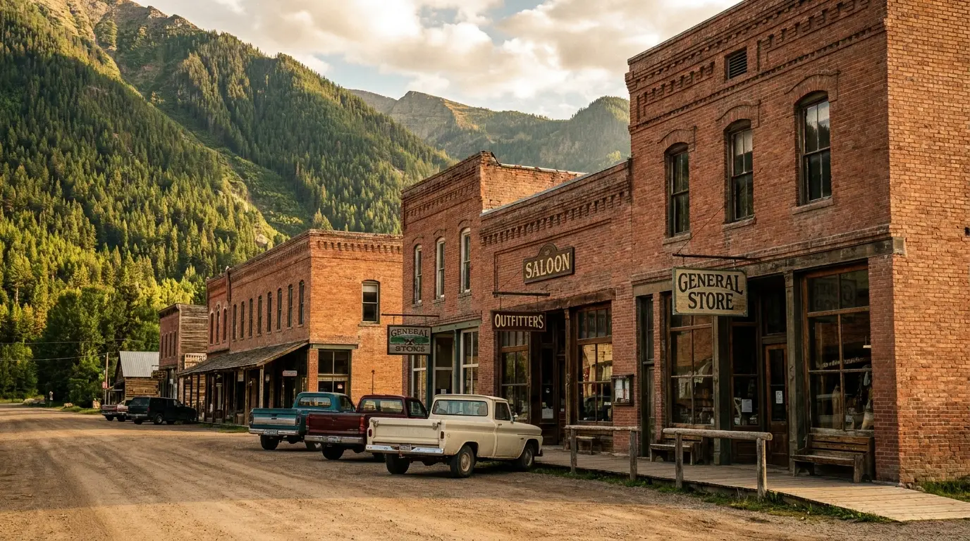
At about 7,600 feet, roughly a hundred year-round residents, 4 miles from Yellowstone's Northeast Entrance. General stores, a fuel station or two (at a premium), cafes, outfitters and a fly shop — but no full grocery and no hospital. Top off fuel here, but do your real provisioning in Red Lodge or Cody. A genuine dead-end in winter (reachable only through Yellowstone).
Cody, WY — the resupply
A working Wyoming town southeast of the plateau via the Chief Joseph Byway, and the best resupply on the Wyoming side — supermarkets, fuel, a hospital, and long-established outdoor retailers (North Fork Anglers, Sunlight Sports). The natural start or finish for a US-212 / WY-296 loop. Reach the plateau from Cody via the Chief Joseph Byway.
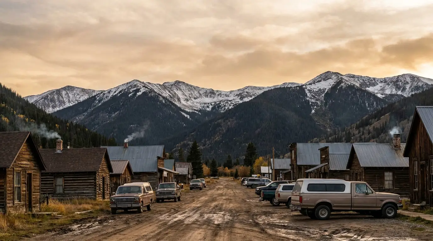
Cooke City, at the west end of the Beartooth. Four miles from Yellowstone's quietest entrance and the gateway to the Lamar Valley. In summer it's a fishing and touring hub; in winter it's a snowmobiling outpost you can reach by car only by driving through the park.
The Northeast Entrance & the Lamar Valley
The west end of the Beartooth Highway delivers you, through Cooke City and Silver Gate, to Yellowstone's Northeast Entrance — the least-used of the park's five gates and the doorway to the Lamar Valley, the finest dawn wolf-and-bison country in the park.
We cover the Lamar Valley, the park's campgrounds and the wildlife-watching craft in depth in Trekkr Trail Journal No. 032 — Yellowstone. For this issue the key point is logistical: a Beartooth trip pairs beautifully with dawn in the Lamar, and the Northeast gate is the quiet way in. Standard Yellowstone entrance fees apply.
Quietest Yellowstone gateSee No. 032 for the Lamar
On gateway-town restaurants — we're not listing any, on purpose
As across the series, gateway-town restaurants here turn over seasonally and close between seasons without notice, and we could not verify current operating status for any of them. Recommending a place that has since closed is worse than recommending none. Use the chamber directories, which reflect closures: Red Lodge (redlodgechamber.org), Cooke City (cookecitychamber.org/member-directory) and Cody (codychamber.org / codyyellowstone.org). Outfitters, gear shops and guide services we could verify are listed on the Trekkr marketplace for this region.
06 / WILDERNESS & WILDLIFE
The Absaroka-Beartooth, and the animals that live in it
The highway is the thread; the fabric is one of the largest, wildest expanses of high country in the Lower 48. The Absaroka-Beartooth Wilderness spreads across nearly a million acres of alpine plateau, granite peaks and glacial lakes on both sides of the road, and it is home to the full greater-Yellowstone cast — including grizzlies. What you do with that determines whether it's a hazard or the whole point.
The Absaroka-Beartooth Wilderness
Nearly a million acres straddling the Montana-Wyoming line, managed across the Custer Gallatin and Shoshone national forests. It holds the highest peaks in Montana — including Granite Peak (~12,800 ft) — hundreds of alpine lakes, active glaciers, and the broad tundra of the Beartooth Plateau itself.
The highway skirts and crosses its edges, so wilderness begins a short walk from many pull-offs. That is the magic and the responsibility: leave-no-trace practice, proper food storage, and respect for how fast this country can turn dangerous.
~1M acres · MT & WYGranite Peak, MT's highpoint
Wildlife — the honest version
The corridor and its wilderness hold grizzly and black bears, moose, elk, mule deer, bighorn sheep, mountain goats, marmots and pika, and — in the adjacent Lamar Valley — wolves. Marmots whistle around the high overlooks; mountain goats work the crags near the passes.
The one that shapes your behaviour is the grizzly. This is core greater-Yellowstone grizzly habitat. Every camping, cooking and hiking decision in this guide is downstream of that fact — see §07 for the rules, which are not optional and, near Cooke City, are legally enforced.
Bears, goats, sheep, mooseCore grizzly habitat
Fishing the plateau — and the licence twist
The high lakes (Beartooth, Island, and the High Lakes country) and the corridor's creeks hold trout, and this is beloved fly-fishing water. Note the boundary logic: on the plateau you need a state fishing licence — Montana on the MT side, Wyoming on the WY side — which is the opposite of inside Yellowstone, where a park permit governs and state licences are not valid. Handy fact: the Cooke City Store's Trout Rider fly shop sells Montana, Wyoming AND Yellowstone licences in one stop, genuinely useful if you're fishing both the plateau and the park. Guided trips run out of Red Lodge, Cooke City and Cody; we could not verify current pricing, so confirm with the shop.
07 / SAFETY — READ THIS FIRST
The plateau is beautiful and genuinely dangerous
Nobody gets hurt here because the Beartooth is scary. They get hurt because it looks benign from a car on a sunny afternoon, and the four real hazards — altitude, sudden alpine weather, cold water, and grizzlies — don't announce themselves until you're committed. This section is not padding. Read it before you leave the pavement.
Altitude — the quiet one
You will drive over 10,947 feet and sleep near 9,000. Altitude sickness is common above a mile: headache, nausea, shortness of breath, dizziness, poor sleep. It hits fit people too.
Give yourself an easy first day, hydrate hard, ease off alcohol, and descend if symptoms build. A short hike that would be trivial at home is a real effort at 10,000 feet — pace everything, and know that the climb back out of places like Gardner Lake is where people feel it.
Sleep near 9,000 ftDescend if symptoms build
Weather & lightning — the fast one
Winter weather is possible in every month — snow on the plateau in July is normal, not exotic, and the road itself closes for it. Afternoon thunderstorms build fast, and above treeline you are the tallest thing around.
Start high hikes early and be off exposed ground by early afternoon. Turn around if the sky builds; do not push to a summit or an overlook into a storm. Pack a warm layer, a hat and rain shell even on a bluebird morning — the temperature at the West Summit can be 20–30°F colder than in Red Lodge.
Snow possible any monthOff high ground by early afternoon
Grizzlies — the rules, and the statistic behind them
This is core greater-Yellowstone grizzly country, and the greater-Yellowstone bear-safety record is blunt: the large majority of people injured by bears were hiking alone or in pairs. Group size is the single most effective thing you control.
1. Hike in groups of three or more. 2. Make noise — especially near running water, in brush, on blind corners. 3. Carry EPA-approved bear spray in a hip or chest holster, not your pack, and know how to use it. 4. Never run from a bear — running triggers pursuit. Stay 100 yards from any bear.
✈️ Flying in? You cannot bring bear spray — it's prohibited in both checked and carry-on baggage and can't be air-shipped. Buy it locally on arrival (Red Lodge, Cooke City, Cody all sell it).
Groups of 3+ · spray on the hipNever run · 100 yards
Food storage — legally enforced here
The Custer Gallatin food-storage order runs March 1 – December 1 across these districts. Compliant storage: a hard-sided vehicle or trailer with windows closed; an IGBC-certified bear canister; or hung at least 10 feet up and 4 feet out. Violators can be cited and held liable.
A rooftop or soft-sided tent is NOT legal food storage, even where tent camping is allowed. And the attractant list is broad — food, coolers, cookware, empty flavoured-drink bottles, sunscreen, lip balm, toothpaste and medications all go in the bear box or the vehicle. Store the sunscreen with the food.
Shoshone NF (the Wyoming side) carries its own orders — the specifics vary by district and we could not verify all of them, so check the Clarks Fork Ranger District before you rely on any of it.
A rooftop tent is not food storageCuster Gallatin: Mar 1 – Dec 1
🔴 Hard-sided camping only near Cooke City — this is not a comfort guidelineSoda Butte, Colter and Chief Joseph campgrounds east of Cooke City are restricted to hard-sided recreational vehicles only — tents and pop-up campers are prohibited. The restriction was imposed in July 2010, after a grizzly sow with three yearlings pulled three separate people from their tents at Soda Butte Campground overnight, causing serious injuries and one fatality. It remains in force because bears still frequent this corridor. Fox Creek Campground on the Wyoming side is also widely reported to require hard-sided units — we could not confirm that against an official page, so treat it as likely and confirm before booking a tent site. If you are in a tent and heading for the Northeast Entrance, plan to sleep at the Custer Gallatin campgrounds near Red Lodge or the plateau lakes instead, and sort it before you drive out there — Cooke City is a long way from a second option.
Cold water
The plateau lakes and creeks are snowmelt: dangerously cold all summer. A capsize far from help is life-threatening, and there are no lifeguards and effectively no fast rescue. Wear a PFD on the water, keep children close at waterfalls and outlets, and treat all backcountry water before drinking.
The road itself
Switchbacks, hairpins, steep grades and cliff-edge exposure, often with cyclists and motorcycles. Use low gears on the descents to save your brakes, watch for gravel and frost-heave, and pull fully into designated overlooks to take in the view — never stop in the travel lane. Fog and sudden squalls cut visibility fast.
Medical reality
There is no hospital in Red Lodge or Cooke City. The nearest hospitals are Billings, MT (north of Red Lodge) and Cody, WY (southeast). From the plateau, help is hours away and cell coverage is nil. Carry a first-aid kit, tell someone your plan, and consider a satellite messenger for backcountry travel.
08 / THE CAMPING STRATEGY
Where to sleep — Rock Creek, the plateau lakes, or the Cooke City end
The corridor's campgrounds split into three groups by elevation and forest: the low Custer Gallatin campgrounds in the Rock Creek drainage near Red Lodge, the high Shoshone lakes on the Wyoming plateau, and a cluster near Cooke City where hard-sided rules apply. Nearly all are first-come or partly first-come, and the high ones open late and close early. As with the Yellowstone issue, we print the least where our sources were weakest: fs.usda.gov blocked automated retrieval, so most fees and exact season dates are omitted rather than guessed — confirm on Recreation.gov.
The low corridor — Custer Gallatin NF near Red Lodge (~12 miles south)
Campground
Sites
Water
Toilets
Reservations
Notes
Parkside
28 (26 single + 2 group)
Yes (drinking)
Vault
Mostly Recreation.gov; some first-come
Largest of the three; National Recreation Trail & creek fishing nearby. Best reservation base
Greenough Lake
18
Hand pump
Vault
Mixed (Rec.gov + first-come)
Streamside; lake fishing steps away
Limber Pine
12
Hand pump
Vault
Mixed (Rec.gov + first-come)
Beside Greenough Lake; small and quiet
All three sit at roughly 7,000 ft in the Rock Creek drainage, about 12 miles south of Red Lodge, and open earlier than the plateau campgrounds. No hookups, no showers, no dump station. Book and price at recreation.gov — we could not confirm 2026 fees against an official source.
The high plateau — Shoshone NF, Wyoming (open late, close early)
Campground
~Elev.
Sites
Water
Reservations
Notes
Beartooth Lake
~9,000 ft
~21
Hand pump (potable)
First-come only
Lakeshore under Beartooth Butte. RV/trailer ~32 ft. Late June – early Sept. Bear boxes
Island Lake
~9,500 ft
~20
Hand pump (potable)
First-come only
High Lakes trailhead. Not for big rigs — steep pitch, tight sites. Late June – late Aug. Bear boxes
Crazy Creek
lower
16
None — carry water
First-come only
11 mi E of Cooke City; short trail to Crazy Creek Falls. A sheltered fallback when the high lakes are snowed in
Fox Creek
~7,000 ft
Hand pump
First-come only
7 mi E of Cooke City. ~33 sites, electric at some. Reported HARD-SIDED ONLY (grizzly) — confirm before booking a tent
The plateau campgrounds are first-come, first-served with a 16-day limit, and their season is short and snow-gated — Beartooth and Island typically don't open until late June and close by early September. No reservations, no hookups (bar Fox Creek's partial electric), no showers, no dump. All are grizzly country: use the bear boxes. Fees reported around $15 (Island) and $25 (Beartooth) by secondary sources, not confirmed officially.
The Cooke City end — Custer Gallatin NF (hard-sided only)
Campground
Tent OK?
Notes
Soda Butte · Colter · Chief Joseph
NO — hard-sided units only
East of Cooke City on US-212. Tents and pop-ups prohibited since a fatal 2010 grizzly attack at Soda Butte. First-come. Verify current dates and the standing order with the Gardiner Ranger District
🔴 The tent camper's plan for the Cooke City / Northeast corner
If you are in a tent and headed for Yellowstone's Northeast Entrance, the hard-sided-only campgrounds east of Cooke City (and, on reports, Fox Creek) are off the table. Your realistic tent options are the plateau lakes (Beartooth, Island) up on the highway — exposed, cold, and snow-gated but tent-legal — or backtracking to the Custer Gallatin campgrounds near Red Lodge. There is limited in-park camping in the Lamar corner too (see No. 032). Sort this before you drive out there: Cooke City is a long, high, fuel-free road from a second option.
The honest recommendation for a 3–4 day tripBase low, day-trip high. Sleep at Parkside or Greenough Lake near Red Lodge (warmer, earlier-opening, reservable, real town 12 miles away for resupply and showers), and drive the plateau as day trips — you dodge the exposure and the first-come scramble up top, and you sleep at 7,000 feet instead of 9,500, which your first night at altitude will thank you for. If you want a night on the plateau for the sunrise and the fishing, take one at Beartooth Lake or Island Lake — but arrive early, because they're first-come and they fill. Finish over the Chief Joseph Byway to Cody, or drop into Yellowstone at the Northeast gate for dawn in the Lamar.
Every plateau bed sits at 9,000 feet or higher. Sleep, hydration and exertion all change up here, and so does the calendar — these campgrounds are snowbound until late June and closing by early September. Bring a real sleeping bag in August. Store the sunscreen in the bear box.
09 / PRACTICAL & SERVICES
No fuel up top. No signal up top. Plan for both.
The plateau has essentially no services — that's much of its appeal, and the whole of its risk. Two facts do most of the planning work: there is no gas in the 68 miles between Red Lodge and Cooke City, and there is no reliable cell coverage across the plateau. Everything else follows from those.
Fuel — top off before you climb
There is no fuel on the plateau — none in the 68 miles between Red Lodge and Cooke City. Fill up in Red Lodge (full service) or top off in Cooke City (limited stations, premium prices). On the Wyoming side, Cody is the reliable fuel town. Carry enough to do the plateau, the side spurs, and any detour with margin — and remember the climb burns more than the map suggests.
Groceries — provision in town
Red Lodge and Cody have real groceries; Cooke City has only general stores, and there is nothing on the plateau but the Top of the World Store (snacks, drinks, fishing permits, souvenirs — a convenience stop, not a resupply). Provision a full trip in Red Lodge or Cody before you commit to the corridor.
Cell & internet — assume none
Coverage across the plateau is effectively nil, and patchy even in the towns. Download offline maps before you climb, tell someone your route and expected return, and don't count on navigation or a 911 call from the high country. A satellite messenger is worth it for backcountry days.
Bear spray — buy it here, don't fly with it
Sold at gear shops, general stores and gas stations in Red Lodge, Cooke City and Cody. We are not printing a purchase price — no reliable current figure is published and the numbers circulating are secondary. Carry it in a hip or chest holster, not your pack, keep it out of a hot car (it can burst above ~120°F), and check the expiry date.
Flying in? You cannot bring it — prohibited in checked and carry-on baggage, and it can't be air-shipped as hazmat. Buy on arrival. Plan to leave it behind or gift it when you go.
Cannot fly with it, either bagHolster on the hip
Fishing licences — state, not park
On the plateau you need the appropriate state licence — Montana on the MT side, Wyoming on the WY side. This is the reverse of inside Yellowstone, where a park permit rules and state licences aren't valid. The Cooke City Store's Trout Rider fly shop sells MT, WY and Yellowstone licences in one stop.
Fly shops and guides operate out of Red Lodge (e.g. Rocky Fork Outfitters, Sylvan Peak, Beartooth Mountain Guides for the high country), Cooke City (Beartooth Plateau Outfitters, the Cooke City Store) and Cody (North Fork Anglers, Sunlight Sports). Guided-trip pricing we could not verify — confirm with the shop.
MT / WY state licencesCooke City Store: all three
Gateway town
Approx. elev.
Real grocery?
Fuel?
Hospital?
The character
Red Lodge, MT
~5,600 ft
Yes
Yes (full)
No — Billings
The base camp. Groceries, fuel, fly shops, gear, breweries, a ski hill. Last full resupply before the plateau
Cooke City / Silver Gate, MT
~7,600 ft
No — general stores
Limited, premium
None
Tiny outpost, 4 mi from Yellowstone's NE gate. Top off fuel, don't rely on resupply. Dead-end in winter
Cody, WY
~5,000 ft
Yes — supermarkets
Yes
Yes
Best resupply on the WY side. Outdoor retailers, hospital. Reach the plateau via the Chief Joseph Byway
10 / TIMING
A short season, and a shorter sweet spot
Unlike Yellowstone, which is a year-round destination, the Beartooth Plateau is functionally a summer place — the high road simply doesn't exist the rest of the year. Within that window, the useful season is shorter than the calendar suggests, because the high campgrounds and trails stay snowbound weeks after the road opens.
The window — and the sweet spot
The road: late May to mid-October, snow-gated (2026 opened May 23). The high campgrounds and trails: realistically July through early September — Beartooth and Island lakes don't open until late June, and plateau trails hold snow into July.
The honest sweet spot: mid-July to mid-September. Wildflowers peak on the tundra in July; September brings fewer people, cooler air and fall colour in the aspen down low — but watch the calendar, because an early storm can close the road before the mid-October norm. Any month can bring snow up high.
Mid-July – mid-Sept is primeSnow can close the road any month
The real risks, ranked
The road being closed — the plateau is snow-gated late May to mid-October and closes for storms inside that window. Check before every plateau day
Altitude — you sleep near 9,000 ft and drive over 10,900. Ease in, hydrate, descend if it builds
Afternoon storms & lightning above treeline — start high hikes early, be off exposed ground by early afternoon
Grizzlies — groups of three, spray on the hip, legal food storage; hard-sided-only near Cooke City
Cold water — plateau lakes and creeks are snowmelt-cold all summer; no lifeguards, slow rescue
The drive — switchbacks and cliff edges, no fuel, no signal. Low gears down, top off up front
11 / THE SHAPE OF A TRIP
Three days, built around the road and the light
This is an editorial synthesis, not an official itinerary — but every element is sequenced against two hard constraints: the road is snow-gated and can close on you, and the high stops reward a morning start before afternoon storms. Base low near Red Lodge, day-trip the plateau, and finish over the Chief Joseph Byway or into the Lamar. Check the road status every morning.
01
Day 1 — Red Lodge & the low corridor
Provision and fuel in Red Lodge — groceries, gas, bear spray, licences. This is your last full resupply
Set up at Parkside or Greenough Lake (~12 mi south, ~7,000 ft) — reservable, warmer, a gentle first night at altitude
Basin Lakes trail in the afternoon (4 mi one way, waterfall en route) — or an easy leg-stretch if you're feeling the elevation
Check tomorrow's road status — Montana 511 and the NPS Beartooth page before you plan the plateau day
Sleep low the first nightBase: Parkside / GreenoughConfirm the road is open
02
Day 2 — Over the top
Climb early, before storms build. Rock Creek Vista first (paved, accessible, 9,190 ft)
West Summit & the plateau lakes — pull off at the top, then Beartooth Lake and Island Lake for photos, a paddle or a High Lakes wander
Clay Butte Lookout if the gravel spur is open, and Gardner Lake if you've got legs for the climb back
Down to Cooke City by late afternoon — fuel, a look at the Northeast gate, and a plan for the night (hard-sided rules apply here)
High stops in the morningOff exposed ground by early afternoonNo fuel up top
03
Day 3 — The Lamar or the loop home
Dawn in the Lamar Valley through the Northeast Entrance — the quiet way into Yellowstone's best wildlife country (see No. 032)
Or loop out via the Chief Joseph Byway — over Dead Indian Pass, through Sunlight Basin and the Clarks Fork Canyon to Cody
Crazy Creek Falls as a leg-stretch on the way, if the high plateau is fogged
Resupply in Cody or Red Lodge — full groceries, fuel, a hospital if you need one
Lamar at dawnWY-296 outlasts US-212Yellowstone fees apply at the gate
+
Add-ons if you have more time
A night on the plateau at Beartooth or Island Lake — arrive early (first-come) for sunrise and the fishing
The Beauty Lake / High Lakes loop — a full plateau hiking day from Beartooth Lake
The Lake Fork toward Sundance Pass — a serious wilderness day or an overnight backpack
Cody itself — a real Wyoming town and the best base for combining the Beartooth with Yellowstone's East side
First-come sites fill earlyGroups of 3 · spray on the hip
12 / TRIP-READY
The departure check
Run it before you leave. Tap each item as it's done — these are the ten things specific to the Beartooth that a general road-trip habit will skip. Almost all come back to three facts: the road is seasonal and can close, the plateau has no services, and this is high-altitude grizzly country.
Road status checked the morning ofUS-212 is snow-gated late May to mid-October and closes for storms inside that window. Check Montana 511, WYDOT and the NPS Beartooth page — and have the Chief Joseph Byway as a plan B.
Fuel topped off before the plateauNo gas in the 68 miles between Red Lodge and Cooke City. Fill in Red Lodge or Cody; Cooke City is limited and premium.
Groceries bought in townRed Lodge and Cody have real groceries; Cooke City has only general stores; the plateau has none. Provision the whole trip before you climb.
Bear spray bought and on your hipYou cannot fly with it — buy locally. Holster on hip or chest, not the pack, and never in a hot car.
Offline maps downloadedCell coverage across the plateau is effectively nil. Download maps, share your route, and consider a satellite messenger for backcountry days.
Warm layers and a real sleeping bag packedThe West Summit runs 20–30°F colder than Red Lodge, snow falls up high in any month, and you'll sleep near 9,000 ft. Pack for the night-time number.
Tent or hard-sided checked against the campgroundSoda Butte, Colter and Chief Joseph near Cooke City are hard-sided-only; Fox Creek is reported so too. Tenting the NE corner? Plan Red Lodge or the plateau lakes instead.
Food-storage plan that includes the sunscreenCuster Gallatin's order (Mar 1 – Dec 1) requires a hard-sided vehicle, a bear canister or a proper hang. Sunscreen, lip balm and empty drink bottles store with the food. A rooftop tent is not food storage.
An easy first day planned for the altitudeYou'll sleep near 9,000 ft and drive over 10,900. Ease in, hydrate, ease off alcohol, and descend if altitude symptoms build.
High hikes planned for the morningAfternoon thunderstorms and lightning above treeline are routine. Start early and be off exposed ground by early afternoon; turn around if the sky builds.
0 / 10 confirmed — the road status sets the plan.
13 / QUICK ANSWERS
Asked at every Red Lodge trailhead
When does the Beartooth Highway open and close?
US-212 over the plateau is a seasonal road: it opens in late May and closes in mid-October, entirely weather-dependent. The 2026 season opened May 23 (a day late, for a storm), and the 2025 season's last day was October 14. The 2026 closing date had not been announced at press. Crucially, it can close temporarily for snow at any time in the open season, including July — check Montana 511 and WYDOT the morning of any plateau day, and don't plan a schedule that depends on it being open at a set hour.
How high does it get, and will the altitude affect me?
The high point is the West Summit at 10,947 feet, and most plateau driving is above 10,000; the campgrounds sit near 9,000–9,500. Altitude sickness is common above a mile — headache, nausea, breathlessness — and it hits fit people too. Give yourself an easy first day, hydrate, ease off alcohol, and descend if symptoms build. Short hikes that would be trivial at home are real efforts up here.
Is there gas or a grocery store on the highway?
No fuel at all in the 68 miles between Red Lodge and Cooke City, and no full grocery on the corridor. Fuel and provision in Red Lodge (full service) or Cody before you climb; Cooke City has limited, premium fuel and general stores only. The Top of the World Store on the highway is a snacks-and-permits convenience stop, not a resupply.
Can I tent camp near Cooke City?
Not at Soda Butte, Colter or Chief Joseph east of Cooke City — those are hard-sided units only under an order imposed after a fatal 2010 grizzly attack at Soda Butte. Fox Creek is also widely reported to require hard-sided units (we couldn't confirm it officially — verify before booking a tent). Tent-friendly alternatives: the Custer Gallatin campgrounds near Red Lodge or the plateau lakes (Beartooth, Island). Sort it before you drive out there.
What's the Chief Joseph Scenic Byway, and should I drive it?
It's Wyoming Highway 296, a 47-mile road over Dead Indian Pass (8,071 ft) that drops through seven switchbacks into Sunlight Basin and the Clarks Fork Canyon toward Cody. Yes, drive it — it's spectacular (the high Sunlight Creek Bridge alone is worth it), and it stays open far longer than the Beartooth, so it's the shoulder-season and stormy-day way east. Pairing US-212 in and WY-296 out makes a superb loop from Cody.
Do I need bear spray, and can I fly with it?
Yes to spray — this is core greater-Yellowstone grizzly country. Carry EPA-approved spray in a hip or chest holster, hike in groups of three or more, and store all food and scented items (sunscreen and lip balm included) in a hard-sided vehicle or bear box under the Custer Gallatin order (Mar 1 – Dec 1). You cannot fly with bear spray — it's banned in checked and carry-on bags and can't be air-shipped. Buy it in Red Lodge, Cooke City or Cody on arrival.
What licence do I need to fish the plateau lakes?
A state licence — Montana on the MT side, Wyoming on the WY side — which is the opposite of inside Yellowstone, where a park permit rules and state licences aren't valid. The Cooke City Store's Trout Rider fly shop sells MT, WY and Yellowstone licences in one stop, handy if you're fishing the plateau and the park. Beartooth, Island and the High Lakes hold trout; the water is cold and the weather turns fast, so fish the mornings.
Is Granite Peak a hike I can do?
No — not as a hike. Granite Peak (~12,800 ft) is the highest point in Montana and a genuine technical mountaineering objective: exposed climbing, route-finding, sometimes glacier travel, and a long committing approach. It injures and kills people who treat it as a walk-up. Go with a qualified guide or the right skills and gear, or leave it for the mountaineers and enjoy the plateau's lakes and passes — which are reward enough.
How long should I budget to drive the highway?
Longer than the mileage suggests. It's roughly 68 miles Red Lodge to Cooke City, but with the switchbacks, the altitude, the photo stops and the wildlife, plan 3–4 hours minimum one way to drive it properly — and treat it as a destination, not a shortcut to Yellowstone. Use low gears on the descents to save your brakes, and never stop in the travel lane; pull fully into the overlooks.
Can I combine this with Yellowstone?
Yes — it's one of the best pairings in the Rockies. The west end of the Beartooth delivers you to Yellowstone's Northeast Entrance, the quiet gateway to the Lamar Valley and its dawn wolf-and-bison watching. We cover the park in depth in Trekkr Trail Journal No. 032 — Yellowstone. Standard Yellowstone entrance fees apply at the gate; an America the Beautiful pass covers both the park and the federal-forest fee areas along the Beartooth.
14 / WHAT WE COULD NOT CONFIRM
The honest gaps, all in one place
Every guide has these. Most don't print them. The Beartooth is unusually well documented in some respects and unusually opaque in others — the highway's status changes daily, and the federal-forest pages that hold the campground details blocked automated retrieval throughout our research. Everything below was last checked on 21 July 2026. A confident wrong number costs more than an admitted gap.
The Beartooth Highway's 2026 closing date — not announced at pressThe road historically closes in mid-October (the 2025 season ended October 14), but the exact 2026 closing date had not been announced when we went to press, and an early storm can move it. Do not plan a late-season trip around a specific date — confirm with Montana 511 / MDT and the NPS Beartooth page.
USFS campground fees and exact season dates — largely omittedfs.usda.gov returned errors to automated retrieval throughout our research, exactly as in the Yellowstone issue, so most Custer Gallatin and Shoshone fees and precise open/close dates are omitted rather than estimated. Secondary sources report roughly $15 (Island Lake) and $25 (Beartooth Lake), and "$8–14" generally for the Rock Creek campgrounds, but we could not confirm these officially. Book and price at recreation.gov, or call the Beartooth Ranger District (406) 446-2103 / Clarks Fork Ranger District.
Fox Creek's hard-sided-only status — safety-critical and unconfirmedMultiple secondary sources state Fox Creek Campground (Shoshone NF, near Cooke City) requires hard-sided units because of grizzly activity. We could not confirm this against an official Forest Service page. Treat it as likely and confirm with the Clarks Fork Ranger District before booking a tent. Some sources also note a past multi-year closure for highway construction — verify it is operating.
Coordinates that are null in the companion data — on purposeSeveral campgrounds and points of interest in the finder and Adventure Builder data files carry null coordinates because OpenStreetMap did not return a confident node during research (Nominatim rate-limited many queries). We publish confirmed OpenStreetMap coordinates where we have them and null the rest rather than guess a pin. The null is the product.
Trail distances and elevation figures — planning estimates, not surveysThe hike distances and elevation gains (Gardner Lake, the Beauty Lake / High Lakes loop, Basin Lakes, Lake Fork / Sundance Pass) come from trail guides and secondary sources, and several disagree with each other — the High Lakes loop in particular is cited anywhere from ~5 to 8+ miles depending on route. Treat every figure as an estimate, carry a map, and confirm on the ground.
Business details deliberately withheld or flaggedThe businesses in this issue are compiled as free, unclaimed marketplace listings from public information; we withhold phone, email and street address for unclaimed listings. Two Red Lodge sites could not be machine-verified during research — Sylvan Peak Mountain Shop (returned a bot-block) and Rocky Fork Outfitters (expired TLS certificate) — so their URLs are recorded but flagged unverified. Confirm before relying on them.
Prices and seasonal hours that change constantlyBear spray retail prices (no reliable official figure), guided fishing/hiking rates, fuel prices, the Beartooth Basin summer ski area's operating status (a short, snow-dependent season), and gateway-town restaurants, which we deliberately do not list at all. Use the chamber directories, which reflect closures.
Fire danger and restrictions — never assertedFire status resets on its own schedule across two national forests and we print none. Check the Custer Gallatin and Shoshone current conditions the day you arrive.
Why this section exists
Anyone can write a guide that sounds certain. The hard part is knowing which of your numbers are real — and on a road whose very existence is weather-gated, where the Forest Service pages return errors to automated retrieval, and where a campground's tent-safety status is life-and-death but unconfirmable, plenty of them need a same-week check. The null is the product. "Fox Creek may be hard-sided-only — confirm before you book a tent site" is a usable instruction that might keep someone out of a bear's way. A confident wrong fee, or a confident wrong tent permission, is not.
🔒
The printable field guide
Everything above, condensed into a print-ready PDF built for the glovebox — for a road with no cell signal, no fuel and a season that opens and closes on the weather. The full seasonal road window and the Chief Joseph alternative; every campground on the Custer Gallatin and Shoshone corridors with amenities and the hard-sided-only bear rules; the plateau overlooks, lakes and passes; the altitude, weather, cold-water and grizzly reality; the gateway towns and fuel plan; and the honest list of what nobody could confirm — on paper that works where the signal doesn't.
Instant access · Built by people who actually camp there
Trail Journal No. 039
Go farther. Camp lighter. Leave it better.
Every Trekkr Trail Journal is built like this one: custom logistics, honest trail beta, the camping and access detail, and the local knowledge that turns a good trip into the one your crew talks about for years — including, always, a plain list of what we could not confirm. New destinations drop all season long, from the BC corridors to the Oregon Cascades to the Alberta badlands to the Beartooth Plateau.