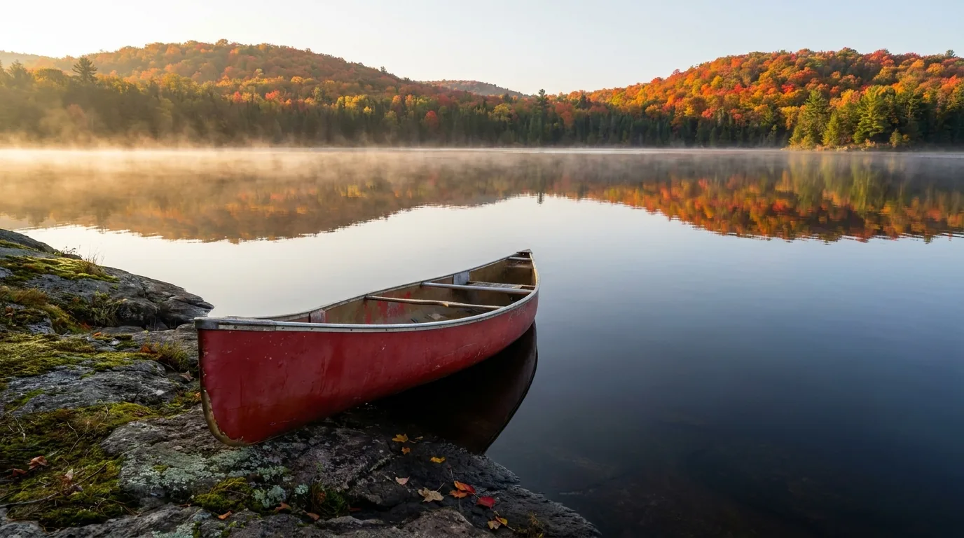
A calm Canadian Shield lake at dawn with a red canoe on a granite shore, mist rising off the water and forested hills of sugar maple and spruce in peak autumn colour reflected in the still surface, Algonquin Provincial Park Ontario, ultrarealistic photograph representative of the region
Trekkr Trail Journal · No. 056 · Algonquin Provincial Park

AlgonquinOntario — the Highway 60 corridor, the canoe country, the year-round yurts & the honest truth about the bugs

Ontario's oldest park is really two trips in one — a car-friendly Highway 60 corridor where nine campgrounds, the day trails, the Visitor Centre and the moose all sit along 56 km of pavement, and a 2,000-km wilderness of canoe routes reached only by paddle and portage. It's 7,650 km² of maple hills, spruce bogs and more than 2,400 lakes on the edge of the Canadian Shield. There's no gate reservation for a day visit — just a vehicle permit, a five-month booking window that fills fast, a fall-colour crush, and a black-fly season nobody warns you about.

Ontario · Canada Highway 60 corridor · interior canoe country 9 corridor campgrounds · year-round Mew Lake Fall colours · black-fly season
7,650 km²Ontario's oldest park (est. 1893), one of its largest
~2,000 kmOf interior canoe routes and portages
56 kmHighway 60 corridor, West Gate to East Gate
Mid-May–JunBlack-fly season — peaks in June, plan around it
Conditions verified 23 July 2026 · The booking window and the bugs decide the trip before the trail does · This block goes stale — the links don't

Two things shape an Algonquin trip: getting a site, and what's biting

The rest of this journal is evergreen; this box is not. At Algonquin two things decide whether your plan works before you pick a trail — whether you can actually book a site (§07), and which season and which bugs you're walking into (§09). There's no gate reservation for a day visit, but every vehicle needs a permit and camping is reserved. Everything below is dated to the day we checked it. Trust the live sources, not our date stamp.

  • No day-visit reservation — but every vehicle needs a permit, and camping books outA day trip needs no reservation, but each vehicle needs a Daily Vehicle Permit (about $21) or an Annual Permit (about $92). To camp you reserve a site, and Ontario Parks opens bookings on a five-month rolling window — popular July–August and every fall-colour weekend fills the moment it opens. [VERIFY current permit prices at ontarioparks.ca] (§02, §07)
  • Black-fly season is real — mid-May to late June, peaking in JuneThe bugs are the thing nobody tells you. Black flies run mid-May to late June and can be genuinely intense in the interior; a bug shirt or head net is strongly recommended for June. Early May is usually essentially bug-free (and prime moose-viewing); August and fall are far more comfortable. (§09)
  • Fall colours peak late Sept–early Oct — and the weekends are a crushThe maple peak is typically the last week of September into the first week of October. It's the marquee season and the Thanksgiving long weekend is extremely busy, especially at the West Gate. Go mid-week (not Fridays) and watch the Friends of Algonquin live Fall Colour Report. [VERIFY colour timing the week you go] (§09)
  • Fire bans happen — and drones are effectively bannedThe Park Superintendent can declare a Total Fire Ban in a dry spell (one was in effect in August 2025), prohibiting all open fires; gas stoves with a shutoff are generally still allowed. Algonquin is effectively a no-drone zone. [VERIFY the current fire rating before lighting anything] (§06)
  • Fuel and cell service are thin — and scarcer off Highway 60Fuel inside the park is limited to small seasonal stores near Lake of Two Rivers; fill up in Huntsville/Dwight (west) or Whitney (east). Cell coverage on Highway 60 is spotty with pockets near the gates and Visitor Centre, and effectively none in the interior or at most remote access points. [Coverage varies by carrier — treat as UNVERIFIED for any site] (§02)
  • Backcountry needs its own permit — and it's bear countryAny interior canoe trip needs an Interior Camping Permit (about $14.13 per person per night), reserved on the same five-month window with an assigned route. Algonquin is active black-bear habitat — a clean site and proper food storage are not optional. (§05, §06)
Live sources · Ontario Parks — Algonquin · Ontario Parks reservations · The Friends of Algonquin Park · Fire-ban status · Fall Colour Report (algonquinpark.on.ca)
In an emergency, 911 where there is signal. This box was true at press and will not stay true — the sources above are the truth on the day you travel.
01 / THE HOOK

Canoe country, moose country, and a highway that opens it all

Algonquin is not one destination but two, laid side by side. There's the Highway 60 corridor — 56 km of pavement across the park's south end where nearly all the developed campgrounds, the day-hiking trails, the Visitor Centre, the Logging Museum and the Art Centre sit within an easy reach of the car, and where moose graze the roadside ditches in spring. And there's the interior — a 7,650-km² mosaic of maple hills, spruce bogs, rocky ridges and more than 2,400 lakes, stitched by roughly 2,000 km of canoe routes and portages, reached only by paddle. It's the transition zone where southern hardwood forest meets the northern boreal, which is why the wildlife is so rich and the autumn colour so famous. Sort the vehicle permit and a site, respect the bugs and the bears, and it's the definitive Ontario wilderness — equally a first family car-camping weekend or a two-week expedition.

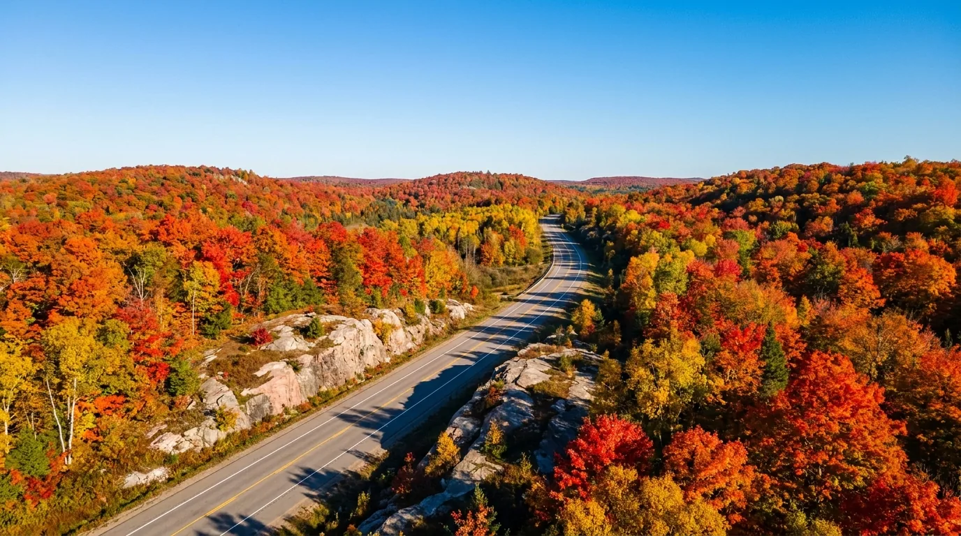
A two-lane paved highway winding between rolling hills of brilliant red and orange sugar maple forest at peak autumn colour, the Highway 60 corridor through Algonquin Provincial Park Ontario, ultrarealistic photograph representative of the region
The Highway 60 corridor in early October. The park's only major through-road runs 56 km across the south end, from the West Gate near Dwight to the East Gate near Whitney. Nearly every corridor attraction and campground is referenced by its "km" marker — and in fall this drive is one of the most crowded stretches of road in Ontario (§02, §09).

The payoff

Genuine Shield wilderness within a half-day of Toronto or Ottawa — 2,000 km of canoe routes, the corridor's day trails and ridgetop lookouts, moose, beaver and wolves, and fall colours that draw visitors from around the world (§04, §05, §09).

The bugs

The trade-off nobody mentions. Black flies mid-May to late June can be intense; mosquitoes follow into late July. Early May and September onward are the comfortable windows. Pack a head net for a June interior trip (§09).

The crush

Sites go on a five-month window and summer and fall-colour weekends fill instantly. The Thanksgiving long weekend at the West Gate is a genuine bottleneck. Book the moment the window opens, or go mid-week (§07, §09).

The way to think about the park — one corridor, one vast interior, and separate remote gateways Nearly everyone bases on the Highway 60 corridor across the park's south end: nine developed campgrounds, the Visitor Centre (km 43), the day trails, and seasonal stores, all reached from the West Gate (near Dwight, coming from Toronto/Huntsville) or the East Gate (near Whitney, coming from Ottawa/Barry's Bay). The interior is the canoe country — permit-only, reached by paddle from corridor launches like Canoe Lake, Opeongo and Rock Lake. And then there are the remote north and east access points — Achray and Barron Canyon on the east side (from Pembroke via Sand Lake Gate), and Brent and Kiosk on the north (off Highway 17) — which are separate driving destinations, not reachable from Highway 60 by road inside the park. Pick your gateway before you pick your trip.
02 / GETTING THERE & ACCESS

Two gates on Highway 60 — and remote entries that are their own trip

Here's what first-timers get wrong: they assume the whole park connects by road. It doesn't. Highway 60 is the only major through-road, and it only crosses the south end. The famous remote areas — Barron Canyon, Brent, Kiosk — are reached off Highway 17 and are separate driving destinations entirely. Sort out which gate you need, top off fuel before you go in, and don't count on a phone signal once you're past the corridor.

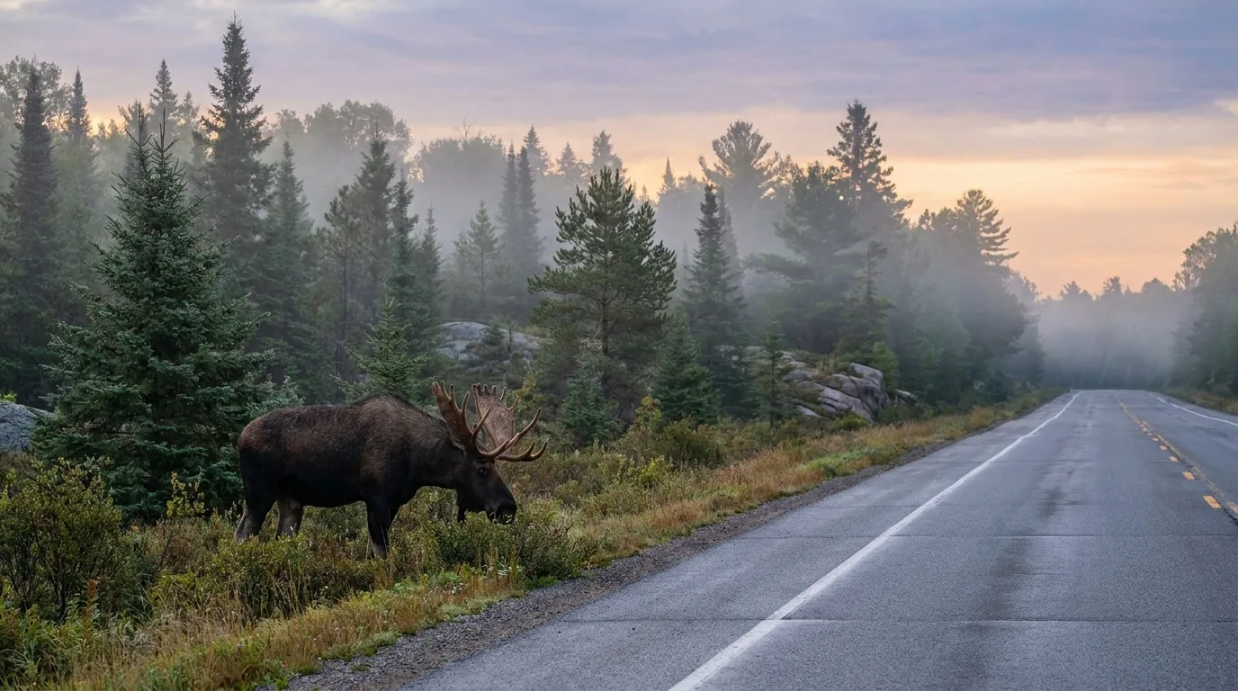
A large bull moose feeding on roadside vegetation at the edge of a highway through boreal forest at dawn, mist and spruce trees behind, Algonquin Provincial Park Ontario, ultrarealistic photograph representative of the region
A bull moose along Highway 60 at dawn. In spring and early summer moose come to the roadside ditches for sodium and aquatic plants — the corridor is one of the best places in Ontario to see them. Drive slowly at dawn and dusk, keep your distance, and never approach (§06).
AccessWhere / howServesThe catch
West Gate
the Toronto side
Hwy 60 just east of Dwight (via Hwy 11 to Huntsville) The main corridor entry from southern/western Ontario km 0 of the corridor; the fall-colour bottleneck — arrive early on peak weekends
East Gate
the Ottawa side
Hwy 60 just west of Whitney (via the Ottawa Valley / Barry's Bay) The corridor entry from eastern Ontario ~km 56; Whitney is the last services on the east side
Sand Lake Gate
the east side / Barron
From Pembroke via Hwy 17, then Barron Canyon Rd The only entrance to the eastern access points — Achray, Grand Lake, Barron Canyon Not reachable from Hwy 60 by road — approach from Pembroke, a separate trip
Brent / Kiosk / Wendigo
the north side
Off Hwy 17 (gravel roads south to the boundary) Remote northern access points on Cedar and Kioshkokwi lakes Very remote; fuel and groceries scarce once you leave Hwy 17 — carry what you need
Access Point #1
the northwest
Off Hwy 11 near South River / Kearney (Voyageur Quest) Northwest interior; first-timer outfitting packages A separate approach from the far west — not the Hwy 60 corridor

Highway 60 kilometre markers run from km 0 (West Gate) to about km 56 (East Gate), and nearly all corridor attractions are referenced by their "km" location. Confirm gate hours and any seasonal access closures at ontarioparks.ca before you rely on them.

🔴 The permit and the fuel reality Every vehicle entering the park needs a Daily Vehicle Permit (about $21) or an Annual Vehicle Permit (about $92) — the daily permit is valid roughly 7:00am–10:00pm on the date of issue, and camping fees are separate and on top of it. Fuel inside the park is limited to small seasonal stores near the Lake of Two Rivers / Portage Store area (seasonal hours) — fill up in Huntsville or Dwight from the west, Whitney from the east. For the north and east access points, fuel and groceries get scarce fast once you leave Highway 17. Confirm the current 2026 permit prices at the source — these figures should be checked before you rely on them.

Gateway towns & last services

  • Huntsville (Hwy 11, ~40 km west of West Gate) — the largest full-service town on the west side: fuel, groceries, LCBO, hospital, outdoor gear. Best place to stock up from the west
  • Dwight — small village just outside the West Gate; fuel, general store, Henrietta's Pine Bakery, restaurants
  • Oxtongue Lake — lodges and outfitters near the West Gate (Wolf Den, Algonquin Outfitters' main store)
  • Whitney — small village just outside the East Gate; fuel, general store, motels — the last services on the east side
  • Pembroke — the regional service centre for the Achray, Brent and eastern approaches

Cell coverage — don't rely on it

Coverage along Highway 60 is spotty and unreliable, with pockets of signal near the gates, the Visitor Centre and Lake of Two Rivers — and no coverage in the backcountry interior or at most northern/eastern access points.

Do not rely on a phone for navigation or emergencies in the interior. Carry maps and consider a satellite communicator.

Coverage varies by carrier — treat any specific site as unverified.

The 60-second access decision
  1. Classic corridor trip from Toronto/west? Enter the West Gate at Dwight; stock up in Huntsville first.
  2. Coming from Ottawa/east? Enter the East Gate at Whitney; that's your last easy fuel and groceries.
  3. Want Barron Canyon and the quiet east side? That's Sand Lake Gate from Pembroke — a separate drive, not off Hwy 60.
  4. Chasing solitude on Cedar or Kioshkokwi Lake? The Brent / Kiosk north access points, off Hwy 17 on gravel — carry everything.
  5. First backcountry trip and want it outfitted? Consider Access Point #1 (Voyageur Quest) off Hwy 11 in the northwest.
03 / THE CORRIDOR & THE INTERIOR

Highway 60 or the deep interior — the reasons to choose

Algonquin gives you two very different trips looking at the same wilderness. The Highway 60 corridor is accessible, serviced and busy — car-camping, day hikes, a Visitor Centre, moose from the road. The interior is quiet, wild and permit-only — paddled to, carried between lakes, earned. Most first-timers should start on the corridor. But know what each is before you either underestimate the interior or fight the corridor crowds for a wilderness feeling it can't quite give.

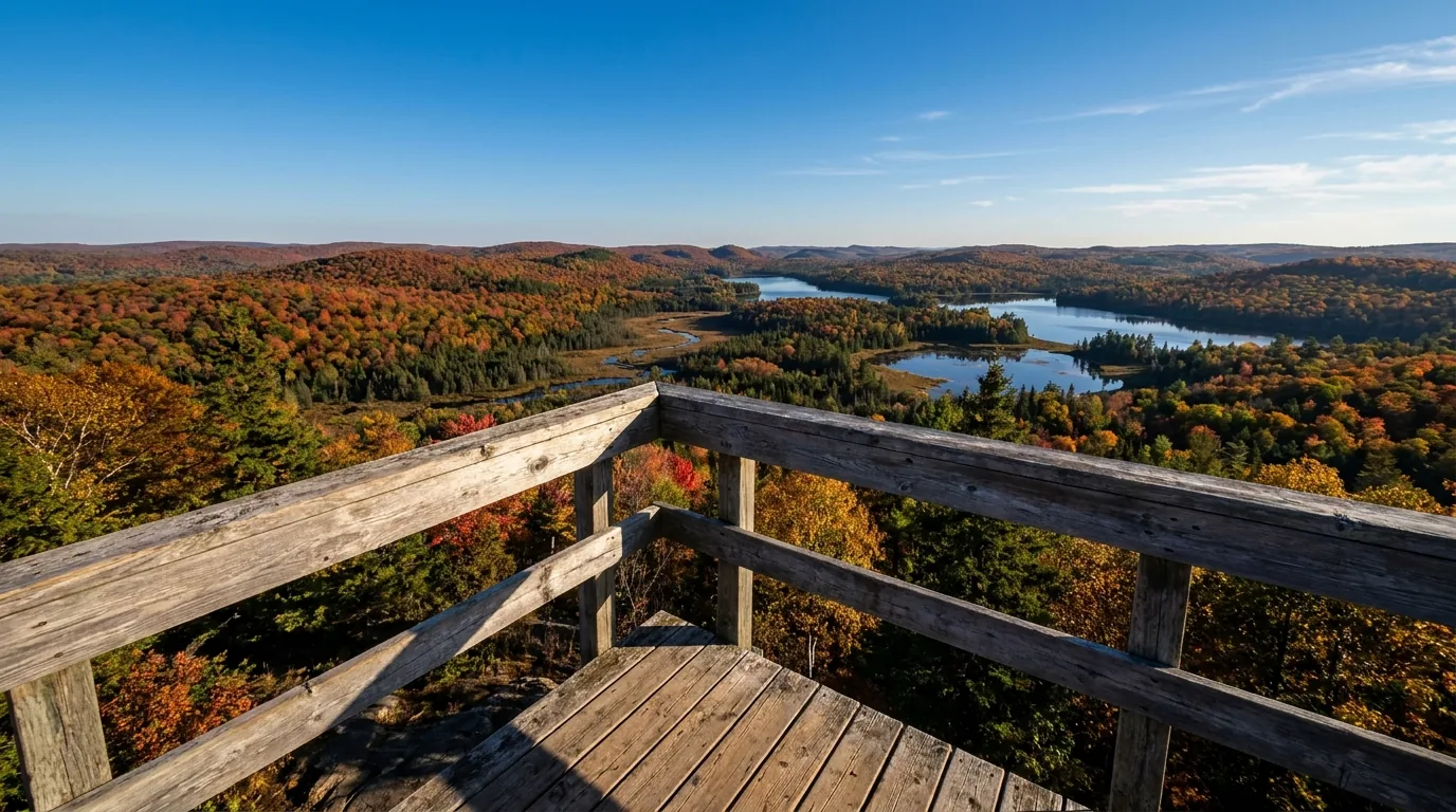
A vast wild expanse of endless forested Canadian Shield hills, a spruce bog valley and distant lakes stretching to the horizon under a big autumn sky, seen from a viewing deck, Algonquin Provincial Park Ontario, ultrarealistic photograph representative of the region
The view from the Visitor Centre deck, km 43. Open year-round, the Visitor Centre is the best orientation stop on the corridor — natural and human-history exhibits, the "Images of Algonquin" theatre film, a bookstore, the Algonquin Room art gallery, and a dramatic viewing deck over the landscape. Start here.

The Highway 60 corridor — accessible & serviced

  • Nine developed campgrounds from full-service to rustic, plus year-round Mew Lake with yurts (§07)
  • The day trails: Spruce Bog Boardwalk, Lookout, Track & Tower, the strenuous Centennial Ridges, Mizzy Lake for wildlife (§04)
  • The culture stops: the Visitor Centre (km 43), the Logging Museum (near the East Gate) and the Art Centre (km 20)
  • Roadside moose, seasonal stores, and canoe launches at Canoe Lake, Opeongo and Rock Lake for day paddles or interior trips
Car-friendly56 km of pavement

The interior — wild & permit-only

  • ~2,000 km of canoe routes and roughly 2,000+ designated interior campsites, reached by paddle and portage (§05)
  • Requires an Interior Camping Permit (about $14.13 per person per night) with an assigned route (§05)
  • Genuine solitude and the park's best wildlife — the escape from the corridor crowds in summer
  • No cell service, no quick rescue — navigation, bear-hanging and self-sufficiency are on you (§06)
Paddle-in onlyPermit + assigned route
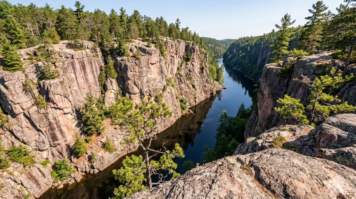
Sheer 100-metre pink and grey granite cliff walls plunging to a narrow dark river far below, seen from the canyon rim with sparse pines clinging to the rock, Barron Canyon in Algonquin Provincial Park Ontario, ultrarealistic photograph representative of the region

The remote east side — Barron Canyon & Achray

The park's most dramatic geology is nowhere near Highway 60. Barron Canyon — a granite gorge roughly 100 m deep on the Barron River — is reached from Sand Lake Gate near Pembroke, with a short (~1.5 km) rim-loop trail and a base campground at Achray on Grand Lake.

It's a quieter, more rugged alternative to the busy corridor — but it's a separate trip approached from the east, not a side-trip off Hwy 60.

Sand Lake Gate from PembrokeNot off Hwy 60
Which trip for which visitor First visit, family, or short on gear? The Highway 60 corridor, easily — car-camp at Mew Lake or Lake of Two Rivers, walk the short trails, watch for moose. Want solitude and a real paddle? The interior, with a permit and a rented canoe, launched from Canoe Lake or Rock Lake. Want cliffs and quiet? The east side — Achray and Barron Canyon from Pembroke. Want winter? Mew Lake's yurts and the groomed ski trails (§09). Whichever you choose, the vehicle permit, the bugs and the bears apply everywhere.
04 / THE DAY TRAILS

The corridor day-hikes, from a boardwalk to a ridgeline

Algonquin's Highway 60 corridor is lined with interpretive and hiking trails, spaced by their km markers and ranging from a flat family boardwalk to a genuinely strenuous ridge loop. The distances below come from Ontario Parks and the Friends of Algonquin and are the best figures we could confirm — but a few individual distances are approximate, and trail conditions and closures change, so check the trailhead board and the park's trail page before you count on any of them. All are on the Highway 60 corridor unless noted.

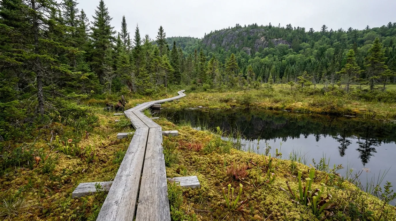
A wooden boardwalk winding through a black spruce bog with low tamarack, sphagnum moss and still dark water, a forested Shield ridge behind under soft overcast light, Algonquin Provincial Park Ontario, ultrarealistic photograph representative of the region
The Spruce Bog Boardwalk, km 42.5. A ~1.5 km loop (about an hour) on boardwalk through two black-spruce bogs — easy, level, and excellent for families and birders. The gentlest way to stand in the heart of a Shield bog ecosystem.

The easy wins — short trails, big payoff

The family classic · level boardwalkSpruce Bog Boardwalk

~1.5 km loop, ~1 hr, easy. Boardwalk through two black-spruce bogs at km 42.5. Level and accessible-friendly, superb for kids and birders, and a genuine window into the Shield's bog ecology. The corridor's gentlest interpretive walk.

Bugs can be fierce here in June — bring a head net in black-fly season (§09).

~1.5 km loopEasy · km 42.5
Level boardwalk
~1 hour

Big view, small effortLookout Trail

~1.9 km loop, ~1 hr, moderate but steep. At km 39.7, a short climb to a magnificent view over several hundred square kilometres of park — the corridor's best short-hike payoff for the effort. A little steep, but brief.

Cliff-edge lookout — keep back from the edge and watch children.

~1.9 km loopModerate · km 39.7
Short steep climb
~1 hour

Old-growth pine & logging historyBig Pines Trail

~2.9 km loop, ~2 hrs, moderate. At km 40.3, a loop through old-growth white pine and the remains of an 1880s logging camp. A quieter walk that pairs the park's biggest trees with its logging story.

Distances for the shorter interpretive trails are approximate — confirm at the trailhead.

~2.9 km loopModerate · km 40.3
Old-growth loop
~2 hours
A panoramic view from a high rocky ridge over an endless mosaic of forested Shield hills, lakes and autumn-colour maple ridges receding into blue haze, with exposed granite and windswept pines in the foreground, Algonquin Provincial Park Ontario, ultrarealistic photograph representative of the region
The panorama from Centennial Ridges, km 37.6. Two high ridges deliver the corridor's finest views — and the ~10 km loop is genuinely strenuous, widely rated the best hike in the park. Give it 3–6 hours, carry water, and start early (§04).

The bigger days — ridges, history & wildlife

The best hike in the park · strenuousCentennial Ridges Trail

~10 km loop, 3–6 hrs, strenuous. At km 37.6, two high ridges with the corridor's best panoramic viewpoints — widely considered the finest hike in Algonquin. A real workout with sustained climbs.

Strenuous and long — carry water and food, start early, and give yourself the full time budget. Not a casual after-lunch walk.

~10 km loopStrenuouskm 37.6
Two ridge climbs
3–6 hours

Cliff lookout & a railway returnBooth's Rock Trail

~5.1 km loop, ~2–3 hrs, difficult. At km 40.3, then ~9 km south on Rock Lake Rd. Two lakes, a dramatic cliff-top lookout, and a return along an abandoned railway. A rewarding, varied loop with some steep sections.

Cliff-top lookout with drops — mind footing and the edge.

~5.1 km loopDifficultRock Lake Rd
Cliff + railway loop
2–3 hours

Cache Lake lookout & rail historyTrack & Tower Trail

7.5 km loop, ~2.25 hrs, moderate (with an option to extend toward Cache Lake, ~10+ km). At km ~25, a spectacular lookout over Cache Lake and a route steeped in railway and logging history.

The Cache Lake extension roughly doubles the distance — plan the time.

7.5 km loopModerate · km ~25
Lookout loop
~2.25 hours

The corridor's premier wildlife walkMizzy Lake Trail

~10.8 km, full day. At km ~15, visiting nine ponds and small lakes — the best corridor trail for moose, beaver and birds. An early start is advised, and no dogs are allowed to protect the wildlife.

No dogs. Full-day length — start early for wildlife and to finish in daylight.

~10.8 kmNo dogsWildlife
Nine ponds
Full day
Other short interpretive trails along the corridor Spaced along Highway 60 you'll also find Hardwood Lookout, Peck Lake, Two Rivers, Beaver Pond and Whiskey Rapids — each roughly 1.5–3 km, easy to moderate, and each with its own interpretive theme. Individual distances for these shorter trails are approximate — pick up the trail guide at a gate or the Visitor Centre and confirm at the trailhead. Just outside the West Gate, Ragged Falls (in Oxtongue River–Ragged Falls Provincial Park) is a short ~1 km walk to a powerful cascade — an easy add-on.
Trailkm markerDistance*Time / difficultyThe draw
Spruce Bog Boardwalkkm 42.5~1.5 km loop~1 hr · easyBlack-spruce bog, families, birds
Lookoutkm 39.7~1.9 km loop~1 hr · moderate/steepBig view, small effort
Big Pineskm 40.3~2.9 km loop~2 hr · moderateOld-growth pine, 1880s logging camp
Track & Towerkm ~257.5 km loop~2.25 hr · moderateCache Lake lookout, rail history
Centennial Ridgeskm 37.6~10 km loop3–6 hr · strenuousThe best panoramas in the park
Booth's RockRock Lake Rd~5.1 km loop2–3 hr · difficultCliff lookout, railway return
Mizzy Lakekm ~15~10.8 kmFull day · no dogsNine ponds, premier wildlife

*Distances and times are Ontario Parks / Friends of Algonquin figures — a few individual distances are approximate, so confirm at the trailhead board. Times are fit-hiker estimates. Trail closures and conditions change — check the park's trail page before you go.

05 / THE CANOE COUNTRY — READ BEFORE YOU PADDLE IN

2,000 km of routes, a permit, and an assigned lake to sleep on

The interior is the real Algonquin — roughly 2,000 km of canoe routes linking more than 2,400 lakes by portage, and about 2,000 designated backcountry campsites reached only by paddle. Paddle-in tripping here is a Canadian rite of passage. But it's a permit system, not a free-for-all: you reserve a route, you're assigned the lakes you sleep on, and once you leave the launch there's no cell service and no quick rescue. Here's how it works, and where to launch.

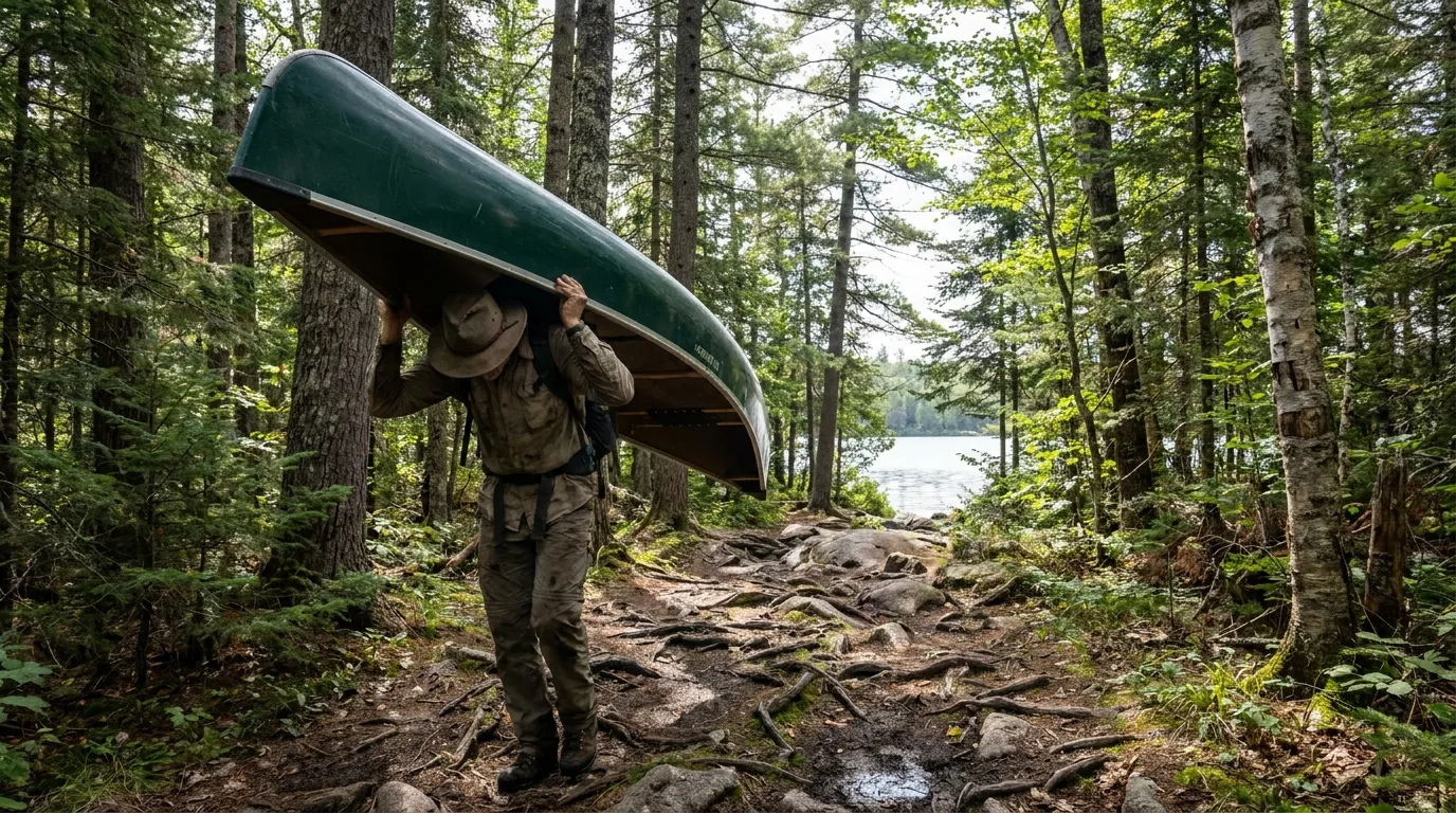
A lone canoe tripper carrying an overturned green canoe on their shoulders along a rugged forest portage trail between two lakes, roots and granite underfoot with tall pines and mixed hardwood forest, dappled summer light, Algonquin Provincial Park Ontario, ultrarealistic photograph representative of the region
A portage between interior lakes. The canoe goes on your shoulders and the packs on your back — portages are the connective tissue of Algonquin's route network, and learning to carry efficiently is half the skill of tripping here. Roughly 2,000 km of routes fan out from the corridor launches.

The permit, plainly

Every interior party needs an Interior Camping Permit — backcountry fee about $14.13 per person per night. You reserve on the same five-month rolling window (reservations.ontarioparks.ca or 1-888-ONT-PARK), specify your route, and are assigned the lakes and nights you're authorized to camp on.

Camping is only at designated backcountry sites. Late May or September mean fewer bugs (§09).

~$14.13 / person / nightConfirm the 2026 fee

Where to launch

  • Canoe Lake (km 14): the Portage Store — the classic launch for day paddles and interior trips, tied to Tom Thomson's history
  • Lake Opeongo (Opeongo Rd, ~km 46): the park's largest lake and the gateway to big interior loops — a water-taxi can shuttle you past the long open-water crossing
  • Rock Lake (~km 40.3): a quieter launch into the southern interior
  • Achray / Grand Lake (east side): the base for Barron Canyon day-paddles and eastern routes
The Opeongo head-start — the water taxi Lake Opeongo is the park's largest lake, and its long open-water crossing can cost paddlers a hard, wind-exposed day before the tripping even begins. The Opeongo water taxi (run by the local outfitters) can shuttle you and your canoe to the far portages, opening up bigger interior loops toward Big Trout, Happy Isle and Redrock. It's the classic way to turn a long expedition into a manageable one — and Opeongo is renowned for lake trout and smallmouth bass fishing besides. Confirm current water-taxi operators, schedules and rates directly — we link rather than quote.
🔴 Before you paddle into the interior — the non-negotiables Carry maps and a compass (and ideally a satellite communicator) — there is no cell service in the interior and rescue is neither quick nor guaranteed. Treat, filter or boil all backcountry water. Store food properly and hang it — at least 4 m high and 2 m out from the trunk, or use a bear barrel (§06). Camp only at designated sites listed on your permit. Get an Ontario fishing licence if you'll fish, and know the park's special regulations. And build in a weather buffer — wind can pin you on a lake for a day. First interior trip? Keep the first night close to the access point and go in a low-bug window.
06 / SAFETY & REGULATIONS

Bears, fire bans, water, and the rules that catch people out

Most of what you need to get right at Algonquin is not exotic — it's food storage, fire status, clean water and a few park-specific rules. This is active black-bear country, the Superintendent can ban all fires in a dry spell, backcountry water must be treated, and drones are effectively prohibited park-wide. None of it is hard; all of it has to be planned for before you go.

Black-bear country — keep a clean site

Algonquin is active black-bear habitat. Keep a "bare" campsite: clean up immediately, store all scented items (food, toothpaste, deodorant) securely, and pack out all garbage.

Backcountry food storage: hang food and scented items at least 4 m high and 2 m out from the tree trunk, or use a bear-resistant food barrel. Burn food scraps thoroughly only where fires are permitted; otherwise pack them out.

Hang food 4 m up, 2 m outOr use a bear barrel

Fire bans & the drone rule

  • Total Fire Ban: the Superintendent can prohibit all open fires in a dry spell — one was in effect 14 Aug 2025. Always check the current fire rating before lighting anything
  • During a total ban, portable gas stoves are generally still allowed if kept ≥1 m from flammable material and fitted with a shutoff
  • Drones: Algonquin is effectively a "no drone zone" — UAVs may not land in the park and recreational flying is prohibited without authorization. Assume they're not allowed
  • Leave No Trace: pack in/pack out, stay on trails, use designated sites, no soap in the lakes
A misty spruce and pine forest edge along a still lake at dusk in deep blue twilight, silhouetted conifers and a faint rising moon, the wild quiet of wolf country, Algonquin Provincial Park Ontario, ultrarealistic photograph representative of the region
Dusk in wolf country. Algonquin's eastern wolves make the park famous, and on Thursday evenings in August park naturalists run the bucket-list Public Wolf Howl — a caravan out to howl and listen for wild responses. It's weather- and wolf-dependent, and the exact 2026 dates should be confirmed with the Friends of Algonquin.

Drinking water & advisories

Treat, filter or boil all backcountry water. Developed campgrounds provide potable water at comfort stations, but boil-water advisories can occur — check current advisories at the gate or office before relying on any tap.

Any specific advisory status is time-sensitive and unverified — confirm on arrival.

Fishing, pets & the other rules

  • Fishing: an Ontario licence is required and special park regulations and slot limits apply — Algonquin holds a big share of Ontario's native brook-trout lakes plus strong lake-trout waters (Opeongo)
  • Pets must be leashed, and some trails (e.g. Mizzy Lake) prohibit dogs
  • Cell service is unreliable — carry maps and a plan (§02)
Wildlife distance, briefly Moose, black bear, beaver and wolves are all here, and the corridor's roadside moose in spring can tempt people far too close. Never feed or approach any wildlife, give moose and bears wide room, and stay in your vehicle for roadside sightings. If an animal changes its behaviour because of you, you're too close. Confirm current wildlife and program guidance with the park, and treat every wild animal as wild.
07 / THE CAMPING STRATEGY

Nine corridor campgrounds, year-round yurts, and the remote grounds

Camping here sorts into three buckets: the nine developed campgrounds along the Highway 60 corridor (from full-service to rustic), the remote drive-in grounds at the north and east access points, and the permit-only interior sites (§05). Ontario Parks books on a five-month rolling window and popular summer and fall-colour weekends fill the moment it opens. The fees below are 2026 developed-campground rates from the Friends of Algonquin fee page and include 13% HST — and a separate Daily Vehicle Permit (about $21) applies on top.

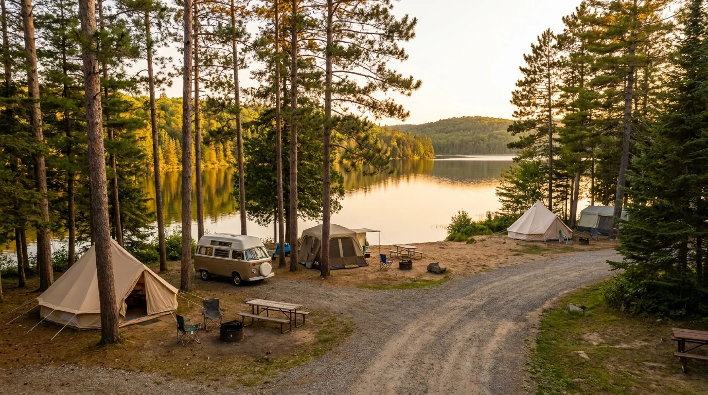
A lakeside drive-in campground with tents and a camper among tall red pines on a sandy shoreline, a calm lake and forested Shield hills beyond in warm late-afternoon light, Lake of Two Rivers area Algonquin Provincial Park Ontario, ultrarealistic photograph representative of the region
Lake of Two Rivers, km 31. One of the corridor's biggest and most central campgrounds — comfort stations, showers, a beach, a nearby store and the Visitor Centre close by. Like all the corridor grounds, it books out for peak summer and fall weekends.

The Highway 60 corridor — nine developed campgrounds

Campgroundkm / locationTypeSeasonReported 2026 fee* (incl. HST)
Tea Lake ~km 8 Drive-in, more rustic; ~40 sites (confirm) ~May–Oct Electrical ~$43.79
Canisbay Lake km 23 Drive-in + 16 paddle-in; 242 frontcountry; comfort stations, showers, beaches (specifics confirm) ~May–Oct Premium electrical ~$53.68–59.33
Mew Lake km 30.6 Drive-in + yurts + cabins; heated comfort station, hot showers year-round; skating rink Year-round Premium electrical ~$53.68–59.33
Lake of Two Rivers km 31 Drive-in (tents/trailers/RVs); comfort stations, showers, beach, store nearby; 200+ early May–late Oct Premium electrical ~$53.68–59.33
Pog Lake ~km 36.5 Drive-in; comfort stations, showers, beaches, pine forest; 280+ (confirm) May long wknd, mid-June–Labour Day Premium electrical ~$53.68–59.33
Kearney Lake ~km 36.5 Drive-in; comfort station, showers (confirm); ~100 sites (confirm) ~summer season Premium electrical ~$53.68–59.33
Raccoon Lake (formerly Coon Lake) Rock Lake Rd area Quieter/rustic; limited or no electrical; ~48 sites, vault toilets (confirm) ~summer season ~$42.38
Rock Lake ~km 40.3, then ~8 km S Drive-in + water access; comfort station, showers, beach, canoe access; ~120 (confirm) ~May–Oct Premium electrical ~$53.68–59.33
Whitefish Lake Group off Rock Lake Rd Group camping only ~summer season Group rates (unconfirmed)

The remote north & east access-point grounds

CampgroundAccessNotesReported 2026 fee* (incl. HST)
Achray Sand Lake Gate → Barron Canyon Rd (east, Grand Lake) Gateway to Barron Canyon; quieter; Grand Lake beach Electrical ~$47.46–52.55
Kiosk Hwy 630 south (north side) On Kioshkokwi Lake; rustic, remote ~$42.38–46.04
Brent Bissett Creek Rd (gravel), north side On Cedar Lake; very remote, rustic ~$42.38

*Fees are 2026 rates from the Friends of Algonquin fee page, inclusive of 13% HST, and a separate Daily Vehicle Permit (~$21) applies on top. Ontario-resident senior (20%) and accessibility (50%) discounts exist. Site counts and some shower/dump-station specifics marked "confirm" are approximate and should be checked on each campground's ontarioparks.ca facilities page before you book. Verify all fees at the source.

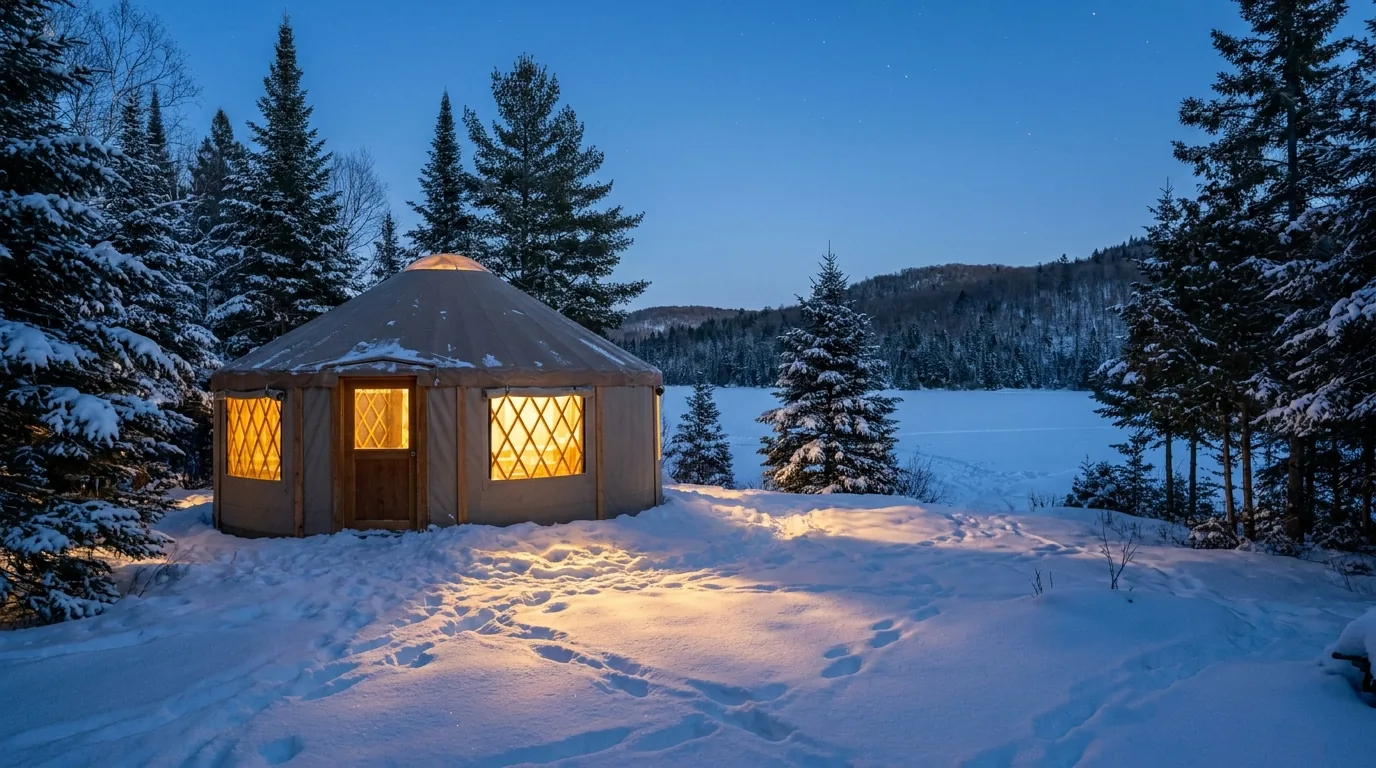
A fabric octagonal yurt in winter with warm light glowing from the windows, deep fresh snow and snow-laden spruce and pine trees, a frozen lake and forested Shield hills beyond at blue-hour dusk, Mew Lake Algonquin Provincial Park Ontario, ultrarealistic photograph representative of the region

Mew Lake yurts & winter camping

Mew Lake (km 30.6) is open year-round and is the park's winter-camping hub. It offers 6 yurts and 4 cabins — fabric octagonal yurts with electric heat, outlets and bunk beds (a double lower + single upper per bunk, sleeping up to ~6).

A heated comfort station with indoor flush toilets, running water and hot showers runs through winter, and there's a lit outdoor skating rink nearby with a campfire pit and warming tent. It's also the gateway to the corridor's groomed ~72 km cross-country ski network, snowshoeing and fatbiking.

Year-roundYurt fee — confirm at ontarioparks.ca
Booking — the five-month window Ontario Parks reservations open on a five-month rolling window (reservations.ontarioparks.ca or 1-888-ONT-PARK / 1-888-668-7275). Popular July–August weekends and every fall-colour weekend should be booked the moment the window opens. The interior is booked the same way, with an assigned route (§05). Confirm the exact window, current fees and any changes at ontarioparks.ca before you plan around a specific date.
08 / OUTFITTERS & SERVICES

The outfitters, the bakery, and the gateway towns

Algonquin has one of the strongest outfitting cultures in Canada — canoe rental, route outfitting, guided trips and water-taxi shuttles clustered around the gates and the big launches. Beyond that, the services thin out fast, so plan your resupply around Huntsville and Dwight in the west and Whitney and Pembroke in the east. Everything below is a real, currently-trading business whose own website we resolved; seasons, menus and prices change, so we link rather than quote.

Outfitters, rentals & guided trips

  • Algonquin Outfitters (Oxtongue Lake main store, near the West Gate, plus in-park locations) — Ontario's best-known Algonquin outfitter for 50+ years; canoe/kayak rentals, gear, full trip outfitting (algonquinoutfitters.com)
  • The Portage Store (Canoe Lake, km 14, inside the park) — rentals, outfitting packages, a restaurant and guided day trips; operated under contract to Ontario Parks (theportagestore.com)
  • Opeongo Outfitters (Lake Opeongo, east corridor) — the oldest Algonquin outfitter (since 1936); rentals, delivery to Hwy 60 access points, and the Opeongo water taxi (opeongooutfitters.com)
  • Voyageur Quest / Algonquin Wilderness Centre (Access Point #1, northwest, off Hwy 11) — rentals, permits, parking, full outfitting and guided trips, plus an "Algonquin Starter Package" for first-timers (voyageuroutfitting.com)
  • Algonquin Portage (east / Barron Canyon side) — outfitter serving the Achray/Barron routes; rentals and packages (confirm exact location/services) (algonquinportage.com)

Call of the Wild (Toronto-based guided Algonquin trips) is another operator, but its details could not be confirmed this pass — verify before relying on it.

Lodging, food & in-park stores

  • The Wolf Den Nature Retreat (4568 Hwy 60, Oxtongue Lake, ~9 km outside the West Gate) — log-cabin hostel plus private cabins on the Oxtongue River; backpacker-friendly (wolfdenbunkhouse.com)
  • Henrietta's Pine Bakery (Dwight, on Hwy 60, plus a Huntsville location) — a 50+ year family-run European-style bakery: pastries, pies, butter tarts, quiche, paninis. A near-obligatory stop en route to the West Gate (henriettaspinebakery.ca)
  • In-park stores: the Lake of Two Rivers Store, the Portage Store (Canoe Lake) and the Opeongo Store provide seasonal fuel, snacks and basic supplies inside the corridor (hours seasonal — confirm)

Additional Whitney, Dwight and Huntsville diners, general stores and lodges exist but were not individually verified this pass — check current websites before you rely on any of it.

The culture stops — worth the corridor time Beyond the trails, three corridor stops are worth building in: the Algonquin Visitor Centre (km 43), open year-round, with exhibits, the "Images of Algonquin" theatre film, a viewing deck and the Algonquin Room gallery — the best orientation stop; the Algonquin Logging Museum (km ~54, near the East Gate), with a 1.5 km interpretive trail, a recreated camboose camp and a steam-powered amphibious "alligator" tug; and the Algonquin Art Centre (km 20), a gallery of Canadian wilderness and wildlife art, open roughly June 1 to mid-October, ~10am–5pm daily. Confirm current hours and dates before you plan around them.
Getting there For the Highway 60 corridor, the common approaches are from Toronto (via Hwy 11 to Huntsville, then Hwy 60 east to the West Gate) or from Ottawa (via the Ottawa Valley and Barry's Bay to the East Gate at Whitney) — the corridor is roughly a half-day's drive from either city. For Barron Canyon and the eastern access points, approach from Pembroke via Hwy 17 to Sand Lake Gate. For the northern access points (Brent, Kiosk), work off Hwy 17. Confirm current drive times and any highway or gravel-road closures with live mapping before you go.
09 / TIMING

When to go — the bugs and the colour decide

Algonquin has one marquee season and one hidden trade-off. The marquee is the fall colour, roughly late September to early October, which draws the world and jams the West Gate on weekends. The trade-off is the bugs: black flies own June, and mosquitoes carry into late July. The best answer for most people is a shoulder window — early May for a bug-free, moose-rich, uncrowded trip, or September onward for colour and comfort. Here's the honest season-by-season.

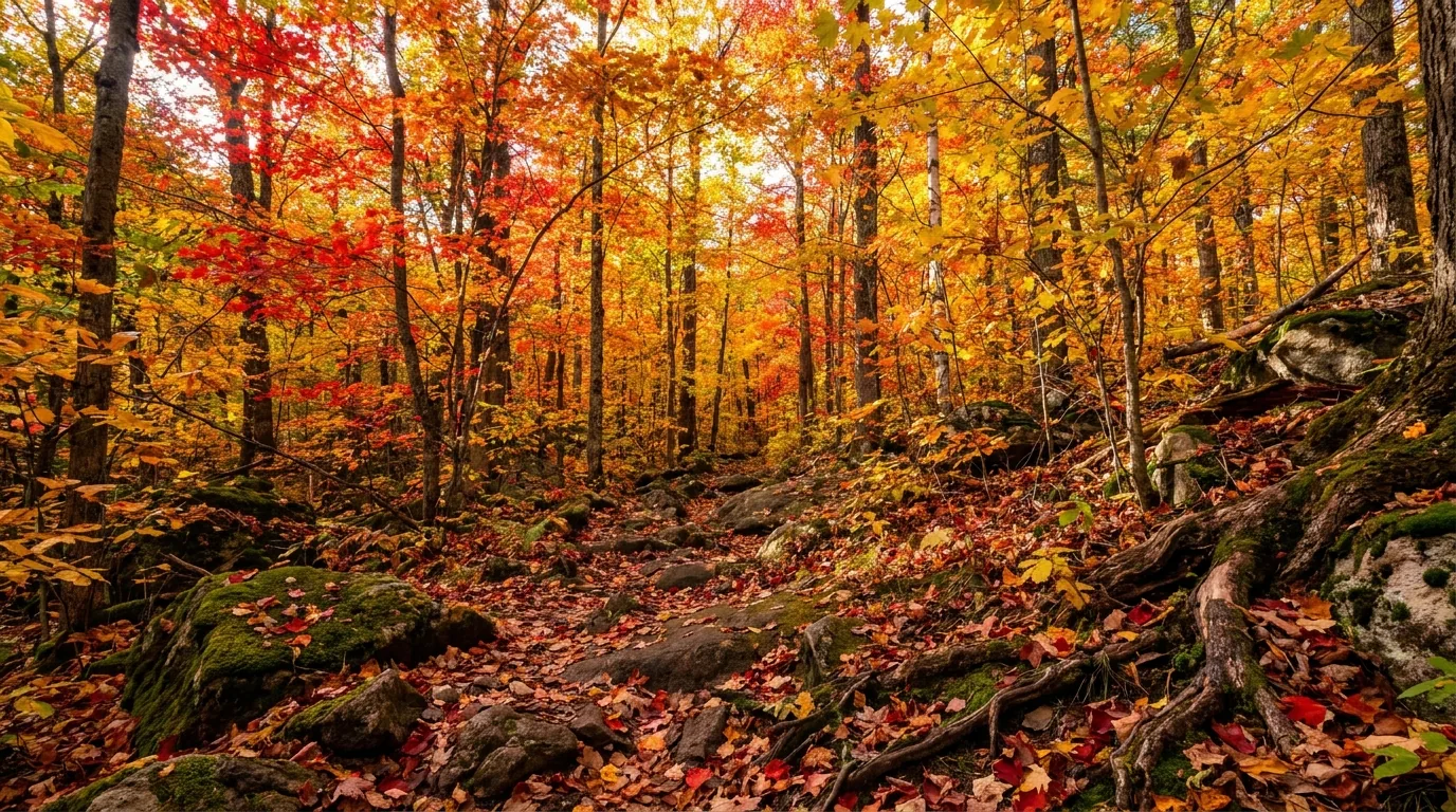
A dense sugar maple and red maple hardwood forest at peak autumn colour, a luminous canopy of vivid scarlet, orange and gold leaves with yellow birch and a leaf-strewn forest floor, backlit afternoon light, Algonquin Provincial Park Ontario, ultrarealistic photograph representative of the region
Peak maple colour, late September. Algonquin's sugar and red maples turn one of the most spectacular displays in eastern North America — and the Friends of Algonquin publish a live Fall Colour Report to help you time it. The catch: everyone comes, so go mid-week and book early (§07).

Season by season, straight

  • Spring (May–early June) — a hidden gem, then the bugs. Early May is usually essentially bug-free, with prime moose viewing and higher water for paddling. After mid-May the black flies arrive — that's the trade-off
  • Summer (July–Aug) — warm water, busy corridor. The best swimming and the busiest corridor campgrounds — book far ahead. Bugs ease through July; the interior is the escape from the crowds
  • Fall (mid-Sept–mid-Oct) — the marquee. Maple peak is typically the last week of September into the first week of October. Extremely busy on weekends, especially the Thanksgiving long weekend at the West Gate. Go mid-week (not Fridays)
  • Winter (Dec–Mar) — quiet and white. Mew Lake yurts and cabins, ~72 km of groomed ski trails, snowshoeing and fatbiking. Highway 60 stays open; most other facilities are closed (§07)

The bug calendar, honestly

  • Black flies: ~mid-May to late June, peaking in June — can be genuinely intense in the interior. A bug shirt or head net is strongly recommended for June
  • Mosquitoes: take over as black flies wane (usually by mid–late June) and persist into late July — more tolerable, still present
  • Bug-light windows: early May is usually essentially bug-free; August and fall are far more comfortable
  • If bugs would ruin it for you, aim for early May or September onward — and pack the head net regardless in June
The one-paragraph answer Go in early May or from September into mid-October for the best balance of comfort, wildlife and (in fall) colour. Summer is warm and great for swimming and paddling but the corridor is packed and you must book far ahead; June is beautiful but buggy, so bring a head net; winter is a quiet, magical yurt-and-ski trip on the corridor. Whichever you pick: get your vehicle permit, book your site the moment the five-month window opens, watch the live Fall Colour Report if you're chasing the maples, go mid-week to dodge the crowds, and plan around the bugs rather than being surprised by them.
10 / THE SHAPE OF THE TRIP

Six ways to do Algonquin, from a weekend to an expedition

Six workable shapes, not the only ones. They range from a car-camping corridor weekend to a multi-day interior expedition, and each keeps the park's realities front and centre — the vehicle permit, the five-month booking window, the bugs, the bears. Adjust freely, but book early, plan the bugs, and confirm gate, fire and colour status before you count on them.

01

Highway 60 Weekend (2–3 days)

  1. Base at Mew Lake or Lake of Two Rivers (central, full-service, near the Visitor Centre).
  2. Day 1: enter the West Gate, stop at the Art Centre (km 20) and the Track & Tower lookout.
  3. Day 2: Visitor Centre orientation, the Spruce Bog Boardwalk and the Lookout Trail; a sunset moose-watch drive along Hwy 60.
  4. Day 3: the Logging Museum near the East Gate on the way out.
Family-friendlyMinimal gear
02

Fall-Colours Loop (2 days)

  1. Book early. Go mid-week to dodge the Thanksgiving crush.
  2. Hike Centennial Ridges (best panoramas) and Booth's Rock for peak-maple views.
  3. Drive the corridor at golden hour; check the live Fall Colour Report.
  4. Add Ragged Falls just outside the West Gate.
Book the moment the window opensMid-week
03

First Paddle-In Trip (2–3 days)

  1. Launch from Canoe Lake / Portage Store or Rock Lake; rent from Algonquin Outfitters or the Portage Store.
  2. Choose a short-portage route to a nearby interior lake; get the Interior Camping Permit.
  3. Learn the bear-hang and keep the first night close to the access point.
  4. Go in late May or September for fewer bugs.
Interior permit requiredBeginner backcountry
04

Opeongo Head-Start Expedition (3–5 days)

  1. Use the Opeongo water taxi to skip the long open-water paddle and reach the far portages fast.
  2. Open up bigger interior loops (toward Big Trout / Happy Isle / Redrock).
  3. Serious trip planning, maps and a weather buffer required.
  4. Fish for lake trout on Opeongo with an Ontario licence.
IntermediateWeather buffer
05

East-Side Barron Canyon (2–3 days)

  1. Enter via Sand Lake Gate from Pembroke — a separate approach, not off Hwy 60.
  2. Camp at Achray (Grand Lake); hike the Barron Canyon Trail.
  3. Day-paddle into the canyon on the Barron River.
  4. A quieter, more dramatic-geology alternative to the corridor.
Quieter east sideApproach from Pembroke
06

Winter Yurt Getaway (2 days)

  1. Book a Mew Lake yurt or cabin (year-round).
  2. Ski or snowshoe the groomed ~72 km network; skate the lit rink.
  3. Use the heated comfort station with hot showers.
  4. The most accessible way to experience Algonquin in winter.
Year-round Mew LakeWinter
11 / TRIP-READY

The departure check

Run it before you leave. Tap each item as it's done — these are the ten things specific to Algonquin that a general road-trip habit will skip. Most come back to two facts: you have to book ahead on a five-month window that fills fast, and the season you pick decides the bugs, the crowds and the colour.

0 / 10 confirmed — book early, plan the bugs.
12 / QUICK ANSWERS

Asked at every Algonquin gate

Do I need a reservation to visit Algonquin?
For a day visit, no — but every vehicle needs a Daily Vehicle Permit (~$21) or an Annual Permit (~$92), and the daily permit is valid roughly 7am–10pm. To camp, you reserve a site: Ontario Parks opens bookings on a five-month rolling window, and summer and every fall-colour weekend fill the moment it opens. Backcountry canoe trips need a separate Interior Camping Permit. Confirm current prices at ontarioparks.ca.
When is black-fly season, and how bad is it?
Black flies run mid-May to late June and peak in June, and in the interior they can be genuinely intense — a bug shirt or head net is strongly recommended for June. Mosquitoes take over as the black flies wane (by mid–late June) and persist into late July. Early May is usually essentially bug-free (and prime moose viewing); August and fall are far more comfortable. If bugs would ruin the trip, aim for early May or September onward.
When do the fall colours peak?
The sugar and red maple peak is typically the last week of September into the first week of October, with the broader colour season mid-September to mid-October. It's the marquee season and the weekends — especially the Thanksgiving long weekend — are extremely busy, particularly at the West Gate. Go mid-week (not Fridays), and watch the Friends of Algonquin live Fall Colour Report to time it.
Can I camp in Algonquin in winter?
Yes — Mew Lake (km 30.6) is open year-round and is the winter hub. It offers heated yurts and cabins with electric heat and bunk beds, a heated comfort station with indoor flush toilets and hot showers through winter, and a lit outdoor skating rink. Highway 60 stays open, and Mew Lake accesses the corridor's groomed ~72 km ski network, snowshoeing and fatbiking. Most other facilities are closed. Confirm the yurt nightly fee at ontarioparks.ca.
Where can I see moose?
The classic spot is roadside along Highway 60 in spring and early summer, when moose seek sodium and aquatic plants in the ditches — early May (before the black flies) is a prime, low-bug window. The Spruce Bog Boardwalk and the full-day Mizzy Lake Trail are the corridor's best walking routes for moose, beaver and birds. Keep your distance, never approach, and drive slowly at dawn and dusk.
Is there fuel and cell service inside the park?
Fuel is limited to small seasonal stores near Lake of Two Rivers — fill up in Huntsville or Dwight (west) or Whitney (east); for the remote north/east access points, carry what you need. Cell coverage on Hwy 60 is spotty, with pockets near the gates, the Visitor Centre and Lake of Two Rivers, and effectively none in the interior or at most remote access points. Carry maps and consider a satellite communicator. Coverage varies by carrier.
How do canoe-trip (interior) permits work?
Every interior party needs an Interior Camping Permit — a backcountry fee of about $14.13 per person per night. You reserve on the five-month window (reservations.ontarioparks.ca or 1-888-ONT-PARK), specify your route, and are assigned the lakes and nights you can camp on. Camping is only at designated backcountry sites. Learn the bear-hang, treat all water, and go in a low-bug window for a first trip.
What are the bear and fire rules?
Algonquin is active black-bear country: keep a clean site, store scented items, pack out garbage, and in the backcountry hang food 4 m high and 2 m out from the trunk (or use a bear barrel). The Superintendent can declare a Total Fire Ban in a dry spell (one was in effect Aug 2025), prohibiting all open fires — gas stoves with a shutoff are generally still allowed. Always check the current fire rating. Drones are effectively banned.
What's the Public Wolf Howl?
A famous summer program run by park naturalists on Thursday evenings in August: visitors caravan out at dusk to howl and listen for wild eastern-wolf responses. It's weather- and wolf-dependent, so it doesn't run every week, and the exact 2026 dates should be confirmed on algonquinpark.on.ca before you plan around it. When it works, it's a bucket-list Algonquin experience.
13 / WHAT WE COULD NOT CONFIRM

The honest gaps, all in one place

Every guide has these; most don't print them. Algonquin's fees, site counts and program dates shift year to year, so some numbers here are estimates, and we've flagged them in place. Everything below was compiled 23 July 2026 and should be re-checked against the linked official source before you rely on it.

Why this section exists Anyone can write a guide that sounds certain. The hard part is knowing which numbers are real — and at a park where the fees change yearly, the site counts drift, the Wolf Howl only runs some Thursdays, and the bugs can define a trip, plenty of them need a same-season check. The null is the product. "Book the moment the five-month window opens" and "pack a head net for June" are usable instructions. A confident wrong answer here costs a wasted drive to a full campground — or a miserable, unprepared week in the black flies.
🔒

The printable field guide

Everything above, condensed into a print-ready PDF built for the glovebox — for a park where the campgrounds book out five months ahead, the fall-colour weekends jam the gate, and the bugs can define a trip. The Highway 60 corridor and its nine campgrounds decoded, year-round Mew Lake and the yurts, the day trails from boardwalk to ridgeline, the interior canoe country and the paddle-in permit, the remote east and north access points, moose and the Wolf Howl, the honest bug calendar, the bear and fire rules, the outfitters and towns, and the honest list of what nobody could confirm — on paper that works where the bars don't.

Highway 60 corridor, decoded 9 campgrounds, 2026 fees Day trails, boardwalk to ridge Canoe country & interior permits Mew Lake yurts & winter Barron Canyon & the east side The honest bug calendar The departure check
Unlock the PDF — $4.95
$4.95 per guide · Instant access · Built by people who actually camp there
Trail Journal No. 056

Go farther. Camp lighter.
Leave it better.

Every Trekkr Trail Journal is built like this one: custom logistics, honest trail beta, the camping and access detail, and the local knowledge that turns a good trip into the one your crew talks about for years — including, always, a plain list of what we could not confirm. New destinations drop all season long, from the Canadian Shield to the Utah canyons to the Desert Southwest.

Unlock the Trail Journal Library
↗ Read another issue — No. 051, Grand Canyon National Park
$4.95 per guide · Instant access · Built by people who actually camp there