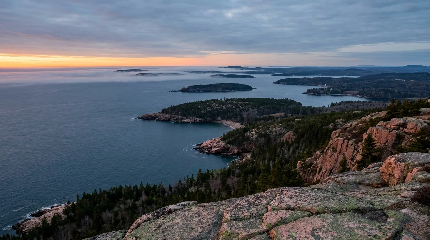
Bare pink granite summit ledges at first light above the open Atlantic, a bay scattered with dark spruce-covered islands and the sun burning low and orange over the water, Cadillac Mountain in Acadia National Park Maine, ultrarealistic photograph representative of the region
Trekkr Trail Journal · No. 065 · Acadia & the Maine Coast

AcadiaMaine — the Cadillac reservation, the tide chart that runs your day, 45 miles of car-free gravel & the coast most people time wrong

This is the place on the eastern seaboard where the mountains fall straight into the Atlantic — bare pink granite at 1,530 feet, sunrise out of open ocean, and a lobster roll at sea level forty minutes later. It's also one of the smallest national parks in the system and reliably one of the most visited. Two invisible forces govern everything: the tide, which opens and closes a land bridge twice a day and decides whether Thunder Hole booms or shrugs, and the fog, which can erase a summit sunrise you got up at 3:45 a.m. and paid $6 to reserve. Plan around the chart, hold the sunrise loosely, and Acadia pays you back enormously.

Maine · USA Mount Desert Island · Schoodic · Isle au Haut Cadillac reservation 20 May–25 Oct 2026 Tide-planned days · falcon closures
1,530 ftCadillac Mtn — highest on the North Atlantic seaboard
45 miMotor-free carriage roads, built 1913–1940
27 miPark Loop Road — one-way in sections, no U-turns
~3 hrsBar Island window — or a ~9-hour wait
Conditions verified 24 July 2026 · The Cadillac reservation and the tide chart decide the trip before the trail does · This block goes stale — the links don't

Two things shape an Acadia trip: a $6 reservation, and what the water is doing

The rest of this journal is evergreen; this box is not. At Acadia two things decide whether your plan works before you pick a trail — whether you hold a Cadillac Summit Road vehicle reservation (§02), and where the tide is on the day you show up (§09). A park entrance pass is required year-round, and it is not the same thing as the Cadillac reservation. Everything below is dated to the day we checked it. Trust the live sources, not our date stamp.

  • Cadillac Summit Road: reservation required 20 May – 25 Oct 2026, $6, Recreation.gov onlyThis is in addition to your entrance pass and is not sold at the park. Sunrise entry windows run 4:00–7:30 a.m. (90-minute window); daytime runs 6:00 a.m.–8:00 p.m. (30-minute window). 30% release 90 days out; 70% release two days out — both at 10:00 a.m. ET. The two-day drop is where most people actually get a slot. Motorcycles, scooters and mopeds each need their own. [VERIFY the fee — NPS has floated a proposed reservation fee change] (§02)
  • Over 21 feet? You cannot drive Cadillac at allVehicles over 21 ft — including anything towed or attached — are prohibited on the Cadillac Summit Road. If you're in a Class C or towing, the summit is a foot, bike or taxi proposition (none of which need a reservation), and the Island Explorer bus does not serve the summit road. The Park Loop Road also has low stone-arch clearances and tight sections — park the trailer and drive the loop in a tow vehicle. [Posted Park Loop clearances/length limits are UNVERIFIED — NPS doesn't publish figures] (§02)
  • The tide runs your day — Bar Island one way, Thunder Hole the otherBar Island: the half-mile gravel bar is walkable only about 1.5 hours either side of LOW tide — roughly a three-hour window — and if you miss it you wait about nine hours. Thunder Hole: best 1–2 hours BEFORE HIGH tide, and it needs swell. Those windows sit 4–5 hours apart — both in one day is possible, but only on purpose. Print a Bar Harbor tide chart before you lose signal. (§09)
  • Peregrine falcon closures start around 1 March — and they're enforcedIn 2026 the NPS closed Jordan Cliffs, Penobscot East, Precipice and Valley Cove from 1 March "until further notice," and closed the Precipice Trail parking lot to vehicles as well. Closures usually lift in late summer once chicks fledge, but the date is never fixed. [VERIFY at nps.gov/acad "Current Conditions" the week you travel — do not drive to the trailhead on hope] (§04, §06)
  • Entrance pass required year-round — and the park is cashless$35 private vehicle / $30 motorcycle / $20 per person on foot or bike (7 days), or $70 for the Acadia annual pass. Required all year, including on the Park Loop Road, and displayed in the windshield. All official fee outlets are card or mobile only — no cash. 24/7 automated machines at Hulls Cove and the Schoodic Institute. [VERIFY current fees at nps.gov/acad] (§02)
  • No fuel in the park, unreliable signal, and drones are banned outrightThere is no fuel inside the park — fill in Ellsworth, Bar Harbor, Southwest Harbor or Trenton. NPS states plainly that "park connectivity is unreliable": expect dead zones on the carriage roads, in the Somes Sound valleys, on Schoodic, and effectively nothing on Isle au Haut. Launching, landing and operating drones is prohibited in Acadia — no recreational permits. (§02, §06)
Live sources · Cadillac Summit Road reservations (NPS) · Acadia Current Conditions & closures · Fees & passes · Recreation.gov · NOAA Tides & Currents — Bar Harbor
In an emergency, 911 where there is signal. This box was true at press and will not stay true — the sources above are the truth on the day you travel.
01 / THE HOOK

Where the mountains end in the Atlantic — and the tide keeps the schedule

Nowhere else in the United States can you stand on bare pink granite at 1,530 feet, watch the sun come out of open ocean, and be eating a lobster roll at sea level forty minutes later. That compression — alpine-feeling summits, spruce-fir forest, glacial ponds, cobble beaches and a working fishing coast, all inside roughly 50,000 acres — is the whole argument for Acadia. It is also exactly why it gets overrun: this is one of the smallest parks in the system and consistently among the ten most visited. Understanding that tension is the difference between a trip that feels like a pilgrimage and one that feels like a parking lot. The park's core is Mount Desert Island, a granite dome the glaciers carved into ridges and valleys and split nearly in two by Somes Sound. But Acadia is not one island — it also holds the mainland Schoodic Peninsula and remote Isle au Haut, and both are quieter by an order of magnitude.

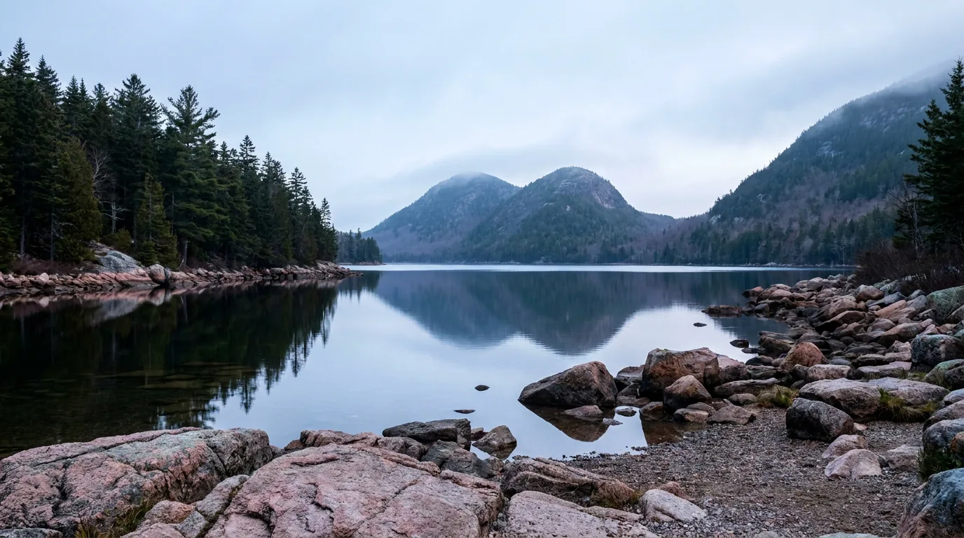
A still glacial pond in early morning reflecting two rounded twin mountain summits at its far end, dark spruce-fir forest lining the shore and calm water, Jordan Pond and the Bubbles in Acadia National Park Maine, ultrarealistic photograph representative of the region
Jordan Pond and the Bubbles. The classic Acadia postcard — a glacial pond framed by twin rounded summits, with a largely flat path circling the water and log-bridge boardwalk on the west shore. It is also one of the first lots in the park to fill, and an Island Explorer stop. Pond-loop distance is commonly cited around 3.2–3.3 miles — confirm on the NPS trail page (§04).

The payoff

Granite summits with 360° ocean views, 45 miles of car-free crushed-stone carriage road stitched by 17 hand-cut stone bridges, sea cliffs with fixed climbing anchors, and a coastline where the surf actually performs. From 7 October to 6 March, Cadillac is the first place in the country to see the sunrise (§03, §05).

The catch

It's small and it's busy. The Sand Beach, Jordan Pond and Bass Harbor Head Light lots fill by mid-morning in summer, the Park Loop's one-way sections mean no U-turns, and the Cadillac Summit Road needs a $6 reservation you can only buy online (§02).

The two invisible forces

Tide and fog. Gulf of Maine tides run an 8–12 foot rise and fall and open a gravel land bridge twice a day. Cold water plus warm air makes sea fog that can sit on the island for days — and eat a paid sunrise. Build a fog contingency into every summit plan (§09).

The way to think about the park — one island, one mainland peninsula, one boat-only island Nearly everyone bases on Mount Desert Island, where the 27-mile Park Loop Road threads Sand Beach, Thunder Hole, Otter Cliff and Jordan Pond, and where the carriage roads climb inland from Eagle Lake. The island has a busy east side (Bar Harbor and the Loop Road) and a genuinely quieter "quiet side" around Southwest Harbor and Bass Harbor. The Schoodic Peninsula — the park's only mainland section, roughly an hour and a quarter around Frenchman Bay from Bar Harbor — has the same granite and harder surf with a fraction of the people, and it holds the only park campground with hookups. And Isle au Haut, reached only by passenger mailboat from Stonington, is the far end of the spectrum: five lean-tos at Duck Harbor are the entire lodging inventory, the visitor number is limited, and half the island is privately owned. Pick which Acadia you're actually going to before you book anything.
02 / GETTING THERE, PASSES & THE CADILLAC RESERVATION

An entrance pass, a separate $6 summit reservation, and a free bus that beats the parking

Here's what first-timers get wrong, in order: they assume the entrance pass covers Cadillac (it doesn't), they assume they can buy the summit reservation at the gate (they can't), they assume the Park Loop Road is a two-way scenic drive (it isn't, in places), and they assume they'll find parking (they won't, after about nine in the morning). All four are solvable, and the solution to most of them is the same free shuttle. Sort the passes, book the reservation on the right drop, and park once.

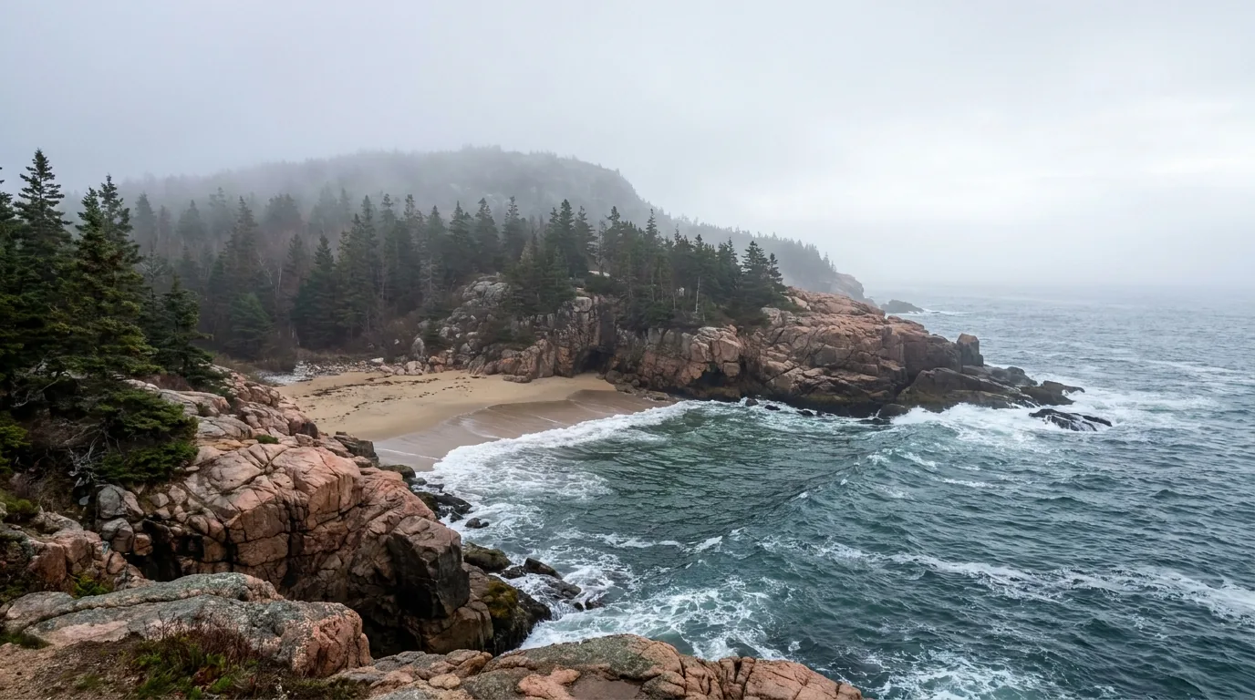
A small crescent sand beach tucked between pink granite headlands with cold blue-green Atlantic waves rolling in and dark spruce forest on the bluffs above, Sand Beach in Acadia National Park Maine, ultrarealistic photograph representative of the region
Sand Beach, on the Ocean Drive corridor. A rare sand beach on a granite coast — the sand is substantially crushed shell — backed by Great Head and the Beehive. Ocean water averages 55–60°F, so swimming is a dare rather than a plan, and alcohol is prohibited here and at Echo Lake Beach. The lot fills very early; it is also an Island Explorer stop (§06).

The entrance pass — required year-round

PassPriceValidityNotes
Private vehicle$35.007 daysThe default. Display it in the windshield
Motorcycle$30.007 daysStill needs its own Cadillac reservation separately
Per person (bike / on foot)$20.007 daysThe cyclist's pass — and bikes need no Cadillac reservation
Acadia Annual Pass$70.0012 months from purchasePays for itself on a second week-long visit

A pass is required year-round, including for all vehicles on the Park Loop Road. Sold at Hulls Cove Visitor Center, the Schoodic Institute Welcome Center, the Park Loop Road entrance station, the Blackwoods / Seawall / Schoodic Woods campgrounds, 24/7 automated fee machines at Hulls Cove and Schoodic Institute, the Jordan Pond Gift Shop, and the Bar Harbor / Ellsworth / Mount Desert / Southwest Harbor–Tremont Chambers of Commerce — plus online at Recreation.gov (print before arrival). The park is fully cashless at official outlets — mobile pay, credit or debit only. An America the Beautiful interagency annual pass covers entrance; whether it is sold on-site is unverified — buy ahead if you need one.

🔴 The Cadillac Summit Road vehicle reservation — the single biggest planning gotcha Required 20 May – 25 October 2026 to drive the Cadillac Summit Road. $6 per vehicle, on Recreation.gov ONLY — it is not sold at the park, and it is on top of your entrance pass. Two types: Sunrise, with entry windows from 4:00 a.m. to 7:30 a.m. and a 90-minute entry window; and Daytime, with entry windows from 6:00 a.m. to 8:00 p.m. and a 30-minute entry window. Memorise the release schedule: 30% of reservations release 90 days in advance at 10:00 a.m. ET, and the other 70% release two days in advance at 10:00 a.m. ET. If you missed the 90-day window you have a real second chance — set an alarm for the two-day drop, which is where most people actually get their slot. Motorcycles, scooters and mopeds each need their own reservation. No reservation is needed for any other area of the park, or for anyone reaching the summit on foot, by bike or by taxi — and the Island Explorer does not serve the summit road, so you cannot shuttle up. Print or screenshot your QR-code confirmation; park connectivity is unreliable. NPS has published a public proposal on a vehicle reservation fee change — treat the $6 figure as verified for 2026 and re-check before each season.

The Park Loop Road — 27 miles, one-way in places

  • 27 miles (43 km) on the east side of Mount Desert Island — the main scenic drive, threading Sand Beach, Thunder Hole, Otter Cliff and Jordan Pond
  • One-way sections. The Ocean Drive corridor past Sand Beach runs one-way — miss a pull-off and you cannot turn around; you commit to the loop. The full segment-by-segment list is unverified — check the current park map
  • Parking is permitted in the right-hand lane along the one-way sections "unless posted otherwise" — so expect parked cars and cyclists swinging out around them. Drive slowly
  • Winter: most of the Loop Road closes to motor vehicles; only the Sand Beach Entrance Station → Otter Cliff Road section usually stays open. Closed sections remain open to walkers, skiers and fat bikes
27 mi · entrance pass requiredNo U-turns

The Island Explorer — free, and the whole trick

  • Fare-free for all passengers. Run by Downeast Transportation Inc. under agreement with NPS — and 72% of its operating cost is funded by entrance-pass revenue, so buying your pass literally pays for the bus
  • Serves Mount Desert Island and the Schoodic Peninsula, connecting the park with the towns, campgrounds, carriage-road entrances and trailheads, plus Bar Harbor and the Hancock County–Bar Harbor Regional Airport
  • Season: 7 days a week through 13 October, with reduced fall service from 18 August. The exact 2026 start date is unverified — the season typically begins in late June
  • Bikes: up to six on exterior racks — but no e-bikes, fat-tire bikes, tandems or tag-alongs. A seasonal Bicycle Express runs Bar Harbor to Eagle Lake. Real-time tracking via the myStop Mobile app
Freeexploreacadia.com
🔴 The rig reality — read this before you tow anything onto the island Vehicles over 21 feet, including anything towed or attached, are prohibited on the Cadillac Summit Road. That is a hard rule, and it means a Class C or a truck-and-trailer simply cannot drive Cadillac — swap the sunrise drive for a pre-dawn hike up the North Ridge Trail, or ride a bike up (no reservation needed either way). On the Park Loop Road, there are low stone-arch bridge clearances and tight sections, and oversize rigs should not attempt the full loopspecific posted clearance heights and any posted Park Loop length limit are unverified; the NPS Park Loop page does not publish figures. The practical answer used by everyone who has done this once: park the trailer at your campsite or in Bar Harbor/Trenton and drive the loop in the tow vehicle, or ride the Island Explorer. And note the carriage roads are closed to all motor vehicles, full stop — no cars, no motorcycles, no motorised scooters (§05).

Getting off Mount Desert Island — Schoodic and Isle au Haut

Schoodic Peninsula — the mainland park

The only mainland section of the park. Reached via US-1 east from Ellsworth, then ME-186 to Winter Harbor — roughly 1 hour 15 minutes from Bar Harbor to Schoodic Woods Campground.

A 6-mile one-way loop road, Schoodic Point itself, and a modern bike-path network — dramatically less crowded than MDI, and served by the Island Explorer. No Cadillac-style reservation of any kind.

A seasonal Bar Harbor–Winter Harbor passenger ferry has run in past years — unverified for 2026. Don't build a plan on it without checking.

Isle au Haut — mailboat only

  • Passenger-only mailboat operated by Isle au Haut Boat Services from Stonington, Maine (isleauhaut.com). No vehicles. Bicycles carried for an extra fee, Town Landing route only
  • The ferry runs year-round to the Town Landing; the Duck Harbor landing (the park side) runs mid-June to late September — plan around the boat, not the campground
  • First-come, first-served — be at the dock at least 30 minutes before departure. The number of visitors allowed in the Acadia section of the island is limited
  • Almost no services — a small store and post office near the town landing, limited hours. Bring everything. Half the island is privately owned

Gateway towns & last services

  • Ellsworth — the last big-box services before the island: supermarkets, hardware, fuel, propane, auto shops. The best resupply stop, full stop
  • Trenton — between Ellsworth and the island bridge; the airport, and where most traveller-oriented private campgrounds cluster
  • Bar Harbor — the main hub: lodging, restaurants, outfitters, bike rental, boat tours, groceries. Busiest and most expensive
  • Southwest Harbor — the "quiet side": working harbour, boatbuilding, good food, fewer crowds. Northeast Harbor — upscale, yacht-and-garden, Cranberry Isles ferry landing
  • Winter Harbor — the Schoodic gateway; small, very limited services. Stonington — the Isle au Haut mailboat port on Deer Isle (~2 hrs from Bar Harbor, unverified)

Fuel, cash and signal — don't assume

There is no fuel inside the park. Fill in Ellsworth, Bar Harbor, Southwest Harbor or Trenton. On-island fuel runs meaningfully higher than Ellsworth. (We won't quote a differential — it's unverified.)

NPS warns explicitly that "park connectivity is unreliable." Expect dead zones on the carriage roads, in the Somes Sound valleys, on Schoodic, and effectively nothing on Isle au Haut. Download offline maps and save your QR codes and tide chart before you arrive.

Cashless: all official park fee outlets are card or mobile only.

The 60-second Acadia access decision
  1. Want the Cadillac sunrise? Book the $6 sunrise reservation on Recreation.gov at the 90-day drop, or set an alarm for the two-day drop, 10:00 a.m. ET. Then check the marine forecast for fog.
  2. Over 21 feet or towing? Cadillac is off the table by vehicle. Hike it, bike it, or take a taxi — and park the trailer before you drive the Loop Road.
  3. Just want the Ocean Drive highlights? Park once at Sand Beach, walk the Ocean Path, and ride the free Island Explorer back. That removes the three worst parking fights of the day.
  4. Arriving in August without reservations? Go to Schoodic. Same granite, same Atlantic, same pass, no summit reservation — and the only park campground with hookups.
  5. Want the remote version? The Isle au Haut mailboat from Stonington. Be at the dock 30 minutes early; it's first-come, first-served.
03 / THE FOUR ACADIAS

Same pass, same granite, four completely different trips

Acadia is administratively one park and practically four places, and the crowding, the rules and the logistics differ sharply between them. Most visitors experience only the first — the busy east side of Mount Desert Island — and then report that Acadia is crowded, which is true and also avoidable. The quiet side of the same island, the mainland Schoodic Peninsula and boat-only Isle au Haut are all covered by the same entrance pass, and none of them require a summit reservation. Choose deliberately.

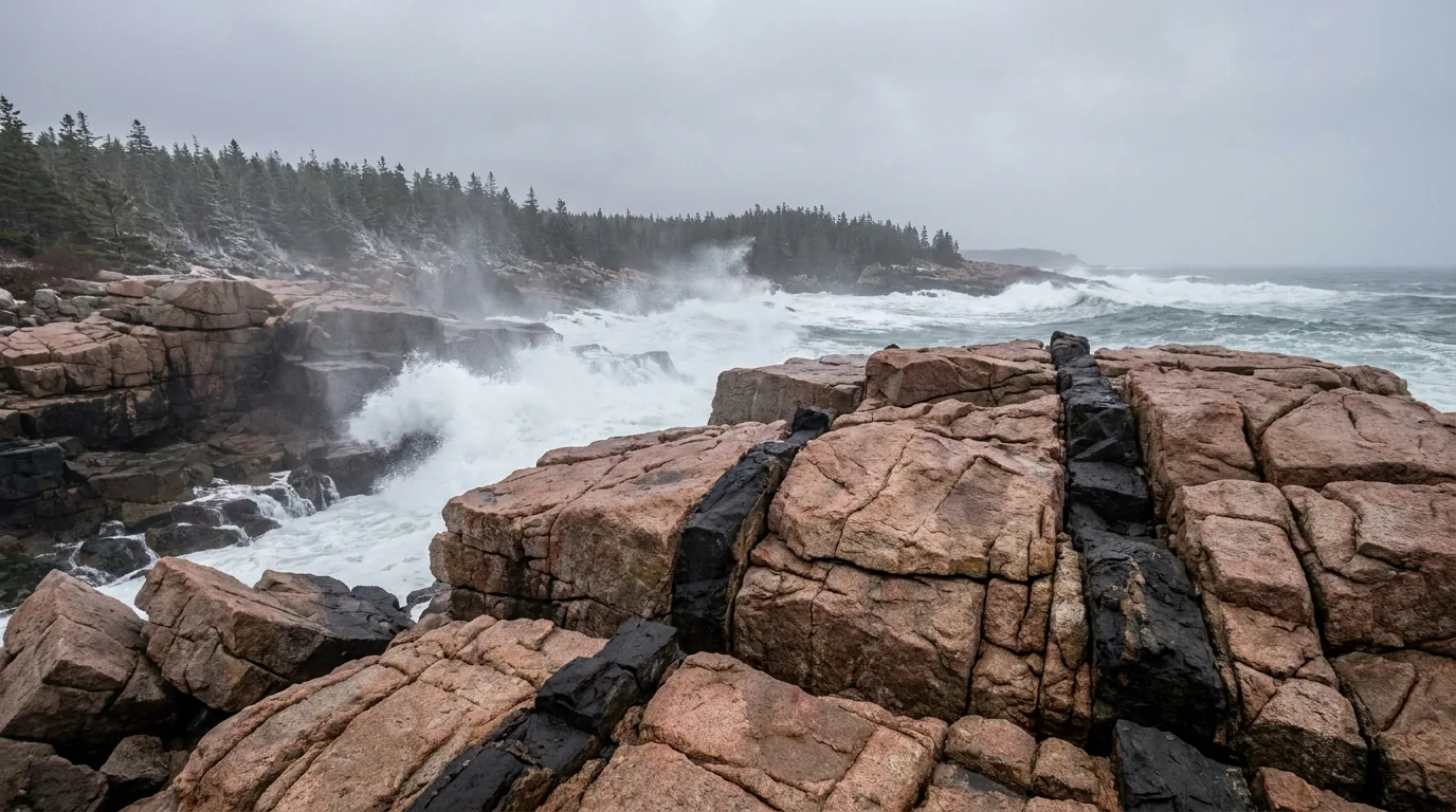
Huge wave-battered flat pink granite ledges cut by dark black basalt dikes with heavy Atlantic surf exploding white against them and low spruce forest behind, Schoodic Point in Acadia National Park Maine, ultrarealistic photograph representative of the region
Schoodic Point, the mainland Acadia. Massive wave-battered granite ledges cut by black basalt dikes, with surf that is bigger and less mediated than anything on Mount Desert Island. NPS describes Schoodic as "a minimally-developed, low-visitation area" — a 6-mile one-way loop road, 8.3 miles of bike path, and the park's only campground with hookups. Rogue waves are the real hazard here: do not turn your back on the sea (§06).

1 · The east side of MDI — the postcard, and the crowd

  • The 27-mile Park Loop Road and the Ocean Drive corridor: Sand Beach, Thunder Hole, Otter Cliff, Jordan Pond — plus Cadillac Mountain above it all
  • Everything with a reservation, a queue or a full lot is here. Sand Beach, Jordan Pond and the Beehive fill by mid-morning in summer
  • Base town: Bar Harbor — outfitters, boat tours, bike rental, restaurants, and the Bar Island trailhead on Bridge Street
  • The fix: be on trail before 7 a.m., ride the Island Explorer mid-day, hike again after 5 p.m. Park once and walk the Ocean Path
BusiestCadillac reservation applies

2 · The quiet side of MDI — same island, half the noise

  • Southwest Harbor, Bernard and Tremont — working harbours, boatbuilding, lobster pounds over the water, and genuinely fewer people
  • Bass Harbor Head Light, Ship Harbor and Wonderland sit down here, as does Seawall Campground and its $22 walk-in tent sites (§07)
  • Somes Sound nearly splits the island in two — steep walls straight out of saltwater, best seen from a kayak or from the Acadia Mountain trail on its west wall
  • Echo Lake is the realistic swim: fresh water, unlike the 55–60°F ocean. Alcohol is prohibited at Echo Lake Beach and Sand Beach
QuieterSouthwest Harbor base
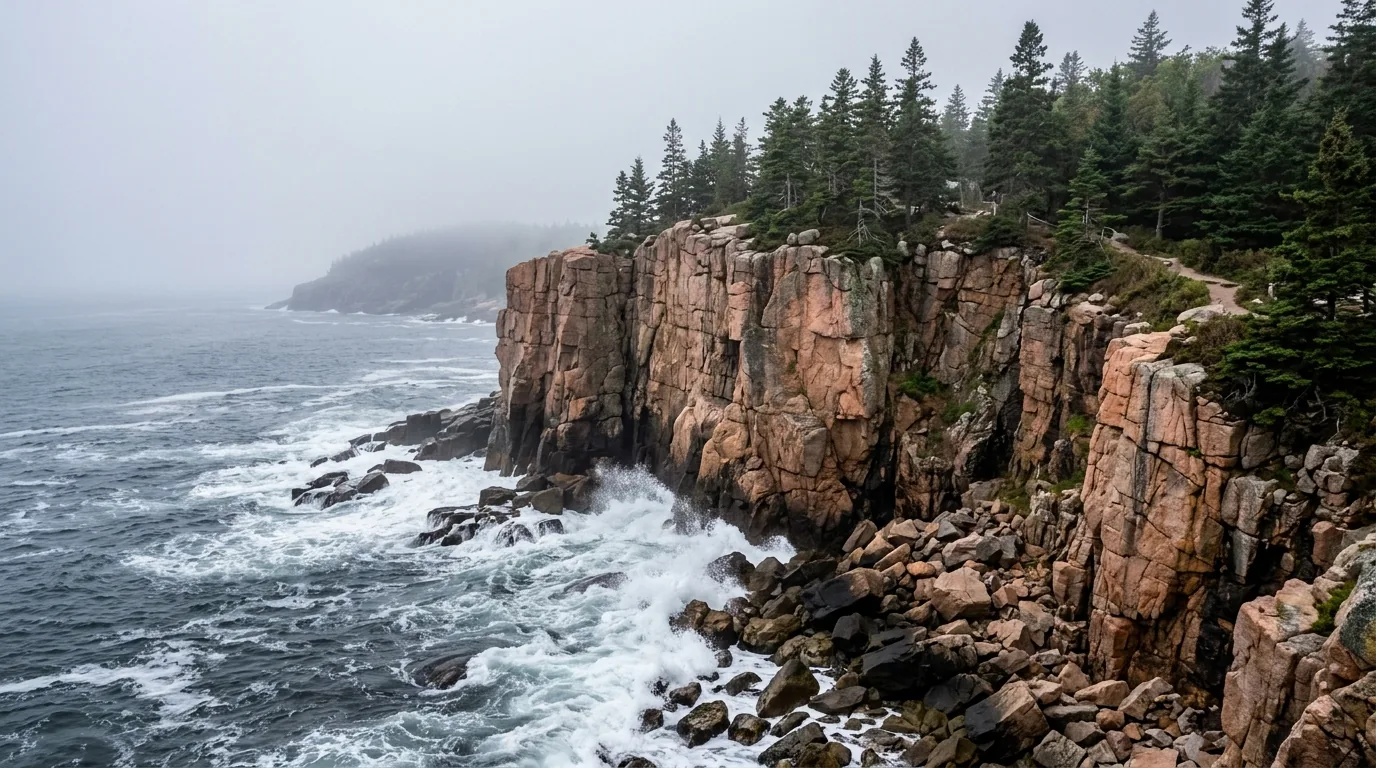
A sheer pink granite sea cliff dropping straight into the cold Atlantic with waves breaking white on boulders at its base and dark spruce trees clinging to the clifftop, Otter Cliff in Acadia National Park Maine, ultrarealistic photograph representative of the region

Somes Sound, and a claim worth not repeating

Somes Sound is the long tidal inlet that nearly cuts Mount Desert Island in half, with steep walls rising directly from saltwater. It is frequently described as fjord-like — and you will hear it called "the only fjord on the US East Coast." That claim is widely repeated and genuinely contested, and we could not confirm that NPS calls it a true fjord. We say "fjord-like" and leave it there.

Best seen from the water by sea kayak or sail, or from Acadia Mountain, whose trail climbs the west wall for the money view down the sound. Acadia Mountain trail stats are unverified — check the NPS trail page. Note the Valley Cove trail on the sound falls under the peregrine falcon closure (§06).

"Fjord-like" — don't overclaimValley Cove: falcon closure

3 · Schoodic Peninsula — the mainland answer

The park's only mainland section, about an hour from the Hulls Cove Visitor Center and 1 hr 15 min from Bar Harbor to the campground. A 6-mile one-way loop road with lighthouse, seabird and island views — vehicle turnouts only; parking outside designated areas is prohibited.

8.3 miles of bike paths, hiking to Schoodic Head (440 ft) and The Anvil (180 ft), the Frazer Point Picnic Area with tables, fire rings and ocean views, and the Schoodic Institute welcome centre with a 24/7 entrance-pass machine. Island Explorer serves it seasonally.

Low visitationOnly park hookups (§07)

4 · Isle au Haut — the far end

Half the island is managed by Acadia; the other half is privately owned. Reached only by passenger mailboat from Stonington — no vehicles, bikes for an extra fee on the Town Landing route only.

The entire lodging inventory in the park section is five lean-to shelters at Duck Harbor, reservable on Recreation.gov from 1 April at 10:00 a.m. EST, maximum 3 nights, one stay per year (§07). The number of visitors allowed in the Acadia section is limited. Effectively no cell signal, almost no services.

Boat-in onlyCarry everything
Which Acadia for which visitor First visit, short on time, want the icons? The east side of MDI — but book the Cadillac reservation and use the Island Explorer. Been before, or hate crowds? The quiet side: Southwest Harbor, Seawall, Bass Harbor, Echo Lake. Towing, in an RV, or arriving in August without a plan? Schoodic — it solves the hookup problem and the crowd problem in one move, at the cost of an hour and a quarter of driving. Want the remote, hard version? Isle au Haut and Duck Harbor, booked on 1 April, with every drop of water carried. Whichever you pick, the entrance pass, the tide and the ticks apply everywhere.
04 / THE TRAILS — INCLUDING THE ONES THAT CLOSE

Ladder trails, a shoreline walk, and a path that only exists twice a day

Acadia's trail network is short on distance and long on consequence. The signature routes are early-twentieth-century "ladder trails" — iron rungs bolted up open cliff faces, non-technical but severely exposed — and the park's serious accidents happen on them. Two more things make this network unusual: several of the best trails close every spring for nesting peregrine falcons, and one of the most popular walks is only walkable for about three hours a day. Distances below are the figures we could confirm from NPS; where we could not, we say so rather than guess.

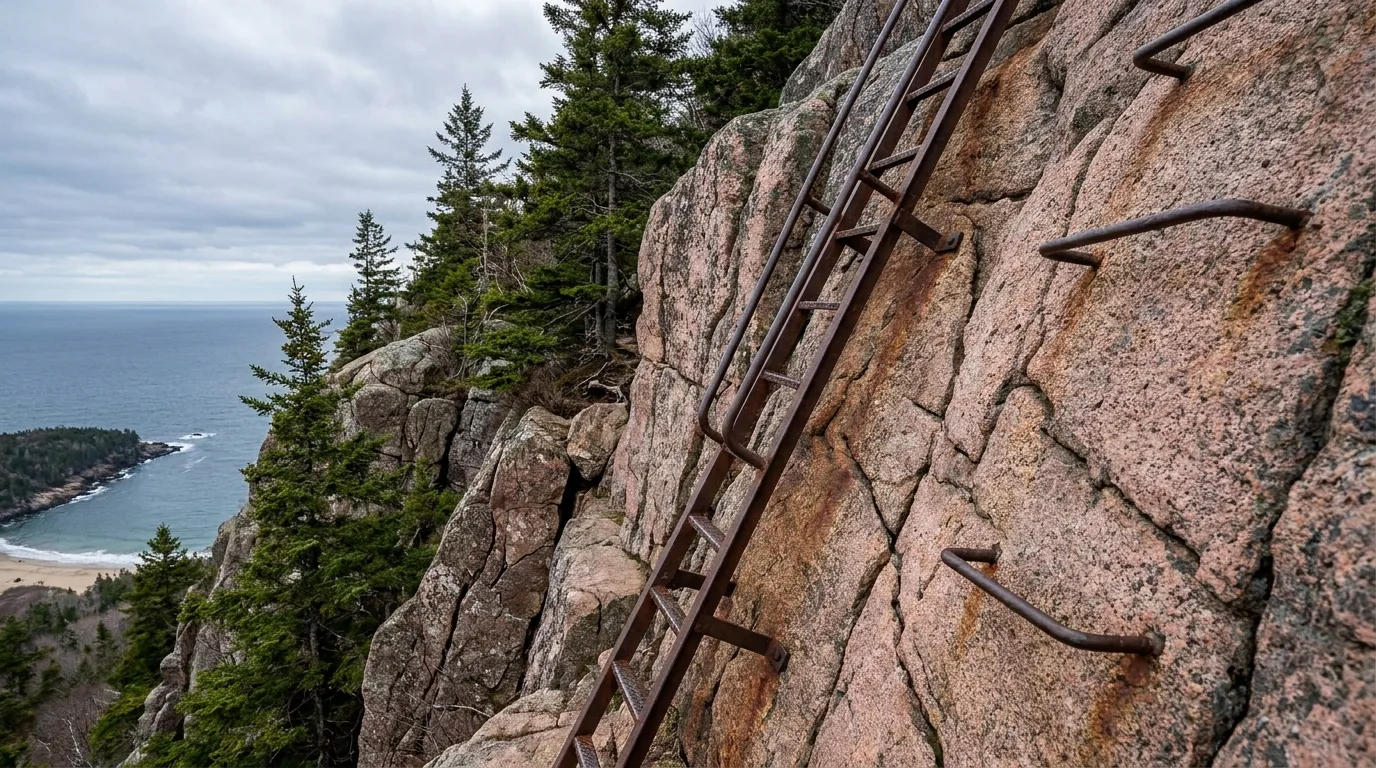
Iron rungs and a metal ladder bolted to a steep exposed pink granite cliff face on a mountain trail with the ocean and a distant beach far below, Precipice Trail in Acadia National Park Maine, ultrarealistic photograph representative of the region
The ladder trails. Iron rungs on open, near-vertical granite — the Precipice climbs over 1,000 feet in 0.9 miles. Non-technical, severely exposed, and not a descent route. Both the Precipice and the Beehive are early-20th-century ladder trails in the Mount Desert path-making tradition. Do not climb them wet, do not take dogs, and check Current Conditions first — the Precipice closes for falcons from around 1 March (§06).

The easy wins — big payoff, low commitment

The smartest walk in the parkOcean Path

Easy, level shoreline walking. Links Sand Beach → Thunder Hole → Otter Cliff / Otter Point along the top of the shoreline granite. This is the single best low-effort, high-payoff walk in Acadia — and the smartest way to see the Ocean Drive highlights without fighting for three separate parking spaces. Park once at Sand Beach, walk it, ride the Island Explorer back.

Distance is commonly given as ~2.2 miles one way — unverified; confirm on the NPS trail page. Stay behind railings at Thunder Hole.

Easy · shorelineDistance unconfirmedShuttle back
Sand Beach → Otter Point
Park once, ride back

The postcard loop · largely flatJordan Pond Path

Circles the pond, largely flat, with log-bridge boardwalk sections on the west shore and the twin Bubbles filling the view at the north end. The gentlest way to get the classic Acadia photograph. South Bubble holds Bubble Rock, a glacial erratic balanced on the cliff edge — a short, steep hike from the Bubbles trailhead.

Distance commonly cited as ~3.2–3.3 miles — unverified; confirm on the NPS trail page. The Jordan Pond lot is one of the first to fill; there's an Island Explorer stop.

Largely flatDistance unconfirmedBubble Rock nearby
Pond circuit + boardwalk
Bubbles view
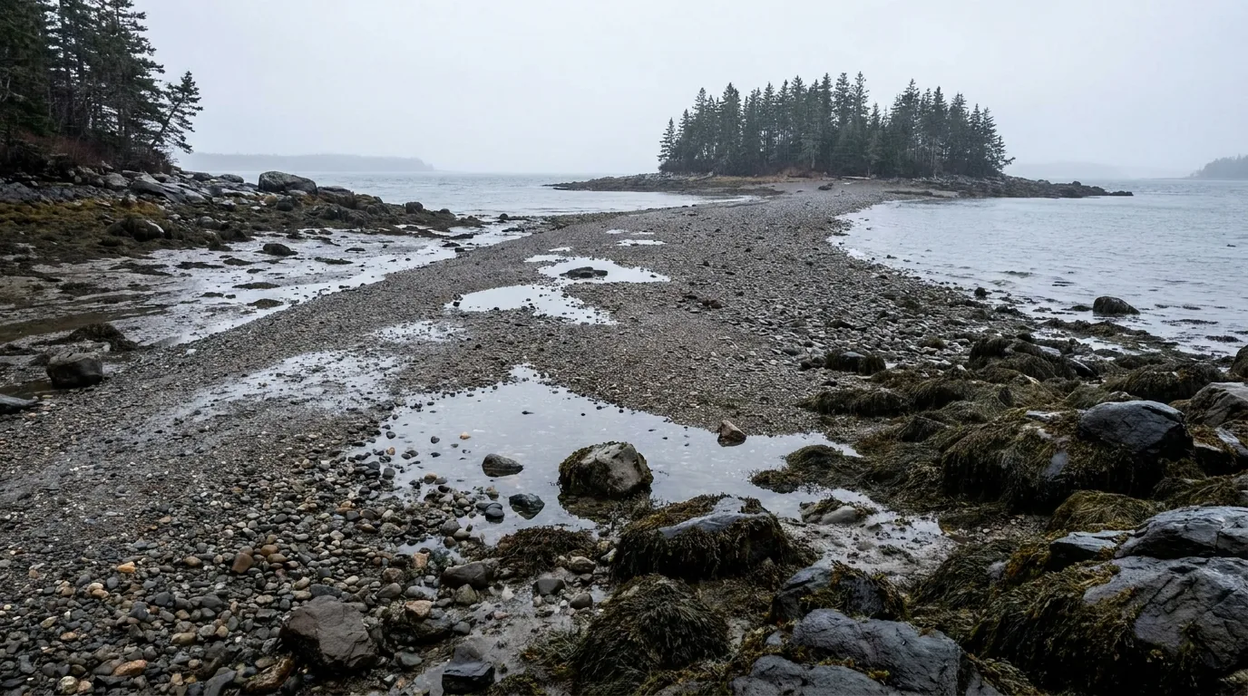
A wet gravel and cobble sandbar exposed at low tide linking a shore to a small spruce-covered island across a tidal channel, seaweed-covered rocks and mudflats either side, Bar Island near Bar Harbor Maine, ultrarealistic photograph representative of the region
The Bar Island land bridge — a trail that only exists twice a day. A half-mile bar of sand, pebbles and rock between downtown Bar Harbor and Bar Island, submerged most of the day and exposed only about 1.5 hours either side of low tide. Miss the window and you wait roughly nine hours. Every season, people get caught (§06, §09).

The tide decides · 3-hour windowBar Island Trail

1.9 miles round trip, 45–90 minutes. Trailhead on Bridge Street, downtown Bar Harbor. Cross the half-mile gravel bar within 1.5 hours either side of low tide, walk up onto the island, and come back with time to spare. It's also the park's premier tidepooling spot, on the same low-tide window.

Miss the window and you wait about 9 hours. Parking is not allowed on the Bar or on Bridge Street — park on West Street and walk. Vehicles left on the bar get flooded. Collecting is prohibited: no rocks, cobbles, plants or marine organisms leave the park.

1.9 mi returnTide-lockedNever park on the bar
1.5 hrs either side of LOW
~3-hour window

The rungs — and the closures that govern them

Iron rungs on a 450-ft cliff · go at dawnBeehive Loop

1.4 miles round trip, 1–3 hours. The summit is 520 ft above sea level and it is a 450-ft cliff trail with steep granite staircases, iron rungs and exposed cliff faces, looking out over Sand Beach, Thunder Hole and the Gulf of Maine. Trailhead from the Sand Beach parking area via the Bowl Trail.

One of the park's most trafficked trails — which means queues on the rungs. Go at dawn. Convention is up the rungs, down the Bowl Trail; you do not want two-way traffic on ladders. Whether "up-only" is a posted regulation or strong etiquette is unverified — treat it as required practice either way.

1.4 mi returnIron rungs · exposure520 ft summit
450-ft cliff trail
1–3 hours

Closed for falcons most of spring · severe exposurePrecipice Trail

3.2 miles round trip, 2–3 hours, rising over 1,000 feet in 0.9 miles to the summit of Champlain Mountain. Non-technical but severely exposed: a long series of iron rungs and ladders up an open, vertical cliff face. Trailhead on the Park Loop Road.

CLOSED FOR PEREGRINE FALCON NESTING from around 1 March "until further notice" — in 2026 that covered Precipice, Jordan Cliffs, Penobscot East and Valley Cove, and the Precipice parking lot was closed to vehicles too. Not a descent route. Not for anyone uneasy with heights, and not in the wet. No dogs.

3.2 mi returnFalcon closure1,000 ft in 0.9 mi
Champlain Mtn
2–3 hours
🔴 Before you drive to a trailhead — the falcon closure list Acadia closes cliff trails annually for nesting peregrines, beginning around 1 March and running "until further notice." The 2026 closures were Jordan Cliffs, Penobscot East, Precipice and Valley Cove, plus the Precipice Trail parking lot. NPS's reasoning is blunt: nesting peregrines are highly vulnerable to disturbance, which can cause temporary or permanent nest abandonment and leave chicks exposed to hypothermia, starvation and predation. These closures are to all uses and they are enforced. They typically lift in late summer once chicks fledge — but the date is never fixed. Check nps.gov/acad "Current Conditions" the week you travel, not the month before.

Headlands & sea cliffs — tide-aware, always

  • Otter Cliff / Otter Point: sheer granite dropping to the Atlantic — one of the highest headlands directly on the US East Coast, and a recognised sea-cliff climbing area where the park maintains fixed anchors for belay purposes
  • Great Head: a granite headland at the east end of Sand Beach; loop trail, big open ocean views, modest scrambling (distance unverified)
  • NPS caution for both: "climbing areas like Otter Cliff and Great Head are more difficult and dangerous at high tide or in heavy seas" — do them on the falling or low side, in calm conditions

Schoodic & the quiet-side walks

  • Schoodic Head (440 ft) and The Anvil (180 ft) — the mainland hiking targets, with a fraction of the MDI foot traffic
  • Ship Harbor and Wonderland near Seawall — short, gentle shoreline walks on the quiet side, good at low tide
  • Acadia Mountain — climbs the west wall of Somes Sound for the best view down the inlet (trail stats unverified)
  • Bicycles and horses are prohibited on hiking trails — bikes belong on the carriage roads and Schoodic bike paths (§05)
🔴 What NPS explicitly tells you to carry At least 20 oz of water per person. Physical maps — cell service is unreliable. Tell someone your route and return time. Weather "can be unpredictable and change quickly," and rain makes granite trails dangerously slippery — wet rockweed on granite is as slippery as ice. 911 for emergencies where there is signal. On the rung trails specifically: don't descend them, don't climb them wet, don't bring dogs, don't start up behind a group you'd have to pass on a ladder, and turn around if you're uncertain about heights — the rungs get committing fast.
05 / THE CARRIAGE ROADS

45 miles of car-free gravel a philanthropist spent 27 years building

This is the best value day in Acadia and the one most visitors skip. Between 1913 and 1940, John D. Rockefeller Jr. built 45 miles of crushed-stone carriage road across the island — roughly 16 feet wide, edged with granite coping stones nicknamed "Rockefeller's teeth," and stitched together by 17 hand-cut stone bridges. They are still closed to motor vehicles. No vehicle reservation, no parking fight, no queue on a ladder — just gravel, ponds and stonework. Bring a bike, or rent one.

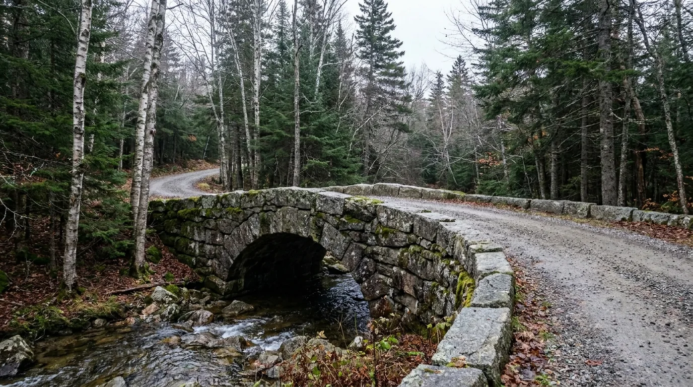
A hand-cut granite arch bridge carrying a crushed-stone carriage road over a mossy forest stream, granite coping stones along the road edge and birch and spruce forest around, Acadia National Park Maine, ultrarealistic photograph representative of the region
One of the 17 carriage-road bridges. Hand-cut granite, built between 1913 and 1940 as Rockefeller's gift to the park, and still motor-free. The road surface is crushed stone — run wider tyres than you would on pavement and brake early on descents. Eagle Lake is the main hub, served in season by the Bicycle Express shuttle from downtown Bar Harbor.

The rules, in order of how often they're broken

  • Only Class 1 e-bikes are permitted on the carriage roads and the Schoodic bike paths. Class 2 (throttle) and Class 3 are prohibited. If you rent electric, confirm the class before you pay
  • Closed to all motor vehicles — no cars, no motorcycles, no motorised scooters, no ATVs. Shared by pedestrians, bicyclists and horse-drawn carriages
  • Speed limit 20 mph. Cyclists yield to horses AND pedestrians; pedestrians yield to horses. Horses always win
  • Bicycles and horses are not allowed on hiking trails — the two networks are deliberately separate
  • Island Explorer bike racks take a maximum of 6 bikes — and no e-bikes, fat-tire bikes, tandems or tag-alongs at all. If you rent an e-bike you are riding to the trailhead, not busing to it
Class 1 e-bikes only20 mphNo reservation needed

Riding it — how the day works

Rent in Bar Harbor or on the quiet side in Southwest Harbor (§08). Take the seasonal Bicycle Express from downtown Bar Harbor to Eagle Lake — the main carriage-road trailhead — or ride any Island Explorer with a rack.

From Eagle Lake the network runs south toward Jordan Pond (bike racks at the Pond House), with the Around Mountain loop for stronger legs and the gentler Witch Hole Pond loop back toward Hulls Cove. Specific loop distances — including the Eagle Lake loop — are unverified; get the NPS Carriage Road User's Map, which is the document this whole network is designed around.

Eagle Lake hubDistances unconfirmed
Two carriage-road caveats worth knowing before you plan around them Spring mud season. Soft, wet crushed stone damages easily, and carriage-road closures during spring thaw are a real annual occurrence — but we could not confirm a specific policy or set of dates from an official page, so check Current Conditions rather than assuming the network is fully open in April. And the boundary. Some carriage roads lie outside the park boundary on land managed by the Land & Garden Preserve, where the rules differ — an unverified detail we're flagging rather than describing. If a posted sign contradicts anything on this page, the sign wins.
Riding the carriage roads the way they were designed Wildwood Stables is the historic base for horse-drawn carriage rides on the network — the way Rockefeller intended the roads to be used, and the reason there is a stables campground in a national park at all (that campground is open only to visitors travelling with stock animals). The current concessioner, season and rates could not be confirmed — check with the park before you plan a carriage ride.
06 / SAFETY & REGULATIONS

Tides, cold water, cliffs, ticks — and the rules that catch people out

Acadia's hazards are not exotic, but they are specific, and most of them are governed by water. The number-one hazard is the tide: it cuts off return routes, it turns Thunder Hole from a boom into a shrug, and it makes shoreline granite lethal at the wrong moment. After that it's cold water, exposed rungs, closed cliff trails, and a Maine tick problem that deserves more respect than it usually gets. None of this is hard to manage; all of it has to be planned before you go.

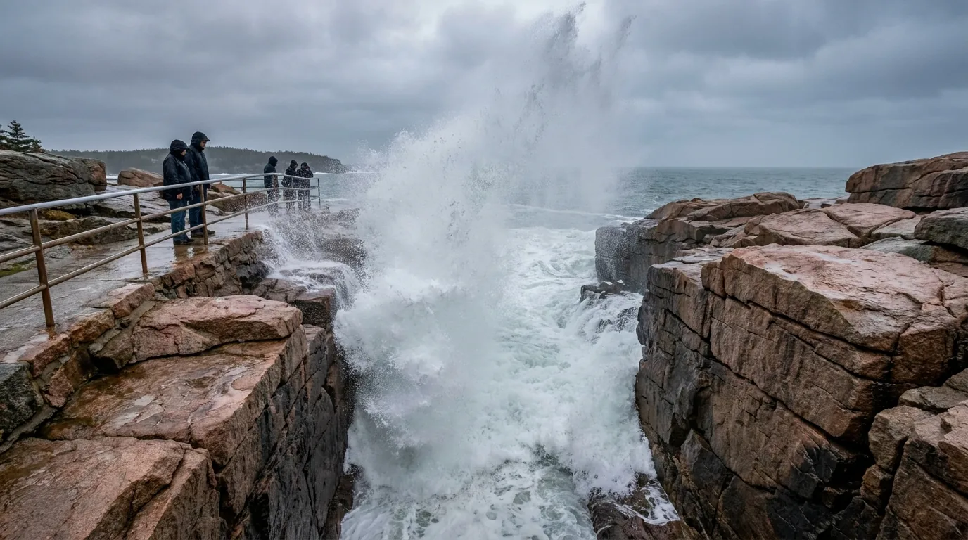
Heavy ocean swell surging into a narrow carved granite inlet and exploding upward in white spray, with wet pink granite ledges and a metal handrail walkway above, Thunder Hole in Acadia National Park Maine, ultrarealistic photograph representative of the region
Thunder Hole, working. Waves surge into the narrow channel, trapped air escapes, and it booms — but only with swell and only near high tide. NPS is explicit: "even in calm weather, rogue waves can suddenly wash over the surrounding granite ledges and outcrops." Spray has exceeded 40 feet, sections of walkway close during storms, and people have been swept off these rocks. Obey closures and stay behind the railings.

Tides — the number-one Acadia hazard

  • NPS's own phrasing: "rising tides may cut off your return route." Two highs and two lows roughly every 24 hours, with an 8 to 12 foot rise and fall
  • Bar Island: a three-hour crossing window — miss it and you wait about nine hours. Do not park on the bar; vehicles left there get flooded
  • Thunder Hole: rogue waves wash over the granite even in calm weather; spray to 40 ft; walkways close in storms. Stay behind railings and off the lower ledges when seas are up
  • Tidepools and shoreline ledges: wet rockweed on granite is as slippery as ice. Turn back rather than commit to a wet slab above water
  • Check a Bar Harbor tide chart every single day of your trip — and print or screenshot it, because cell service is unreliable. Free at NOAA Tides & Currents
Cut-off riskNOAA Bar Harbor station

Cold water & rip currents

Ocean temperature averages 55–60°F. That is cold-shock territory year-round, not a bracing dip. NPS notes that natural water is nothing like a pool: cold impairs your ability to swim, and depth can change suddenly to above chin level.

Rip currents occur. If caught, swim parallel to shore, not straight out.

Alcohol is prohibited at Sand Beach and Echo Lake Beach. Lifeguard season at either is unverified — do not assume cover. Echo Lake, being fresh water, is the realistic swim.

55–60°F year-roundSwim parallel to shore

Ticks and Lyme — take this seriously in Maine

NPS: ticks are most active late spring through early fall. Recommended: light-coloured clothing, pants tucked into socks, and full tick checks after every hike.

Maine carries a significant and growing burden of tick-borne illness — Lyme, anaplasmosis, babesiosis. We will not cite case-rate numbers; they're unverified here. Use the Maine CDC tick page.

Practical version: permethrin-treat your clothing before the trip, DEET or picaridin on skin, check the dog too, and know that deer ticks in the nymph stage are the size of a poppy seed.

Full tick check, every hikePermethrin clothing

Cliffs, rungs & poison ivy

  • "Be careful while walking near cliff ledges" — falls on the Precipice and Beehive are the park's signature serious accident
  • Do not descend the rungs. Do not climb them in rain or when wet. No dogs on them. Do not start up behind a group you'd have to pass on a ladder. Turn around early if heights bother you
  • Otter Cliff and Great Head are "more difficult and dangerous at high tide or in heavy seas." NPS maintains fixed climbing anchors at Otter Cliff for belay purposes
  • Poison ivy is "found throughout the park" — as ground cover and as a climbing vine, common on shoreline margins and around Sand Beach and Great Head. Wash with soap and water within 30 minutes of contact
🔴 Drones are prohibited — there is no version of this that is allowed "Launching, landing, and operation of unmanned aircraft, or drones, is prohibited in Acadia National Park." Full stop, no recreational permits. That includes launching from outside the boundary and flying in. If drone footage is the reason you're coming, come anyway and leave the drone at home.

Camping, fires & pets

  • Camping only at designated locations: Blackwoods, Seawall, Schoodic Woods and Duck Harbor. No dispersed camping, and no sleeping in vehicles at pull-offs
  • Fires: contained fires with charcoal or wood only in campgrounds and designated picnic areas, in park-provided receptacles or private grills
  • Pets must be leashed at six feet or less or otherwise physically restrained at all times. Ladder trails are unsuitable for dogs regardless; Duck Harbor allows no pets at all

Collecting, hunting & the rest

  • Collecting is prohibited: rocks, cobbles, plants, marine organisms, other natural materials, historic objects and artifacts. Tidepool with your eyes and your camera
  • Hunting is prohibited. Also prohibited: fireworks, marijuana use, feeding wildlife, and ATVs on trails and carriage roads
  • Additional park-specific rules live in the Superintendent's Compendium — the document to check if you're doing anything unusual
07 / THE CAMPING STRATEGY

Three drive-in park campgrounds, one with hookups, and five lean-tos on an island

Read this line before you book anything: the drive-in NPS campgrounds are not full-service RV parks. Blackwoods and Seawall have no hookups and no showers. Only Schoodic Woods offers electric and water — and it's on the mainland, an hour and a quarter from Bar Harbor. If you need 50-amp and a shower every night on Mount Desert Island, you are staying at a private park in Trenton or Bar Harbor, and that's a legitimate answer, not a failure. Everything below comes from NPS and Maine Bureau of Parks & Lands pages; where a site count or a season date wasn't published, we say so rather than invent one.

🔴 How the NPS booking system actually works Recreation.gov only for Blackwoods, Seawall and Schoodic Woods — no in-person or phone reservations. 90% of campsites release six months in advance, on the first of each month, at 10:00 a.m. EST. The remaining 10% release on a rolling basis 14 days ahead, at 10:00 a.m. Senior and Access pass holders receive discounts. Duck Harbor on Isle au Haut is different: reservations open 1 April at 10:00 a.m. EST each year, maximum 3 nights per stay, one stay per year. Set the six-month alarm the way you'd set the Cadillac alarm — and remember the campsite fee is separate from your entrance pass.

The National Park Service campgrounds

CampgroundWhereFeesSeasonThe reality
Blackwoods
NPS · the default
East side of MDI, ~5 mi south of Bar Harbor on ME Route 3 $30 tent / camper / motor home
$60 group tent
May 2 – Oct 20 (2025 dates; confirm current year) NO showers (fee showers privately in Otter Creek), no hookups. Toilets, potable water, fires/stoves permitted. Max one vehicle per site — overflow in A-Loop, extras on Route 3. Island Explorer served. No off-season camping (site count & dump station unverified)
Seawall
NPS · the quiet side
West side of MDI, ~4 mi south of Southwest Harbor on ME Route 102A $22 walk-in tent
$30 drive-up tent/camper/RV
$60 group tent
May 21 – Oct 13 (2025 dates; confirm current year) NO showers at the campground (private vendors nearby), no hookups. Toilets available. The $22 walk-in tent sites are the best value in the park. Close to Bass Harbor Head Light, Ship Harbor and Wonderland (site count, potable water, dump station unverified)
Schoodic Woods
NPS · the ONLY hookups
3 mi southeast of Winter Harbor, Schoodic Peninsula — the mainland. ~1 hr 15 min from Bar Harbor Hike-in tent $22
Drive-up tent / small RV (20A) $30
RV electric only $36
RV electric + water $40
Group tent $60
Not published on the NPS page — typically late May to mid-October. Confirm on Recreation.gov The only park campground with electric and water hookups, including 50-amp. NO showers. Campfires prohibited at hike-in sites (petroleum stoves/grills allowed). Direct access to the Schoodic bike paths, and a fraction of the MDI crowding (site count & dump station unverified)
Duck Harbor
NPS · Isle au Haut, boat-in
Duck Harbor, Isle au Haut, off Stonington — passenger mailboat only Nightly fee NOT stated on the NPS page — confirm on Recreation.gov Mid-June to mid-October — but the Duck Harbor boat landing runs mid-June to late September. Plan around the boat Five lean-to shelters — three-sided, roof and floor, 8 ft × 8 ft × 12.5 ft, max 6 persons. Fire rings, picnic tables, composting toilets. NO potable water on site — a hand pump is 1,600 ft away; treat it or carry your own. Dead-and-down wood only, no outside firewood. Pack out all trash. No pets. Generators prohibited
Wildwood Stables
NPS · stock animals only
Mount Desert Island, on the carriage-road network Details unverified Open only to visitors travelling with stock animals (horses). Not applicable to general overlanders — but it explains why a national park has a stables campground (§05)

Fees are the figures published by NPS and are separate from and additional to your park entrance pass. Site counts are not published on the NPS campground pages for Blackwoods, Seawall or Schoodic Woods — check the current Recreation.gov listings rather than trusting a number from any guide, including this one. Season dates shown for Blackwoods and Seawall are the 2025 season as listed; confirm the current year before you plan a date around them.

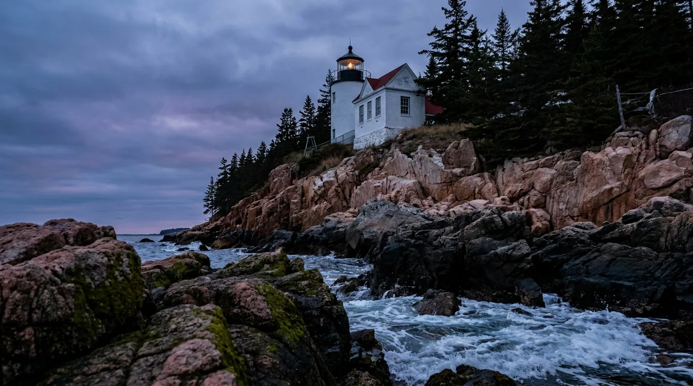
A small white lighthouse with a red-roofed keeper's house perched on pink granite ledges above the sea at dusk, viewed from the rocks below with dark spruce forest behind, Bass Harbor Head Light on the Maine coast, ultrarealistic photograph representative of the region

Bass Harbor Head Light — 180,000 visitors, 27 parking spaces

In Tremont, on the southwest corner of Mount Desert Island, marking the entrance to Bass Harbor and Blue Hill Bay. It is unique among Maine's roughly 80 lighthouses in being reachable by car — a quarter-mile entrance road leads to a 27-space parking lot, with restrooms and a short trail and stairway down to a shoreline viewpoint.

Roughly 180,000 visitors a year into 27 parking spaces — that's the whole story. Arrive early, arrive late, or ride in. Sunset is the classic shot and the worst parking. Transferred from the US Coast Guard to NPS in 2020; the Coast Guard still runs the automated light. It appeared on the 2012 America the Beautiful quarter and the 2016 NPS centennial stamp.

Whether any building interior is open to the public is unverified — historically the residence was not.

Maine state parks — the budget play

ParkWhereSites & servicesSeasonFee
Lamoine State Park
Maine Bureau of Parks & Lands
23 State Park Road, Lamoine — 8 mi southeast of Ellsworth off Route 184, on Frenchman Bay, looking across at MDI Showers, picnic area, playground, trailered boat launch, loop trail. Excellent sea-kayak launch (site count, dump station and hookups unverified — assume no hookups) May 15 – Oct 15, open 9 a.m. to sunset daily $20 resident / $30 non-resident + $5 per site per night reservation fee + 9% Maine lodging tax
Cobscook Bay State Park
The Downeast extension
40 South Edmunds Road, Edmunds Township — on US Route 1, four miles south of Dennysville. 888 acres, well east of Acadia 106 campsites, many bordering Whiting Bay, plus two group areas (to 12 and to 30). New shower/toilet building, flush toilets, drinking water, RV dump station, boat launch, playground Camping begins May 15; day use year-round, 9 a.m. to sunset $20 / $30 + $5 reservation fee + 9% lodging tax

Maine state parks book at CampWithME.com (call centre 800-332-1501 in Maine / 207-624-9950 outside). For 2026, most parks opened reservations Thursday 5 February 2026 at 9:00 a.m. EST (Lily Bay and Sebago Lake opened 2 Feb); online reservations run through 12 September 2026 at 4:00 p.m. EST, and after 14 September 2026 all campsites revert to first-come/first-served through the end of the season. 2026 park condition report: Cobscook Bay campsites 1–27 have no power due to a mechanical issue — verify current status before booking those sites.

Why Cobscook Bay is in an Acadia guide "Cobscook" comes from a Maliseet-Passamaquoddy word meaning "boiling tides." The tidal range averages 24 feet and can reach 28 feet. If your Acadia trip taught you to respect the tide, this is the graduate seminar — plus 200-odd bird species, eagles, ospreys and seals. It is not an Acadia base; it's a "keep going Downeast" extension for anyone who caught the tide bug.

Private campgrounds — where the hookups and showers actually are

CampgroundWhereSites & hookupsSeasonWhy it's here
Timberland Acres RV Park
timberlandacresrvpark.com
Route 3, Trenton — 14 miles from Acadia / Bar Harbor 80+ pull-through full-hookup sites, ~50 of them over 100 feet long. 30/50 amp. Free WiFi at each site, propane filling station, laundry, pool, playground, on-site tavern, dog park. Seasonal sites available May 8 – October 25, 2026 The big-rig / long-trailer answer for Acadia. If you're towing something serious, this is the shape of the solution
Smuggler's Den Campground
smugglersdencampground.com
Southwest Harbor, MDI — the quiet side, on-island Over 100 sites — full-hookup RV sites with cement pads, plus tent and pop-up sites. Heated pool and kiddie pool, clean bathrooms with free hot showers, and an Island Explorer bus stop on site May 22 – October 19, 2026 (2027: May 28 – Oct 18) Best of both worlds: hookups, showers and the free park shuttle from your own site, without leaving the island
Hadley's Point Campground
hadleyspoint.com
33 Hadley Point Rd, Bar Harbor — northern end of MDI, above a public saltwater beach, minutes from park and town Tent (primitive), RV sites with electric and water hookups, and cabins (count, showers, pool, laundry and dump station unverified) Open for the 2026 season; exact dates unverified Reservations online via Campspot, strongly recommended. 2025 RV LIFE "Best of the Best Campground" winner
Bar Harbor Campground
Salisbury Cove, ME Route 3
Bar Harbor / Salisbury Cove — the site now redirects to modernamericacampgrounds.com Site count, hookups, amenities, season and fees all unverified after the ownership/branding change Historically a no-reservations, first-come/first-served campground — which is the single most useful thing about it, and exactly the claim we could not re-confirm. Call before you drive there on that basis.

We publish no private campground nightly rates. Private rates move every year and we would rather print nothing than print a stale number — verify current-season rates directly with each operator. Other real options near Acadia that we could not verify this pass, and are therefore listing by name only: Narrows Too Camping Resort / Sun Outdoors Bar Harbor Oceanside (Trenton), Mount Desert Narrows Camping Resort / Sun Outdoors Acadia (Bar Harbor), Mount Desert Campground (Somesville, tent-focused, at the head of Somes Sound — not for big rigs), Bar Harbor / Oceanside KOA, and Under Canvas Acadia (Surry, glamping). Brand and ownership names in this market have changed repeatedly — confirm the current operator and URL before booking.

08 / OPERATORS, OUTFITTERS & THE FOOD

The boats, the bikes, the guides and the lobster pounds

Acadia has a dense, long-established operator culture — sea-kayak outfits running since the early nineties, an AMGA-accredited climbing school working the sea cliffs, a four-masted schooner, and lobster pounds that have been cooking in seawater for fifty years. Everything below is a real, currently-trading business whose own website we resolved. Seasons, hours, menus and rates change, so we link rather than quote, and we publish no operator pricing. Small seasonal operators change hands and domains — re-check every URL resolves before you rely on it.

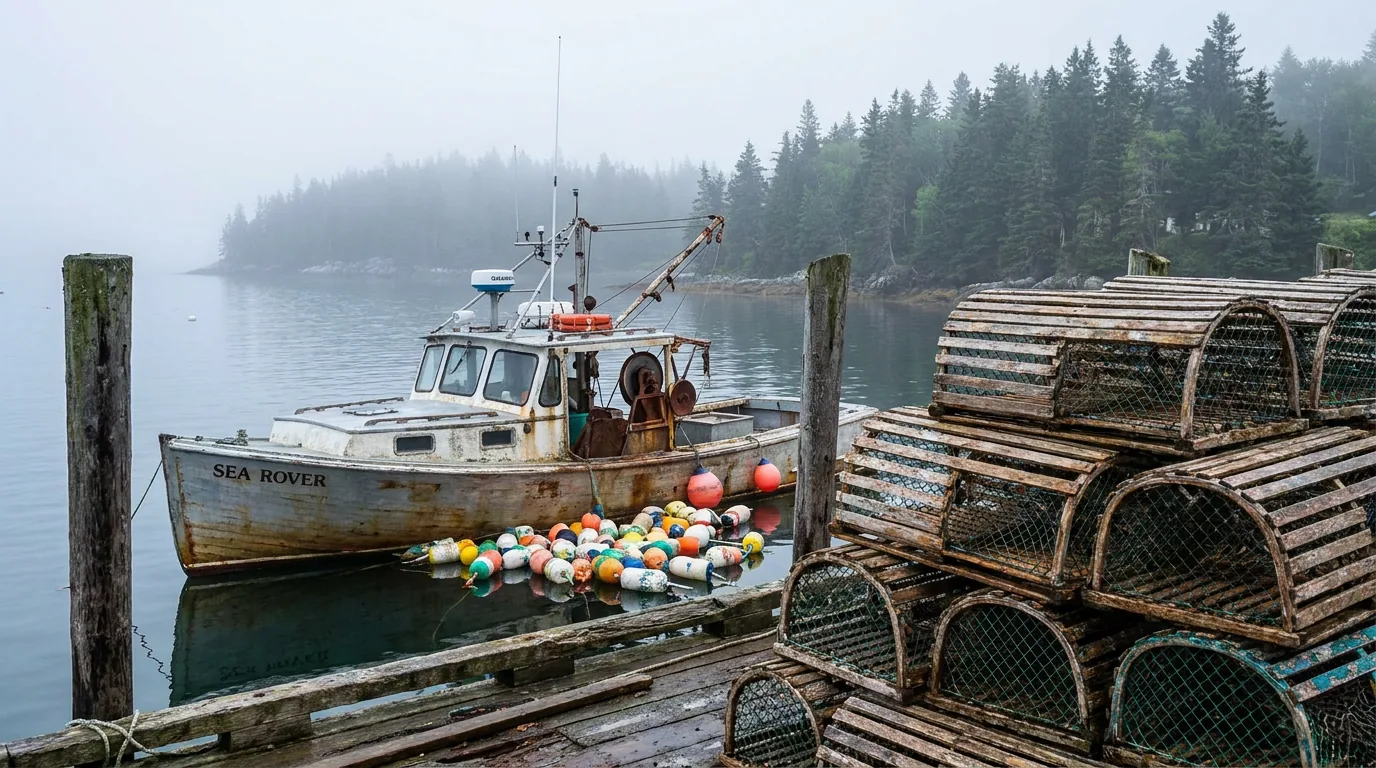
A working Maine lobster boat moored in a calm harbour among coloured buoys and wooden lobster traps stacked on a weathered pier, with spruce-covered shoreline and morning fog behind, Maine coast, ultrarealistic photograph representative of the region

Transport & access

  • Island Explorer (Downeast Transportation Inc.), Bar Harbor / MDI / Schoodic — the fare-free seasonal shuttle linking the park, campgrounds, trailheads and towns. The single best way to beat Acadia parking (exploreacadia.com)
  • Isle au Haut Boat Services, Stonington — the passenger mailboat to Isle au Haut and, mid-June to late September, the Duck Harbor park landing (isleauhaut.com)
  • Downeast Windjammer Cruise Lines, Bar Harbor — operates the 151-ft four-masted schooner Margaret Todd on morning, afternoon and sunset sails of Frenchman Bay, plus ferry services (downeastwindjammer.com)

Oli's Trolley and Acadia National Park Tours (narrated bus/trolley tours from Bar Harbor), the Bar Harbor–Winter Harbor passenger ferry, Schoodic Institute and Friends of Acadia are all real and all worth looking up — but their current operators, URLs or season status could not be confirmed this pass.

Bikes & gear — essential for the carriage roads

  • Bar Harbor Bicycle Shop (Bar Harbor) — full-service shop on Cottage Street renting carriage-road bikes, under a mile from the nearest carriage-road entrance (barharborbike.com)
  • Acadia Bike (Bar Harbor) — downtown bike and e-bike rental, same operator as Coastal Kayaking Tours, running since 1980 (acadiabike.com)
  • Southwest Cycle (Southwest Harbor) — the quiet side's only full-service bike shop, founded 1981, with a rental fleet of around 75 bikes (southwestcycle.com)
  • Acadia Ebike Adventure (Bar Harbor / Hulls Cove) — Class 1 e-bike rental half a mile from a carriage-road entrance (acadiaebikeadventure.com)
  • Island Time E-Bike Rentals (Bar Harbor / Southwest Harbor) — Class 1 e-bike rentals positioned for carriage-road and quiet-side riding (islandtimeebike.com)
  • Cadillac Mountain Sports (Bar Harbor & Ellsworth) — Maine's local performance outfitter: layers, boots, packs and last-minute rain gear, with two stores on the approach (cadillacsports.com)
Confirm Class 1 before you rent electric

On the water & on the rock

  • National Park Sea Kayak Tours (Bar Harbor) — locally owned since 1993; small-group half-day ecological tours on the quieter west side of MDI (acadiakayak.com)
  • Coastal Kayaking Tours / Acadia Bike (Bar Harbor) — long-established downtown outfitter running small guided sea-kayak trips (12 paddlers max), half-day to multi-day (acadiafun.com)
  • Acadia Sea Kayaking Adventures (Bar Harbor) — small-group tours, max 8 guests, departing daily from Hadley Point public beach (acadiaseakayakingadventures.com)
  • Acadia SUP & E-Bike (Bar Harbor) — stand-up paddleboard and sea-kayak tours plus e-bike rental, based downtown (acadiasup.com)
  • Atlantic Climbing School (Bar Harbor) — AMGA-accredited full-service guide service, small custom rock, ice and snow instruction in Acadia (climbacadia.com)
  • Acadia Mountain Guides Climbing School (Bar Harbor / Orono) — AMGA- and PCIA-accredited, guiding in Acadia since 1993 including sea-cliff climbing at Otter Cliff (acadiamountainguides.com)
  • Bar Harbor Whale Watch Co. — large-catamaran whale watching into the Gulf of Maine with College of the Atlantic naturalists aboard (barharborwhales.com). Lulu Lobster Boat Ride — two-hour working-lobster-boat tour with a trap-hauling demonstration and seal-ledge stop (lululobsterboat.com)
Food & drink — the pounds, the popovers and the pre-dawn coffee Jordan Pond House (in the park, Mount Desert) — the park's historic restaurant, popovers and tea on the lawn since 1893, now run by concessioner Dawnland; reservations recommended (jordanpondhouse.com). Its current season, hours and whether reservations are required could not be confirmed — the NPS page we tried returned a 404. Confirm with the concessioner directly. · Thurston's Lobster Pound (Bernard, Tremont) — harbourside pound over the water on the quiet side, open roughly Memorial Day weekend to mid-October (thurstonforlobster.com) · Beal's Lobster Pier (Southwest Harbor) — a working fish-and-lobster pier since 1932 with a dockside restaurant; closed October to May (bealslobster.com) · Trenton Bridge Lobster Pound (Trenton) — wood-fired seawater lobster cookers right before the bridge onto the island, a 50-plus-year institution and the classic first stop (the business is real and long-established, but we could not confirm an official website URL — so we're printing none) · Atlantic Brewing Company (Bar Harbor) — family-owned, a farm brewery on Knox Road and a downtown Cottage Street taproom, known for Bar Harbor Blueberry Ale (atlanticbrewing.com) · Fogtown Brewing Company (Ellsworth, plus a Bar Harbor taproom) — brewery, beer garden and wood-fired pizza on Pine Street (fogtownbrewing.com) · Mount Dessert Bakery (Bar Harbor) — local cafe and bakery, pastry and coffee for a 4 a.m. Cadillac run; note the deliberate "Dessert" spelling (mountdessertbakery.com) (hours unconfirmed — check before you plan a pre-dawn stop around it).
🔴 One deliberate omission Morning Glory Bakery in Bar Harbor is permanently closed after losing its Rodick Street lease. It appears in a great many Acadia guides still on sale, and it is the fastest way to spot a guide that has not been re-researched. It is not listed here, and if you see it recommended elsewhere, treat that source's other details with the same suspicion.
09 / TIMING — THE SEASON AND THE TIDE

When to go, and how to build a day backwards from a tide chart

Acadia has one marquee season and one planning trick, and most visitors get both slightly wrong. The marquee is autumn — but the coast peaks later than inland Maine, which is the single most common Acadia planning mistake. The trick is the tide: build the day around the chart rather than fitting the chart around the day, and two of the park's best experiences stop being a coin flip. Everything else — fog, bugs, crowds, closures — is a matter of knowing which season owns which problem.

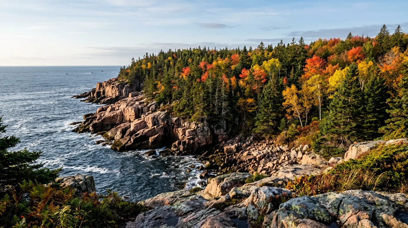
A rocky granite coastline in mid-October with red and gold maple and birch mixed into dark spruce forest running down to the blue Atlantic under low autumn sun, Maine coast at Acadia, ultrarealistic photograph representative of the region
Coastal colour, mid-to-late October. The ocean moderates Mount Desert Island, so while the western Maine mountains and the Whites peak in late September and early October, the coast typically peaks later. Book the last week of September for "peak foliage" and you arrive to green trees. The NPS foliage page we tried 404'd — treat any specific peak window as unverified and watch the Maine Forest Service report at mainefoliage.com.

Season by season, straight

  • Spring (April–early June) — the closures season. Peregrine closures begin around 1 March and run "until further notice": in 2026 that meant Precipice, Jordan Cliffs, Penobscot East and Valley Cove. Carriage roads are vulnerable to mud damage. Black flies and mosquitoes run roughly mid-May into June and are genuinely trip-ruining unprepared — head nets and permethrin-treated clothing; DEET alone is only partly effective on black flies. (Exact bug peak varies year to year.) Campgrounds open in stages: Blackwoods ~2 May, Seawall ~21 May, Maine state parks 15 May. Cadillac reservations began 20 May in 2026
  • Summer (late June–August) — peak crowding, and fog. The Park Loop lots fill by mid-morning. The Island Explorer runs 7 days a week; use it. Reduced fall service starts 18 August. Fog is the defining summer weather feature — cold water plus warm air makes sea fog that can sit for days and will absolutely eat a paid Cadillac sunrise. Water is 55–60°F; Echo Lake is the realistic swim. Best strategy: on trail before 7 a.m., shuttle mid-day, hike again after 5 p.m.
  • Autumn (mid-Sept–late Oct) — the sweet spot. Bugs gone, water at its warmest (which is to say cold), colour arriving later on the coast than inland. From 7 October Cadillac is the first place in the US to see the sunrise — so early October stacks first-sunrise, colour and a reservation season that still runs to 25 October. Campgrounds close through the month: Seawall ~13 Oct, Blackwoods ~20 Oct, Maine state parks 15 Oct, Timberland Acres 25 Oct. Island Explorer ends around 13 October — after that you're driving, and parking pressure returns
  • Winter (Nov–Mar) — quiet, and mostly closed to cars. Most of the Park Loop Road closes to motor vehicles; only Sand Beach Entrance Station → Otter Cliff Road usually stays open. Closed sections remain open to walkers, skiers, snowshoers and fat bikes. No winter camping — all park campgrounds closed, and Blackwoods explicitly prohibits off-season camping. Entrance pass still required. Whether and when the Cadillac Summit Road is gated closed is unverified — confirm.

The tide, as a planning tool

  • Two highs and two lows roughly every 24 hours, with an 8 to 12 foot rise and fall
  • Tides shift later by roughly 50 minutes per day — so a low tide that suits your schedule today will not tomorrow. (Standard tidal science, not an NPS-stated figure.)
  • Bar Island: cross within 1.5 hrs either side of LOW. Tidepooling: the same low-tide window
  • Thunder Hole: 1–2 hrs BEFORE HIGH — and it needs swell. Calm flat days mean no thunder
  • Great Head / Otter Cliff shoreline scrambling: safer at low tide and in calm seas
  • The itinerary insight: Bar Island's low-tide window and Thunder Hole's pre-high-tide window sit ~4–5 hours apart. You can do both in one day — but only if you plan it that way
  • Free official source: NOAA Tides & Currents (tidesandcurrents.noaa.gov), Bar Harbor, Maine station. Download it before you lose signal
Build the day backwardsPrint the chart
The Cadillac reservation calendar — set two alarms
  1. 90 days before your date, 10:00 a.m. ET30% of reservations release on Recreation.gov. This is the one everyone tries for.
  2. Two days before your date, 10:00 a.m. ET70% release. This is where most people actually get their slot. If you missed the 90-day window, you have not lost.
  3. Sunrise or daytime? Sunrise = 4:00–7:30 a.m. entry windows, 90-minute window. Daytime = 6:00 a.m.–8:00 p.m., 30-minute window. Arrive about an hour before sunrise or sunset — parking fills.
  4. Check the marine forecast for fog the night before. There are no refunds for a summit inside a cloud, and no re-booking either.
  5. Print or screenshot the QR code. Park connectivity is unreliable, and a dead phone at the gate is a dead reservation.
The one-paragraph answer Go in early-to-mid October if you can: bugs gone, colour arriving on the coast, the Cadillac reservation season still open until 25 October, and from 7 October the first sunrise in the country. Late June to August is warm, fully serviced and completely packed — workable if you're up at 6 a.m. and riding the Island Explorer by ten. Spring is the wrong season if the ladder trails are on your list, and the black flies are real. Winter is a walker's and skier's park, not a driver's one. Whichever you pick: buy the entrance pass, book the Cadillac slot on the right drop, get the Bar Harbor tide times for your dates before anything else, check Current Conditions for falcon closures, and hold your sunrise plan loosely because of the fog.
10 / THE SHAPE OF THE TRIP

Five ways to do Acadia, from a reserved sunrise to a boat-in island

Five workable shapes, not the only ones. Each assumes a valid park entrance pass, a printed or screenshotted Bar Harbor tide chart, and offline maps. All timings assume peak summer crowds — in October, subtract the parking anxiety and add a jacket. Adjust freely, but book the Cadillac slot, check Current Conditions for closures, and let the tide chart pick your order of operations.

01

Cadillac Sunrise + Park Loop (1 day, the classic)

  1. Prerequisite: a Cadillac SUNRISE reservation, $6, Recreation.gov. Book at the 90-day drop or the two-day 10:00 a.m. ET drop.
  2. T-minus 1 day: check sunrise time, check the marine forecast for fog, check the tide, fuel up in Ellsworth or Bar Harbor.
  3. ~4:00–5:00 a.m.: drive up inside your 90-minute window, arrive about an hour before sunrise. Layers and a headlamp — it's cold and windy on bare granite regardless of date.
  4. 8:30 a.m.: park once at Sand Beach, walk the Ocean Path to Thunder Hole and Otter Cliff, ride the Island Explorer back. Three parking battles removed in one move.
  5. Time Thunder Hole for 1–2 hrs before high tide. If high tide is badly timed, come back another day rather than standing at a quiet hole.
  6. Midday: Jordan Pond and the Bubbles; popovers at the Pond House (reserve ahead). Late afternoon: finish the loop — remember the one-way sections mean no U-turns.
Reservation requiredOver 21 ft? Hike or bike it
02

Carriage Road Cycling Day (1 day, no car needed)

  1. Rent in Bar Harbor or Southwest Harbor. If renting electric, confirm Class 1.
  2. Take the seasonal Bicycle Express from downtown Bar Harbor to Eagle Lake — or any Island Explorer with a rack (6 bikes max, no e-bikes/fat bikes/tandems).
  3. Morning: the Eagle Lake carriage roads — the gentlest introduction, crushed stone with lake views.
  4. Midday: push south toward Jordan Pond, taking in the hand-cut stone bridges (17 across the network). Lunch at the Pond House — bike racks on site.
  5. Afternoon: the Around Mountain loop if you have the legs, or the gentler Witch Hole Pond loop back toward Hulls Cove.
  6. Why this is the best value day in Acadia: no vehicle reservation, no parking fight, no queue — 45 miles of car-free gravel a philanthropist spent 27 years building.
No reservation neededLoop distances unconfirmed
03

The Quiet Schoodic Alternative (2 days)

  1. For anyone arriving in August without reservations, or towing something big. Drive US-1 east from Ellsworth, then ME-186 to Winter Harbor (~1 hr 15 min from Bar Harbor).
  2. Camp at Schoodic Woods — the only park campground with electric and water (20/30/50 amp), so the rig problem solves itself.
  3. Day 1 afternoon: the 6-mile one-way loop road to Schoodic Point. Park only in designated turnouts. Watch the surf on pink granite and black basalt from well back — rogue waves are the real hazard here.
  4. Day 1 evening: Frazer Point Picnic Area — tables, fire rings, ocean views.
  5. Day 2: ride the 8.3 miles of bike paths or hike Schoodic Head (440 ft) and The Anvil (180 ft); then the Schoodic Institute, and the Island Explorer or the drive back.
Only park hookupsNo summit reservation
04

Tide-Aware Coastal Weekend (2–3 days)

  1. Build the whole itinerary backwards from the chart. Get Bar Harbor tide times for your dates first, then slot everything else in.
  2. Low tide, morning: the Bar Island bar from Bridge Street. Cross within 1.5 hrs either side of low. Park on West Street — never on the bar or Bridge Street. 1.9 mi return, 45–90 min. Turn around with time to spare.
  3. Same window: tidepool along the bar and the shoreline ledges — look, photograph, take nothing.
  4. Mid-tide, midday: Ocean Path, Sand Beach, Great Head loop — on the falling or low side, since both are more dangerous at high tide and in heavy seas.
  5. 1–2 hrs before high tide: Thunder Hole. This is the payoff for planning. Stay behind the railings.
  6. High tide, evening: get on the water instead of beside it — a schooner sail on the Margaret Todd, a lobster-boat tour, or a guided sea kayak. Dinner at a pound: Trenton Bridge on the way off-island, Thurston's or Beal's on the quiet side.
Tide chart firstBoth windows in one day
05

Ladder Trails & Summits (1 day, experienced hikers)

  1. Check nps.gov/acad Current Conditions FIRST. Precipice, Jordan Cliffs, Penobscot East and Valley Cove close from ~1 March for peregrine nesting, "until further notice" — and the Precipice parking lot closes too.
  2. Dawn: the Beehive Loop — 1.4 mi return, 1–3 hrs, iron rungs on a 450-ft cliff to a 520-ft summit above Sand Beach. Go early: it's one of the busiest trails in the park and you do not want a queue on the rungs. Up the rungs, down the Bowl Trail.
  3. Mid-morning: cool off at the Bowl, then descend to Sand Beach.
  4. If the falcon closure has lifted (usually late summer): the Precipice — 3.2 mi return, over 1,000 ft of gain in 0.9 mi, 2–3 hrs. Do not descend the rungs. Not in the wet. No dogs.
  5. Afternoon: Acadia Mountain for the view down Somes Sound, or a guided sea-cliff climb at Otter Cliff — the park maintains fixed anchors there.
  6. Non-negotiables from NPS: 20 oz of water minimum, a paper map, tell someone your route and return time, and check the forecast. Wet granite is genuinely dangerous.
Closures decide this dayNot for the height-averse

The Isle au Haut extension (add 1–3 days)

  1. Drive to Stonington on Deer Isle — a working lobster port, and a long drive from Bar Harbor (~2 hours, unverified).
  2. Take the Isle au Haut Boat Services mailboat. First-come, first-served — be at the dock at least 30 minutes early. No vehicles; bikes for a fee on the Town Landing route only.
  3. For the full version, hold a Duck Harbor lean-to reservation — booked on Recreation.gov from 1 April, 10:00 a.m. EST, max 3 nights, one stay per year.
  4. Carry every drop of water or plan to treat from the hand pump 1,600 ft from the shelters. Pack out all trash. No pets. No generators. Dead-and-down wood only.
  5. The Duck Harbor landing runs mid-June to late September — plan around the boat, not the campground.
Book 1 AprilNo water on site
11 / TRIP-READY

The departure check

Run it before you leave. Tap each item as it's done — these are the ten things specific to Acadia that a general road-trip habit will skip. Most come back to three facts: the summit needs a separate reservation you can only buy online, the tide decides half your itinerary, and the trails you most want to climb may be closed for falcons.

0 / 10 confirmed — book the summit, print the tide chart.
12 / QUICK ANSWERS

Asked at every Acadia entrance station

Do I need a reservation to visit Acadia?
Not to enter the park — but you do to drive up Cadillac Mountain. A Cadillac Summit Road vehicle reservation is required 20 May–25 October 2026, costs $6 on top of your entrance pass, and is sold on Recreation.gov only — not at the park. Sunrise windows run 4:00–7:30 a.m. (90-minute entry window); daytime runs 6:00 a.m.–8:00 p.m. (30-minute window). 30% release 90 days out, 70% release two days out, both at 10:00 a.m. ET. No reservation is needed on foot, by bike or by taxi — and the Island Explorer does not serve the summit road. A separate entrance pass is required year-round: $35 vehicle / $30 motorcycle / $20 per person (7 days), or $70 annual.
Why does everyone tell me to check the tide?
Because two of the park's best-known stops only work at specific tides. The Bar Island land bridge is exposed only about 1.5 hours either side of low tide — roughly a three-hour window — and if you miss it you wait about nine hours. Thunder Hole is the opposite: best 1–2 hours BEFORE high tide, and it needs swell; at low tide it's a wet hole in the rocks. Those windows sit 4–5 hours apart, so both in one day is possible on purpose. Gulf of Maine tides run an 8–12 ft rise and fall, two highs and two lows per ~24 hours, shifting later by roughly 50 minutes a day. Print a NOAA Bar Harbor chart before you arrive — connectivity is unreliable.
Which campground has hookups, and can I bring a big rig?
Schoodic Woods is the only park campground with electric and water hookups — RV electric only $36, electric and water $40, in 20/30/50 amp — and it's on the mainland, ~1 hr 15 min from Bar Harbor. Blackwoods ($30) and Seawall ($22 walk-in tent, $30 drive-up) have no hookups and no showers. Duck Harbor is five boat-in lean-tos with composting toilets and no potable water on site. NPS books on Recreation.gov only, 90% six months out on the 1st at 10:00 a.m. EST, 10% at 14 days. For big rigs: over 21 feet is banned from the Cadillac Summit Road entirely, and the Park Loop has low stone-arch clearances — park the trailer, or use Trenton's full-hookup parks.
Are the Precipice and Beehive always open?
No. The Precipice closes annually for peregrine falcon nesting. In 2026 NPS closed Jordan Cliffs, Penobscot East, Precipice and Valley Cove from 1 March "until further notice," and closed the Precipice parking lot to vehicles as well. Closures typically lift in late summer once chicks fledge, but the date is never fixed, and they are to all uses and enforced — check "Current Conditions" at nps.gov/acad the week you travel. The Beehive Loop (1.4 mi return, 1–3 hrs, a 450-ft cliff trail with iron rungs to a 520-ft summit) is one of the park's busiest trails — go at dawn. On both: up the rungs, down another trail; never in the wet; no dogs.
Can I ride an e-bike on the carriage roads?
Only a Class 1. Class 2 (throttle) and Class 3 are prohibited on the carriage roads and the Schoodic bike paths. The 45 miles of crushed-stone carriage road — built by John D. Rockefeller Jr. between 1913 and 1940, ~16 ft wide, edged with the granite coping stones called "Rockefeller's teeth," and crossed by 17 stone bridges — are closed to all motor vehicles and shared by walkers, cyclists and horse-drawn carriages. Speed limit 20 mph; cyclists yield to horses and pedestrians; pedestrians yield to horses. Bikes and horses are not allowed on hiking trails. Note the Island Explorer's racks take 6 bikes max and no e-bikes, fat-tire bikes, tandems or tag-alongs at all.
When do the fall colours peak on the coast?
Later than most visitors expect. The ocean moderates the coast, so while the western Maine mountains and the Whites peak in late September and early October, Mount Desert Island typically peaks mid-to-late October. This is the mistake people make — booking the last week of September for "peak foliage" and arriving to green trees. We could not confirm a specific window from an official NPS page (the foliage URL 404'd), so treat any date as unverified and watch the Maine Forest Service report at mainefoliage.com, which publishes weekly condition maps by zone. Early October is the strong compromise: colour arriving, reservations still running to 25 October, and from 7 October Cadillac is the first place in the US to see the sunrise.
Is there fuel and cell service inside the park?
There is no fuel inside the park. Fill in Ellsworth (the last big-box services and the best resupply), Bar Harbor, Southwest Harbor or Trenton — on-island fuel runs meaningfully higher. NPS warns explicitly that "park connectivity is unreliable": expect dead zones on the carriage roads, in the Somes Sound valleys, on Schoodic, and effectively nothing on Isle au Haut. Download offline maps and save your reservation QR codes and tide chart before you arrive. Also note the park is fully cashless at official fee outlets — mobile pay, credit or debit only.
What are the main safety hazards?
Tides first: "rising tides may cut off your return route," and the Bar Island bar strands people every season. Cold water second: ocean temperature averages 55–60°F — cold-shock territory year-round — rip currents occur, and if caught you swim parallel to shore. Then the rocks: at Thunder Hole rogue waves wash over the granite even in calm weather, spray has exceeded 40 feet, walkways close in storms and people have been swept off. Otter Cliff and Great Head are more dangerous at high tide or in heavy seas, and wet rockweed on granite is as slippery as ice. Ticks are active late spring through early fall and Maine's tick-borne illness burden is real — light clothing, pants tucked in, full checks after every hike. Poison ivy is found throughout the park; wash within 30 minutes of contact. Drones are prohibited outright.
Is Schoodic actually worth the drive?
If you're towing, arriving without reservations, or allergic to crowds — yes. It's the only mainland section of the park, about 1 hr 15 min from Bar Harbor, described by NPS as "a minimally-developed, low-visitation area." You get a 6-mile one-way loop road to Schoodic Point (wave-battered pink granite cut by black basalt dikes, with harder surf than MDI), 8.3 miles of bike paths, hikes up Schoodic Head (440 ft) and The Anvil (180 ft), the Frazer Point picnic area, and the only park campground with hookups. Same entrance pass, no summit reservation, Island Explorer service. Park only in designated turnouts — and stay well back from the water; rogue waves are the real hazard there.
13 / WHAT WE COULD NOT CONFIRM

The honest gaps, all in one place

Every guide has these; most don't print them. Acadia's fees, reservation dates, campground details and closure windows shift year to year, and several things simply are not published on the official pages at all. Everything flagged in place above is consolidated here. Compiled 24 July 2026 — re-check against the linked official source before you rely on any of it.

Why this section exists Anyone can write a guide that sounds certain. The hard part is knowing which numbers are real — and at a park where the summit needs a $6 online-only reservation with two separate release drops, where the tide opens and closes a trail twice a day, where four cliff trails vanish from the map every March, and where the official pages simply do not publish half the campground details people plan around, plenty of them need a same-season check. The null is the product. "Set an alarm for the two-day drop at 10:00 a.m. ET" and "cross the bar within 1.5 hours of low tide" are usable instructions. A confident wrong answer here costs a 3:45 a.m. wake-up for a summit you can't drive to — or nine hours stuck on the wrong side of a gravel bar.
🔒

The printable field guide

Everything above, condensed into a print-ready PDF built for the glovebox — for a park where the summit needs a reservation you can only buy online, the tide decides half your itinerary, and four of the best trails close every March for nesting falcons. The Cadillac reservation and its two release drops, the tide windows for Bar Island and Thunder Hole side by side, the Park Loop Road and the rig limits, the free Island Explorer, 45 miles of car-free carriage road and the Class 1 e-bike rule, the ladder trails, every campground with its real fee and its honest gaps, Schoodic and Isle au Haut, the ticks and the cold water, the outfitters and the pounds — and the full list of what nobody could confirm, on paper that works where the bars don't.

Cadillac reservation, decoded Tide windows for the whole coast Every campground & real fee The falcon closure list 45 mi of carriage roads Schoodic & Isle au Haut Ticks, cold water, cliffs The departure check
Unlock the PDF — $4.95 USD
$4.95 USD per guide · Instant access · Built by people who actually camp there
Trail Journal No. 065

Go farther. Camp lighter.
Leave it better.

Every Trekkr Trail Journal is built like this one: custom logistics, honest trail beta, the camping and access detail, and the local knowledge that turns a good trip into the one your crew talks about for years — including, always, a plain list of what we could not confirm. New destinations drop all season long, from the Maine coast to the Canadian Shield to the Utah canyons.

Unlock the Trail Journal Library
↗ Read another issue — No. 056, Algonquin Provincial Park
$4.95 USD per guide · Instant access · Built by people who actually camp there