Everyone drives the Icefields Parkway. Far fewer people actually pull off it. The 232-kilometre run between Lake Louise and Jasper is deservedly famous, but the marquee viewpoints get elbow-to-elbow by mid-morning while the genuinely good stuff sits a short walk or a gravel spur away. Here's where we point the rig — and the fuel, pass, and signal realities you plan around before you roll out.
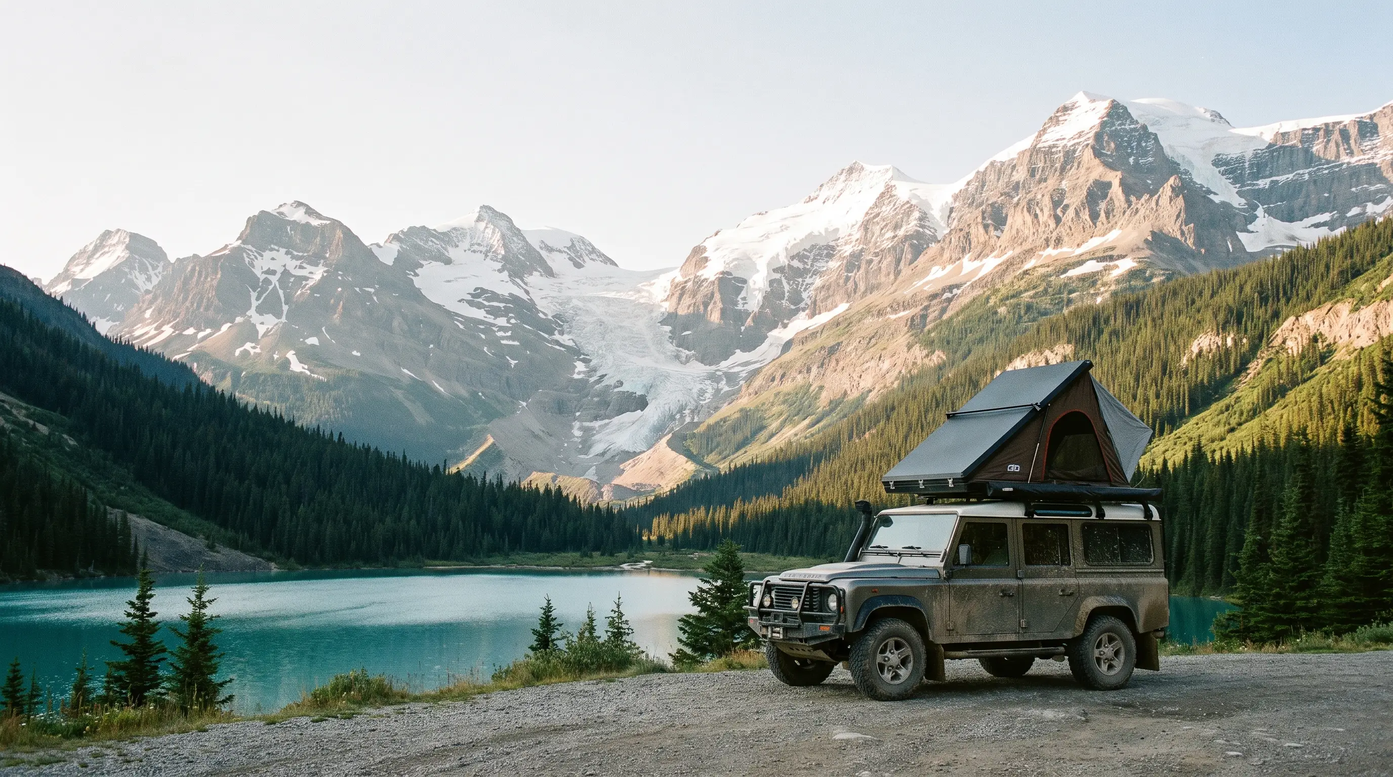
The pass situation is unusually good this summer
Normally you need a valid Parks Canada pass to drive Highway 93N, stopping or not — the whole corridor sits inside Banff and Jasper national parks, so it's treated as a scenic route rather than a through-highway. For summer 2026 that changes: the Canada Strong Pass gives free admission to national parks from June 19 to September 7, 2026, so the entire Parkway is pass-free through peak season. If you were ever going to drive it, this is the year the toll booth stops mattering.
Don't let "free" quietly turn into "unprepared," though. The pass was never the thing that got people into trouble out here — fuel, weather, and wildlife are. The corridor climbs past 2,000 metres at Bow Summit and the Sunwapta Pass, weather flips fast at that elevation, and services are almost nonexistent between the two townsites. Treat the money you're saving on the pass as budget for a full tank, a paper map, and an extra layer in the back seat.
One more planning note: free admission tends to mean busier viewpoints, not quieter ones. The strategy in this guide — get to the marquee stops early, then spend the crowded midday hours on the detours nobody photographs — matters more in a free-pass summer, not less.
Fuel is the one thing you cannot wing
There is exactly one gas station on the entire Parkway, at Saskatchewan River Crossing, roughly the halfway mark. It runs a steep remote premium, it isn't open around the clock, and in shoulder season its hours shrink further. Everything reliable is at the two ends: Lake Louise on the south, Jasper on the north. Plan your fuel around those two points and treat the Crossing as a bonus, never a certainty.
- Fill up before you leave Lake Louise or Jasper, every single time — a full tank at the trailhead removes the entire problem.
- Do the math on your range. It's about 154 km from Jasper south to the Crossing, and roughly 80 km from the Crossing on to Lake Louise. A rig that struggles to clear 300 km on a tank needs a plan.
- Carry a jerry can if your vehicle is thirsty, you're towing, or you plan to idle for heat at a sunrise viewpoint. Twenty litres of insurance is cheap.
- Top up even if you're "fine." Detours, idling in wildlife jams, and low-range crawling on the side spurs all burn more than the map suggests.
The route map below shows the shape of the problem — two fuel points at the ends, one unreliable one in the middle, and a lot of empty in between.
Bow Lake and Peyto: go early, then keep driving
These two are the postcards, and they earn every bit of their fame — Bow Lake's glacier-fed blue and Peyto's wolf-head shape from the upper platform are genuinely worth the stop. But by 10 a.m. the Peyto Lake lot is a scrum, and the viewing platform is a short paved 600-metre walk, which is exactly why it fills up: it's accessible to every tour bus on the road. Hit both at first light or in the golden hour before dusk and they transform from a crowded selfie queue into the reason you came.
The move is to treat them as a warm-up, not the destination. Watch the sunrise at Bow Lake with a coffee, grab the Peyto platform before the buses roll in from Banff, then spend the crowded midday hours somewhere the buses don't stop. That's where the rest of this list comes in.
A quick note on Peyto specifically: the main upper viewpoint reopened after a multi-year rebuild and is now fully paved and railed. It's beautiful and it's busy. If you want the same lake without the platform crowd, the short trails below the parking area give you quieter angles for the price of a few extra minutes on your feet.
Mistaya Canyon: the detour most people blow past
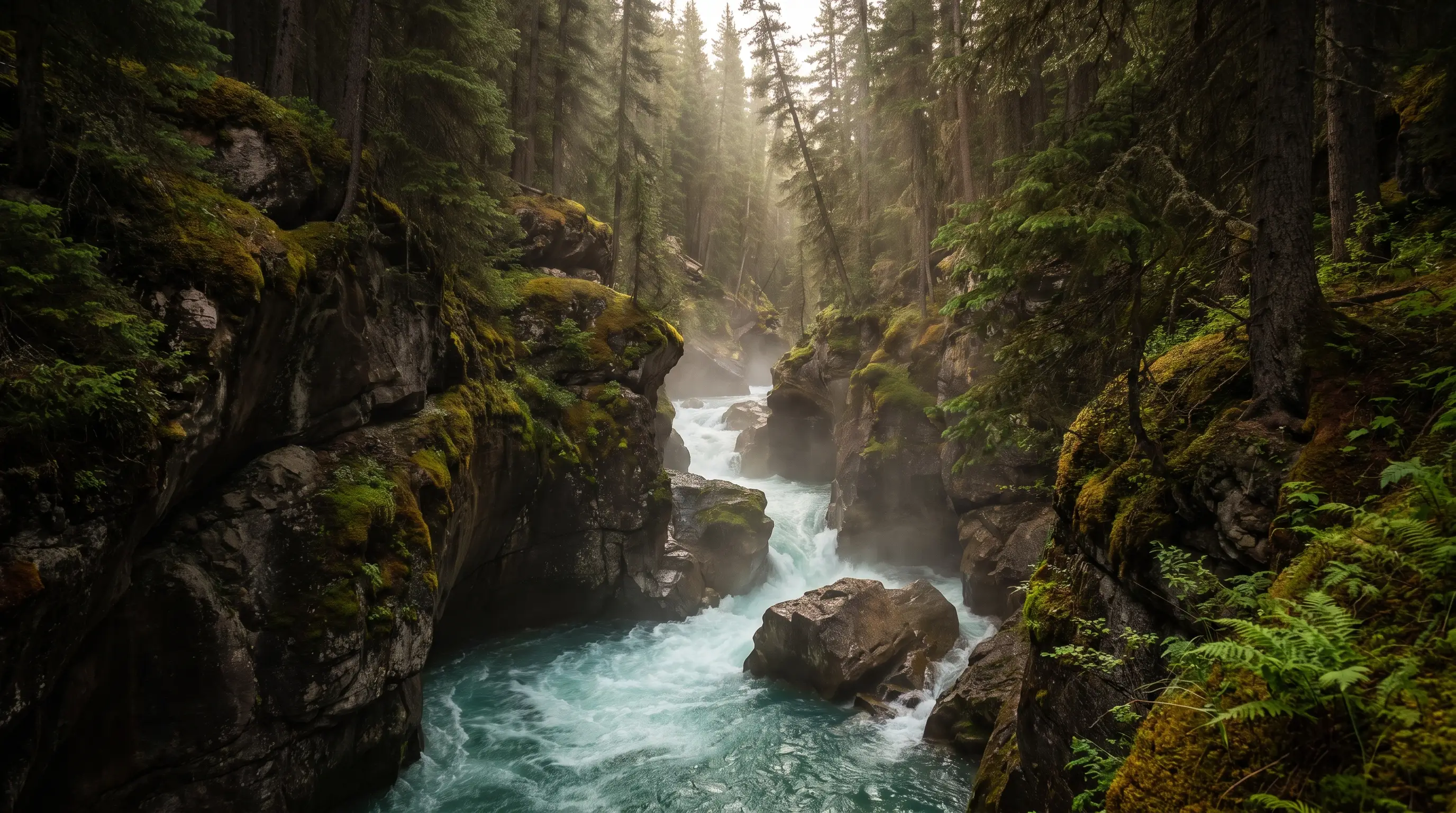
A few kilometres south of Saskatchewan River Crossing, an unassuming trailhead drops a short, steep path to Mistaya Canyon — a tight limestone slot the Mistaya River has drilled into a twisting, potholed gorge over thousands of years. It sees a fraction of the traffic of Peyto or Athabasca Falls, largely because there's no giant sign and no viewing platform visible from the road. You park, you walk down for about ten minutes, and you're standing over a churning slot canyon with almost nobody around.
It's the definition of "worth the detour": minimal effort, maximum payoff, and the kind of feature people drive right past at 90 km/h because it doesn't announce itself. Watch your footing near the edges — the rock is smooth and wet from spray, and there are no railings on the best angles.
Parker Ridge and Wilcox Pass: earn the view
If you've got a couple of hours and want the alpine without a full expedition, these two short hikes are the play. Both trade a modest climb for a view most people only see from a helicopter tour.
- Parker Ridge is a short, steady switchbacked climb that tops out on a ridge overlooking the enormous Saskatchewan Glacier — a tongue of the Columbia Icefield you can't see from the road at all. If you do one hike on the entire Parkway, make it this one. Stay on the built trail; the alpine meadows here are fragile and slow to recover.
- Wilcox Pass starts near the Wilcox Campground just south of the Icefield Centre and runs about 2.4 km return to the first viewpoint, giving you a straight-on look at the Athabasca Glacier and the Icefield without fighting the crowds at the glacier's toe. Push further and you're into open pass country with a real chance of seeing bighorn sheep.
Both are steep enough at the start to shed the casual crowd at the trailhead, which is exactly the point. Bring layers — the wind at the top of Parker Ridge can be brutal even in July — and start early enough that you're not descending in afternoon thunderstorms, which build fast over the icefield.
Timing the day so the crowds work for you
The single biggest lever you control on the Parkway isn't your rig or your gear — it's your clock. The marquee stops follow a predictable curve: near-empty at dawn, jammed from mid-morning through mid-afternoon, then emptying again as the day-trippers head back to Banff for dinner. Plan your day against that curve and the same road feels like two completely different places.
Put simply: shoot the famous viewpoints at the edges of the day, and put the detours — Mistaya, Parker Ridge, Wilcox — in the middle when the paved-platform crowds are at their worst. You end up seeing more, photographing better light, and spending the busy hours somewhere the tour buses physically can't follow.
Drive it like the backcountry road it is
The Parkway is paved and mostly two lanes with occasional passing lanes, so it lulls people into treating it like a highway. It isn't. The hazards are specific and predictable: wildlife on the shoulder, vehicles stopped dead in the lane for a photo, sudden weather at elevation, and long stretches with no way to call for help.
- Check 511 Alberta for live road status and closures before you leave pavement — snow, rockfall, and construction closures happen well outside winter.
- Expect no signal. Cell coverage is essentially nonexistent for most of the route. Download offline maps, carry a paper backup, tell someone your plan, and consider a satellite messenger for the hikes.
- Slow down for stopped cars. "Bear jams" appear out of nowhere on blind bends. Never stop in a live lane for wildlife — pull completely off, or keep driving.
- Give wildlife room. This is prime bear, elk, and bighorn country. Stay in your vehicle, don't feed anything, and keep 100 metres from bears and 30 from everything else.
- Watch the weather clock. Afternoon thunderstorms build fast over the icefield. Be off exposed ridges like Parker Ridge before they hit.
The Parkway rewards the same discipline as any remote route: full tank, offline map, and a start early enough to beat the buses. Do those three things and the free-pass summer of 2026 is one of the best drives in the country — do none of them and the free pass is the least of your problems.
Quick Answers
Do I need a park pass to drive the Icefields Parkway in 2026?
Normally yes, a valid Parks Canada pass is required to drive Highway 93N even if you do not stop. However, for summer 2026 the Canada Strong Pass provides free admission to national parks from June 19 to September 7, 2026, so no pass is required during that window.
Where can I get fuel on the Icefields Parkway?
There is only one gas station on the entire Parkway, at Saskatchewan River Crossing near the halfway point, and it charges a remote premium and is not open all hours. Fill up in Lake Louise or Jasper before you leave rather than relying on the Crossing.
Is there cell service on the Icefields Parkway?
No, cell coverage is essentially nonexistent along most of the route. Download offline maps before you go, check 511 Alberta for road conditions, and tell someone your travel plan.
What is the best quiet stop on the Icefields Parkway?
Mistaya Canyon, a short trail a few kilometres south of Saskatchewan River Crossing, sees far fewer visitors than Peyto Lake or Athabasca Falls. It is a quick walk to a dramatic limestone gorge and one of the best low-effort detours on the road.
How long is the Icefields Parkway drive?
The Icefields Parkway runs about 232 kilometres between Lake Louise and Jasper. Without stops it takes roughly three hours, but with viewpoints and short hikes most travellers make it a full day.
Trusted Sources
Field-tested by the Trekkr community. Trail conditions change — always check current advisories before you roll out.
Your Rig Belongs on This Page
Drop your best shots and the story of your build. Every week we feature community rigs — free, always.
Trekkr.life shares field notes from the overlanding community for general information only. Backcountry travel carries real risk — verify routes, weather, fire bans, and regulations with official sources before you go. Gear opinions are our own and never sponsored.