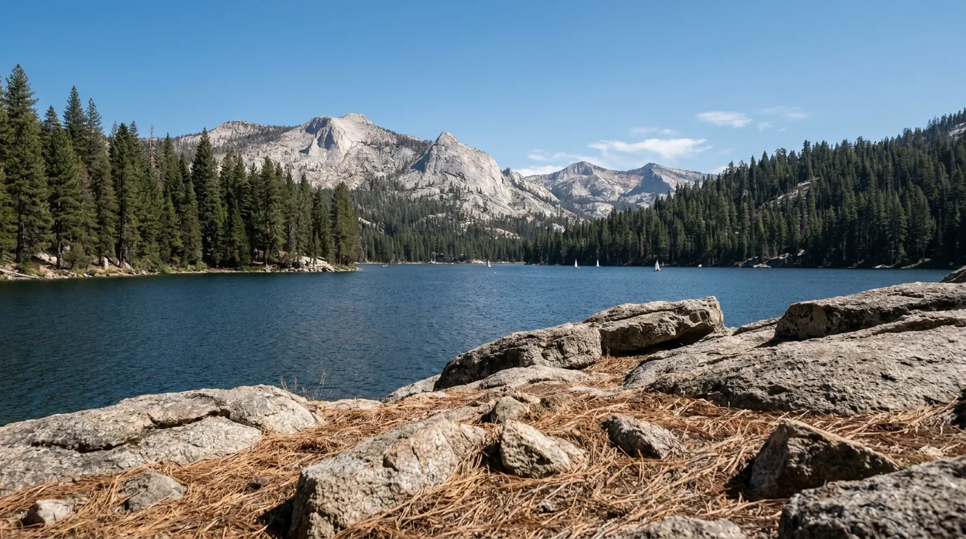
A long deep-blue alpine reservoir at about seven thousand feet ringed by dense red fir and lodgepole pine with a bare granite ridge behind and small sailboats far out on the water, Huntington Lake Sierra National Forest California, ultrarealistic photograph representative of the region
Trekkr Trail Journal · No. 070 · Sierra National Forest

Shaver & HuntingtonCalifornia — the Highway 168 lake country, Kaiser Pass, Florence & Edison Lakes, Mono Hot Springs, Mammoth Pool, Dinkey Creek & Bass Lake

The west-side Sierra between Yosemite and Kings Canyon, and almost nobody writes it up honestly. A highway that climbs 5,000 feet out of the Central Valley into lake country. A one-lane road over a ~9,200-foot pass that people underestimate badly, and that is the only way to Florence and Edison Lakes. A reservoir that closes every spring for migrating deer and whose campground burned to the ground. And two enormous fire scars five years apart. Get the road, the season and the closures right and you get the emptiest good lake country in California.

California · USA Sierra National Forest · Hwy 168 Shaver · Huntington · Florence · Edison Mammoth Pool · Dinkey Creek · Bass Lake
~9,200 ftKaiser Pass — reached by a road that is largely one lane
379,895Acres burned by the 2020 Creek Fire, which started here
59,844Acres burned by the 2025 Garnet Fire, five years later
Each springMammoth Pool reservoir closes for the deer migration — dates reset yearly
Conditions verified 25 July 2026 · This forest has burned twice in five years and its facilities are in flux · This block goes stale — the links don't

The gates: one narrow road, two burn scars, a rebuilt campground and a ferry that isn't running

The rest of this journal is evergreen; this box is not. Almost everything that can spoil a trip here is a status rather than a skill — whether Kaiser Pass Road is open and whether your vehicle belongs on it (§03), what is still closed inside the two fire footprints (§05), and which facilities exist this year at all (§07). We checked each campground individually rather than assuming it operates, because in this forest that assumption is how a guide ends up sending you to a gate that has been locked for six years. Trust the live sources, not our stamp.

  • Kaiser Pass Road is genuinely one lane — and it is the only way eastRoughly 20–22 miles from the end of Hwy 168 over Kaiser Pass (~9,200 ft) to Florence Lake, Lake Thomas A. Edison and Mono Hot Springs, with long single-lane stretches, blind corners and grades reported near 12%. RVs over ~25 ft are not recommended, and large vehicles and trailers are not recommended at all. Seasonal — commonly late May to November; for 2026 Mono Hot Springs Resort published a 22 May opening. [VERIFY the current gate status with the High Sierra Ranger District before you drive up] (§03)
  • Two burn scars, five years apart — and post-fire hazards everywhereThe 2020 Creek Fire burned 379,895 acres starting in the Big Creek drainage between Shaver and Huntington; the 2025 Garnet Fire burned 59,844 acres around Dinkey Creek, McKinley Grove and Courtright. Over 99% of the Garnet footprint was reported reopened on 31 Oct 2025, but our sources conflicted on whether Black Rock and Sawmill Flat campgrounds and Ross Crossing have reopened or remain closed, hazard-tree felling continues along McKinley Grove Road, and a recreation-site/road/trail closure order was reported running to 27 July 2026. [VERIFY current Forest Orders — we could not retrieve them directly] (§05)
  • Mammoth Pool: the campground burned, and the reservoir shuts every springMammoth Pool Campground was destroyed in the Creek Fire and is being rebuilt by Southern California Edison; the boat launch was reported reopened in June 2026 when its rehab closure order was terminated, while the campground is reported targeted for ~May 2027. Separately, the reservoir is closed to public entry for roughly six weeks each spring — generally early May into mid-June — for the deer migration, under a Forest Order reissued with new dates annually (the 2025 order ran 2 May – 14 June). [Sources disagreed on the pattern — never assume last year's dates] Dispersed camping on designated roads, shore fishing and the road/trail system were reported to remain open. [VERIFY with the Bass Lake Ranger District — it is a long, slow road to a closed gate] (§04, §07)
  • The VVR ferry is NOT running in 2026Vermilion Valley Resort states the ferry is not running as of the 2026 season, dates to be determined. The hiker shuttle is running, resupply boxes are being accepted, and the resort, kitchen and camp store are open for a season closing in September 2026. If you planned to ferry across Lake Edison, that is extra miles on foot. (§03, §08)
  • Florence Lake store & ferry — a short, late seasonThe Florence Lake store and ferry, run under permit by Muir Trail Ranch, were reported opening 20 June 2026 (one source cited ferry-only from mid-June), running seven days through roughly Labor Day, tickets at the store, no advance reservations. [VERIFY dates directly — sources disagreed] (§03)
  • Permits, fire rules and the things that catch peopleOvernight wilderness trips into the John Muir, Ansel Adams, Dinkey Lakes and Kaiser wildernesses need a permit year-round (trailhead quotas reported 1 May – 1 Nov, via Recreation.gov). A California Campfire Permit is required for any fire or portable stove outside a developed recreation site. Fire restrictions change through the season. [CHECK the current fire restriction stage and air quality the week you go] (§06, §07)
Live sources · Sierra NF — alerts, closures & fire restrictions · Sierra NF recreation sites · Recreation.gov — campgrounds & wilderness permits · Vermilion Valley Resort · Mono Hot Springs Resort · Florence Lake store & ferry
In an emergency, 911 — where there is signal, which is nowhere near everywhere here. This box was true at press and will not stay true; the sources above are the truth on the day you travel.
01 / THE HOOK

The west-side Sierra everyone drives past on the way to a national park

Between Yosemite to the north and Kings Canyon to the south sits a block of the Sierra Nevada that almost no guidebook treats seriously: the Sierra National Forest. It has no entrance station, no shuttle bus, no reservation lottery and no queue at dawn. What it has instead is a staircase of reservoirs — Shaver at roughly 5,500 ft, Huntington at 7,000 ft, then Florence and Edison beyond a pass of about 9,200 ft — strung together by the Big Creek hydroelectric system, one of the most ambitious pieces of engineering in the American West. It also has the burn scars of two enormous fires five years apart, a road that punishes optimism, and a genuine shortage of anyone to help you. That combination is the whole appeal and the whole risk, and it is why this issue spends as much space on what is closed as on what is beautiful.

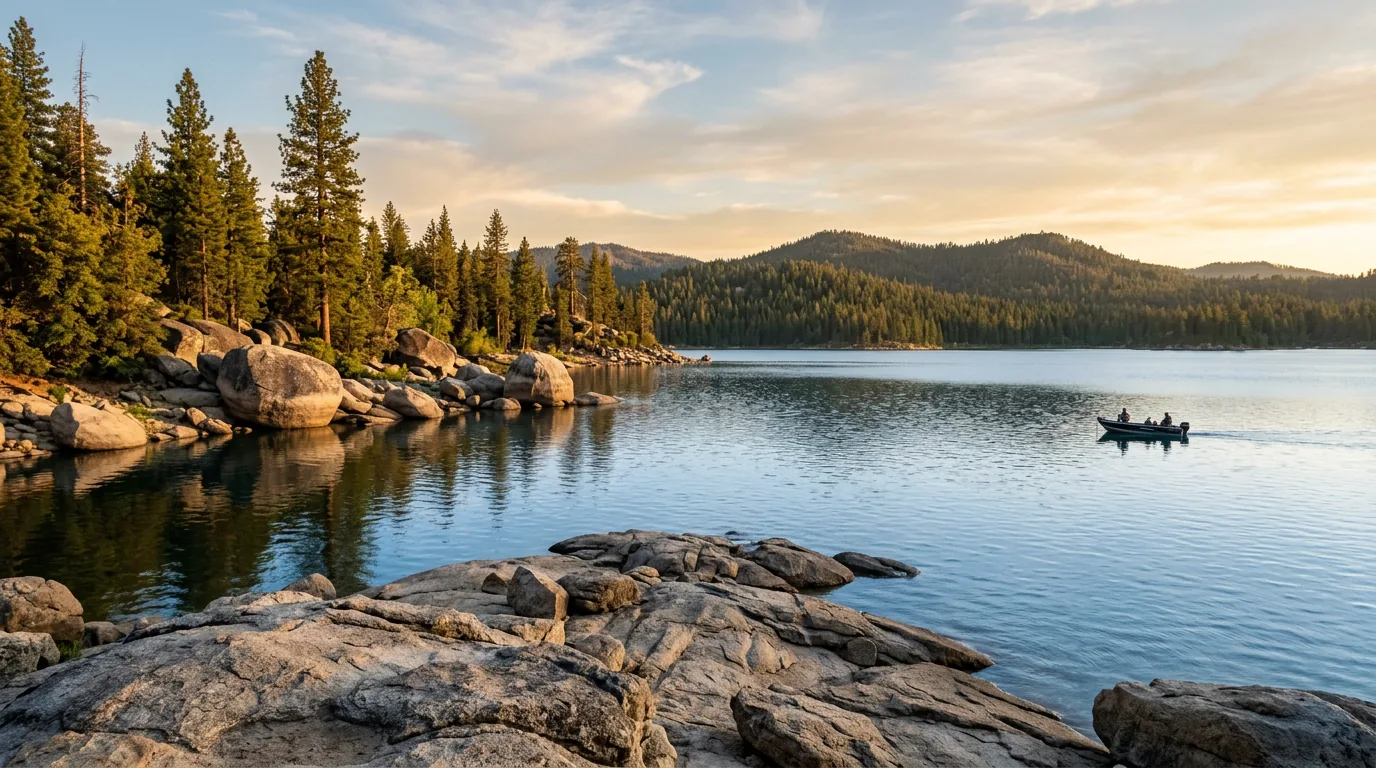
A calm blue mountain reservoir in golden evening light with rounded granite boulders and slabs along the shoreline, tall ponderosa and jeffrey pines and a low forested ridge across the water, Shaver Lake Sierra National Forest California, ultrarealistic photograph representative of the region
Shaver Lake, roughly 5,500 ft — the first rung of the ladder. About an hour and a bit up Highway 168 from Clovis, warm enough to swim in high summer, ringed by granite and pine, and home to the only real village and service hub on the corridor. Most people stop here, which is exactly why the country above it stays quiet (§04, §08).

The payoff

Four reservoirs at four different elevations, granite basins and lake-strewn wilderness in the Kaiser and Dinkey Lakes country, natural hot springs on the San Joaquin, giant sequoias at McKinley Grove — and campgrounds you can often still get into on a Friday (§04, §07).

The ladder

From valley-floor Clovis to ~5,500-ft Shaver to 7,000-ft Huntington to a ~9,200-ft pass and the ~7,300-ft high lakes beyond. Weather, season, water temperature and what your engine feels like all change with every rung (§02, §06).

The catch

A one-lane road to the best of it, two burn scars full of hazard trees and unstable ground, campgrounds still shut six years after a fire, and no fuel and no cell service past Huntington Lake (§03, §05, §06).

The way to think about the region — one highway, one hard road, and three side-doors Nearly everything here hangs off Highway 168, which climbs northeast out of Clovis through Prather and Auberry to Shaver Lake and terminates at Huntington Lake, some 78 miles from Fresno. That is the spine (§02). At the east end of Huntington Lake, Kaiser Pass Road (Forest Road 80) — the hard road — carries on over the pass to Florence Lake, Lake Thomas A. Edison and Mono Hot Springs: the deep-country payoff, and the part most people are not equipped for (§03). Then there are three side-doors that do not connect neatly to the spine. Dinkey Creek Road runs about 11 paved miles east from Shaver Lake to Dinkey Creek, and McKinley Grove Road another 13 or so to the McKinley Grove sequoias and the Wishon and Courtright reservoirs — this is the country the Garnet Fire burned in 2025 (§04, §05). Minarets Road runs from North Fork down to Mammoth Pool, a long, slow, hot canyon road on the Sierra Vista Scenic Byway (§04). And Bass Lake is administratively Sierra National Forest but reached from Highway 41 near Oakhurst on the Yosemite side entirely (§04). Treat those four as separate trips, not as a loop.
The hardest working water in the world Every lake in this issue except Bass is part of the Big Creek Hydroelectric Project, and understanding that explains almost everything odd about the place. Conceived by engineer John S. Eastwood and financed by Henry E. Huntington's Pacific Light & Power, construction began in 1911 and the first power reached Los Angeles in 1913; Southern California Edison acquired the system in 1917 and the last powerhouse came online in 1987. Today it is reported to comprise nine powerhouses, 23 generating units, six reservoirs and 27 dams, generating on the order of 1,000 megawatts by reusing the same water down a 6,200-foot vertical drop — which is why it has long been nicknamed "the hardest working water in the world." It is also why the roads exist at all (Kaiser Pass Road was built as project access), why the lakes draw down late in the season, and why the town of Big Creek sits where it does.
02 / THE ROAD IN

Highway 168 — and the place locals call "the top of the four-lane"

Highway 168 out of Clovis is the Sierra Heritage Scenic Byway, and for the first stretch it is a fast, modern, divided road — a nine-mile four-lane segment built in the realignment that abandoned the old Tollhouse Grade. Then it isn't. Where those lanes end, at the point everyone here calls "the top of the four-lane," the highway becomes a hard-working two-lane mountain climb, and the roughly six miles from there up to Shaver Lake are the segment that news reports and the CHP keep naming when weather or rockfall shuts the road. It is entirely manageable in any vehicle. It just is not the road the first twenty minutes suggested.

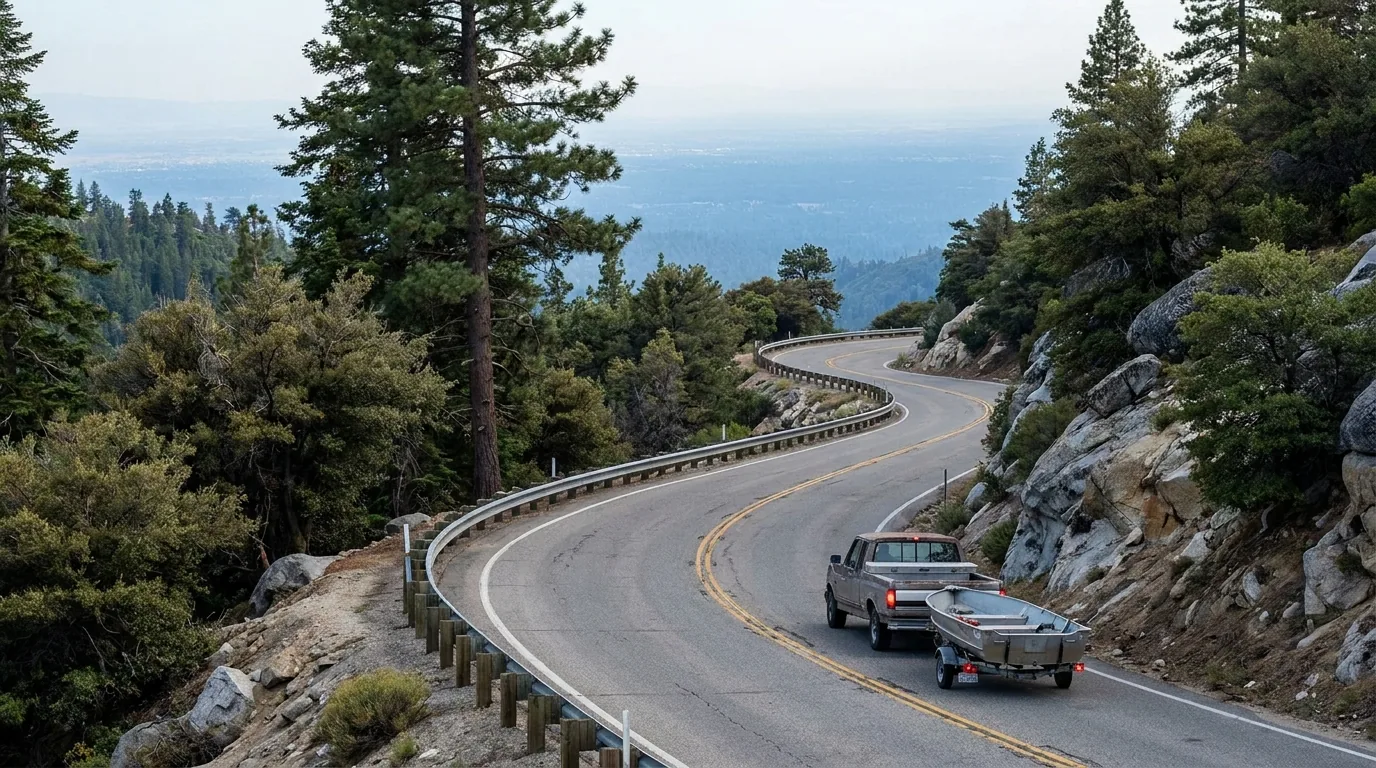
A two-lane mountain highway climbing through a long sweeping curve on a steep forested slope with ponderosa pine and manzanita and granite outcrops, a hazy Central Valley far below and a pickup truck towing a small boat trailer, California Highway 168 above Clovis, ultrarealistic photograph representative of the region
Highway 168 above the foothills. Roughly 78 miles from Fresno to Huntington Lake at 7,000 ft, with Shaver Lake about 50 miles up. Divided and quick at the bottom, a genuine mountain two-lane above the four-lane's end — and on a summer Friday every boat, camper and trailer in Fresno County is on it with you.
Your vehicle / planHighway 168 to Shaver & HuntingtonKaiser Pass Road (§03)What it means
Car, van or small 4x4
the whole region is open to you
No problem — a state highway with a long climb Yes, with patience and low speed Go early in the day, expect around 20 mph on the narrow section, and yield without ego at the turnouts
Truck camper / mid RV / small trailer
~20–25 ft
Fine — use low gears on the descents Not recommended at the upper end of this range Base at Shaver or Huntington and day-trip over the pass in a smaller vehicle if you have one. Do not tow anything over
Large RV / big trailer / towing a boat
over ~25 ft
Doable, slowly — this is the standard way boats reach Shaver and Huntington No. The Forest Service is reported to advise against buses, large motorhomes and vehicles towing trailers, and Recreation.gov's own high-country campground listings warn that RVs over 25 ft are not recommended Shaver Lake and Huntington Lake are your trip, and they are a good one. Florence, Edison and Mono Hot Springs are a separate, smaller-vehicle day — or not this trip

Kaiser Pass Road guidance is advisory, not a posted legal limit, in every source we could reach — and we could not open the Forest Service's own pages to confirm the wording first-hand. Confirm current conditions and restrictions with the High Sierra Ranger District before committing any large vehicle above Huntington Lake.

🔴 The single most common Highway 168 mistake Treating the drive time like valley miles. People leave Fresno at four on a Friday expecting to be at a Huntington Lake campsite by five-thirty, and instead spend it behind a line of boat trailers on a two-lane grade — then arrive at 7,000 feet in the dark, cold, at a campground they have never seen. Give the climb far more time than the map says, fuel and shop at the bottom, and arrive with daylight left. If you are continuing over Kaiser Pass (§03), that is a whole additional undertaking of up to an hour on a one-lane road, and it should never be tacked onto the end of a travel day.

Fuel — the most important paragraph in this issue

Mono Hot Springs Resort puts it about as plainly as anyone can: fill up at Shaver Lake, which it describes as 24-hour service, or at Rancheria Enterprises at Huntington Lake, which it says closes at 6 PM — because no fuel is sold at Mono Hot Springs or anywhere past Huntington Lake.

That is the whole rule. There is no station over the pass, no station at Florence or Edison, and nowhere to buy your way out of a bad calculation. We did not independently verify the current hours or operating status of any individual station — small mountain stations change hands and hours. Arrive full.

No fuel past Huntington LakeConfirm hours before you rely on them

Winter narrows it to two things

In winter this corridor becomes Shaver Lake and China Peak, and very little else. Highway 168 is plowed and maintained up to China Peak and Huntington, but in a serious storm Caltrans has closed it at the Shaver Lake Marina, cutting off both. Chain controls are routine — R-2 has been posted from about 8.6 miles east of Prather upward, and R-3 (chains on everything, including 4WD) has been imposed as well.

Kaiser Pass Road is shut all winter and becomes a groomed snowmobile trail; winter users park at Eastwood Sno-Park. Tamarack Sno-Park, roughly ten miles beyond Shaver Lake, is the main snow-play and cross-country base — a California Sno-Park permit is required, reported at $15/day or $40/season from 1 November to 30 May.

Carry chainsKaiser Pass gated all winterSno-Park permit
The 60-second "how far up do I belong" decision
  1. Big rig, boat, or a trailer? Shaver Lake or Huntington Lake is your trip, and both are worth it on their own terms. Do not take it over Kaiser Pass.
  2. Normal vehicle, and you want the deep country? Base at Huntington, then do Kaiser Pass as a dedicated day with an early start and a full tank (§03).
  3. Chasing giant sequoias or the Dinkey Lakes? That's the Dinkey Creek Road side-door east of Shaver — inside the 2025 Garnet Fire footprint, so check closures first (§05).
  4. Mammoth Pool? A different approach entirely, from North Fork on Minarets Road, and the campground is not back until around 2027 (§04).
  5. Bass Lake? Don't come up 168 at all — it's reached from Highway 41 at Yosemite Forks, north of Oakhurst (§04).
03 / KAISER PASS ROAD — READ BEFORE YOU DRIVE

Twenty miles that people badly, consistently underestimate

This is the section to read twice. At the east end of Huntington Lake, where Highway 168 gives up, Kaiser Pass Road carries on east over a pass of about 9,200 feet and down to Florence Lake, Lake Thomas A. Edison and Mono Hot Springs. It is paved the whole way. It is also, past the first few miles, more or less one lane of pavement with turnouts, blind rock corners, no centre line and grades reported around 12 percent — built in the 1920s as access for the Big Creek hydro project and never finished as the highway it was meant to become. There is no alternative route, no shoulder to think on, no fuel and no phone signal. It rewards small vehicles, early starts and very low expectations about speed.

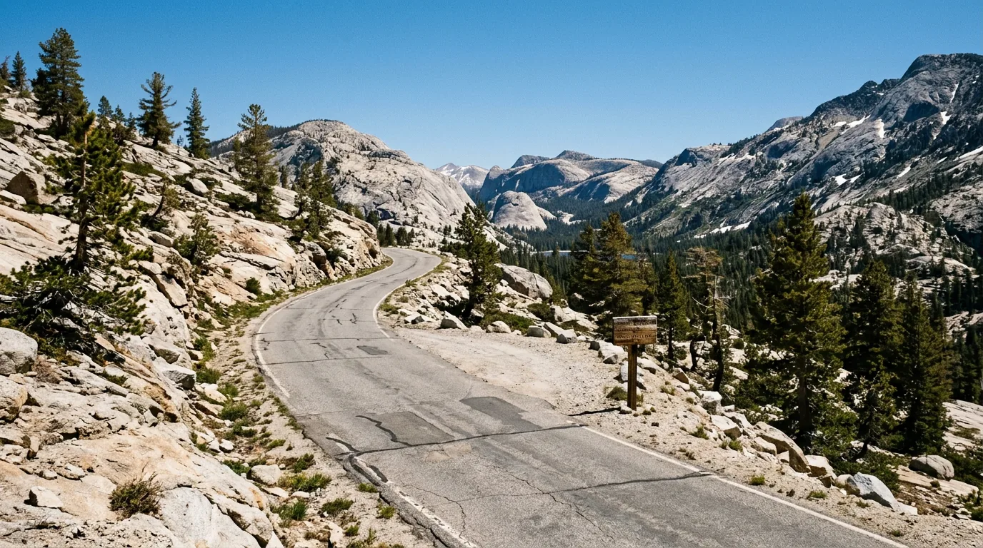
A narrow single-lane paved mountain road with no centre line winding across open granite slabs past stunted lodgepole pines at about nine thousand feet, a small gravel turnout cut into the rock and granite domes and snow patches in the distance, Kaiser Pass Road Sierra National Forest California, ultrarealistic photograph representative of the region
Kaiser Pass Road, near the top. Mono Hot Springs Resort describes it as five miles of smooth two-lane followed by about twelve miles of narrow, curving, more-or-less one-lane pavement where you can manage about 20 mph. That description matches every other account we found — and it is the reason the advice against big rigs is unanimous.

The road, plainly

  • Length: reported at 22.4 miles from CA-168 to Florence Lake by one road database; another account puts the High Sierra Ranger Station about 17 miles from the Huntington turnoff. Call it "about twenty miles, and longer than it sounds"
  • Where it narrows: Mono Hot Springs Resort says the first five miles are smooth two-lane, then the last twelve turn narrow, curvy and more or less one lane; Vermilion Valley Resort says good two-lane for about six miles before it narrows. Either way, most of the road is the hard part
  • Speed and time: about 20 mph on the narrow section; Huntington Lake to Mono Hot Springs is reported at about an hour, and the last 17 miles at 30–60 minutes "depending on traffic and your level of machismo." From Fresno, allow 2.5 hours to either Mono Hot Springs or VVR
  • Grade: reported to hit around 12%. Low gears on the way down, and let your brakes cool
  • Vehicles: the Forest Service is reported to advise against buses, large motorhomes and vehicles towing trailers; Recreation.gov's Jackass Meadow and Vermilion listings warn that RVs over 25 ft are not recommended. We found no evidence of a hard legal length limit — treat it as strong advice, not a ban, and take the advice
Mostly one laneNo fuel · no signal~20 mi · up to 1 h

The season, the gate, and the etiquette

  • Season: commonly described as late May through mid-November. It is snow-gated and the dates move with the snowpack every single year
  • For 2026, Mono Hot Springs Resort published that the resort and Kaiser Pass Road would open Memorial Day weekend, 22 May 2026, with their season ending 26 October. That is a business describing its own season, not a Forest Service road order — confirm before you rely on it
  • Turnout etiquette is the whole skill. When two vehicles meet, one usually has to reverse to a turnout — the technique is to back past it on your mirrors, then pull forward into it. Whoever is closer to a turnout uses it. No ego, no negotiating on a blind corner
  • In winter the road is unplowed and becomes a groomed snowmobile trail; Eastwood Sno-Park at the Huntington end is where winter users park

Always confirm the gate is open with the High Sierra Ranger District before you drive up. There is nothing at the top if it is shut, and nowhere to turn a big vehicle around when you find out.

🔴 Before you commit to Kaiser Pass Road — the non-negotiables Leave the trailer, the boat and the big rig at Huntington Lake. Not because someone will fine you, but because there is nowhere to pass and nowhere to turn around. Fuel before you turn off Highway 168 — there is none beyond it, at any price, in any season. Go early, for the light and for the lighter oncoming traffic. Sound your horn on blind corners and drive expecting someone around every one of them. Carry water, a spare and the tools to fit it, because roadside assistance is not a concept that applies out here and there is no cell signal past Huntington Lake — accounts describe coverage beyond it as spotty at best and absent around Edison and Florence. Download your maps, reservations and permits before you leave signal. And leave the daylight and the energy to come back over the same road: this is a full day, not a detour.
A high granite-rimmed reservoir at about seven thousand three hundred feet with a small open passenger ferry crossing blue water toward a distant landing, bare pale granite domes and a rocky drawn-down shoreline, Florence Lake Sierra National Forest California, ultrarealistic photograph representative of the region

Florence Lake — the end of the road, and the door to the John Muir Trail

At about 7,330 ft, Florence Lake is where the pavement stops and the wilderness starts. A small store and passenger ferry run under Forest Service permit by Muir Trail Ranch: the ferry cuts several miles off the walk up the South Fork of the San Joaquin toward the John Muir and Pacific Crest Trails, which is why this small lake matters far out of proportion to its size. The day-use area, picnic area, boat ramp and parking were reported fully reopened on 17 June 2026 after inspection.

The 2026 ferry opening was reported as 20 June, seven days a week through roughly Labor Day, with departures reported at 9:30am, 12:30pm and 3:30pm from the road’s end and 10:00am, 1:00pm and 4:00pm returning. Tickets at the store, cash or card, no advance reservations; arrive 30 minutes early and park in the upper lot. We are deliberately printing no fares: two sources both tracing to the operator gave materially different prices (adult round trip appeared as both $40 and $45), and one cited a mid-June ferry-only start against the other’s 20 June. Confirm dates and fares with Muir Trail Ranch before you build a resupply around them.

Ferry ~20 Jun–Labor Day (reported)JMT / PCT accessStart date contested

Lake Edison & VVR — and the ferry that isn't running

Lake Thomas A. Edison lies down the other fork off Kaiser Pass Road, and at its far end is Vermilion Valley Resort — the off-grid backcountry basecamp that has fed and resupplied Pacific Crest and John Muir Trail hikers for decades. The last stretch matters: at the dam, follow the sign, and where the asphalt ends do not continue straight (that is an Edison maintenance road) — jog left onto dirt for the final 1.7 miles.

For 2026, VVR states plainly that the ferry is not running, with dates "TBD." The hiker shuttle is running, resupply boxes are being accepted, and the kitchen, camp store and lodging — hostel through tiny house, with token showers, laundry, wi-fi and EV charging — are open for a season closing in September 2026. Nearly every older write-up on the internet still says the ferry runs. If your plan assumed a boat across Edison, rebuild it around the shuttle or the extra trail miles.

No VVR ferry in 2026Shuttle runningPCT / JMT resupply
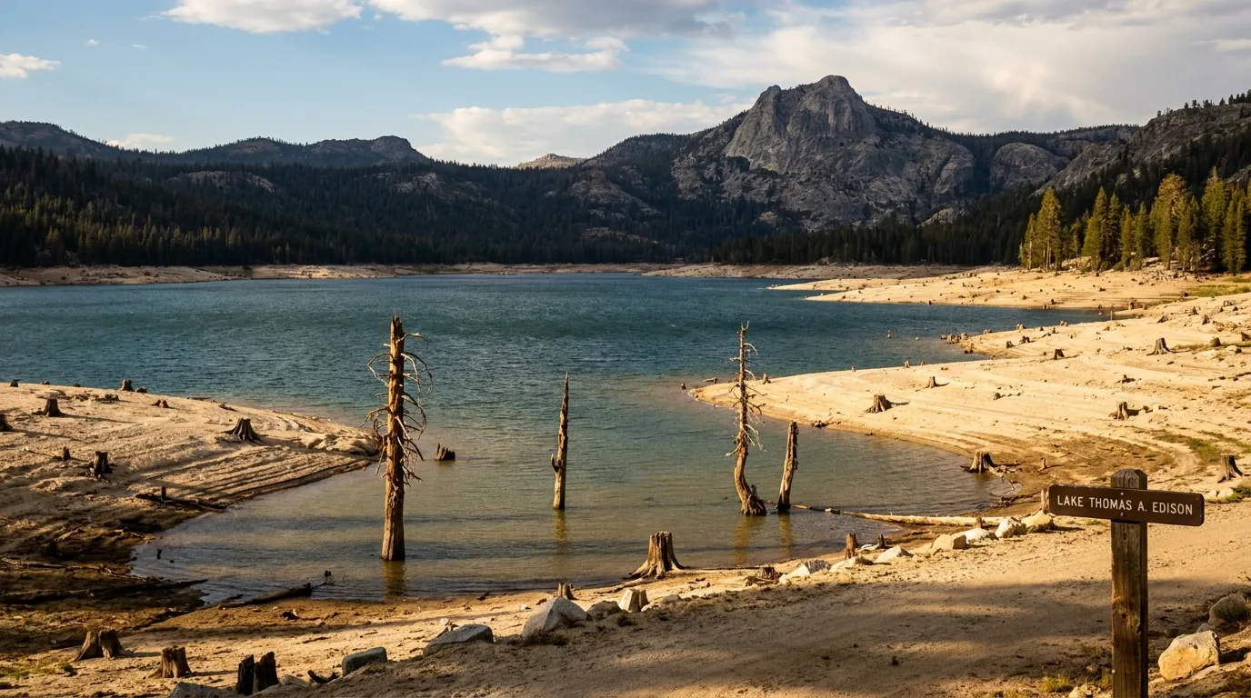
A High Sierra reservoir drawn down well below its high-water line exposing a wide pale band of bare granite sand and stumps, dark blue water and forested ridges behind with weathered pine snags in the shallows, Lake Thomas A. Edison Sierra National Forest California, ultrarealistic photograph representative of the region
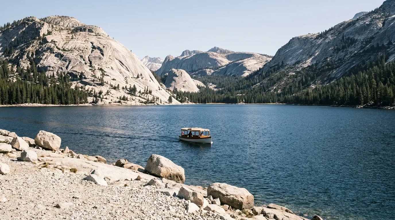
The drawdown nobody warns you about Florence, Edison and Mammoth Pool are not lakes; they are working parts of a hydroelectric system, and they are operated as such. By late summer and autumn they can sit a long way below their high-water marks, leaving wide aprons of bare granite sand, stumps and a conspicuous bathtub ring — sometimes putting a boat ramp a considerable walk from the water. Edison's operator says so directly in its own filings: "operations of boat ramps are directly related to water surface elevation," and shoreline fishing, picnicking and camping are all affected by it. At low water, the crossing is run by smaller boats making more frequent trips. It is not a drought story and it is not a scandal; it is how the system works. Plan boating and swimming earlier in the season if water level matters to you, and treat any late-season photograph of a brim-full reservoir as optimistic. We did not confirm 2026 lake levels — if you are trailering a boat any distance, ask the operator or the ranger district first.
04 / THE LAKES & THE WALKS

Six waters, four approaches, and the walks that go with them

There is no single centre to this forest — there are separate lake basins reached by separate roads, and choosing between them is most of the planning. Below, each water gets its own honest paragraph, followed by the walks. A note on the trail figures: unlike a national park, this forest does not publish one authoritative table, and the sources we could reach disagreed on some distances outright. Every number here is flagged for what it is, and where two sources conflicted we say so rather than picking the prettier one.

Shaver Lake — the accessible one

Roughly 5,500 ft and about 50 miles up from Fresno, Shaver is the lake most people mean when they say they are "going to the mountains." Reported at about 2,177 surface acres with 22 miles of shoreline and roughly 135,000 acre-feet of usable storage, dammed in 1927 and managed by Southern California Edison, it is warm enough to swim, big enough to ski on, and ringed by granite. Fishing is rainbow trout, kokanee salmon and smallmouth bass, with reported annual stocking of roughly 50,000 kokanee fingerlings and 10,000 rainbows, and spring and autumn as the good kokanee windows.

It also has the village (§08) — the last full-service stop before the country gets serious. Sources gave Shaver's elevation variously as about 5,500 and 5,627 ft depending on whether they meant the lake or the community; we have not resolved it. Check current fishing regulations with CDFW rather than trusting any limit quoted online, including ours.

Swim · ski · fishVillage & services

Huntington Lake — the sailing one

At 7,000 ft at the end of Highway 168, Huntington is about seven miles long by one wide, held by three separate Big Creek dams, and reliably windy — a moderate thermal westerly fills in most mornings, which is why it has hosted the High Sierra Regatta since 1953. The Fresno Yacht Club's 73rd running in 2026 was scheduled for 11–12 and 18–19 July, five races each weekend. If you want a quiet campsite, those are the two weekends to avoid; if you want to watch a hundred boats on an alpine lake, they are the only two that work.

Above the lake, China Peak runs summer chairlift rides from a base at about 7,030 ft to above 8,700 ft, plus a lakeside boathouse. Note for mountain bikers: 2026 was reported to be the final season of China Peak's bike park, which is closing permanently at season's end.

Regatta 11–12 & 18–19 Jul 2026Bike park's last season
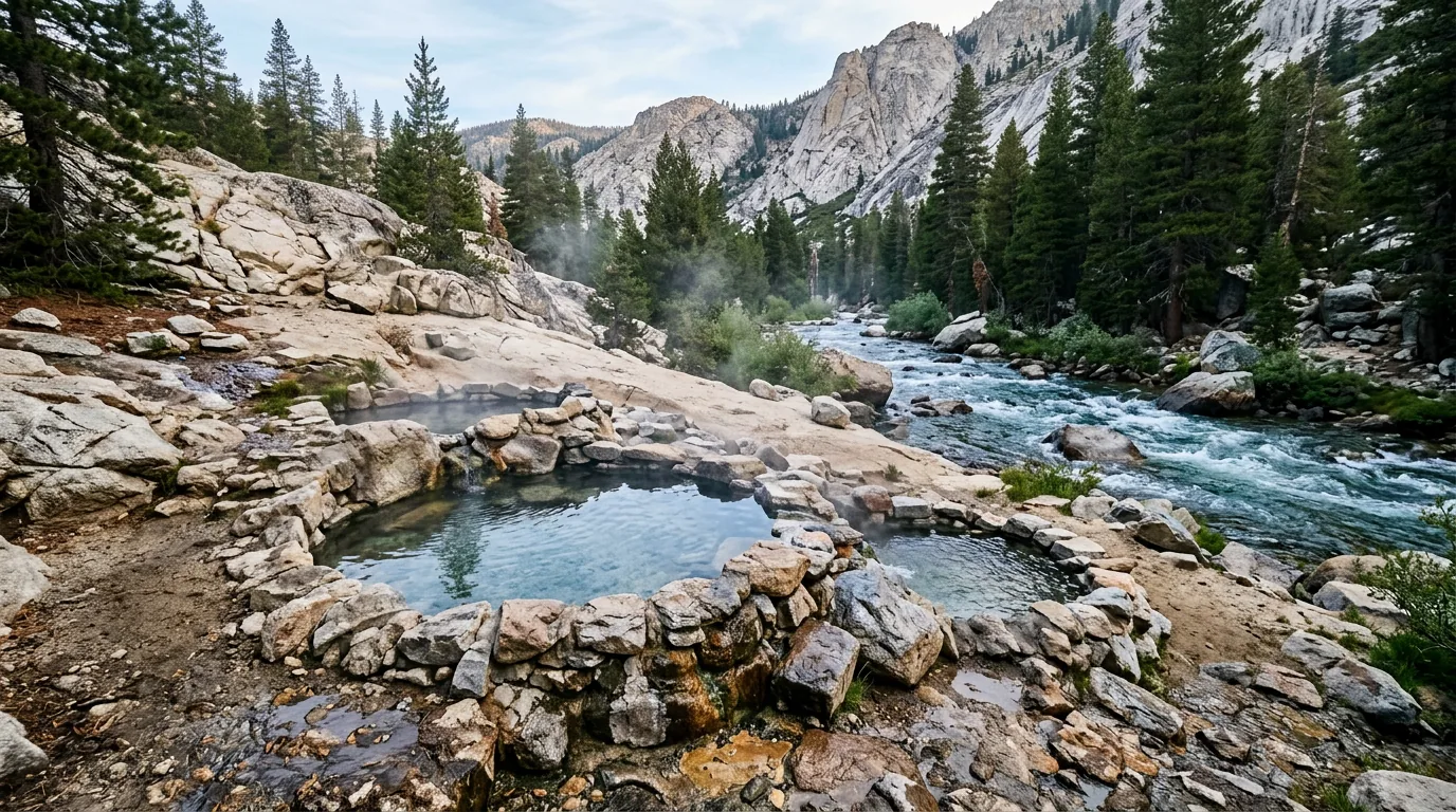
Small natural hot spring soaking pools of clear warm water rimmed with stacked river rock on a granite and sand bench beside a cold rushing snowmelt river in a High Sierra canyon with lodgepole pines and pale granite slopes, Mono Hot Springs Sierra National Forest California, ultrarealistic photograph representative of the region
Mono Hot Springs, about 6,700 ft, over Kaiser Pass. Thermal pools a short walk from the campground down to the San Joaquin, plus a resort with historic cabins, a bathhouse, the River Rock Cafe and a general store — reported to be running a 22 May to 26 October season in 2026 and taking reservations by phone only. The Creek Fire reportedly moved around the property without damaging it (§03, §05).

Mammoth Pool — the one with the hardest story

Mammoth Pool sits deep in a hot, steep San Joaquin canyon, reached the long way round from North Fork: Road 225 out of town, then Minarets Road (Forest Road 81) for around 37 miles, then Mammoth Pool Road about four miles east. Minarets Road is reported to open 1 May and close 31 December. This is a genuinely long, slow approach — not a spur off anything.

Two things gate it. First, the reservoir closes to public entry for roughly six weeks each spring for the deer migration — the 2025 order ran 2 May to 14 June, but descriptive sources give the pattern as anything from 1 May–15 June to 15 May–15 June, and the order is reissued with new dates each year. Second, the campground burned in the Creek Fire and is not back: Southern California Edison is rebuilding it, the boat launch was reported reopened in June 2026, and the campground is reported targeted for around May 2027.

Campground closed until ~2027Spring reservoir closure — dates vary

Dinkey Creek, McKinley Grove & Bass Lake

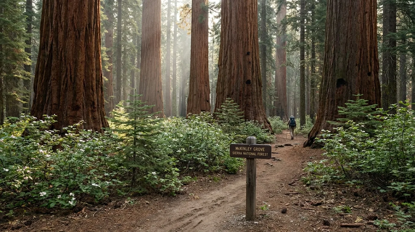
Dinkey Creek Road runs about 11 paved miles east from Shaver Lake, and McKinley Grove Road a further 13 or so to the McKinley Grove of giant sequoias — an isolated, uncrowded grove of about 100 acres holding more than 200 giant sequoias — and on, paved, to Wishon Reservoir. It is usually a May-to-October road. All of this is inside the 2025 Garnet Fire footprint (§05); the fire crossed Dinkey Creek and burned into the grove itself, and while most of the big sequoias were reported to have survived, we could not obtain a post-fire assessment.

Bass Lake is the outlier — 3,400 ft, warm, busy, and reached not from 168 at all but from Highway 41 at Yosemite Forks, about 3.4 miles north of Oakhurst, where Road 222 turns east and becomes Road 274 along the north shore. It is a boating-and-swimming lake with a chain of concession-run campgrounds (§07), and a completely different trip.

Garnet Fire footprint — check closuresBass Lake off Hwy 41
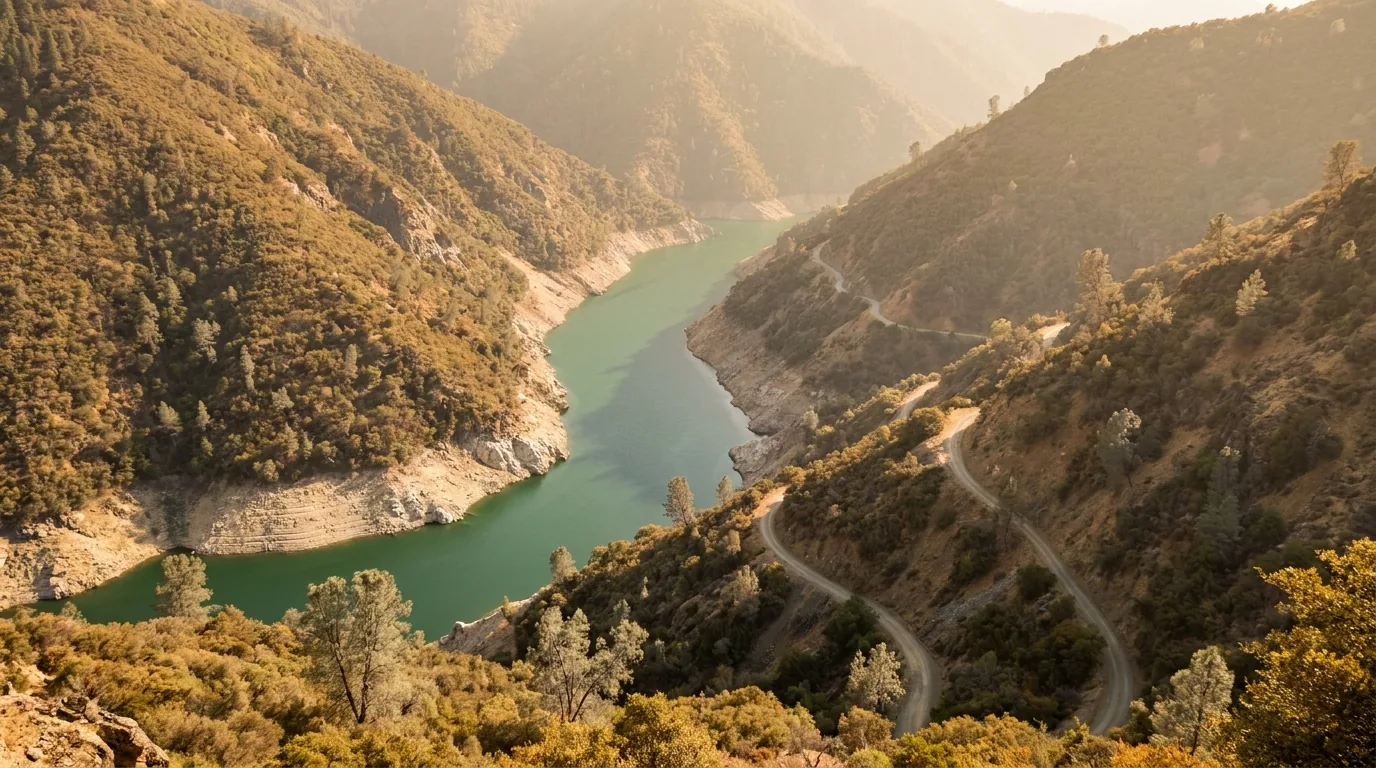
A long narrow reservoir deep in a steep dry river canyon in the western Sierra Nevada seen from high on the rim, green-blue water far below with steep brushy chaparral slopes, a pale bathtub ring above the waterline and a thin dirt road switchbacking down the far wall, Mammoth Pool Reservoir Sierra National Forest California, ultrarealistic photograph representative of the region
Mammoth Pool, deep in the San Joaquin canyon. Hot, steep and a long way in from North Fork — and the place where the Creek Fire trapped campers over Labor Day weekend 2020. The campground burned and is not due back until around 2027, and the reservoir itself closes to entry for roughly six weeks each spring while the deer herd migrates through. Come for the drive and the overlook (§04, §05).
A small quiet grove of giant sequoia trees in a mid-elevation Sierra Nevada forest with massive cinnamon-red fluted trunks rising out of dogwood and young white fir, a narrow footpath and a low interpretive sign in deep forest shade, McKinley Grove Sierra National Forest California, ultrarealistic photograph representative of the region
McKinley Grove, off Dinkey Creek Road. About 100 acres holding more than 200 giant sequoias, a short flat walk, a picnic area and — most of the time — nobody: the sequoia experience without the queue. In September 2025 the Garnet Fire burned into this grove. Crews held it for days, ran sprinklers non-stop and sent smokejumpers up into the crowns to put out embers; reporting afterwards was that only the understory burned and the big trees came through, most of the lower grove expected to survive with little or no damage. Hazard-tree work continues along the access road — confirm closures before you drive out.
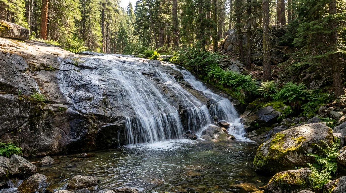
A wide granite-slab waterfall in a Sierra Nevada forest, a creek fanning down a broad polished granite apron in multiple silver threads into a clear pool surrounded by red fir and lodgepole pine and green ferns, Rancheria Falls near Huntington Lake Sierra National Forest California, ultrarealistic photograph representative of the region
Rancheria Falls — reported at around 150 ft, on a ~2 mi round trip with about 200 ft of gain, just off Kaiser Pass Road above Huntington Lake. Widely described as the most accessible waterfall walk in Fresno County, mostly shaded under fir, and at its best early in the season — by late summer there is far less water coming over.

The walks

A short, honest list. Wilderness overnights need a permit (§07); day hiking does not. Nearly all of these sit between 5,000 and 9,000 feet, so pace the first day.

The easiest big payoff in the corridorRancheria Falls National Recreation Trail

~1.6–2 mi round trip · ~200 ft of gain to a waterfall reported at around 150 ft, dropping through a narrow canyon in a series of cascades, on a mostly shaded trail under red and white fir just off Kaiser Pass Road above Huntington Lake. Widely described as the most accessible waterfall hike in Fresno County, and a good first-afternoon leg-stretcher at altitude.

Season roughly June to October and snow-dependent. The falls are at their best early in the season; by late summer expect far less water.

~2 mi RT · easyBest early season
~2 mi round trip · ~200 ft
1–1.5 h (estimate)

The swimming-hole walk · distances disagreeIndian Pools

From the back parking lot at China Peak, a granite-lined path along Big Creek to a chain of pools and slides — the classic hot-afternoon family objective at Huntington Lake. The wildly different distances you’ll see quoted are both right; it depends where you stop. The maintained Forest Service trail is about 0.7 mi to the pools, with the first clear shallow ones roughly half a mile in — fifteen minutes’ walk. But an informal creekside use-path carries on upstream about another 1.5 mi, and people who walk the whole creek log around 4.7 mi round trip with 670–700 ft of gain.

Granite around moving water is slick, and snowmelt keeps the creek cold and pushy well into summer, with some rock scrambling on the upper path. Watch children closely and don't jump into water you haven't checked (§06).

0.7 mi to the pools~4.7 mi to the end of the pathCold, slippery creek
0.7 mi to the pools
~4.7 mi RT to the top of the path

The wilderness day above HuntingtonPotter Pass, the Twin Lakes & Kaiser Peak

~9 mi round trip · ~1,500 ft of gain. The most popular way into the ~22,000-acre Kaiser Wilderness, from the signed Badger Flat horse-staging area about 4.8 miles up Kaiser Pass Road — restrooms, parking on the south side, trail starting across the road. Around 800 ft of climb over ~2.5 mi to Potter Pass (~9,000 ft), then down into a basin of rolling granite and meadow holding Upper and Lower Twin Lakes (~8,600 ft).

Kaiser Peak (10,320 ft) is the big summit day, from the pack station near Lakeshore — reported at roughly 11 mi round trip and 3,300–3,700 ft of gain, uphill nearly the whole way but never steep. Sources gave a spread on both routes; these are consensus bands, not one official figure.

High and exposed; start early and watch the afternoon sky (§06). Overnight trips need a wilderness permit (§07).

Twin Lakes ~9 mi RTKaiser Peak ~11 mi · ~3,300–3,700 ft
Twin Lakes ~9 mi RT · ~1,500 ft
Kaiser Peak ~11 mi · ~3,300–3,700 ft

Lake after lake after lakeDinkey Lakes Wilderness

From the Willow Meadow trailhead (Road 9S62, reached via 9S10), the Dinkey Lakes country stacks up fast: Mystery Lake ~2.0 mi, Swede Lake ~2.5 mi, First Dinkey Lake ~3.0 mi, South Lake ~3.2 mi from the trailhead, with Second Dinkey and Rock Lake beyond. The through-trail is given as 11.3 miles from Willow Meadow to Cliff Lake, and the popular circuits are reported at about 7 mi with ~895 ft of gain for the short loop or ~10.6 mi with ~1,780 ft for the full round. Granite basins, easy grades and a lot of water for the effort.

This wilderness sits inside the 2025 Garnet Fire footprint — the fire crossed Dinkey Creek. Verify trail and road status before you commit, and expect hazard trees (§05). Overnight needs a permit (§07).

Mystery Lake ~2 miGarnet Fire area
2–3 mi to the first lakes
11.3 mi through-trail

The big one from EdisonDevils Bathtub

~9 mi round trip · ~1,450–1,600 ft of gain (sources differ slightly) from off Kaiser Pass Road near Mono Hot Springs, to a granite-bound lake that is the classic objective out of the Edison basin. Moderate for the first two-thirds, genuinely hard for the last third. A high-clearance vehicle is reported to be needed to reach the trailhead — which changes the plan entirely if you are in a low two-wheel-drive van.

The lower section has been burned and has little shade — carry more water and sun protection than you think, and start early. No signal out here (§03).

~9 mi RT · full dayBurned, exposed startHigh-clearance to the trailhead
~9 mi round trip · ~1,450–1,600 ft
Full day (estimate)
WalkAreaRound trip*Note
Rancheria FallsKaiser Pass Rd, above Huntington~2 mi~200 ft gain to a ~150 ft fall; shaded; June–Oct, snow-dependent
Indian PoolsChina Peak / Big Creek0.7 mi to the pools; ~4.7 mi RT to the endGranite swimming pools; cold, slick rock; both quoted distances are right
Potter Pass & Twin LakesKaiser Wilderness~9 mi RT · ~1,500 ftFrom Badger Flat, 4.8 mi up Kaiser Pass Rd; pass ~9,000 ft
Kaiser Peak (10,320 ft)Kaiser Wilderness~11 mi RT · ~3,300–3,700 ftThe summit day above Huntington; long but never steep
Mystery / Swede / First Dinkey LakesDinkey Lakes Wilderness~2.0 / ~2.5 / ~3.0 mi one wayFrom Willow Meadow TH; inside the Garnet Fire footprint
Dinkey Lakes loopsDinkey Lakes Wilderness~7 mi or ~10.6 miShort loop ~895 ft gain; full circuit ~1,780 ft; through-trail 11.3 mi
Devils BathtubOff Kaiser Pass Rd, nr Mono Hot Springs~9 mi · ~1,450–1,600 ftBurned, unshaded start; high-clearance reported needed to the trailhead
Mono Hot Springs poolsOver Kaiser PassShort walkThermal pools by the San Joaquin, below the campground
McKinley GroveMcKinley Grove RdShort loop (length not confirmed)~100-acre grove, 200+ giant sequoias; survived the Garnet Fire
Bald Mountain LookoutOff Dinkey Creek Rd~5.9 mi · ~1,490 ftRated hard; looks down on Shaver Lake and out over the valley

*This forest does not publish one official trail table, and our sources disagreed on several of these. Every figure above is as reported, and the ones we could not confirm are marked rather than guessed. Confirm at the trailhead board or with the ranger district. Times are fit-hiker estimates at altitude, not official figures. Trail conditions inside both fire footprints change with every storm — hazard trees fall, tread washes out, and a trail being on a map does not mean it is walkable.

05 / THE BURN — READ BEFORE YOU PLAN

Two enormous fires, five years apart, and what they left behind

You cannot plan a trip to this forest without planning around fire, and not in the abstract "wildfire season" way that every western guide mentions. Two specific, enormous fires have reshaped this exact country inside six years, and their consequences are still the operative facts on the ground: campgrounds shut, hazard-tree crews working, logging trucks inside open campgrounds, roads damaged, slopes unstable. This section is the honest version.

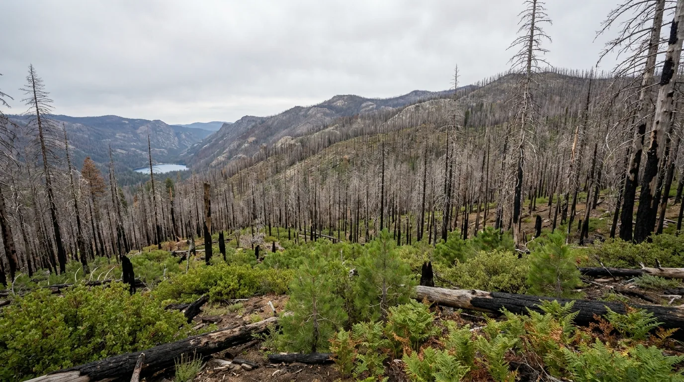
A vast wildfire burn scar on a Sierra Nevada mountainside several years after a severe fire, thousands of standing dead conifers with bare silvered and charcoal trunks over ridge after ridge with a bright green understory of young shrubs and seedling pines between them, Sierra National Forest California, ultrarealistic photograph representative of the region
The burn scar, years on. Standing dead timber over ridge after ridge, with green coming up hard underneath. This is what a great deal of the country between Shaver Lake, Huntington Lake and Mammoth Pool looks like now — and the dead trees, not the fire, are what is still closing campgrounds six years later.

The Creek Fire, 2020 — 379,895 acres

  • Ignited the evening of 4 September 2020 in the Big Creek drainage — between Shaver Lake and Huntington Lake. Not near here. Here
  • 379,895 acres, not fully contained until 24 December 2020; at the time, the largest single (non-complex) wildfire in California's recorded history. 853 structures destroyed, and the town of Big Creek heavily damaged
  • It exploded from around 2,000 to 36,000 acres in a day, and famously trapped campers at Mammoth Pool over Labor Day weekend — some 207 people at the reservoir, with military helicopter crews lifting out 396 people and 27 animals over two days in near-blackout conditions
  • We are not stating a cause. The reporting we could reach disagreed, and a later Forest Service release we could not open appears to address it. Look it up if it matters to you

The Garnet Fire, 2025 — 59,844 acres

  • Started 24 August 2025 from lightning, in Fresno County. 59,844 acres, fully contained 23 October 2025
  • It burned the Dinkey Creek country — crossing Dinkey Creek, with lines built east of Tollhouse and Shaver Lake, and closures reaching Courtright, Wishon and the John Muir Wilderness trailheads
  • It burned into the McKinley Grove sequoias. Crews ran sprinklers continuously and smokejumpers climbed the trees to kill embers; most of the giants were reported to have survived, though younger trees did not. We could not obtain a final damage assessment
  • The fire area was reported reopened to public access from 31 October 2025 — but as post-fire terrain, with hazard trees, unstable slopes, loose soil, flooding and debris-flow risk explicitly called out, and roughly 3 million board feet of hazard-tree removal reported along McKinley Grove Road. Our sources conflicted on whether Black Rock and Sawmill Flat campgrounds and Ross Crossing reopened with it or remain closed — assume closed until the district says otherwise
🔴 What this actually means for your trip — the part guides skip Six years on, it is the dead trees, not the fire, that close things. Recreation.gov's own notices for campgrounds here read "closed until further notice due to a massive hazard tree removal." One large open campground at Huntington Lake — Rancheria — was reported to have active commercial logging inside it, seven days a week, with areas fenced off from the public. That is not a reason to avoid it; it is a reason to know before you arrive with a family expecting silence. Meanwhile the burn scars shed: post-fire debris-flow mitigation barriers were installed at seven locations to protect the Mammoth Pool pumphouse and Big Creek Dam 2, and Shaver Lake has drawn mudslide evacuation warnings during storms. Do not camp under standing dead trees, do not park under them, and get out of drainages below burn scar when it rains hard. We could not retrieve the official soil-burn-severity mapping and are not publishing severity percentages or a "worst drainage" claim.
The closure order problem, stated honestly Sierra National Forest manages all of this through Forest Orders — numbered documents with an "Exhibit A" listing exactly which campgrounds, roads and trails are closed. Those orders are reissued and superseded constantly: over the past year alone they have reopened Kinnikinnick Campground, reopened Jackass Meadow, reopened the Florence Lake day-use area and terminated the Mammoth Pool boat-launch closure. The master recreation-site closure order in effect during this build was reported to expire on 27 July 2026 — two days after we went to press — which means the closure list will have changed by the time you read this. We also have to tell you that fs.usda.gov refused every automated request we made, so the order contents above are reported from secondary sources rather than read first-hand. Call the district. That is not a disclaimer, it is the instruction. High Sierra Ranger District covers the 168 corridor; Bass Lake Ranger District covers Mammoth Pool and Bass Lake (§08).
06 / SAFETY — READ THIS FIRST

Dead trees, cold water, thin air, and nobody coming quickly

The hazards here are not exotic, but the margin is thinner than in a national park, because the thing that saves you elsewhere — other people, signal, a ranger ten minutes away — is largely missing. Past Huntington Lake you are on a one-lane road with no phone coverage and no fuel. Plan as though help is hours away, because it is.

🔴 Hazard trees — the specific danger of a twice-burned forest Millions of fire-killed conifers are standing across this forest, and they come down without warning, in wind, and in dead calm. This is the hazard that has kept campgrounds closed for six years, and it does not respect a campsite boundary. Look up before you pitch a tent, hang a hammock or park. Do not camp or park beneath standing dead or fire-scorched trees, do not linger under them in wind, and treat any burned stand as a place to move through rather than sit in. Falling limbs and whole trees are a leading cause of injury in post-fire forests. If the wind gets up at night in a burned area, moving your vehicle is a reasonable thing to do at 2 a.m.

Water — cold, working, and unpredictable

  • Snowmelt creeks stay dangerously cold and fast well into summer. Big Creek, Dinkey Creek and the San Joaquin all run hard in early season — cold shock takes your breath and your swimming ability in seconds
  • These are working reservoirs. Levels change on an operator's schedule, not the weather's. Do not anchor, moor or camp on an exposed lakebed assuming the water stays where it is
  • Wet granite is slick — most swimming-hole injuries here are falls, not drownings. Never jump into water you haven't waded and checked
  • Filter or treat everything. Several high-country campgrounds have no potable water at all (§07), and one is reported to run a solar pump with no water available at night

Altitude, storms & heat — all in one day

You can start a day at 3,400 ft at Bass Lake in real heat and finish it at over 9,000 ft on Kaiser Pass in a hailstorm. Visitors from sea level feel 7,000 to 9,000 feet — headache, breathlessness, poor sleep. Pace the first day, hydrate, and don't make your biggest hike your arrival hike.

Afternoon thunderstorms build over the high country most summer days. Start high and exposed walks early, and be off open granite before they develop. Carry layers and raingear even on a hot morning — and remember the Mammoth Pool canyon runs brutally hot when the high country is pleasant.

Altitude at Huntington & aboveAfternoon storms
🔴 No signal, no fuel, no quick rescue — the isolation is the hazard Cell coverage past Huntington Lake is spotty at best and generally absent around Florence and Edison. There is no fuel past Huntington Lake in any season (§02). Kaiser Pass Road is largely one lane and can take an hour to drive; an ambulance cannot do it faster than you can. Before you leave signal: download offline maps, screenshot your reservations and permits, tell somebody your plan and your return date, and check your spare tyre is actually inflated. A satellite messenger is not overkill on this corridor — it is the difference between an inconvenience and an emergency. And if you break down on the narrow section, get the vehicle into a turnout if it can still roll, because you are otherwise blocking the only road for everyone above you.

Bears & food storage

  • This is black-bear country — no grizzlies. Use the bear lockers where campgrounds provide them (several high-country sites do), and never leave food, coolers, rubbish or scented items loose
  • Wilderness overnights: proper storage means a bear canister or pannier, or a correct counterbalance well off the ground and away from the trunk. Canisters are required in specified areas and recommended everywhere
  • We could not confirm exactly which zones make canisters mandatory here, and the governing order we found had lapsed without our being able to verify a renewal. This one has legal teeth — ask when you collect your permit

Fire rules — assume they're on

A California Campfire Permit — free, from any Forest Service, BLM or CAL FIRE office or online — is required for a campfire, charcoal fire or portable gas stove used outside a designated recreation site. Under seasonal restrictions, campfires are typically permitted only in developed campgrounds and picnic areas listed in the order; wood and charcoal fires are prohibited elsewhere, while pressurised gas or liquid-fuel stoves with a shut-off valve remain allowed with a valid permit.

Our sources contradicted each other on the current restriction stage, so we are not stating one. Check the Sierra NF alerts page the week you travel. A permit does not exempt you from a prohibition.

Campfire permit requiredStage not asserted
Smoke & the late-season wildcard This forest has had a major fire in 2020 and another in 2025, and the wider central Sierra burns most years. Fire and smoke can close roads and campgrounds, or simply make the air unhealthy, most often from late July through October. There is no way to predict it far ahead. Check the forest's alerts page and a current air-quality source the week you go, keep the plan flexible, and understand that a road you can see on a map may be behind a closure order by the time you arrive. No fire, smoke or air-quality status is asserted anywhere on this page — it changes daily.
07 / THE CAMPING STRATEGY

Checked one by one — because assuming is how you arrive at a locked gate

This is the section this issue exists for. In a forest that has burned twice in six years, a campground appearing on a map, in an app, or in a five-year-old blog post tells you nothing about whether it is open. So we went through them individually. Below, campgrounds are split into three honest groups: confirmed open against live reservation listings, confirmed closed with the reason in the operator's own words, and — the group most guides silently omit — the ones we could not verify at all, which you should treat as unknown until you have phoned the district.

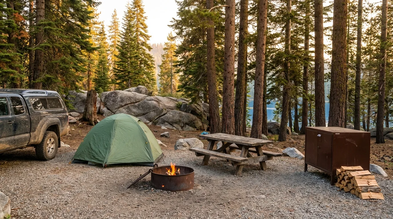
A forest campsite in a Sierra Nevada national forest campground at about seven thousand feet with a dome tent and pickup truck on a gravel pad among tall red fir and lodgepole pine, a metal fire ring, picnic table and bear-resistant food locker, with blue lake water visible through the trunks, Sierra National Forest California, ultrarealistic photograph representative of the region
Camp by basin, not by luck. Shaver is the easy, serviced base; Huntington is the classic 7,000-ft lake camping and the biggest cluster of sites; the Kaiser Pass high country is small, primitive and hard to reach; Bass Lake is warm, busy and on a different highway; and Mammoth Pool is not back yet. Look up before you pitch — this is a forest full of standing dead timber (§06).

Confirmed open for 2026

CampgroundArea · managerSitesFee*BookingNotes
Camp Edison Shaver Lake · SCE ~252 ~$40–105 campedison.com The serviced option: ~43 full-hookup, the rest electric; showers, laundry; a loop reported open year-round. Rates from secondary sources — confirm with SCE
Dorabelle Shaver Lake · Forest Service concession 68 $48–95 Recreation.gov ~5,500 ft; drinking water and vault toilets; on the lake
Dinkey Creek Dinkey Creek · FS concession 127 + 1 group $47–275 Recreation.gov Drinking water, both flush and vault toilets. Closed during 2025 Garnet Fire suppression, now reservable — post-fire terrain (§05)
Rancheria Huntington Lake · FS concession ~124 + 3 group $47–119 Recreation.gov Max RV ~40 ft; flush and vault; register at the boat-ramp kiosk. Active commercial logging reported inside the campground, 7 days a week, with areas fenced off
College Huntington Lake · FS concession not confirmed $47–92 Recreation.gov ~7,000 ft; lakeside cluster; water alert reported — check before relying on taps
Kinnikinnick Huntington Lake · FS concession not confirmed $47–92 Recreation.gov Reopened June 2026 after a hazard-tree closure — one of this year's genuine additions
Catavee Huntington Lake · FS concession not confirmed $47–87 Recreation.gov Handy for the regatta and the north-shore trailheads
Deer Creek Huntington Lake · FS concession ~27 $47–92 Recreation.gov Two loops next to the lake, reported lake views from all sites; water alert reported
Lower Billy Creek Huntington Lake · FS concession not confirmed $46–96 Recreation.gov RV tanks reportedly may not be filled from the supply; water alert reported
Upper Billy Creek Huntington Lake · FS concession not confirmed $47–122 Recreation.gov The quieter Billy Creek option
Badger Flat Group Kaiser Pass Rd · FS concession Group ~$398 (group) Recreation.gov A few miles up Kaiser Pass Rd above Huntington. An individual Badger Flat campground may also exist — we could not confirm it
Jackass Meadow Florence Lake · FS concession ~50 $37–77 Recreation.gov Newly renovated and reopened for 2026. Bear lockers, accessible vaults; water is on a solar pump — reported unavailable at night. Over Kaiser Pass (§03)
Mono Hot Springs Kaiser Pass · FS concession not confirmed $37–74 Recreation.gov + some first-come ~6,700 ft; vault toilets; no water in the campground — get it at the resort. Bear-resistant storage required
Mono Creek Kaiser Pass · FS concession not confirmed $37–77 Recreation.gov ~7,500 ft; small and high, on the way to Edison
Vermilion Lake Edison · FS concession 31 (tent only) ~$37 Mixed reservation / first-come Tent-only; 8 potable water spigots; vault toilets. First-come sites are cash only — bring notes, there is no ATM out here
Lupine & Cedar Bluff Bass Lake · Vista Recreation ~113 combined $52 / $104–208 Recreation.gov 3,400 ft; reported open year-round. Cedar Bluff has many sloped sites and limited tent space
Spring Cove Bass Lake · Vista Recreation ~61 $52 Recreation.gov Reported max vehicle ~30 ft — tents and small RVs; roughly spring to early autumn
Forks Bass Lake · Vista Recreation ~31 $52–104 Recreation.gov Reported Memorial Day to Labor Day
Wishon Bass Lake · Vista Recreation ~47 $52–104 Recreation.gov Reported Memorial Day to Labor Day; register at the Bass Lake camp store
Recreation Point Bass Lake · Vista Recreation Group $131–397 Recreation.gov No RV parking — autos only

*Fees are the ranges shown on live reservation listings, which bundle standard, premium, double and group sites together — the top of a range is not what a single tent site costs. Book by site and read the actual listing. Site counts, seasons and elevations come from a mix of Forest Service, concessionaire and aggregator sources and vary by source; where we could not confirm a figure we have left it marked rather than guessed.

Confirmed closed — do not plan around these

CampgroundAreaStatus, in the operator's words
Mammoth PoolMammoth PoolClosed until further notice for massive hazard tree removal; destroyed in the Creek Fire and being rebuilt by SCE — reported targeted for around May 2027. Boat launch reported reopened June 2026
SweetwaterMammoth Pool areaReported "remains closed due to the 2020 Creek Wildfire"
Rock CreekMammoth Pool areaReported closed until further notice, hazard tree removal. Severely burned, with some trees surviving along the creek
Fish CreekMammoth Pool areaReported "remains closed due to the 2020 Creek Wildfire"
Crane Valley GroupBass LakeReported closed for the entire 2019–2028 camping seasons for hazard tree removal — a decade shut
Black Rock CG · Sawmill Flats CG · Ross CrossingGarnet Fire areaReported still closed after the 2025 Garnet Fire, along with Black Rock Road (11S12) for bridge damage
Dry Gulch · Dirt FlatSierra NFReported closed indefinitely — listed here so you know they exist and are not an option
🔴 The ones we could NOT verify — treat every one as unknown These campgrounds are mostly first-come, first-served and therefore do not appear in reservation systems, so their absence is not proof of closure — but nor is a listing on an aggregator proof they are open. In at least one case our sources directly contradicted each other. Do not drive to any of these without phoning the ranger district first: Ward Lake (reported 17 sites, ~7,400 ft, no potable water — but one source listed it closed), Sawmill Flat (reported first-come and free by one source, closed by another), Swanson Meadow, Buck Meadow, Gigantea, Bolsillo (reported just 3 free sites), Portal Forebay (~7,180 ft), an individual Badger Flat as distinct from the group site, and Placer and Soda Springs (both reported closed for reconstruction into 2027). We are printing this list precisely because most guides quietly drop the campgrounds they could not check. That silence is what sends people down a forty-mile road to a locked gate.

Which basin for which trip

  • Hookups, showers, a big rig or small kids: Camp Edison or Dorabelle at Shaver Lake — services, a warm lake, and the village minutes away
  • The classic mountain-lake week: the Huntington Lake cluster — Rancheria, College, Catavee, Deer Creek, Kinnikinnick, Upper and Lower Billy Creek. Book early for the July regatta weekends (§04)
  • Going over the pass: Jackass Meadow (Florence), Mono Hot Springs, Mono Creek or Vermilion (Edison) — small, high, primitive, and a serious drive in (§03)
  • Sequoias and granite lakes: Dinkey Creek — but it is post-fire country now, so check conditions (§05)
  • Warm water and a shorter drive from the south: Bass Lake, off Highway 41 — an entirely different approach (§04)

Permits & the rules that catch people

Wilderness permits are required year-round for all overnight trips into the John Muir, Ansel Adams, Dinkey Lakes and Kaiser wildernesses. Day hiking needs none. Trailhead quotas are reported in effect 1 May – 1 November, with about 60% of each trailhead's quota available by advance reservation on Recreation.gov — released in the first week of January, then six months ahead of your start date.

Reported fees: $6 non-refundable reservation per permit plus $5 per person (higher for permits exiting at Mt. Whitney), with no discounts. Maximum 15 people per permit. Pick-up is at the ranger district. We could not obtain the per-trailhead quota numbers, and could not confirm which zones make bear canisters mandatory — ask when you book.

Permit for all overnightsCanister zones unconfirmed
Booking strategy for a forest in flux Three habits, specific to here. One: book by site, not by campground — a "$47–119" listing means the range spans everything from a standard site to a group loop, and the actual site page tells you the real price, the real length limit and the real season. Two: read the alerts tab on the listing before you pay, because in this forest that is where "closed until further notice due to a massive hazard tree removal" lives. Three: have a fallback in a different basin. Shaver and Bass Lake fill on summer weekends; Huntington fills solid for the two regatta weekends in July; the high-country sites over Kaiser Pass are small enough that a single group can take a meaningful share of them. And if you are relying on a first-come site, remember several of the ones people historically used are on the unverified list above.
08 / TOWNS & SERVICES

Clovis is the real resupply. Shaver is the last hub. Then it stops.

Services here follow the elevation ladder down, not up. Clovis and northeast Fresno are your last full-service, full-choice, full-price resupply — supermarkets, tyres, propane, hardware, outfitters, hospitals. Prather is the foothill stop and where the ranger district that runs this whole corridor sits. Shaver Lake village is the mountain hub and the last place with real choice. Huntington Lake has the final fuel. Past that, the high country runs on a handful of tiny, short-season, off-grid operations that are wonderful and that you must not depend upon.

The two offices worth phoning before anything else

  • High Sierra Ranger District (Prather) — the office for the Highway 168 corridor: Shaver, Huntington, Kaiser Pass, Florence, Edison, Dinkey Creek. Published line: 559-855-5355. This is who you call about the Kaiser Pass gate and current closures
  • Bass Lake Ranger District (North Fork) — the office for Mammoth Pool and Bass Lake, and the wilderness permit issuing station. Published line: 559-877-2218. This is who you call about the deer-migration closure dates
  • Sierra National Forest Supervisor's Office — published line 559-297-0706, for anything the districts can't answer
  • A high-season contact point on the road itself: the High Sierra Ranger Station sits on Kaiser Pass Road several miles up from Highway 168, before the fork to Florence and Edison. Its seasonal hours we could not confirm

These are published agency lines, which is why we print them. Business phone numbers are withheld until each owner claims a listing.

Shaver Lake village — the last real choice

  • Fuel & propane: the 76 / Shaver Lake Gas & Deli on Tollhouse Road carries petrol and diesel, with a C-store and propane exchange — the corridor's last round-the-clock fuel. Shaver Lake Hardware does propane refills, not just exchange, which matters if you run fixed tanks — plus tools, a Stihl dealership and small-engine repair
  • Shaver Lake Sports (Tollhouse Rd, family-run since 1993) — the single most useful shop in the village: tackle, live bait, fishing and hunting licences, camping gear, snow chains, and a winter ski and board rental shop. Open year-round; summer hours were reported as 7am–7pm daily from 8 June 2026
  • Groceries: Ken's Market (family-owned since 1943) and Bob's Market are the two village grocers, with The Happy Camper general store by Camp Edison for the things you forgot
  • On the water: Sierra Marina at the north end (pontoons, ski boats, waverunners, kayaks, slips, ice and fuel) and Shaver Lake Marina inside Camp Edison (pontoons, jet skis, fishing boats, SUPs)
  • Camp Edison (§07) is here, and is the answer to “where do I dump and do laundry” — reported to have two laundromats and four RV dump stations, plus showers and a store
🔴 The fuel rule, one more time, because it is the thing that strands people There is no fuel sold past Huntington Lake. Not at Mono Hot Springs, not at Florence Lake, not at Vermilion Valley Resort, not anywhere over Kaiser Pass, in any season, at any price. The last stop is Rancheria Enterprises at Huntington Lake, which is reported to close at 6 PM — so an evening arrival can find the corridor's final pump already shut. Before that, Shaver Lake is the reliable one. Work out your round trip over the pass, double it for a one-lane road driven in low gear, and fill up below. We did not independently verify the current hours, prices or operating status of any station named here; small mountain stations change hands, hours and seasons. Confirm, then fill up anyway.
Up the hill and over the pass — the operators, linked not quoted All of the following are real, currently-trading operations whose own sites or listings we resolved. Season, hours and prices change, so we link rather than quote, and phone numbers are withheld except where an operator's own booking method requires one.

Huntington Lake & China Peak

  • Rancheria Enterprises / Rancheria Marina — the last fuel on the corridor, carrying premium and diesel, with a mini market, boat-engine repair and rental of fishing boats, patio boats, jet skis, kayaks and SUPs. Reported hours 7am–6pm daily Memorial Day to Labor Day, and 9am–3:30pm Friday to Monday the rest of the season — so an evening or midweek arrival can find the corridor's final pump shut
  • Lakeshore Resort — the most complete single stop at Huntington: cabins and an RV park, restaurant (reported Thursday to Sunday), saloon, general store, sports shop, marina, and a bathhouse and laundry. Reported open year-round, with a new lodge under construction, and host of the regatta social on its party dock
  • Huntington Lake Resort & Marina — cabins with kitchens, a full-service marina (kayaks, fishing boats, pontoons), a grill, and live music on the dock at weekends
  • China Peak Mountain Resort — summer chairlift rides toward the 8,700 ft summit and a lakeside boathouse; the Inn at China Peak was reported open Friday and Saturday nights 3 July – 5 September 2026, with RV spots with electrical hookups and Friday live music. Also the Indian Pools trailhead car park. 2026 was reported to be the final season of its mountain-bike park
  • D&F Pack Station, near Lakeshore — guided hourly rides and full pack trips, and the usual reference point for the Kaiser Peak trailhead

Over Kaiser Pass

  • Mono Hot Springs Resort — historic and tent cabins, a mineral bath house, the River Rock Cafe, a general store and massage; reported 2026 season 22 May – 26 October, about 16 miles up Kaiser Pass Road. Reservations by telephone only — no email or text — so book from somewhere with signal
  • Vermilion Valley Resort, Lake Edison — camp store, full-service kitchen, hostel-to-tiny-house lodging, token showers, laundry, wi-fi and EV charging, and hiker resupply package holds. Shuttle running; ferry NOT running in 2026; season reported closing end of September
  • Florence Lake Store & Ferry — run under Forest Service permit by Muir Trail Ranch; store, tickets and the passenger ferry to the John Muir Trail side (§03), reported opening 20 June 2026, seven days a week through Labor Day, no advance reservations
  • None of these sell fuel, all are short-season, and all sit an hour of one-lane road from the nearest highway

We confirmed no operator pricing beyond figures an operator published itself, and those are reported rather than guaranteed. Hours and seasons change; check the current website before you drive over a pass to reach one.

The other approaches — North Fork, Oakhurst & Bass Lake

North Fork is the gateway to Mammoth Pool and the Sierra Vista Scenic Byway — a roughly 100-mile loop climbing from about 2,600 ft to over 7,300 ft, reported at some five hours' driving and closed by snow from November into mid-June. North Fork also holds the Bass Lake Ranger District office (permits, and the people who know the deer-closure dates) and the Sierra Mono Museum, run by the North Fork Rancheria of Mono Indians and reported to hold the largest collection of Mono basketry in the state — open Tuesday to Saturday, and the most substantial cultural stop on the corridor.

Oakhurst, on Highway 41, is the real resupply on that side — full supermarkets, plus outfitters carrying gear rentals and tyre chains. At Bass Lake itself, the Pines Village is the hub, with marina and boat rental, and Miller's Landing reported to have a convenience store and a laundromat. Bass Lake day-use fees we could not confirm.

Permits at North ForkResupply in OakhurstByway closed Nov–mid-June

Big Creek, Cressman's, and what fire does to a service economy

Big Creek is the Southern California Edison company town at the heart of the hydro system — the reason the roads, the dams and half the place names exist, and home to Powerhouse No. 8, reported to have been the first plant in the world designed in 1921 to transmit at 220 kilovolts. The Creek Fire ignited in the drainage just above it and took roughly half the homes in town; the cafe, church and school were saved. The Big Creek General Store is reported open and trading, with a bakery and deli — but on unusual hours, reported as Tuesday to Friday and Sunday only, closed Mondays and Saturdays, which is the opposite of what anyone assumes. No fuel in Big Creek.

Cressman's, the landmark store and gas stop below Shaver Lake since 1904, is the clearest illustration of all this: it burned to the ground in the Creek Fire in September 2020 and has been trading out of a temporary container since, with a rebuild reported under way and aimed at reopening around summer 2026. Do not treat it as a normal fuel stop. More broadly: 853 structures were destroyed across this fire, and a small mountain economy does not simply resume afterwards. Verify any business before you rely on it — and note that guidebooks and directories in this region are full of places that no longer exist.

Verify before you relyBig Creek store: closed Mon & Sat
Getting there & getting help Fresno Yosemite International (FAT) is the nearest major airport, and Fresno and Clovis are the nearest full medical facilities to the whole 168 corridor — worth knowing, because from Huntington Lake that is a long way down a mountain highway, and from over Kaiser Pass it is a very long way indeed. On the Bass Lake side, Oakhurst is the nearest town and Fresno again the major centre. In an emergency dial 911 — where there is signal, which past Huntington Lake generally means "not here" (§06). A satellite messenger genuinely changes the risk profile of the high-country half of this trip. Confirm current drive times and any highway closures with live mapping and the Caltrans road-conditions feed before you set out; mountain roads here close for weather, rockfall and fire.
09 / TIMING

When to go — one gate decides most of it

More than anywhere else in this series, the calendar here is really a single question: is Kaiser Pass Road open? Below that gate, Shaver and Huntington run a long season. Above it, the whole high country exists for roughly five months, and the businesses that serve it exist for even less. Everything else — water temperature, crowds, smoke, reservoir levels — layers on top of that one fact.

Season by season, straight

  • Winter (Dec–Mar) — Shaver and China Peak, and that's it. Highway 168 is plowed but runs on chain controls, and in a serious storm has been closed at the Shaver Lake Marina. Kaiser Pass Road is gated and becomes a snowmobile trail. Snow play at the sno-parks, skiing and riding at China Peak
  • Spring (Apr–May) — the waterfalls, and the waiting. The lower corridor opens up and the creeks run hard; Rancheria Falls is at its best. The high country is still shut — Kaiser Pass Road typically opens around late May (Memorial Day weekend in 2026). Mammoth Pool's reservoir is closed for the deer migration through much of this window
  • Summer (Jun–Aug) — everything open at once. Kaiser Pass, the Florence Lake ferry (reported from around 20 June), the high campgrounds, the warmest water. Also the busiest: the High Sierra Regatta filled Huntington Lake on 11–12 and 18–19 July 2026. Afternoon storms build; start early
  • Early autumn (Sep–Oct) — the quiet, with two catches. Crowds thin and the light is superb, but the reservoirs are drawn down hard by now (§03) and this is peak wildfire and smoke season in a forest that has burned twice in six years. VVR closes in September; Mono Hot Springs was reported running to 26 October; Kaiser Pass Road typically closes with the first real snow

Crowd & access strategy

  • Avoid — or embrace — the regatta weekends. Two weekends in July put a hundred boats and their crews on Huntington Lake. Wonderful to watch, hopeless if you wanted a quiet campsite
  • Drive Kaiser Pass early in the day. Less oncoming traffic, better light on the blind corners, and time in hand to come back (§03)
  • Weekday beats weekend, dramatically. This is a Fresno-and-Clovis weekend forest; midweek in the same campground is a different place
  • Late June is the sweet spot for having the high country open, the creeks still running and the reservoirs still high — but confirm the gate rather than assuming
  • Re-check closures within a week of leaving. Forest Orders here are reissued constantly, and what was closed in spring may be open, or vice versa (§05)
The one-paragraph answer Go from late June to early September if you want the whole forest — that is when Kaiser Pass Road, the high lakes, the Florence Lake ferry and every campground that is open this year are all available at once. Come in spring for waterfalls and an empty lower corridor, knowing the high country is shut. Come in September for quiet and light, accepting drawn-down reservoirs and smoke risk. Come in winter for Shaver, China Peak and the sno-parks, with chains. Whenever you come: confirm the pass is open, fuel below Huntington Lake, look up before you pitch, and check the closure orders the week you travel — not the month before.
10 / THE SHAPE OF THE TRIP

Four days, built around one hard road

One workable shape, not the only one. It climbs the ladder deliberately so you acclimatise, puts the Kaiser Pass day in the middle with a full tank and a fresh start, and keeps the fire-affected side-doors as their own day rather than a bolt-on. Adjust freely — but do not compress the Kaiser Pass day, and confirm every closure before you count on a place.

01

Day 1 — Up the ladder to Shaver Lake

  1. Stock up and fuel in Clovis — this is your last full-price, full-choice resupply (§02, §08).
  2. Climb 168 with more time than the map suggests. Settle at Camp Edison or Dorabelle, swim, and let the altitude land.
  3. Walk the village, buy your California Campfire Permit if you don't have one, and check the district's current closures (§05).
Resupply at the bottomAcclimatise
02

Day 2 — Huntington Lake at 7,000 ft

  1. Move camp up to the Huntington Lake cluster. Walk Rancheria Falls (~2 mi RT) in the morning while it's cool.
  2. Afternoon on the water, or Indian Pools from China Peak, or the summer chairlift for the view (§04).
  3. Fuel up now — Huntington is the last fuel of any kind, and reportedly closes at 6 PM (§02).
Rancheria FallsLast fuel — fill tonight
03

Day 3 — Kaiser Pass, the whole day

  1. Leave at first light, full tank, small vehicle, maps downloaded. Confirm the gate is open before you commit (§03).
  2. Over the pass to Mono Hot Springs for the pools, or on to Florence Lake for the ferry and the granite. Around 20 mph on the narrow section — this is the day, not part of it.
  3. Back over the same road with daylight in hand. Do not leave the return until dusk.
One lane · no signal · no fuelConfirm the gate
04

Day 4 — The sequoia side-door

  1. East from Shaver on Dinkey Creek Road to McKinley Groveonly after checking Garnet Fire closures (§05).
  2. Or trade it for a walk into the Dinkey Lakes — Mystery Lake is about 2 miles from the trailhead (§04).
  3. Post-fire terrain: hazard trees, loose ground, and no shade where it burned. Don't linger under dead timber (§06).
Check closures firstHazard trees
+

The two variants

  1. Backpacking: with an advance Recreation.gov wilderness permit (§07), Florence Lake is the classic door to the John Muir Trail — but note the VVR ferry is not running in 2026, so an Edison-based plan needs the shuttle or extra miles (§03).
  2. Mammoth Pool / Sierra Vista Byway: a long, slow, hot day from North Fork on Minarets Road. The campground is closed until around 2027 and the reservoir shuts each spring — go for the drive and the overlook, not to camp (§04).
No VVR ferry in 2026Mammoth Pool CG closed
11 / TRIP-READY

The departure check

Run it before you leave. Tap each item as it's done — these are the ten things specific to this forest that a general road-trip habit will skip. Most come back to three facts: the road above Huntington is narrow and unforgiving, the forest is full of dead trees, and nothing here is open just because it used to be.

0 / 10 confirmed — the road and the closures set the schedule.
12 / QUICK ANSWERS

Asked at every Shaver Lake gas pump

Can I take an RV or trailer over Kaiser Pass?
You should not plan on it. Kaiser Pass Road runs roughly 20–22 miles from the end of Highway 168 over a pass of about 9,200 feet, and past the first five or six miles it is more or less one lane of pavement with turnouts, blind rock corners and grades reported near 12%. The Forest Service is reported to advise against buses, large motorhomes and vehicles towing trailers, and Recreation.gov's own high-country campground listings warn that RVs over 25 feet are not recommended. We found no evidence of a hard legal limit — but there is nowhere to pass and nowhere to turn around, so take the advice. Base at Huntington Lake and go over in the smallest vehicle you have.
When does Kaiser Pass Road open?
It is snow-gated, and commonly described as open late May through mid-November. For 2026, Mono Hot Springs Resort published that the resort and Kaiser Pass Road would open Memorial Day weekend, 22 May, with their season ending 26 October. That is a business describing its own season rather than a Forest Service road order, so treat it as reported. The dates move every year with the snowpack. Confirm with the High Sierra Ranger District before you drive up — there is nothing at the top if the gate is shut, and nowhere to turn a big vehicle around when you find out.
Is Mammoth Pool campground open?
Reported no. Mammoth Pool Campground was destroyed in the 2020 Creek Fire and is being completely rebuilt by Southern California Edison in partnership with the forest; reservation listings carry a closure notice for massive hazard tree removal, and the campground is reported targeted for around May 2027. The boat launch was reported reopened in June 2026. Dispersed camping on designated roads, shore fishing and the designated road and trail system were described as remaining available. Separately, the reservoir closes to public entry for roughly six weeks each spring for the deer migration — the 2025 order ran 2 May to 14 June, but the dates are reissued annually and our sources disagreed on the pattern, so never assume last year's. Call the Bass Lake Ranger District; it is a long, slow road to a closed gate.
How badly did the fires hit this forest?
Severely, twice. The Creek Fire ignited 4 September 2020 in the Big Creek drainage between Shaver Lake and Huntington Lake, burned 379,895 acres, destroyed 853 structures, heavily damaged the town of Big Creek and was not contained until 24 December 2020 — at the time the largest single wildfire in California's recorded history. It also trapped campers at Mammoth Pool over Labor Day weekend, and military helicopter crews lifted out 396 people and 27 animals over two days. Then the lightning-caused Garnet Fire burned 59,844 acres from 24 August 2025, crossing Dinkey Creek and reaching into the McKinley Grove sequoias — where most of the big trees were reported to have survived. Expect standing dead timber, hazard trees, damaged roads and debris-flow risk across large areas.
Is the VVR ferry running across Lake Edison?
No. Vermilion Valley Resort states that the ferry is not running as of the 2026 season, with dates "TBD." The hiker shuttle is running, VVR is accepting Pacific Crest Trail and John Muir Trail resupply boxes, and the kitchen, camp store and lodging are open for a season closing in September 2026. This matters because almost every older resupply write-up online still says the ferry runs. If your plan assumed a boat across Edison, rebuild it around the shuttle or the extra trail miles, and confirm directly with VVR before you go.
Where's the last fuel?
Shaver Lake, then Huntington Lake, then nothing. Mono Hot Springs Resort puts it plainly: fill up at Shaver Lake (described as 24-hour) or at Rancheria Enterprises at Huntington Lake (reported to close at 6 PM), because no fuel is sold at Mono Hot Springs or anywhere past Huntington Lake. Clovis and northeast Fresno are your last full-service, full-price resupply for everything else — groceries, tyres, propane, hardware. We did not independently verify the current hours or operating status of any individual station, so treat named businesses as a starting point and arrive with a full tank.
Do I need a permit to backpack here?
For overnights, yes. Wilderness permits are required year-round for all overnight trips into the John Muir, Ansel Adams, Dinkey Lakes and Kaiser wildernesses; day use needs none. Trailhead quotas are reported in effect 1 May – 1 November, with about 60% of each trailhead's quota reservable in advance on Recreation.gov — released in the first week of January, then six months ahead of your start date. Reported fees are $6 per permit plus $5 per person (more for permits exiting at Mt. Whitney), maximum 15 people. Bear-resistant containers are required in specified areas; we could not confirm exactly which zones, so ask when you collect the permit.
Which lake should I pick?
Shaver for services, warm swimming and the easiest drive — the family-and-big-rig lake, with the village and hookups. Huntington at 7,000 ft for classic mountain-lake camping, sailing and the wilderness trailheads; it is windy, which is why the regatta lives there. Bass Lake at 3,400 ft for warm water and a boating scene, reached from Highway 41 rather than 168. Florence and Edison, over Kaiser Pass, for granite, hot springs and near-solitude — if your vehicle and your patience are up to the road. Mammoth Pool is currently the one to admire from the overlook rather than camp at.
Is it safe to camp in the burn scar?
With discipline, yes — the risk is specific and manageable. The danger is not the fire, it is the millions of fire-killed trees still standing, which fall without warning in wind and in dead calm. That hazard is what has kept campgrounds closed here for six years, and one open Huntington Lake campground was reported to have active logging inside it. Look up before you pitch a tent or park; never camp under dead or scorched timber; move the vehicle if wind gets up at night. Add the post-fire ground risks: unstable slopes, loose soil, and debris flows in heavy rain — get out of drainages below a burn scar when a storm comes through. Shaver Lake has drawn mudslide evacuation warnings during storms.
When's the best time to go, in one sentence?
Late June to early September if you want the whole forest open at once — Kaiser Pass, the high lakes, the Florence Lake ferry and every campground running this year — with spring for waterfalls in an empty lower corridor, September for quiet light (accepting drawn-down reservoirs and smoke risk), and winter for Shaver, China Peak and the sno-parks with chains aboard. Avoid the two July regatta weekends at Huntington Lake unless you have come specifically to watch a hundred sailboats race.
13 / WHAT WE COULD NOT CONFIRM

The honest gaps, all in one place

This list is longer than usual, and it should be. This forest runs on Forest Orders that are superseded every few weeks, its facilities are mid-rebuild after two enormous fires, and — the single biggest limitation on this issue — the Forest Service's own website refused every automated request we made while building it. That means the closure orders below are reported from secondary sources rather than read first-hand. Everything here was compiled 25 July 2026 and should be re-checked against the official source before you rely on it.

Why this section exists Anyone can write a guide that sounds certain. The hard part is knowing which numbers are real — and in a forest that has burned twice in six years, where the campground list is rewritten by a Forest Order every few weeks and the agency's own website would not answer us, a great many of them need a same-week check. The null is the product. "Call the district before you drive to Mammoth Pool," "leave the trailer at Huntington Lake," "fuel before you turn onto Kaiser Pass Road" and "we could not verify whether Ward Lake is open" are all usable instructions. The alternative — printing a confident list of twenty campgrounds, five of which have been shut for years — is how a reader ends up forty miles down a one-lane road at dusk, out of fuel, at a locked gate, with no signal to call anyone.
🔒

The printable field guide

Everything above, condensed into a print-ready PDF built for the glovebox — for a forest where the signal dies above Huntington Lake, the fuel stops entirely, the best road is one lane wide, and half the campgrounds you'll find online have been shut since a fire. Kaiser Pass told straight, the Highway 168 climb, the campgrounds sorted into open, closed and genuinely unknown, both burn scars and what they still close, the Mammoth Pool rebuild and its spring reservoir closure, the ferry that isn't running, permits and fire rules, and the honest list of what nobody could confirm — on paper that works where the bars don't.

Kaiser Pass, told straight Campgrounds: open / closed / unknown Both fires & what they closed The fuel rule Mammoth Pool's spring closure Permits & fire rules The hazard-tree discipline The departure check
Unlock the PDF — $4.95 USD
$4.95 USD per guide · Instant access · Built by people who actually camp there
Trail Journal No. 070

Go farther. Camp lighter.
Leave it better.

Every Trekkr Trail Journal is built like this one: custom logistics, honest trail beta, the camping and access detail, and the local knowledge that turns a good trip into the one your crew talks about for years — including, always, a plain list of what we could not confirm. New destinations drop all season long, from the BC corridors to the Oregon Cascades to the California Sierra.

Unlock the Trail Journal Library
↗ Read another issue — No. 050, Sequoia & Kings Canyon
$4.95 USD per guide · Instant access · Built by people who actually camp there