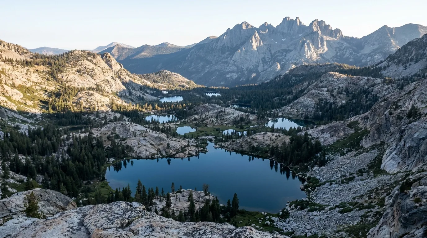
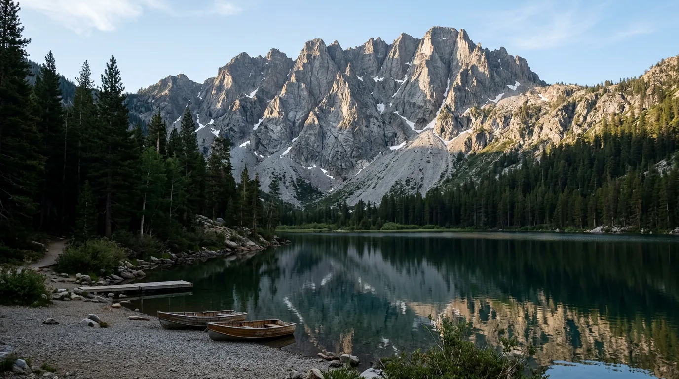
A high overlook across a shallow granite basin holding a scatter of small dark-blue alpine lakes among fir and pine forest, with a jagged serrated grey rock crest rising on the horizon, clear morning light, the Lakes Basin below the Sierra Buttes, California, ultrarealistic photograph representative of the region
Trekkr Trail Journal · No. 069 · Plumas, the Lakes Basin & the Feather River

Plumas, the Lakes BasinCalifornia — the Feather River Canyon, the Gold Lake Highway, Quincy, Graeagle, Bucks Lake & the Dixie Fire country

This is the county most people drive past on the way to Tahoe or Lassen — a quiet, deeply forested, improbably lake-dense corner of the northern Sierra where the trailheads have parking and the lakes have nobody on them. The whole forest is open for 2026 and the canyon highway is running. What decides your trip instead is a construction project, a fire order, and a 30-day camping cap most visitors have never heard of.

California · Plumas & Sierra counties Lakes Basin · Gold Lake Hwy · Bucks Lake CA-70 open · 24/7 control at Cromberg Stage I fire restrictions since 9 Jul 2026
25 minReported delay through the Cromberg roadworks — 24 hours a day, into winter
Stage IFire restrictions since 9 July 2026 — stove yes, dispersed campfire no
30 daysMaximum camping per year on the whole forest — an unusually hard cap
8,591 ftSierra Buttes lookout, up about 180 open steel steps
Conditions verified 25 July 2026 · The canyon roadworks and the fire order decide this trip before any trailhead does · This block goes stale — the links don't

Good news first: the road is open and the forest is open

The rest of this journal is evergreen; this box is not. Unusually for this series, the 2026 headline here is positive — the canyon highway is running and every Plumas National Forest campground was reported open for the season on 1 July. What you actually have to plan around is roadworks (§02), a fire order that decides how you cook (§07), and a camping cap that catches long-trip travellers out (§07). Trust the live sources, not our date stamp.

  • CA-70 through the canyon is OPEN — and under 24-hour traffic control at CrombergThree independent July 2026 reports show the canyon open and drivable. The real 2026 problem is construction: the $101 million Cromberg Combined Rehabilitation Project began around 13 July 2026, runs around-the-clock traffic control with delays reported up to 25 minutes, and is scheduled to continue into winter 2026 (360 working days; resurfacing, shoulder widening, guardrail, drainage). Separately, PG&E undergrounding between the Butte–Plumas county line and Storrie adds roughly 15-minute weekday delays, and short-notice controls appear for fire activity — the Twain Fire (11–23 July 2026, 276 acres, 100% contained) held daytime controls while it burned. Budget the time; do not plan a sunset arrival. (§02)
  • But this corridor closes, repeatedly, from November to MayThe winter record is the reason to keep an alternate in your head: closed roughly two months in early 2024 (Jarbo Gap–Greenville Wye); a May 2024 reopening cancelled by a fresh rockslide near Cresta with Caltrans stating there was no estimate for reopening; closed again 25 November 2024 after two slides at post miles 17 and 21; a slide across both lanes at Rich Bar on 28 December 2024. In October 2025 it was open with one-way controls and delays reported up to an hour. Summer is reliable here; winter and spring are not. (§02)
  • Plumas National Forest is in STAGE I fire restrictions — Forest Order 05-11-26-01, effective 9 July 2026Campfires only at designated recreation sites listed in the order's Exhibit A, in established rings, in a 3-ft cleared area, with a shovel and a gallon of water or an extinguisher. That means no campfire at a dispersed camp. Stoves are still allowed outside those sites — with a valid free California Campfire Permit, portable gas/kerosene/pressurised-liquid stoves and lanterns with working shut-off valves, and wood-pellet grills, in a 3-ft cleared area. Smoking restricted; vehicles and generators to designated roads and trails; welding and open-flame torches prohibited. Chainsaw status daily on 1-800-847-7766. Penalties to $5,000 individual / $10,000 organisation. Expiry date not confirmed — stages move both ways. (§07)
  • The whole forest is open — and it opened earlyAs of 1 July 2026 the Plumas NF reported every campground open for the season; the last was Red Feather at Little Grass Valley Reservoir on 26 June 2026. Bucks Lake, Antelope Lake, Frenchman Lake, Lake Davis and the Lakes Basin all opened in early May, ahead of schedule, after an exceptionally light snowpack. Roughly 40 campgrounds are reservable via Recreation.gov or 877-444-6777; some remain first-come. (§07)
  • The Dixie Fire closure is long gone — the hazard is physical, not legalThe blanket Dixie Fire / Beckwourth Complex closure was terminated early, effective 19 November 2021. There is no general Dixie closure in 2026. What remains is site-specific and short-lived — the Twain Fire roads (FR 26N18 Kingsbury Grade and part of FR 25N21) were closed through 31 July 2026, and roads such as Antelope Lake Road (FS 29N43) have closed for hazard-tree removal and salvage. We could not date the Antelope Lake notice — verify it before you drive out there. The real risk is standing fire-killed trees that fall without warning. (§05, §06)
  • An above-normal fire season is forecast — plan for smoke, not for crowdsThe Northern California outlook issued 1 July 2026 puts large-fire potential above normal July through September, on low snowpack, heavy grass loading and above-normal temperatures. Nothing here fills up the way Tahoe does; what ruins a Plumas week is smoke from a fire that need not be anywhere near you. Watch AirNow and fire.ca.gov/incidents alongside the weather, and keep the itinerary loose. (§06, §09)
Live sources · Caltrans QuickMap · Caltrans SR-70 text · 1-800-427-7623 (Caltrans highway info) · Plumas NF alerts & orders · California Campfire Permit · Recreation.gov / 877-444-6777 · AirNow
In an emergency, 911. This box was true at press and will not stay true — the sources above are the truth on the day you travel.
01 / THE HOOK

The county everyone drives past

Plumas County sits in the gap — north of Tahoe, south of Lassen, west of nothing much — and it is the part of the northern Sierra that most travellers experience as a windscreen. That is the whole opportunity. Behind the highway is a compact, glacier-scoured basin holding more than twenty small alpine lakes and thirty-plus miles of trail, a 176-foot waterfall at the end of a one-mile paved path, a fire lookout at 8,591 feet reached by open steel stairs bolted to a crag, a reservoir ringed with first-come campgrounds, and a river canyon carrying both a scenic byway and a transcontinental railroad. There are no timed-entry systems, no wilderness quotas, no dawn parking wars. Locals call it the Lost Sierra, and the marketing line — world-class trails without the crowds — is for once close to true. What you get instead is a quieter set of problems: a road under construction, a forest that burned, a fire order that decides how you cook, and a camping cap most visitors have never met.

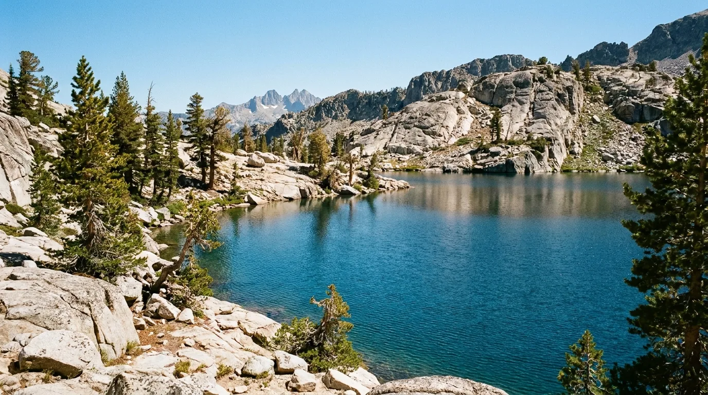
A clear dark-blue subalpine lake held in a shallow granite bowl with low glacier-polished rock slabs and boulders along the shore, wind-shaped lodgepole pines and fir, a rocky ridge behind, midday summer light, Long Lake in the Lakes Basin, California, ultrarealistic photograph representative of the region
The Lakes Basin, around 6,400–6,450 ft. A glacial basin below the Sierra Buttes holding more than twenty small alpine lakes and over 30 miles of trail, within a short walk of each other and of the Gold Lake Highway. The density is the point: you can visit four lakes in a morning without moving the vehicle far (§03, §04).

The payoff

Short walks to real alpine lakes with nobody on them, a 176-ft waterfall down a paved path, the 8,591-ft Sierra Buttes lookout and its steel stairs, and a canyon carrying the least-steep transcontinental railroad ever built (§02, §03, §04).

The catch

24-hour roadworks at Cromberg into winter, a forest carrying the Dixie Fire scar and its falling snags, Stage I fire restrictions, a 30-day annual camping cap, and no signal where you want to check a road (§02, §05, §06, §07).

The clock

The basin is normally snow-gated to late May — though 2026's light snowpack opened it in early May — and smoke-exposed through an above-normal fire season. The good windows are narrow at both ends (§09).

The way to think about the region — one county, four corridors, and a canyon that ties them together This guide runs four distinct corridors and the canyon between them. The Lakes Basin sits off the Gold Lake Highway between Graeagle and Bassetts — the lake-dense heart of the trip, and split between two national forests (§03). Bucks Lake, west of Quincy, is the reservoir-and-first-come-campground corridor with a wilderness and the PCT behind it — reached by two very different roads, one of which trailers should avoid (§07). The eastern reservoirsLake Davis, Frenchman, Antelope — are the quiet, big-sky, fishing-and-solitude end of the county. The Feather River Canyon on CA-70 is the spectacular, rail-haunted artery running west from Quincy toward Oroville (§02). And the Dixie Fire scar is not a corridor at all — it is the medium a great deal of this map is now made of (§05). Sort the roadworks and the fire order first, then pick a corridor and stay in it.
02 / THE FEATHER RIVER CANYON

Open, spectacular, and moving at 25 minutes a delay

California Highway 70 through the Feather River Canyon is the Feather River Scenic Byway, and it deserves the title: a two-lane road blasted into the wall of a deep, dark, dripping canyon, running for miles beside the North Fork Feather River with the old Western Pacific main line threading the opposite wall, crossing and recrossing on steel bridges and vanishing into tunnels. It is open as of late July 2026. It is also, right now, a construction zone — and it is a corridor with a long habit of shutting down between November and May. Neither fact should stop you driving it. Both should change how much time you budget and what you have in your back pocket.

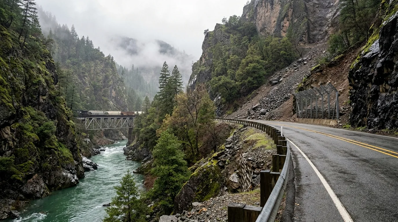
A narrow two-lane highway cut into a steep densely forested canyon wall above a green river, a railroad line on the opposite wall crossing a steel deck bridge, bare rock cliffs and rockfall scree above the road, guardrail and rock-catchment cut bank, overcast light, the Feather River Canyon on Highway 70, California, ultrarealistic photograph representative of the region
The Feather River Canyon, CA-70. Road on one wall, railroad on the other, river between them. The rock above the road — much of it now above burned, root-loosened slopes — is exactly why this corridor keeps sliding, and why catchment fences, cut banks and one-way controls are permanent features rather than temporary ones.
🔴 The 2026 reality: it is open, and it is slow Do not arrive expecting a free run. The $101 million Cromberg Combined Rehabilitation Project started around 13 July 2026 and is scheduled for roughly 360 working days, into winter 2026 — resurfacing, shoulder widening, new guardrail and bridge rail, drainage and ADA work, by Mercer-Fraser Company for Caltrans District 2. It runs around-the-clock traffic control with reported delays of up to 25 minutes. A later summary describes one-way control weekdays roughly 7 a.m.–5 p.m. with delays up to 20 minutes, between just south of Little Bear Road and just south of Forest Lane, with no control over Labor Day weekendthat refinement is a secondary summary; treat the 24/7 figure as the planning number. Separately, PG&E undergrounding work between the Butte–Plumas county line and Storrie adds roughly 15-minute weekday delays. Budget an extra hour and do not plan a sunset arrival on the far side.

The winter record, and why you keep an alternate

Summer here is reliable. November to May is not. The pattern is well documented:

  • June 2023: Caltrans counted at least 13 slides overnight after heavy rain; reopened to through traffic 28 June 2023 with several one-way sections
  • Early 2024: reported closed indefinitely in January; a rockslide near the Shady Rest Area (post mile 46) on 2 February; closed roughly two months Jarbo Gap to Greenville Wye
  • 6 May 2024: the scheduled reopening was cancelled by a fresh rockslide near Cresta. Caltrans: “There is no estimate for when the highway will reopen.” It reopened about 11 May under one-way control
  • 25 November 2024: closed again, Grandview Station to Greenville Wye, two slides at post miles 17 and 21, “at least a week”
  • 28 December 2024: a slide across both lanes at Rich Bar. Caltrans afterwards: “SR-70 is open. Please be cautious… the hillside can be unstable”
  • October 2025: open, one lane with controls at points between Quincy and Jarbo Gap, delays reported up to an hour

We could not confirm any major canyon closure during 2025.

Unreliable Nov–MayReliable in summer

How to check it, and what to do if it shuts

  • Check Caltrans QuickMap the morning you drive, or call the Caltrans highway information line on 1-800-427-7623. Not from inside the canyon — there is no signal in there
  • The northern alternate: round the top via CA-89 / CA-36 through the Lake Almanor and Chester side. Longer, entirely usable, and it puts you at the Lassen end of the map
  • The southern alternate: reach Quincy and the Lakes Basin from the south and east instead — via CA-89 from the Truckee side, or the Gold Lake Highway from Bassetts on CA-49
  • Big rigs: a standing restriction bars vehicles over 65 ft (doubles over 75 ft) from a stretch running east of SR-191 through the Greenville Wye
  • Three tunnels — Arch Rock, Grizzly Dome and Elephant Butte — plus real freight-truck traffic. This is a working corridor that happens to be scenic
Check day-of65-ft rig limit
The railroad is the reason the canyon looks like this The line on the far wall is the Western Pacific's Feather River Route, now Union Pacific, and it is here because of a single engineering decision: WP built to a 1.0% maximum grade — the least steep of any transcontinental railroad — deliberately undercutting Southern Pacific's brutal Donner Pass profile. Following the river instead of climbing over the range is what that costs, and what it bought.

The set pieces

  • Keddie Wye — about six miles west of Quincy, high above Spanish Creek: the only railroad wye in the world with two legs on bridges and the closing track in a tunnel. The mainline reached here in 1909; the wye itself was not built until 1930–31
  • Williams Loop — a one-mile spiral near Spring Garden, about five miles east of East Quincy, built 1914: the track crosses over itself to gain 65 feet while holding the 1% grade toward Beckwourth Pass
  • Tobin Bridges — highway and railroad bridges stacked on top of each other because the gorge is too tight for anything else. Rail: 234 ft, single-span camelback Pratt truss, 1910. Highway: 290 ft single-span truss, 1936
  • Pulga Bridges — the steel-arch highway bridge carries CA-70 directly over the railroad bridge, longest span 350 ft, roadbed 170 ft above the rail deck; opened 1932

The Last Spike, and Rich Bar

  • 1 November 1909 — the Last Spike completing Oakland to Salt Lake City was driven at the Spanish Creek trestle at Keddie, with no ceremony at all: section foreman Leonardo de Tomasso, aged 25, drove a standard steel spike. A “Ruby Jubilee” re-enactment was staged there on 1 November 1949, with de Tomasso, then 65, doing it again
  • Rich Bar — a gold camp on the East Branch North Fork. Word of the strike spread from Nelson's Creek on 20 July 1850; one miner reportedly took 33 pounds of gold in eight days. CA-70 runs straight past it
  • Rich Bar is also where “Dame Shirley” — Louise Amelia Knapp Smith Clappe — wrote 23 letters between 13 September 1851 and 21 November 1852, published in The Pioneer and a direct influence on Bret Harte
  • All track, bridges and tunnels are active Union Pacific property. Watch from public ground. Do not walk the right-of-way

We could not confirm current traffic levels, the best rail-fan pullouts, or what damage the Dixie Fire and the slides did to the rail line — so we have not printed any of that.

The 60-second canyon decision
  1. Summer, no closure posted? Drive it — and add an hour for the Cromberg controls and the PG&E work. It is slow, sinuous and worth stopping on.
  2. Winter or spring? Check before you commit, every time. This corridor has closed for two months at a stretch and has had a reopening cancelled with no new estimate given.
  3. Closed? Take the northern alternate via CA-89/CA-36, or approach the Lakes Basin from the south via CA-49 and the Gold Lake Highway. Neither is a hardship; both are longer.
  4. Driving something long? Over 65 ft is barred through the Greenville Wye stretch. Check your length before you commit.
  5. No signal to check? That is the normal state inside the canyon. Check before you enter — QuickMap, or 1-800-427-7623.
03 / THE LAKES BASIN

Twenty-odd lakes, one road, and two national forests

The Lakes Basin Recreation Area is the reason to make this trip rather than read about it. It is a compact glacial basin under the Sierra Buttes, reached by the roughly fifteen paved miles of the Gold Lake Highway between Graeagle on CA-89 and Bassetts on CA-49, holding more than twenty small alpine lakes and over thirty miles of trail in a very small area — Gold, Long, Silver, Round, Big Bear, Little Bear, Cub, Grass, Packer, the Sardines, Salmon, Snag, Deer, Smith, Jamison, Wades, Rock and more. Most are a short walk from a road or from each other, which makes it one of the easiest places in California to string several real alpine lakes into a single unhurried day. Two things you need to know before you go: the road is seasonal, and the basin is not one forest.

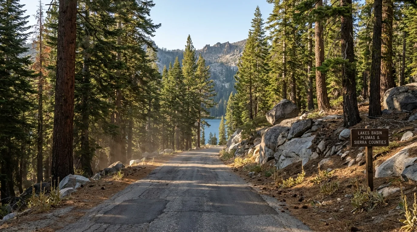
A narrow patched two-lane paved forest road curving through tall red fir and lodgepole pine with granite outcrops and mule-ears meadow at the shoulder, a glimpse of a blue alpine lake through the trees and a rocky ridgeline beyond, late afternoon summer light, the Gold Lake Highway in the Lakes Basin, California, ultrarealistic photograph representative of the region
The Gold Lake Highway — about 15 paved miles. The spine of the basin, running between Graeagle on CA-89 and Bassetts on CA-49, signed about 1.5 miles south of Graeagle. Not plowed in winter, when the far end belongs to the snowmobile trail system out of the Gold Lake Winter Staging Area.
🔴 The thing everyone gets wrong: this is two forests, not one The Lakes Basin is split between the Plumas and the Tahoe national forests, and people ring the wrong district office and get told “that is not ours.” The Plumas National Forest — Beckwourth Ranger District administers the northern portion; the Tahoe National Forest administers the southern portion toward Sierra City and the Buttes. In practice that means Lakes Basin Campground is Plumas, while Sardine Lake, Salmon Creek and Packsaddle are Tahoe — two offices, two separate alert pages, two sets of fire orders that do not have to match, and one road running through both. Check the order for the forest you are actually standing in. Beckwourth Ranger District also covers Lake Davis and Frenchman Lake; the Mt. Hough district covers the Quincy and Bucks Lake side.

The season, plainly

  • Winter: the Gold Lake Highway is not plowed. It is cleared a few miles from Graeagle to the Gold Lake Winter Staging Area — a Plumas NF facility with parking for vehicles and trailers — and beyond that it becomes a groomed snowmobile route feeding the Lakes Basin trail system, shared with skiers and snowshoers
  • Normal season: campgrounds late May into October. But 2026 was not a normal year — after an exceptionally light snowpack, the Lakes Basin opened in early May, ahead of schedule
  • Elevations: Gold Lake about 6,400 ft; Lakes Basin Campground 6,445 ft. High enough for real weather and cold water, low enough that the season is longer than the Sierra crest's
  • Exact open and close dates we could not confirm — they move every year with snow, and campground water-system testing has delayed openings in past seasons. Check the specific site
Not plowed in winter2026 opened early May

The lakes, and what they actually are

Manage the expectation and you will love this place. These are small, cold, glacier-set mountain lakes — not Tahoe. Several are only a few acres. The pleasure is the number of them, the short distances, and how completely ordinary it is to have one to yourself on a weekday.

Gold Lake is the exception, and the hazard. It is the largest and most exposed, with a public boat launch and rentals — and its afternoon wind is real and predictable. Swim, fish or ski in the morning; strong gusty afternoon winds arrive and can overwhelm small watercraft. Good for sailing and windsurfing, bad for an inflatable kayak.

Per-lake motor and launch restrictions we did not verify individually, and we could not source water temperatures — these are snowmelt-fed lakes that stay cold well into summer. Read the posted rules at the lake you intend to launch on.

Gold Lake: afternoon windSmall lakes, short walks
A small deep green-blue lake at the foot of an enormous serrated grey rock wall of shattered crags streaked with snow chutes, dark conifer forest ringing the shore, small wooden rowboats pulled up on gravel, morning light on the crag face, Lower Sardine Lake beneath the Sierra Buttes, California, ultrarealistic photograph representative of the region

Why this basin rewards a slow day

Most people treat the Lakes Basin as a stop on the way to somewhere. Given a full day it is much better than that: park once, walk the lake-to-lake trails, swim in something small and freezing at lunchtime, take the paved mile to Frazier Falls in the afternoon (§04), and be back at a lakeside camp before the light goes.

There is no reservation to win and no permit to hold. The Sardine Lakes sit dramatically right under the Buttes; Long, Silver, Round, Big Bear and Little Bear are the classic short-walk cluster.

Fuel before you turn up the highway. There is none anywhere in the basin (§08). And store food properly — at Lakes Basin all food must be kept in approved containers, for raccoons as much as bears.

No permit, no quotaNo fuel up here
04 / THE HIKES

Short walks to real lakes, and one serious staircase

The walking here divides cleanly. Most of it is short, gentle and absurdly rewarding for the effort — lake-to-lake trails in the Lakes Basin, a paved mile to a big waterfall, a bog boardwalk among carnivorous plants. Then there is the Sierra Buttes lookout, which is a steep, exposed climb finishing on open metal stairs bolted to a crag, and which is in a different category entirely. There is no single official table of distances and gains for these trails, so treat the numbers below as the best sourced figures we could find and confirm them at the trailhead. Times are fit-hiker estimates. Mileages are round trip unless noted. None of these required a wilderness permit at press — a real part of this region's appeal.

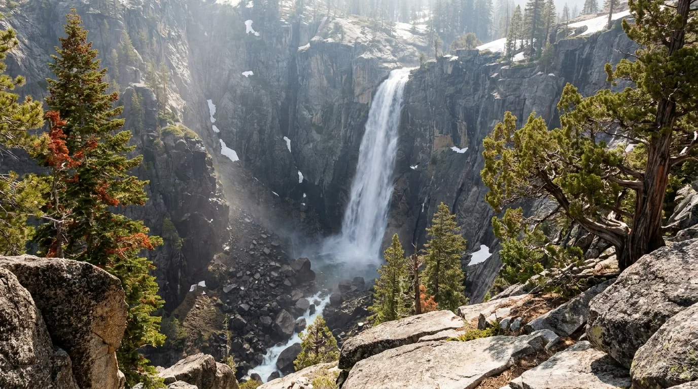
A tall single-drop waterfall pouring off a dark granite cliff into a narrow rocky gorge framed by fir and juniper on broken granite slabs, seen from a rock overlook across the canyon, early summer snowmelt flow and spray, Frazier Falls in the Lakes Basin, California, ultrarealistic photograph representative of the region
Frazier Falls — 176 ft, a one-mile paved round trip to a fenced overlook. The best effort-to-payoff ratio in this guide, on Frazier Creek below Gold Lake, reached by Frazier Falls Road off the Gold Lake Highway. Go early in the season: like everything snowmelt-fed here, it thins as summer wears on.

The short walks — where this region earns its keep

No permits, no quotas, no dawn parking scramble. Just get up the Gold Lake Highway once it is open.

The guaranteed win · pavedFrazier Falls Trail

1 mile round trip, paved, to a fenced scenic overlook across the gorge from a 176-ft waterfall on Frazier Creek, which drains out of Gold Lake. Reached by Frazier Falls Road off the Gold Lake Highway. Widely described as wheelchair accessible — though hiker accounts note the grade is not fully compliant throughout, so call it paved and largely accessible rather than guaranteed.

Snowmelt-fed and much better in late spring and early summer; a thin ribbon by late season. Access shares the Gold Lake Highway's seasonal closure. The overlook is across the gorge, not at the brink.

1 mi RT · paved176 ft fallsBest late spring/early summer
1 mi round trip · minimal gain
~45 min with stops (estimate)

Carnivorous plants on a boardwalkButterfly Valley Botanical Area

A 500-acre botanical area on the Plumas NF, 3.5 miles north of Quincy off Hwy 70/89 via Blackhawk Road, protecting four species of insectivorous plants — including Darlingtonia californica, the California pitcher plant. There is a two-mile loop with a boardwalk out over the bog. Peak bloom May to July.

Completely undeveloped: a one-lane unpaved forest road, no parking lot, no toilets, no tables, no interpretive signs and no marked trails. Plant collection is prohibited. Nearest services are Quincy. Go in a vehicle you do not mind on a rough single-lane road.

~2 mi loop · boardwalkPeak bloom May–JulNo facilities at all
~2 mi loop · flat
1–2 h (estimate)

The classic lake-to-lake wanderThe Round Lake / Bear Lakes cluster

From the trailheads around Elwell Lodge and Gold Lake, a network of short connecting trails links Big Bear, Little Bear, Cub, Long, Silver and Round lakes, with old mine remains near Round Lake. Walked as a loop or an out-and-back to whichever lake you like the look of, inside a basin carrying 30-plus miles of trail. We could not pin an authoritative distance to any one configuration — mileage depends entirely on which lakes you string together. Read the trailhead board.

The junctions are numerous and signage is variable — carry a downloaded map, because you will not have signal. Boggy right after melt-out.

Several short linked trailsDistance depends on your routeEasy–moderate
Variable — pick your lakes
Half a day, comfortably (estimate)

The one that is genuinely serious

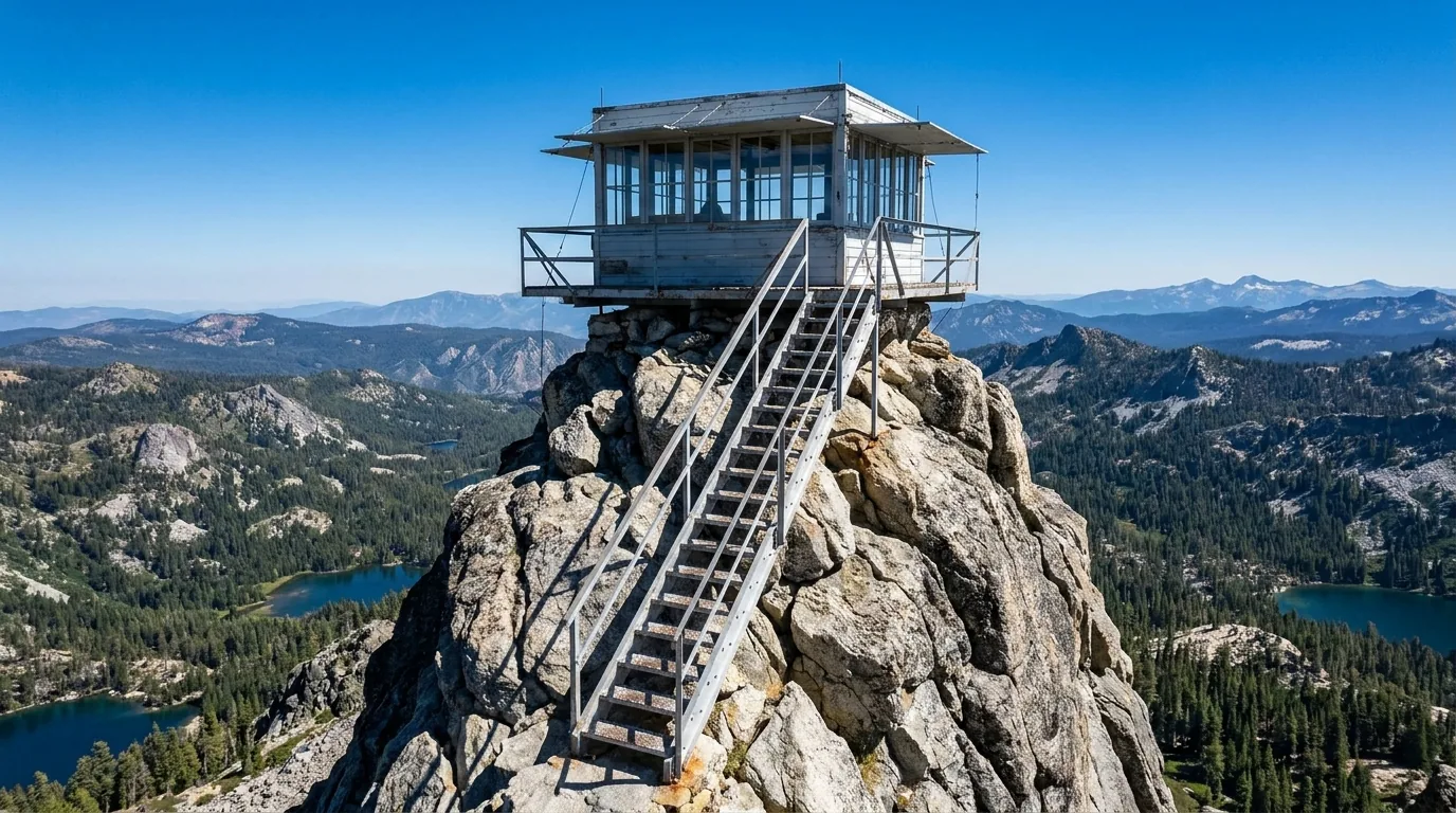
A small steel-and-glass fire lookout cabin perched on the tip of a narrow serrated rock summit with an open steel stairway of several flights riveted to the bare rock leading up to it, sheer drops on both sides, forested ridges and tiny blue lakes far below, bright high-altitude light, the Sierra Buttes lookout, California, ultrarealistic photograph representative of the region
The Sierra Buttes lookout, 8,591 ft. About 2.3 miles one way and roughly 1,587 ft of gain from Packer Lake Saddle, finishing on stacked flights of open-grate steel steps — sources say 176 or 180 — riveted to the rock and running up to the lookout catwalk. The best short summit in this guide, and the one most likely to stop somebody cold.

The showpiece · not for anyone uneasy with heightsSierra Buttes Lookout

Summit 8,591 ft. The standard route from Packer Lake Saddle is reported at about 2.3 miles one way with roughly 1,587 ft of gain, finishing up about 180 open-grate metal steps in stacked flights to the lookout catwalk. The view is reported to run from Lassen to Shasta and over dozens of lakes. Administered on the Tahoe National Forest side of the basin. Step counts vary between sources (176 vs 180) and there is no official trail table; the lookout's 2026 condition we could not confirm.

The stairs are the crux, and the exposure is genuine — open treads, long drops on both sides. If anyone in the party is uneasy with heights, decide that at the bottom, not the top. The summit is above the trees with no shelter — start early and be off it before afternoon storms. Snow lingers on the upper trail into early summer.

~2.3 mi each way · ~1,587 ft~180 open steel stepsNo shelter on top
~4.6 mi round trip · ~1,587 ft
3–5 h (estimate)

Reopened autumn 2025 · and now shadelessFeather Falls Trail

A nine-mile loop to a 410-ft waterfall, on the Plumas NF southwest of the county, reopened in autumn 2025 after being destroyed by the 2020 North Complex/Bear Fire — bridges and the scenic overlook rebuilt through a collaboration of the Mooretown Rancheria, Concow Maidu Tribe, Plumas National Forest, the Butte County Collaborative Group and the Sierra Nevada Conservancy, with hazard-tree removal across roughly 4,000 acres.

Nearly the entire canopy burned — there is no shade for the whole hike, and organisers described the setting as almost a moonscape. Carry far more water than nine miles would normally need, start very early in summer heat, and note that the campground was destroyed and is still being rebuilt.

9 mi loop · 410 ft fallsNo shade anywhereCampground still rebuilding
9 mi loop
Most of a day (estimate)

History underfoot · the state-park sideEureka Peak & the Jamison Mine trails

From Plumas-Eureka State Park near Johnsville, a moderate out-and-back climbs to Eureka Lake with views of Eureka Peak, the trail continuing to the summit; Jamison Mine Road runs from Johnsville Road back to the mine complex and the lakes above it — Jamison, Rock, Wades and Grass. This is the mining-history end of the region. We could not confirm official distances or gains — get them from the park.

Historic mining ground: stay out of adits, shafts and structures. Old workings are unstable and are not maintained for visitors.

Distances unconfirmedDo not enter mine workingsMuseum & stamp mill at the trailhead
Several options from the park
Half to full day (estimate)
DestinationAccessDistance*CharacterPermit
Frazier FallsFrazier Falls Rd off Gold Lake Hwy1 mi RT, pavedFenced overlook, 176-ft fallsNone
Butterfly ValleyBlackhawk Rd, 3.5 mi N of Quincy~2 mi loopBog boardwalk, carnivorous plantsNone · no collecting
Round / Bear lakes clusterGold Lake & Elwell trailheadsvariableShort linked lake trailsNone
Sierra Buttes LookoutPacker Lake Saddle~2.3 mi each way, ~1,587 ftSteep, exposed, ~180 steel steps, 8,591 ftNone
Feather FallsSW Plumas NF9 mi loop410-ft falls, reopened 2025, no shadeNone
Eureka Peak & Jamison MinePlumas-Eureka State ParkunconfirmedMining history, lakes aboveNone (park day use)
Bucks Lake WildernessBucks Lake road, west of Quincyunconfirmed2,000–7,017 ft; PCT runs ~13 mi of itNone confirmed — check
Quincy–Taylorsville ConnectorOver Mt. Hough from Quincy13.5 mi (one way)New multi-use singletrack, Lost Sierra RouteNone

*Distances are the best sourced figures we could find, not an official land-manager table, and several are marked unconfirmed because we could not find one we trusted. Confirm at the trailhead board. Times in the entries above are fit-hiker estimates. None of these routes required a wilderness permit at press — confirm current requirements with the managing forest or park.

Two long trails you should know about The Pacific Crest Trail: 75 of its 2,650 miles cross the Plumas National Forest, through two major river canyons — the Middle Fork and the North Fork Feather — and the granite of the Lakes Basin and the Bucks Lake Wilderness, where it runs about 13 miles along the escarpment below Spanish Peak (7,017 ft). In season you will meet through-hikers resupplying in Quincy, Belden and Chester; a hiker who walked through yesterday knows more about what is open than any website.

The Lost Sierra Route is the biggest recreation story in the region. The Sierra Buttes Trail Stewardship is building a roughly $10 million, 527-mile multi-use singletrack to connect 15 mountain towns across six counties — Greenville, Quincy, Graeagle, Portola, Taylorsville, Loyalton, Sierraville, Sierra City, Downieville, Truckee and Reno among them. The first leg is already open: the 13.5-mile Quincy–Taylorsville Connector over Mt. Hough. Work has begun on the next segment. If you ride, this is the reason to come back.

05 / THE DIXIE FIRE SCAR — READ BEFORE YOU GO

You are going to drive through it, so understand it

On 13 July 2021 a Douglas fir fell onto a PG&E distribution line in the Feather River Canyon near Cresta Dam, just above Highway 70. The resulting fire burned for 105 days across five counties, reached 963,309 acres, and became the largest single wildfire in California's recorded history. On 4 August 2021 it destroyed roughly three-quarters of the town of Greenville. This is not a background fact for a Plumas trip — it is the physical landscape of a great deal of this map. The good news, and it is genuinely good, is that the blanket closure was lifted in November 2021 and the forest is fully open. What remains is a hazard rather than a rule, and it deserves your attention.

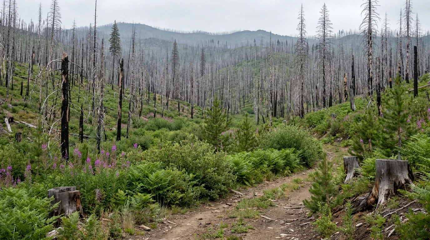
Hillsides of standing bare silver-grey dead conifer snags with blackened trunks stretching to the ridgeline, the ground beneath green with returning bracken fern, brush, fireweed and knee-high young pines, a few salvage-logged stumps and a dirt forest road, overcast flat daylight, a wildfire burn scar in the Plumas National Forest, California, ultrarealistic photograph representative of the region
The burn, years on. Standing silver snags to the ridgeline, and underneath them fireweed, brush, bracken and knee-high pines. It is not a continuous moonscape — the burn is patchy, and you round a curve into an otherworldly vista of char and dead trees, then round another and the forest is green again.

The Dixie Fire, in numbers

  • Ignited 13 July 2021, around 6:48 a.m., in the Feather River Canyon near Cresta Dam in Butte County, above Highway 70
  • Cause: a Douglas fir fell onto a PG&E 12-kV distribution line; investigators concluded utility equipment started it. PG&E later paid a $55 million civil penalty (2022, with Kincade), a $24 million county settlement (2023) and a $45 million CPUC settlement (2024)
  • 963,309 acres — about 1,505 square miles — across Butte, Plumas, Lassen, Shasta and Tehama counties. Contained 25 October 2021, after 105 days. The largest single wildfire in California's recorded history
  • 1,329 structures destroyed, at least 600 of them homes, and 95 damaged; more than 9,500 people evacuated. One firefighter died, of COVID-19; three were injured. No civilian deaths
  • Greenville: roughly 75% of structures destroyed on 4 August 2021, including the historic downtown. Canyon Dam largely burned the next day as the fire reached Lake Almanor's eastern shore. Chester was threatened and saved
  • About 22,000 acres burned inside Lassen Volcanic National Park, destroying the historic Mount Harkness fire lookout (see No. 068)

The bigger picture, and why the road keeps sliding

Dixie was not an isolated event here. Reporting on the forest's condition states that roughly two-thirds of the Plumas National Forest has burned in the last seven years, and that over 70% of the two-million-acre Feather River Watershed has burned since 2020. About a quarter of one studied area burned at high severity — near-total tree mortality.

In January 2023 the Forest Service added 285,000 Plumas NF acres to its Wildfire Crisis Strategy with $273.93 million.

And there is a direct line from the burn to §02: burned slopes lose the roots that held them. Combine that with freeze-thaw and heavy rain and you get precisely the rockfall and slope failure that keeps closing Highway 70 through the canyon. The fire scar and the road closures are the same story.

Burned slopes → slidesTwo-thirds of the forest in 7 yrs
The closure was lifted — in November 2021 This matters because outdated guidance still circulates. The blanket Dixie Fire and Beckwourth Complex area, road, trail and recreation-site closure was terminated early, effective 19 November 2021, when suppression-repair crews finished ahead of schedule. There is no general Dixie Fire closure in 2026, and as of 1 July 2026 the Plumas National Forest reported every campground open for the season. What you will still meet is site-specific and short-lived: individual forest roads closed for hazard-tree removal and salvage logging, and brief fire closures that come and go. Two examples current at press: the Twain Fire closure on Forest Road 26N18 (Kingsbury Grade) and part of FR 25N21, through 31 July 2026; and Antelope Lake Road (FS 29N43) closed for hazard-tree removal and road repair — though we could not date that second notice and it may be from a prior season. Verify before you drive out to Antelope Lake.

What it means for you, practically

  • Fire-killed trees fall without warning. The single biggest practical hazard in the burn. Do not camp, park, sit or pitch under standing snags — and be much more conservative in wind
  • Burned ground moves water differently. Expect debris flows and washouts on burned slopes in heavy rain, and gullied, rutted forest roads that were fine before the fire
  • Shade is gone where the burn was severe. Plan for sun exposure on trails and at camps that used to be shaded, and carry more water than the map suggests. Feather Falls is the extreme case (§04)
  • Navigation gets harder, not easier. Blazes, signs and familiar landmarks burned; downed trees cross old tread. Downloaded maps matter more here
  • Check current forest orders rather than assuming — the specific closures change season to season
Never camp under snagsCheck current orders

Greenville, and how to be a decent visitor

Rebuilding is real but slow — red tape, insurance and labour shortages. Confirmed signs of progress include a new foundation laid by a jerky manufacturer, movement toward a new gas station, a sawmill announced, and The Way Station — a much-loved bar — being rebuilt as a restaurant and bar around its surviving brick walls.

Do not plan on buying fuel in Greenville. Reporting describes progress toward a station; we could not confirm one is actually pumping in 2026. Fuel in Quincy or Chester instead (§08).

The decent-visitor version is simple: this is a place people live, not a ruin to photograph. Buy coffee and groceries in the affected towns. Do not photograph private property or damaged homes. Do not treat the burn as a backdrop for content. And take the fire restrictions seriously here of all places.

Spend money locallyDon't count on Greenville fuel
🔴 The burn-country mistakes that get people hurt Two of them, and both are ordinary. First, camping under a fire-killed tree — they look stable, they are not, and they come down silently and without weather to prompt them. Walk your site and look up before you pitch, every time. Second, assuming a road is open because it is on the map — post-fire closures for hazard-tree and salvage work are common, signage in burned country is patchy, and a road that was fine last season may be gated. Check the current forest orders, carry a downloaded Motor Vehicle Use Map, and turn around when a road stops making sense. Add the standing rule for this region: you will not have signal to look any of it up once you are out there.
06 / SAFETY — READ THIS FIRST

Snags, smoke, a steep grade, and no bars to look any of it up

Plumas is not dangerous the way a big glaciated park is dangerous. What it has instead is a set of quiet hazards that a general road-trip habit will walk straight into, and one structural problem that makes all of them worse: you cannot look anything up out here. The burn has left standing dead trees over enormous areas. The 2026 fire outlook is above normal, which means smoke. One of the two roads to Bucks Lake will ruin your day with a trailer on it. And the road you most need a status for runs through a canyon with no reception.

🔴 Standing dead trees — the hazard specific to this region With roughly two-thirds of this forest burned in the last seven years, fire-killed trees remain standing over vast areas and then fall without warning. They do not need weather to prompt it, though wind makes it far more likely. This is the most likely way to be seriously hurt in this country and it is almost entirely avoidable.

Look up before you stop. Do not pitch a tent, park a vehicle, hang a hammock or set a chair under a standing snag or under a tree with a burnt base. Scan the whole circle around your site, not just what is overhead, and widen the margin in wind. In a windy spell, consider moving out of burned timber entirely — there is still plenty of unburned forest and open ground in this county to camp on instead.

🔴 Bucks Lake Road is not one road, and the obvious one is wrong for trailers This single fact will save you an afternoon. Bucks Lake Road — the direct climb from Quincy — rises fast through sharp, narrow corners to Bucks Summit and is not recommended for RVs, large boats or trailers. Take Big Creek Road instead: longer, but much gentler and wider, and the route locals send trailers up. From the Oroville side, the Quincy-Oro Highway was once steep and narrow but has been substantially improved and is now reported fine for RVs and trailers. In winter the road from Quincy is usually open as far as Bucks Summit but is not plowed beyond it, and can be icy. Check locally early and late season — no road in this area is maintained past certain points in winter.

Smoke season, as a plan input

The Northern California outlook issued 1 July 2026 puts large-fire potential above normal from July through September across the mountainous prediction areas — driven by low snowpack, heavy herbaceous fuel loading and above-normal temperatures. July averages around 15 large fires in the region, August around 17.

It is already borne out locally: the Twain Fire burned 276 acres north of Hwy 70 in the canyon between 11 and 23 July 2026, holding daytime traffic controls on the highway while it did. Smoke from a fire nowhere near you can grey the basin out for days.

Check AirNow, fire.ca.gov/incidents and InciWeb alongside the weather, keep the itinerary loose enough to drive out of it, and have a low-exertion fallback. This is the most common way a good Plumas week goes flat.

Above-normal Jul–Sep 2026Check AQI, not just weather

Cold water, wind, and thunderstorms

These lakes are small enough to look benign and cold enough to matter — snowmelt-fed at around 6,400 ft. Cold-water shock does not require a big lake. We could not source actual water temperatures, so we will not print one; treat them as cold well into summer.

Gold Lake's afternoon wind is predictable enough to plan around. Swim, fish or ski in the morning; strong gusty afternoon winds arrive and can overwhelm small watercraft. Wear a life jacket for any paddling and get off open water when it builds.

Summer afternoons build storms. The Sierra Buttes lookout is the obvious place not to be — a bare rock crest with a metal staircase and no shelter. Start early, set a turnaround time, and if caught out avoid summits and isolated features and crouch on your heels rather than lying flat.

Gold Lake: afternoon windOff the summit early
🔴 No signal, and the thing you most need to look up is a road Coverage is reasonable in and around Quincy, Portola, Chester and Graeagle and falls away fast on the forest roads, in the Lakes Basin, and — most consequentially — through the Feather River Canyon, a deep walled canyon with poor reception for long stretches. Coverage aggregators report no usable data service at all at Bucks Lake on any of the three major carriers; we would treat those specific figures as low-confidence, but the direction is right.

The defensible version: assume no signal anywhere off the highway corridors. Carry a paper map. Before you leave town, every time: download offline maps and the forest's Motor Vehicle Use Map, screenshot your reservations and your campfire permit, check the road status and the fire restrictions, and tell somebody your plan and your expected return. Treat a satellite messenger as standard kit here rather than a luxury — this is a county with long forest roads and very few other vehicles on them.

Black bears & food storage

This is black-bear country — no grizzlies. At Lakes Basin, all food must be kept in approved containers, for raccoons as much as bears, and bear lockers are reported as standard at Packsaddle. Whether hard-sided canisters are legally mandated rather than simply recommended, and which other campgrounds provide lockers, we could not confirm — so do not assume a locker is waiting. Where none exists, store food, coolers, toiletries and anything scented locked in a hard-sided vehicle out of sight, never in a tent. Pack rubbish out; a bear that gets a food reward is often the bear that ends up dead.

Wildlife distance, and the low country

Keep well back from all wildlife, never feed or approach, and if an animal reacts to you, you are too close. Black bears, coyotes, deer and the occasional mountain lion live here. Rattlesnakes are present at lower elevations — the Feather River Canyon drops to around 2,000 ft — so watch your hands and feet on warm rock and around woodpiles, and keep dogs leashed and close at dawn and dusk. There is no single posted minimum wildlife distance across these mixed lands — use conservative distances and treat every posted notice as current.

07 / THE CAMPING STRATEGY

Everything is open — and there is a 30-day cap you have never heard of

This is one of the few regions left in California where turning up without a reservation is a reasonable plan rather than an act of optimism. As of 1 July 2026 the Plumas National Forest reported every campground open for the season, roughly forty of them reservable through Recreation.gov, and a meaningful number first-come, first-served. But two things catch people out. The booking systems are scattered — most sites on Recreation.gov, Haskins Valley run by PG&E on its own platform, Plumas-Eureka on ReserveCalifornia. And this forest runs unusually strict occupancy limits, including an annual cap on total camping that most national forests simply do not have.

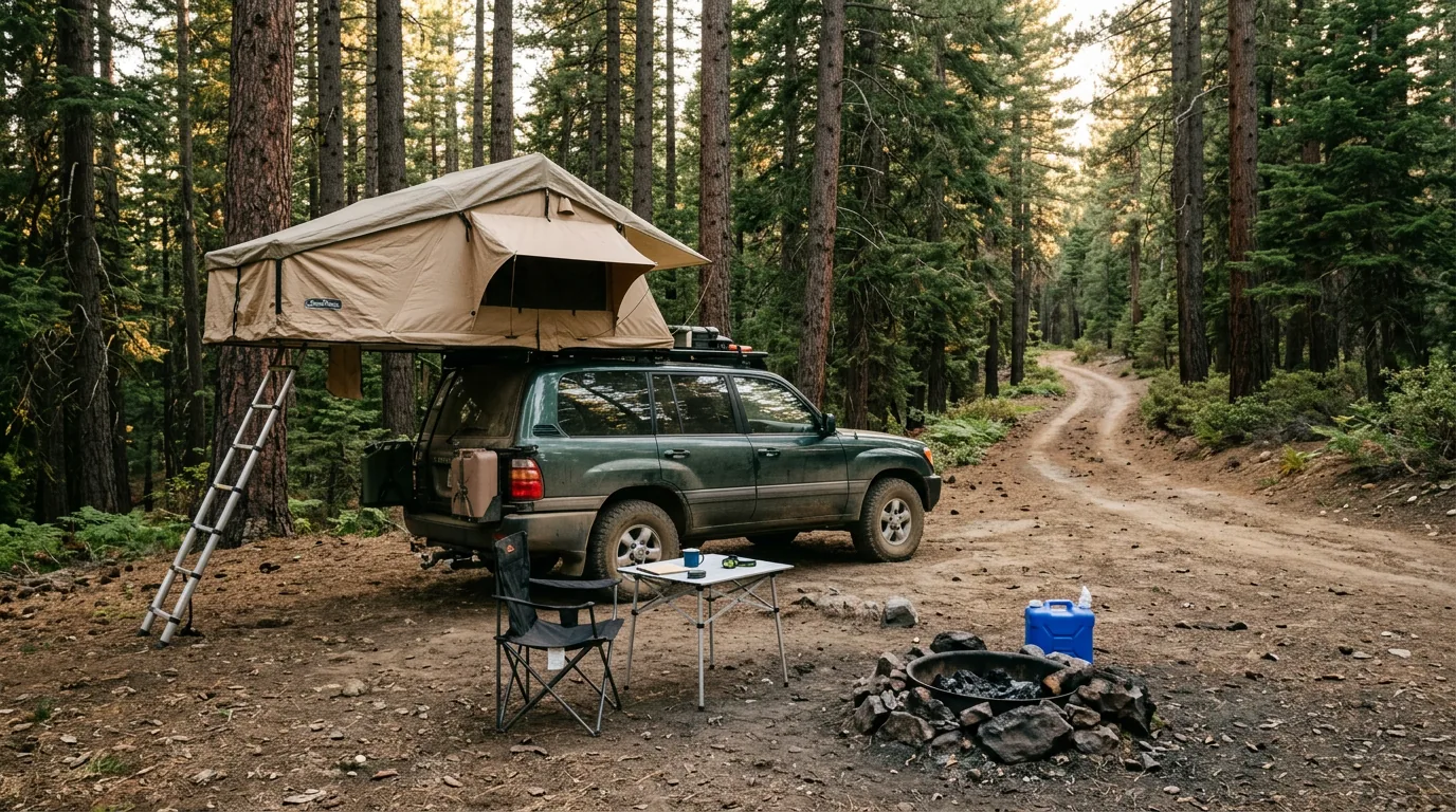
A single well-used bare-dirt pullout among tall ponderosa pine and incense cedar on a national forest road, a canvas rooftop tent on a dusty wagon, a folding chair, a camp table and an existing blackened rock fire ring with no fire lit, golden evening light through the trunks, dispersed camping in the Plumas National Forest, California, ultrarealistic photograph representative of the region
Dispersed camping is genuinely available here — and genuinely rule-bound. Use an existing bare site, camp well back from water, check the Motor Vehicle Use Map, and note that under the Stage I restrictions in force since 9 July 2026 a campfire at a site like this is not permitted. A permitted stove is — and that distinction is the single most useful thing in this section.
🔴 The limits nobody reads — Forest Order 05-11-25-01 In force from 24 June 2025 through 30 April 2027, and stricter than most of the West:
  • 14 days maximum in a developed campground
  • 14 days dispersed camping per Ranger District, per year
  • 30 days total camping per year on the entire forest — most forests have no annual cap at all
  • 8 people and 2 vehicles per campsite, developed or dispersed
Violations carry penalties up to $5,000 for an individual and $10,000 for an organisation. If you are a long-trip traveller or a seasonal worker who thinks of a national forest as somewhere you can simply keep moving around in, this is the order that says otherwise.
CampgroundCorridor · managerSites*BookingNotes
Lakes Basin Lakes Basin · Plumas NF 25 reported
incl. primitive & group
Recreation.gov At ~6,445 ft; the basin's main developed ground. All food in approved containers
Sardine Lake Lakes Basin · Tahoe NF 27 reported
26 standard + 1 double
Recreation.gov Right under the Buttes. Fee reported at ~$24 + $5 extra vehicleconfirm on the platform
Salmon Creek Lakes Basin · Tahoe NF 31 reported
single-family
Recreation.gov Fee not confirmed
Packsaddle Lakes Basin · Tahoe NF confirm Recreation.gov Bear lockers reported standard. Fee reported ~$24 — confirm
Snag Lake · Berger · Diablo Lakes Basin · Tahoe NF (believed) confirm confirm Small basin grounds; we could not confirm administering forest or counts
Haskins Valley Bucks Lake · PG&E 65 reported PG&E's own platform, not Recreation.gov Sites 10 and 14–29 first-come. 2026 booking reported opening 14 April (7+ nights) and 21 April (shorter)
Sundew Bucks Lake · Plumas NF confirm Recreation.gov listing Western shore of the lake. Count and fee not confirmed
Mill Creek Bucks Lake · Plumas NF 11 reported 100% first-come Vault toilets, drinking water. No reservations at all
Grizzly Creek Bucks Lake · Plumas NF 11 reported Recreation.gov Standard non-electric, RV and tent
Whitehorse Bucks Lake area · Plumas NF (Mt. Hough RD) confirm Mixed Within ~3 miles of the lake. Sites 1–7 first-come, the rest reservable
Upper Jamison Creek Plumas-Eureka SP · CA State Parks 60 reported
41 tent/small RV, 19 tent-only
ReserveCalifornia, 6 months out 2026 season reported opening 21 May. ~5 mi west of Blairsden, inside the 6,700-acre park
Boulder Creek · Lone Rock · Long Point Antelope Lake · Plumas NF ~196 units
across all three
Recreation.gov / mixed The quietest corner here; ~20 mi up Indian Creek from Taylorsville. Check the Antelope Lake Road hazard-tree closure first
Grizzly · Grasshopper Flat · Lightning Tree Lake Davis · Plumas NF (Beckwourth RD) confirm Recreation.gov / mixed Stocked rainbow trout; Portola's drinking-water reservoir
8 campgrounds incl. Red Feather, Running Deer, Horse Camp, Little Beaver, Peninsula Little Grass Valley Reservoir · Plumas NF (Feather River RD) ~323 units
across all eight
Recreation.gov / mixed ~5,000 ft, via La Porte Road (Plumas #120), which closes for winter snow. Red Feather opened 26 June 2026
Frenchman Lake grounds Frenchman Lake · Plumas NF (Beckwourth RD) confirm Recreation.gov / mixed Reported open for the 2026 season; individual grounds not verified
Queen Lily · North Fork · Gansner Bar · Hallsted Feather River Canyon · Plumas NF confirm confirm Closed in past seasons when CA-70 was shut for slide repair. Covered by the 1 July 2026 "all open" announcement but not named in it — check

*Site counts are as reported by secondary sources and Recreation.gov listings, not verified against the official land-manager table, and are marked "confirm" where we found nothing we trusted. We have printed only the two fees we could source, and flagged both — book by site on the correct platform and read the actual price and site type there. Note the platform differs: Recreation.gov (or 877-444-6777) for most federal sites, PG&E's own reservation system for Haskins Valley, ReserveCalifornia for Plumas-Eureka. Roughly 40 Plumas NF campgrounds are reservable; the rest are first-come.

Which corridor for which trip

  • Lakes and short walks: the Lakes Basin off the Gold Lake Highway. Camp there and you are inside the basin all day rather than driving up to it (§03, §04)
  • First-come with a boat: Bucks Lake — Mill Creek is entirely first-come, Whitehorse and Haskins Valley partly. Come up Big Creek Road with a trailer, not Bucks Lake Road (§06)
  • History and a real bed nearby: Upper Jamison Creek at Plumas-Eureka State Park, with the museum, stamp mill and Johnsville at the door and Graeagle minutes away
  • Solitude above all: Antelope Lake, Lake Davis and Frenchman on the eastern side — open, quiet, fishing-led, a long way from services. Arrive fuelled and provisioned
  • Off the map entirely: Little Grass Valley Reservoir above La Porte in the southwest — eight campgrounds, a winter-closed access road, and old mining country around it

Dispersed camping, done legally

  • Campfire permit: a free California Campfire Permit is required for any campfire, charcoal fire or portable stove or lantern used outside a designated recreation site. Get it at permit.preventwildfiresca.org and carry it
  • Under Stage I that permit buys you a stove, not a fire. Campfires are restricted to designated recreation sites in established rings. Assume no campfire at a dispersed camp until the order changes
  • Mind the clock: 14 days dispersed per Ranger District per year, and 30 days total per year on the whole forest
  • Use an existing site. Camp on bare, previously used ground; do not clear vegetation or build new rings. Camp at least 100 ft from water, trails and roads (widely reported figure — confirm against the order text)
  • The MVUM is effectively mandatory this season. Stage I restricts internal-combustion engines to designated roads and trails, so the Motor Vehicle Use Map is what keeps you legal. Download it before you lose signal
  • Look up before you pitch. In burned country, snags are the hazard (§05, §06)
No dispersed campfire under Stage I30-day annual cap
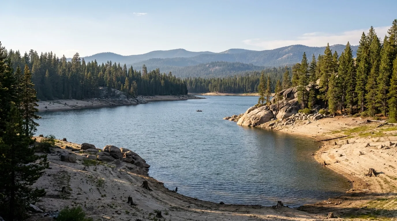
A mid-sized forest reservoir ringed by dense mixed conifer forest and low granite headlands with a broad drawdown band of pale rock along the shoreline, a small aluminium fishing boat far out on the water and forested wilderness ridges behind, late-summer afternoon with faint haze, Bucks Lake in the Plumas National Forest, California, ultrarealistic photograph representative of the region

Bucks Lake, and the two roads to it

Bucks Lake sits west of Quincy at about 5,161 ft, ringed by forest with the Bucks Lake Wilderness behind it — 2,000 ft in the Feather River Canyon up to Spanish Peak at 7,017 ft — and the PCT running about 13 miles along the escarpment. It is a boating, fishing and first-come-camping lake rather than a scenic-drive destination, and the most straightforward place in this guide to turn up and get a site midweek.

The road choice matters more than the campground choiceBig Creek Road for anything towed, not the direct Bucks Lake Road (§06). And like every reservoir it draws down through the season: late-summer shorelines are wider, rockier and further from where the ramp thinks the water is.

First-come is realisticTrailers: Big Creek Road
The camper's edge where there is no reservation war In most of the places this series covers, the campground is how you beat a crowd. Here it is simpler: there is not much of a crowd to beat. What camping buys you in Plumas is time in a corridor — a night in the Lakes Basin means you walk to lakes at dawn instead of driving an hour up a seasonal road to get to them, and a night at Bucks or Antelope means you are not doing the steep or the long road twice in a day. Pick a corridor, sleep in it, and stop commuting. And because so much here is first-come, have a second and third choice in mind rather than a booking to defend — while keeping one eye on the 14-day and 30-day clocks if you are out for a long season.
08 / TOWNS & SERVICES

Small towns, real distances, and a fuel plan

Plumas County has proper towns rather than resort villages — Quincy is a working county seat at 3,432 feet with a courthouse, a community college and a main street; Portola is a railroad town with one of the largest collections of diesel locomotives in the country; Chester sits at the top of Lake Almanor; Graeagle is a former lumber-company town of small red cottages that has turned itself into a holiday village. What it does not have is density. The distances between services are long, the roads between them slow, and the corridor most likely to delay you is the one that reaches the western half of the county. Fuel before you commit, not after.

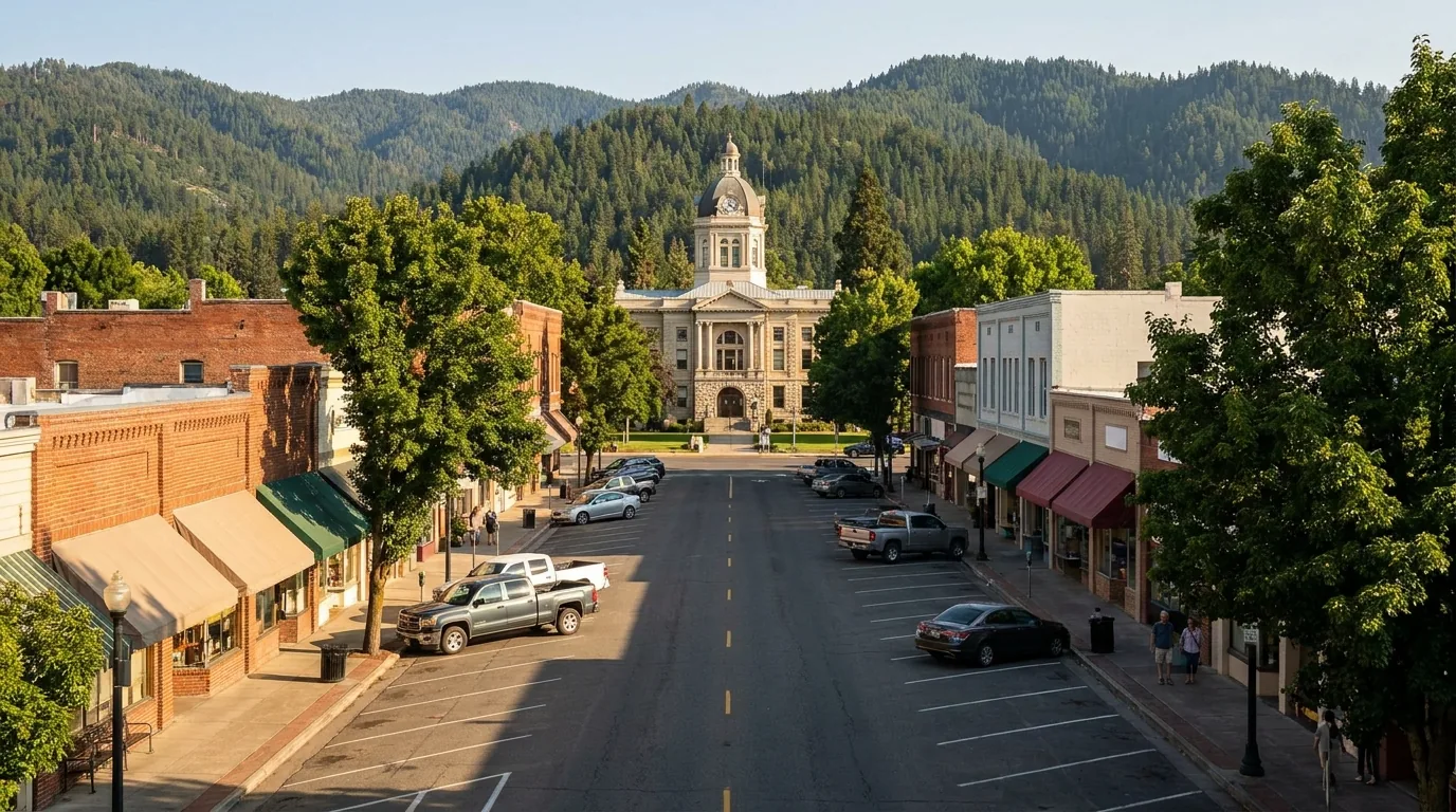
A small northern Sierra county-seat main street in a mountain valley with low brick and painted-wood storefronts, awnings and angled parking, mature street trees and a historic domed county courthouse of pale stone at the end of the street, forested ridges rising behind the town, warm late-afternoon summer light, Quincy California, ultrarealistic photograph representative of the region
Quincy, 3,432 ft — the county seat and the practical hub of this guide. A working small town rather than a tourist one: the courthouse, a main street with two breweries on it, Feather River College, groceries and fuel, and the jumping-off point for Bucks Lake, the Feather River Canyon and the new Quincy–Taylorsville trail over Mt. Hough.

The towns, and what each is for

  • Quincy (3,432 ft) — the county seat and your main resupply. Groceries, fuel, food, a main street worth an hour, the county museum, Feather River College. The base for Bucks Lake and the eastern end of the Feather River Canyon
  • Graeagle & Blairsden (~5,164 ft) — the Lakes Basin gateway. Graeagle is the village of barn-red former lumber-company cottages; between them they cover food, lodging and basic supplies, and Plumas-Eureka State Park is about five miles west of Blairsden
  • Portola — the railroad town on the Middle Fork, home of the Western Pacific Railroad Museum, and the eastern approach to Lake Davis and Frenchman
  • Chester (~4,564 ft) — at the north end on Lake Almanor, the practical hub if you come in over the top on CA-36 or continue to Lassen (see No. 068)
  • Greenville, Taylorsville & Indian Valley — the valley communities north of Quincy and the heart of the Dixie Fire story (§05). Indian Valley takes in Greenville, Taylorsville, Crescent Mills and Canyon Dam, and the county's Scenic Byway Link runs through it to join the Feather River and Volcanic Legacy byways
  • Belden & Caribou — in the canyon on CA-70, right where the PCT crosses. Sierra City & Bassetts — over the county line on CA-49, the southern gateway to the Gold Lake Highway

The fuel and services plan

Treat Quincy, Portola, Chester, Blairsden/Graeagle and Oroville as your fuel points, and fill up when you pass one rather than when you need one.

There is no fuel on the Gold Lake Highway in the Lakes Basin, none at the eastern reservoirs, and very little through the Feather River Canyon. Add the 2026 roadworks and a tank you meant to fill "on the way through" becomes a real problem (§02).

Do not plan on fuel in Greenville. Post-fire reporting describes progress toward a new station, but we could not confirm one is pumping in 2026.

We have deliberately printed no station-by-station fuel table. We could not verify individual stations and their 2026 hours, and small-town pumps keep small-town hours — some are seasonal. Confirm locally rather than trusting any guide, including this one.

No fuel in the Lakes BasinDon't count on Greenville
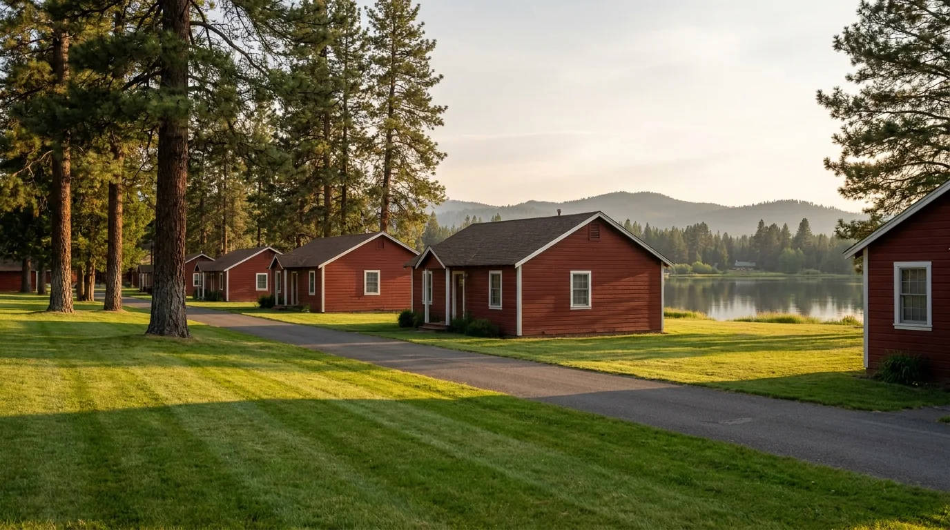
A row of small identical barn-red clapboard cottages with white trim, former lumber-company mill housing, along a quiet lane on a mown green with tall ponderosa pines, a millpond and low forested Sierra ridges beyond, early evening summer light, the village of Graeagle, California, ultrarealistic photograph representative of the region

Graeagle, and why it looks like that

The uniform barn-red cottages with white trim are not a design scheme — they are surviving lumber-company mill housing, built to one pattern and painted one colour because a single company built and owned the whole town. The mill went; the village stayed, and became the accommodation and services base for the Lakes Basin.

Practically it is the most convenient civilian base in this guide: minutes from the Gold Lake Highway, minutes from Plumas-Eureka State Park, on CA-89 for the run north to Quincy or south toward Truckee, and with enough food and lodging to make a rest day pleasant.

Best base for the Lakes BasinCompany town, still standing
The one attraction worth planning a day around — the Western Pacific Railroad Museum, Portola Confirmed from the museum's own site for the 2026 season, and unusually specific for this guide because the source is primary. 700 Western Pacific Way, Portola. Open Thursday and Friday 12:00–4:00, Saturday and Sunday 10:00–5:00, closed Monday to Wednesday — all hours weather-dependent.

Admission & rides

  • Admission: adults (19–64) $10; youth (5–18) $6; seniors 65+ and active military $8; under 5 free; family pass $25 (two adults plus children up to 18)
  • Caboose train rides weekends from Memorial Day to Labor Day, reported $4–$5 per person, family pass $14
  • Locomotive cab rides reported $20 adult / $12 youth (4–18)
  • Special events in October and December, weather permitting

Run-A-Locomotive

  • You get ground instruction and then an hour operating a real locomotive, with a qualified engineer aboard. This is not a simulator and it is not a cab ride
  • Reported rates: WP 1503 at $500/hour ($400 members); Quincy 1100 at $400/hour ($320 members)
  • Runs outside winter and certain special-event weekends. Book direct and confirm — prices and availability change

One secondary source gave youth admission as $5; we have printed the museum's own $6. Confirm all prices at wplives.org before you budget.

Operators and institutions we could actually verify — names, not prices Everything below we resolved as real and currently trading. Season, pricing and hours change annually, so we name and describe rather than quote. Several of the Lakes Basin lodges are strictly seasonal and close with the snow.

Quincy & the canyon

  • Quintopia Brewing Co. (Quincy) — craft brewery and taproom with New-American pub food, indoor and outdoor seating, family-friendly. Reported as Quincy's first brewery in 100 years. Two sources gave different street addresses, so we have not printed one
  • Morning Thunder Cafe (557 Lawrence St, Quincy) — breakfast, brunch and lunch; consistently the top-rated restaurant in town. Locals also know it as Patti's Thunder Cafe — the same place under two names
  • Belden Town Resort & Lodge (Belden, on CA-70) — lodging, store, restaurant with a deck over the river and a full bar; reported open year-round, hosts music festivals, and accepts PCT hiker resupply packages — it sits right at the trail's Feather River crossing
  • Caribou Crossroads (16242 Hwy 70, Belden) — cafe, store, campground and cabins about a mile from the PCT; hundreds of hikers pass through each summer
  • Note: a long-standing Quincy sporting-goods shop is reported closed, so we have not listed a gear store here. Buy what you need before you arrive

Graeagle, the Lakes Basin & the state park

  • Graeagle Store (7386 Hwy 89, Blairsden-Graeagle) — small grocery, reported in business over 100 years
  • Elwell Lakes Lodge (6200 Gold Lake Forest Hwy) — a small summer lodge of equipped cabins, reported owned and run by the same family for over a century and reported open 6 June to 30 September in 2026. Trailheads for the Bear Lakes cluster are on the doorstep
  • Sardine Lake Resort — reported nine housekeeping cabins on the shore of Sardine Lake under the Buttes, with a restaurant and boat rental
  • Gold Lake Lodge — one of the long-established seasonal lodges on the Gold Lake Highway. Bassetts Station — the historic store, fuel and lodging stop at the CA-49 junction and the traditional Lakes Basin resupply
  • Plumas-Eureka State Park — museum and visitor centre in the original miners' bunkhouse, with the Mohawk Stamp Mill, a Bushman five-stamp mill, stables, blacksmith shop, mine office and the Moriarity House. Reported museum and visitor centre daily 9:00–4:00 in season, opening Memorial Day weekend; the park is open year-round for day use, sunrise to sunset. Day-use fee not confirmed

We confirmed no operator pricing beyond the railroad museum's published rates, and we have printed no phone numbers. Several Graeagle retail names that appear on local listings we could NOT verify as currently trading, so they are not listed here. The Quincy and Lost Sierra chambers of commerce maintain current business listings — a better source than any guide for what is open this week.

Getting there, and medical The realistic approaches are CA-70 west from Quincy through the canyon toward Oroville and the Central Valley (subject to §02), CA-89 north–south linking Truckee, Graeagle, Quincy and Chester, and CA-36 across the top via Chester. Reno is the nearest large city and major airport to the eastern side; Sacramento serves the western approach. We have not printed drive times — with 24-hour roadworks in the canyon and slow mountain two-lanes, any figure would mislead. Check live mapping on the day and add margin. For medical: Quincy, Portola and Chester have local health facilities, and serious cases go out of county. We did not verify current emergency-department capability or hours at any of them — in an emergency call 911 and let dispatch route you.
09 / TIMING

A short season, and 2026 is running early

Plumas has a narrower usable season than its elevation suggests, squeezed from both ends — snow at the front, smoke at the back. Normally the Gold Lake Highway and the Lakes Basin are gated into late May. But 2026 was not a normal year: after an exceptionally light snowpack the basin, Bucks Lake, Antelope, Frenchman and Lake Davis all opened in early May, ahead of schedule, and the whole forest was reported open by 1 July. The flip side of that dry winter is a fire season forecast above normal from July through September. There is no crowd calendar to work around here. The calendar you are working around is physical, and this year it has shifted.

Season by season, straight

  • Winter (roughly Nov–Apr) — a different sport. The Gold Lake Highway is not plowed past the Winter Staging Area and the basin belongs to snowmobiles, skiers and snowshoers. La Porte Road closes with snow. Bucks Lake Road is usually open to Bucks Summit but not beyond, and can be icy. And this is when the canyon closes (§02)
  • Late spring (May–early June) — normally the wildcard, in 2026 the early opening. Waterfalls are at their best. Plumas-Eureka's campground reported opening 21 May 2026; the Lakes Basin and the big reservoirs opened in early May; Red Feather at Little Grass Valley came last on 26 June 2026
  • Melt-out to mid-July — the first sweet spot. Frazier Falls at its best, lakes full, meadows flowering, and everything open. Expect mosquitoes after snowmelt at these elevations — we could not source a season for them, so treat repellent as a precaution rather than a forecast
  • High summer (mid-July–Aug) — warm, reliable, and this year smoky. Everything open, water swimmable, falls thinned. Stage I fire restrictions from 9 July 2026, and an above-normal fire outlook through September
  • September into October — the second sweet spot. Cooler, quieter, often clearer once the fire season breaks. Fall colour is staggered: the aspens on Gold Lake Road turn in early October, two to three weeks before the valleys, which peak from the third week of October into early November — cottonwoods along the Middle Fork and Gray Eagle Creek, and red, orange and gold through Indian Valley and Genesee Valley

What to actually plan around

  • The canyon, first. In summer that means budgeting an hour for the roadworks; in winter and spring it means checking whether it is open at all (§02)
  • The fire stage, second. It decides whether you cook on a fire or a stove, and it can move mid-trip. In 2025 the forest sat at Stage II and dropped back to Stage I in late September (§07)
  • Air quality, third, from July on given the 2026 outlook. Watch it like a weather forecast and be willing to move corridors or drive out of it (§06)
  • Your 14-day and 30-day clocks if you are out for a season — the Plumas caps total annual camping in a way most forests do not (§07)
  • Weekday over weekend still helps at the first-come campgrounds — the difference between choosing a site and taking one
  • Season windows vary year to year with snowpack and fire. 2026's early opening followed a snowpack far below average; do not assume next year behaves the same. Treat every date here as indicative
The one-paragraph answer Go in late June or early July for full lakes, a loud Frazier Falls and the best of the meadows. Go in early October if you want the Gold Lake Road aspens, and late October into early November if you want the valleys instead — they are two different trips two to three weeks apart. September is the safest bet for quiet air and cool nights once the fire season breaks. Whenever you go: budget time for the canyon roadworks, check the fire restrictions before you plan a campfire, fuel in the towns, download your maps, and pick one corridor rather than trying to cross the county twice a day.
10 / THE SHAPE OF THE TRIP

Five days, one corridor at a time

One workable shape, not the only one. It is built around the things that actually constrain a Plumas trip — the canyon roadworks, the seasonal basin road, and a principle that matters more here than anywhere else in this series: stop commuting. The distances are long and the roads slow, so sleeping in the corridor you are exploring buys you more than any early start. Adjust freely, but budget the canyon delay honestly, take the right road up to Bucks Lake, and do not plan the Sierra Buttes for an afternoon.

01

Day 1 — Quincy, and the lie of the land

  1. Arrive. If you came through the canyon, you already know about the Cromberg roadworks — add an hour, 24 hours a day (§02).
  2. Resupply and fuel in Quincy. Walk the main street, look at the courthouse, find a brewery. Buy any gear you need before you get here.
  3. Easy legs: the Butterfly Valley Botanical Area boardwalk, 3.5 miles north of town — carnivorous plants, no facilities at all (§04).
  4. Get your free California Campfire Permit if you do not have one, and read the current fire order. Under Stage I your dispersed camp gets a stove, not a fire (§07).
No reservation neededPermit + fire order first
02

Day 2 — Bucks Lake, first-come

  1. Towing anything? Take Big Creek Road, not Bucks Lake Road — the direct climb is sharp, narrow and not recommended for trailers (§06).
  2. Mill Creek is entirely first-come; Whitehorse has first-come sites 1–7; Haskins Valley is PG&E's, with its own booking system (§07).
  3. Boat, fish, swim, or walk into the Bucks Lake Wilderness — the PCT runs about 13 miles along the escarpment under Spanish Peak.
First-come is realisticTrailers: Big Creek Road
03

Day 3 — Move to the Lakes Basin

  1. Over to Graeagle via CA-89, then up the Gold Lake Highway — about 15 paved miles, signed 1.5 miles south of Graeagle (§03).
  2. Fuel before you turn up the highway. There is none in the basin (§08). Camp in the basin so tomorrow starts on foot.
  3. Afternoon: the paved mile to Frazier Falls and its 176-ft drop (§04). Evening: a small cold lake and no one else on it.
No fuel up hereTwo forests — check which
04

Day 4 — The basin on foot, and the stairs

  1. Morning: the Sierra Buttes lookout if the party is up for it — about 2.3 miles each way, ~1,587 ft, finishing on about 180 open steel steps at 8,591 ft (§04).
  2. Not up for the stairs? The Bear Lakes and Round Lake cluster instead — several real lakes, minimal effort, no permit.
  3. Morning on Gold Lake if you are paddling. The afternoon wind there is predictable and can overwhelm small craft (§06).
Stairs are the cruxOff the summit early
05

Day 5 — History, rails, or the burn

  1. Plumas-Eureka State Park: the bunkhouse museum, the Mohawk Stamp Mill, Johnsville, and the trails toward Eureka Lake and Peak (§04, §08).
  2. Or Portola for the Western Pacific Railroad Museum — Thursday to Sunday, and the place you can actually drive a locomotive (§08).
  3. Or drive the canyon slowly for the Keddie Wye, Williams Loop, Tobin and Pulga, and Rich Bar (§02) — or go north into the Dixie Fire country and Indian Valley, and spend money there (§05).
Rail history · mining historyMuseum closed Mon–Wed
+

The solitude variant

  1. Swap the back half for the eastern reservoirs — Antelope Lake, Lake Davis, Frenchman — and expect to see almost nobody.
  2. Check the Antelope Lake Road hazard-tree closure first, and arrive fully fuelled and provisioned; services out there are thin to non-existent (§05, §08).
  3. It is fishing-and-sitting country rather than hiking country, and it is very good at being that. Lake Davis is stocked with rainbow trout.
  4. No signal. Tell somebody your plan, and carry a paper map (§06).
Genuine solitudeSelf-sufficient
11 / TRIP-READY

The departure check

Run it before you leave. Tap each item as it's done — these are the ten things specific to Plumas, the Lakes Basin and the Feather River that a general road-trip habit will skip. Most come back to three facts: the canyon is slow this year and shuts in winter, a fire order decides how you cook, and you cannot look either of them up once you have left town.

0 / 10 confirmed — the canyon and the fire order set the plan.
12 / QUICK ANSWERS

Asked at every Plumas trailhead

Is Highway 70 through the Feather River Canyon open?
As of late July 2026, yes — three independent 2026 reports show the canyon open and drivable. Two things qualify that. First, the $101 million Cromberg Combined Rehabilitation Project began around 13 July 2026 and runs around-the-clock traffic control with delays reported up to 25 minutes, scheduled into winter 2026; PG&E undergrounding between the Butte–Plumas county line and Storrie adds roughly 15-minute weekday delays. Second, this corridor closes repeatedly. It shut for about two months in early 2024, had a May 2024 reopening cancelled by a fresh rockslide with Caltrans stating there was no estimate for reopening, closed again in November 2024 after two slides, and had a slide across both lanes at Rich Bar that December. Reliable in summer, unreliable November to May. Check QuickMap or call 1-800-427-7623 on the day.
Can I have a campfire on the Plumas National Forest right now?
Only in a designated recreation site. Forest Order 05-11-26-01 put the forest into Stage I fire restrictions effective 9 July 2026: campfires only at designated recreation sites listed in the order's Exhibit A, in established rings, in an area cleared three feet in diameter, and you must carry a shovel plus either a gallon of water or a fire extinguisher. That rules out a campfire at a dispersed camp. Crucially, stoves are still allowed outside those sites — with a valid free California Campfire Permit you may use a portable gas, kerosene or pressurised-liquid-fuel stove or lantern with a working shut-off valve, or a wood-pellet grill, in a cleared area. Smoking is restricted, vehicles and generators are limited to designated roads and trails, and welding and open-flame torches are prohibited. Penalties run to $5,000 for an individual. Stages move both ways — confirm the current one.
How long can I camp on the Plumas National Forest?
Less than you might assume. Forest Order 05-11-25-01, in force 24 June 2025 through 30 April 2027, sets a maximum of 14 days in a developed campground, 14 days dispersed per Ranger District per year, and — the one that catches people — no more than 30 days of camping per year on the entire forest. Most national forests have no annual cap at all. There is also a limit of 8 people and 2 vehicles per campsite, developed or dispersed, and violations carry penalties up to $5,000 for an individual. Dispersed campers should also camp well back from water, trails and roads — 100 feet is the widely reported figure — and use the Motor Vehicle Use Map, which matters more than usual because Stage I restricts vehicles to designated roads and trails.
Are the Dixie Fire closures still in effect?
No. The blanket Dixie Fire and Beckwourth Complex area closure was terminated early, effective 19 November 2021, when suppression-repair work finished ahead of schedule. There is no general Dixie Fire closure in 2026, and as of 1 July 2026 the Plumas National Forest reported every campground open for the season — the last, Red Feather at Little Grass Valley Reservoir, opened 26 June 2026. What remains is site-specific: individual forest roads close for hazard-tree removal and salvage work, and short-term fire closures appear and expire — the Twain Fire roads were closed through 31 July 2026, and Antelope Lake Road has been closed for hazard-tree work. The residual risk is physical rather than legal: standing fire-killed trees fall without warning, and rolling rock off burned slopes is part of why Highway 70 keeps sliding.
What is the Lakes Basin, and when can I get there?
A compact glacial basin below the Sierra Buttes holding more than twenty small alpine lakes and over 30 miles of trail, reached by the roughly 15-mile paved Gold Lake Highway between Graeagle on CA-89 and Bassetts on CA-49. Lakes Basin Campground sits at about 6,445 ft, Gold Lake at about 6,400. One thing everyone gets wrong: the basin is split between two national forests. The Plumas NF Beckwourth Ranger District administers the northern portion and the Tahoe NF the southern portion toward Sierra City — so Lakes Basin Campground is Plumas while Sardine, Salmon Creek and Packsaddle are Tahoe, with different offices, different alert pages and fire orders that need not match. The Gold Lake Highway is not plowed in winter. Campgrounds normally run late May to October, though after an exceptionally light snowpack the basin opened in early May in 2026.
How hard is the hike to the Sierra Buttes lookout?
Steep, exposed, and finishing on open metal stairs — and the stairs are what stop people. The summit is 8,591 ft, and the standard route from Packer Lake Saddle is reported at about 2.3 miles one way with roughly 1,587 ft of gain. The final section climbs stacked flights of open-grate steps bolted to the rock up to the lookout catwalk; sources give the count as 176 or 180, so call it about 180. The exposure is genuine and this is not a route for anyone with a fear of heights — decide that at the bottom rather than the top. The summit is above the trees with no shelter, so start early and be off it before afternoon storms build, and expect snow on the upper trail into early summer. The lookout's 2026 condition we could not confirm.
Can I take an RV or a boat trailer up to Bucks Lake?
Not by the obvious route. Bucks Lake Road, the direct climb from Quincy, rises fast through sharp narrow corners to Bucks Summit and is not recommended for RVs, large boats or trailers. Use Big Creek Road instead — longer, but much gentler and wider, and the route locals send trailers up. From the Oroville side, the Quincy-Oro Highway was once steep and narrow but has been substantially improved and is now reported fine for RVs and trailers. In winter the road from Quincy is usually open as far as Bucks Summit but is not plowed beyond it and can be icy. Bucks Lake sits at about 5,161 ft and is one of the easier places in this guide to get a first-come site midweek — Mill Creek is entirely first-come, and Whitehorse holds sites 1–7 back.
Where can I actually buy fuel out here?
Treat Quincy, Portola, Chester, Blairsden and Graeagle, and Oroville on the far side of the canyon, as your fuel points — and fill up when you pass one rather than when you need one. There is no fuel along the Gold Lake Highway in the Lakes Basin, none at the eastern reservoirs, and very little through the Feather River Canyon itself. We have deliberately not printed a station-by-station fuel table, because we could not verify individual stations and their 2026 hours — small-town pumps keep small-town hours and some are seasonal. In particular, do not count on buying fuel in Greenville: post-fire reporting describes progress toward a new gas station, but we could not confirm one is actually pumping.
Is there cell service in Plumas County?
Assume none away from the towns and the highway corridors. Coverage is reasonable in and around Quincy, Portola, Chester and Graeagle and falls away fast on the forest roads, in the Lakes Basin, and through the Feather River Canyon, which is a deep walled canyon with poor reception for long stretches. Coverage aggregators report no usable data service at all at Bucks Lake on any of the three major carriers — we would treat those specific figures as low-confidence, but the direction is right. The defensible version: carry a paper map, download your offline maps, the Motor Vehicle Use Map, your reservations and your campfire permit before you leave town, and treat a satellite messenger as standard kit. The thing you most want to look up out here is a road status, and the canyon is exactly where you cannot.
13 / WHAT WE COULD NOT CONFIRM

The honest gaps, all in one place

Every guide has these; most don't print them. This one begins with a methodological problem worth stating plainly: several of the primary sources for this region — the Forest Service site, the two main local newspapers, and CAL FIRE — block automated access, so a number of the facts above rest on official press releases republished verbatim by third parties rather than on a direct read of the original page. We have said so wherever it matters. Where we could not verify something to the standard this guide holds, we left it out rather than guessed. Everything below was compiled 25 July 2026.

Why this section exists Anyone can write a guide that sounds certain. The hard part is knowing which numbers are real — and in a quiet county where a state highway closes most winters, a fire order rewrites your cooking arrangements mid-trip, and an annual camping cap exists that most travellers have never met, plenty of them need a same-week check. The null is the product. "Under Stage I your dispersed camp gets a stove, not a fire," "take Big Creek Road with a trailer, not Bucks Lake Road," and "do not camp under a fire-killed tree" are usable instructions. So, for that matter, is "we found a dramatic story about this road and could not stand it up, so we left it out."
🔒

The printable field guide

Everything above, condensed into a print-ready PDF built for the glovebox — for a county where the canyon highway is running but slow, the fire order decides whether you get a campfire, an annual camping cap exists that most travellers have never met, and there is no signal to look up any of it. The canyon and its roadworks and closure record, the Lakes Basin split across two forests, Frazier Falls and the 8,591-ft lookout at honest numbers, the campgrounds by corridor with the right platform for each, dispersed camping under Stage I, the Dixie Fire scar and what it means for where you pitch, the road up to Bucks Lake that trailers should avoid, and the honest list of what nobody could confirm — on paper that works where the bars don't.

The canyon, decoded Stage I, plainly The 14/14/30-day cap Campgrounds by corridor The Lakes Basin roster Burn-country safety Towns & fuel gaps The departure check
Unlock the PDF — $4.95 USD
$4.95 USD per guide · Instant access · Built by people who actually camp there
Trail Journal No. 069

Go farther. Camp lighter.
Leave it better.

Every Trekkr Trail Journal is built like this one: custom logistics, honest trail beta, the camping and access detail, and the local knowledge that turns a good trip into the one your crew talks about for years — including, always, a plain list of what we could not confirm. New destinations drop all season long, from the BC corridors to the Oregon Cascades to the California Sierra.

Unlock the Trail Journal Library
↗ Read another issue — No. 048, Lake Tahoe & the Northern Sierra
$4.95 USD per guide · Instant access · Built by people who actually camp there