The least-visited big volcano park in the Lower 48 hides behind a road that will not open when you want it to — as late as 26 July in a bad year. Inside it, all four types of volcano on Earth, a hydrothermal basin where an inch of crust covers boiling acid, and the burn scar of a fire that took 69% of the park. Get the road date right, stay on the boardwalk, and you get California's emptiest national park under some of its darkest sky.
The rest of this journal is evergreen; this box is not. At Lassen a single fact decides whether your trip exists — whether the 30-mile park highway has been plowed open (§02) — and it has landed anywhere from 28 April to 26 July across the park's own records. Everything below is dated to the day we checked it. Trust the live sources, not our date stamp.
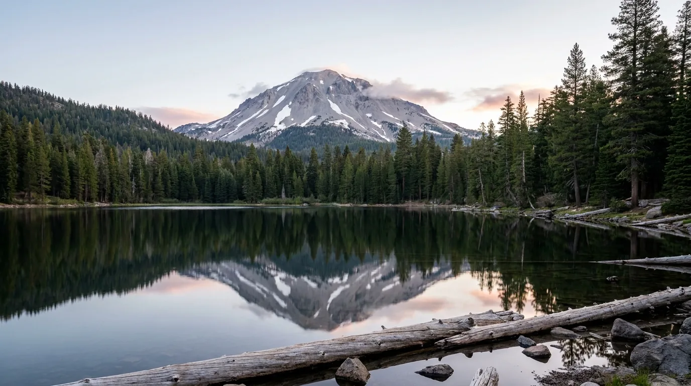
Lassen Volcanic is the national park that Californians drive past on their way to somewhere more famous. It protects the southernmost volcano of the Cascade arc — the chain that runs north through Shasta, Crater Lake, the Three Sisters, Hood, St Helens and Rainier — and it is the only park on Earth that holds all four types of volcano inside one boundary. It has a summit you can climb in a morning, a hydrothermal basin that rivals anything outside Yellowstone, and campgrounds that still have space in August. What it does not have is a reliable season: the road through it is one of the last major park roads in the country to open each year, and in 2017 it did not open until 26 July. Get that date right and you have the emptiest big park in California to yourself.
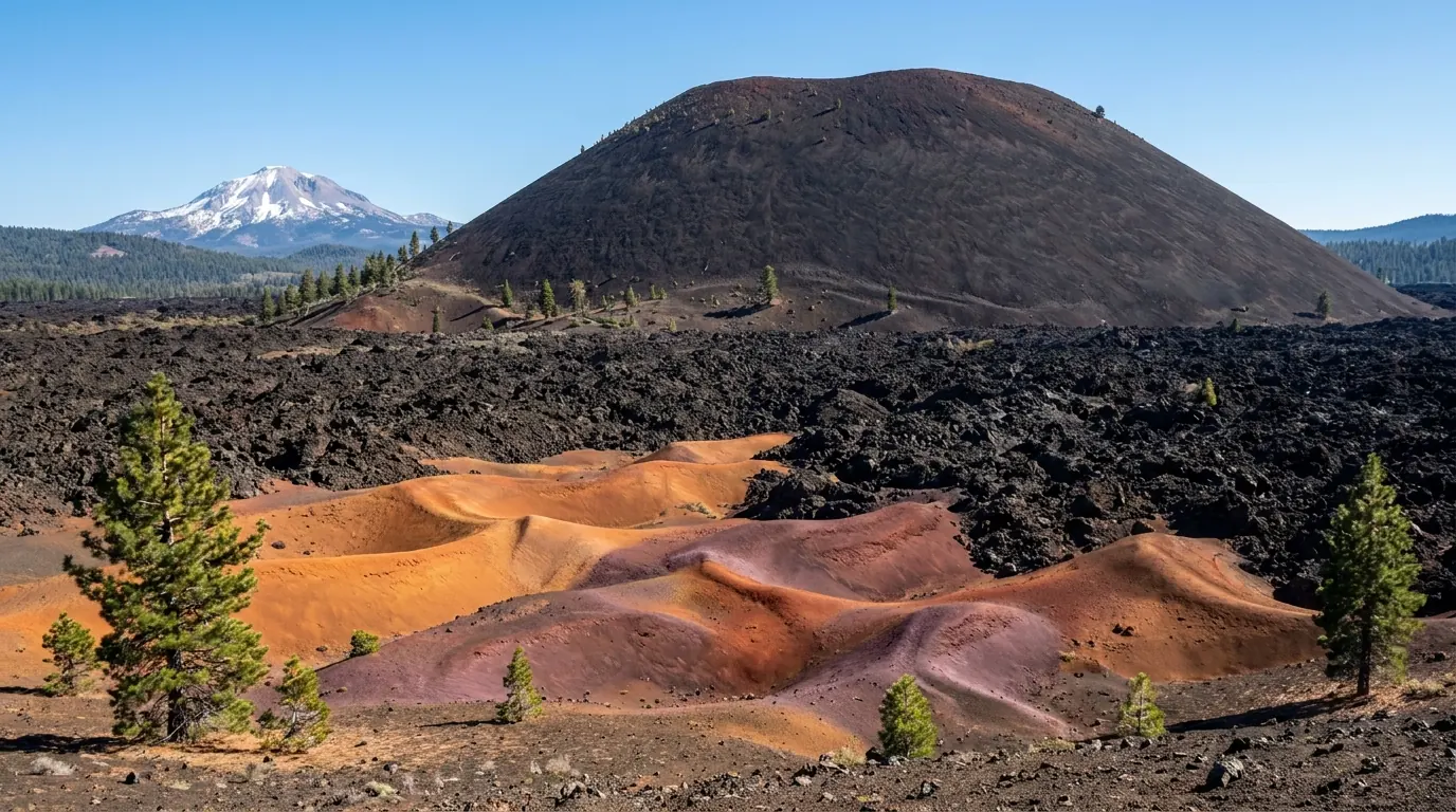
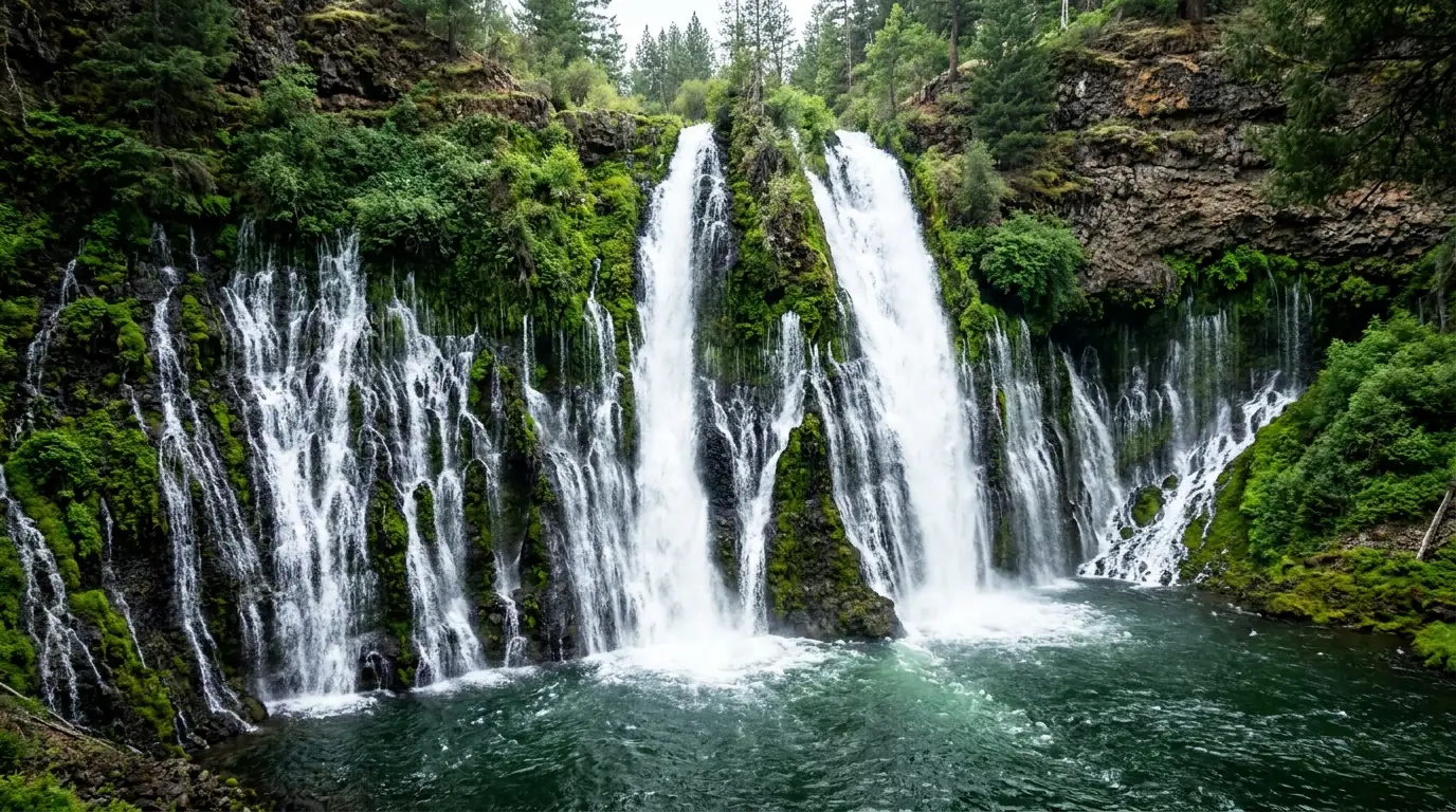
A 10,457-ft summit reachable in half a day, the boiling basin at Bumpass Hell, the Painted Dunes at Cinder Cone, and a 129-ft waterfall an hour north — all with a fraction of the crowds of any comparable park (§03, §04, §08).
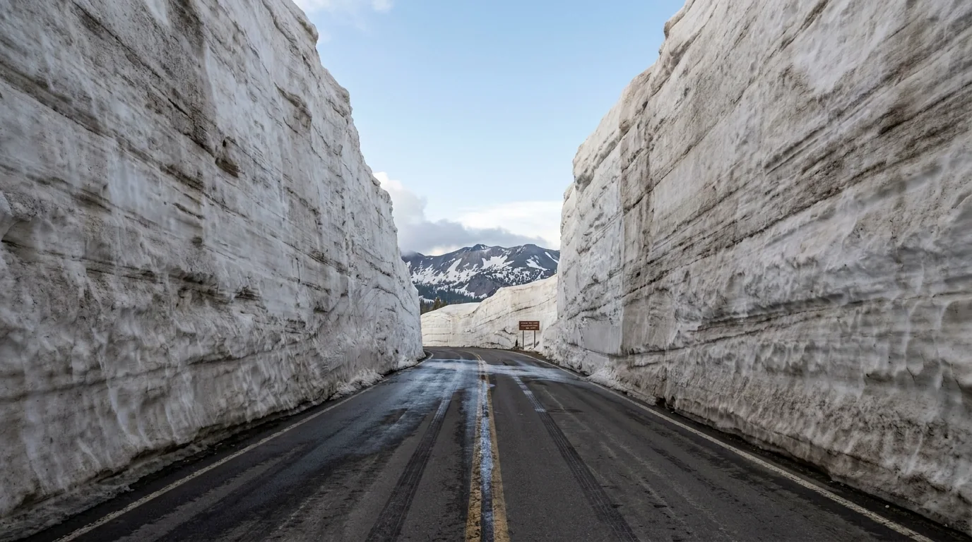
One road, roughly 30 miles, climbing past 8,000 ft. It has opened as early as 28 April and as late as 26 July. Nothing else about your trip matters until you know its status (§02).
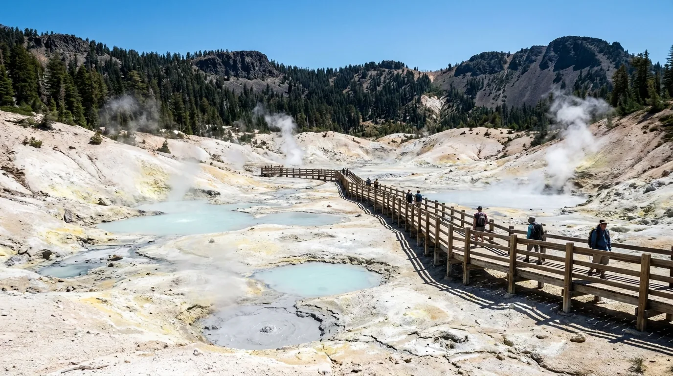
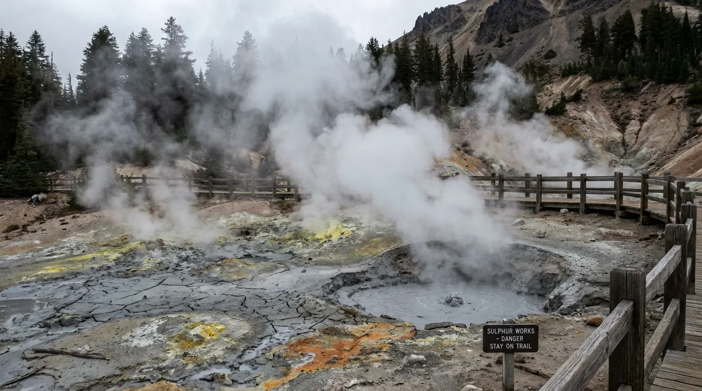
Stay on the boardwalk. The ground in the hydrothermal basins can be an inch of crust over boiling acidic water, and the park is blunt that footprints are not evidence the ground is solid (§03).
Most park guides open with trails. This one opens with a plow. The Lassen Park Highway climbs from about 5,900 ft at Manzanita Lake to over 8,000 ft near the Lassen Peak trailhead, and the snow that lands on that stretch is measured in feet, not inches — Lake Helen, near the high point, is one of the snowiest measured places in California. Crews cut through it every spring, and the date they finish has swung by nearly three months across the park's own records. If you take one operational fact from this issue, take this one: check the road before you book anything.
| Season | Highway opened | What it meant |
|---|---|---|
| 2026 | 22 May | Below-average snowpack; the park had targeted "fully open by Memorial Day weekend" and made it |
| 2025 | 27 June | A normal-to-late year — the whole of June was a gamble |
| 2024 | 20 June | Mid-June. Typical of the last decade |
| 2023 | 1 July | After a huge snow year. Anyone who booked mid-June lost the park |
| 2017 | 26 July | The latest opening in the park's records. Most of the summer season gone |
| 1990 | 28 April | The earliest opening in the park's records. Do not plan around this happening again |
Dates are from the National Park Service's own spring road-clearing page, which publishes a full year-by-year table from 1980. The 2026 date is confirmed; treat every future season as unknown until the park says otherwise.
Southwest entrance — near Mineral on CA-36, at the Kohm Yah-mah-nee Visitor Center (6,707 ft). This is the winter-accessible end and the one nearest Sulphur Works, Bumpass Hell and the Lassen Peak trailhead.
Northwest entrance — Manzanita Lake, on CA-44/89 (about 5,900 ft), nearest Redding. The big campground, the store, the showers and the only dump station are all here.
The east-side roads are separate trips. Butte Lake, Warner Valley and Juniper Lake are reached on gravel from outside the park and do not connect to the park highway. Budget hours, not minutes (§05, §07).
Lassen sits on an active volcanic centre, and the clearest evidence is on the surface: boiling pools, roaring fumaroles, and mudpots that throw grey clay a metre into the air. It is a genuine rival to Yellowstone's basins with a tenth of the people. It is also the single most dangerous thing in this guide, and the danger is specific and unglamorous — the ground beside the boardwalk frequently is not ground. The Park Service's own wording is that travelling off-trail here is "dangerous and unlawful," and that footprints are not evidence that ground is solid. That last clause is doing a lot of work: people follow other people's footprints straight through the crust.
We could not confirm a documented death in a Lassen hydrothermal area, and we are not going to imply one. What is confirmed is bad enough, and it is the injuries — not a body count — that should keep you on the planks. Prolonged exposure to the sulphuric acid in the water and gases can damage skin and lungs. Boiling Springs Lake alone sits at roughly 125 °F, and that is one of the cooler features.

Parking sits about a mile north of the southwest entrance, and the feature is right at the roadside with sidewalk access — no hike, no effort. That is exactly why it deserves a warning: it is the hydrothermal area people wander into casually, in trainers, with children.
It is also where the 2012 one-inch-crust airlift happened. Roadside does not mean safe. Keep to the sidewalk, keep hold of small children, and keep dogs out entirely.
| Hydrothermal area | Where & how you reach it | What to know |
|---|---|---|
| Bumpass Hell | ~3 mi round trip from the park highway; boardwalk throughout | The largest area in the park. Opens later than the road — high, and holds snow. Small lot, fills mid-morning |
| Sulphur Works | Roadside sidewalk, ~1 mi north of the southwest entrance | Easiest access in the park, and the site of the 2012 crust break-through and airlift |
| Devils Kitchen | Moderate trail from Warner Valley | Site of the 2010 off-trail burn injury. Remote — help is a long way off |
| Boiling Springs Lake | Short hike from the Warner Valley trailhead | Roughly 125 °F. Not a swimming lake in any sense |
| Terminal Geyser | From the Warner Valley trailhead | Despite the name, a powerful steam vent rather than a true erupting geyser |
| Little Hot Springs Valley | No trail. Viewable with binoculars from the park road | The park deliberately provides no access. Take the hint |
Access details are from the National Park Service's hydrothermal areas page. Boardwalk and trail status changes with snow and with damage — confirm on the park's conditions page before you drive to one.
Lassen's trail roster is short, which is a feature. Three objectives carry the park — the peak, the hydrothermal basin, and the cinder cone on the east side — and each is genuinely world-class. Where the Park Service publishes a figure we use it and say so; where it does not, we say that too. Everything here starts above 5,900 ft and most of it above 8,000, so treat the altitude as real, and treat the afternoon as unreliable: this is exposed volcanic country with almost no shelter above treeline.
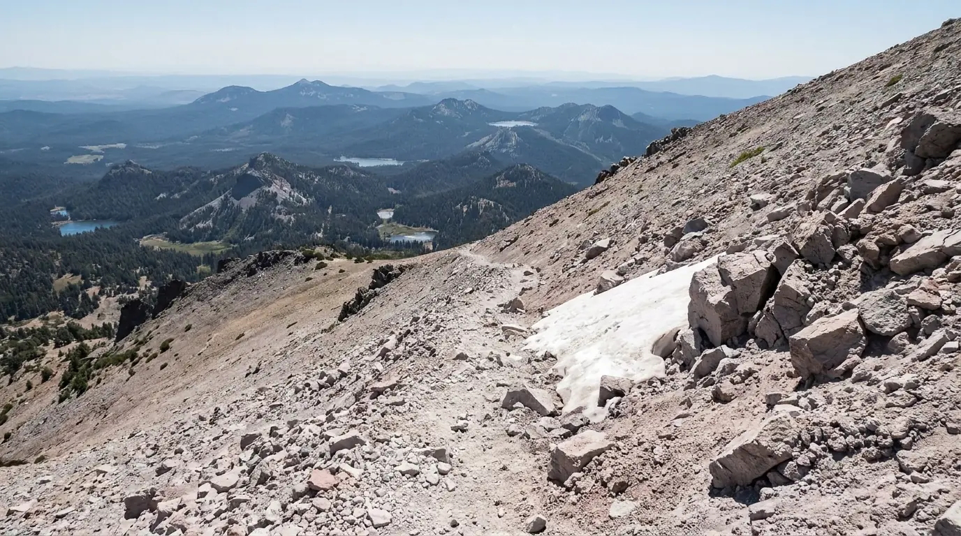
About 2.5 mi each way — 5 mi round trip — with roughly 1,957 ft of gain, from a trailhead at 8,500 ft to a 10,457-ft summit. The Park Service puts it at 4–5 hours round trip and rates it strenuous. Switchbacks on loose volcanic scree the whole way, no shade, and a view from the top that takes in Shasta on a clear day.
Fully exposed above treeline — start early and be off the summit before afternoon storms build. Snow lingers on the upper trail well past the road opening. This is the hike that punishes people who drove up from sea level that morning.
About 3 mi round trip from the park highway, rated easy to moderate, ending on a boardwalk through the park's largest hydrothermal basin. This is the hike most people come for and the one most likely to be closed when they arrive — it sits high and holds snow after the road itself has cleared.
Parking is limited and commonly full from mid-morning to early afternoon, especially at weekends — the one real crowding problem in this park. Go early. And stay on the boardwalk (§03).
From the Butte Lake trailhead, a walk across the Fantastic Lava Beds to a steep, loose climb up the cone itself, with the option of dropping into the crater and looping the Painted Dunes. We could not pin a single authoritative distance and gain to this one — figures vary by source and by which loop you take. Confirm at the trailhead board.
The climb is on deep loose cinder — genuinely hard work for the distance, and unpleasant in heat with no shade. Butte Lake is reached on a long gravel road from outside the park; budget the driving time properly.
From the Warner Valley trailhead in the park's south, short-to-moderate trails reach Boiling Springs Lake (~125 °F), Devils Kitchen and Terminal Geyser. This is the quiet hydrothermal country — no boardwalk crowds, and correspondingly less margin if something goes wrong.
Distances here we did not confirm to an official figure. Access is via Warner Valley Road from Chester, and the corridor was inside the Dixie Fire perimeter — check current status (§05).
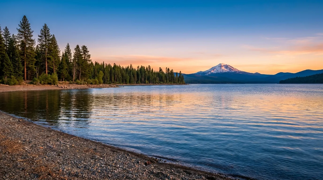
Kings Creek Falls and Mill Creek Falls are the park's two named waterfall hikes, and the Manzanita Lake loop is the flat, family-friendly one with the reflection of the peak that ends up on every postcard.
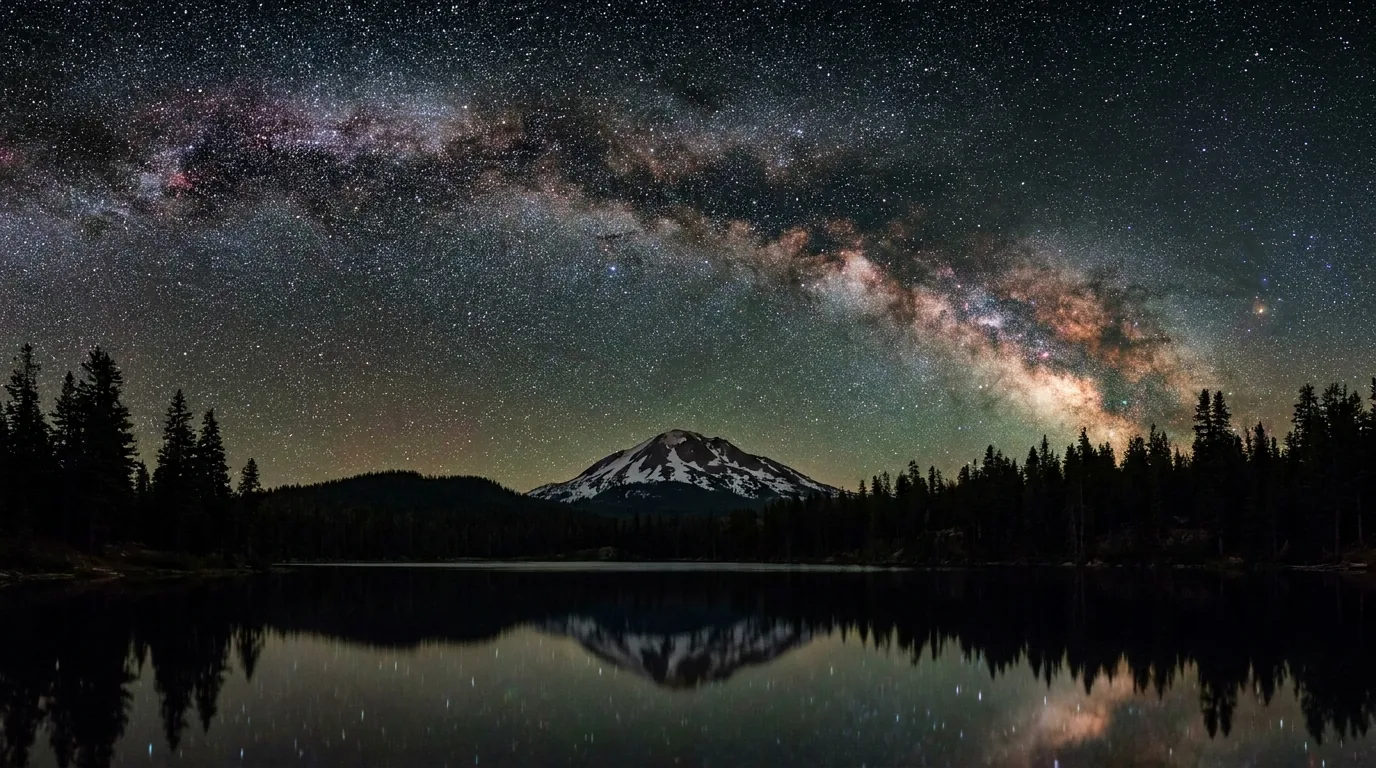
We could not confirm official distances or gains for the falls hikes and have not invented any. The Manzanita loop is genuinely easy and genuinely worth doing at dawn — it is also the best dark-sky spot you can reach without a hike (§09).
| Destination | Access | Round trip | Gain | Source confidence |
|---|---|---|---|---|
| Lassen Peak | Park highway, TH 8,500 ft | ~5 mi | ~1,957 ft | NPS figure |
| Bumpass Hell | Park highway | ~3 mi | modest | NPS figure |
| Cinder Cone | Butte Lake (gravel, outside park) | varies by loop | steep, loose | unconfirmed |
| Boiling Springs Lake | Warner Valley TH | short | modest | unconfirmed |
| Devils Kitchen | Warner Valley TH | moderate | modest | unconfirmed |
| Kings Creek Falls | Park highway | unconfirmed | unconfirmed | unconfirmed |
| Manzanita Lake loop | Northwest entrance | flat lake loop | minimal | unconfirmed |
Only the Lassen Peak and Bumpass Hell figures come from a National Park Service page; everything marked unconfirmed is exactly that, and we have not filled the gap with a guess. Confirm at the trailhead board or the visitor center. All times quoted are fit-hiker estimates at altitude.
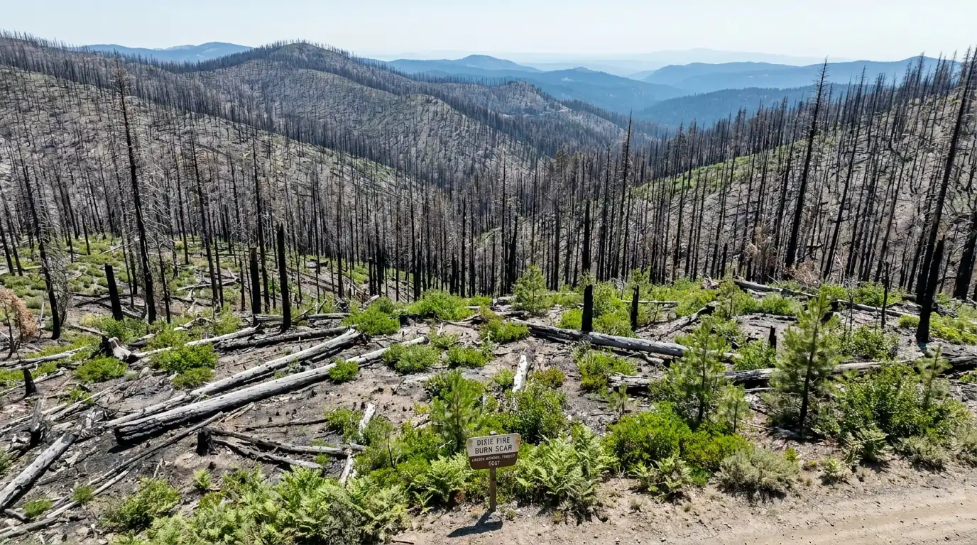
You cannot write an honest guide to this region without the fire. The Dixie Fire started in July 2021 and burned 963,309 acres before it was fully contained on 25 October — one of the largest single wildfires in California's recorded history. It burned 73,240 acres inside Lassen Volcanic National Park, which is 69% of the park. It destroyed most of the town of Greenville. Five years on, the landscape you drive through on the park's east and south sides is a burn scar, some of it recovering fast and some of it still closed — and that is the honest state of it.
Closures in a recovering burn change season to season and sometimes week to week. Everything here must be re-checked on the park's conditions page before you drive.
A burn scar is not simply a sad view. The park's stated hazards are falling trees and limbs (the big one — dead trees come down without wind and without warning), hidden stump holes where a root system burned out underground and left a covered pit, loose and falling rock on slopes stripped of vegetation, higher-than-normal stream flow, unstable shorelines, and burned signs — meaning navigation aids you would normally rely on may simply not be there.
Do not camp or park under standing dead trees, and do not go into the burn on a windy day.
Four things account for most of what goes wrong here, and only one of them is exotic. The hydrothermal ground is the specific hazard this park has and others don't. Altitude catches people who drove up from the Sacramento Valley in two hours. Afternoon storms catch people on an exposed volcanic summit with nowhere to shelter. And the burn scar has added a fourth: falling timber. None of it is hard to plan for.
Stay on boardwalks and sidewalks. Hold small children. Leave dogs in the vehicle or, better, at the campsite. If somebody does go through, they need immediate cooling and evacuation — and in Warner Valley or Devils Kitchen that is a long way from a road.
Manzanita Lake sits at about 5,900 ft, the Kohm Yah-mah-nee Visitor Center at 6,707 ft, the Lassen Peak trailhead at 8,500 ft, and the summit at 10,457 ft. You can be at the trailhead within a couple of hours of leaving Redding at sea level.
Acute mountain sickness can begin around 8,000 ft regardless of fitness. Don't make Lassen Peak your first activity on arrival day. Hydrate, sleep a night at campground altitude first, and if symptoms get worse rather than better, go down.
Lassen Peak is a bare cone above treeline with no shelter of any kind on the upper trail, and the Bumpass Hell basin is open ground. Summer thunderstorms build over the high country through the afternoon.
Start early and be off the summit before the build-up. If you are caught above treeline in lightning: avoid the summit and isolated features, and crouch on your heels rather than lying flat. Carry a warm layer and rain shell even on a hot day — it is cold at 10,457 ft.
Black bear country, no grizzlies. In the backcountry a bear canister is mandatory, not advisory, from 16 April to 30 November — any IGBC-approved canister, and the Ursack Major and AllMitey are also accepted. Rentals are available at the Loomis Museum and the Kohm Yah-mah-nee Visitor Center during business hours, which is a genuinely useful fallback if you have flown in. In campgrounds, store all food and scented items properly and never in a tent.
Standing dead timber across the Dixie Fire scar falls without warning — don't camp, park or linger under it, and stay out of the burn in wind (§05). Wildfire smoke can fill these valleys for days in late summer and is its own health hazard. And cell coverage in and around the park is poor to nonexistent — download maps, your pass and your reservations before you arrive, and do not plan on calling for help from a trailhead.
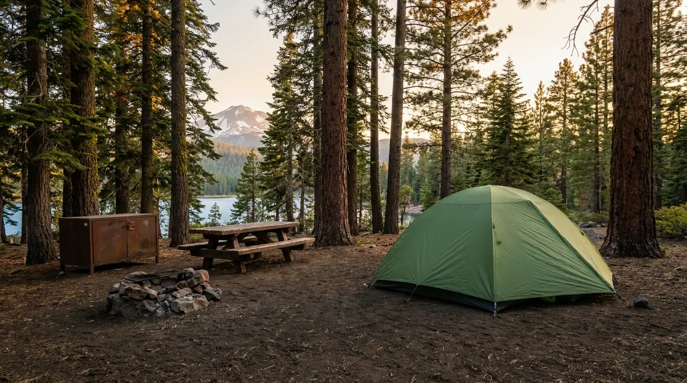
Lassen is a rare park where camping is still relatively easy — but it comes with hard constraints that catch RV travellers out. There are no RV hookups anywhere in the park, and exactly one dump station and one set of showers, both at Manzanita Lake. Two campgrounds are first-come. One is closed altogether from the Dixie Fire. Below is the roster as the Park Service published it, with the figures we could confirm and the one place our sources disagreed.
| Campground | Sites | Booking | Fee / night* | RV limit | Notes |
|---|---|---|---|---|---|
| Manzanita Lake | 179 | Reservation | $26 full / $15 dry | 40 ft | The only dump station ($8) and the only showers in the park. Store, 20 camping cabins, 5 group sites |
| Butte Lake | 101 | Reservation | $22 full / $15 dry | 40 ft | Northeast corner, reached on gravel from outside the park. The Cinder Cone base |
| Summit Lake South | 48 | Reservation | $22 full / $15 dry | not stated | Mid-park on the highway; high, and a superb dark-sky site (§09) |
| Summit Lake North | 46 | Reservation | $24 | not stated | The lakeside loop. Books out first of the two |
| Southwest Walk-in | 21 | First-come | $16 | walk-in | At the southwest entrance. Carry your gear in — the cheapest bed in the park |
| Warner Valley | 17 (disputed) | First-come (disputed) | $21 | not stated | NPS lists 17 sites first-come; a lodging source lists 18 with sites 1–15 reservable. Confirm before you drive Warner Valley Road. |
| Lost Creek Group | 8 group sites | Reservation | $62 | 40 ft | Groups only |
| Juniper Lake | 18 (tent only) | — | CLOSED | tent only | Closed, with work in progress to reopen. Juniper Lake Road is closed too (§05). No announced date |
*Site counts and fees are as published by the National Park Service. "Full" means water on; "dry" is the reduced rate once water is shut off, typically in autumn. Seasons and opening dates are not fixed and depend entirely on snow — the park does not publish firm dates far ahead, and neither will we. There are no RV hookups anywhere in the park. Book on Recreation.gov.
In the park: an overnight wilderness permit is required, and a bear canister is mandatory from 16 April to 30 November (§06). Rentals at the Loomis Museum and Kohm Yah-mah-nee VC.
Outside, in the Lassen National Forest: dispersed camping is broadly allowed but rule-bound — the forest limits you to 14 days per year in any one developed campground, 14 days within a mile of any one undeveloped site, and 30 days per year in total outside developed campgrounds.
A free California Campfire Permit is required for any stove, lantern or campfire outside a developed campground — get one at preventwildfireca.org. And seasonal fire orders can ban fires and dispersed camping outright. Check the forest's current order the week you go.
The park is the centrepiece but not the whole trip, and in a year when the highway opens late the outer region is the trip. North on CA-89 the Hat Creek valley runs through lava-tube country to one of California's best waterfalls. South on CA-36, Chester sits on the big reservoir at Lake Almanor. East past Susanville, Eagle Lake is a strange, alkaline, shrinking inland sea. All of it is thinly serviced — fuel and groceries need planning, not improvising.
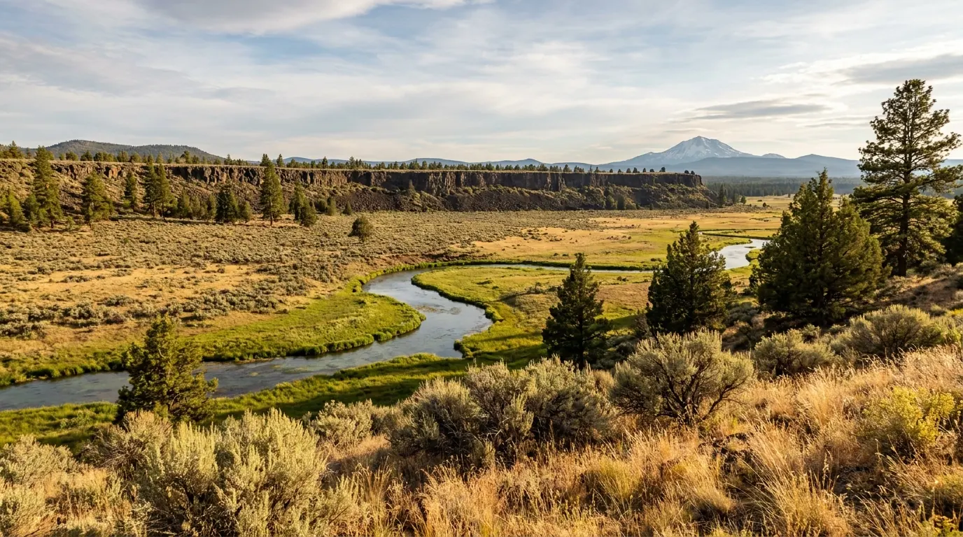
The CA-89 corridor north of the park runs down a valley floored with young lava. Subway Cave, a lava tube in the Hat Creek flow (less than 20,000 years old, nearly 40 ft wide in places), sits about a quarter-mile north of the CA-44/89 junction at Old Station. It is free, roughly a third of a mile, and completely dark — bring a real light, not a phone — and it holds at about 46 °F year-round. Typically open late May through October, closed in winter.
Hat Creek itself is a well-known wild-trout stream, and the Hat Creek Rim carries a long, dry, exposed stretch of the Pacific Crest Trail — notorious among thru-hikers for having no water.

A PG&E reservoir of roughly 28,000 acres, with west-shore campgrounds at about 4,540 ft and Lassen Peak on the skyline across the water. PG&E runs campgrounds here including Rocky Point and Last Chance.
The Dixie Fire burned the west shore from Canyon Dam northwest to the CA-36/89 junction — Prattville, Big Meadows, Lake Almanor West, the Rocky Point campground and the Canyon Dam boat launch were all inside the perimeter (§05). Confirm which of these facilities are operating before you rely on one.
Chester on CA-36 is the practical south-side town — fuel, groceries, hardware — and the gateway to Warner Valley.
California's second-largest natural lake, about 5,100 ft up and roughly 15 miles north of Susanville. It has no outlet, which makes it strongly alkaline — hard water that supports its own subspecies of trout, the Eagle Lake rainbow, and very little else.
Its level is the local news story. As of a late-March 2026 measurement it stood at about 5,095.18 ft at the Gallatin low-water ramp, up around 1.63 ft over the winter and spring. That is a county-reported figure, not a federal gauge reading, and the lake has declined dramatically over past decades — check current levels before you tow a boat here, because ramps go dry.
The Forest Service's Eagle Lake Ranger District runs Christie, Merrill, Aspen Grove and Eagle campgrounds at the southwest end. Aspen Grove is tent-only — no camping vehicles of any kind and no generators. Reported site counts at Merrill are high and varied by source; confirm on Recreation.gov. The Bizz Johnson Trail, a rail-trail out of Susanville, is the other reason to come this way.
There is no fuel inside the park. Fill up in Redding, Chester, Susanville, Burney or Shingletown before you drive in, and treat Old Station and Mineral as small, seasonal and not guaranteed. Cell coverage in and around the park is poor — download maps and passes before you leave a town.
We confirmed no operator pricing and we are printing no phone numbers, because we could not verify them. Check current websites before you rely on any of this. Several small businesses in this region are still recovering from the 2021 fire and seasonal hours are unpredictable.
Lassen's night sky is genuinely exceptional, and the reason is structural: the park sits on a high plateau with no large city for a very long way in any direction, and the surrounding country is national forest rather than suburb. What we are not going to do is hand you a certification the park may not hold. Here is what we could confirm, and what we could not.
We could not confirm that Lassen Volcanic holds formal International Dark Sky Park certification from DarkSky International. Several secondary and commercial sources describe the park as pursuing that designation rather than holding it. Plenty of travel pages state it as fact; we could not verify it, so we are not repeating it.
The "Bortle Class 1" claim likewise appears only in secondary sources and we could not trace it to a measurement. The sky here is superb — that much is not in doubt — but a specific class number is a technical claim and we do not have one we trust.
The exact 2026 Dark Sky Festival dates we could not confirm. Check the park's events page before you build a trip around the weekend.
Lassen has the shortest reliable season of any national park in California, and it is set by snow rather than by crowds. The usable window for the full park is roughly July to early October, with the shoulders determined entirely by the plows in spring and the first big storm in autumn. If you want one answer: go in late July, August or September, and check the road before you book anything at all.
One workable shape, not the only one. It assumes the highway is open — if it isn't, run days 1, 2 and 5 from the northwest and skip the rest. It puts an easy day first because you have probably just climbed 6,000 ft in two hours, saves the peak for when you're acclimatised, and finishes on the quiet side.
Run it before you leave. These are the ten things specific to Lassen and the Southern Cascades that a general road-trip habit will skip. Most come back to two facts: one road decides whether the park exists this week, and the ground in the thermal basins is not what it looks like.
Every guide has these; most don't print them. This issue has more than usual, for a specific reason: three of the most widely-repeated claims about this region — a dark-sky certification, a Roosevelt quotation, and deaths in the hydrothermal basins — we could not verify, and we would rather tell you that than pass them on. Everything below was compiled 25 July 2026 and should be re-checked against the linked official source before you rely on it.
Everything above, condensed into a print-ready PDF built for the glovebox — for a park whose season is decided by a snowplough, whose signature basin sits under an inch of crust over boiling acid, and which lost 69% of its area to a single fire. The road-opening record year by year, the fee and pass structure, all eight campgrounds with the figures we could confirm and the one we couldn't, the hikes with their sources named, the Dixie Fire closures, the dark-sky reality without the marketing, and a full list of what nobody could confirm — on paper that works where the bars don't.
Every Trekkr Trail Journal is built like this one: custom logistics, honest trail beta, the camping and access detail, and the local knowledge that turns a good trip into the one your crew talks about for years — including, always, a plain list of what we could not confirm. New destinations drop all season long, from the BC corridors to the Oregon Cascades to the California Sierra.
Unlock the Trail Journal Library